-
Posts
3,687 -
Joined
-
Last visited
Content Type
Profiles
Blogs
Forums
American Weather
Media Demo
Store
Gallery
Everything posted by RitualOfTheTrout
-
All 00z models look to be slightly better. As is we would have one hell of a flash freeze / abrupt change to snow. Should be some serious wind too, plus the low position in New York state would give a period of lake enhancement as it pulls away. Captain obvious but if we get a continued improvement could get even more interesting. I'm all for a clean snow event but a dynamic beast of a storm could still be fun.
-
As of right now I don't think it's projected to last very long. Low near Alaska should shift West letting -epo re-establish. People much more up on things also think the -Nao will reload and typically strong negative -AOs like we have now bode well for reoccurring throughout winter. That all assumes models aren't breaking the colder look down to fast. Nina Winters seem to swing back and forth, I don't think anyone was saying the cold pattern would lock in until March.
-
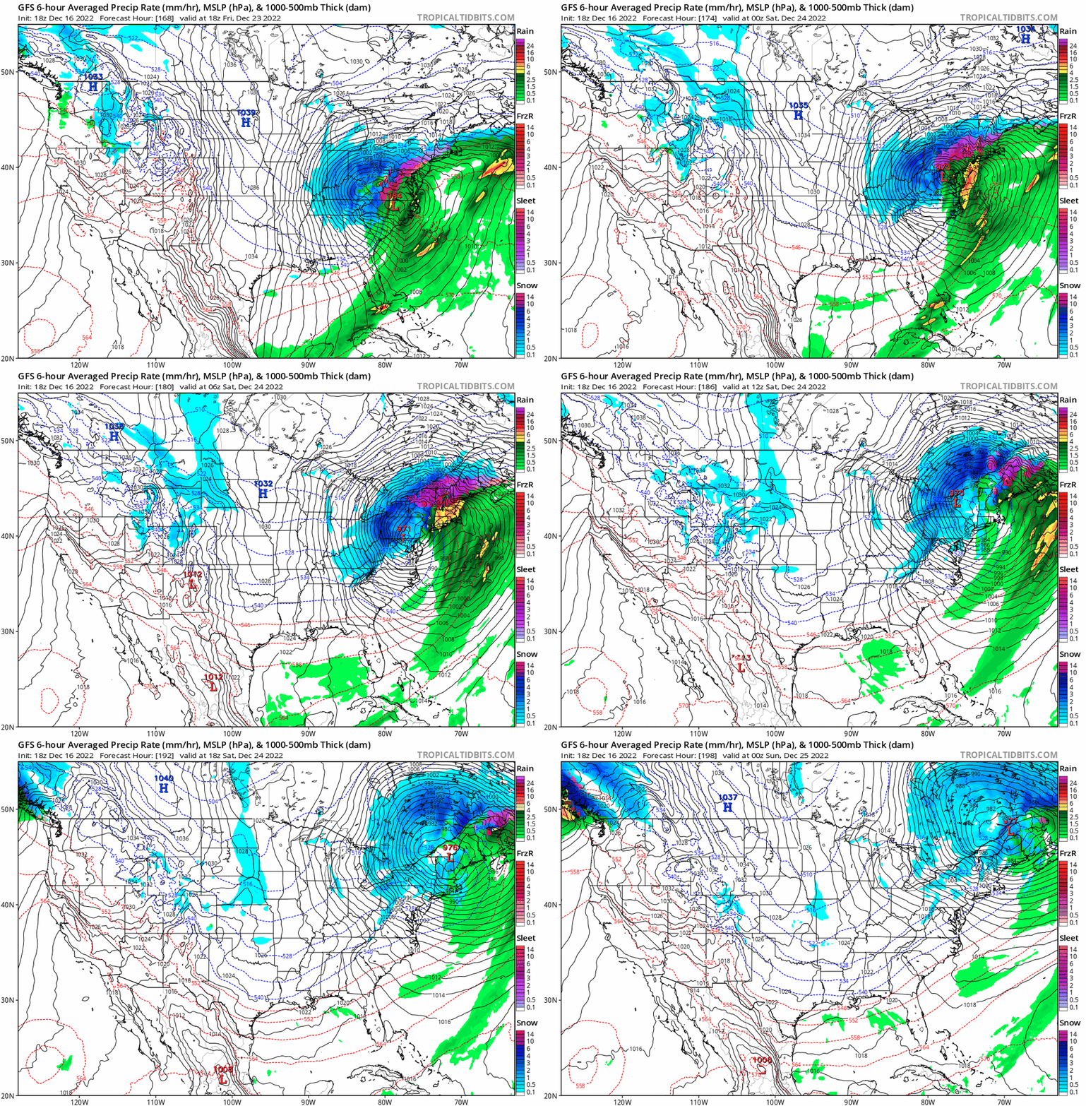
Yeah, I'll say. We all get crushed vs those sharp SE to NW cutoffs that seems to happen with the bigger storms lately. It was weaker with the confluence with a tad more energy held back which is a nod towards the CMC / Euro camp. It's not clear whether some sort of meeting in the middle with respect to that happens or if we see an all out whiff / cave to one idea or the other yet.
-
I'm going to throw out some Christmas optimism.. but let's just imagine if say there is an 80/20 split between GFS and the rest of the models by way of having a weaker piece stretch / break-off and get caught under the block but enough to keep it from cutting way west and this beast bombs and crawls just east of the spine of the apps.
-
I don't have a real solid feeling one way or the other on this right now. The ridge axis is further east out west and the confluence from the low trapped under the block is stronger and we don't see a clean phase on the 12z runs today so that makes North and East closer to the coast areas favored. Whether we see enough changes in any of those to get a bigger impact storm here or that the trend continues the other way is anyone's guess.
-
Who knows, GFS used to be somewhat better in some instances with northern stream stuff because that bias played into the fast flow that we usually see. To be honest though the models go through upgrades much more frequently and I haven't kept tabs on what the tendencies are. I thought the Euro went through an upgrade somewhat recently that was going to help its tendency to hold energy back for example so I have no idea whether to consider that when looking at any given output anymore. I'd be curious to hear from a MET or someone with more knowledge what the prevailing opinion is these days.
-
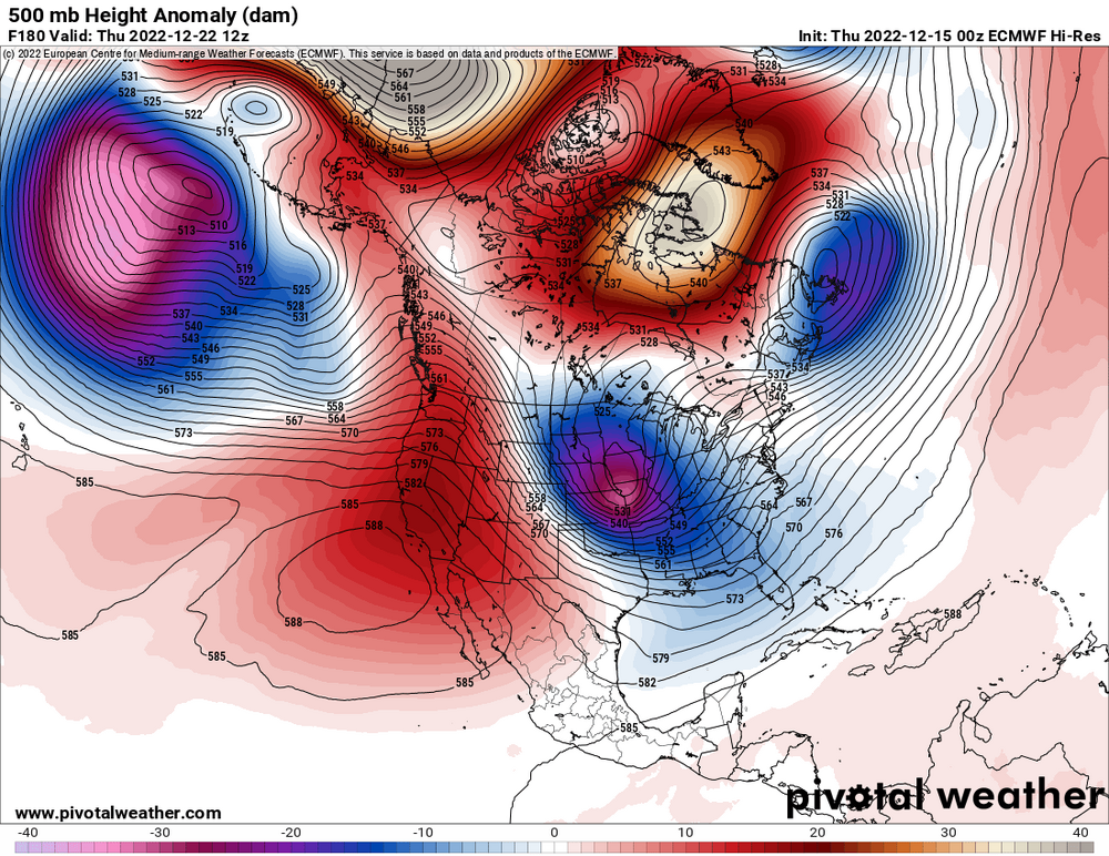
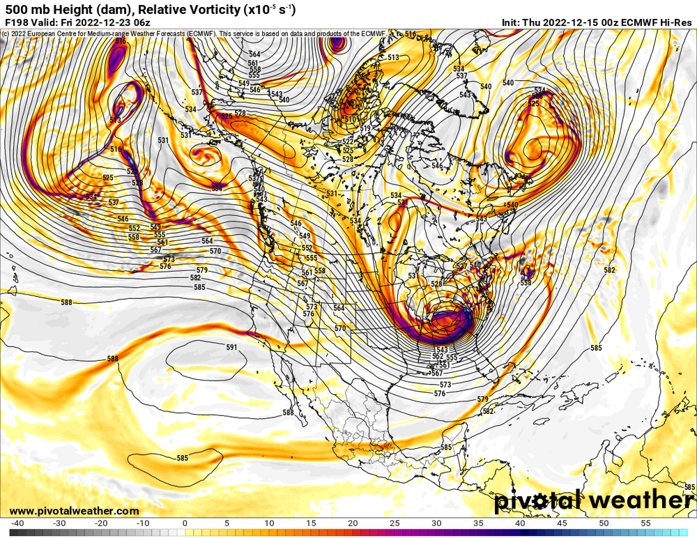
00z Euro... if you could hear graphics on the internet it might sound like... JAWS THEME Really just a matter of timing the phase if the rest of this was accurate. Ridge axis out west is in pretty good spot. Just doesn't quite get consolidated / phased in time and we just miss. Wouldn't take much change in timing of the shortwaves to get this going sooner. Even with that said its a decent storm on the Euro for us, but northern PA / Upstate NY gets absolutely blasted on this run. My gut says Euro is probably over doing things and still to far out to assume anything is set but as rarely as we get hit with a storm even having some maps to parse for something big isn't that common, imho next to watching the snow fall this is the next most fun part.
-
With that low being all the way in Wisconsin WAA won't be as strong however we still lack an in place cold airmass and high to the north to replenish low level cold to offset latent heat release. Those ice maps just look at any precip that falls with surface temperatures at 32 or lower and say its ice accretion. You won't see much accretion at 31.9 with light / moderate rain. I agree, unless we really see a trend towards colder air most of what we see in Allegheny county will be rain. Still could be a dicey period as it only takes a slight glaze to cause a big problem on the roads, but a big ice storm like the NAM shows isn't happening for SWPA lowlands.
-
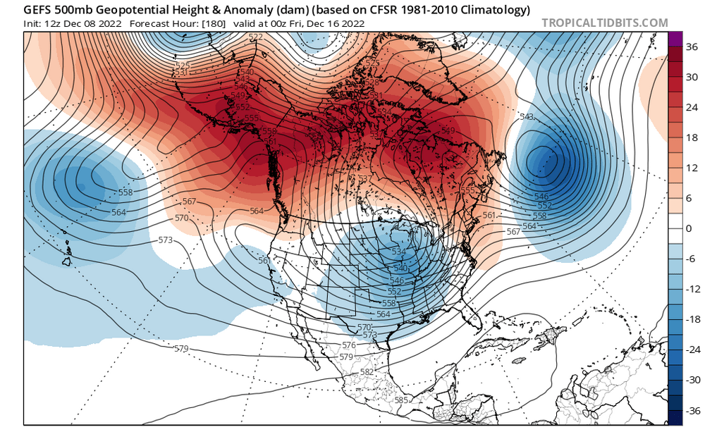
I think we are in a fool me once shame on you full me twice shame on me mode and want to see how things evolve before getting to invested. Global ENS all seem to be agreeing we get a -EPO to start dumping cold into the West / Central US with a -NAO and somewhat less hostile PNA. It will take a cutter or two to drag some of this east but there will be cold close enough to tap. Best part is the changes are evident under the day 7-8 period while models still have reasonable skill. I could see some slop storms with systems trying to cut, hitting the block and redeveloping with this setup. Having that trough around Hawaii usually teleconnects to some ridging in the west and a trough in the east. How long it lasts / what it morphs into is way beyond my skill but if this comes to fruition we should see storms with at least some frozen popping up soon.
-
Yeah, I think we are seeing some solid evidence of Jwilson's statement earlier saying some sort of +PNA is the most important metric being correct, at least for early season. You can have the biggest -NAO but if there is zonal flow off the pacific you just block in mediocre airmass. Some of those earlier looks with the PV lobe blocked under the -NAO and the solid +PNA had me worried about suppression and had that verified verbatim we probably would have saw a few storms to far South, but the look has degraded so much aside for some -NAO we are hardly looking at the same pattern now. Definitely need some pacific help but seems we keep seeing that get pushed out. Further we get into the season the more our odds increase for some fluke event. Even if we can manage to get some -EPO to dump cold out west we can get a transient cold shot behind a storm and maybe time something up.
-
That's my "concern" as well, to much of a good thing if its too strong and all the storms get pushed well underneath us and off the coast. I think at a minimum though if that pattern materializes we will feel the cold, and likely see some little lake enhanced things as you say. Volatile is key, lots of pendulum swings as patterns break down / reload. Should be fun to see how it all evolves.
-
Fall 2022 Pittsburgh/Western PA Discussion
RitualOfTheTrout replied to Ahoff's topic in Upstate New York/Pennsylvania
That is what I see being a concern with the advertised upcoming pattern. Still lots of other variables that will dictate things but seems more likely than now the trough axis will be to far east which is why coastal folks are jumping for joy. Miller Bs almost always end as slop storms when the warm air arrives sooner than anticipated or we get caught in a dryslot unless we get the perfect pass before it jumps. They can be fun though if we get a thump from the primary and lucky enough to get some love from the secondary throwing back moisture. -

Fall 2022 Pittsburgh/Western PA Discussion
RitualOfTheTrout replied to Ahoff's topic in Upstate New York/Pennsylvania
Give it a few days, we are still about a week out at least for the block / pattern change to start getting established. All we have now is a general idea of how things will look at H5. Should be interesting to see how the first storm interacts with the block. -

Fall 2022 Pittsburgh/Western PA Discussion
RitualOfTheTrout replied to Ahoff's topic in Upstate New York/Pennsylvania
I'm far from qualified to answer and to RD9108s point if coastal folks are really happy we probably see the storm track to far out to sea for any real shot. That being said, in my opinion in general if the pattern is favorable for the east coast we have a shot. If there is a monster -NAO we actually probably want a more nuetralish / slightly negative PNA as we want some SE ridging to push against the NAO to force the storm path inland. To many variables in my mind to say one specific metric is better than another for any discrete threat, things like timing of a phasing / other shortwave interactions can alter the track in ways that would make a less than optimum setup work for us or kill us. -

Fall 2022 Pittsburgh/Western PA Discussion
RitualOfTheTrout replied to Ahoff's topic in Upstate New York/Pennsylvania
The upcoming 10-12 days has been fairly well advertised as meh for any winter weather of interest in terms of discrete storm threat tracking, something little could always pop up short term but overall it looks pretty hostile. Whether the upcoming "pattern change" materializes is the real question. (Yay! Pattern tracking lol) Lots of posts seem to be proclaiming the modeled -Nao as a panacea for everything else will likely end in disappointment. I'm paying more attention to the PNA, if it's very negative the calls for big cold will fail as cold air source gets cut off and SE ridge pushes. Then again you rarely score a big storm with a huge purple temp anomaly overhead. -

Fall 2022 Pittsburgh/Western PA Discussion
RitualOfTheTrout replied to Ahoff's topic in Upstate New York/Pennsylvania
Just hit here, pretty awesome just seeing this cloud of wind whipped snow approaching in the distance. -

Fall 2022 Pittsburgh/Western PA Discussion
RitualOfTheTrout replied to Ahoff's topic in Upstate New York/Pennsylvania
Looks worth monitoring radar tomorrow morning for sure. NWS makes mention of some potential for heavier snow or even a squall. Friday will continue to be cold, Hi-Res models portray snow shower potential increasing with the passing shortwave passage from late morning through late afternoon. With reinforced cold air from the west, CAPE could increase between 20-35 J/kg and convective snow bands could hold together. Nevertheless, models indicate a very well defined vortmax associated with he shortwave moving in tomorrow morning just after 12Z with strong winds aloft. The potential certainly exists with the amount of instability present for an isolated heavier band or even a snow squall. Thus have upped snowfall amounts a tad and included all of the Ohio counties in the HWO. As well, the better agreement with the hi res models showing better instability coupled with mechanical assistance from the terrain in the southeast, the totals in the southeast were raised to 1 to 3 inches. A Special Weather Statement may be needed or even a Winter Weather Advisory. -

Fall 2022 Pittsburgh/Western PA Discussion
RitualOfTheTrout replied to Ahoff's topic in Upstate New York/Pennsylvania
Models indicating the possibility of something brewing for black Friday. Looks like a miller B type setup with low odds but if you are in the mood to track could be first threat to keep an eye on.


