-
Posts
3,687 -
Joined
-
Last visited
Content Type
Profiles
Blogs
Forums
American Weather
Media Demo
Store
Gallery
Everything posted by RitualOfTheTrout
-
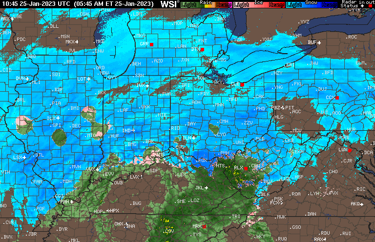
Dry slot, what dry slot? Gotta love this region.. lol To be fair, we had a pretty good idea for at least 24 hours this was going to be the outcome, but you can never be 100% until nowcast time. Still think there is a shot at a brief but moderate to heavy burst when that main slug moves in if we can hold onto temps long enough. Surface temperatures are already 32-34 through the area for the most part, but I could see that cool briefly under heavier precip rates. Roads were all pre-treated and with marginal temperatures will probably be minimal impact. This has all the hallmarks of being one of those events were people bitch and moan about how meteorologists suck especially with the impending "winter storm" making headlines on the evening news last night. I can hear it now, wheres the snow, I stayed home / worked from home / my kids school was delayed for this?
-
I think it's just setting realistic expectations vs being outright negative doom and gloomer at least to this point. Data supports it, especially city and south. That being said I'll be watching radar hoping to see the models bust and get a heavy period of snow, but I'm expecting by the time I get home from work whatever does fall will be gone.
-
The earlier runs that had us closer to that WAA band also had the boundary between M/D line / I70, it's now up by I80 / PA NY border on the NAM. I'll be a little disappointed if there's not a burst of heavy snow to watch but if that misses it will be less irritating in some ways to not see it all melt / wash away 2 hours later anyways.
-
Not liking the trends here, everything seems to be leaning towards the best thump being just north of Allegheny County. Still a lot of uncertainty though. NW of the city (sometimes way NW) is going to be favored in this pattern, but you'd think we could get something being so close to the boundary. 00z GFS provides some hope for that, but even that changes so drastically it's hard to put much faith.
-
Everything riding on where that frontogenetic band sets up. Seems like it's been slowly ticking North so wouldn't shock me if NAM is right about placement but little over zealous with amounts. Still time, placement of that feature is a short range thing, if we keep it close still a chance for a good bust during nowcast time.
-
Anything like this the short range hi res models should out perform when it comes to getting the temp profile nailed down. 3k NAM seems to do well, but we all know typically the change over happens quicker. If your expectation is a quick 1-2 with a period of moderate snow that's probably a reasonable bet, then adjust as we get closer.
-
Ended up with about a half inch that all mostly fell between 3am and 9am. Never made it below freezing and it's all melted now. Can see on some higher hills nearby not much higher in elevation made a difference. Rained all day yesterday, my location sucks in these marginal setups and is equally pretty bad in the type of setup we will have Wed.
-
I'll enjoy whatever snow we get, but pretty pessimistic with all the things going against it. My thinking is snow to start, but mainly mix / rain with the marginal temps and the weak lift / precip. The prospects of seeing much more than a slushy coating during daylight hours for my yard with a low elevation is a long shot. Areas just NW of the city may fair a little better but I think you need to really get even further than that for a satisfying event.
-
I agree, Sunday looks like 1-3 best case scenario when you factor in the very marginal surface temperatures, its likely to get above freezing so some will certainly be lost to melting. I'd feel a bit better about it if we could get a little colder for this one because it's awfully close to going the wrong way. Everything with this upcoming window is about perfect timing of various features without a legit -NAO block or better placement of the ridge out west like you said. The Wednesday storm is still worth tracking though as small changes in the strength / timing of that northern stream energy ahead and the high behind that and even the ultimate evolution of the Sunday storm could be the difference between a driving rain storm and a front end thump to dry slot type setup.
-
The upcoming pattern looks very gradient like. There is a chance we get on the right side of a couple storms riding along that depending on wave spacing / SE ridge strength. I'd feel better for more dice rolls the further North and West you go. To many other variables to say much past that but hopefully we can get something. Longer range would lean towards SE Ridge really building into Feb.
-
Right now the period around the 20th or so should offer some better chances. PAC fire hose slows down with that low finally shifting to the Aleutians and a -EPO / +PNA ridge popping. I'm skeptical right now on how long it lasts though. Early December the "pattern change" that really ended up only being a 5-7 day cold snap looked similar to what we are seeing now in the mid / long range.
-
Well, got my wish, woke up to dry bare ground. Not complaining though, maybe it's the start of a hot streak. Next I'll try my wish hand at a Blizzard of 93 redux and mega millions jackpot. Sad thing is I'm not sure which has lower odds. Next "storm" continues to evolve with some ENS members hinting there is a path to some snow on the backend of the secondary. Nothing else weatherwise to follow but day 10+ pattern changes. Could end up being something more interesting than a straight up rain storm though.
-

Central PA Winter 2022/2023
RitualOfTheTrout replied to Blizzard of 93's topic in Upstate New York/Pennsylvania
Difference this year is the cold/dry is more like cool/dry or downright warm/dry.


