wxsniss
-
Posts
5,787 -
Joined
-
Last visited
Content Type
Profiles
Blogs
Forums
American Weather
Media Demo
Store
Gallery
Everything posted by wxsniss
-
Messenger's back yard (may he RIP) in Plymouth must be pushing 8" at this point That coastal front / area of convergence has been nearly stationary for >24 hours Let's repeat late January
-
Was just thinking same and logged in to get the feel, watching this ongoing firehose into south shore. Let's repeat in late January.
-
This secondary line pushing into Boston metro and southshore is more impressive... very heavy downpours, CG
-
Says both radar-confirmed and OTG... 812 WWUS51 KBOX 062008 SVSBOX Severe Weather Statement National Weather Service Boston/Norton MA 408 PM EDT Sat Sep 6 2025 MAC017-027-062045- /O.CON.KBOX.TO.W.0003.000000T0000Z-250906T2045Z/ Worcester MA-Middlesex MA- 408 PM EDT Sat Sep 6 2025 ...A TORNADO WARNING REMAINS IN EFFECT UNTIL 445 PM EDT FOR EAST CENTRAL WORCESTER AND CENTRAL MIDDLESEX COUNTIES... At 407 PM EDT, a confirmed tornado was located over Holden, or near Worcester, moving east at 40 mph. HAZARD...Damaging tornado and quarter size hail. SOURCE...Radar confirmed tornado. IMPACT...Flying debris will be dangerous to those caught without shelter. Mobile homes will be damaged or destroyed. Damage to roofs, windows, and vehicles will occur. Tree damage is likely. This tornado will be near... Worcester, Marlborough, Shrewsbury, Hudson, Westborough, Holden, Northborough, Clinton, Lancaster, and Sterling around 415 PM EDT. Southborough, Stow, and Harvard around 420 PM EDT. Framingham, Acton, Sudbury, Maynard, and Boxborough around 425 PM EDT. Littleton around 430 PM EDT. PRECAUTIONARY/PREPAREDNESS ACTIONS... To repeat, a tornado is on the ground. TAKE COVER NOW! Move to a basement or an interior room on the lowest floor of a sturdy building. Avoid windows. If you are outdoors, in a mobile home, or in a vehicle, move to the closest substantial shelter and protect yourself from flying debris. Torrential rainfall is occurring with this storm, and may lead to flash flooding. Do not drive your vehicle through flooded roadways. && LAT...LON 4223 7187 4241 7195 4252 7150 4230 7143 TIME...MOT...LOC 2007Z 251DEG 34KT 4234 7186 TORNADO...OBSERVED MAX HAIL SIZE...1.00 IN $$
-
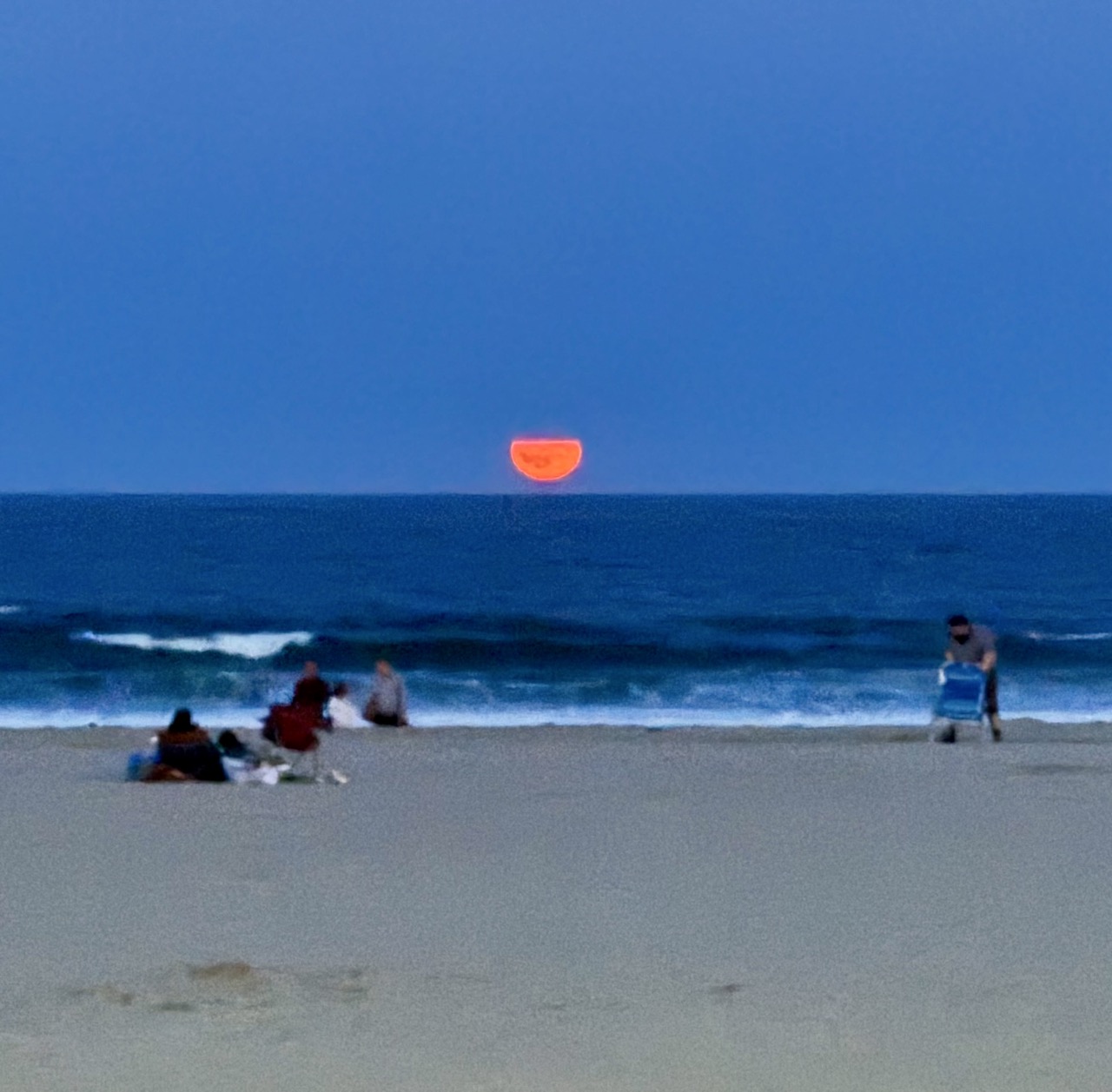
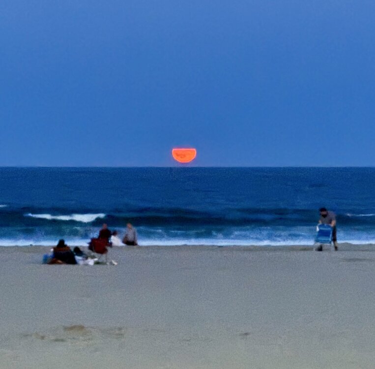
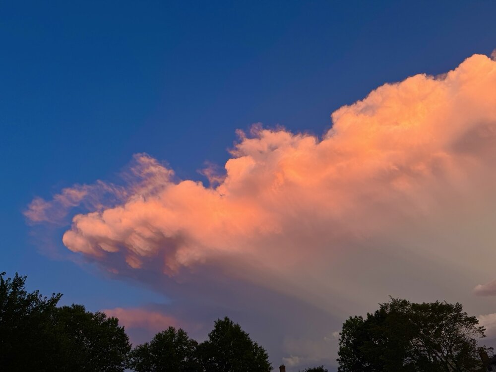
100% Incredible sunset colors backlighting towering CB with frequent crystal clear lightning, and otherwise clear dark blue sky… amazing I wish I could capture better My wife was yelling at me for wasting ice cream as I was frantically taking photos Another beaut… moonrise at Hampton Beach this weekend:
-
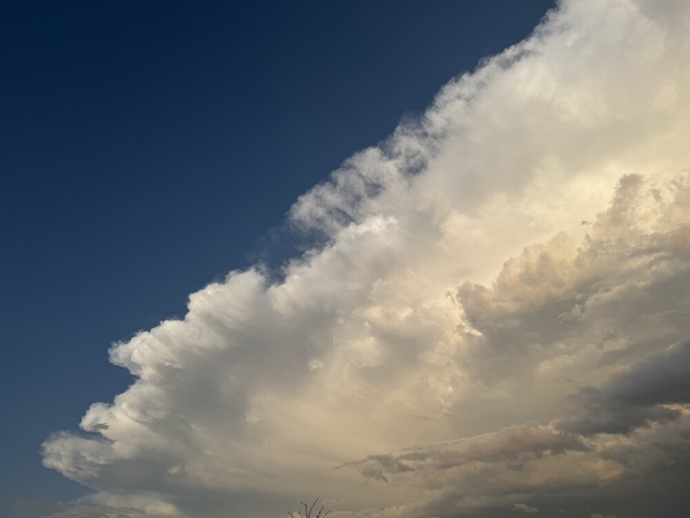
Man photos don’t do this justice and I wasn’t able to catch the best… Spectacular lightning with sunset colors

-
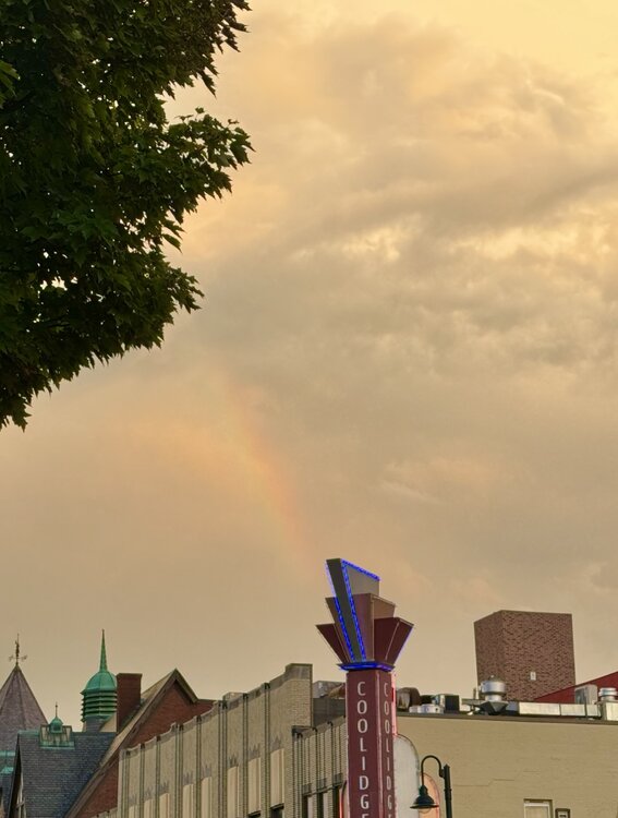
Extremely heavy here for a few minutes Back side looking from Coolidge Corner, with clear blue following it… A hint of a rainbow too:
-
Let’s hope this isn’t true… https://studyfinds.org/winter-weather-moving-west-how-the-polar-vortex-rewriting-americas-cold-map/ “LOWELL, Mass. — Americans expecting the worst winter weather to slam the East Coast might need to look northwest instead. A major study spanning four decades reveals that severe winter storms are shifting away from traditional snow belt regions toward the Pacific Northwest and northern Rockies, potentially changing where Americans should brace for brutal cold and heavy snow…” ”According to the study, published in Science Advances, the first pattern “features an upper-level vortex displaced toward western Canada and linked to northwestern U.S. severe winter weather.” The second “features a weakened upper-level vortex displaced toward the North Atlantic and linked to central-eastern U.S. severe winter weather.”
-
Amazing feed, just keeps going into Boston metro... another rumble heard at 12:30am looks near Hingham
-
Thunder in Fenway area
-
This is really impressive LLJ taking its time lifting north Heaviest of day right now, hoping we hear some thunder Love the activity in here… if only this was January
-
New England Winter 2024-25 Bantering, Whining, and Sobbing Thread
wxsniss replied to klw's topic in New England
Theories? Easily audible so I checked FlightAware. Looks like a systematic screen. This one ~9pm Monday March 3 took off from Hanscom: A 2nd one ~11:30pm took off from Northeast Philly: -
New England Winter 2024-25 Bantering, Whining, and Sobbing Thread
wxsniss replied to klw's topic in New England
Some younger folks here might be interested in this… summer student volunteer program with NWS Boston: https://www.weather.gov/media/box/Summer_2025.pdf -
Fond memory on multiple levels... the turning point, Euro ~60 hrs prior... went from OTS to a retro for a few inches to a blizzard:
-
Congrats! I think most here were thrilled not to see a 3peat!
-
~5-5.25" in Brookline I love the fresh stark white on everything
-
Take a 3peat tonight to the bank?
-
Look at Feb 9 0z HREF… 3z/4z RAP and 3z/4z HRRR, that’s go-time guidance… even short term mesos failed horribly here in handling dry air, had it snowing in east at least through 7am
-
Brookline: Great snowgrowth and heaviest rates of season, has to be at least 1”/hr RAP HRRR HREF look good esp NOP and NEMA
-
Warnings up This degree of model consensus seems so rare lately
-
Been a while since we've had a no-drama significant storm... Regionwide 6-10" would probably accurately cover almost everyone outside Cape/southcoast
-
Just saw this from Box, sorry if posted earlier... Are they relying on ratios for such widespread 8-12"? Solid event incoming for a change... most guidance supports widespread 4-8", maybe some spots 8"+
-
Actually decent 4-day-lead consensus EC / GFS / CMC for once
-
Healthier SWFE and that fledgling CCB keeps improving Widespread warning snows, would be SNE's largest storm of season so far
-
https://earthquake.usgs.gov/earthquakes/eventpage/at00sqr6q8/dyfi/intensity