
Jonathan
-
Posts
1,466 -
Joined
-
Last visited
Content Type
Profiles
Blogs
Forums
American Weather
Media Demo
Store
Gallery
Posts posted by Jonathan
-
-
-
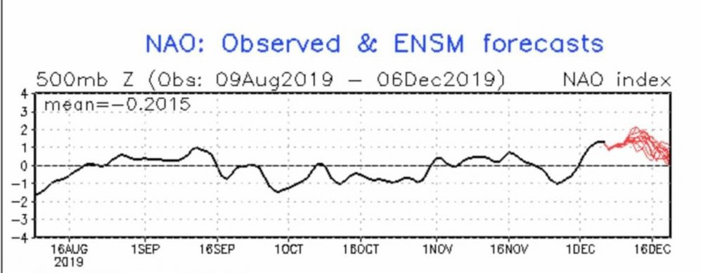
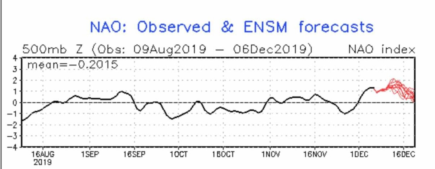
Unrelated, but how absolutely incredible is this? The NAO is a living being and it knows EXACTLY when meteorological winter begins. It's like someone flips the POSITIVE switch literally at 12am on 12/1. Unreal.
-
 1
1
-
-
Ended the "event" with about an hour and a half of sleet to sleet/snow to all snow. Got a nice little coating on the decks, cars and dirt. Temp got down to 33. Neat little early November treat.
-
14 hours ago, PackGrad05 said:
Unless the pattern shifts, this may be the last winter-like thing to track for at least a week or two.
Maybe so, but the EPS (and GEFS) paints a not-terrible pattern after day 10 with some -NAO action. So at least maybe we don't torch. Yet.

-
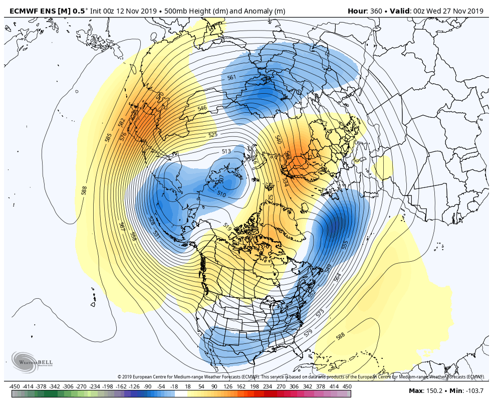
From WOOF to POOF on the 12z EURO
-
2
-
-
27 minutes ago, kvegas-wx said:
And unfortunately it ends just as fast. I can see lighter skies to the west. Aligns with radar pretty well.
I have 1/2 a dusting if that counts. We'll see what later brings.
Looks like some more returns trying to form to the SW. Are you in Stuart for the storm or do you live there? I just left from there in that heavy band.
-
31F / TD 28
Heavy snow the last hour, already a good coating of 1/2"
-
 1
1
-
-
Anyone have access to the 6z EURO? @griteater ?
-
2 hours ago, Disc said:
Quite a complicated forecast and is very fluid and changing. Again, from my experience here, the snow/ice line will be (in my opinion) a bit south of what the NAM and GFS are showing... CAD stronger than modeled. Surprise, surprise! Yes this low ends up moving to the west in a Miller B fashion, but it's so darn weak, so I just can't see WAA being overly strong and I believe it's being over modeled. So couple a stronger CAD and weaker WAA, I'm thinking a bit more snow to the south of 460 than a lot of models are showing. Areas that I have a higher confidence in mixing is Southside VA, as well as the NC Foothills and the NRV. Our most recent snow map shows this well.
The change from ice, to snow, and back to ice is certainly plausible as the low begins to transfer from the TN valley to the coast. The tricky part is figuring out how long the mixing lasts and how far north it gets. (Again, goes back to how strong the WAA is.) Other thing would be to hope for heavier precip rates to overcome the marginal warm nose showing during the transfer. +1C to around +2C warm nose can be overcome if rates are high enough, but as soon as rates fall, you'll see a transition to ice/sleet.
I hope that somewhat answers your question and wasn't too repetitive. Running on very little sleep ....!
Thanks for the reply! (And wait a sec, are you with NWS Blacksburg?!) I may have to chase to Roanoke or Vinton for this one!
Also, the EURO is in and it's bone dry. Cuts a lot of totals almost in half. 3k NAM is dry, 0z GFS was dry, now 0z EURO is dry. Lot of local news outlets with some big 5-10" and 6-12" numbers. I'm afraid they may be in trouble. Hate these "dropping out of the Rockies" systems. Rather have the bowling ball coming out of Baja and into the Gulf.
-
8 minutes ago, Buddy1987 said:
0z Canadian is a nice moderate snowstorm for all of SW VA. High is in a better position this go around just looking at 850 map. Mixing doesn’t happen until you go south of the VA border. Snow maps should update shortly as it’s taking awhile tonight on tidbits.
Beautiful run by the Canadian, but isn't it usually too cold/snowy? Especially in the upper levels?
-
2 minutes ago, Buddy1987 said:
Id also say someone in and around the Blacksburg/Roanoke area on up 81 to just south of Charlottesville will jackpot with snow totals. Other scary part is to figure out how severe the icing becomes for a bunch down the escarpment etc..
I think the areas I mentioned including the NC mountains it would be prudent to issue watches for now and then get another couple of model cycles in to where a final determination will be made. Meso models naturally will be key.
Yeah I fear some may see .25-.50" of ice somewhere, perhaps even here.
-
Wow, the GFS is really, really dry.
-
9 minutes ago, Buddy1987 said:
A.m. package for sure. If you’re in an affected area with a watch, I would venture to say the forecast offices would have enough time to wait on advisory or warning until Sat a.m. packages.
Curious to see your and @Disc thoughts for SWVA on this. Gonna be a headache to find the SN/IP/ZR lines between Roanoke and southside.
On another note, the 12k NAM takes the foothills from snow to ice, then back to snow as the coastal takes over. Is that scenario even plausible?
-
I give up on anything coming down and out of the Rockies. Unless it's a baja low that traverses the waters of the GOM, I'm not interested.
-
16 minutes ago, BornAgain13 said:
ABC 13 out of Lynchburg
Flickenger? lol
-
4 minutes ago, BornAgain13 said:
So the 18z GFS and FV3 both are just to far north... mainly ice or rain... need it to come back south...
Where have you gotten the 18z (or even the 12z) FV3? TT and PW are both stuck at 6z for the FV3.
-
27 minutes ago, griteater said:
My take from the 12z runs is that the models now have a general concensus with the wave handling and have gone a bit away from the weak sheared-out solution. Question is, how does that concensus trend going forward? I think this has a better chance now of climbing a little north than it does south as we approach go time
Don't you put that voodoo on us, grit! Hopefully not too far north with the 50/50 and a 1040+ (?) HP dropping in!
-
The ICON HAS to be too warm with a 1040-1041 HP in a beautiful spot. 32F line runs right along the VA/NC border.
It has this problem with the December storm too, IIRC.
-
4 minutes ago, HKY_WX said:
Brandon do you think north of I-40 has a decent shot to stay all snow or do we mix? Would really love to see another Miller A but a B/hybrid would mix a lot of folks.
Also, both GFS models continue bringing the goods with southern storm after southern storm and big Canadian HPs dropping down every few days. Fun times ahead?
-
1 hour ago, ryan1234 said:
After getting repeatedly screwed where we live especially last night, I am for this, just make suppress it and make it stronger than currently advertised. We need a south of I-85 storm. You northern folks already got yours. It’s time for people farther south to cash in. Sorry, but not sorry. Lol.
.Mother nature doesn't care who "wins" in snowfall.
Signed,
I got 16" today.
 You guys can have the next one, unless it's on Christmas, in which case we'll take that one too and you guys can have the next one...
-
Merry Christmas from goofy! 384hr GFS has snow on Christmas Day.
-
25/22 and still just freakin' RIPPIN' here in southern VA. All dry snow, medium flakes, winds of 8-15mph just an amazing system.
Measured 10" at 10am, gotta be 12-14" by now because it's been heavy snow ever since.
-
1
-
-
2 hours ago, superjames1992 said:
I think it seems to have done a decent job still, though? It still generally showed a good storm for GSO, but it seems to have nailed CLT’s sleet/ZR fest. At least the warm nose isn’t over performing this time. Seems like Durham is really doing better than expected, too.
Anyways, looks like 10”+ there, which would have been my biggest storm since 2002. Quite possibly 12”+, which would have been the biggest storm I’ve ever experienced. Finally, a storm where the crazy QPF forecasts actually happen!
I’ll have to talk to my parents later and see what it looks like there.
Yeah I thought the NAM done great. RDU coming out pretty good! Congrats Brick and others!
-
25 F
TD 22F
+SNMeasured between 8-10" an hour ago, probably 10-12" now and just ripping!
-
1
-
Mid to Long Term Discussion 2020
in Southeastern States
Posted
Soooo, which is it?