

jaxjagman
-
Posts
8,302 -
Joined
-
Last visited
Content Type
Profiles
Blogs
Forums
American Weather
Media Demo
Store
Gallery
Posts posted by jaxjagman
-
-
-
Much as i gave up on the MJO this morning i'm much more of a skeptic once again where the MJO will be at.Seems more Euro ensembles today are more on the faster side like the velocity has been showing
.thumb.png.3393cfa536a7482517c08d656e403ed3.png)
.thumb.png.eaba4f13f53207409851c439f0818c61.png)
-
 2
2
-
 1
1
-
-
45 minutes ago, Coach B said:
Have I read that phase 7 in February is actually pretty decent for se snowstorms? Maybe that's just for the east coast?
Should be out west not the east
-
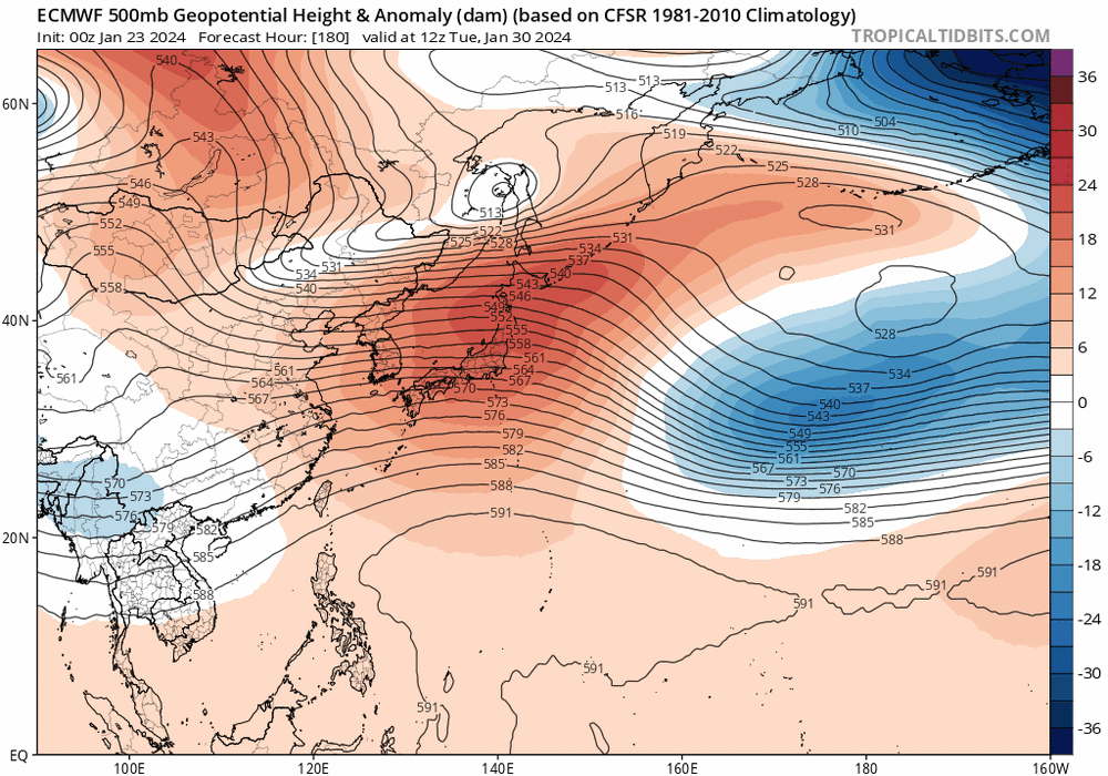
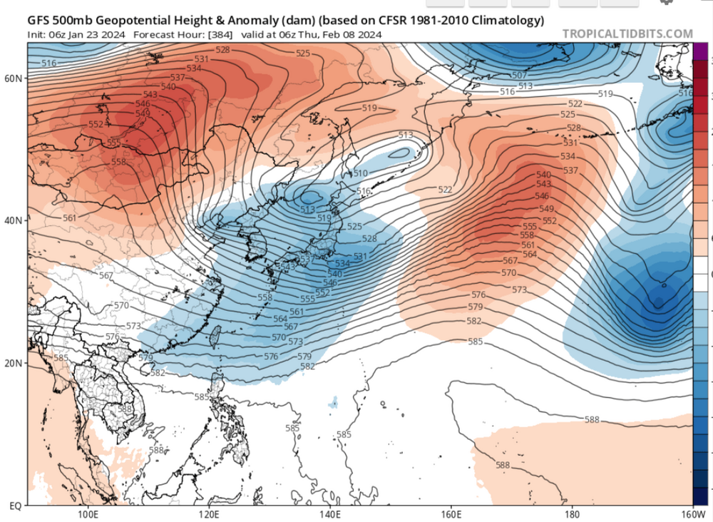
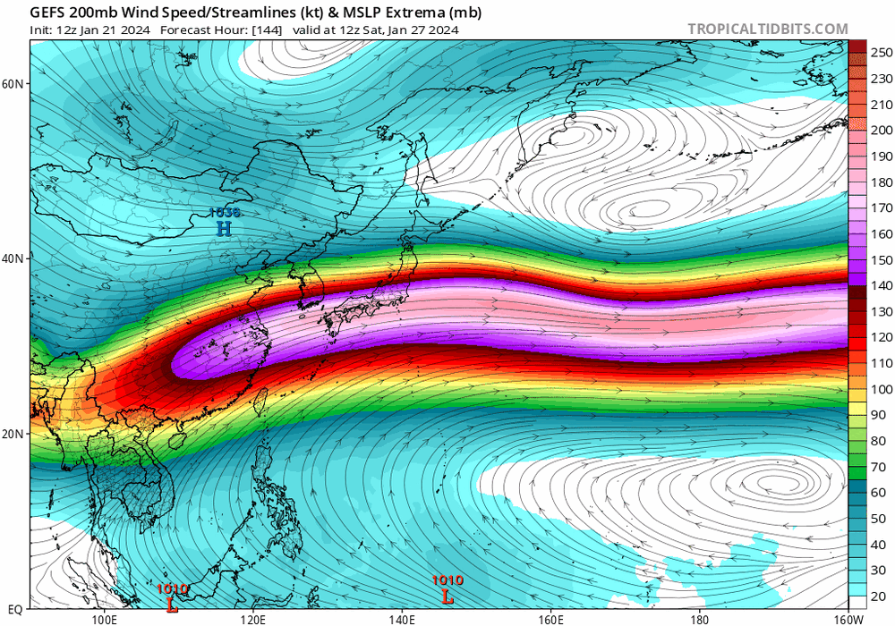
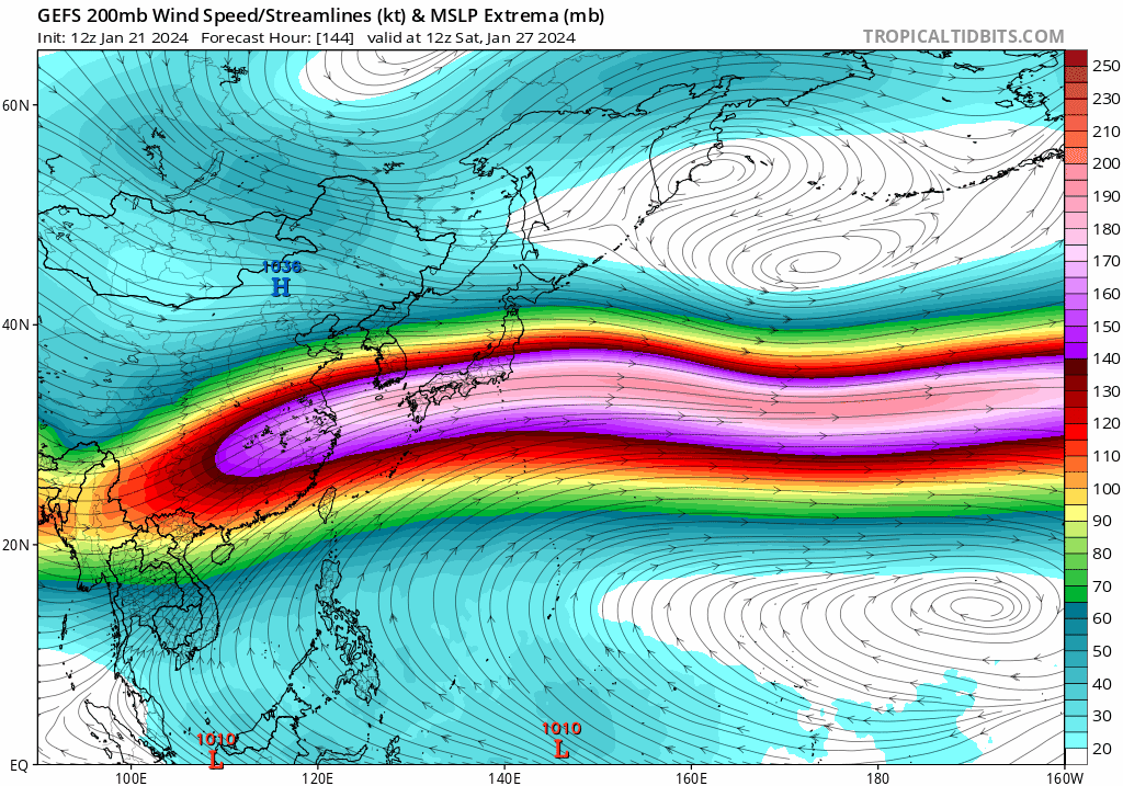
Most of the models in the long range models shows a ridge into East Asia,with height rises into East China/Korea,that should be a warm look towards Feb 8-9th around that time anyways for us,maybe some hints also that some sort of change is upcoming afterwards into Mongolia and China on that map.If the GFS is anywhere right we should see a cool down shortly after,this is a cold look in the lower latitude of East Asia,but we all know how the GFS can whiff at this range
-
3
-
2
-
-
Guess ill give up on the MJO being more adavanced,it dont seem to have much support,the next 10 days the Euro ensembles are pretty much bunched up into the WP
.thumb.png.aa62d51dd84549f4b2b4d6b72be774c7.png)
-
1
-
-
I busted my ass on the ice trying to get the trash to the curb.Trash hasnt ran in 2 weeks so i had to try but it didn't work,sprained my left knee and left wrist,no broke bones anyways
-
1
-
 3
3
-
-
1 hour ago, Carvers Gap said:
I am starting to feel like modeling has a decent handle on the timing of the upcoming 500 pattern.
Webb mentioned this on Twitter. JB mentioned this as well, and so did Cosgrove. -> The pattern, which began the days after Christmas and will end early this week, is set to repeat itself beginning Feb 7th. Now, that might sound like I am speeding up the timeline. Nope, not in general. Maybe an argument can be made that modeling has moved forward about 72 hours depending on the metric (500 vs surface temps). MJO plots reflected that this morning - slightly speeding up the return of winter. The second week of Feb(7-14) will be similar to the transition right after Christmas. Ridge gets kicked out. BN heights (weak at first) begin to nudge under the eastern ridge. The trough will have little to no cold in it. Eventually, the trough builds in the East w/ a -NAO building over the top. Look familiar? By Valentine's Day, the Weeklies have this:
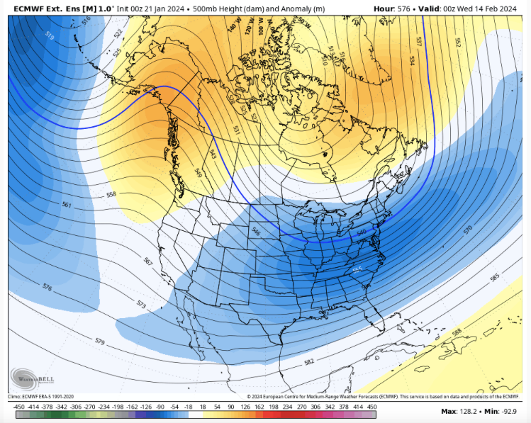
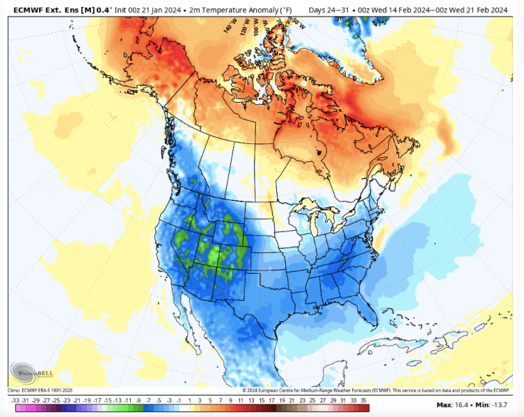
By the third week in February, we get this in regards to temps - round 2. Now, we need BN temps by this time in order to have a decent shot at snow(average temps are higher by this time), and that is what is in order if this model is correct. Week 1 - warm. Week 2 - less warm. Week 3 - cold. Week 4 cold. Early March - cold.
I feel like I have seen this movie before. Jet retracts. MJO rotates into colder phases. NAO fires. Winter. I do think the MJO is playing a familiar game in which it is too slow to rotate in the long range and dawdles too long in warm phases. Let's see if the cold is moved up during the next few days.
Models are just now "feeling" the effects of the recent strat warm. It is still possible that model mayhem could ensue.
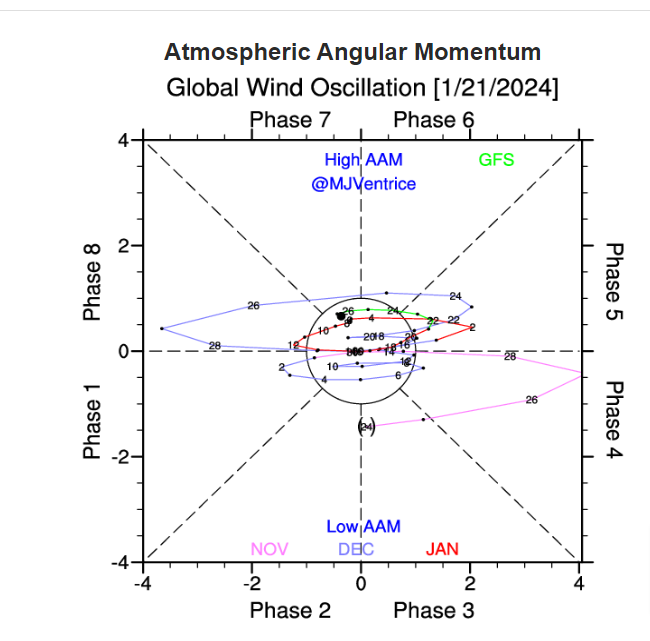
It seems that way.There is some slight differences.When we saw the last jet extension(+EAMT)in Dec the GWO gained momentum we also saw the MJO strenghten into WH headed towards Africa,this time looks different and with question marks.The GWO is certainly,seemingly gaining momentum compared to in Dec but questions still loom where the MJO is going.Also around Christmas the SOI was more coupled with a NINO
25 Dec 2023 1009.91 1007.95 -9.13 -3.78 -6.83 24 Dec 2023 1007.62 1009.15 -27.25 -3.37 -6.80 23 Dec 2023 1006.15 1009.45 -36.43 -2.68 -6.55 The SOI in late Dec(top) was more coupled with Nino.Soi as of late(bottom) looks like we are in a NINA
21 Jan 2024 1010.18 1003.25 10.93 5.24 -1.69 20 Jan 2024 1010.92 1003.10 15.13 3.85 -1.89 19 Jan 2024 1011.60 1002.65 20.45 2.87 -2.30 18 Jan 2024 1011.14 1002.35 19.70 2.12 -2.79 The GWO is certainly on the rise but compared to this time
Oh well its just a waiting game it seems.I posted the GWO for comparison to around Christmas time,its really similar right now
-
3
-
1
-
-
Still curious about the MJO.GEFS show a +EAMT as the MJO goes into the Pac its enhances the Jet extension into the Pac,as it leaves the Jet retracts back towards Asia
-
1
-
-
-
1
-
2
-
-
Seriously is the MJO gonna be where the Euro seems to be at?Euro mean and CFS look quite similar with the MJO progression
.png.1a94883b64a7d5fa55d6b02b67c9f63b.png)
.png.358bfaa5ca593172933ad12f2b5601c9.png)
-
2
-
-
1 hour ago, Itryatgolf70 said:
How do I read this graph? No expert like yourself lol
Its just my interpretation of where the MJO could/should be at as be head into Feb
.png.f77b28895d28cd2561c9c611ab9a8e12.png)
-
1
-
-
-
22 minutes ago, Wurbus said:
I have a question on how temp is reported at the main stations. For example, if the temp reaches 32.6 as the high for the day, do they round up to 33?
Pretty sure it stays at 32
-
1
-
1
-
-
1 hour ago, Save the itchy algae! said:
It looks like this is pretty much it then the storm is done, anyone else seeing something different?
.It should be misting here for a bit longer,it never has been shown to be a strong system,very little QPF,higher elevations can always get upslope
-
Here is a good OBS site if anyone is looking for one,its pretty good to a sense
-
1
-
2
-
-
It just started snowing in SE Mo,crazy system
-
3
-
-
14 minutes ago, Save the itchy algae! said:
It looks like this is pretty much it then the storm is done, anyone else seeing something different?
.Depends where youre at
-
1
-
-
27 minutes ago, John1122 said:
Hopefully, but it's about gone until any NW flow might happen. It was odd that 30 degrees today felt warm.
Still think you can get some more snow.The inverted trough that helped with the warm nose,the cold front is stationary,we could get a few flakes here maybe but seems to me the higher elevations could get something,wont be much but it seems to me you could squeeze maybe a tenth or so before it done.That map is a hour old
-
2
-
-
7 minutes ago, John1122 said:
Hopefully, but it's about gone until any NW flow might happen. It was odd that 30 degrees today felt warm.
You still could get a bit more snow,there still is moisture to the west,its not totally dry
-
1 minute ago, John1122 said:
Now have moderate snow with a few sleet pellets.
you should stay snow now
-
1
-
-
Warm nose was/is more extensive than shown,its all the way up into S/Ky they should be all snow but its rain
-
1
-
-
Still jus rains ,here we was at 32 then when it seemed the qpfs rose the temps rose to 34,now at 32 again.By the looks we should change over to ip,sn for a brief time before it ends,dont think ill drive anywhere tonight
-
Nothing but virga here
-
3
-
1
-
-
wInds are east here,S already in West Tn,NW in east,just going by the NWS OBS
-
1
-
.png.6e64b1a93811c565d09b7b66fbc599ff.png)
.png.57aabd7b583f64304ba0b5b10f25bf2c.png)
.png.f71894ee0048031f9228308ec222e00f.png)


.png.e993878dddc60194ae40eaca30dc175a.png)
.png.1c7f9cea9735ca5512d0155e111b441f.png)
January Medium-Long Range Discussion
in Tennessee Valley
Posted
I'm not sure myself,there is signs tho the AO could crash right now but you'd need other teles to work in tandem