

jaxjagman
-
Posts
8,699 -
Joined
-
Last visited
Content Type
Profiles
Blogs
Forums
American Weather
Media Demo
Store
Gallery
Posts posted by jaxjagman
-
-
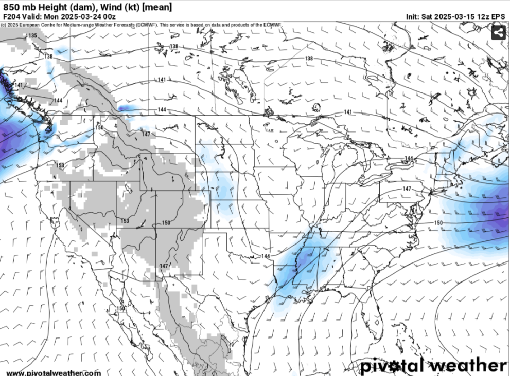
Still looks like we have a severe threat upcoming and possibly some BN temps for a few days after.Thats a big trough in East Asia going through all the way to Taiwan the next couple days,probably more indictive of the MJO into the I0/Maritime during this period.
If the JMA is anywhere right the MJO is going to move fast into the WH in a couple weeks,still looks like at this point as we get into well part of April it could be quite interesting as long as the signal stays strong,which is nothing guaranteed at this point
-
40 minutes ago, *Flash* said:
Man, you can really see that warm front on reflectivity!
https://www.star.nesdis.noaa.gov/goes/meso_band.php?sat=G16&lat=34N&lon=90W&band=FED13&length=30
-
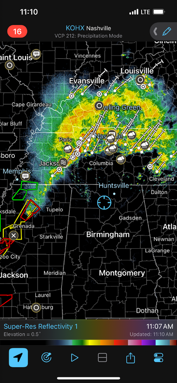
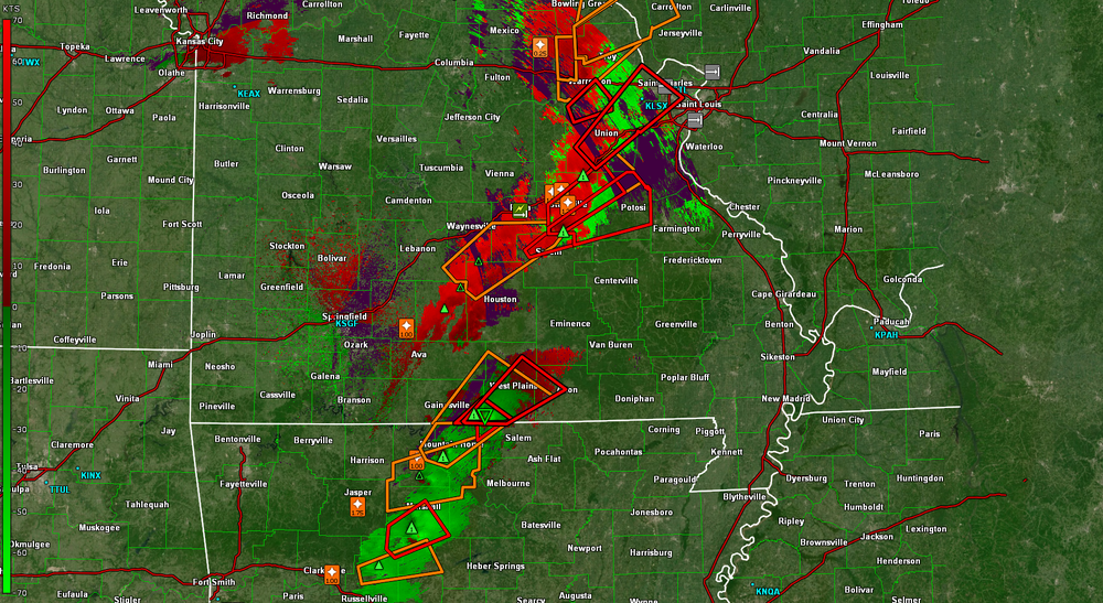
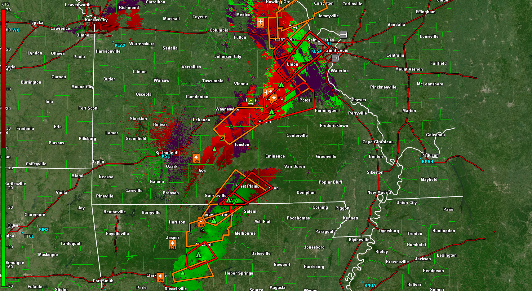
these cell are booking it in MS
-
Tornado headed towards Morgan City
-
14 minutes ago, *Flash* said:
Man, you can really see that warm front on reflectivity!
Yeah to bad its not at night,would be a awesome light show
-
 1
1
-
-
15 minutes ago, jaxjagman said:
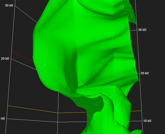
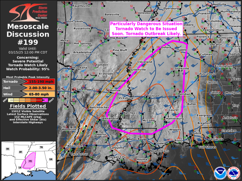
PDS now
Starting to recycle maybe
-
1
-
-
12 minutes ago, jaxjagman said:
PDS now
-
1
-
-
1 minute ago, vortexse93 said:
Safe bet
-
1
-
-
-
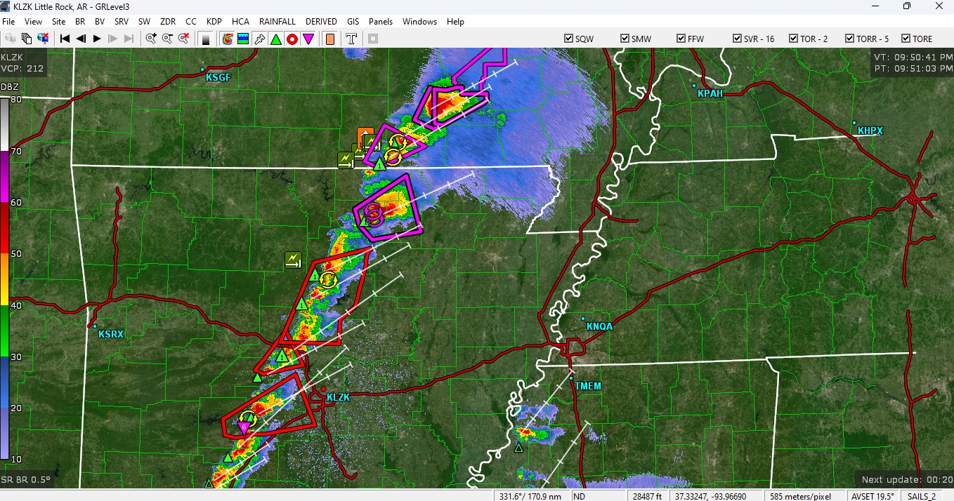
4 minutes ago, Matthew70 said:
It’s really unbelievable what’s happening with this outbreak. I hope the cams are wrong about multiple waves of supercells tomorrow.
Yeah and the sad parts its just starting,wait until tomorrow
-
 1
1
-
-
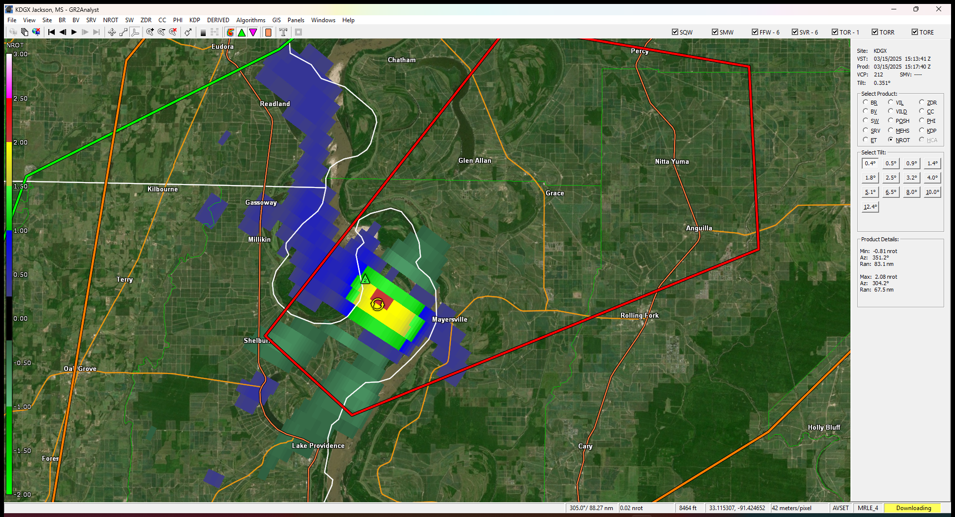
2 minutes ago, jaxjagman said:
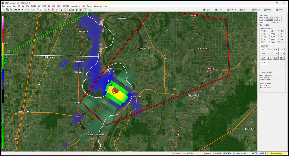
Tor emergency in MO,Carter CO
-
Tor emergency in MO,Carter CO
-
4 minutes ago, WestTennWX said:
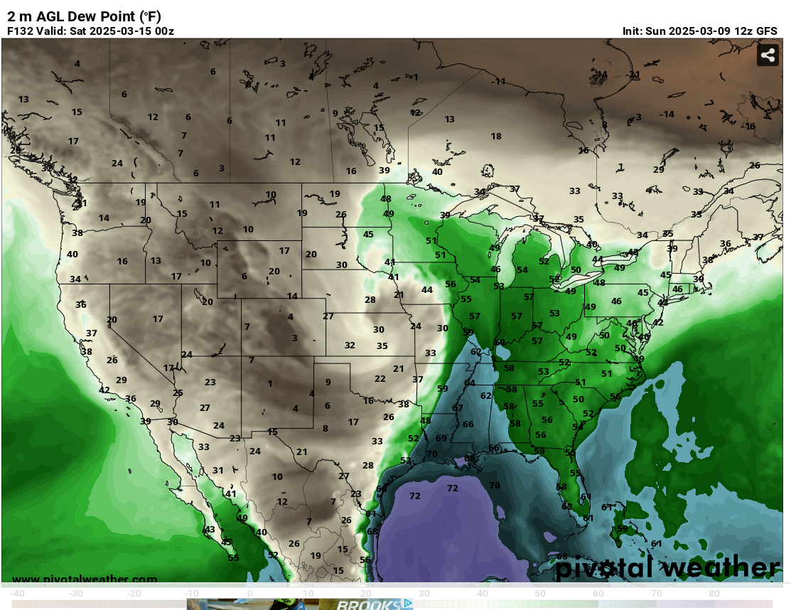
Ominous line to our west here in Union City. Dew points are starting to climb, 57 now.

Yes,these are all broken cell super cells which should mature the next couple hrs
-
16 minutes ago, vortexse93 said:
It might be a road of this


Oh its such a mesmerizing road,but there is so many few exits,its really dangerous in severe weather,i really love going through there any other time
-
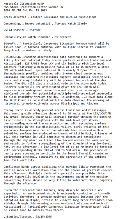
Franklin Co is getting hit hard in MO,already had one tor and another is fixing to hit,2.75"hail marker
-
Cranking up
-
2
-
-
1 hour ago, vortexse93 said:

No chase for me tonight as storm development will after sunset. This will likely be my last full breakdown discussions before tomorrow, any updates from will likely be brief or will be quoting SPC MDs for much of the day.
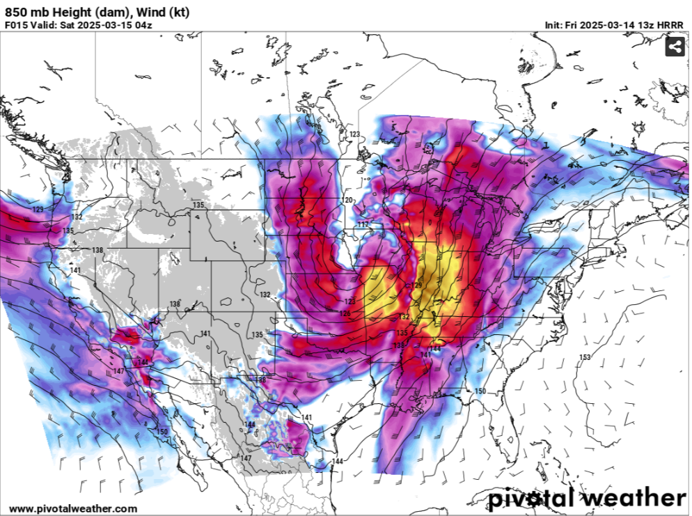
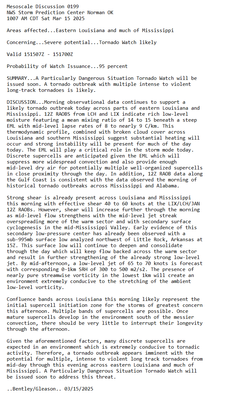
Tomorrow has me very concern for long-track and violent tornadoes across much of Central MS as model guidance has severely backed off on any morning time convection for the region. My second concern is the possible eastward progression of a dryline ahead of the cold front. Dry lines are not common for this region and could be the reason why models have supercell heavy the over the last couple of days. Drylines are excellent lifting sources for storm development and are more common out in Tornado Alley. Timing of these storms can be as early as mid-day tomorrow and will most likely remain discrete and supercell storms. These discrete storms will not have the biggest tornado threat associated with them, but will also have the potential to produce long track and violent tornadoes tomorrow. Since I am new to this forum, I do not use that language very lightly or very often. Tomorrow has the day to be a very eventful day.
For chasing, had thoughts to chase, however, having to fight any potential supercells on the way back or QLCS storms in this type of environment is not warrant for me. However, as @jaxjagmanmentioned, if things line up properly, the storms will come to me. For this reason, I will remain local for tomorrow's severe weather threat. I have some local spots that will be great for viewing if the opportunity presents itself. Tomorrow is not a day for inexperience chasers to be chasing in Dixie Alley. The setup were more into the Delta, I would most be considering a chase, but that is not the case.For those that go chasing, be extremely careful and mindful of the weather conditions and the road networks around MS/AL.
Yeah dont go down the Natchez to get to Jackson..lol..That could be the road of no return during severe
-
1
-
-
On 3/12/2025 at 6:43 PM, vortexse93 said:


I am currently keeping my eyes out for Friday into Saturday. By glancing at the models over the last few days, I am personally not liking the timing nor the placement of this setup. This round I may end up sitting this one out. For me personally, it will be a stretch to make near Northeast AR/MO on Friday.
For Saturday, the threat will be to my east and chasing east of I-55 is nearly impossible. While there are some spots that are decent to chase in, I am not much on fighting trees and hills. Plus, have some concerns in how Saturday morning may play out with the morning storms ahead of the main show. Have seen time after time when morning storms tend to ruin events. Not saying that will happen, it is something to keep in the back of the mind when making these decisions. Will continue to watch and see what the higher res models are showing by this time tomorrow.
If the NAM is anywhere right,you might be chasing in your back yard,stay safe bro
-
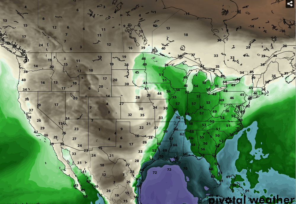
Tomorrow there is a trough moving through into East China with a ridge off of Japan, so we should possibly see a trough into the plains and at least a severe threat upcoming
-
1
-
-
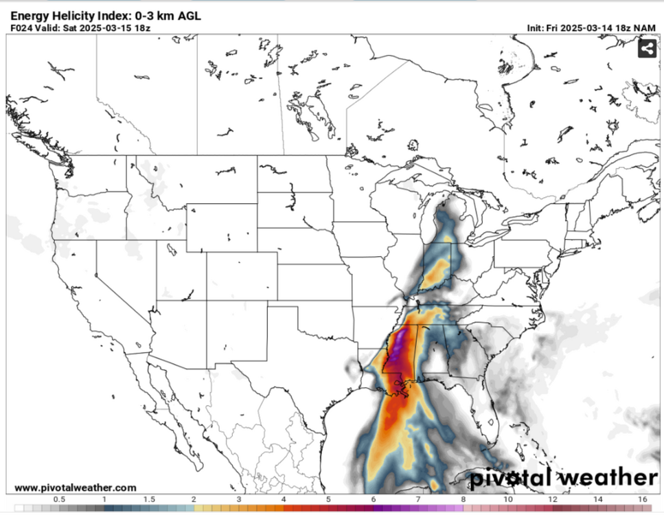
Seemingly right now in Mid Tn models have been showning nothing but invergence into parts of Mid TN.But some of the latest Mesoscales are showing a stronger LLJ, which should aide into being a cap buster for possibly early morning severe storms
-
3
-
-
Day 4-8 Convective Outlook
   NWS Storm Prediction Center Norman OK
   0354 AM CDT Mon Mar 10 2025

   Valid 131200Z - 181200Z

   ...DISCUSSION...
   ...Day 4/Thu - Southeast...

   A shortwave upper trough will move across the Southeast on Thursday.
   Stronger deep-layer flow will mainly be focused over the Gulf.
   However, cooler temperatures aloft will support weak instability and
   a strong storm or two may occur over portions of AL/GA and the FL
   Panhandle. Overall severe potential appears limited.

   ...Day 5/Fri - ArkLaTex to the Mid/Lower MS Valley vicinity...

   A regional outbreak of severe storms is forecast late Friday
   afternoon into the overnight hours. An intense upper cyclone will
   deepen as it ejects northeast from the central/southern Plains to
   the Upper Midwest by Saturday morning. A 100+ kt 500 mb jet streak
   will move across OK into the Ozark Plateau during the late afternoon
   and evening, before lifting north across the Mid-MS Valley
   overnight. At the surface, a rapidly deepening surface low will move
   across the central Plains to the Upper Midwest, with a cold front
   surging east across the region from late afternoon into Saturday
   morning.

   Deeper Gulf moisture will be confined to the I-20 corridor Friday
   morning. However, intense low-level flow will quickly transport
   moisture northward through the mid-MS Valley. Surface dewpoints
   greater than 60 F will likely remain south of the MO Bootheel
   vicinity, with a broader area of more modest moisture as far north
   as northeast IA/southwest WI and northern IL. While moisture will be
   less favorable with northward extent, strong large-scale ascent,
   intense deep-layer flow and a surging cold front will likely be
   sufficient for severe convection even amid weak instability. Further
   south from the ArkLaTex vicinity to the Lower MS Valley, better
   quality moisture is expected to overlap intense shear. Overall, this
   pattern will support all severe hazards, with a potential mixed mode
   evolution (QLCS and supercells).

   The north and east extent of severe potential remains a bit
   uncertain either due to moisture concerns and/or spread among
   various guidance in timing and position of key features. Severe
   probabilities will likely be refined over the coming days as these
   features become better resolved.

   ...Day 6/Sat - Southeast...

   The Upper Midwest cyclone will eject northeast into Ontario on
   Saturday. Meanwhile the base of the larger-scale upper trough over
   the Plains ejects east toward the Lower MS Valley and Southeast.
   This will maintain strong deep-layer southwesterly flow across the
   region, with an intense low-level jet expected to develop by late
   afternoon as stronger height falls overspread the Deep South.
   Ongoing convection at the beginning of the period from the Lower OH
   Valley toward northern MS/LA adds some uncertainty regarding how the
   airmass will destabilize (especially with northward extent).
   However, it appears likely that a very favorable corridor of rich
   boundary layer moisture will overlap strong shear from
   central/southern MS into northern AL ahead of a cold front expected
   to surge across the area during the evening. This overall pattern
   appears favorable for both supercells and an eventual QLCS.

   ...Day 7/Sun - Eastern states...

   The upper trough over the central U.S. will lift northeast over the
   eastern states on Sunday. Some severe potential is possible given
   strong deep-layer flow atop a moist boundary layer ahead of the
   eastward-advancing cold front. However, destabilization may be
   limited by widespread training precipitation.

   ..Leitman.. 03/10/2025
-
Sorry.cut the time stamp out

-
1 hour ago, vortexse93 said:
I totally agree with this 100%. This also why I tend to be down to earth and not get so into hype and excitement.
Still think you run with the ensembles right now,think this is his time frame hes using,i know you could get severe with DP'S in the 50's but come on now,but you still shouldnt make these vids on social media,i'm fine with a couple days out
-
 1
1
-
-
But i dont see no reason to hype a storm 5-6 days out on social media,it could still change especially,which he is using the GFS
-
1
-


Fall/Winter Banter - Football, Basketball, Snowball?
in Tennessee Valley
Posted
My pick to win the big dance this year is the Gators.Those guys are playing awesome as of late.I'd like to say Auburn,but i think they look tired now from playing all these Quad1 teams which in my mind has been insane.
I'd be shocked still if Auburn isnt a one seed.JMHO