dendrite
-
Posts
73,519 -
Joined
Content Type
Profiles
Blogs
Forums
American Weather
Media Demo
Store
Gallery
Everything posted by dendrite
-
We should plot the grades on a map at the end of winter
-
A on pack (mostly semi deep since 12/2) B on cold (consistent but nothing high end) C on snow (basically running near avg) D on intangibles (too much nickle and diming…missing the biggies…little rain is a plus B-/C+
-

"Don’t do it" 2026 Blizzard obs, updates and pictures.
dendrite replied to Ginx snewx's topic in New England
Good thing it was Cantore and not Bob Stokes -
Let me out.
-
I’m still hoping Legro can fit freshet into an AFD one of these Marches.
-
Let’s melt it all in a few days and get a cutter on top of it.
-
Emotional trauma aside…I agree with Scoot. There’s strong ens/AI support for a big warmup toward d10 and beyond. But I still need to see it inside d5 without it breaking down.
-
Clipper Fires In Wednesday Feb 25 Disco/ Obs
dendrite replied to Damage In Tolland's topic in New England
Kevin has been controlling the weather with his weenie all winter. Hopefully he flips the switch with it soon. -

-
It’s been a persistent pocket of cold in the northeast…just a little too much for up here (snowfall wise).
-
It has to end sometime, but I’m broken down to the point where I’ll believe it when I see it.
-
Yeah if you’re an A after DJF it’s locked in…especially down there.
-
"Don’t do it" 2026 Blizzard obs, updates and pictures.
dendrite replied to Ginx snewx's topic in New England
Looks like PYM shat the bed before 11z…power issue? Maybe the raw obs will be saved. I’ll try to remember to check in a week or so. -
"Don’t do it" 2026 Blizzard obs, updates and pictures.
dendrite replied to Ginx snewx's topic in New England
Yup…wind failed at TAN. Interesting. Still they had a stretch with frequent gusts over 40 before it crapped out. 1045-1252z…lame. I’d count it. -
"Don’t do it" 2026 Blizzard obs, updates and pictures.
dendrite replied to Ginx snewx's topic in New England
That’s rare now too because they have heated ultrasonics. I believe the old cup ones were heated as well. But there were some cases of bad readings yesterday where the snow and wind was so heavy it was probably trying to cake up on the transducers faster than it could melt. -
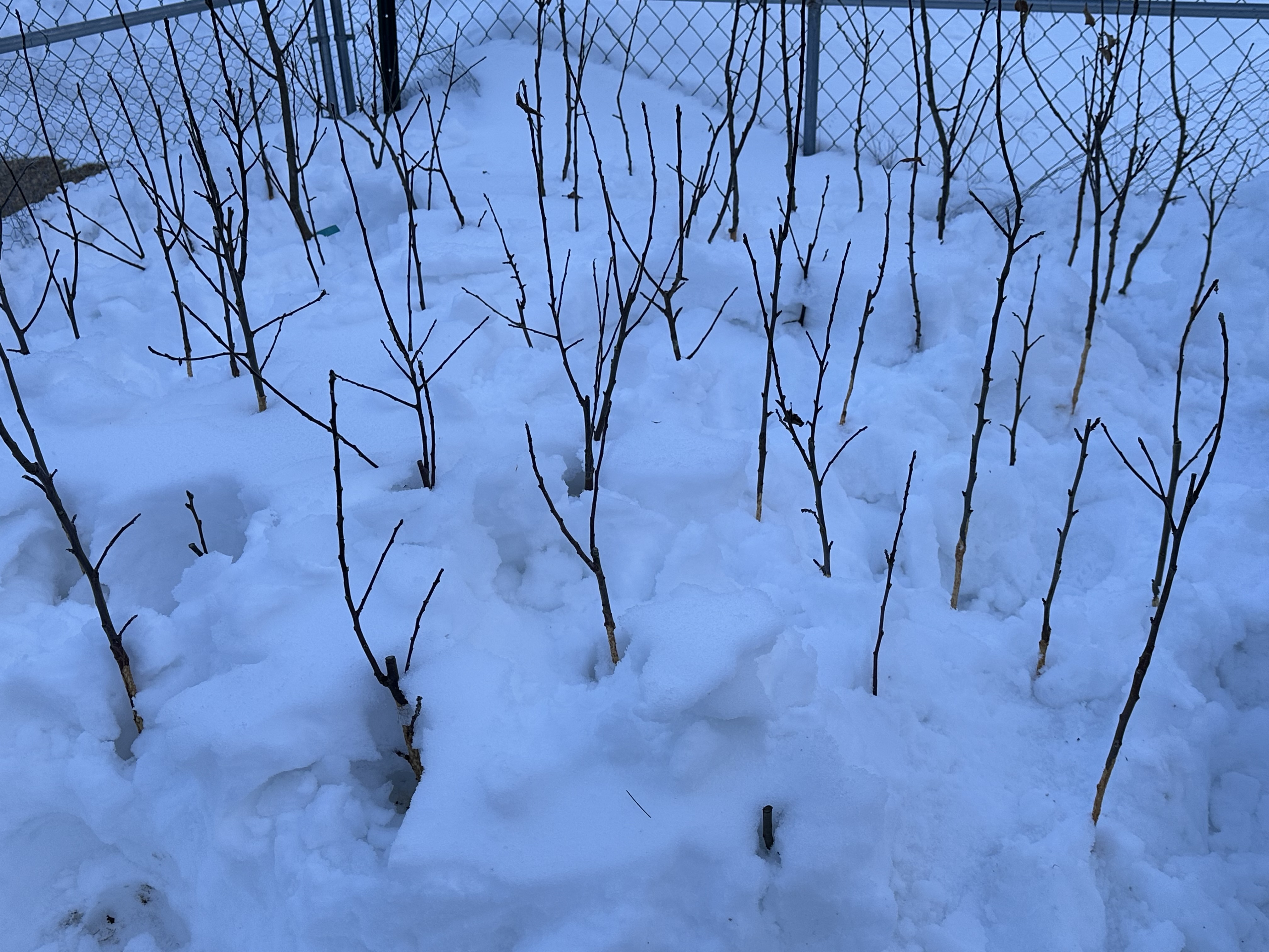
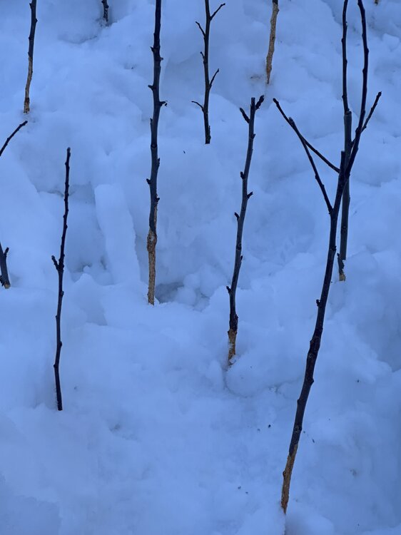
They were all young and grafted by myself. The plan was to plant many of them this spring in the field. They were untouched above the snow line. Bastards.

-
"Don’t do it" 2026 Blizzard obs, updates and pictures.
dendrite replied to Ginx snewx's topic in New England
It was easier to meet criteria before ASOS because human observers had no problem reporting 0sm, 1/16sm, and 1/8sm. ASOS rarely reports M1/4sm and there’s the 5 min obs and SPECIs that catch brief lulls down to 1/2sm. Wind is difficult too, but allowing frequent gusts over 30kt helps. -
"Don’t do it" 2026 Blizzard obs, updates and pictures.
dendrite replied to Ginx snewx's topic in New England
Precip ID or the vis too? I can’t recall many times seeing the vis sensor fail. -
The only saving grace has been the deep pack which is good for my pawpaw trees. OTOH, fucking voles girdled and killed every single one of my 50+ young pear and apple trees under the snow.
-
"Don’t do it" 2026 Blizzard obs, updates and pictures.
dendrite replied to Ginx snewx's topic in New England
Stations are fine. I have to take a look at the read up and obs -
D+ so far
-
"Don’t do it" 2026 Blizzard obs, updates and pictures.
dendrite replied to Ginx snewx's topic in New England
If half of the land area is homes and all of the snow blows off the roofs does that make the depth on the ground twice as high? -
Should be unlimited now…not sure why the met group was set to 70.
-
"Don’t do it" 2026 Blizzard obs, updates and pictures.
dendrite replied to Ginx snewx's topic in New England
Blue Hill record is 38.7” from Feb 69. -
"Don’t do it" 2026 Blizzard obs, updates and pictures.
dendrite replied to Ginx snewx's topic in New England
It remember looking at my 34” 5 years ago and thinking that was the peak for my lifetime.