dendrite
-
Posts
74,980 -
Joined
Content Type
Profiles
Blogs
Forums
American Weather
Media Demo
Store
Gallery
Everything posted by dendrite
-
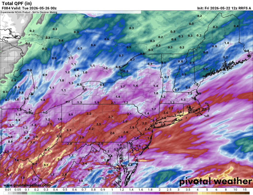
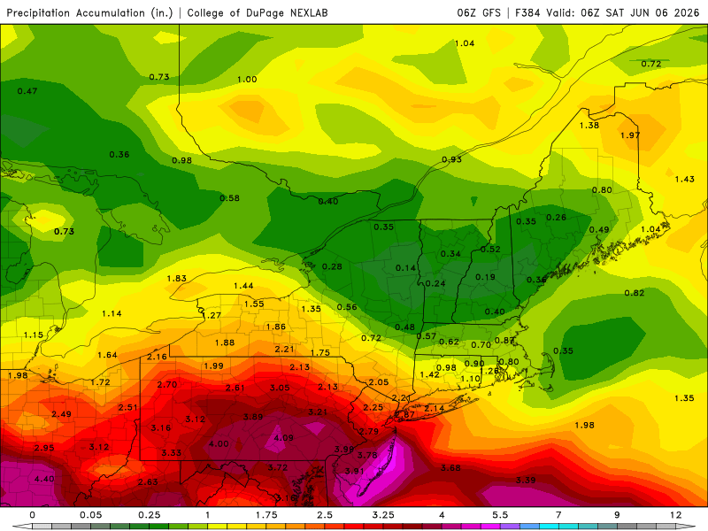
48° -RA The day is going into the dumpster so hopefully it’s at least a good soaker.
-
I can’t understand cheering on 52° and drizzle on Memorial Day weekend, but we do have a mental health crisis in this nation.
-
Need to rotisserize so I don’t burn the
-
I already expect to have the oven on a couple times to take the edge off.
-
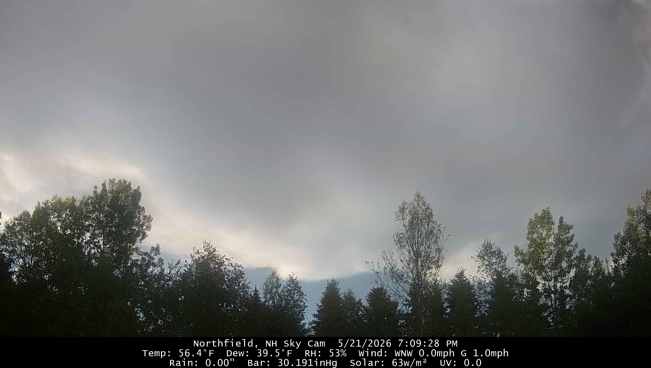
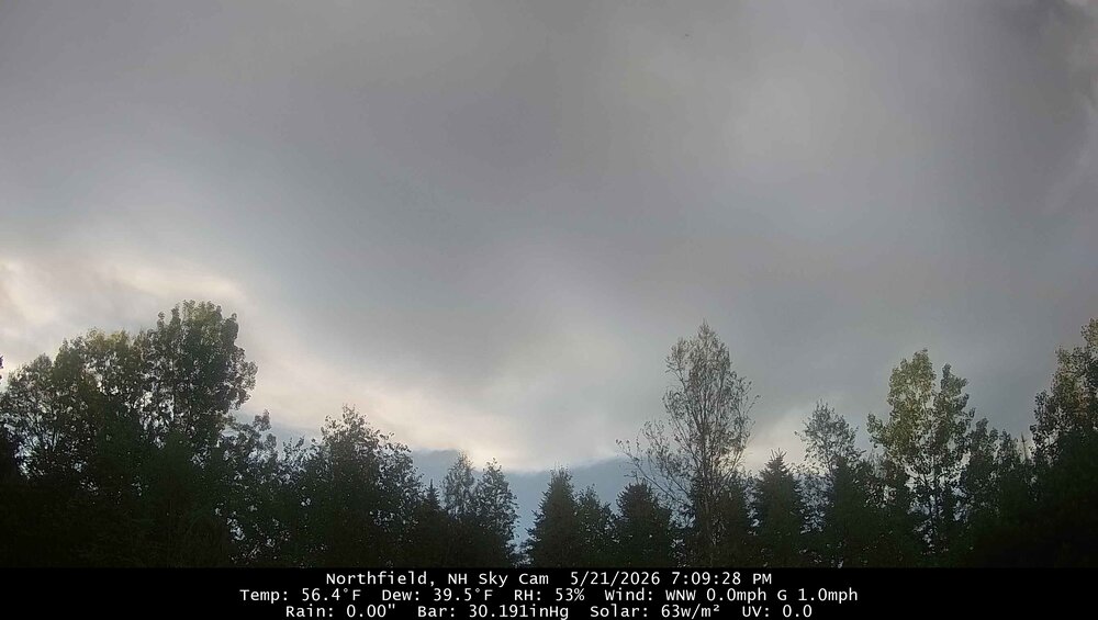
Decent morning with filtered sun through thin cirrus. 63.3°
-
I’m trying to figure out what he’s blehing. We get some rain and then some heat.
-
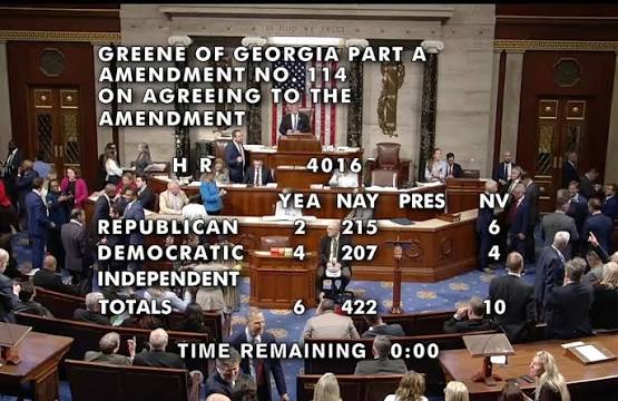
https://www.loveagain.app/find-a-wife.html
-
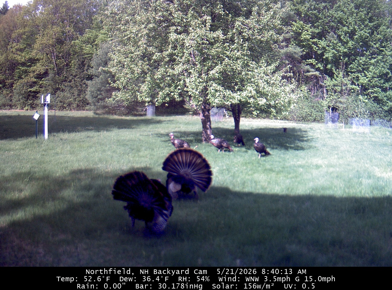
Rufus is wet
-
They will be our only winter this year
-
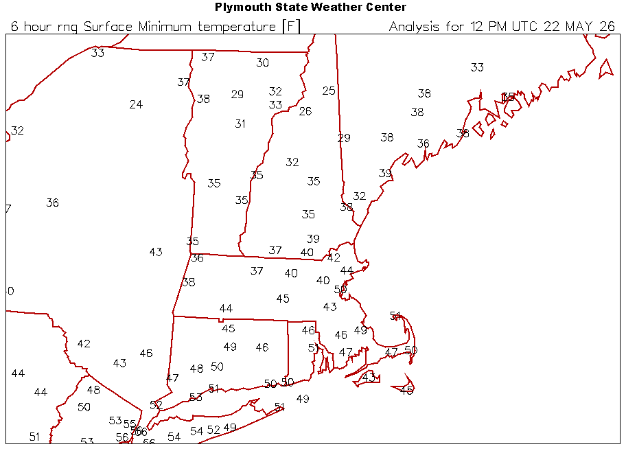
MAV with 29° for MVL.
-
Clouds all day, but of course the clear skies will creep in overnight.
-
Hopefully lots of clouds for as long as possible. Do not want the 30s.
-
Are you racing tomorrow?
-
We sun

-
May need the heat here on Sunday. I’ll take the rain. Goofus is basically a goose egg after this weekend.
-
You can do it put your into it
-
Sad
-
RIP Woodstock
-
We want dews and rain. Pants stay on.
-
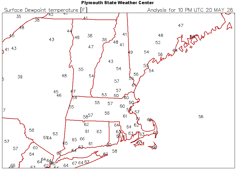
Boundary is through here. Skies are mostly clear, wind has picked up, and dews are dropping.