

NorthShoreWx
-
Posts
5,510 -
Joined
-
Last visited
Content Type
Profiles
Blogs
Forums
American Weather
Media Demo
Store
Gallery
Everything posted by NorthShoreWx
-
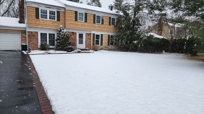
0.72" from that cell here. Found the old milk crate we put recyclables washed down the street (was already empty, fortunately). The rainfall total from the prior 3 days was only 0.20", mostly at night. I just missed it all while driving back from Westchester County, but the traffic still sucked on the dry roads in the Bronx and Queens.
-
This is nasty. On the flip side, it's really cool to see on satellite images how the smoke is suppressing convection.
-
0.03" rain from a shower here around 10 am, and another 0.03" here combined from two showers this afternoon. We're really raking in the rainfall. Lot's of long rolling thunder from that cell to our west earlier (the first of this afternoons two trivial rain showers) and that red sun is whacky!
-
40s at this moment along Long Island Sound and mid 60s by the expressway
-
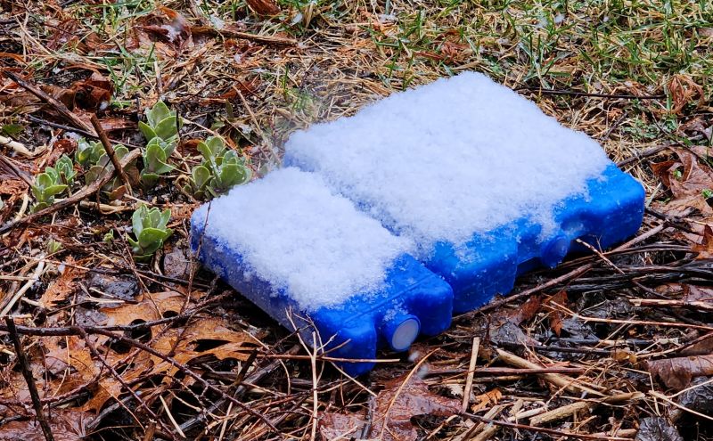
My maximum depth yesterday was 2.0", but wiping the blue ice pack board every 6 hours yielded 6", three inches of which stuck to the cold packs while the lawn was still green. Reporting 2" just doesn't seem right when I can nearly double my seasonal total by using the ice pack measurements. Total LE here was 1.85". C'est la vie. ...actual seasonal snowfall total is now a whopping 8.6", snow depth this morning was 2" (rounded), snow depth this afternoon is zippo. Maybe something is left in the shade somewhere.
-
That standard is only used at airports/FAA. Airports have different requirements unrelated to climatology. For all others board is wiped once in a 24 hour period and snowfall is reported as maximum depth on the board during that time.
-
Most likely, 0.6" is the correct total for the day. You shouldn't have wiped the board. To be fair, this kind of slop isn't easy to measure.
-
This was at 5:25
-
Snowing at a good clip here and the temp back down to 32.1° We're very close to 2" now, although its a bit uneven...you can tell which are the warm spots. A little over 3" on the ice packs
-
Earlier before the snow started sticking, I created the ultimate weenie snowboard. It worked quite well:
-
Still getting parachutes here. 32°
-
The nor'easter thread is making my brain hurt. Lots of stuff that should never be shared outside of therapy.
-
There was a blizzard from eastern LI to eastern New England on the first day of spring in 1973. If 1973 is your analogy.
-
Was there a different reason for BOS failing this year?
-
Low viz in S+ but not so windy
-
April 9 1996 was a great storm, but there were no Blizzard conditions on LI
-
West of William Floyd too. https://northshorewx.com/ClimateData/PNSOKX20010307.htm
-
Norlun in early December 1988 was over a foot in parts of central Suffolk, as was April 1982, but I can't think of any others.
-
We made it to about 9:30
-
Central Park showing 0.06" liquid overnight. Haven't seen a snowfall measurement yet
-
Makes sense. We had a west to NW wind during the snowfall. We were so close to the edge where I am that I doubt we'd have seen any accumulations with that radar presentation had the winds been more northerly. You were safely in the area of snowfall.
-
My middle of the night eyeballing didn't stand up to the scrutiny of the ruler. Actually only 0.6" here. Still an overachiever vs what was expected and it is a very pretty morning. 31⁰
-
We were right on the edge. If I saw the radar, I would have guessed we had nothing more than flurries.
-
Wow, we're really padding those seasonal totals now. Looks like about an inch through these bleary eyes. Didn't really expect that up here.


