-
Posts
5,494 -
Joined
-
Last visited
Content Type
Profiles
Blogs
Forums
American Weather
Media Demo
Store
Gallery
Everything posted by NorthShoreWx
-
Moderate snow 33/30. Less than half an inch so far. Side roads covered, main roads not yet.
-
It just started flurrying here. 35/28. A couple of hours ago it was in the teens.
-
Temp has skyrocketed near the coast from the teens to above freezing. Any reports of rain? That will be disasterous for the commute. Road surfaces must be cold.
-

Winter cancelled/uncancelled banter 25/26
NorthShoreWx replied to Rjay's topic in New York City Metro
The precipitation can't be right. Better than 25:1 ratios for the entire month assuming none of the 1.66" was rain. -
I drove around a bit today. Main roads are fully cleared. Some of the secondary roads aren't always wide enough for 2-way traffic, but passable. Whatever it is they were trying to do in the vicinity of the Ronkonkoma LIRR station around 1 pm was utter chaos, absolute amateur madness. Also defies imagination that they would plow Union Ave last. It's like a city Avenue. I drove from Sunrise Highway up to 25A in Stony Brook on Nichols Rd. There was more snow near Bellport than in Stony Brook but it's hard to gage how much from the car on a sunny late winter day.
-
There's still piles from December 14 under the piles from December 27 under the piles from ... etc
-

Winter cancelled/uncancelled banter 25/26
NorthShoreWx replied to Rjay's topic in New York City Metro
How is it possible that you don't know the answer? -

Winter cancelled/uncancelled banter 25/26
NorthShoreWx replied to Rjay's topic in New York City Metro
Snow depth and water content are a better way to compare apples to apples. But I still like to see snowfall stats. -
I'm not sure it was sound enhancement. It had the appearance of the opposite. Bands came down through CT, vaporized over the sound and regenerated within spitting distance south of here, as if we had a dome overhead. I suspect the meteorological explanation for this would be fascinating.
-

Winter cancelled/uncancelled banter 25/26
NorthShoreWx replied to Rjay's topic in New York City Metro
I wipe the boards once every 24 hours. For me it's consistently at midnight so it happened that I cleared the boards about mid-way through the storm and added 9" + 8" to total 17". If the same snowfall distribution had occured in a calendar day instead of crossing midnight, I would have had about 14.5". I am not particularly comfortable with such random differences. -
This! The only 20 inchers since I've been here (since 1995) are 1/1996 (22") and 2/2013 (27"). A bunch of near misses though, including today. Boxing day was 12" here, PDII was 19".
-
That's a pretty good list for 10 years!
-
More than 2013?
-
I think we get to 60". I think.
-
Final stats from N Smithtown: 2-22 9.0" snow, 0.79" LE, ratio 11.4:1 2-23 8.1" snow, 1.04" LE, ratio 7.8:1 Overall Storm Total 17.1", 1.83" LE, ratio 9.3:1 Current snow depth 18" For those of you thinking of adding today's snowfall to the seasonal totals, don't! The season was cancelled in December. But if it hadn't been cancelled, the total IMBY would be up to 48.2" Driveway cleanup is complete, a Black IPA has been drank, all is well.
-
If they were wiping a board at 6 hour increments, that should have translated to approximately another 1.5". If not, that most likely did not increase the maximum snow depth.
-
Although the Jan 25 snow is still there. This will most likely take us into March with continuous snow cover since January. We just finished shoveling out and it was a very different experience from the January cold-powder/sleet oxymoron storm. Today, the bottom of the snow was melted and heavy next to the pavement, but after a little initial melting the moisture remaining after we shoveled froze pretty quickly into a skating rink. There was no melting or icing of the bottom of the snow pack in the January storm. FYI, the water equivalent today was very similar to the January storm; 1.9" then vs 1.83" today.
-
Is the CP Conservancy supposed to follow FAA standards or COOP? ...not withstanding that they sometimes seem to follow neither
-
Unlike the park, they do measure and start over every 6 hours. Not only that, they report new snow every hour. It is very unlikely to exceed their totals using a different measuring protocol (non FAA), but that's just the way it is. I don't have a major issue with today. ISP had hours more accumulating snowfall than there was here despite being only 8 or 9 miles away as the crow flies. I am a wee bit envious of those who didn't spend a huge chunk of the storm in a subsidence hole, or whatever that was. On the other hand, we're still digging out and the xc skiing will be great.
-
-
That extra 5 hours of S+ was bound to make a difference.
-
ISP is the anti-Central Park
-
I'm not ungrateful How much at the stake?
-
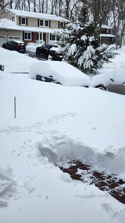
Storm total here 17.1" @IrishRob17, interesting measurements: 9.0" of snow through midnight melted down to 0.79" (11.4:1). I cleared the boards at midnight (my standard is once per 24 hours at midnight) 8.1" new measured on the boards a short while ago. Sample from that hasn't melted yet. I had 4.5" at the stake before the snow started and 18" now. The 4.5 inches is rock hard and did not compact, so you know the front 9 sure did. It is possible the snow could have been a little higher on the stake earlier, maybe 19". Alas, if we do manage to get another inch or two, it probably won't increase the snow depth.


