Jump to content

NorthShoreWx

Members
  • Posts

    5,025
  • Joined

  • Last visited

Everything posted by NorthShoreWx

  1. We had 2" here before the rain, but IIRC DC had all snow and another 8". Just unlucky at the end of a very good week.
  2. The original KU list was a subjective list of major northeast storms that Kocin and Ucelliini found impactful and meteorologically interesting and subsequently published and then updated an excellent book on their research. Taking it to the next level they worked to quantity the list by devising a calculation to attempt an estimate of how many people were impacted and how severely they were impacted. This became NESIS which I understand is now described as a "regional index", whatever that means as it seems to cover 2/3 of the country. Here are some things that I think should be considered when using "K-U" events to make broader climate associations in the northeast: 1. There is no "KU track". Clippers that largely do not achieve warning level snows in our region can get elevated to KU status if a cold wind in their wake manages to bury the Chicago area (as well as western and central NY, etc.) in lake affect, adding millions of people to the calculation. Likewise, a storm that drops a few inches across the deep south and manages to get some routine snows up towards the northeast can get the designation. Benchmark tracks feature in most of the biggest snowfalls in our area, but they are not common to all KU events. 2. Pretty much every significant snowfall (and some fairly insignificant ones) this century gets a NESIS rating (i.e., is a "KU"). Nearly every year has a KU; between the 1999-2000 and 2022-23 winter seasons there were only 4 winters out of 24 without a KU (2001-2, 2007-8, 2011-12, and 2019-20). The odds of a snowy winter having a KU are high because the odds of any winter having a KU are high. Prior to this century, storms were not evaluated in the same way. 3. Many of the NESIS cases had limited impacts on the northeast, others had major impacts limited to the northern tier of states from the upper Midwest to Maine, but little impact south of there. Still others were mostly notable from the gulf coast through the mid-Atlantic. In short, they are all different, with different evolutions, effect different areas, have variations in the long wave patterns, and individual KUs often represent an aggregation of the effects of multiple shortwaves with varying reflections at the surface. The breadth of these events is not the same as what Kocin and Ucellini originally focused on. 4. I looked at 30 years of snowfall data from my own site since I had easy access and I trust the data. 8 of those years had snowfall of between 25 and 72 inches exclusive of snow that fell during KU events. The list would be even longer if we assume that there would have been some snowfall even if the KU events not occurred (i.e., there may still have been smaller or less widespread snowfalls during the same time periods). In other words, "zeroing out" KU totals from the record is probably not realistic. Of course there is no way to quantify what that might have been.
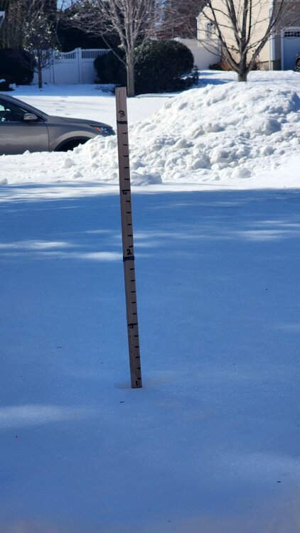
  3. 2014 1 1 19 32 0.00 0.0005 2014 1 2 15 31 0.04 3.0 1 2014 1 3 8 16 0.81 5.5 9 2014 1 4 0 28 0.00 0.0 8 2014 1 5 10 50 0.00 0.0 7 2014 1 6 25 58 0.36 0.0005 T 2014 1 7 6 25 0.13 0.0 T 2014 1 8 8 24 0.00 0.0 T 2014 1 9 17 32 0.00 0.0 T 2014 1 10 17 35 0.0005 0.0005 T 2014 1 11 35 59 0.30 0.0 2014 1 12 30 51 0.70 0.0 2014 1 13 26 51 0.00 0.0 2014 1 14 39 47 0.13 0.0 2014 1 15 31 47 0.57 0.0 2014 1 16 30 39 0.00 0.0005 2014 1 17 24 45 0.0005 0.0 2014 1 18 28 46 0.0005 0.0005 2014 1 19 26 36 0.00 0.0 2014 1 20 31 46 0.00 0.0 2014 1 21 13 32 0.00 0.0 2014 1 22 6 14 0.47 8.0 T 2014 1 23 7 22 0.00 1.0 8 2014 1 24 10 20 0.00 1.5 7 2014 1 25 17 34 0.00 0.0 6 2014 1 26 16 30 0.10 0.0005 5 2014 1 27 20 47 0.0005 0.0 4 2014 1 28 12 20 0.00 0.1 2 2014 1 29 11 26 0.11 1.5 4 2014 1 30 5 32 0.00 0.0 3 2014 1 31 16 43 0.00 0.0 3 2014 2 1 28 45 0.00 0.0 3 2014 2 2 31 58 0.00 0.0 2 2014 2 3 28 39 0.51 8.8 4 2014 2 4 21 40 0.61 0.0 9 2014 2 5 28 33 1.04 3.1 11 2014 2 6 19 30 0.00 0.0 10 2014 2 7 16 34 0.04 0.0 9 2014 2 8 18 29 0.00 0.0 9 2014 2 9 16 31 0.00 1.3 8 2014 2 10 18 30 0.09 0.0 9 2014 2 11 13 27 0.00 0.0 9 2014 2 12 13 26 0.00 0.0005 9 2014 2 13 26 32 1.45 12.5 17 2014 2 14 27 43 0.38 1.0 18 2014 2 15 25 36 0.20 2.9 17 2014 2 16 21 29 0.00 0.2 20 2014 2 17 16 32 0.00 0.0 19 2014 2 18 18 37 0.00 4.0 20 2014 2 19 23 45 0.23 0.0 17 2014 2 20 30 51 0.28 0.0 15 2014 2 21 35 52 0.03 0.0 13 2014 2 22 31 53 0.11 0.0 10 2014 2 23 31 56 0.00 0.0 8 2014 2 24 25 44 0.02 0.0005 6 2014 2 25 22 34 0.00 0.0005 5 2014 2 26 16 32 0.0005 1.2 5 2014 2 27 7 33 0.06 0.3 6 2014 2 28 10 26 0.02 0.0 5 2015 1 1 18 39 0.00 0.0 2015 1 2 28 44 0.00 0.0 2015 1 3 25 43 0.00 0.0005 2015 1 4 40 54 0.82 0.0 2015 1 5 19 50 0.25 0.0 2015 1 6 14 22 0.00 0.5 2015 1 7 8 26 0.04 0.0005 1 2015 1 8 7 23 0.0005 0.0 T 2015 1 9 16 33 0.00 1.7 1 2015 1 10 14 25 0.11 0.0 2 2015 1 11 10 35 0.00 0.0 1 2015 1 12 33 36 0.00 0.0 1 2015 1 13 20 35 0.69 0.0 2015 1 14 19 27 0.0005 0.0005 2015 1 15 20 35 0.0005 0.0 2015 1 16 19 43 0.00 0.0 2015 1 17 15 28 0.00 0.0 2015 1 18 20 48 0.00 0.0 2015 1 19 35 43 1.18 0.0 2015 1 20 30 41 0.00 0.0 2015 1 21 24 34 0.00 0.0005 2015 1 22 29 40 0.0005 0.0005 2015 1 23 20 42 0.00 0.0 2015 1 24 33 36 0.00 4.0 4 2015 1 25 27 44 0.83 0.0 3 2015 1 26 23 27 0.00 5.0 2 2015 1 27 15 24 1.64 10.0 15 2015 1 28 15 30 0.00 0.0005 14 2015 1 29 13 36 0.00 0.0 13 2015 1 30 19 36 0.02 0.8 13 2015 1 31 12 26 0.02 0.0 12 2015 2 1 7 40 0.00 0.4 12 2015 2 2 16 32 0.00 7.9 14 2015 2 3 8 27 1.06 0.0 16 2015 2 4 9 42 0.00 0.0 15 2015 2 5 13 37 0.0005 0.9 13 2015 2 6 5 28 0.05 0.0 13 2015 2 7 8 34 0.00 0.0005 13 2015 2 8 24 39 0.0005 0.0 12 2015 2 9 22 25 0.00 0.3 12 2015 2 10 23 37 0.06 0.0005 12 2015 2 11 17 31 0.00 0.0 11 2015 2 12 16 41 0.00 0.2 11 2015 2 13 8 22 0.01 0.0 10 2015 2 14 4 33 0.00 1.5 10 2015 2 15 4 26 0.07 0.0 12 2015 2 16 1 19 0.00 0.0 11 2015 2 17 9 24 0.00 4.0 15 2015 2 18 6 31 0.20 0.0 14 2015 2 19 8 24 0.00 0.0005 13 2015 2 20 1 19 0.0005 0.0 12 2015 2 21 -2 32 0.64 3.5 12 2015 2 22 28 42 0.30 0.9 14 2015 2 23 8 34 0.00 0.0 13 2015 2 24 -1 23 0.00 0.0005 13 2015 2 25 10 39 0.0005 0.0 13 2015 2 26 21 27 0.00 0.0005 12 2015 2 27 17 29 0.0005 0.0 12 2015 2 28 12 30 0.00 0.0 12
  4. You may have seen this long ago, but the lead article about the central park observatory is an interesting read: https://www.weather.gov/media/coop/newsletter/19coop-spring.pdf
  5. Do you consider a "benchmark storm" synonymous with a KU? I think there can be future disagreements about cause and effect with regard to the association between such a storm and higher winter snowfall (which you seem to have defined as over 25 or 30"). I'm not talking about years like 1983 and 2006 which clearly fit with your preferred scenario. It's interesting and worthwhile to discuss these associations, but sometimes they seem a bit forced. I also think Central Park is not a good test case with the data challenges that have been well documented there.
  6. This morning's snow clearing shenanigans: https://www.instagram.com/reel/DTG0DRUCCVW/?igsh=MTRsN3l5MXN1MzJiaA==
  7. And you say he got there from Williamsport on just a quarter bale of hay?
  8. FWIW, my backyard sensor had 0° on 1/4/2014 (snow depth was 8"). Then we hit 50 on the 5th and 58 on the 6th after which we repeated the whole cycle (6° on the 7th, 59° on the 11th). Following that we had constant snow cover of at least 2" from January 23 through March 10 (max 20" on February 16 and February 18). March was cold, but the snowstorms stayed down in the mid Atlantic or that winter could have rivaled 1996 for snowfall. Other 0° days IMBY: -2 2/21/2015 -1 2/24/2015 -2 2/14/2016 Close but no cigar: 1° 1/7/2018 3° 1/31/2019 3° 2/4/2023 The last time we had single digits at my site was 6° on 1/23/2025
  9. Not at all. 2015 and 2016 come to mind and it's happened once or twice this decade too. I'd have to check, but I think maybe 2018 too.
  10. Picked up 0.6" new snow here this morning. Still snowing lightly. 26⁰
  11. Light measurable here again. 3 of the first 4 days of the year. I like the percentage. 25⁰, S-
  12. Been seeing hockey games on the ponds here for a week now.
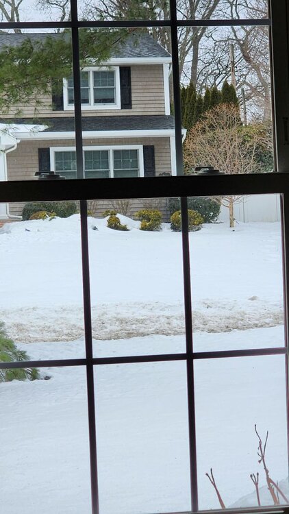
  13. Addendum: December 2025 was the 5th coldest out of the past 31 Decembers here. It didn't even seem that cold, but certainly we didn't have the extreme warm outlier days that seem to have become prevalent in December. 12/25 average was 33.1, December mean is 37.2. Here are the 5 coldest: December 2000 - 29.6° December 1995 - 30.7° December 2010 - 32.2° December 2002 - 32.9° December 2025 - 33.1°
  14. On the heels of yesterday's "record breaking" New Years Day snowfall, here are some more stats from the current winter season in Smithtown: The period of record for snowfall is 10/1/1995 through the present. The old daily January 1st record of 0.1" was the lowest daily record of any date between November 30 and March 25. Yesterday's 0.3" of snowfall shattered (tripled ) the old record set on New Years Day 2010. Here are all New Years Day snowfalls in Smithtown since 1996: 1997 - Trace 2006 - Trace 2010 - 0.1" 2014 - Trace 2020 - Trace 2021 - Trace 2026 - 0.3" Snowfall this season through 1/2 is 13.4". The December mean temperature was 33.1° and monthly snowfall was 13.0". Thus far we have had 11 days with at least a trace of snow, 7 days with measurable snowfall, and 3 days with at least 1 inch. Total precipitation for December was 4.33". Total precipitation for 2025 was 39.46" (8.34" below the 13-year average) Finally, the only other day in January with a daily snowfall record below 1" is January 13 (0.5" in 2000). We might have a shot at breaking that this year.
  15. Same here. Was that you on mping near that same location?
  16. Perfect fetch for LIS effect snow into the north fork right now. @wthrmn654 might wake up to a surprise. 21⁰ with light snow in Smithtown at 2am. Temp had been down to 16⁰ earlier.
  17. Right on the edge here. Those annoying models that said we would be right on the edge were right. How annoying.
  18. Frequent light to moderate snowfalls reminds me of when I was a kid. It's not terrible if the warmups aren't too much. One of my earliest memories, which may have been exaggerated by the years, was of it seeming like every morning waking up to a new snowfall. Mid to late 60s, maybe early 70s it would have been, probably more than 1 winter. Don't care whether that was quite the reality, I'm hanging on to that memory... and 1978.
  19. Philly looked like it was getting skunked too with the snow shield northeast of there, but then it backed up just enough to put them in a heavy band near the edge and they got 8".
  20. Snowcover is about 50-50 here, but not all of the covered area is even an inch, so I'm going with a trace. But it still looks nice in places.
×
×
  • Create New...