Caveman
-
Posts
219 -
Joined
-
Last visited
Content Type
Profiles
Blogs
Forums
American Weather
Media Demo
Store
Gallery
Everything posted by Caveman
-
Yup!
-
Trace...

-
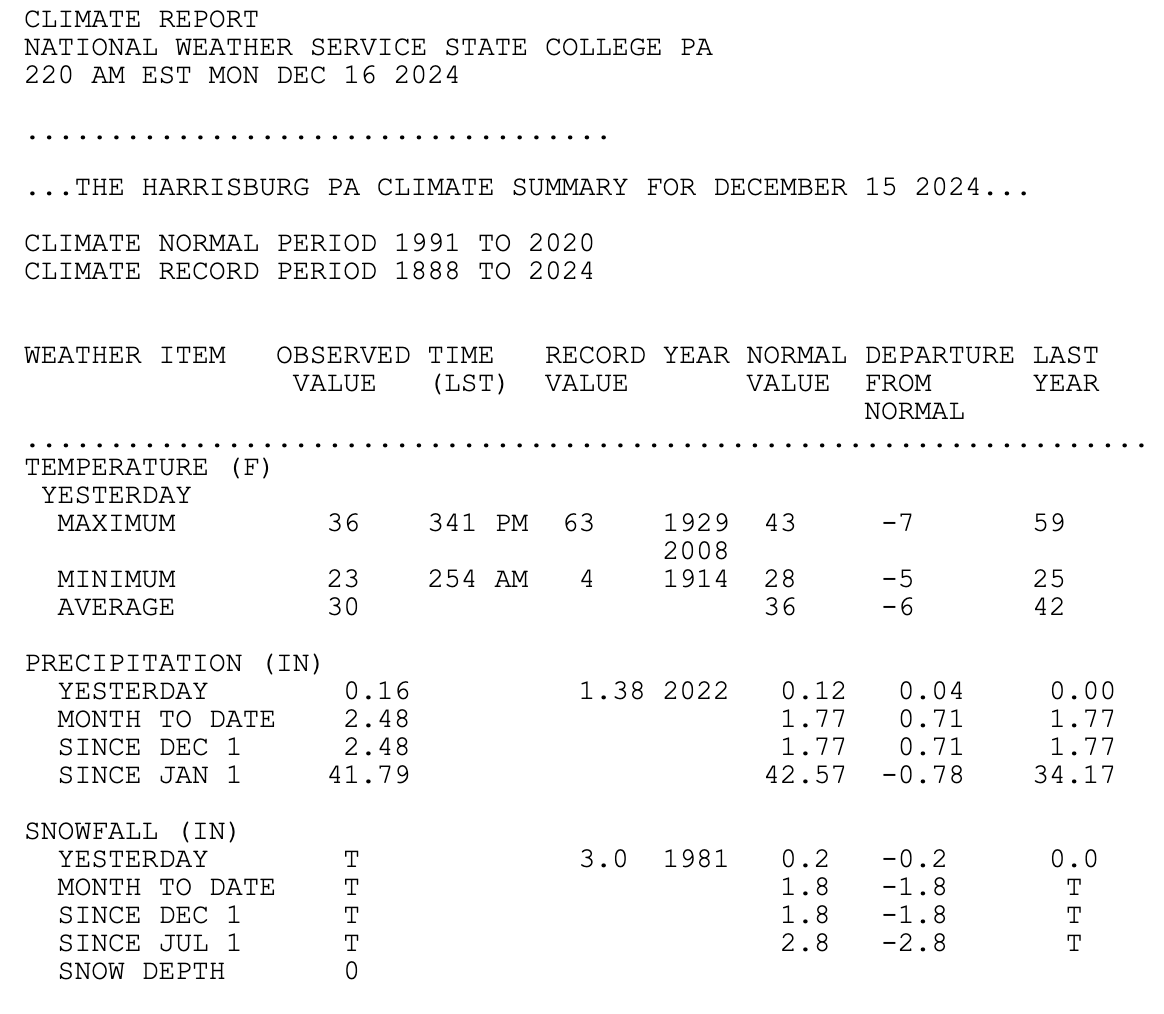
0.11" liquid with 1.6" snow, Valley Green, northern York County.
-
Dewpoints are low; gonna take some time to saturate the column. Higher elevation=less time to saturate=greater accumulation.
-
0.01" of snow, IP, and rain; Valley Green, Etters PA. The "bulk" fell around 6 pm Thursday...
-
I'm at 5.1" with 0.5 mi visibility; I'm melting my contents in the overflow open cylinder presently for my cocorahs report...and the pressure has been falling rapidly over the last 2 hours; down to 998 mb!
-
2.2" on my snowboard as of 6 am...visibility <0.25 mi...it changed over around 3:45 am...Etters, PA northern York County PA
-
The height falls are impressive with the upward motion on the NAM Tuesday am; when the cold feeds into a strengthening coastal low, funny things do happen. Just sayin'...
-
7 am ob: 3.8" snow with 0.24" liquid in Valley Green, northern York County...
-
Pretty good depiction of cyclonic flow here in these parts as per the current radar from the NWS...https://radar.weather.gov/station/KCCX/standard
-
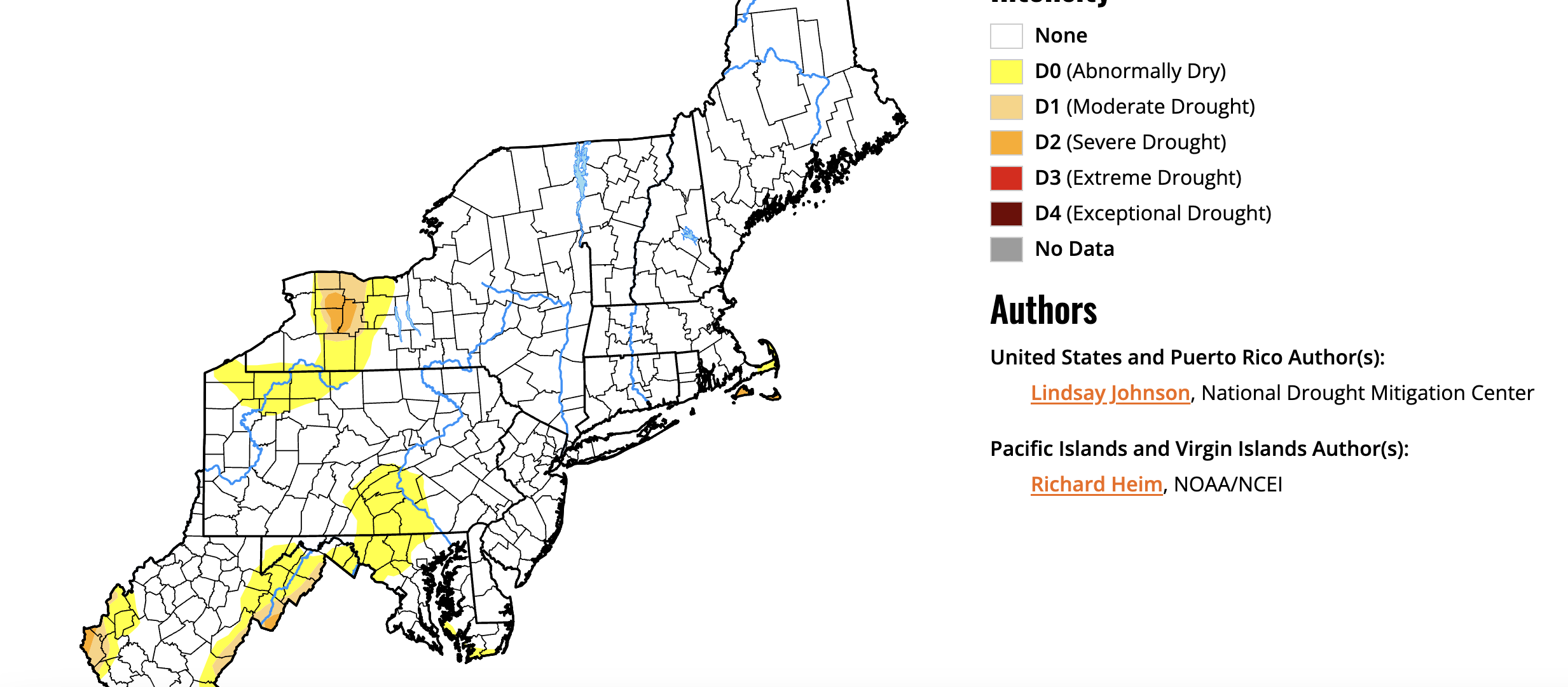
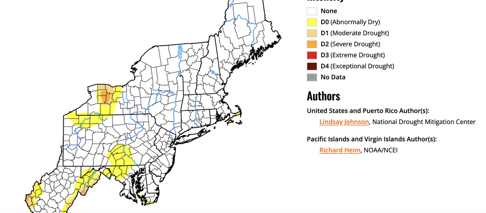
No doubt! I'm in northern York County and "play" in the middle of that "abnormally dry" region in south central PA...and frankly, for this time of year, it's abnormally wet.
-
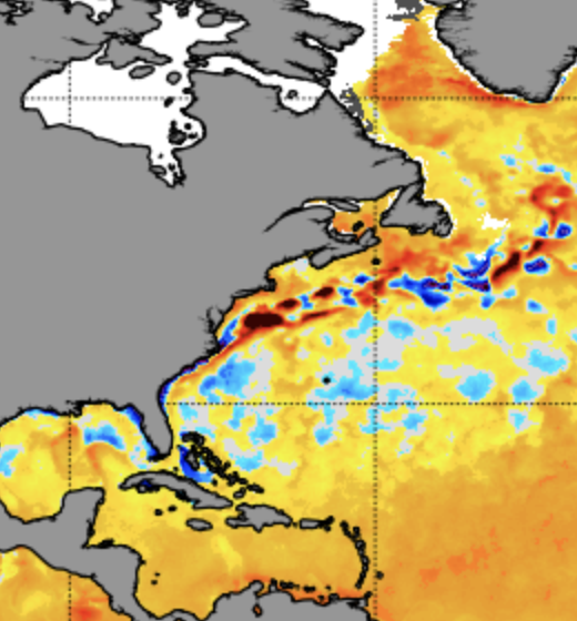
It also shows a deep tropical connection w/ the water vapor; one thing for sure; the weather pattern has certainly turned from our dry late summer and fall!
-
1.53" from the event with a VERY BRIEF period of frozen mix at the onset Tuesday morning. All snow is gone except in small piles. 29.12" on the aneroid barometer this am. Koeppen's subtropical humid continental (Cfa) is alive and well here in southern PA!
-
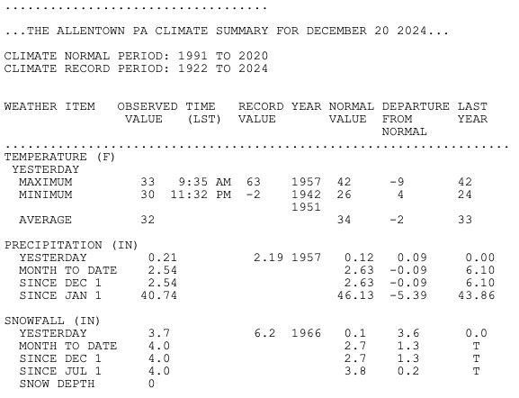
1.03" total liquid and 3.6". Had a lull from 2-3 pm here; then the notorious mixed bag until it ended in the evening. Good initial 4 hours gave us the bulk of our accumulation; then again about 3-5 pm for another inch of slop...that ocean off the mid-Atlantic is warm...3-5°C warmer than normals for 5 Jan 2024...enhances precip but any storm strength will bring warm air in as well...
-
I live in Etters and we are at 1" and roads/pavement are snow covered. I just drove from Lancaster and plows were clearing the shoulders of route 30. My visibility as I type is 1/4 mile.
-
The NWS office used to be located in the Federal Bldg in Harrisburg before politics moved the radar up in the center part of the state and thus felt the office should be located there as well. The "old" radar was atop a mountain WSW of Mt. Holly Springs...That's when wx models were dot matrix plots!
-
Chester County is very often split NW-SE...Philly/Mt. Holly
-
Gotta smell the rain to get the heaviest snows!
-

Central PA Winter 2022/2023
Caveman replied to Blizzard of 93's topic in Upstate New York/Pennsylvania
BIG flakes fell for about 20-30 minutes around 2 am...0.7" snow on board. Northern York County, PA -
Central PA Winter 2022/2023
Caveman replied to Blizzard of 93's topic in Upstate New York/Pennsylvania
Christmas Tree! -
Central PA Winter 2022/2023
Caveman replied to Blizzard of 93's topic in Upstate New York/Pennsylvania
I do believe you're correct...in fact, I believe the entire Mid-Atlantic and northeast US as per the NWS watch/warn map might just look like a Christmas Tree! -
Central PA Winter 2022/2023
Caveman replied to Blizzard of 93's topic in Upstate New York/Pennsylvania
I think the ensembles are showing a storm going up west of the mountains transitioning vorticity to the coast for a coastal development...very common in these parts as you are all aware. If the antecedent cold is sufficient, that makes for a nice winter event in these parts...albeit possibly a tad sloppy or heavy...? Storm to Pittsburgh, overrunning precip; then coastal take over...hammer time! That model posted is 234 hours out...Thoughts? -
Central PA Winter 2022/2023
Caveman replied to Blizzard of 93's topic in Upstate New York/Pennsylvania
20°F+ surface T anomalies for a couple of days with Td >32°F will erode snow cover quickly if that indeed occurs as per the Euro...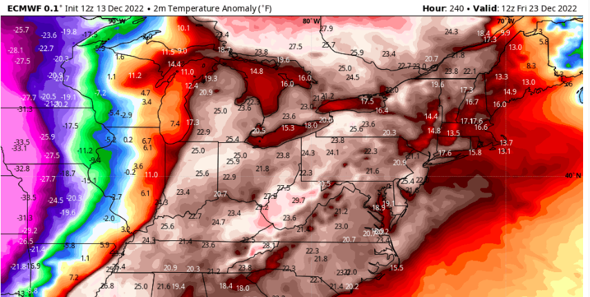
-
Central PA Winter 2022/2023
Caveman replied to Blizzard of 93's topic in Upstate New York/Pennsylvania
Christmas Eve and early Christmas morn 2015 was awesome! It was warm and humid! As a young kid, I would've been depressed. Now, I loved it! I believe the maxT was 70F at KMDT on Christmas Eve! -
7" here in Valley Green, northern York County. Liquid equivalent later for my 7 am COCORAHS observation...