IUsedToHateCold
-
Posts
838 -
Joined
-
Last visited
Content Type
Profiles
Blogs
Forums
American Weather
Media Demo
Store
Gallery
Everything posted by IUsedToHateCold
-
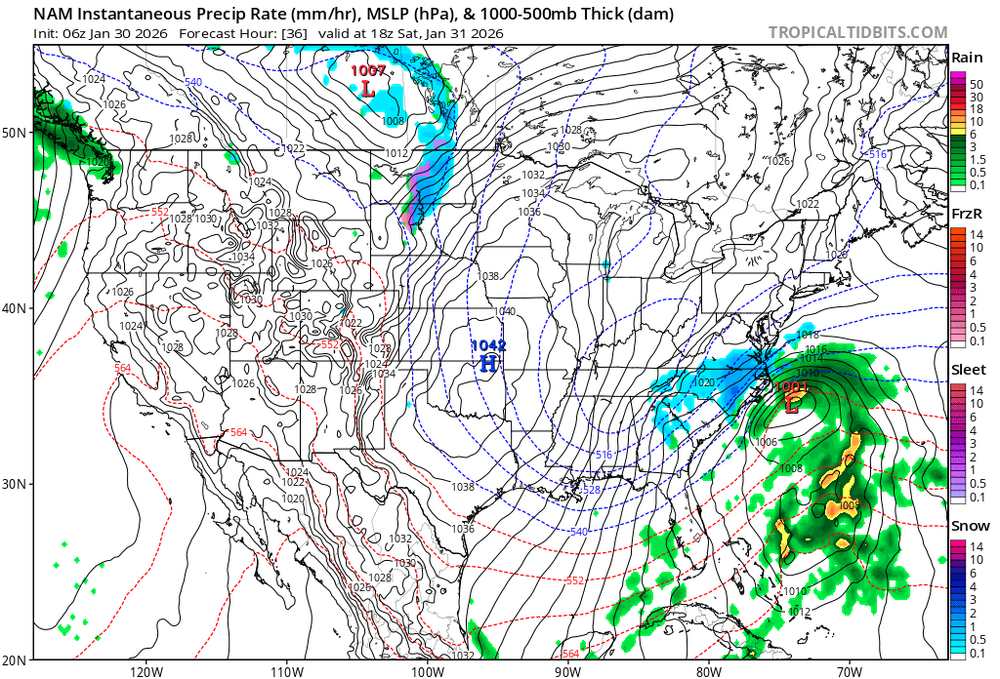
 6z:
6z:
-
The “I bring the mojo” Jan 30-Feb 1 potential winter storm
IUsedToHateCold replied to lilj4425's topic in Southeastern States
If I wanted to chase this one I'd go to Greenville NC. Seems to be in a pretty good spot and I think it will get better. You're getting a bit of a NW trend as it draws closer and that's actually good for you this time around. -
The “I bring the mojo” Jan 30-Feb 1 potential winter storm
IUsedToHateCold replied to lilj4425's topic in Southeastern States
Congrats - this one is yours - been a long time since we've seen a storm like this down there. I used to live in Charlotte back in 2010 and 8 inches of snow is going to shut them down hard. Maybe it will also kill the fire ants that have invaded since when I lived there. Have fun and post pictures. -
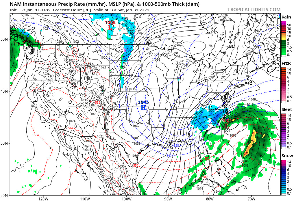
It's just getting pushed south by the confluence up top which is being driven by the system diving into the dakotas - that system needs to be less aggressive and stay up in Canada.
-
Confluence seems a smidge more south at 36, otherwise no differences that I can see
-
The GooFus is queuing up. It's the last 2 minutes of the game and we need a hail mary.
-
Nope, not giving up on an 18z run of the GooFus. If 00z Euro doesn't trend NW then I'll throw in the towel
-
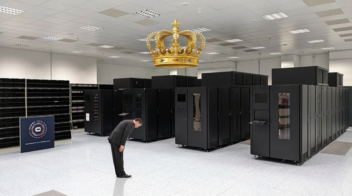
Good trends so far. Need the King to come on board.
-
Anyone who's out now hasn't been at this for awhile. We got a day before the blinds start to close. Need to see those trends work in our favor on the 18z and 00z runs. If we're having this conversation at the same time tomorrow it's probably time to plan a trip to central NC or get out a pack of that smooth cold cirrus. I heard it doesn't have nicotine and isn't addictive.
-
It is too early to give up on the north jog. But the solution advertised is similar to Jan 25th, 2000 - it IS possible.
-
Seems like a poor choice to berate the model which bestows hope upon you. It too can send the storm to the fish whom are hungry for it. Let us be kind to our model friends ... Keep the hope alive GFS.
-
All hail the King, might it have benevolence upon us

-
This is right where we want it at this time frame. It needs to come north another 150 miles or so and then it's real tasty.
-
January 2026 Medium/Long Range Discussion
IUsedToHateCold replied to snowfan's topic in Mid Atlantic
Believe man, GFS is going to nuke us. 47" for DC with 50 MPH winds. Yeah, that's probably not going to happen. But... if you're not going to believe why are you here watching every model run? -
January 2026 Medium/Long Range Discussion
IUsedToHateCold replied to snowfan's topic in Mid Atlantic
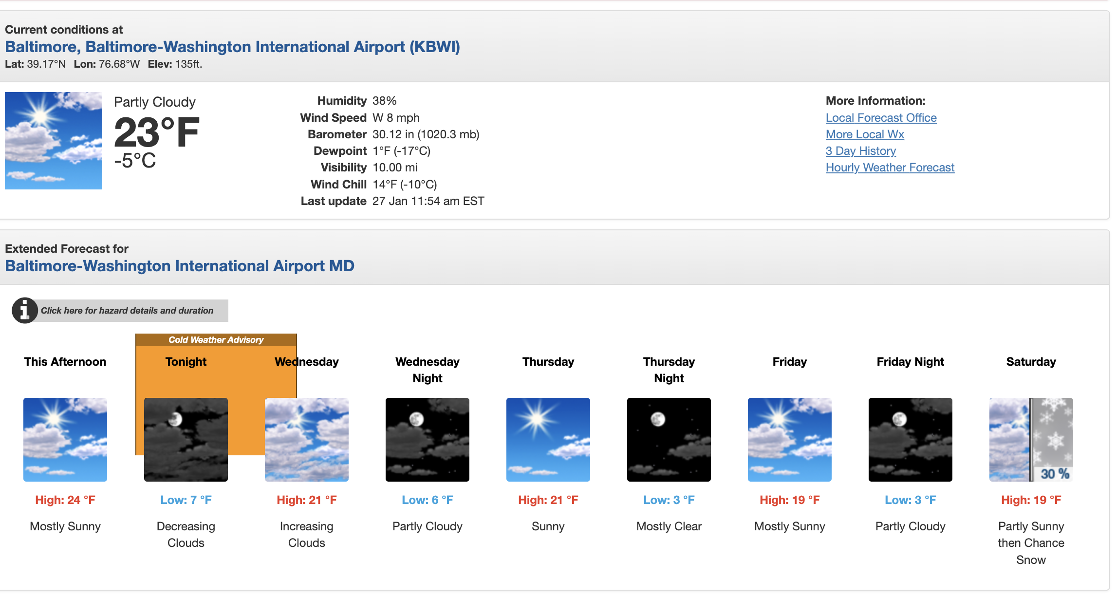
I haven't seen a forecast this cold in a long time, maybe since 2014
-
January 2026 Medium/Long Range Discussion
IUsedToHateCold replied to snowfan's topic in Mid Atlantic
It was really that it went more north than west. The primary went into the OHV and transferred to a low off of Ocean City. We would've rather the primary stayed down south and transferred off the coast of NC. But I agree that it's too early to throw in the towel. -
January 2026 Medium/Long Range Discussion
IUsedToHateCold replied to snowfan's topic in Mid Atlantic
I'm just willingly and for no good reason going to assume that this typo in their AFD means this thing is going to be something to see. But as for the run-to-run noise - they call it thread the needle for a reason. This is a high stakes game right here. One 50-75 mile line is going to win huge if anyone wins at all. I ran the die roll last night - 18 - I think we got a good shot at this. Keep up the spirits and don't let a single run get you down. You're going to see fluctuations. All that matters is where the storm actually goes in the end. But I do think if that line in the GFS that gave 48" of snow to Salisbury comes north a hundred miles the board will probably crash lol. -
January 2026 Medium/Long Range Discussion
IUsedToHateCold replied to snowfan's topic in Mid Atlantic
That's almost 4 feet of snow on the eastern shore with 50-65 mile per hour winds. Absolutely catastrophic. -
January 2026 Medium/Long Range Discussion
IUsedToHateCold replied to snowfan's topic in Mid Atlantic
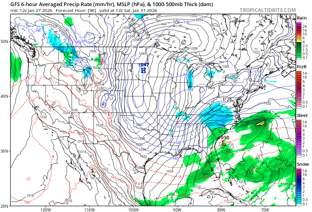
Big difference at 96 hours with the placement of the surface low - much further west on 12z.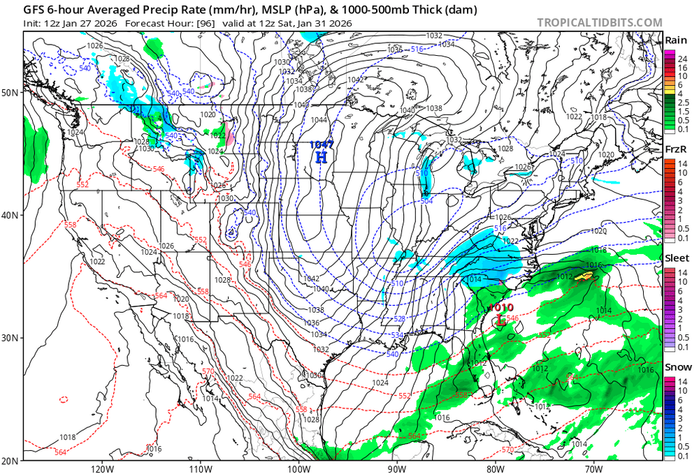
-
January 2026 Medium/Long Range Discussion
IUsedToHateCold replied to snowfan's topic in Mid Atlantic
I'm not out. Things could trend back the right way. I'd say if by end of day tomorrow it's considerably offshore it's time to turn out the lights. But if all we need is a 100-200 mile shift then we can get that as we approach the event. -
January 2026 Medium/Long Range Discussion
IUsedToHateCold replied to snowfan's topic in Mid Atlantic
They call these clown maps for a reason. Really, multiple reasons. A: They have an unbelievable look. B: They're funny as hell. I mean, I don't understand fluid dynamics, so I shouldn't talk. But I know climo, and there's no way that this map is ever going to verify even if the storm took the track that was advertised. Bring on the King. -
January 2026 Medium/Long Range Discussion
IUsedToHateCold replied to snowfan's topic in Mid Atlantic
In 2037 your phone will be walking around your house doing your laundry. Banter, but it had to be said. As for this storm, it's time for the good old die roll. It was a good one. 18 means I'm liking our chances. Needed a high roll for this thread-the-needle type situation. Would've loved to see a critical hit here, but 18 is still really good.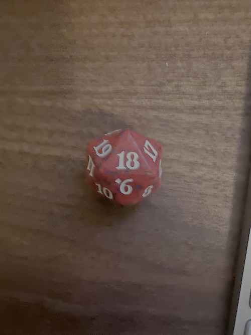
-
January 2026 Medium/Long Range Discussion
IUsedToHateCold replied to snowfan's topic in Mid Atlantic
This is in their example - so they use GFS data. from earth2studio.data import GFS -
January 2026 Medium/Long Range Discussion
IUsedToHateCold replied to snowfan's topic in Mid Atlantic
Based upon their performance this past weekend, my guess is that they're powered by AI or something. It's reading the QPF map and the temperature and saying "2 feet of snow!" without analyzing the midlevels, or it is analyzing the midlevels and coming up with something wildly wrong. -
January 24-26: Miracle or Mirage OBS Thread!
IUsedToHateCold replied to Jebman's topic in Mid Atlantic
Oh yeah, NAM definitely whiffed the QPF. Maybe I don't remember correctly, but didn't GFS have a lot higher totals? And yeah, Chicago didn't get more snow than most of us, but still actually got snow.