psuhoffman
-
Posts
27,419 -
Joined
-
Last visited
Content Type
Profiles
Blogs
Forums
American Weather
Media Demo
Store
Gallery
Everything posted by psuhoffman
-
Speaking of the MJO one lesson we should remember in the future, when the mjo has a weak wave through phases out of phase with the base state it will have very little to no impact on sensible weather. A weak phase 8 during a La Niña Pac base state isn’t going to save us usually. Conversely a weak phase 4 during a cold winter won’t have the same disastrous impact as last years.
-
It’s about setting proper expectations. When I saw the pattern that was setting in around Xmas I set my expectations so low that even though it was the worse season I recorded out of 15 up here I felt lucky and enjoyed what little snow I got. Some of the other comps to that were almost complete skunks even up here! I knew it was going to be pretty awful so I wasn’t that upset when it was. People that put any stock into Merskys CFS MJO predictions on the other hand...
-
His biases aside there isn’t much to be optimistic about ATT. But long range seasonal is low probability and things can change quick. But that’s not a reason to predict a cold snowy winter. I don’t see much to justify such a prediction right now.
-
You’re right we should stick to the CFS
-
2017-18 was weak. Peaking at -1.0 on the tri monthlies. 2016-17 was actually borderline cold neutral as it peaked at -.7 in fall and dropped below Nina status by the DJF period! But there is a lag and enough of the other factors were crap that it didn’t matter. I am not saying the correlation isn’t accurate. Although now I’m curious and will look when I get the chance. Simply saying off the top of my head knowing the enso of some years he included in his “weak Nina” dataset is flawed I wouldn’t take that product very seriously. But in general we do want the qbo negative. So the idea is correct. I doubt that map accurately depicts the correlation though. Wait for the “it’s never going to snow again” crowd to notice the QBO suddenly has tended to want to stay in unfavorable phases lately! Just one more thing for them to pile on! Actually one thing positive to note from recent results. Despite a recent bias to spend a lot of tome in unfavorable phases of pattern drivers (qbo/NAO/AO/EPO/MJO) we have still managed to have a few snowy periods in the last 5 years. Is seems like we do hit more often when we do line up a good pattern. But getting a good pattern is less frequent. If we can ever get into a period of more favorable longwave pattern influences and keep the penchant for frequent big precip events...we could get an epic run! Hopeful I know but why not inject some positivity now.
-
Possibly but 2015 was a weak nino and 1982 wasn’t cold neutral it was just neutral. Spent DJF at 0 and JFM at +.1. How much is that chart skewed by those 2 years? And counting 1963 which never came close to nino status and fell in the middle of a cold -NAO period is dubious at best imo. I think he just made a mistake inputting some years. Oddly wrt QBO the last 2 cycles failed to ever attain a deeply negative phase. Perhaps that muted their impact.
-
Maybe there is a correlation but I would take that product with a whole cup of salt. First of all 1963, 1968, 1982 and 2015 weren’t la Nina’s. 2015 was a weak modoki Nino and the others were neutral.
-
I know a dropping qbo that’s transitioning to negative correlates to colder. Last year was pretty good wrt qbo but did us no good. We wasted it. Frankly other than the solar minimum I see nothing that looks favorable att. There is always dumb luck though.
-
I haven't done any data digging yet. I’m way too busy and it’s too early. But there are other factors that can portend a “colder” Nina. QBO phase and whether the Nina is west/east based factor in. NAO is huge but it’s not predictable. If you get a colder variety Nina we usually do “ok”. At least some snow which for us is “ok”. Once in a while you combine a colder Nina type with a rare -NAO and you get 1996. There was another early 1900s Nina that while not as good was an example of lucking into a colder archetype Nina and a -NAO. Or we can get lucky with just a -NAO period like 2000 and score big in that window. But if you get a warm archetype Nina like 2008/2012 and no NAO help...then you get last year again. In summary can do well but it’s not the favored outcome. Doesn’t mean we don’t get lucky. But I doubt anyone’s feeling lucky right now.
-
It’s what we know about probabilities in a Nina. A couple decent years. A whole lot of crap. A few years about as bad at last year even. Then there is 1996 teasing and giving hope to weenies. Ill try to re-create it if I get the time (I lost the data when my hard drive crashed years ago) but I did a weekly Nina case study (took forever) and found that If you actually get a -NAO during a Nina your odds of snow are just as good as a -NAO in any other pattern. Recent history supports that. We only had 2 brief -NAO periods in 2017 and 2018 but both produced a frozen event. We only got 2 weeks or a -NAO in 2000 and we went on an epic tear. There are some examples of wasted -NAO in a nino but no more than examples in other enso conditions. The problem was 2 things. A -NAO is much less frequent in a Nina. The typical tropical forcing association with a Nina favors conditions disruptive to blocking. And our chances of snow in non NAO blocking go way down, even more so than normal. I found warning level snowfalls almost non existent in +NAO regimes during a Nina. So this winter turning out well pretty much comes down to needing NAO help. What could go wrong?!
-
Cape: there are decadal trends within those even broader periods. From 1904 to 1940 the NAO was predominantly positive. It was more negative from 1940-1972. It’s been in another predominant positive phase since. Then within those decadal trends there are small scale variations. We are due for both a decadal and or a shorter duration winter phase change. However predicting the flip is impossible. And I’ve even read speculation the slightly more negative period in the late 90s through 2011 was the phase flip only the NAO is trending more positive overall. I don’t know if I buy that yet. A few more years of this and I probably would. Maestro: wrt the shorter term NAO drought...it’s bad but not quite to unheard of territory. First of all we have had some negative NAO periods fairly recently. January 2016 was actually a really favorable NAO and we were unlucky to only cash in once. Of course it was a jackpot so can’t really complain imo. March 2017 and 2018 both featured blocking that brought us frozen events. The NAO wasn’t actually awful in 2019...both the pac and atl were just “ok” but we had expected great so it felt like a letdown. Last year was just a train wreck. But the positive NAO periods have been so anomalously positive such to hide any negative periods in a seasonal or even sometimes monthly mean The other problem is parts of our area (DC/Balt) have been kinda unlucky, making a not so good period seem even worse. 2017 and 2018 actually could have been much better. Not saying they should have been good winters. They were Nina’s (weak though). But some Nina’s (especially east based) can be decent. Those winters featured decent patterns and bad luck with storms missing every which way and dc being a meso scale snow minimum. 2019 was a decent winter but “felt” worse due to expectations. Here is the problem (and I tried to warn about this and got some angry kick back) the large scale weather patterns don’t care about our feeling and perceptions OR our local bad luck. The fact that we missed a lot of chances in an otherwise decent pattern 2017-2019 and felt unsatisfied didn’t change the probabilities. We actually were due for a total due. The kind of winter where the whole east coast suffers. They happen every 7 years or so and there hadn’t been one in a while. Just because we got unlucky locally recently didn’t change that. It’s like if you strike out with your two best hitters in baseball. That is unlucky but it doesn’t mean the next guy who sucks is now more likely to get a hit. It just means you blew your best chance and your probably screwed. Sometimes we get lucky and a not so good pattern over achieves. You could argue we got a lot of that in 2014-2015. We just paid the piper!
-
It’s hard to be very positive about the pacific. We’ve been in a very Nina ish hostile background state even when the SSTs weren’t that bad across the pacific basin. There has been good discussion and speculation about the SST patterns near the maritime continent and correlated mjo impacts being a cause. But it’s hard to imagine an actual Nina would improve that. The Atlantic side is always the wildcard though. At some point the NAO will go negative again in winter. Anyone holding their breath died a long time ago though.
-
Thank you to all the well wishes. I am alright. I’ve had an intestinal condition my whole life that had complications and required a relatively minor procedure. Im doing very well now and mostly recovered.
-
I disappeared suddenly due to a health issue and minor surgery. I’m fine and back mostly lurking.
-
Well you are the expert
-
Yea. He liked them all. I think 6&9 were his favorites. He is 5 and if not for the current situation might have waited another year or two but what the hell. We got through all the movies in about a week and are now on the cartoon series Rebels. I think Last Jedi was a good movie as a stand alone movie but it also was the least Star Wars Star Wars movie and had issues as a middle chapter in the trilogy. I see both the critics and fans perspectives. I think Rise of Skywalker would be an awful stand alone movie but was a very good Star Wars movie. So I see why critics panned it (same reason they pan most action flicks) BUT I think with Star Wars fans it suffered from “I’m hurt about #8 so I’m gonna trash #9”. I love Rogue one, it might be the best of the post Lucas films imo.
-
I remember we talked before you saw the last one. Empire is by far the best and the other originals beat anything since but after viewing the last one again with my son on Disney+ still don’t get the hate. It might not be exactly how I would have done things but it’s entertaining enough if you just watch it as an action movie and don’t bring in the “how you wanted it to end” stuff. It’s not the hard to watch mess some of the prequels were imo.
-
Something happen over there?
-
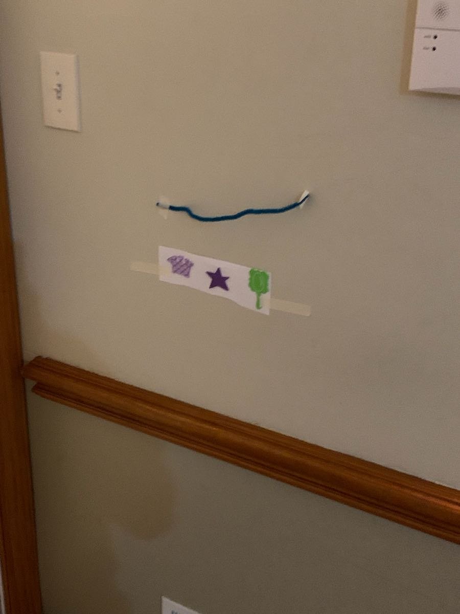
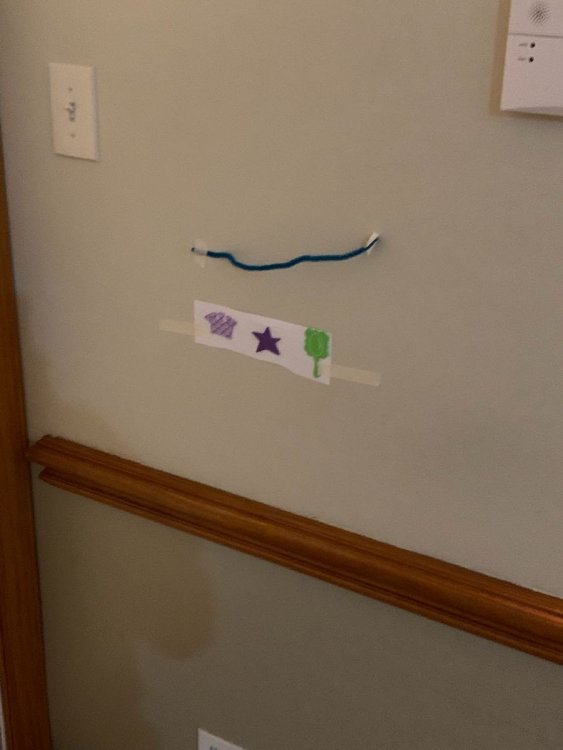
My 5 year old took it upon himself to decorate for my soon to be 2 year olds birthday tomorrow.
-
@jonjon I’ll have to stop in next tine I’m up there.
-
Trolls=people who dont agree with you lol? I see you hit up the bait shop this morning.
-
It was mostly my fault. Instead of ignoring the trolls I got into a flame war with them and it made the thread mostly useless garbage.
-
and all this time I didn't realize i was arguing with the happiest person in the world!
-

2019 Mid Atlantic Lawn, Garden, Pool, etc. Thread
psuhoffman replied to Eskimo Joe's topic in Mid Atlantic
How have you been doing? Hope everything is good. ...my wife went ahead and planted the tomatoes a few days ago when it was nice out...I warned her but she thought I was being silly. We are pretty much screwed up here...might be better off if we did get a coating of snow tomorrow evening to provide some cover and prevent a hard freeze penetrating the plants. Oh well... -
Shhhh they don’t know it was me. That chair is earning its keep. Cant imagine anyone would give them a hard time. I hope it was just a clarification that yes it is ok.