

psuhoffman
-
Posts
27,419 -
Joined
-
Last visited
Content Type
Profiles
Blogs
Forums
American Weather
Media Demo
Store
Gallery
Everything posted by psuhoffman
-
If it makes you feel any better I’ve had plenty of posts deleted by mods over the years for being “too political” and they were mostly liberal leaning. I just think everyone is too sensitive on both sides. Banning discussion is not the answer Imo. If someone can’t keep it clean and amicable then they can get banned. No reason people that can be adults and have a normal rational discussion and disagree/debate without being childish and nasty shouldnt be able too just because of trolls. We need more discourse not less imo.
-
@losetoa6 didn’t say anything wrong. He hasn’t been hostile to anyone. He didn’t insult anyone. You know...it’s a virus. It’s NOT political. Covid dont care what your ideology is. It’s only political so far as our two parties adopted a specific stance on the virus. But that can be true of ANYTHING! I’m tired of having topics eliminated from what we can discuss everytime the left or right decides to take a group ideological position on something. So as soon as either party decides to put something in their platform suddenly it’s off limits? F that and F them. That’s BS. Total garbage BS. We have to be able to discuss things that aren’t inherently political amicably and intelligently regardless of what some political party decides to say. It’s lazy to ban the whole topic v simply deleting posts that go to far and turn the discussion in a hostile way.
-
I wasn’t advocating a policy position I was opining about the effects on the State numbers. I was ready to go back. Twice. Made no stink at all. Then they delayed. Nothing to do with me. I’m simply stating the reasons. Whether you agree or disagree. Wrt the survey parents had input. They had to let us know who would be coming back. And in my one class of 32 it was 4 students. I’m not claiming that is normal across the state. This is specific to my district! I will push back on the assertion the guidelines aren’t important. This is personal but let me say I don’t take offense at what anyone says. I totally understand the hardship schools being closed has caused. I do! Also I’m one of the lucky ones that got a vaccination early in the process (luck of the draw) so this isn’t about me. I feel 100% comfortable going back. But it will be another 1-2 months before all the staff get vaccinated. Covid isn’t “highly” dangerous to the students but it is to the staff! There most definitely HAVE been numerous cases of educators contracting and dying of covid from exposure at schools. 3 teachers just died last month in Cobb County and there might be a lawsuit due to accusations the district didn’t follow guidelines and didn’t take immediate measures to stop the outbreak that exposed them to covid and cost them their lives. I admit I had a falling out with my Union over this. They continued to try to spin their campaign around student safety. I found that insulting. It wasn’t entirely true but it also devalued my life. I’m not going to lie about it. The evidence suggests this wasn’t that dangerous to the students. But it was to me! I have crohns, asthma and early stages of diabetes. My doctor was VERY adamant I not allow myself to be exposed. I tend not to argue with my doctor since I can assume they know WAY more about what’s best for my health then I do. And it was a risk for many of my colleagues. That should be a good enough reason. I shouldn’t have to lie and say it’s about the kids. My life matters to me and my children. If my school wasn’t able to do what the CDC says was necessary to protect me from being exposed why should I risk my life for a job that I’ve dedicated almost 2 decades too selflessly for way less pay then I could make in the private sector! I often give up evenings and weekends. I teach out of love and passion. But I also love my family and I have a responsibility to them. I have 2 young children. I can’t afford to take chances with my life! All that said I’m ready to go back. I feel safe now. I will be back in my administrative capacity either way. But still there are some basic safety guidelines they are still struggling to meet and not all teachers are vaccinated yet and many have health conditions. I won’t begrudge them for requiring the district protect them by following the state guidelines for safely opening.
-
I wonder how much of that is due to the fact one of our largest districts has financial issues AND structural problems that make returning harder. We keep having to push back the restart dates partially due to delays in making our facilities compliant with state CDC guidelines. There are some things other districts had already done anyways like air filters that we can’t even do now because most of our buildings lack a functioning central air system. That makes it more complicated. In many cases we don’t have the spaces to accommodate the class restrictions. Our “mess” of a situation was ill equipped to handle this situation. Many of our facilities are barely functional under normal circumstances. ETA: another part is lack of demand. My students were polled on returning and only a handful intended to return to the building. Then right after that survey suddenly the district delayed again. Likely didn’t feel the need to rush and spend crazy $ we don’t have if only like 5% even wanted to come back.
-
Cant remember a year where we had so many marginal boundary temp storms and every degree and 100 feet elevation mattered as much as it did this year. Very odd. The upper level pattern was perfect so places like Catoctin and the peaks of Parrs Ridge that had just enough elevation to overcome the general lack of low level cold did great compared to everyone else, even compared to the typical climo differences.
-
Storms plural? The only March storm, singular, that I know of that dropped those kinda of numbers over a widespread portion of this area was 1958 and even that storm the 20”+ zone was confined to the higher elevation NW 1/3 of this sub. The Ashe Wed storm in 62 I guess you could argue was close with the SW 1/3 experiencing those type numbers. But if we look at the last 50 years some of the March storms the last 10 years have been the best.
-
I’m ready for it to melt
-
State of the snowpack address. 2/24/21 Soggy, battered, weakened, but still despite the efforts of the evil sun empire it perseveres for a 25th day.
-
It was 44 when I left an hour ago. In Baltimore for vaccine shot. Snow was holding on ok. It’s compacting but it’s so thick not melting easy.
-
I’m starting to think that spot in central southern VT might be the best location for snow. It always gets more snow, I think because it’s downwind of the enhanced moisture stream from lake Ontario. But it’s more widespread than further north where the snow is mostly all upslope and confided to the immediate peaks. Plus southern VT gets into coastals way more. It also warms up in spring a lot faster then further north. If I had a spot to pick that might be it.
-
39* 40' 43" N 76* 53' 53" W
-
It’s a pretty good spot. It’s not just about elevation but also about proximity to other features. I could be at 1035 feet in a valley and get way less snow. But this area has several advantages. It’s the first significant ridge you hit going west from the Atlantic. So with storms that have any easterly or southerly (rare but today showed it can happen) wind component the upslope is pretty good. Coastals that track close enough crush this area. It’s far enough east not to miss coastals but far enough west not to be rain with a hugger track. Far enough south to get mid atlantic storms but just far enough north to get in on miller b’s. Far enough east of the Allegheny front to not suffer too much on a SW wind either. Clippers often redevelop just in time to get this area pretty good. It’s kind of perfectly located to take advantage of a lot then add in it’s the highest elevation around and that’s why it’s an extreme local snow maximum. If you added another 1400 in elevation without affecting the surrounding terrain that would translate to about 4-5 degrees and more upslope so you could likely tack on another 1-3” to most every event and the avg might be about 55” v 40”.
-

Feb Long Range Discussion (Day 3 and beyond) - MERGED
psuhoffman replied to WinterWxLuvr's topic in Mid Atlantic
Around 35. Avg is around 40 -
Sounds like not far from here.
-
obviously I have not been getting the message out enough
-
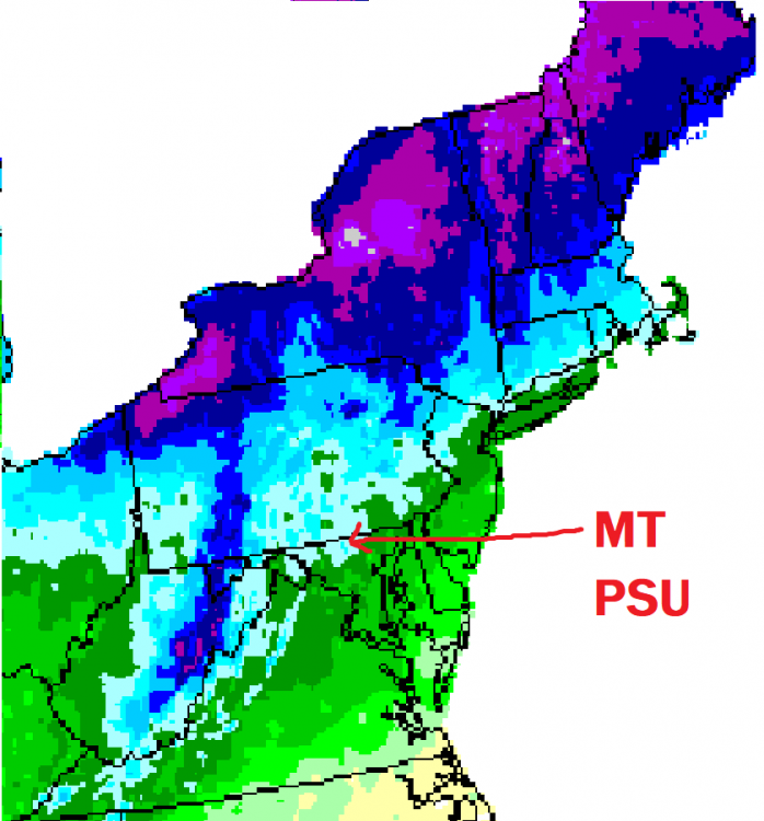
This was from a project they did years ago that used both snowfall reports and estimates using a model that factored in geography to come up with an accurate snowfall map. I lost the key years ago but you can figure it out from what known locations get in each color code. Love how my ridge shows up on the map. Shame I can't find the whole project online anymore, it had really cool maps like average first and last day of snow, average days of snowcover, and average largest storm.
-
like snowchaser's storm maps
-
A couple years ago the property next door was in foreclosure and vacant for a while. The woman who owned it passed away and the daughter was a bit of a deadbeat and lost the property. I actually thought it would be cool to buy it and start a B&B. It has a lodge type layout and an amazing view with 5 acres of property and would have been amazing to host events...but it was a pipe dream. Thought it would have been cool though. If I ever finish the basement I would have plenty of space for "crashers" though and definitely want to host event again if anyone is interested.
-
Yes its attached to the pool. And it is nice in the summer and typically catches a nice breeze. I also have a covered back porch that stays pretty cool in summer and is good for entertaining and BBQ's. Years ago I had a get together BBQ up here and I would love to host another event when all this covid stuff is over with.
-
12/14: 3.1" 12/16: 10.5" 1/26: 0.5" 1/31-2/2: 12.2" 2/5: 0.9" 2/7: 7" 2/11: 3.5" 2/18: 7.8" 2/22: 6" Season: 51.5"
-
I know the area around Princess Court on the south side of town has a ton. They are about 1050 feet plus in a bowl on the northeast side of the ridge there. They get dumped on, maybe slightly more then me even.
-
That’s the ridge I live on....on the highest point of Dug Hill Ridge just west of 30.
-
@HighStakes Nora demanded we take our normal walk, snow or not, so we made it down the goat trail and are walking in your hood now. There is a definite MAJOR difference. Up top at the bottom It’s not uniform and I’m just eyeballing it but it’s ~12-15” depth up top and 5-8” at the bottom. That’s CRAZY!!!!
-
Feb Long Range Discussion (Day 3 and beyond) - MERGED
psuhoffman replied to WinterWxLuvr's topic in Mid Atlantic
The fight for 50 is over. Now I’m seeking 60!


