griteater
-
Posts
9,581 -
Joined
Content Type
Profiles
Blogs
Forums
American Weather
Media Demo
Store
Gallery
Everything posted by griteater
-
From @WorldClimateSvc - "The latest Environment Canada CanSIPS seasonal forecast is finally available. Much weaker El Niño now indicated: Dec-Feb Niño3.4 anomaly now only +0.67°C versus +1.08 last month." Meanwhile, the Sept run of the Euro Seasonal has this as the 500mb mean for Dec-Feb:
-

Weak-Moderate El Nino 2018-2019
griteater replied to AfewUniversesBelowNormal's topic in Weather Forecasting and Discussion
From @WorldClimateSvc - "The latest Environment Canada CanSIPS seasonal forecast is finally available. Much weaker El Niño now indicated: Dec-Feb Niño3.4 anomaly now only +0.67°C versus +1.08 last month." -
The ENSO waters are murky. I mean, it is go time for an El Nino to develop and today's daily Nino 3.4 reading on SV came in at +0.09. Are we going to get real El Nino atmospheric forcing this winter or are we going to be stuck in neutral-land??
-
I agree CR, and I would personally give warm neutral a higher chance than moderate nino. The upper atmospheric portion of ENSO (VP Anomalies) has been leaning more toward El Niño so that is good to see.
-
I’ll bet something large we don’t see a strong El Niño
-
Weak-Moderate El Nino 2018-2019
griteater replied to AfewUniversesBelowNormal's topic in Weather Forecasting and Discussion
The buoy data shows cool anomalies along 120W so we've run out of warmth there and to the immediate west near the surface to see Nino 3.4 climb. Getting to an official El Nino (SST) is going to depend on renewed westerly wind anomalies in the western and central Pacific over the next few months, of which, there are good westerlies ongoing right now. -
Weak-Moderate El Nino 2018-2019
griteater replied to AfewUniversesBelowNormal's topic in Weather Forecasting and Discussion
This has to be the most scrutinized El Nino in the history of El Ninos in terms of whether it is actually going to occur -
Hello strangers. I posted some long range thoughts on El Nino here: https://www.americanwx.com/bb/topic/51207-weak-el-nino-2018/?do=findComment&comment=4947953
-
Weak-Moderate El Nino 2018-2019
griteater replied to AfewUniversesBelowNormal's topic in Weather Forecasting and Discussion
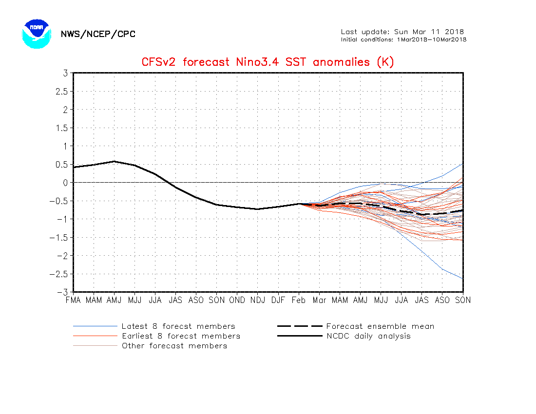
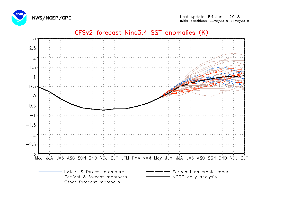
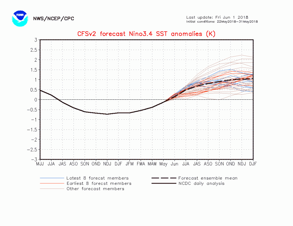
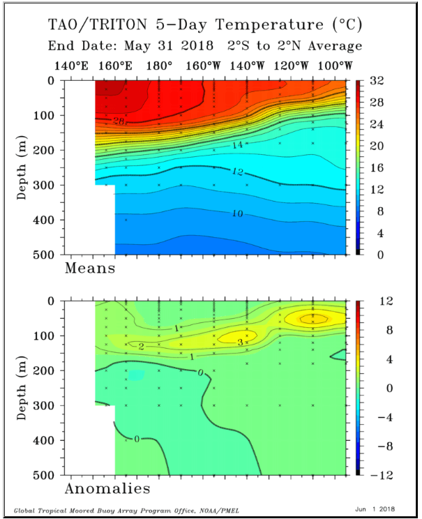
These predictions look reasonable to me. Nino 3.4 has been on a steady climb since March, and has now edged into positive territory (+0.35) The core of the subsurface warmth is currently east of 150W (east of the dateline) The current CFS forecast shows continued westerly wind anomalies in the central Pacific, as seen below from 150E to 120W. This should promote continued gradual warming in Nino 3.4 given the state of the subsurface warmth. Since the start of the year, there have been 3 downwelling Kelvin waves contributing to the eastern slosh of warm water across the Pacific. The impetus for those downwelling Kelvin waves was a series of westerly wind bursts in the western Pacific from late Jan to early May (from 120E to the dateline) Without another significant westerly wind burst in the western Pacific initiating another downwelling kelvin wave and subsequent push east of additional subsurface warmth, I think a moderate El Nino would be tough to come by, but possible. And of course, a failure to obtain enough warmth to reach official weak El Nino status is on the table as well, as forecasting the details of ENSO several months in advance can be a difficult task. Aside from sea surface temperatures, we will have to see how the atmosphere responds in the fall in terms of the placement of convection (OLR) and velocity potential (rising/sinking motion) -
Weak-Moderate El Nino 2018-2019
griteater replied to AfewUniversesBelowNormal's topic in Weather Forecasting and Discussion
The CFS forecast has changed quite a bit since early March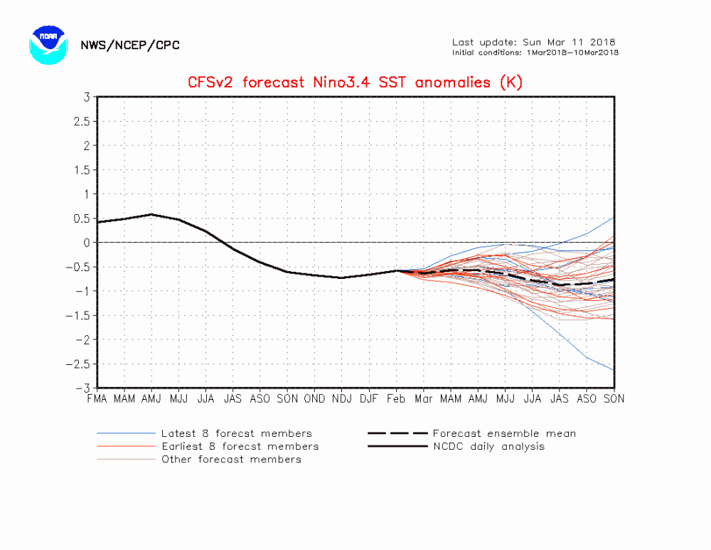
-
Weak-Moderate El Nino 2018-2019
griteater replied to AfewUniversesBelowNormal's topic in Weather Forecasting and Discussion
Subsurface warmth east of the dateline is healthy right now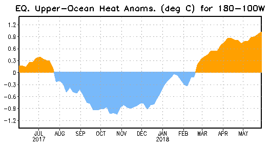
-
JMA falls in line with the Euro and looks like a repeat of this week's storm....rain next Tues, then flip to snow on Wed
-
Snow on today's Euro run for Tues-Wed...the cool March doesn't want to die
-
If would have to come down hard right before the precip pulls out...oh the joys of southern winters
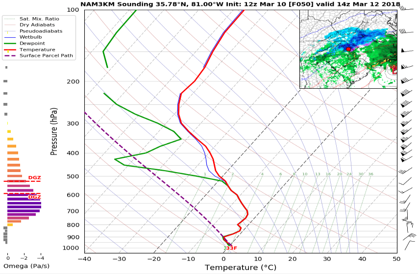
-
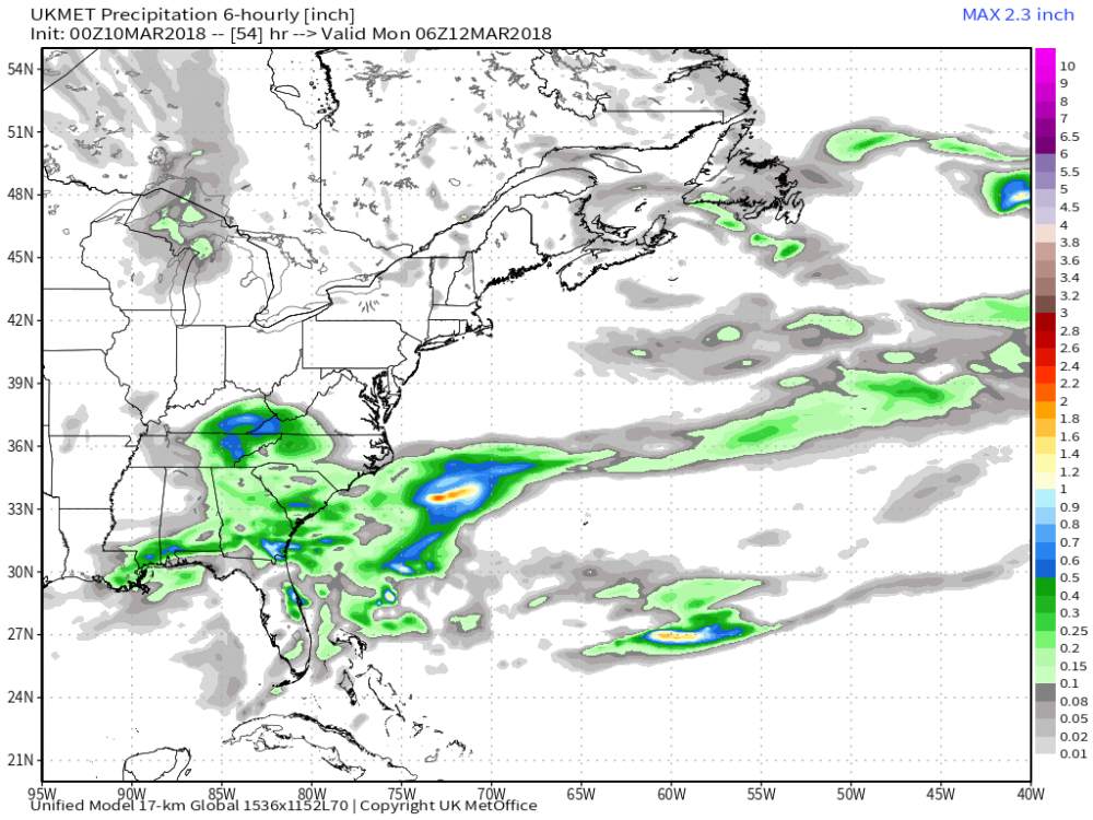
Yeah GFS is a nice run for you Buddy. 12z CMC is south of the GFS. Core of backside precip runs thru northern NC and southern VA
-
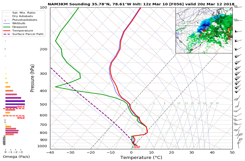
Sounding to go with it just east of Hickory. 33 at the surface and below freezing above it
-
12z NAM was the best run we've seen from any model with the wave. Drops it down and closes it off over northwest SC with good strength
-
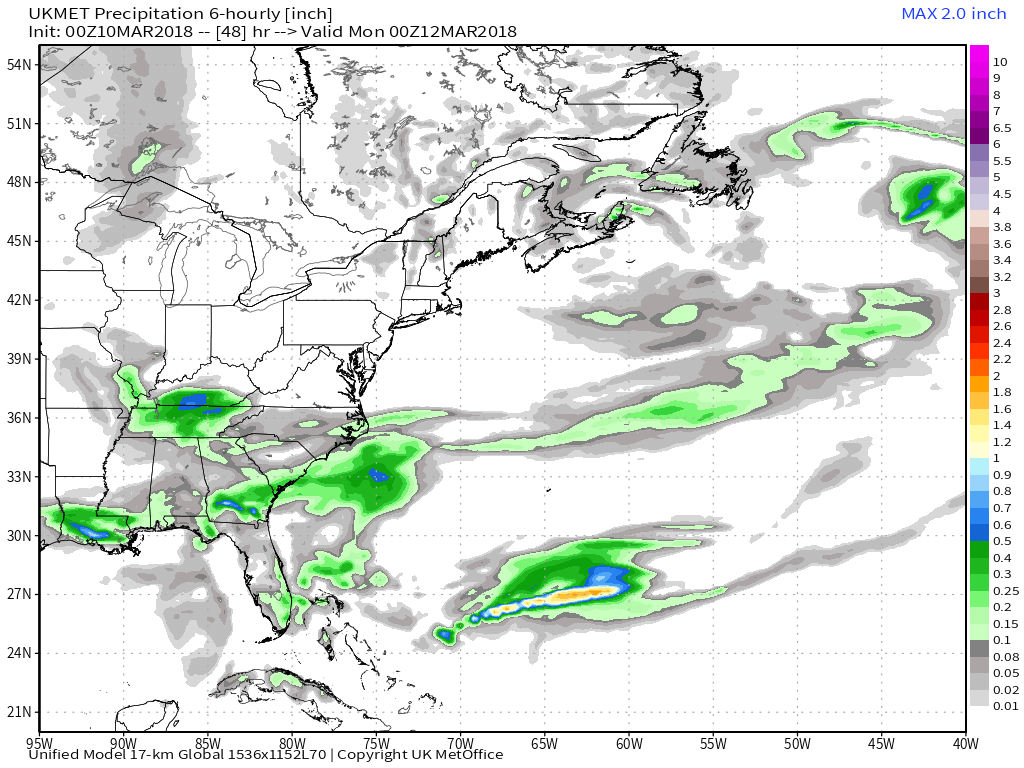
Here's 00z
-
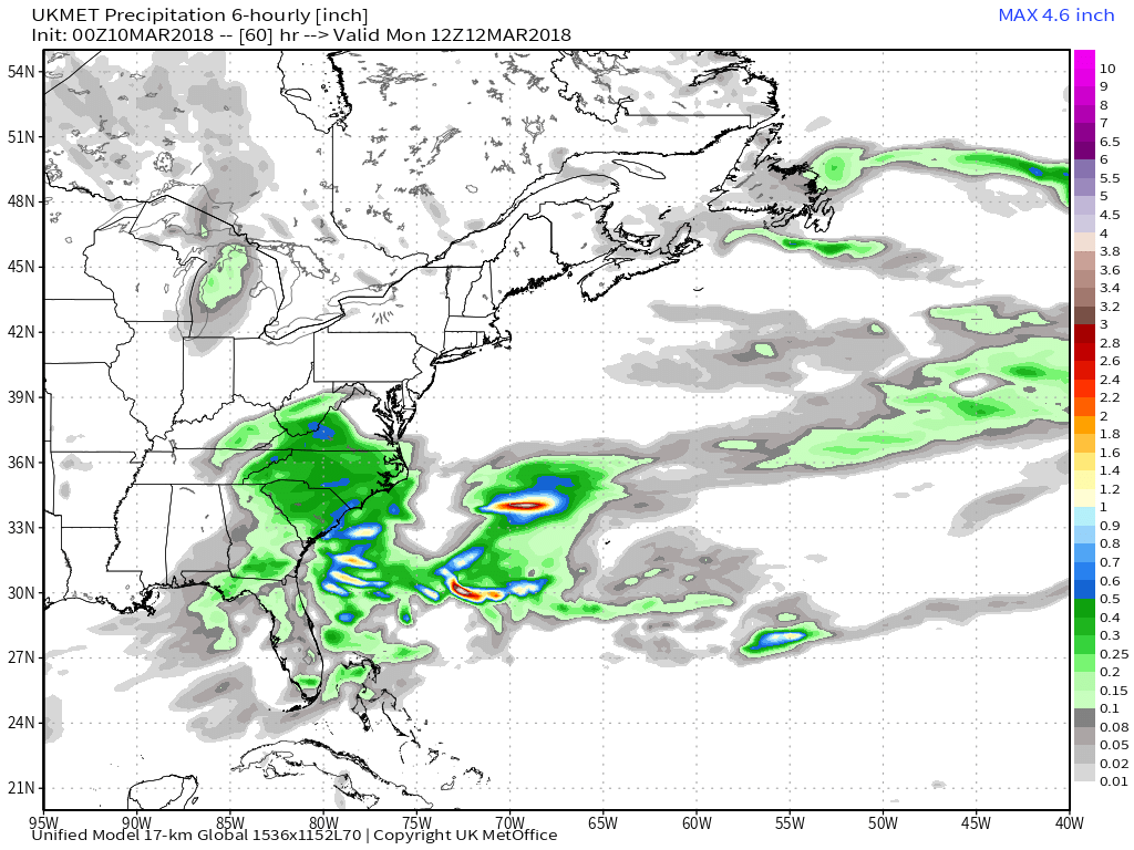
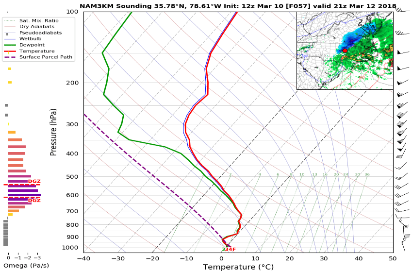
Not the best. Definitely a cold chasing precip deal, but maybe a flip before ending.
-
Euro looks similar to last run but with maybe a little less backside precip as the colder air filters in...it looks best in parts of northwest NC, and parts of southwest and south central VA
-
It looked similar to the morning Euro with the wave. The backside precip blossoms nicely as it rolls thru the Carolinas.


-
00z CMC is farther south with the focus of the backside changeover to some snow (more like the NAM trajectory)...it flips over to some snow in SE TN, NE Bama, N GA, SW NC. Backside precip looks decent there
-
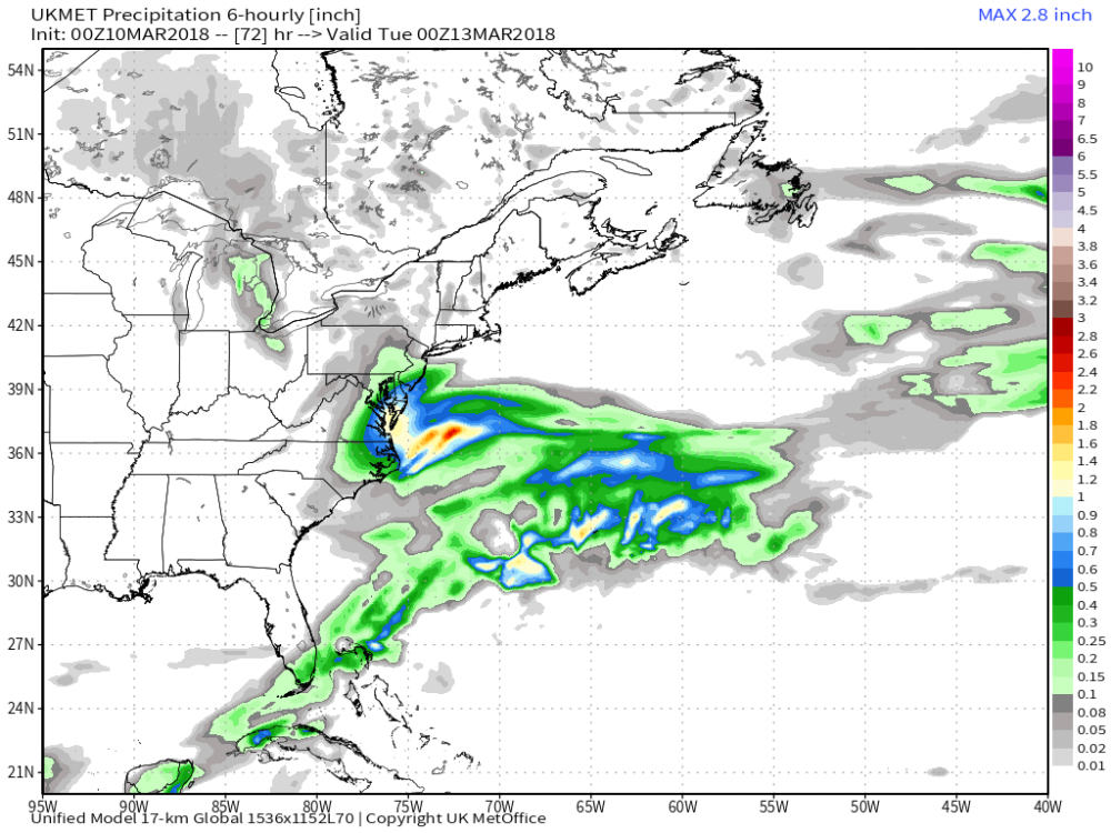
00z GFS is on the north side of the guidance with the wave track, but does have some light accumulations roll through parts of NC (mainly northern 1/2)...more thru S VA
-
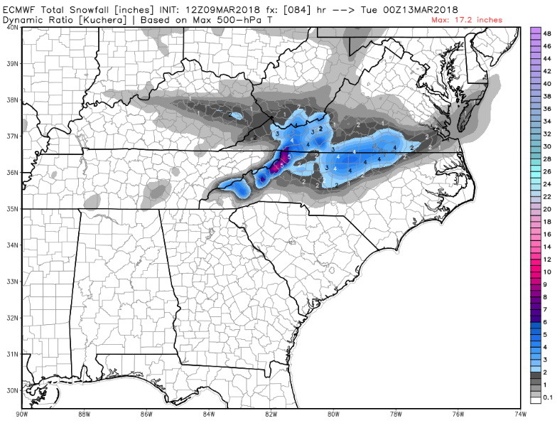
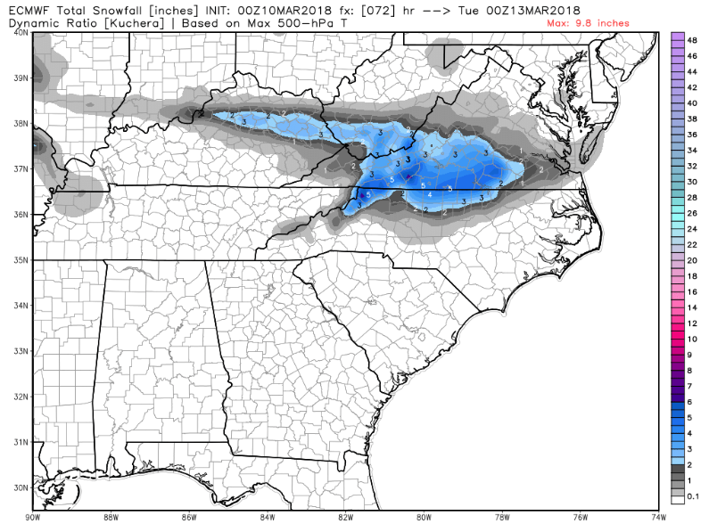
Here's the Kuchera
-
Well I think having low expectations is warranted. It's a rain to backside snow scenario which is fraught with question marks. Upper wave on the Euro has a nice track for parts of NC, but would prefer it to trend stronger. GFS and CMC have been improving some as well with the wave.