
Violentweatherfan
-
Posts
3,493 -
Joined
-
Last visited
Content Type
Profiles
Blogs
Forums
American Weather
Media Demo
Store
Gallery
Posts posted by Violentweatherfan
-
-
3 minutes ago, Birds~69 said:
My record inside a house is 46F with the heat completely off and overnight temps in the single digits/low teens. A house insulates itself. Camping is a whole different story...better have a solid sleeping bag.

Damn, that's too close to the pipes possibly freezing for me. Lowest I have let it get was 53 degrees
-
On 1/27/2022 at 3:08 PM, Birds~69 said:
Keep the heat at 60-62F during the day and 56-58F at night while wearing a flannel, wool slippers and it's not bad at all...maybe throw in a little whiskey and you're all set.
It's the older folks
 and the majority of females (from my experience, not all)who like the thermostat at 70-75F+ then wonder why the heat bill is a mess. Myself, anything over 65F I start to feel stuffy and uncomfortable...
32F/ roads treated/brine...
Yep, I turn off the heat at night. It plays havoc with my sinuses. Woke up to the thermostat reading 57 degrees
-
 1
1
-
-
You can tell it's winding down by watching the radar. Storms always seem to end earlier than expected. It was supposed to finish by 2/3 pm but now it looks like 12 noon it's out of here.
-
-
Beyond my 5" call as of now. At least 7" and still falling there is a shot at double digits if it can continue to snow til 2pm
-
 2
2
-
-
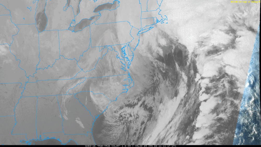
Nice radar from the NY forum
-
Just now, Hurricane Agnes said:
Looks like it's trying to get its act together and take it on the road.
Still looks like it could sling some more moisture back on to our forum area for a good bit.
-
2
-
1
-
-
Under a nice band now in Langhorne
-
Painful to see, so close but yet so far.
-
11 minutes ago, The Iceman said:
Looks to be 2” out there so far and coming down nicely. 2.5” including the .5” this morning. Going out at midnight for an official measurement though. Still have 12 hours to go and haven’t gotten into the true heavy stuff yet. Could be in for a real nice event here in Levittown.
L-town FTW!
-
2
-
-
3 minutes ago, Hurricane Agnes said:
Currently fine-flaked SN and 29 with dp 28. Have about 1.5" out there (ballparked).
Man, look at Manhattan/Long Island it's about to get pasted.
-
-
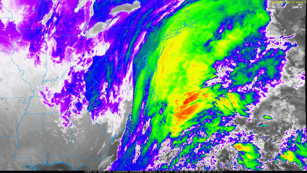
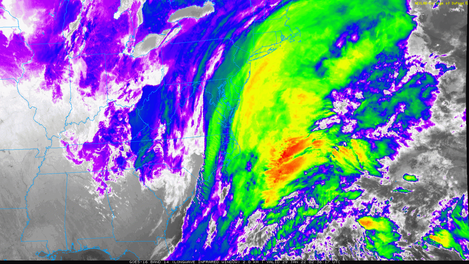
1 minute ago, Hurricane Agnes said:
LWIR of the intensification and you can actually see the digging trough.

Have I had too many Margaritas or does that look positively tilted
-
1
-
1
-
-
I know it's two hours old
-
Just now, RU848789 said:
??
Dude, 5/8 of an inch?
-
1
-
-
1 minute ago, RU848789 said:
As of 9 pm, we only picked up another 1/8" since 8:30 pm, as the snow let up, meaning we have 5/8". However, the radar is looking great and intensity just picked up and it's coming down nicely. Also, so far the snow that's falling is easily 15-20:1 snow to liquid, with very nicely formed dendrites making a nice fluffy snow. Not sure how long that will last, but if we can retain this kind of crystal growth in the DGZ once the precip gets heavier, we could pile up some snow quickly during the first half of the night - one of the pros on 33 said he thought we'd retain good snow growth through the first half of the storm. Down to 30F.
Were gonna need confirmation on that measurement.
-
 1
1
-
1
-
-
Has anyone have an idea when this storm will exit out and finish? Last I heard was around 3pm.
-
-
Solid video here from Steve D, even if you doubt his call the info contained in the video is exceptional.
-
 1
1
-
1
-
-
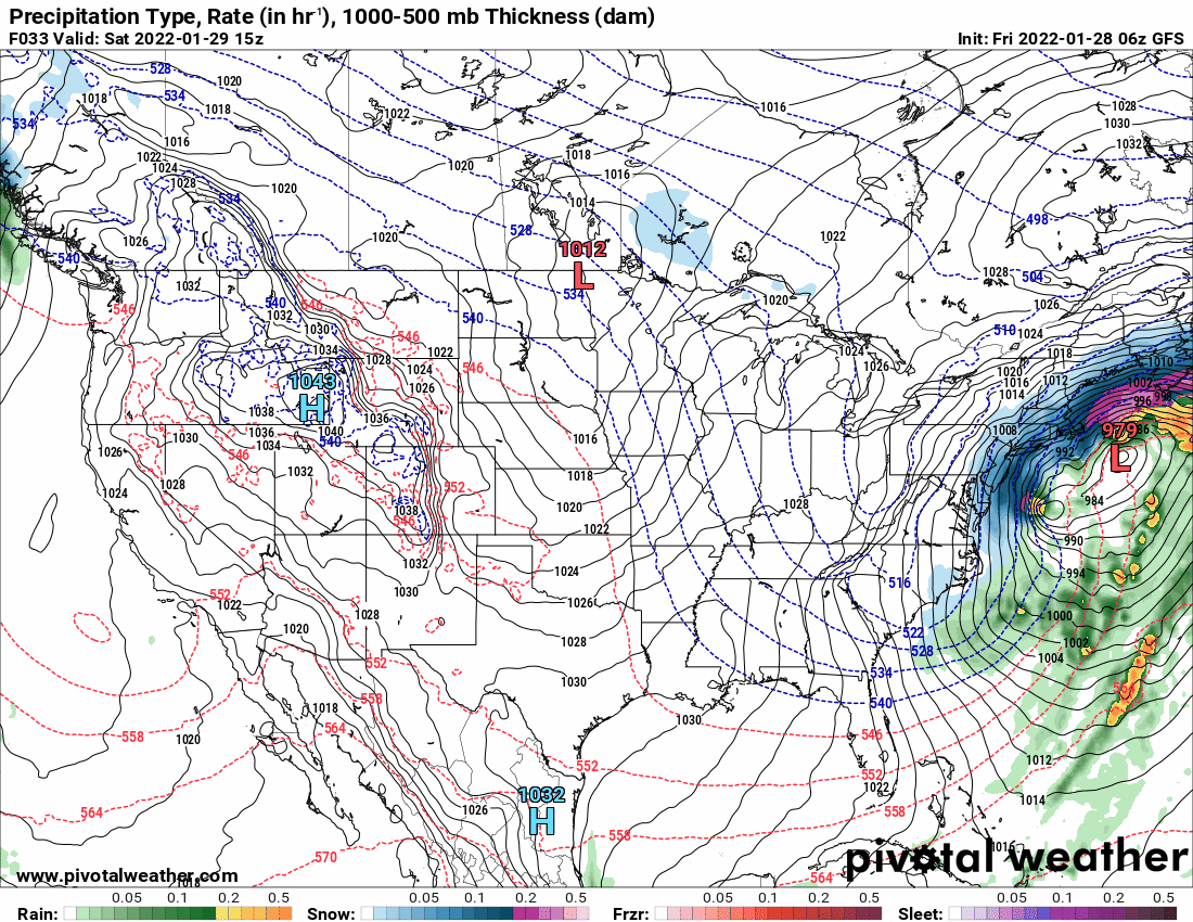
2 minutes ago, Hurricane Agnes said:
6z GFS and a later wild panel with that damn "ball and chain other low".
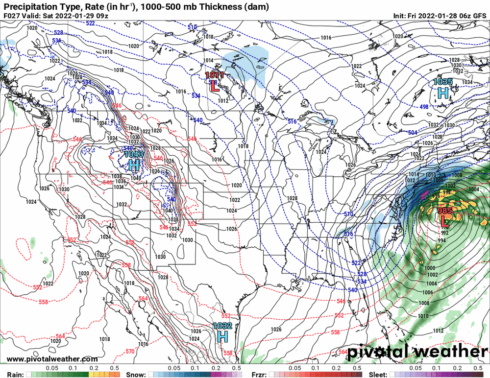

I thought I read in the MA forum that when a double low apears on the GFS the west low takes over.
-
Finally seeing some flakes, @Blue Dream you are next.
-
Damn, I hope that appetizer snow fills in some more. I just wants to ride northeast and not come down past Doylestown
-
That edge of snow just doesn't want to move east
-
1 minute ago, mattinpa said:
So would be seeing 10-1 ratios? Or could it be higher?
I wouldn't put too much concern into it. The wind will bust up the flakes to the point of affecting ratios, but it will damn sure look awesome.
-
2
-


January 28th/29th Event Obs - From KU to FU?
in Philadelphia Region
Posted
Question for @MGorse. During a Miller B storm is there really no transfer of energy to the coast for redevelopment.
It's actually not a transfer of energy. That terminology is incorrectly used many times. What happens is that the primary low is becoming more vertically stacked, and thus losing upper level support (differential vorticity and temperature advections). The best upper level dynamics are now out ahead of the primary low, and as it reaches the coast where a natural baroclinic zone is present between the warm ocean and cold land, a secondary low develops.
First of all in no way am I referencing yesterday's storm, just Miller B's in general and do you agree with the above.