Violentweatherfan
-
Posts
3,689 -
Joined
-
Last visited
Content Type
Profiles
Blogs
Forums
American Weather
Media Demo
Store
Gallery
Everything posted by Violentweatherfan
-

Jan. 31-Feb. 2 Miller B storm
Violentweatherfan replied to LVblizzard's topic in Philadelphia Region
KTTN does well with Miller B's enough for Bucks County to cash in on wrap around snow. -
Jan. 31-Feb. 2 Miller B storm
Violentweatherfan replied to LVblizzard's topic in Philadelphia Region
Anyone south of Bucks County can get shafted by Miller B's, sorry MontCo -
Jan. 31-Feb. 2 Miller B storm
Violentweatherfan replied to LVblizzard's topic in Philadelphia Region
How north of Philadelphia, how about Bucks County which is near KTTN Trenton or are you talking directly north and not northeast. -
Very light snow in Langhorne PA
-
Jan. 31-Feb. 2 Miller B storm
Violentweatherfan replied to LVblizzard's topic in Philadelphia Region
Excellent video by Steve DiMartino, especially his analogy of understanding and use of models @6:50 -
Jan. 31-Feb. 2 Miller B storm
Violentweatherfan replied to LVblizzard's topic in Philadelphia Region
One other factor that will limit accumulation is timing, the majority of these long duration storms rarely verify. -
Jan. 31-Feb. 2 Miller B storm
Violentweatherfan replied to LVblizzard's topic in Philadelphia Region
I think RDPS stands for Rapid Deployment of Pseudo Snow. -
Jan. 31-Feb. 2 Miller B storm
Violentweatherfan replied to LVblizzard's topic in Philadelphia Region
Lifted this from the MA forum, just enough to nail Bucks County. -
Jan. 31-Feb. 2 Miller B storm
Violentweatherfan replied to LVblizzard's topic in Philadelphia Region
Hopefully without the dryslot -
Jan. 31-Feb. 2 Miller B storm
Violentweatherfan replied to LVblizzard's topic in Philadelphia Region
@JERSEYSNOWROB is not gonna like these trends, earlier he was in the bullseye -
Jan. 31-Feb. 2 Miller B storm
Violentweatherfan replied to LVblizzard's topic in Philadelphia Region
Oops, my geographical error. Avondale is near Kennett Square way west of Bucks. -
Jan. 31-Feb. 2 Miller B storm
Violentweatherfan replied to LVblizzard's topic in Philadelphia Region
Bucks is waaaay west of you. -
Jan. 31-Feb. 2 Miller B storm
Violentweatherfan replied to LVblizzard's topic in Philadelphia Region
The map pushing 24 hours old, I wouldn't be too hard on their first call. -
Jan. 31-Feb. 2 Miller B storm
Violentweatherfan replied to LVblizzard's topic in Philadelphia Region
I'm talking about the term transfer and not specifically this storm. -
Jan. 31-Feb. 2 Miller B storm
Violentweatherfan replied to LVblizzard's topic in Philadelphia Region
There really is no transfer of energy.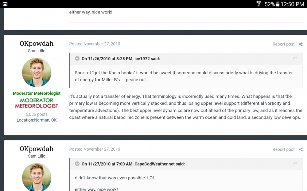
-
-
Lol, like it's any better here.
-
Jan. 31-Feb. 2 Miller B storm
Violentweatherfan replied to LVblizzard's topic in Philadelphia Region
It originated in the GOM, when I have time I'll look for better confirmation. This is from Glen Allen weather.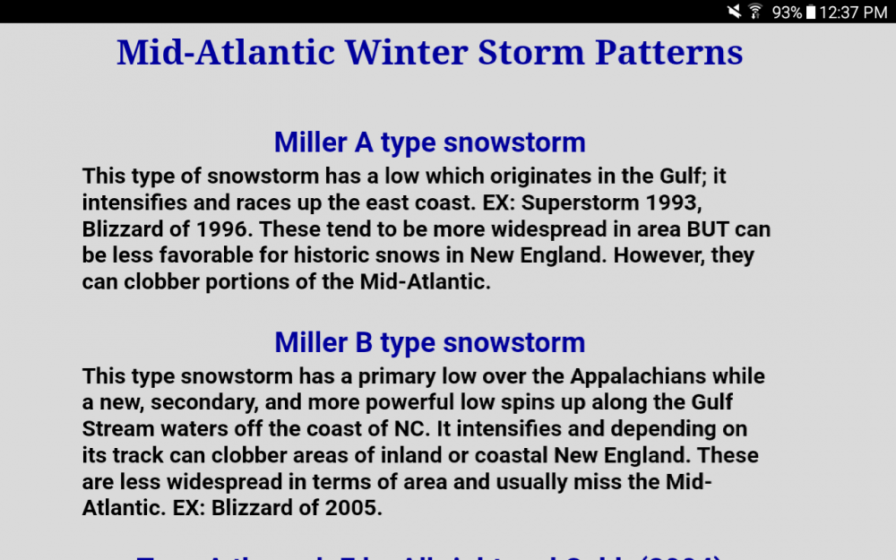
-
Jan. 31-Feb. 2 Miller B storm
Violentweatherfan replied to LVblizzard's topic in Philadelphia Region
January 6-7 1996 was a Miller A -
Jan. 31-Feb. 2 Miller B storm
Violentweatherfan replied to LVblizzard's topic in Philadelphia Region
NYC is in such a good spot for Miller B storms, anything south of Bucks County - Philadelphia County Pa misses out on intensification. And there is always the dryslot. -
nope
-
same here, zero access unless I am logged out.
-
Vendor, Blog and TV Channel Forecasts Thread Part 2
Violentweatherfan replied to Rjay's topic in New York City Metro
Lovely, I couldn't be happier. -
Attention All Philly Subforum Members
Violentweatherfan replied to Rjay's topic in Philadelphia Region
and you miss mookie