
LakePaste25
-
Posts
1,351 -
Joined
-
Last visited
Content Type
Profiles
Blogs
Forums
American Weather
Media Demo
Store
Gallery
Everything posted by LakePaste25
-

2026-2027 Record-breaking El Nino
LakePaste25 replied to Stormchaserchuck1's topic in Weather Forecasting and Discussion
Should see that -PDO continue to weaken into the Fall as the CTKW’s move north along the west coast and the upwelling from the california current weakens as the N Pac high begins to take a beating. -
2026-2027 Record-breaking El Nino
LakePaste25 replied to Stormchaserchuck1's topic in Weather Forecasting and Discussion
Important to note though, those mid atlantic blizzards happened because you were able to get PV lobes dropping south from the Hudson’s and phasing. Even if this did not show up in the post season mean. One of the issues during super Ninos you tend to get too much warm air/ridge bridging in Canada for these PV lobes to really set up to begin with.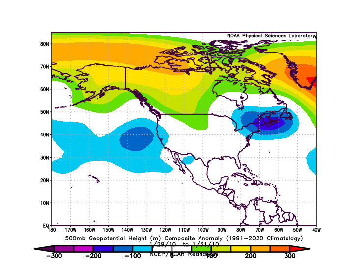
-
2026-2027 Record-breaking El Nino
LakePaste25 replied to Stormchaserchuck1's topic in Weather Forecasting and Discussion
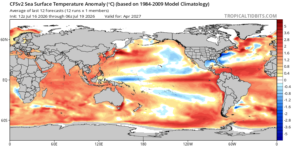
This is true, but tropical convection isn’t decided by absolute SSTs alone. It’s relative to global mean tropical SSTs. Assuming the negative SSTAs materialize in the W pacific, the gradient between the negative SSTAs and the 30C waters shifted east of the dateline is what matters. You can’t really use 2016 or 2024 as an analog for this because such a gradient did not exist, and thus the convection was still present well west of the dateline. If the CFS does not materialize, and the W pac SSTAs are not below normal or closer to normal, then there’s a stronger argument for more persistent convection well west of the Dateline. -
2026-2027 Record-breaking El Nino
LakePaste25 replied to Stormchaserchuck1's topic in Weather Forecasting and Discussion
The CFS is starting to catch on to the idea of this event running its course (just like 97-98) with W pac cool anomalies showing up. This would be the first time in over a decade that we’ve seen this to a significant degree.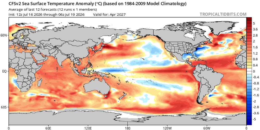
-
2026-2027 Record-breaking El Nino
LakePaste25 replied to Stormchaserchuck1's topic in Weather Forecasting and Discussion
I don’t think anyone here is saying it’s not going to snow, or that there won’t necessarily be a big storm. But I think it’s an easy call that next winter will be both warmer and wetter than the previous 2 winters on the coastal plain. Here on the Great Lakes, probably warmer and drier. -
2026-2027 Record-breaking El Nino
LakePaste25 replied to Stormchaserchuck1's topic in Weather Forecasting and Discussion
Preliminarily, I think this event lands between +3.2 to +3.7 on the RONI. I will adjust accordingly as we get closer to October. -
2026-2027 Record-breaking El Nino
LakePaste25 replied to Stormchaserchuck1's topic in Weather Forecasting and Discussion
Not to mention, -PDO usually works against cold and snow. Funny that it’s magically now something that we want lmao. -
2026-2027 Record-breaking El Nino
LakePaste25 replied to Stormchaserchuck1's topic in Weather Forecasting and Discussion
Yeah, the cooling W pac kicking off trades and loss of equatorial ocean heat to the atmosphere always argues for this whenever we go super nino IMO. -
2026-2027 Record-breaking El Nino
LakePaste25 replied to Stormchaserchuck1's topic in Weather Forecasting and Discussion
Yes, but they’re likely to be more correct this year, since the event will be so strong that it overwhelms all other competing signals. Broken clock rule. -
2026-2027 Record-breaking El Nino
LakePaste25 replied to Stormchaserchuck1's topic in Weather Forecasting and Discussion
-
2026-2027 Record-breaking El Nino
LakePaste25 replied to Stormchaserchuck1's topic in Weather Forecasting and Discussion
Can’t wait to pull the ERA-5 data next month on the Southern Pacific low for July. Could be the deepest we’ve seen it (relatively) in awhile. -
2026-2027 Record-breaking El Nino
LakePaste25 replied to Stormchaserchuck1's topic in Weather Forecasting and Discussion
Important to note that this El Niño event will remove a lot of heat from the oceans (and into the atmosphere) if it materializes as record-breaking. This is one of the reasons why El Nino doesn’t preclude a strong La Niña, and ENSO itself acts more like a damped nonlinear recharge oscillator. -
2026-2027 Record-breaking El Nino
LakePaste25 replied to Stormchaserchuck1's topic in Weather Forecasting and Discussion
Seems counterintuitive because wouldn’t heat being released in the tropics combined with a cold arctic strengthen the N Pacific low due to a greater contrast? -
2026-2027 Record-breaking El Nino
LakePaste25 replied to Stormchaserchuck1's topic in Weather Forecasting and Discussion
Yeah which makes sense. It lags both from warmth going bottom-up in the tropics via instability/upper level divergence and from planetary scale baroclinicity aloft, which seasonally strengthens in late NH summer and early fall as the Arctic cold pool begins to develop. -
2026-2027 Record-breaking El Nino
LakePaste25 replied to Stormchaserchuck1's topic in Weather Forecasting and Discussion
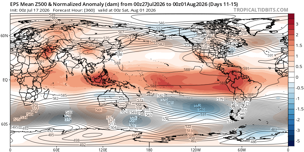
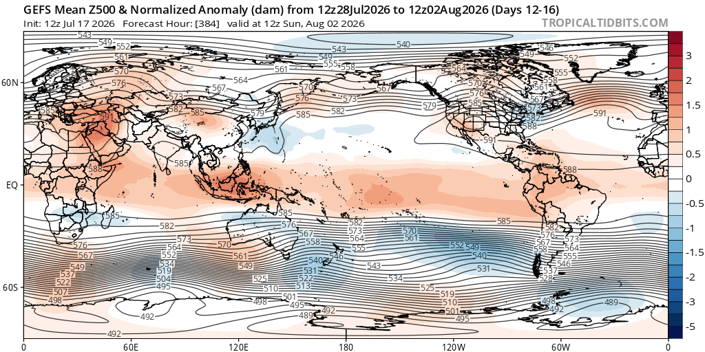
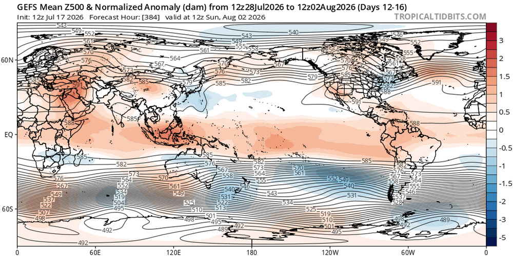
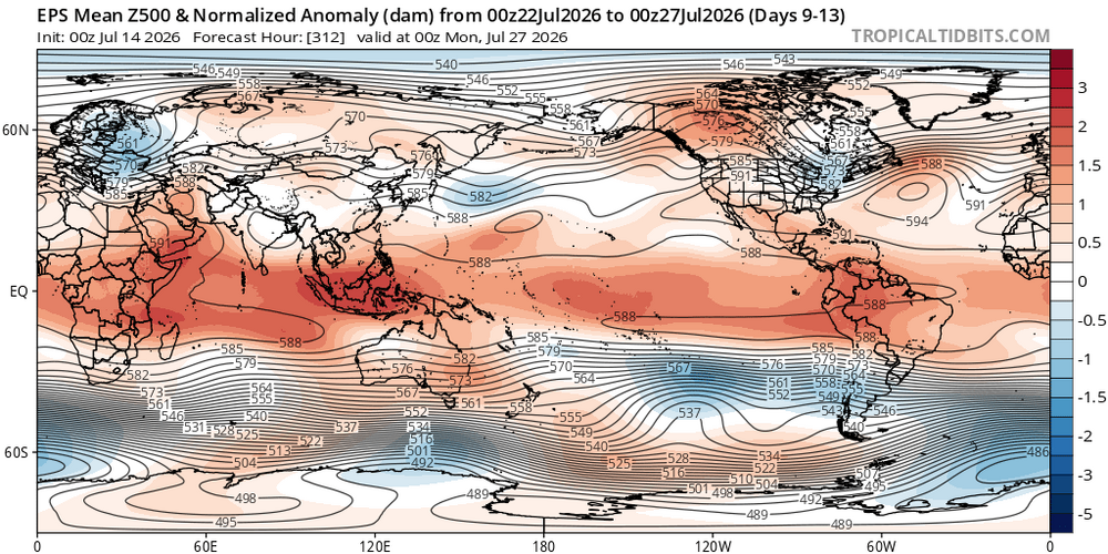
The lack of H5 over the central equatorial pacific does indicate a skew towards La Niña the last 20-30 years, which could also be contributing. I don’t have the research handy, but climate models argue that more frequent La Niña will not be the case long term. Possibly a temporarily aberration the past couple of decades. We are probably due for a major decadal regression the other way. Not necessarily right now, but it could happen eventually. -
2026-2027 Record-breaking El Nino
LakePaste25 replied to Stormchaserchuck1's topic in Weather Forecasting and Discussion
IMO, I think of the PDO like snow cover. If a large area has deep snow cover (or lack thereof), it can enhance (or weaken) a polar high, which can impact an individual storm track. But it can only do so much. If you have a cutter going into ORD, snow cover in new england or the mid atlantic won’t stop it from cutting. And over time, as we know, those repeated cutters will weaken the snow cover. So think of the super Nino as the pattern driving the cutters, and the -PDO as the snow cover. The super Nino will continuously override it over time with a zonal jet until it flips to +PDO. I know this is not a perfect analogy because El Niños mean less cutters literally. But you get the idea. -
2026-2027 Record-breaking El Nino
LakePaste25 replied to Stormchaserchuck1's topic in Weather Forecasting and Discussion
They exist on Tropical Tidbits, but they’re smoothed 5 day means. World view.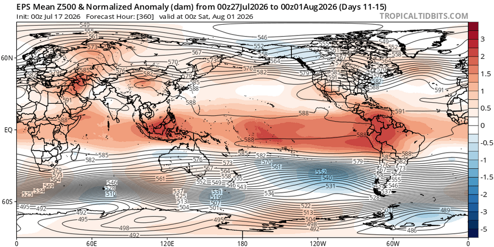
-
2026-2027 Record-breaking El Nino
LakePaste25 replied to Stormchaserchuck1's topic in Weather Forecasting and Discussion
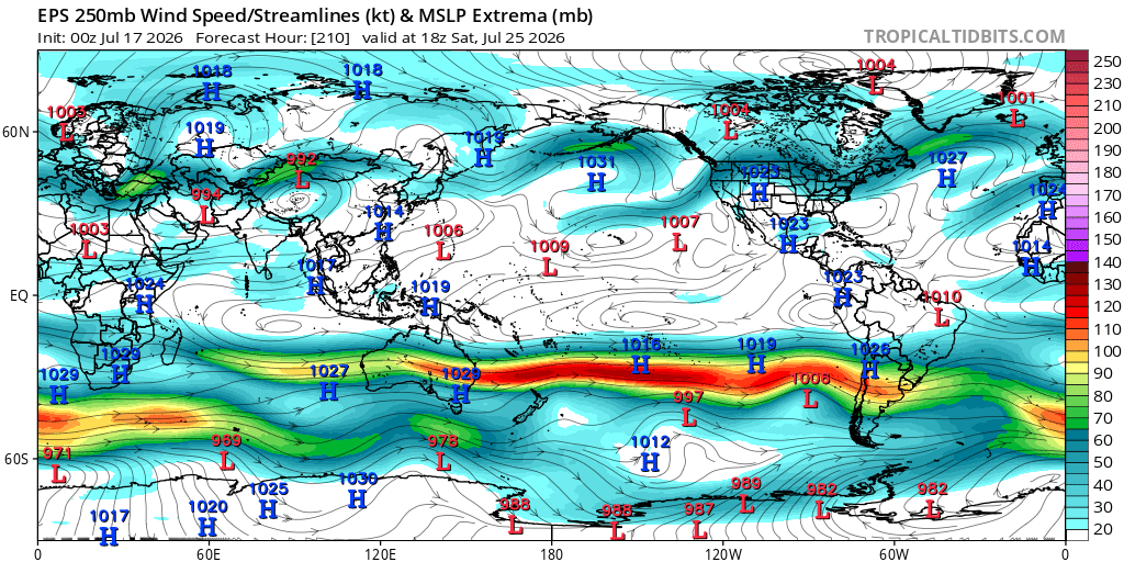
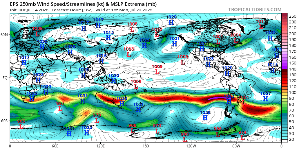
Jet extension is going full steam in the southern hemisphere winter, with copious amounts of snow in the Andes: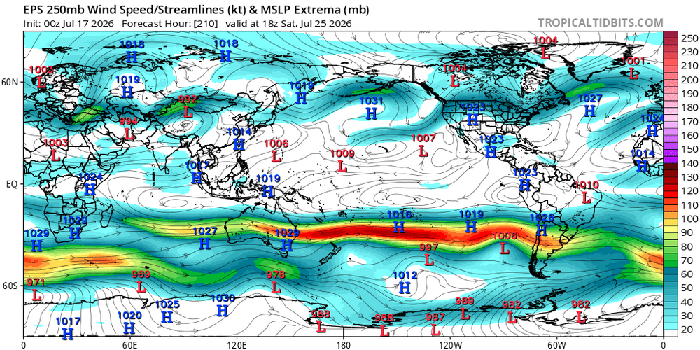
-
2026-2027 Record-breaking El Nino
LakePaste25 replied to Stormchaserchuck1's topic in Weather Forecasting and Discussion
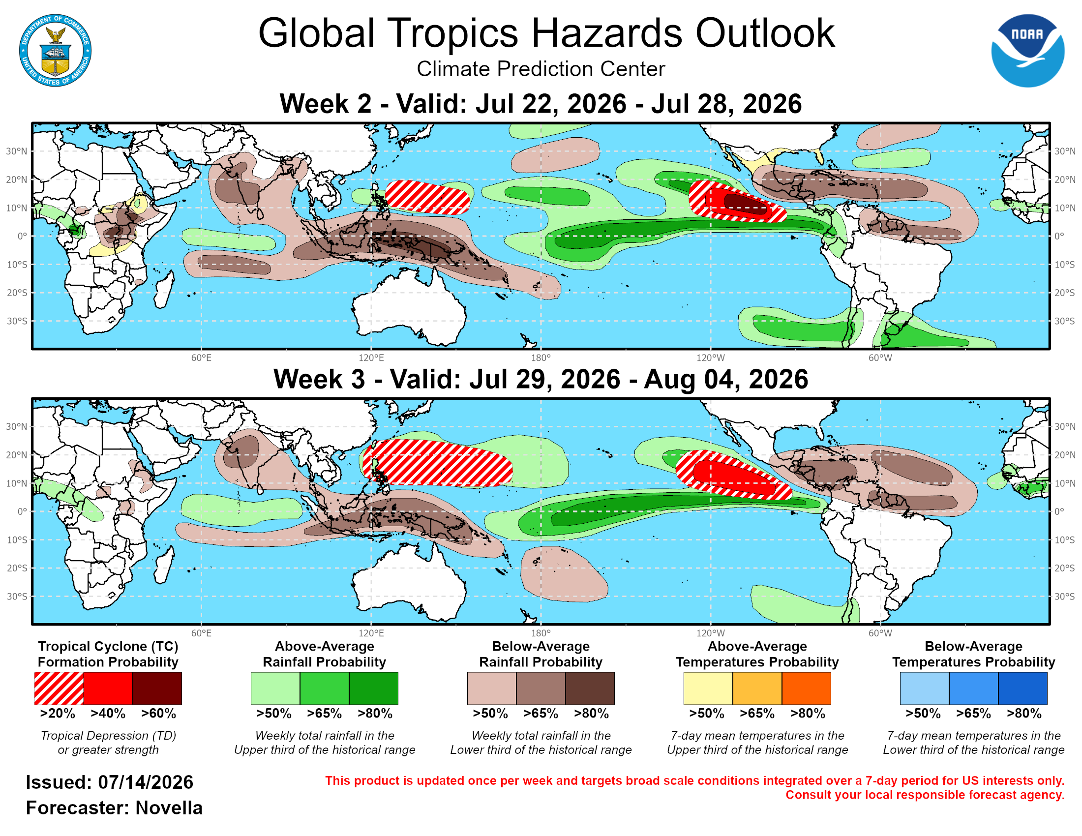
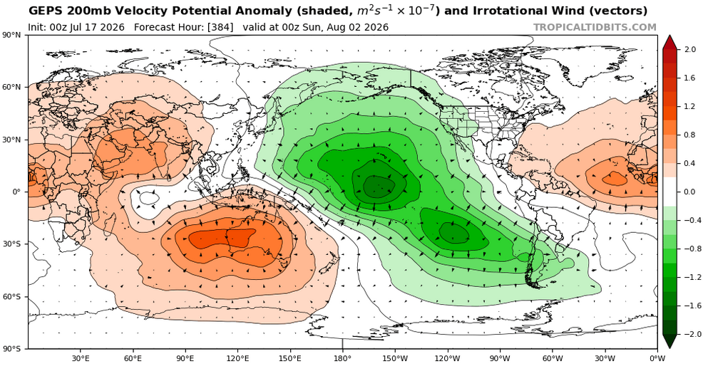
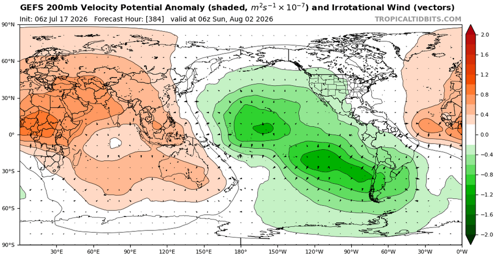
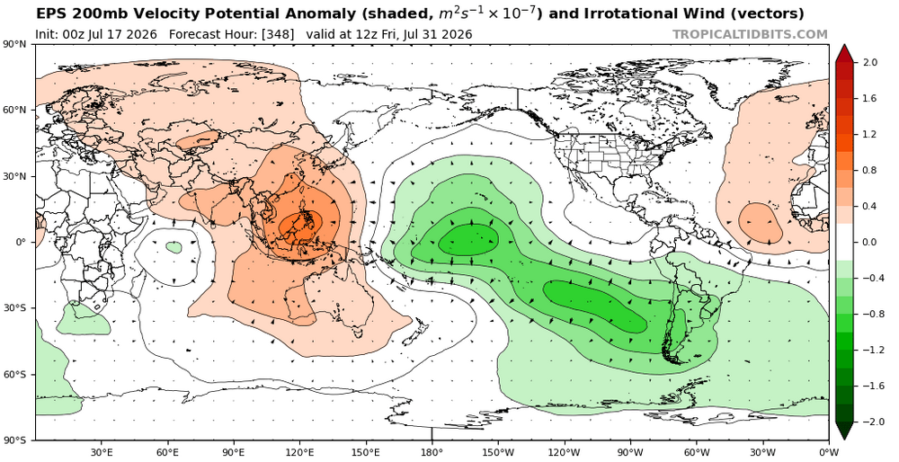
Entire basin looks pretty favorable for development into August. Makes sense with the Hadley cell out in the central pacific. While I think the Eastern Pacific has the highest chance of above normal ACE due to the +PMM you mentioned, I think the basin as a whole has a chance to be above normal in all 3 regions.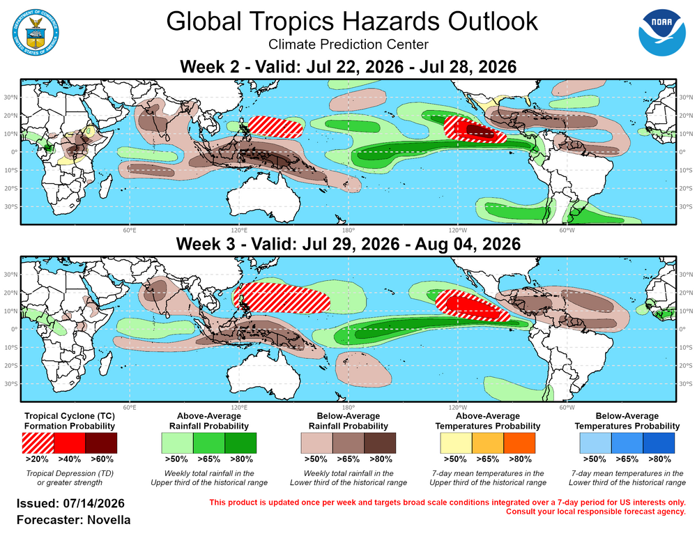
-
2026-2027 Record-breaking El Nino
LakePaste25 replied to Stormchaserchuck1's topic in Weather Forecasting and Discussion
Jan/Feb look like the -WPO Nina pattern, but flipped. -
2026-2027 Record-breaking El Nino
LakePaste25 replied to Stormchaserchuck1's topic in Weather Forecasting and Discussion
I mean this goes into the discussion with @40/70 Benchmark that past super Ninos were not torches for the Northeast due to “clean forcing” as in, less competing Nina-like convection in the Maritime Continent. It used to be more of a torch signal for the upper Midwest. Only modern super Ninos have been torchy in the NE. -
2026-2027 Record-breaking El Nino
LakePaste25 replied to Stormchaserchuck1's topic in Weather Forecasting and Discussion
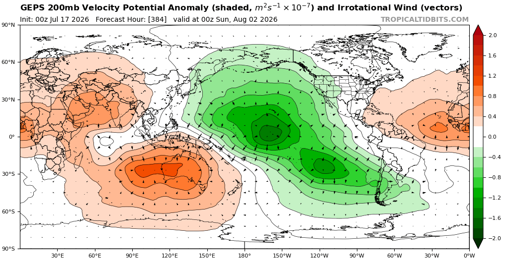
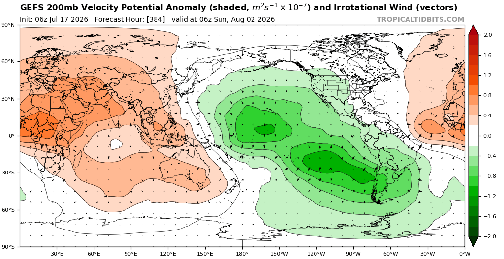
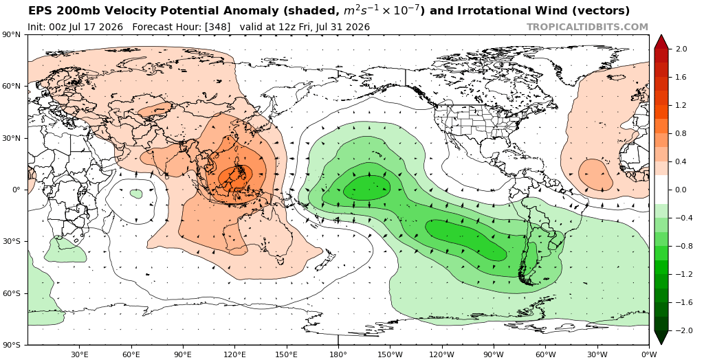
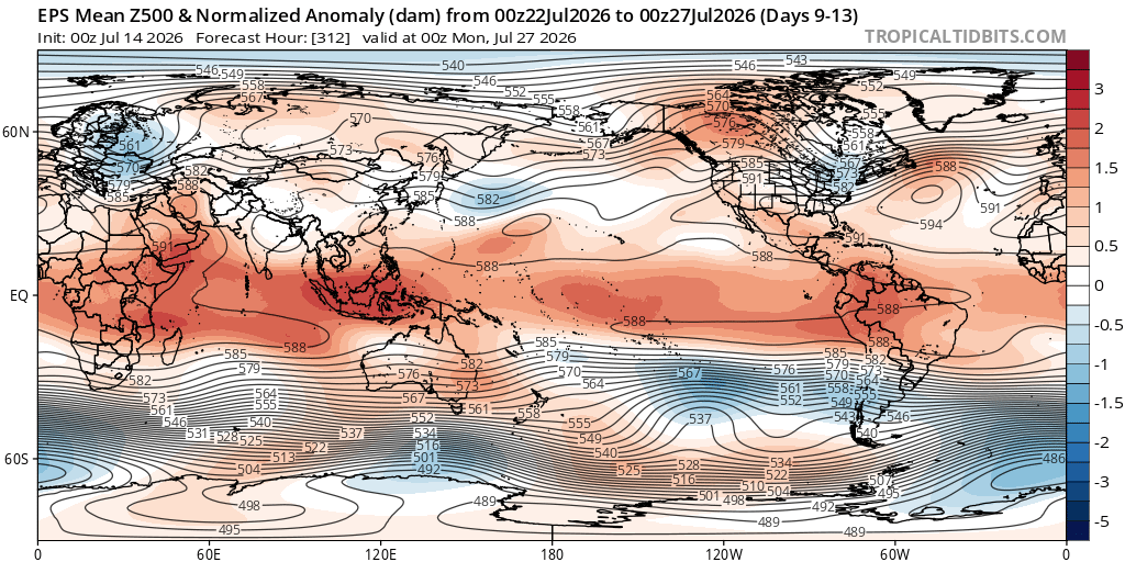
Yeah I don’t think the Hadley cell will just park at 120W all winter. Kind of like what Snowman is showing in the Hovmoller above, I can see it wobbling 30-50 degrees in the mean. -
2026-2027 Record-breaking El Nino
LakePaste25 replied to Stormchaserchuck1's topic in Weather Forecasting and Discussion
It already is in South America. Chile is getting slammed in the short-medium range models. -
2026-2027 Record-breaking El Nino
LakePaste25 replied to Stormchaserchuck1's topic in Weather Forecasting and Discussion
yeah there’s a solid mid latitude response happening in Chile. Nice mid latitude cell off the coast, extended pac/STJ and they’re getting blasted with rain and mountain snow. That’s what’s convincing me right now.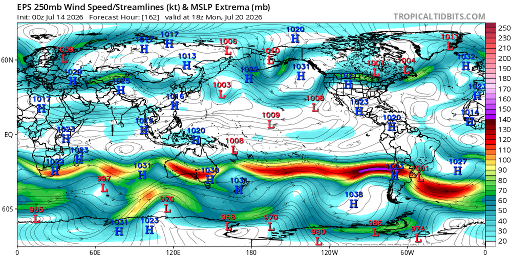
-
2026-2027 Record-breaking El Nino
LakePaste25 replied to Stormchaserchuck1's topic in Weather Forecasting and Discussion
Not ready to say it will never reverse. Maybe 10 more years of -PDO and I’ll start having those thoughts. The only thing that’s certain is the that the planet will be warmer. When it comes to everything else, weather can always feel like it’s in a permanent state until one day it isn’t anymore.