LakePaste25
-
Posts
1,351 -
Joined
-
Last visited
Content Type
Profiles
Blogs
Forums
American Weather
Media Demo
Store
Gallery
Everything posted by LakePaste25
-

2026-2027 Record-breaking El Nino
LakePaste25 replied to Stormchaserchuck1's topic in Weather Forecasting and Discussion
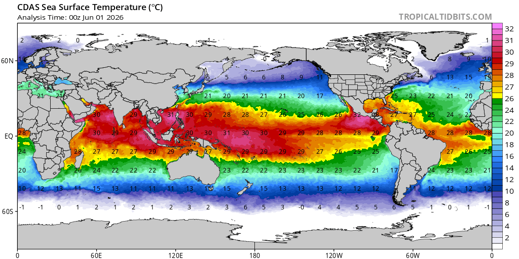
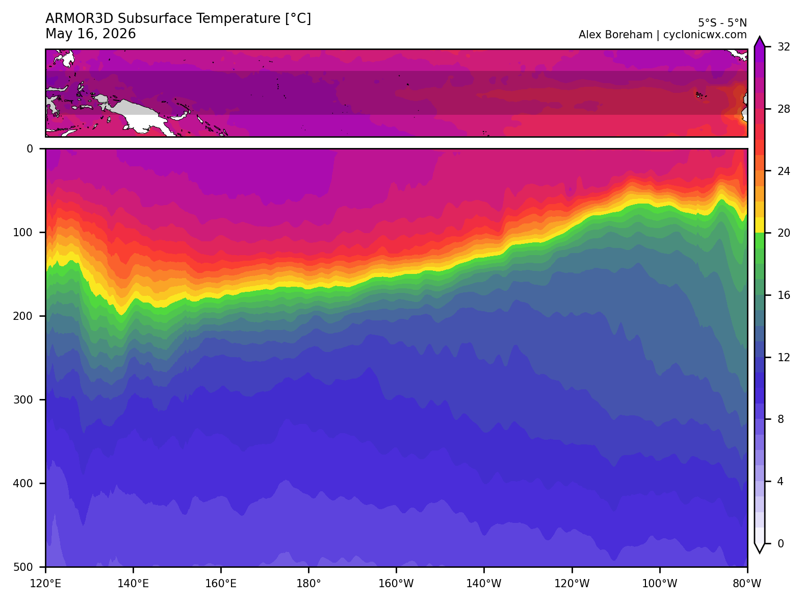
To be fair, we are also putting a major dent in the warm pool, and the warmest waters are now between 160-170E with plenty of westerlies remaining in the forecast.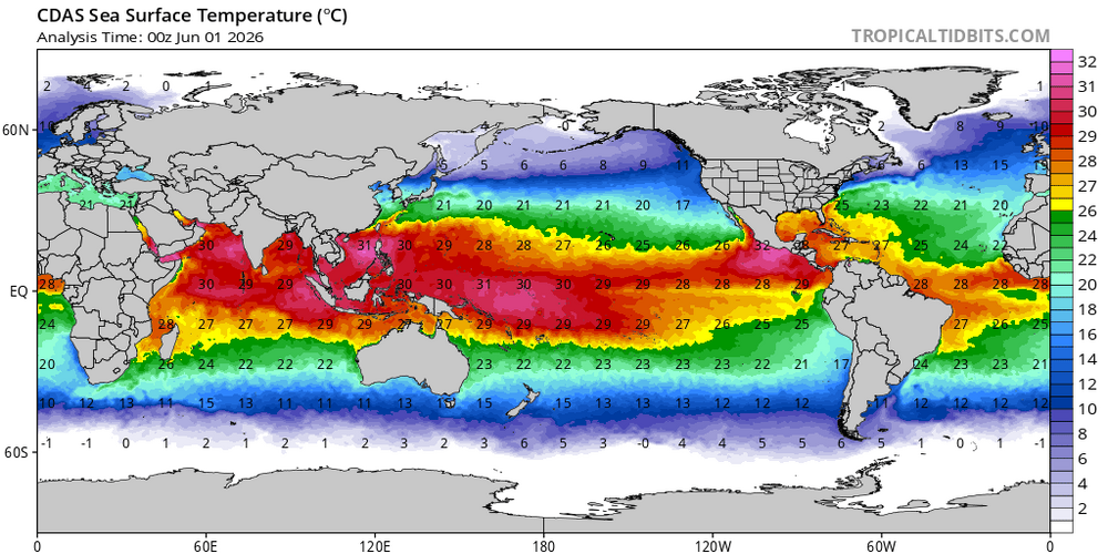
-
2026-2027 Record-breaking El Nino
LakePaste25 replied to Stormchaserchuck1's topic in Weather Forecasting and Discussion
Super Ninos aren’t always record warm for the NE unless you get that competing Nina forcing from the W pac warm pool. The typical way to get record warm temps here is via the SE ridge which ushers in subtropical air from the Gulf. Ninos don’t have this and instead typically usher in a pacific jet extension which floods the lower 48 with mild pacific air, and you have a raging southern stream bringing cool and stormy weather in the south. This pattern is usually record warm for the northern plains and Canada, but not the NE. -
can do these dumb warm vs cold wars in a banter thread? Seriously if you don’t like someone’s forecast or analysis you’re free to do your own and contribute to this thread.
-
2026-2027 Record-breaking El Nino
LakePaste25 replied to Stormchaserchuck1's topic in Weather Forecasting and Discussion
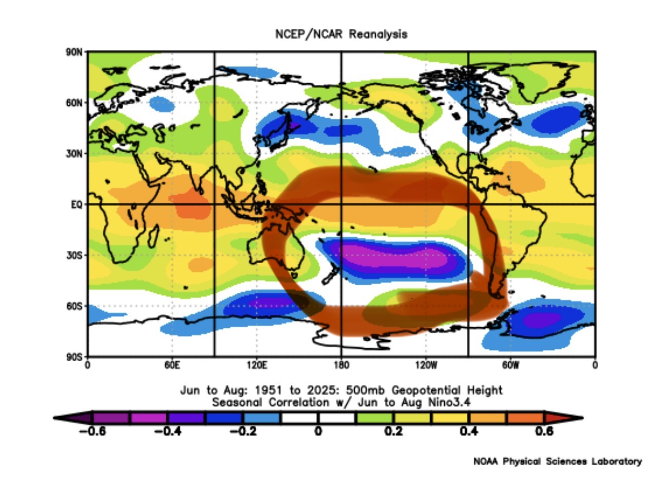
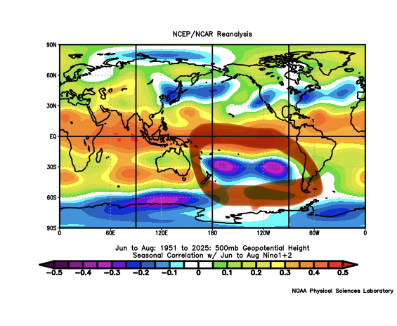
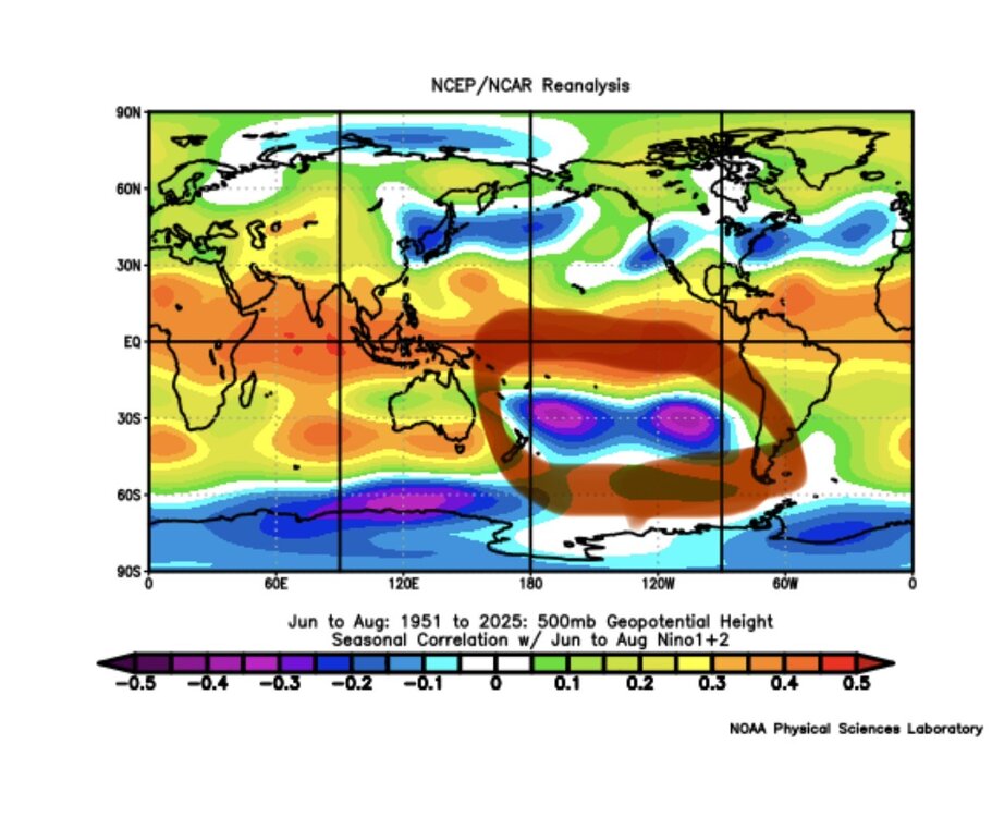
Curious to see the S hemisphere height anomalies for the ensembles. As they go into the cold season, are we seeing their counterpart to the deep Aleutian/GOA low? Asking because I don’t have access to good SH height anomaly ensemble maps.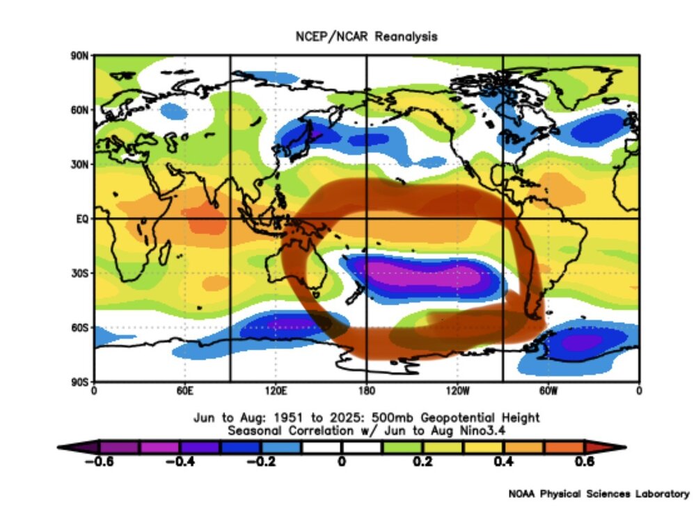
-
2026-2027 Record-breaking El Nino
LakePaste25 replied to Stormchaserchuck1's topic in Weather Forecasting and Discussion
Getting (cautiously) more bullish that we see a classic Nino response and the W pac warm pool will not be as influential. The suppressed convection in the W pac, believe it or not, is actually being under modeled now.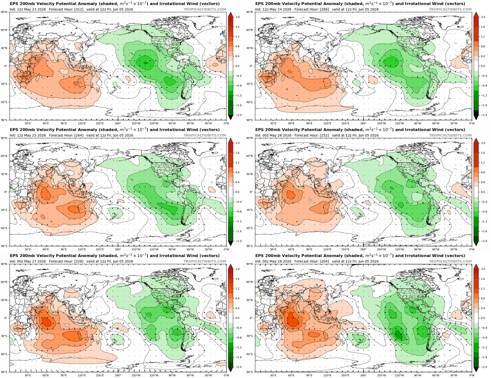
-
2026-2027 Record-breaking El Nino
LakePaste25 replied to Stormchaserchuck1's topic in Weather Forecasting and Discussion
Pac jet came in stronger than expected in Feb 2024, which pushed the jet exit region well onshore over the western US. One of the few times we got true Nino forcing, we got too much of it. -
2026-2027 Record-breaking El Nino
LakePaste25 replied to Stormchaserchuck1's topic in Weather Forecasting and Discussion
Yup but I’m still taking a wait and see approach because it can still respond between now and Oct. Zero complaints if I end up with a more Nina-like summer and it’s hotter and less rainy. -
2026-2027 Record-breaking El Nino
LakePaste25 replied to Stormchaserchuck1's topic in Weather Forecasting and Discussion
-
2026-2027 Record-breaking El Nino
LakePaste25 replied to Stormchaserchuck1's topic in Weather Forecasting and Discussion
Plenty of gas in the tank out in the west pac and Nino 4 regions to go higher too.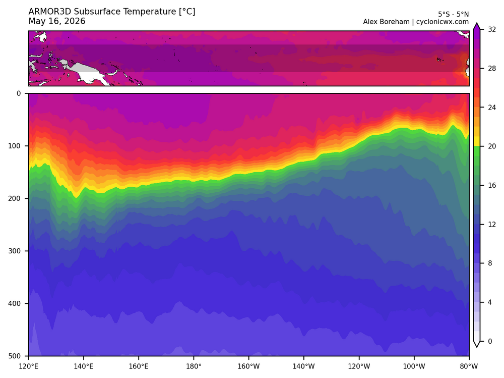
-
2026-2027 Record-breaking El Nino
LakePaste25 replied to Stormchaserchuck1's topic in Weather Forecasting and Discussion
Yup. To eradicate that W pac warm pool (which is what we want), we will need to maximize on this potential. -
2026-2027 Record-breaking El Nino
LakePaste25 replied to Stormchaserchuck1's topic in Weather Forecasting and Discussion
Can’t wait for the “not a torch!!!” copium on twitter because it’s 45 and cloudy in nyc under a CAD setup while it torches everywhere else -
2026-2027 Record-breaking El Nino
LakePaste25 replied to Stormchaserchuck1's topic in Weather Forecasting and Discussion
If you’re talking the difference between 97-98 and 15-16, I don’t think it matters as much as one might think it does in terms of winter prospects. 97-98 could’ve easily had a mid atlantic KU blizzard just like 82-83, 15-16 did. Maybe 15-16 had more cold periods, but that’s it. The reason we prefer a 97-98 outcome is because it will eradicate the W pac warm pool. -
2026-2027 Record-breaking El Nino
LakePaste25 replied to Stormchaserchuck1's topic in Weather Forecasting and Discussion
Yeah Dec ‘97 vs. ‘15 were night and day especially for the high elevations of NE. There is a difference between mild pacific air from a jet extension and mild pacific air from a jet extension + subtropical Gulf flow from the SE ridge. The former (‘97) is serviceable. -
2026-2027 Record-breaking El Nino
LakePaste25 replied to Stormchaserchuck1's topic in Weather Forecasting and Discussion
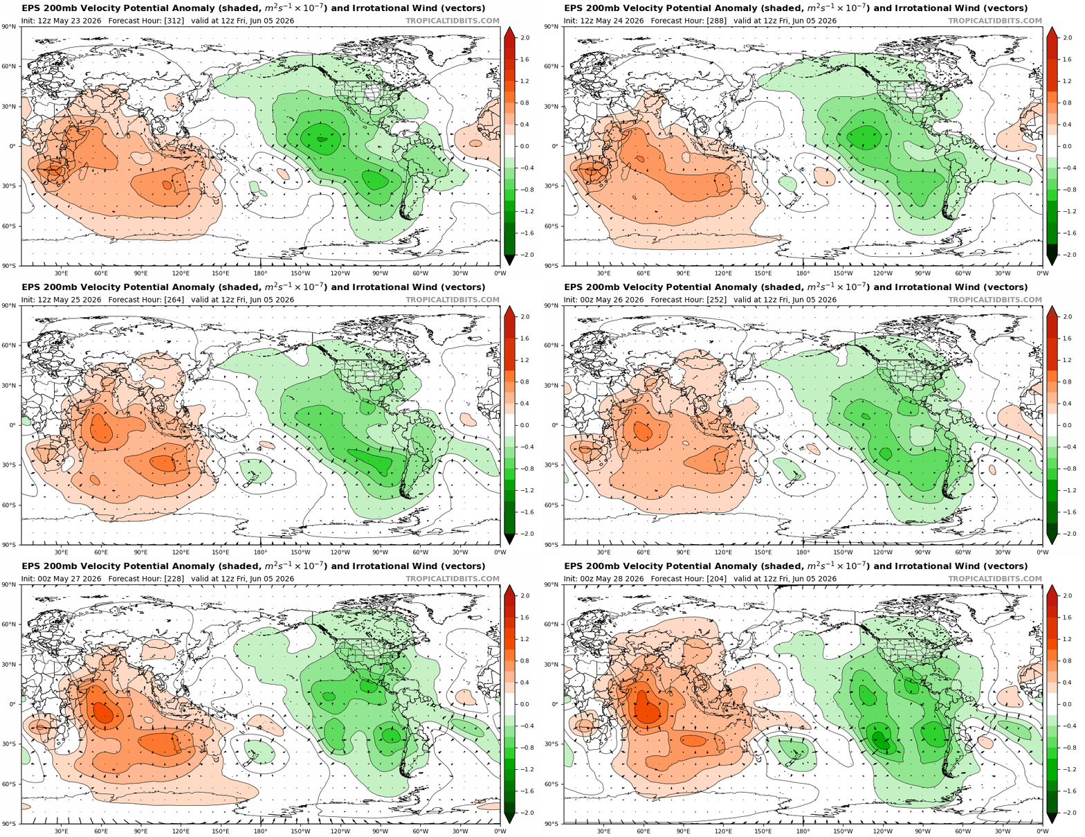
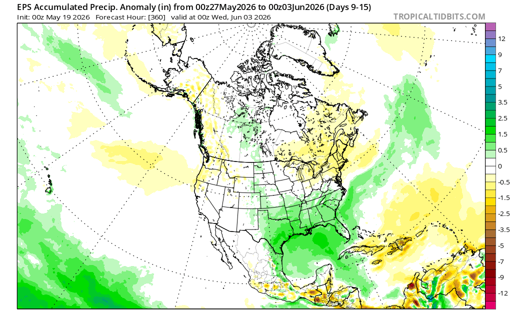
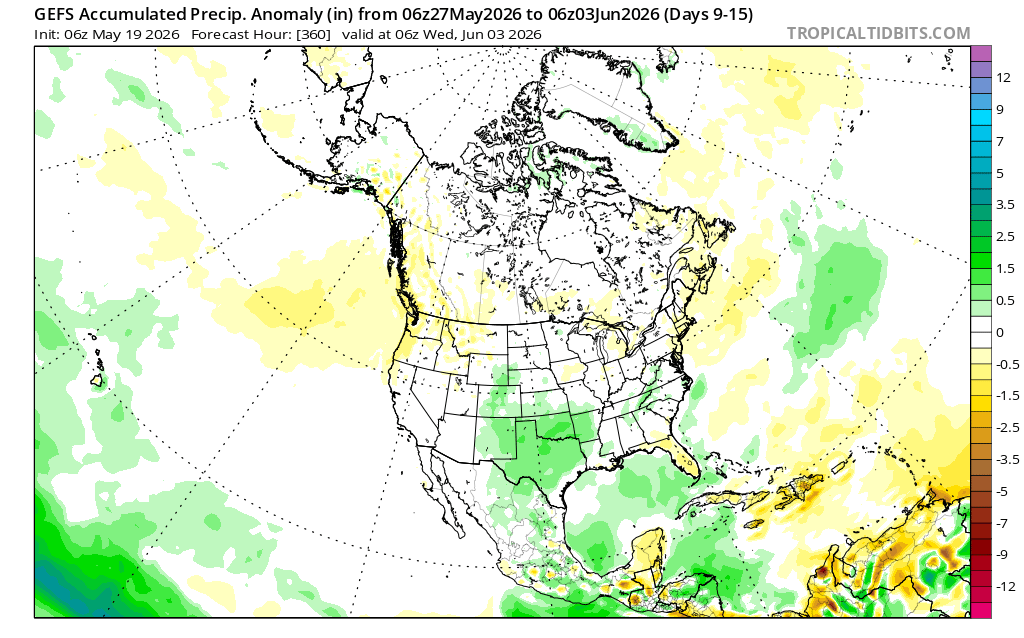
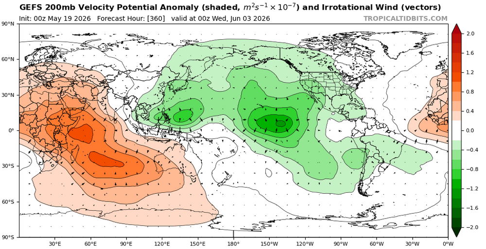
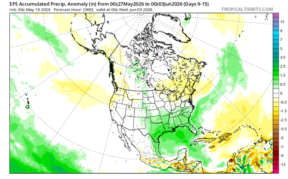
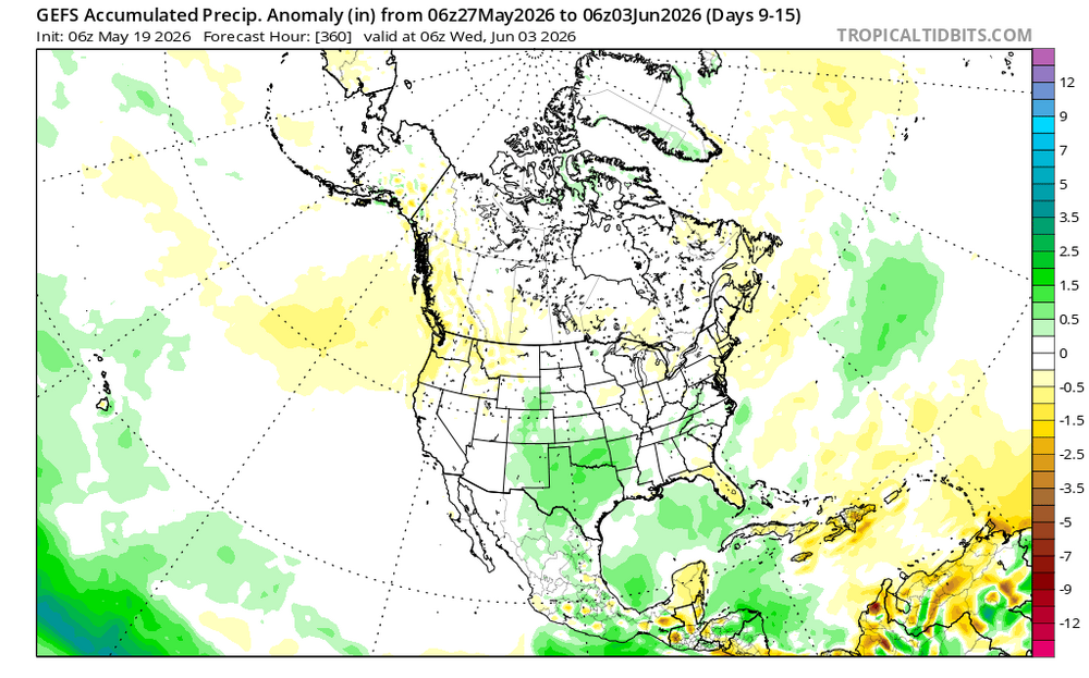
can really see where this makes a difference in +/- precip anomalies. With a traditional Nino look and more suppressed convection in the W pac on the EPS, you get the typical deep +precip anoms in the traditional Nino southern stream belt in the SE with -anoms in NE. whereas the GEFS, with its lingering convection in the W pac, has a more muted precip signal.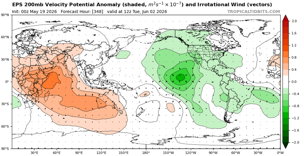
-
2026-2027 Record-breaking El Nino
LakePaste25 replied to Stormchaserchuck1's topic in Weather Forecasting and Discussion
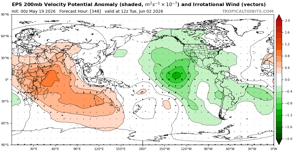
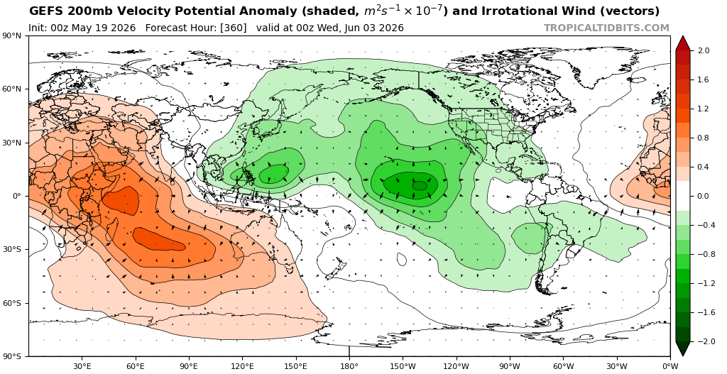
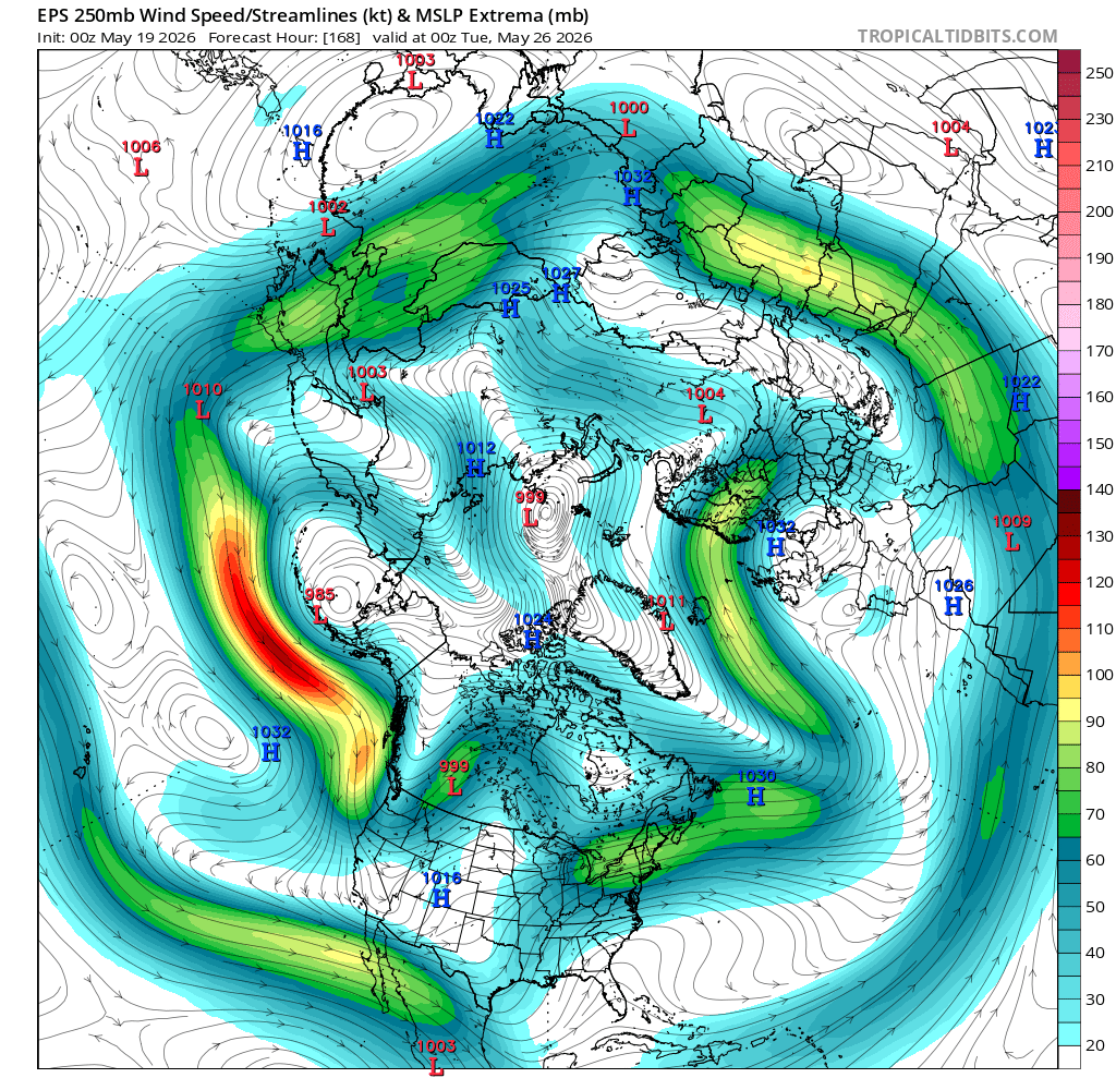
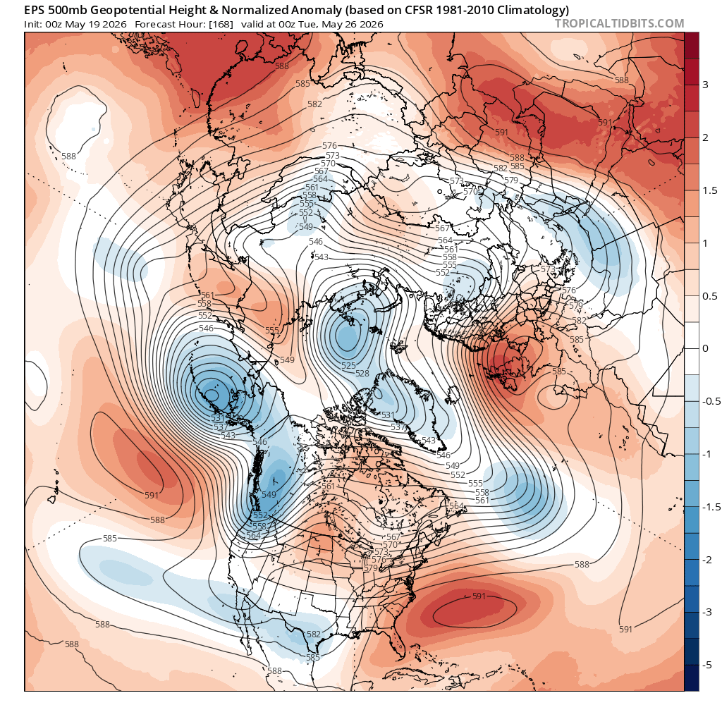
The EPS appears to be modeling less lingering convection in the west pac vs. the GEFS and CMCE.
-
2026-2027 Record-breaking El Nino
LakePaste25 replied to Stormchaserchuck1's topic in Weather Forecasting and Discussion
I’m going to wait until September or October to see if we can do anything to that west pac warm pool first. Agreed that’s where we’re headed if it lingers. -
2026-2027 Record-breaking El Nino
LakePaste25 replied to Stormchaserchuck1's topic in Weather Forecasting and Discussion
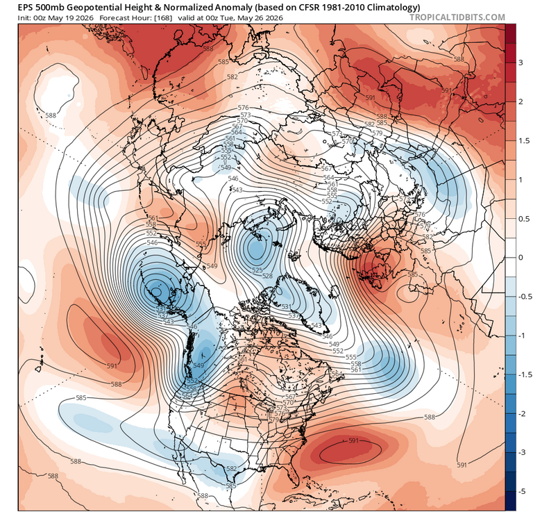
“La Nino” pattern with the strong southern stream (relative to seasonal normals) that curves northward due to the se ridge. Could be due to the lingering warm pool that @bluewave refers to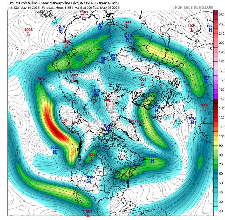
-
2026-2027 Record-breaking El Nino
LakePaste25 replied to Stormchaserchuck1's topic in Weather Forecasting and Discussion
hopefully this pre nino summer is a bust and we set multiple heat records throughout the summer. I love hot and humid summers -
2026-2027 Record-breaking El Nino
LakePaste25 replied to Stormchaserchuck1's topic in Weather Forecasting and Discussion
I wouldn’t say that coming 1 degree short of the all-time record high for May is “normal” -
2026-2027 Record-breaking El Nino
LakePaste25 replied to Stormchaserchuck1's topic in Weather Forecasting and Discussion
Just recorded our 2nd earliest 90+ degree day on record at ERI. The earliest was 5/16/1991. Definitely not typical for a pre Nino May. -
2026-2027 Record-breaking El Nino
LakePaste25 replied to Stormchaserchuck1's topic in Weather Forecasting and Discussion
The key is to just roll with it. Fire up the BBQ on Christmas and make something good -
2026-2027 Record-breaking El Nino
LakePaste25 replied to Stormchaserchuck1's topic in Weather Forecasting and Discussion
Pretty much my preliminary thoughts until we see cool anomalies replace the west pac warm pool like during the past super nino events. -
2026-2027 Record-breaking El Nino
LakePaste25 replied to Stormchaserchuck1's topic in Weather Forecasting and Discussion
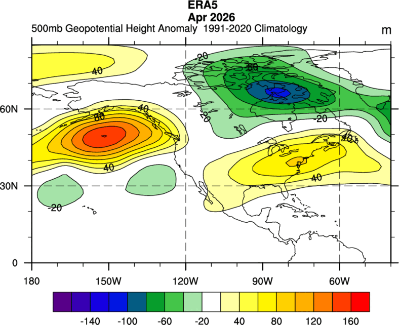
March and April were warm in the east. March was +6 here at ERI and April was +5.1.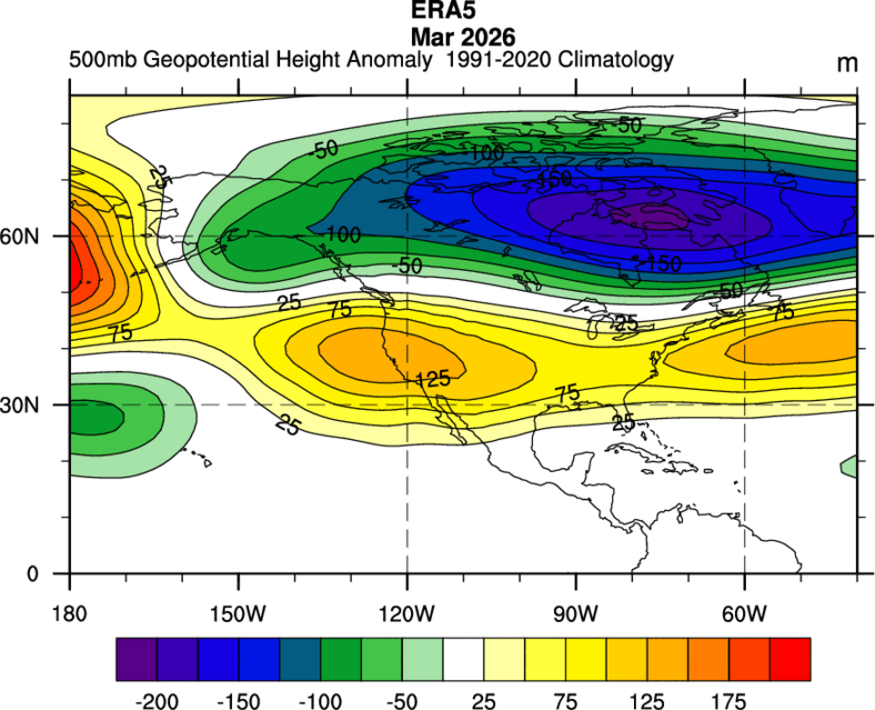
-
2026-2027 Record-breaking El Nino
LakePaste25 replied to Stormchaserchuck1's topic in Weather Forecasting and Discussion
My cool/wet summer for the great lakes will go up in flames unless we start seeing this -
2026-2027 Record-breaking El Nino
LakePaste25 replied to Stormchaserchuck1's topic in Weather Forecasting and Discussion
FWIW, whether it’s more like 1997-98 or 2015-16 doesn’t really change the odds of a big NE snowstorm or two between breaks of the pacific jet IMO. Just really getting into semantics here of what more closely defines a super Nino pattern in the western hemisphere.