
LakePaste25
-
Posts
1,350 -
Joined
-
Last visited
Content Type
Profiles
Blogs
Forums
American Weather
Media Demo
Store
Gallery
Everything posted by LakePaste25
-

2026-2027 Record-breaking El Nino
LakePaste25 replied to Stormchaserchuck1's topic in Weather Forecasting and Discussion
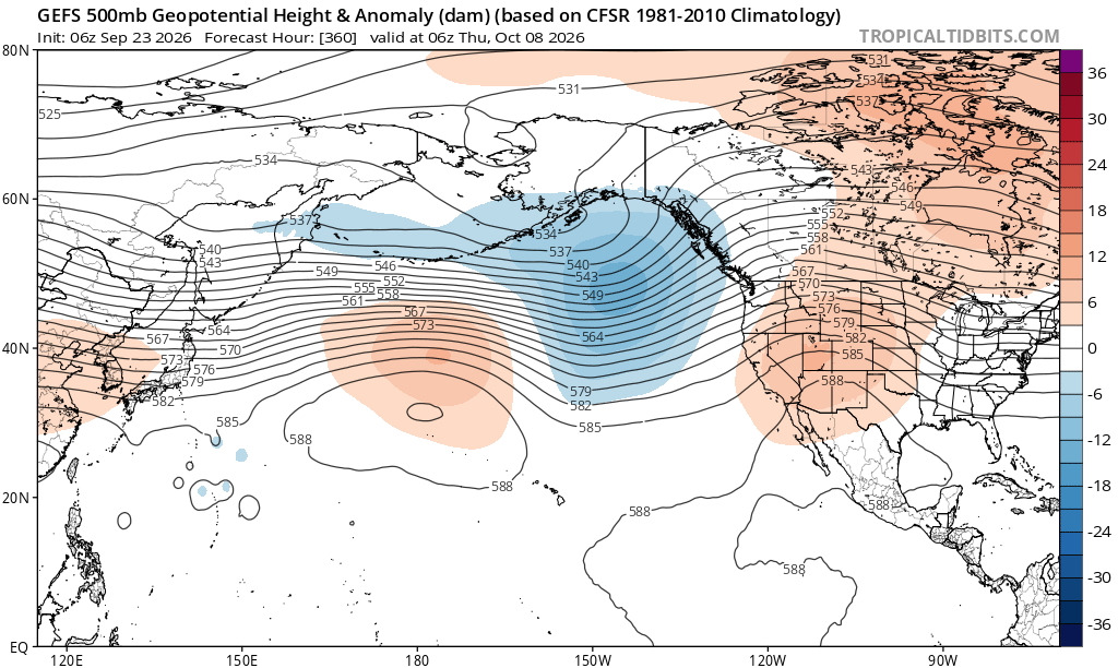
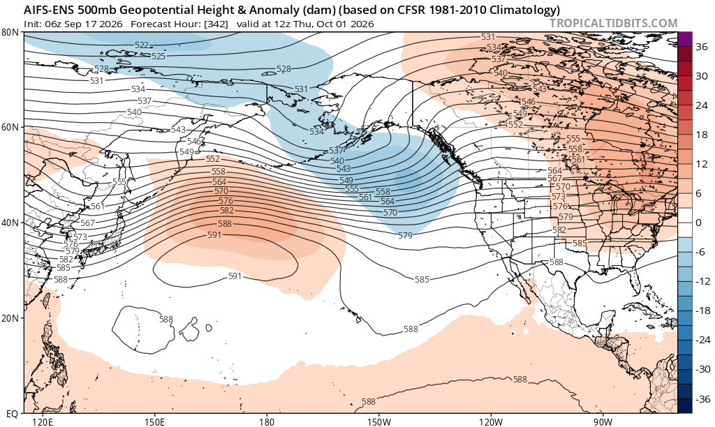
The +EPO is, but the H5 itself is not entirely cool ENSO flavored however, as the low is displaced SW will of BC into the GOA. -
2026-2027 Record-breaking El Nino
LakePaste25 replied to Stormchaserchuck1's topic in Weather Forecasting and Discussion
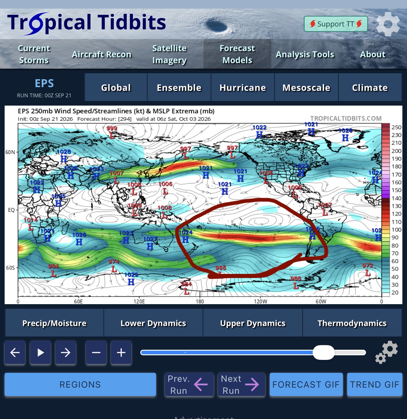
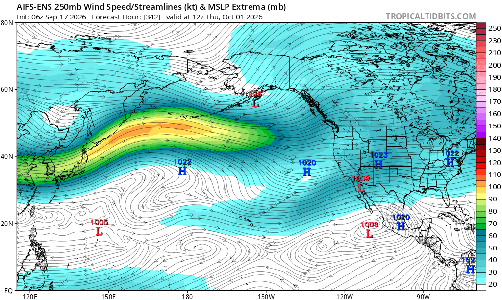
Getting there…seeing less and less N Pac -ENSO flavored ridging out there. Does seem it’s possible we might go straight from cool ENSO pattern to full blown super Nino style (cool season) jet extension at some point between now and mid November.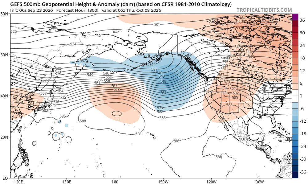
-
2026-2027 Record-breaking El Nino
LakePaste25 replied to Stormchaserchuck1's topic in Weather Forecasting and Discussion
I agree with this. A lot of emphasis in this thread about the -PDO but I think the Arctic had much to do with it. In any sense it likely enhanced the -PDO over the summer. -
2026-2027 Record-breaking El Nino
LakePaste25 replied to Stormchaserchuck1's topic in Weather Forecasting and Discussion
If CFS is going off how NOAA is calculating it, that model output makes more sense. Interesting to see the difference as Cyclonicwx’s is closer to Australian BOM’s RONI measurement. -
2026-2027 Record-breaking El Nino
LakePaste25 replied to Stormchaserchuck1's topic in Weather Forecasting and Discussion
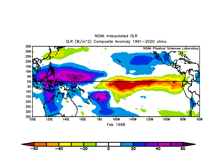
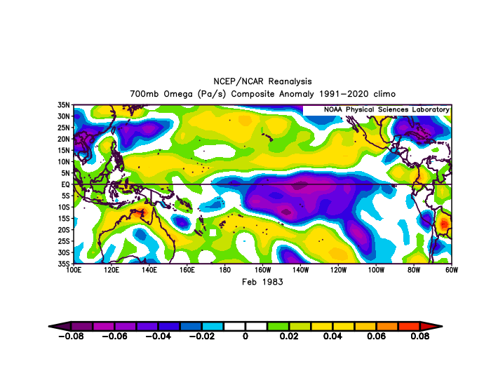
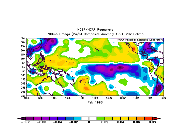
Can really see the difference here: Both had convection pretty far east, but 1983 was more concentrated just east of the dateline during February, while 1998 had more periods of Eastern Pacific forcing.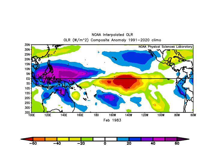
-
2026-2027 Record-breaking El Nino
LakePaste25 replied to Stormchaserchuck1's topic in Weather Forecasting and Discussion
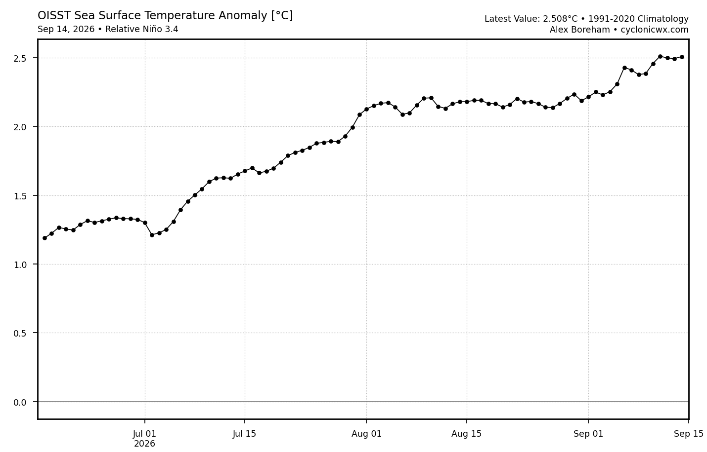
I imagine this will go back up. RONI is already at +2.5 and while I am aware this is a daily index compared to a 3 month mean, it is only September and we likely have 2-3 more months until the peak. I am thinking the 3 month mean will be closer to 3-3.3 -
2026-2027 Record-breaking El Nino
LakePaste25 replied to Stormchaserchuck1's topic in Weather Forecasting and Discussion
ok, but your original comment that I reacted to implied that it’s only coupled in the tropics, which isn’t true. -
2026-2027 Record-breaking El Nino
LakePaste25 replied to Stormchaserchuck1's topic in Weather Forecasting and Discussion
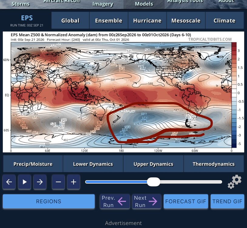
Trying to figure out when this region became the tropics.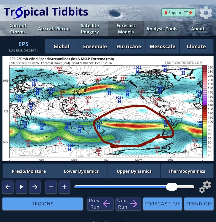
-
2026-2027 Record-breaking El Nino
LakePaste25 replied to Stormchaserchuck1's topic in Weather Forecasting and Discussion
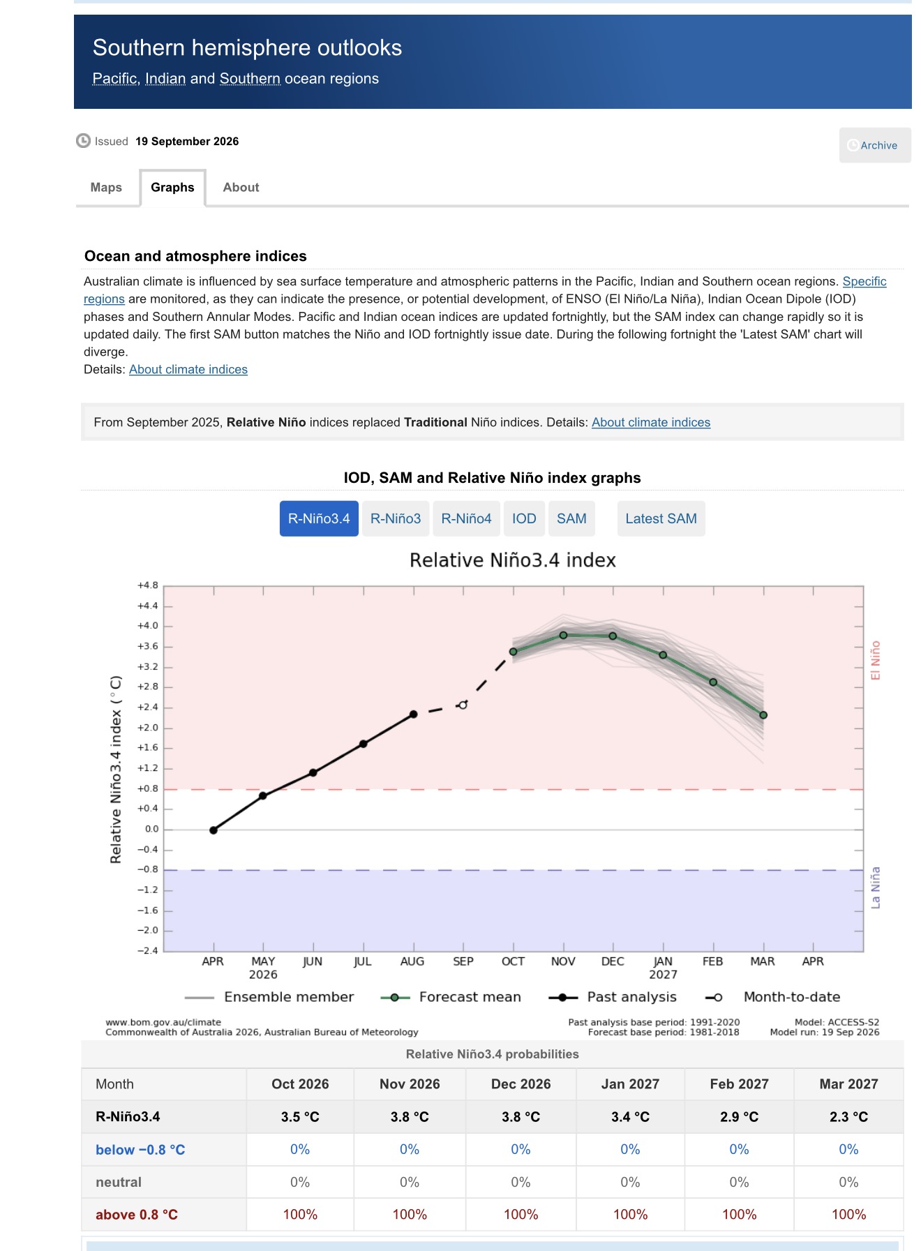
BOM updated with a +3.8C RONI. Might be too high, but it will easily get above +3C on the monthly mean.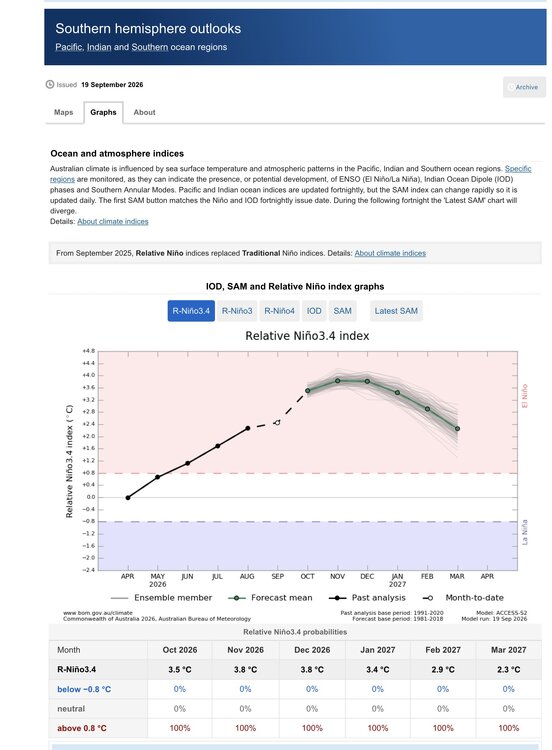
-
2026-2027 Record-breaking El Nino
LakePaste25 replied to Stormchaserchuck1's topic in Weather Forecasting and Discussion
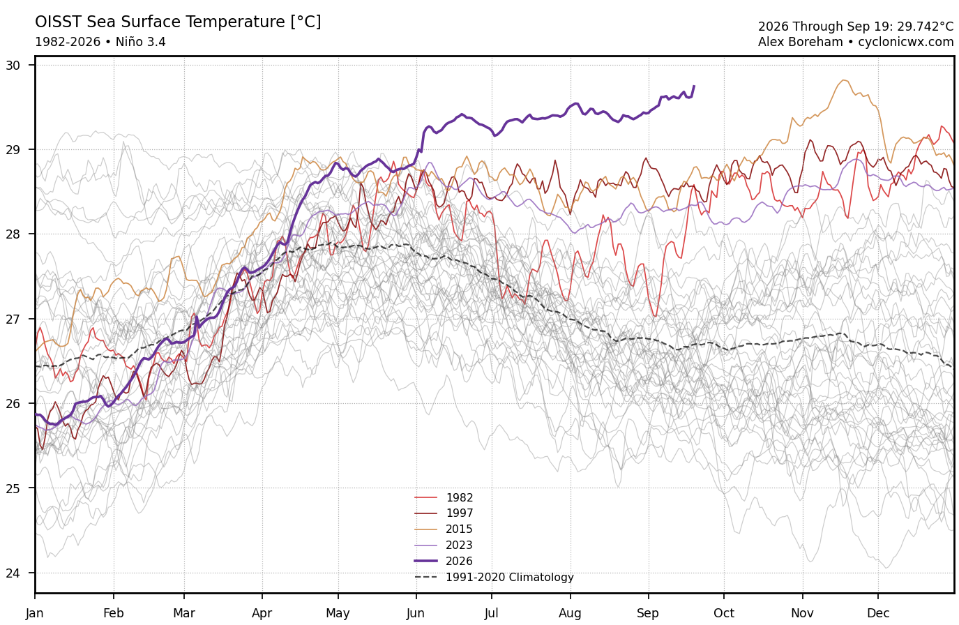
Very close to beating the all-time record warmest SST in the Nino 3.4 region.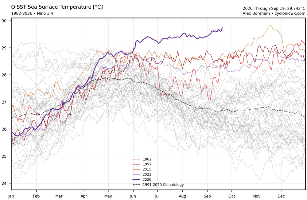
-
2026-2027 Record-breaking El Nino
LakePaste25 replied to Stormchaserchuck1's topic in Weather Forecasting and Discussion
Still not sold on the PDO having any meaningful influence this cool season. But time will tell. -
2026-2027 Record-breaking El Nino
LakePaste25 replied to Stormchaserchuck1's topic in Weather Forecasting and Discussion
Ah yes. The famous -PDO of September 2015 that was actually positive.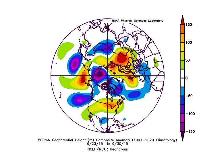
-
2026-2027 Record-breaking El Nino
LakePaste25 replied to Stormchaserchuck1's topic in Weather Forecasting and Discussion
Yeah for record highs in the winter at least, the classic way to do that around here is a Great Lakes Cutter tracking north and west of here. rainy/wet snow/slop mix coastals without cold air are more of a warm overnight low type of deal, and those are what I expect. December 2015 was the weird one because we actually did get lows going well NW despite being a super El Niño. -
2026-2027 Record-breaking El Nino
LakePaste25 replied to Stormchaserchuck1's topic in Weather Forecasting and Discussion
Much of this winter warmth will likely be driven by overnight lows IMO due to the active pattern. -
2026-2027 Record-breaking El Nino
LakePaste25 replied to Stormchaserchuck1's topic in Weather Forecasting and Discussion
Right now I’m leaning towards a fairly torchy winter with *maybe* 1 salvageable month on the back side where it’s just slightly above normal. Can’t really ignore that every analog that was supposed to give us below normal temps has busted warm thus far into mid september, and there’s no signs of October being cooler than normal yet. -
2026-2027 Record-breaking El Nino
LakePaste25 replied to Stormchaserchuck1's topic in Weather Forecasting and Discussion
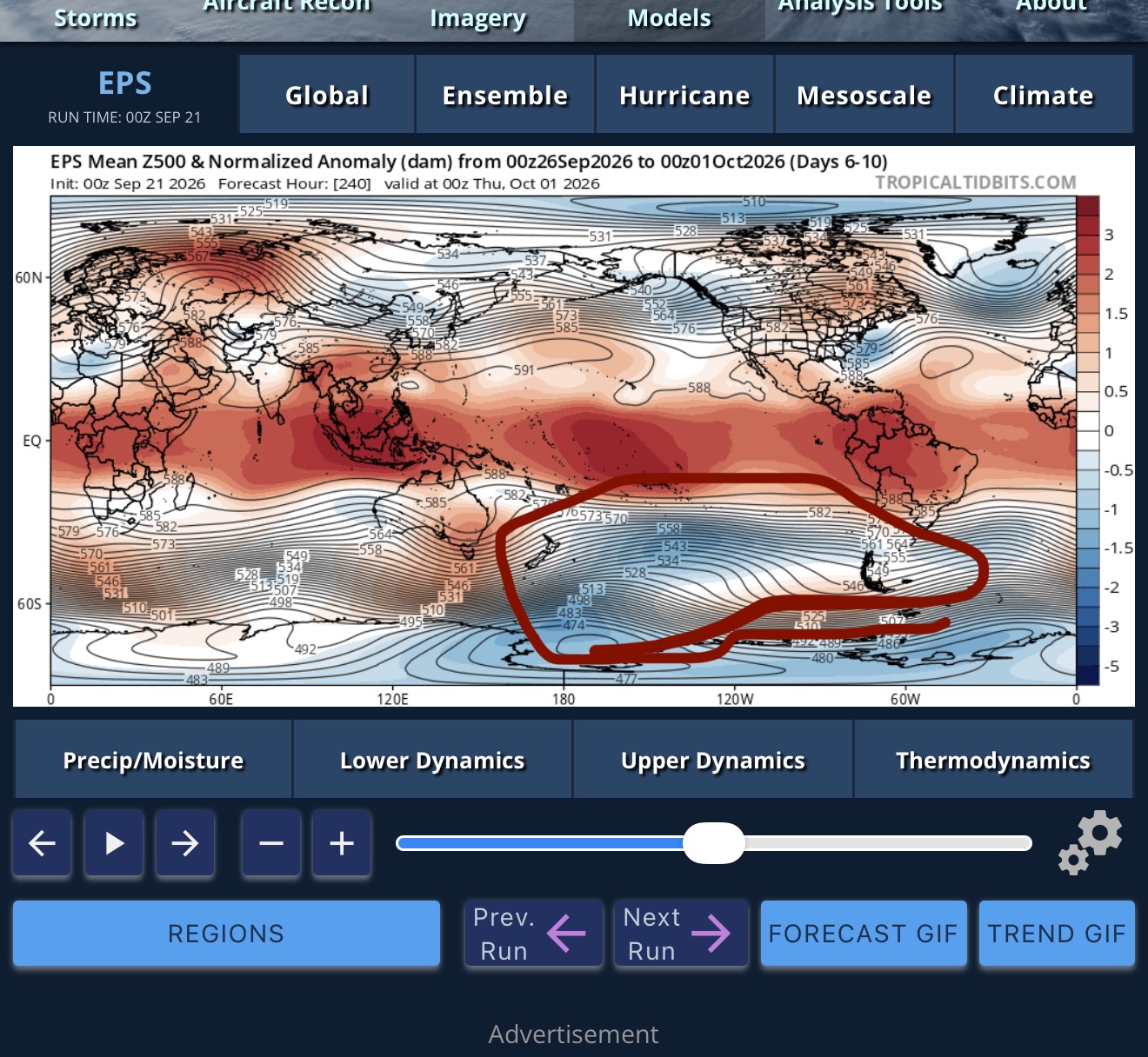
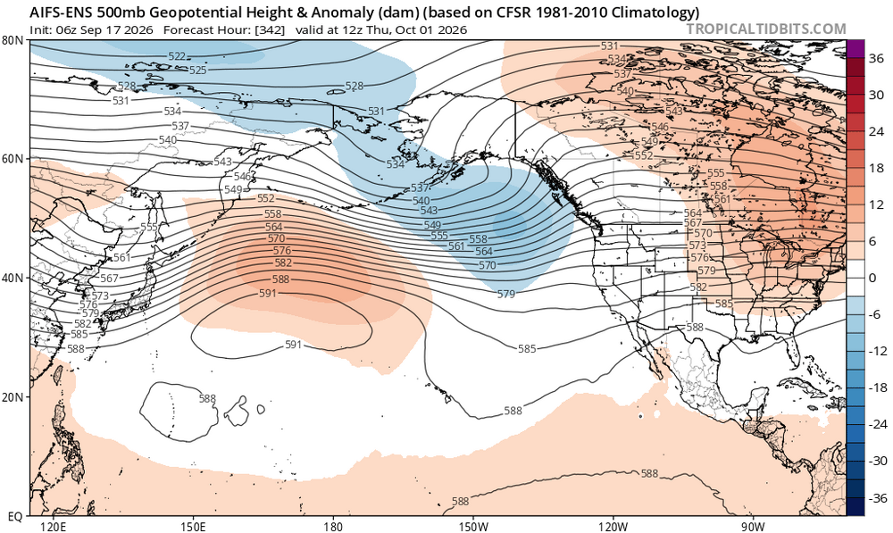
You can tell we are slowly getting to that warm ENSO state. Plenty of +U in the NH. Still some residual ridging out west of the Aleutians but even that’s weakening and probably flattens out with time.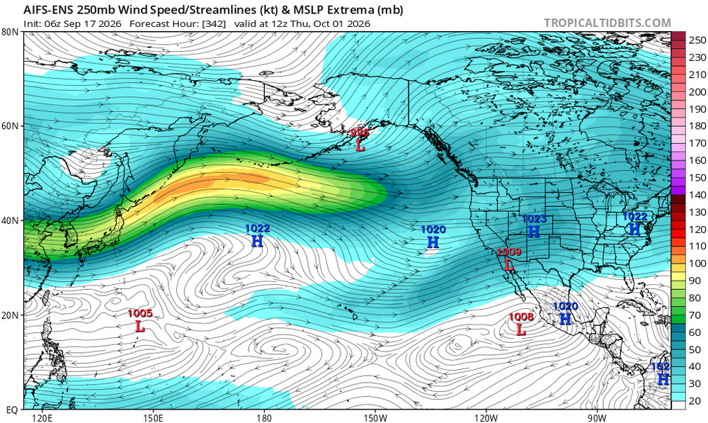
-
2026-2027 Record-breaking El Nino
LakePaste25 replied to Stormchaserchuck1's topic in Weather Forecasting and Discussion
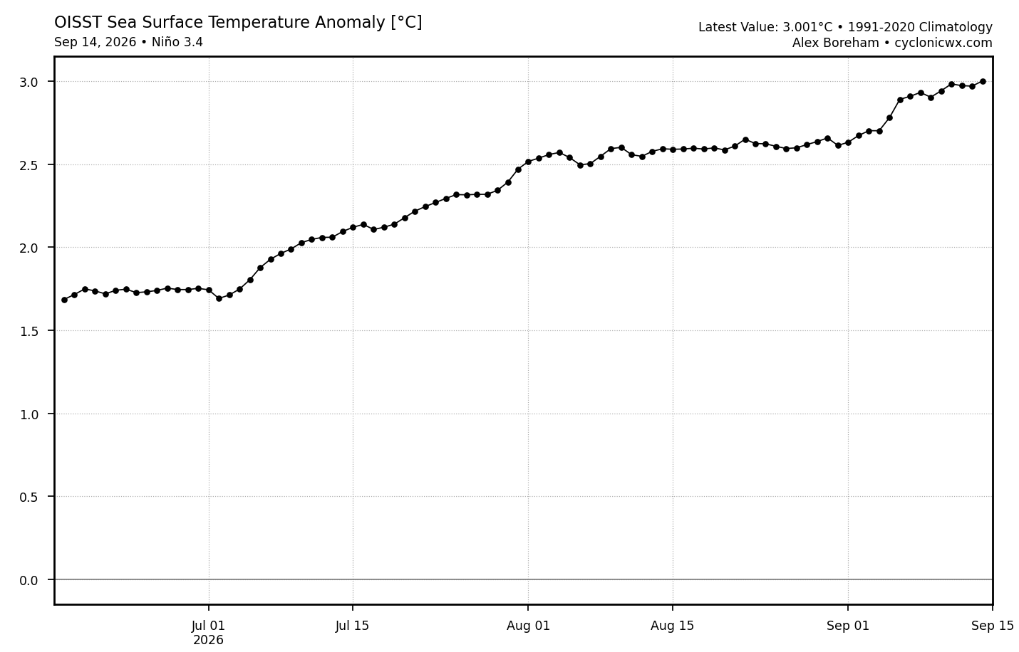
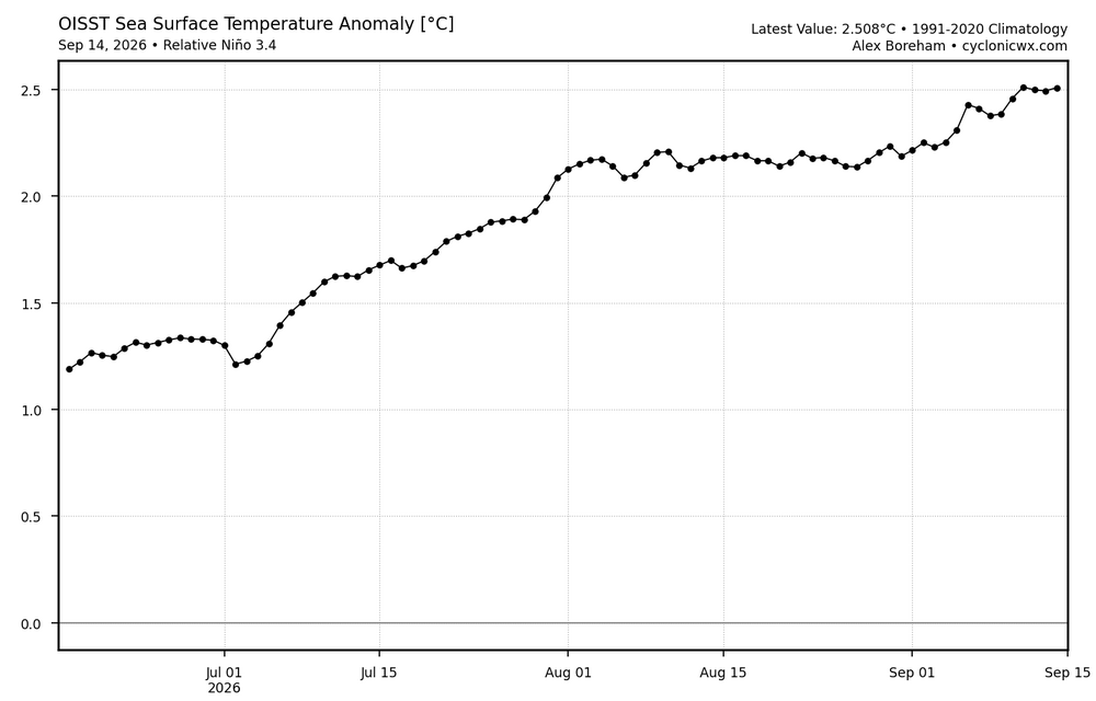
Officially crossed +3C on ONI and +2.5C on RONI!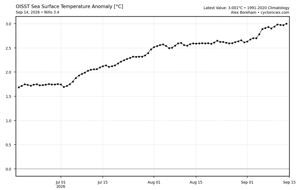
-
2026-2027 Record-breaking El Nino
LakePaste25 replied to Stormchaserchuck1's topic in Weather Forecasting and Discussion
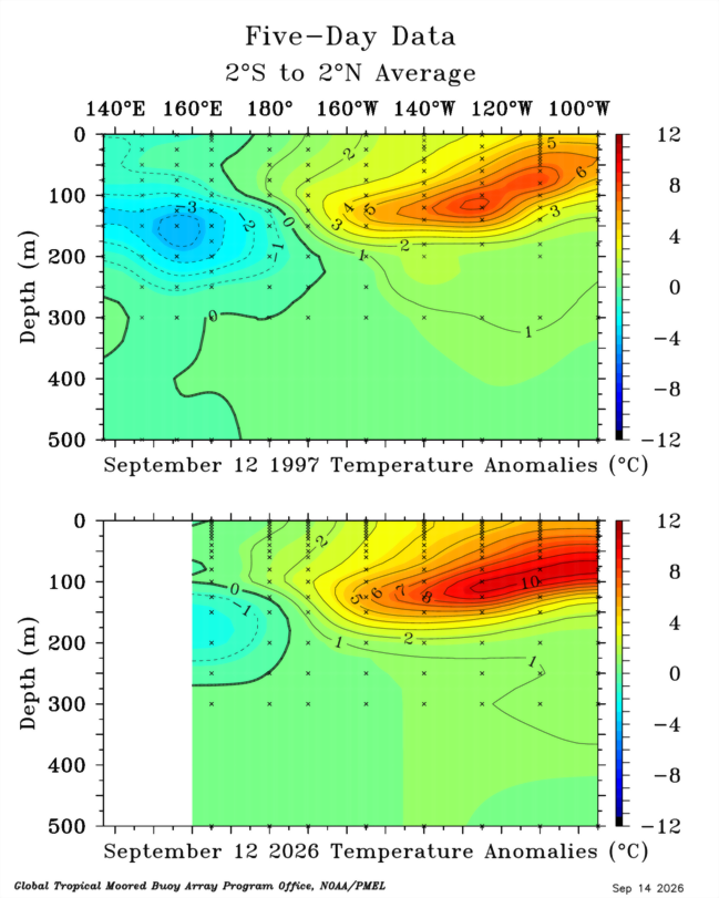
I’m a little more skeptical of the “back loaded Modoki” idea than I was a month ago given how this keeps evolving. What you’re saying is potentially we see an 82-83 outcome which was exactly that. Only issue is we are east of 82 and even 97 on tao/tritton so it’s difficult to just say go with “basin waters are warmer, so it’s further west” when you also have to account for the actual position of the warmest waters being further east. I think i don’t disagree yet but I need another month to see where OLR’s land vs 82 and 97. -
2026-2027 Record-breaking El Nino
LakePaste25 replied to Stormchaserchuck1's topic in Weather Forecasting and Discussion
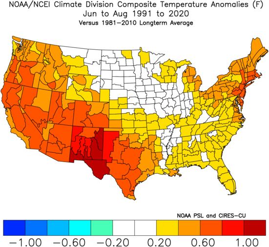
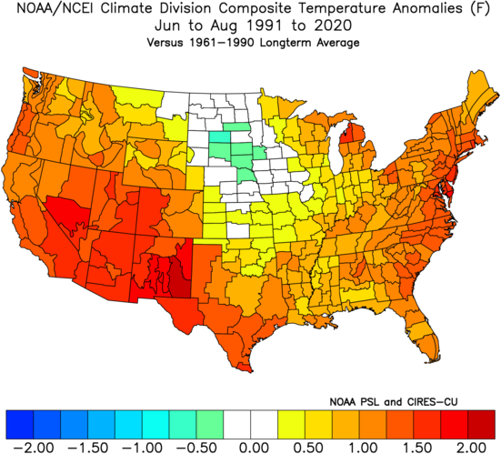
This was essentially just a slightly east-shifted version of the long term trends of summer in CONUS. The strongest El Niño on record was unable to shake it.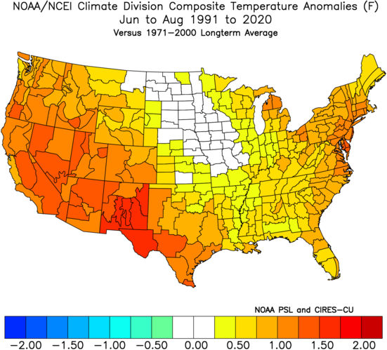
-
2026-2027 Record-breaking El Nino
LakePaste25 replied to Stormchaserchuck1's topic in Weather Forecasting and Discussion
To verify sure, there’s no requirement in how one gets there. It’s more about trusting the prognosis to begin with. Say it’s 100 in Atlanta. A model says starting tomorrow, we will see the forecast high drop 5 degrees every day for the next 6 days. So in a few days it’ll only get to 80 in Atlanta. It’s now tomorrow, and the high didn’t drop 5 degrees. It’s 99. Continue on to the next day, it’s 100 again. Why should I trust what the model is saying 3 weeks out when it’s making such a massive forecast error 2-5 days out? -
2026-2027 Record-breaking El Nino
LakePaste25 replied to Stormchaserchuck1's topic in Weather Forecasting and Discussion
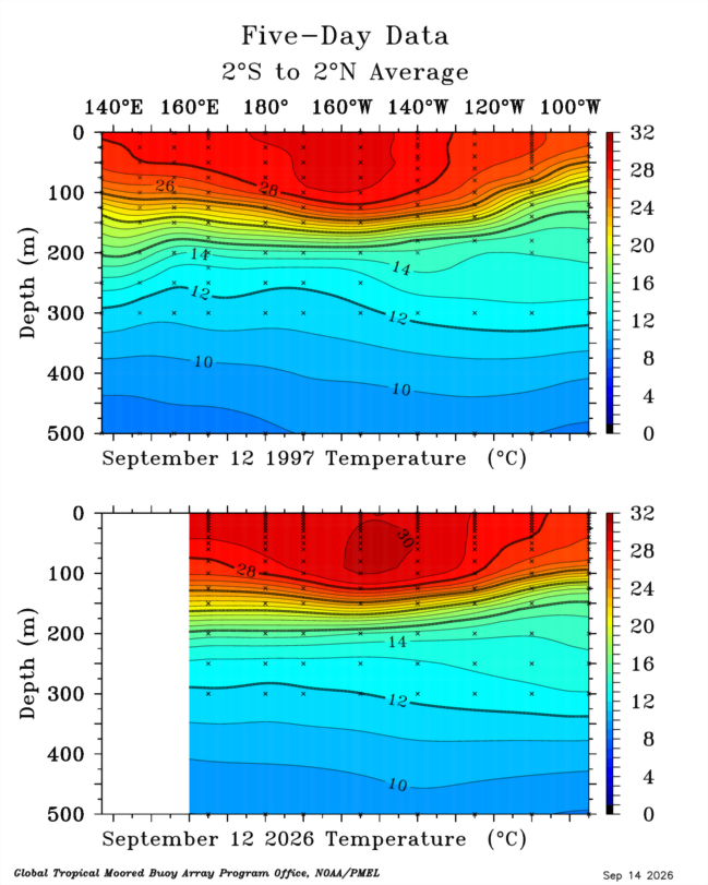
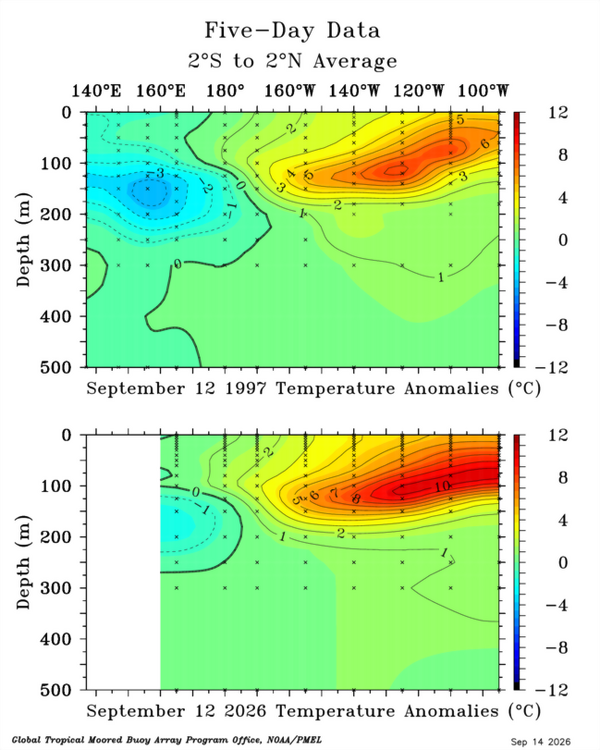
Further east and a much greater volume of warm water than 1997 with the 30C isotherm approaching 140W: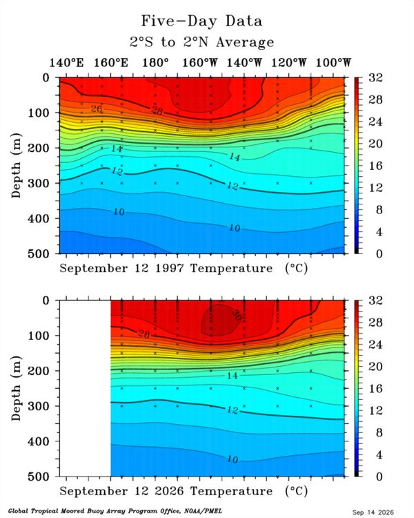
-
2026-2027 Record-breaking El Nino
LakePaste25 replied to Stormchaserchuck1's topic in Weather Forecasting and Discussion
So it’s already initialized too low? Toss IMO. -
2026-2027 Record-breaking El Nino
LakePaste25 replied to Stormchaserchuck1's topic in Weather Forecasting and Discussion
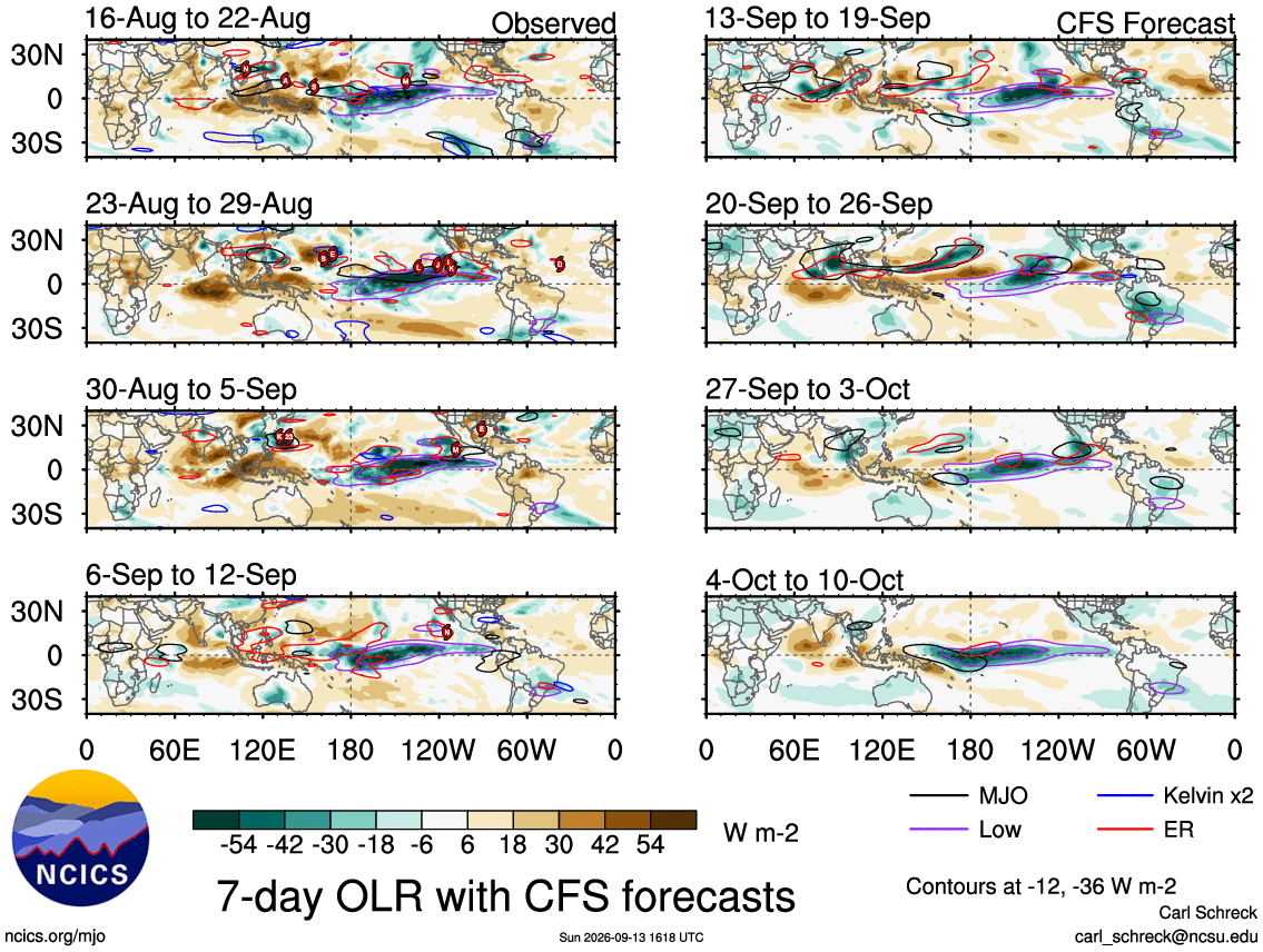
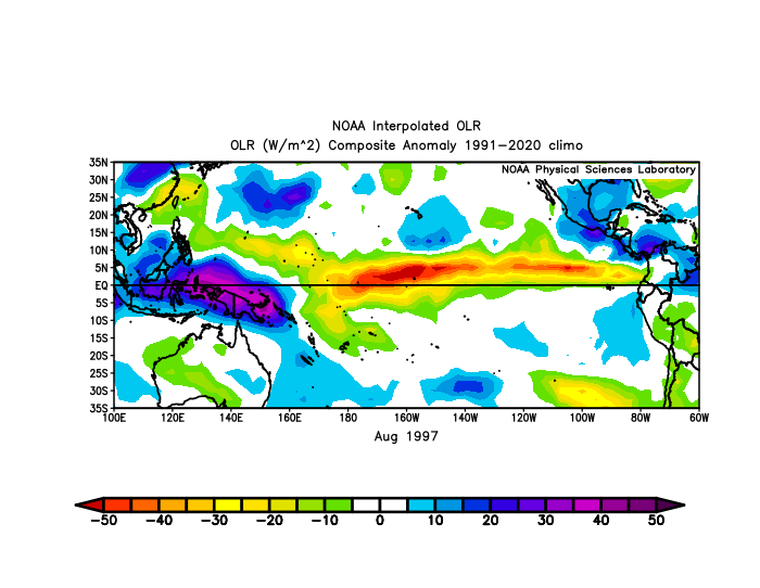
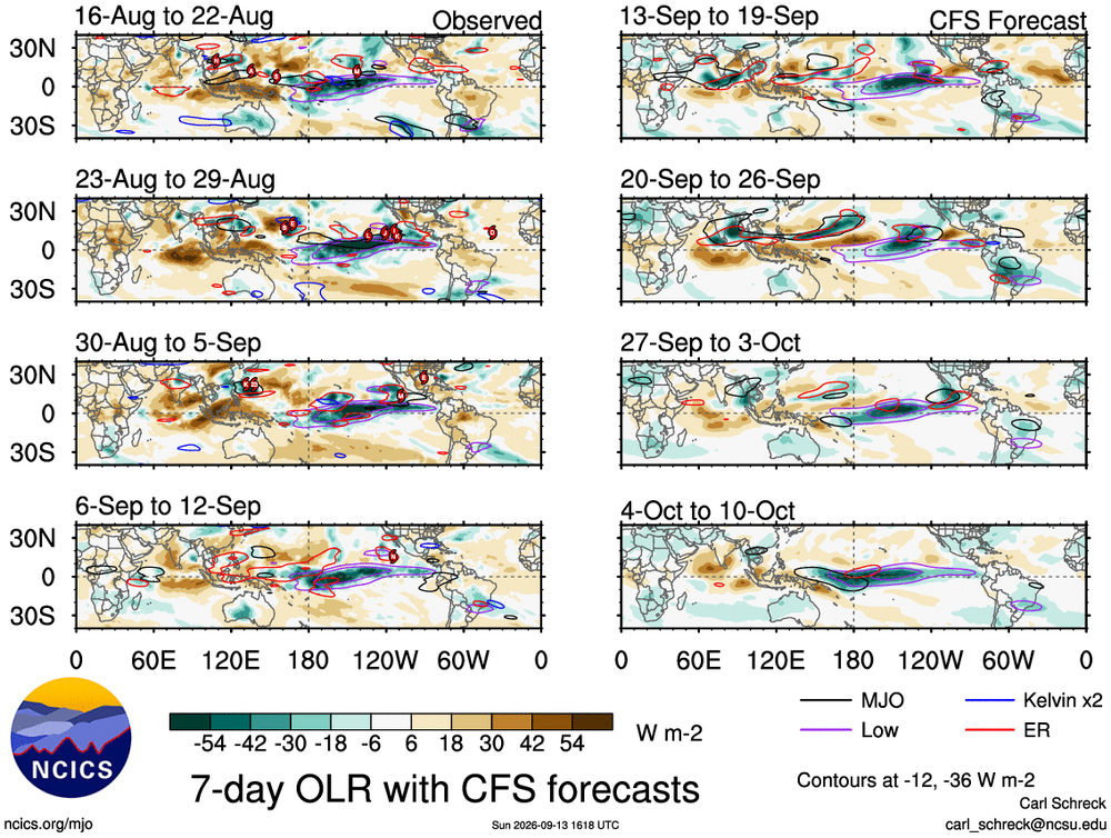
This event is more east-based than 1997. 1997 had convection far west in July in particular.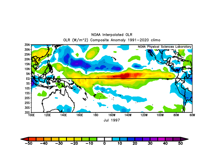
-
2026-2027 Record-breaking El Nino
LakePaste25 replied to Stormchaserchuck1's topic in Weather Forecasting and Discussion
The MJO isn’t “avoiding” the IO/MC, it’s being suppressed by the descending branch of the hadley cell triggered by the Nino standing wave whenever it enters that region. If you use VP and OLR plots you can still see the MJO pass thru those regions in a very suppressed state. On the RMM plot, El Niño is overwhelming the signal. -
2026-2027 Record-breaking El Nino
LakePaste25 replied to Stormchaserchuck1's topic in Weather Forecasting and Discussion
They tend to be pretty accurate with the big picture, as the MJO orbit is very predictable. Minor details, such as exact strength of the WWB, exact day (late sept or early oct) are more TBD and this won’t accurately predict that this far out.