LakePaste25
-
Posts
1,351 -
Joined
-
Last visited
Content Type
Profiles
Blogs
Forums
American Weather
Media Demo
Store
Gallery
Everything posted by LakePaste25
-

2026-2027 Record-breaking El Nino
LakePaste25 replied to Stormchaserchuck1's topic in Weather Forecasting and Discussion
Part of this is because these ensembles are not very good at spotting troughs in the summer. They tend to over smooth. I think the N Pac will begin to organize by late August/early September. -
2026-2027 Record-breaking El Nino
LakePaste25 replied to Stormchaserchuck1's topic in Weather Forecasting and Discussion
I think he’s referring to the GLAAM. Nonetheless, I’m sure I’ll wake up to another 10 posts here tomorrow about how it’s 5 degrees in longitude off from some height anomaly map from a century ago so it’s not el niño. -
2026-2027 Record-breaking El Nino
LakePaste25 replied to Stormchaserchuck1's topic in Weather Forecasting and Discussion
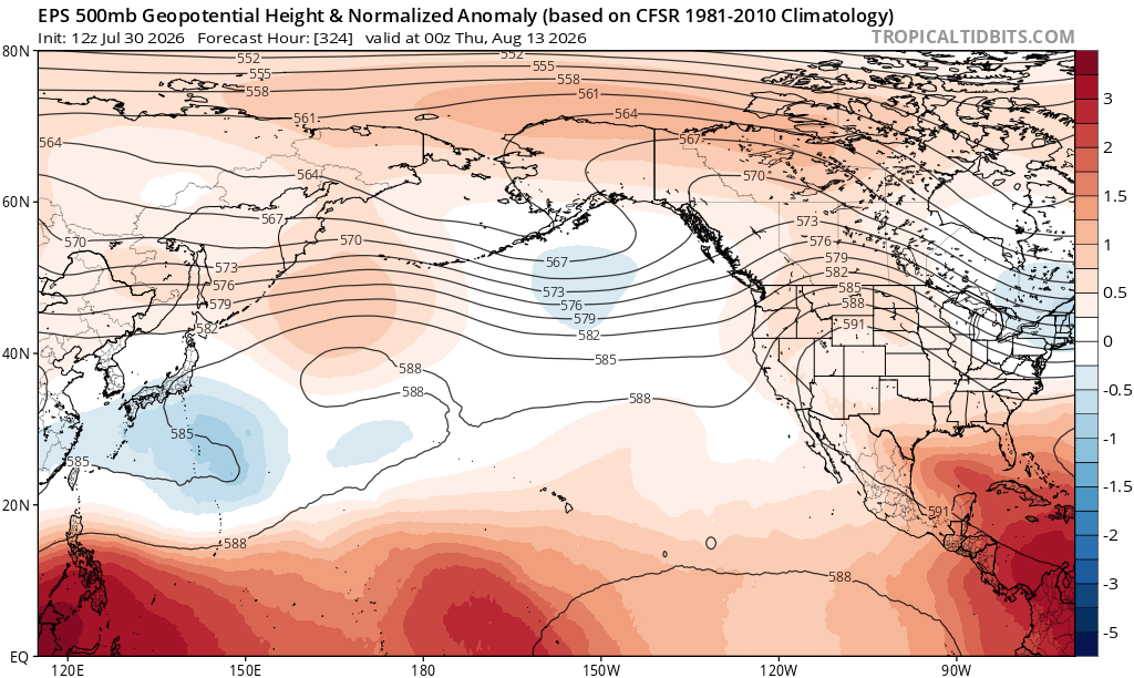
N Pac finally waking up to El Niño? This is what you’d expect in the warm season (weak Aleutian Low that slowly deepens).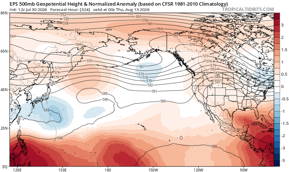
-
super el nino banter thread
LakePaste25 replied to forkyfork's topic in Weather Forecasting and Discussion
Hope so, if it’s not going to snow then i want BBQ and shorts weather for the holiday -
2026-2027 Record-breaking El Nino
LakePaste25 replied to Stormchaserchuck1's topic in Weather Forecasting and Discussion
La Niña or cold neutral is likely after any super Nino because the cold waters in the W pac propagate eastward/promote trades, and a lot of the ocean heat in the tropics is released into the atmosphere. -
super el nino banter thread
LakePaste25 replied to forkyfork's topic in Weather Forecasting and Discussion
Unironically, a fully coupled Nino could bring better KU chances than a half assed Nino like 23-24, which had a ton of forcing in the Maritime Continent. I’d absolutely gamble with a 97-98 type setup. Sure there will be a ton of demoralizing rainstorms with the perfect track, but all you need is 1 to phase with cold air. -
2026-2027 Record-breaking El Nino
LakePaste25 replied to Stormchaserchuck1's topic in Weather Forecasting and Discussion
If it’s anything like 97-98 there will be a lot of coastal storms that are mostly rain. -
2026-2027 Record-breaking El Nino
LakePaste25 replied to Stormchaserchuck1's topic in Weather Forecasting and Discussion
My early thoughts is we see a predominately bootleg +PNA/extended pac jet state in the mean that will occasionally retrograde to a -EPO/+TNH for brief periods. Still need to see where the Hadley cell will set up though. -
2026-2027 Record-breaking El Nino
LakePaste25 replied to Stormchaserchuck1's topic in Weather Forecasting and Discussion
I don’t think it’s a cop out. If it statistically argues so (which is absolutely does for the mid Atlantic) there’s no reason to pretend that it doesn’t. -
2026-2027 Record-breaking El Nino
LakePaste25 replied to Stormchaserchuck1's topic in Weather Forecasting and Discussion
I’d put the mid atlantic under “equal chances” IMO. Super Ninos are usually hit or miss there, dependent on 1 storm. It’s close to 50% likelihood given the sample size. -
2026-2027 Record-breaking El Nino
LakePaste25 replied to Stormchaserchuck1's topic in Weather Forecasting and Discussion
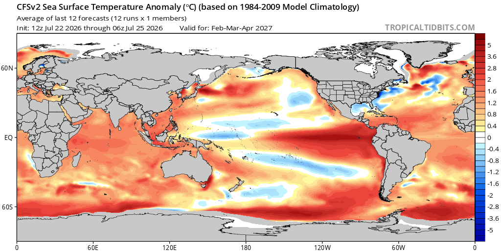
CFS does have a 1983/1998 look to it, where we get - anomalies to the dateline. I don’t worry too much about Nino 1+2 or even much of Nino 3. What matters most to me is how far east we see suppressed convection. You’re pretty much never going to see heavy convection near 1+2 anyway.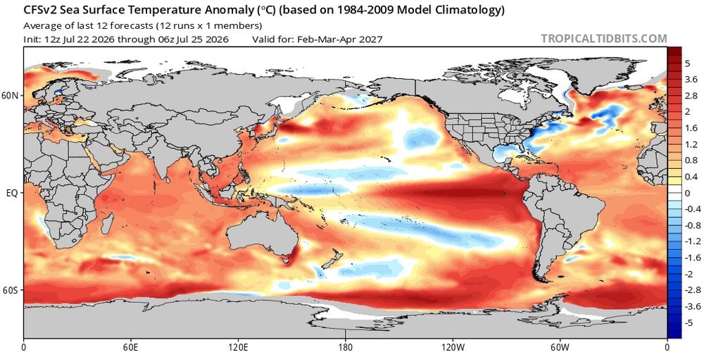
-
2026-2027 Record-breaking El Nino
LakePaste25 replied to Stormchaserchuck1's topic in Weather Forecasting and Discussion
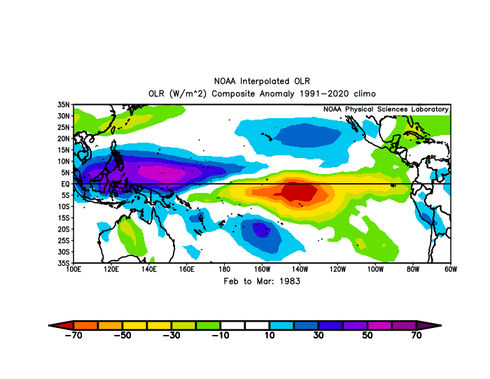
Yeah I’m feeling optimistic we can at least get to a point where convection shuts down in the MC, but still have work to do for getting suppression to the dateline. The interesting thing here is that 1983 and 1998 produced nearly identical results in OLR for the back half of winter but have different outcomes in the Eastern US. Goes to my original point I made awhile ago that KU events are a huge part “luck” and not to look too much into the exact placement of warm SSTAs for this. 1998 was close to one multiple times.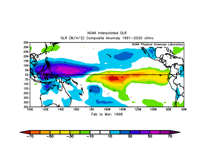

-
2026-2027 Record-breaking El Nino
LakePaste25 replied to Stormchaserchuck1's topic in Weather Forecasting and Discussion
I think the -PDO stays solidly negative until the early Fall when the pacific jet starts to climatologically strengthen for the season. At that point it will open the door for disruptions to it. The warming waters off the Western US does work against the -PDO but it’s obviously just one component of it. -
2026-2027 Record-breaking El Nino
LakePaste25 replied to Stormchaserchuck1's topic in Weather Forecasting and Discussion
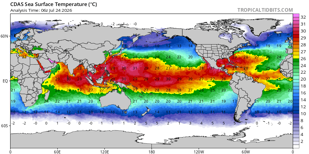
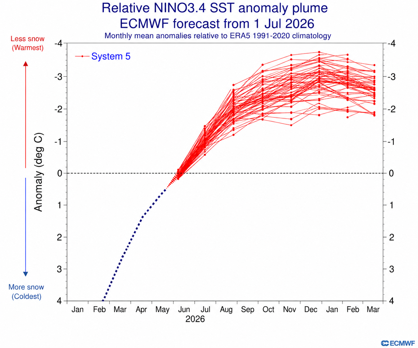
Yeah, there is still a 30C isotherm west of Nino 4. So it could spike again sometime between now and in the Fall before we actually start to see some real replacement upwelling in the W pac. This Nino has ways to go before it peaks. I also think some models that show 3.4 peaking in November are peaking it too early.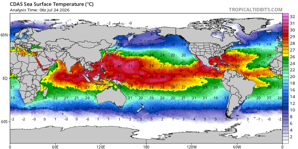
-
2026-2027 Record-breaking El Nino
LakePaste25 replied to Stormchaserchuck1's topic in Weather Forecasting and Discussion
This is what I was referring to. If this is how someone makes their seasonal forecast, you should immediately unsubscribe from them.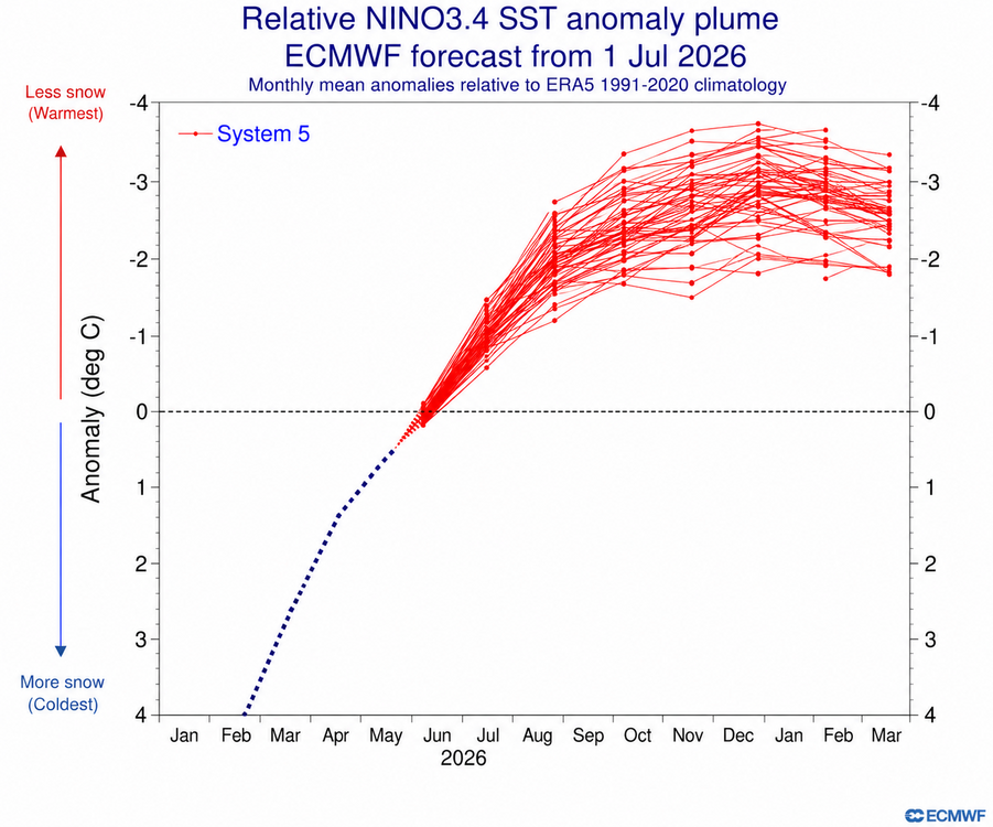
-
2026-2027 Record-breaking El Nino
LakePaste25 replied to Stormchaserchuck1's topic in Weather Forecasting and Discussion
They think ENSO is just some sliding scale where the warmest ENSO = no snow and less warm ENSO = more snow and anything that counters “warmest ENSO” means more snow. It’s not true, it’s much more nuanced as it has been discussed plenty of times in this very thread. -
2026-2027 Record-breaking El Nino
LakePaste25 replied to Stormchaserchuck1's topic in Weather Forecasting and Discussion
I was asking about the contours in the rossby wave source map. Assuming those are 200mb ridges and troughs (with the opposite sign). -
2026-2027 Record-breaking El Nino
LakePaste25 replied to Stormchaserchuck1's topic in Weather Forecasting and Discussion
Do you know what the solid red contours and the dashed blue contours mean? Trying to learn this. -
2026-2027 Record-breaking El Nino
LakePaste25 replied to Stormchaserchuck1's topic in Weather Forecasting and Discussion
We will see. I’ll hold off until September because that’s when I would expect to start seeing some semblance of an Aleutian low. -
2026-2027 Record-breaking El Nino
LakePaste25 replied to Stormchaserchuck1's topic in Weather Forecasting and Discussion
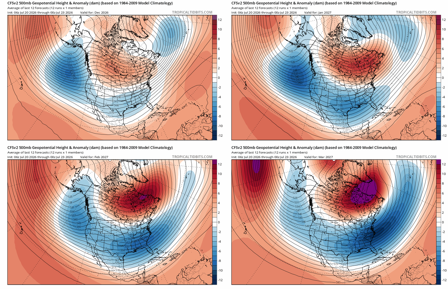
CFS has a nice “back loaded idea” with the Canadian block becoming a -NAO later in the season. Take it with a grain of salt. IF (big if) you’re going to get anything out of this season, this would be the way to do it.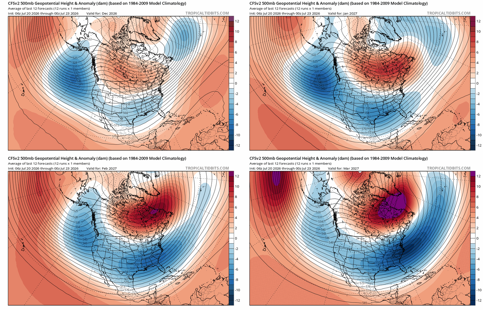
-
2026-2027 Record-breaking El Nino
LakePaste25 replied to Stormchaserchuck1's topic in Weather Forecasting and Discussion
Looking at past OLR, it looks closest to 1997…maybe a tad west. It does have that broad convective signature across the basin.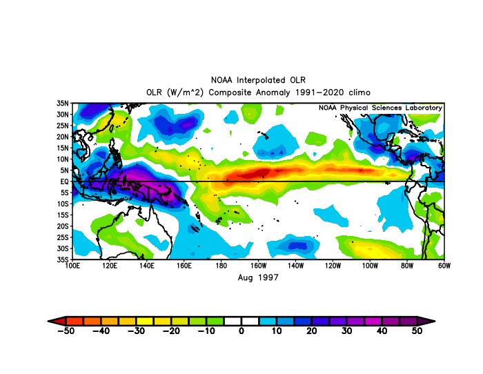
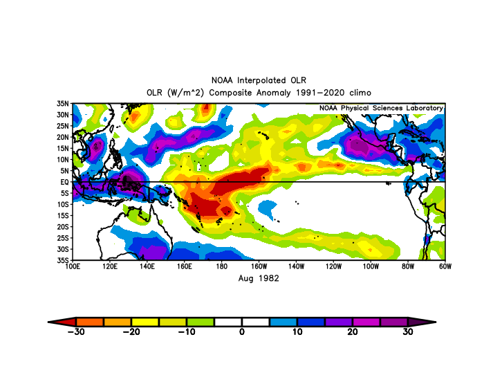
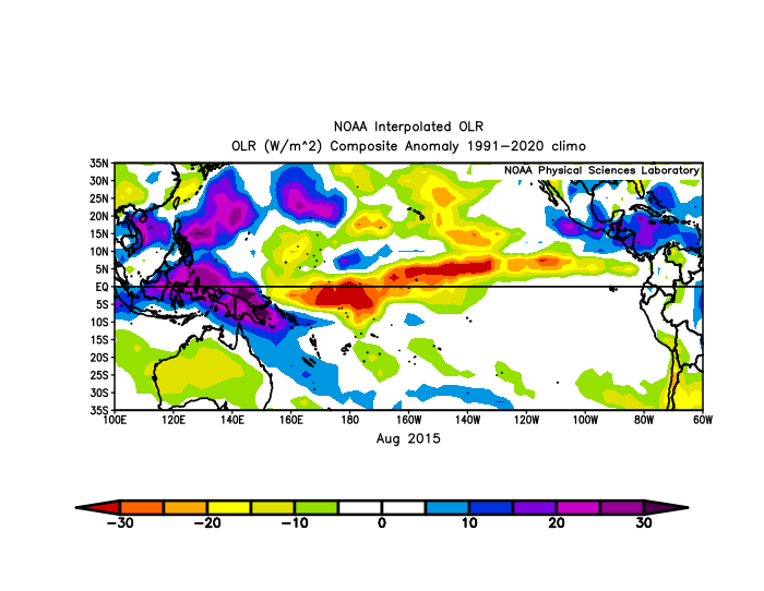
-
2026-2027 Record-breaking El Nino
LakePaste25 replied to Stormchaserchuck1's topic in Weather Forecasting and Discussion
Yeah, I mean some of this is just noise from TCs. W pac basin was also active in 1997. Just not ready to blame it on this because nearly the entire N PAC basin has seen above normal heights outside the subtropics. We will see. I really want to see where we are at by September. It does seem TCs out there are forming a bit west of 1997.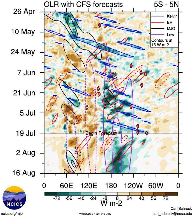
-
2026-2027 Record-breaking El Nino
LakePaste25 replied to Stormchaserchuck1's topic in Weather Forecasting and Discussion
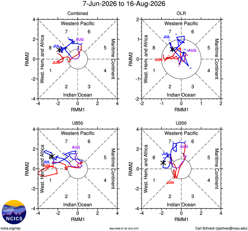
I must be missing something because I don’t see a ton of MC competition. I agree the N Pac is not exhibiting your typical response but I think it could be due to something else.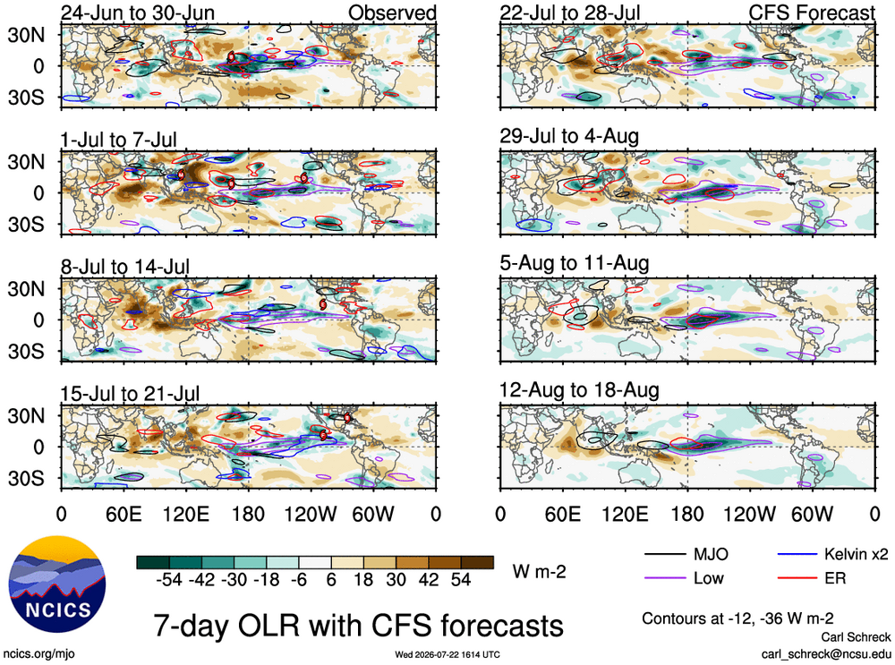
-
2026-2027 Record-breaking El Nino
LakePaste25 replied to Stormchaserchuck1's topic in Weather Forecasting and Discussion
The North Pacific is indeed the last quadrant to respond (possibly due to the arctic) but I think it wakes up to El Niño in due time. It is responding well everywhere else in the world (including the raging jet in the Southern Pacific). -
2026-2027 Record-breaking El Nino
LakePaste25 replied to Stormchaserchuck1's topic in Weather Forecasting and Discussion
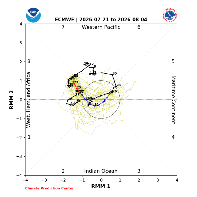
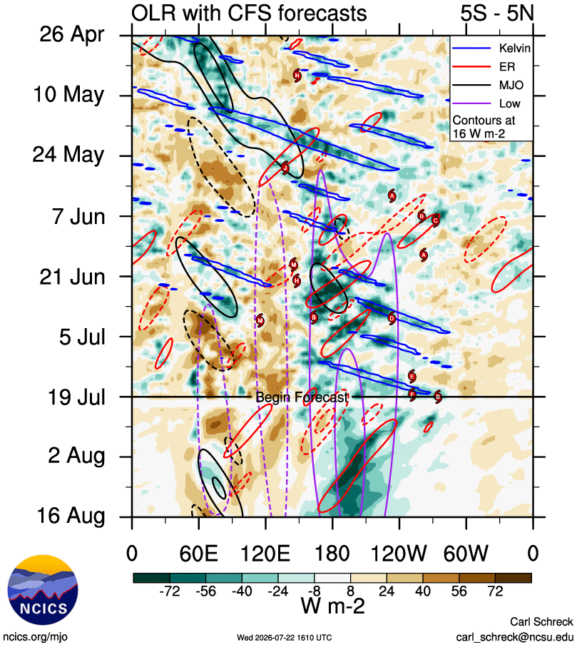
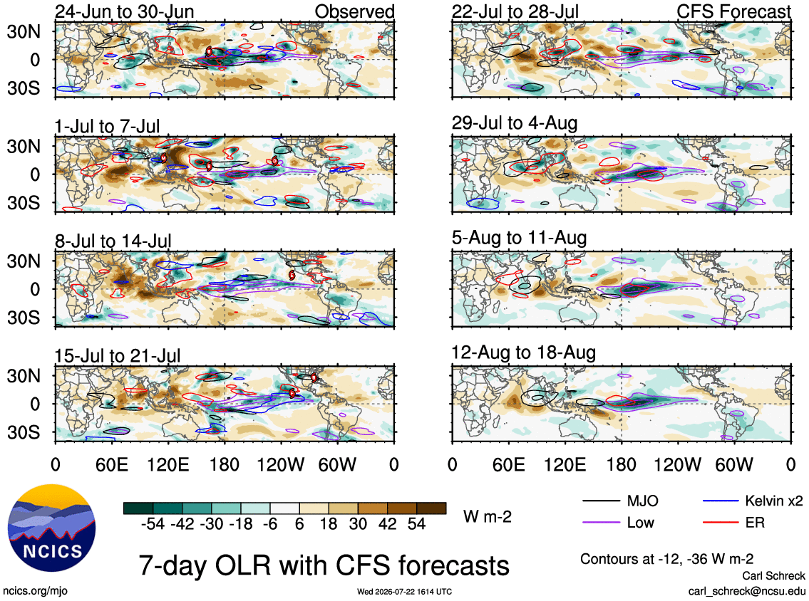
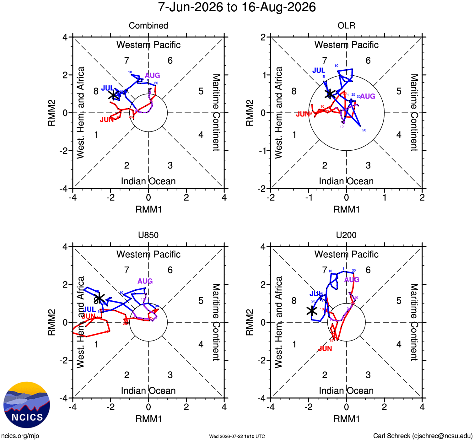
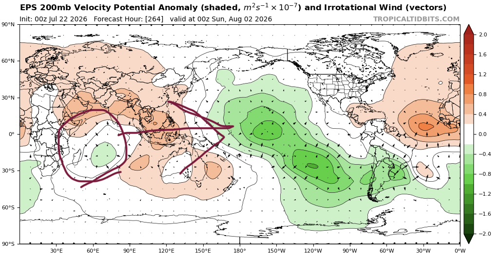
This is the strong atmospheric coupling with El Niño being reflected in the RMM’s. You might get the occasional weak pulse that crosses the IO which would bring it into the COD from time to time on the mean before looping back around into 7-8-1. That’s basically what is about to happen: