.jpg.b9a795a9fe89b3aa2ead015665ae36fe.jpg)
nvck
-
Posts
386 -
Joined
-
Last visited
Content Type
Profiles
Blogs
Forums
American Weather
Media Demo
Store
Gallery
Everything posted by nvck
-
think they might need to curve that arrow preeeeeeetty sharply in the opposite direction
-
Good to see some colors back on the map
-
waiting on the euro in a couple hours, but between this run and the icon, its a good trend imo. keeps the rain/snow line south of i-94 in mi
-
new gfs looking good
-
LOT AFD
-
i fear i'm too young to get this reference... is that like today's weenies running custom wrf models off of the 300hour GFS initial conditions?
-
i hear the korean is the one to ride this winter....
-
Interesting that ILN doesn't mention weekend snow chances at all in the afd, obviously looks unlikely, but not out of the question as the 6z euro and eps show. About 1/2 members of the 0z eps had some sort of snowfall saturday into sunday, I think with this complex of a pattern you can't rule it out.
-
having to drive back north on sunday, I'm watching this closely, but am honestly more just excited for something to track
-
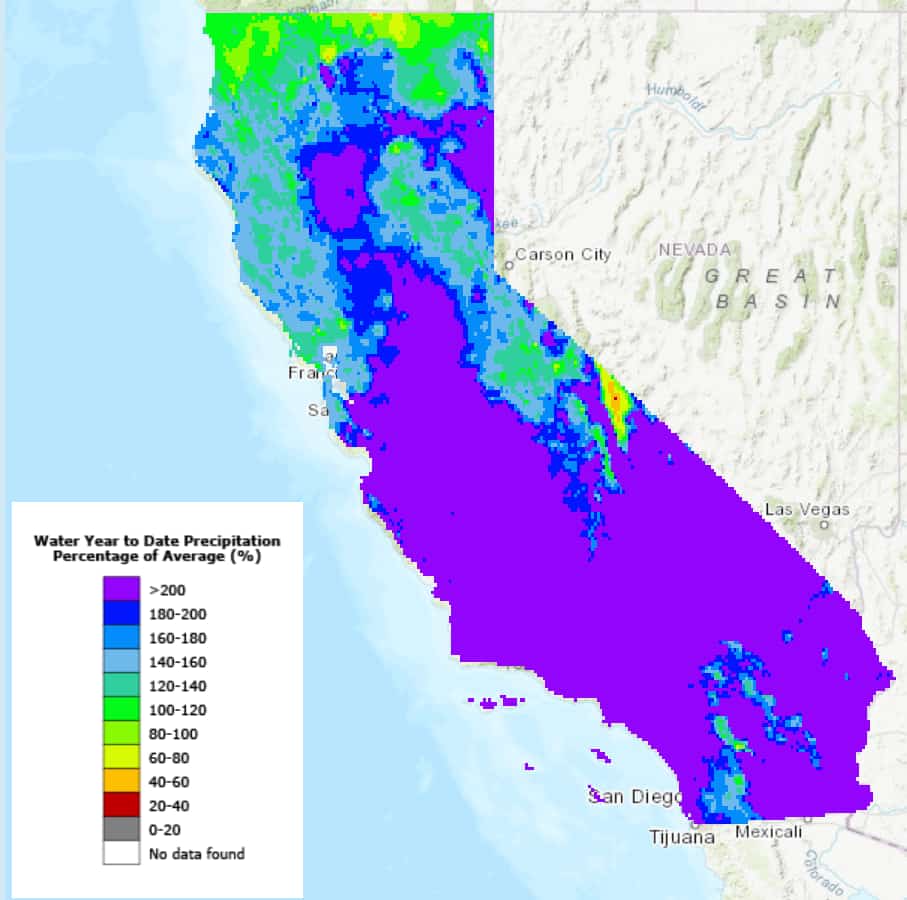
yeah, was looking at that a couple days ago, actually. Thankfully, California is running way above normal for precip on the year.

-
not sure if this has been posted yet, but ....
.thumb.png.4c172c328fc43acda8b7e4cfa6e09b02.png)
-
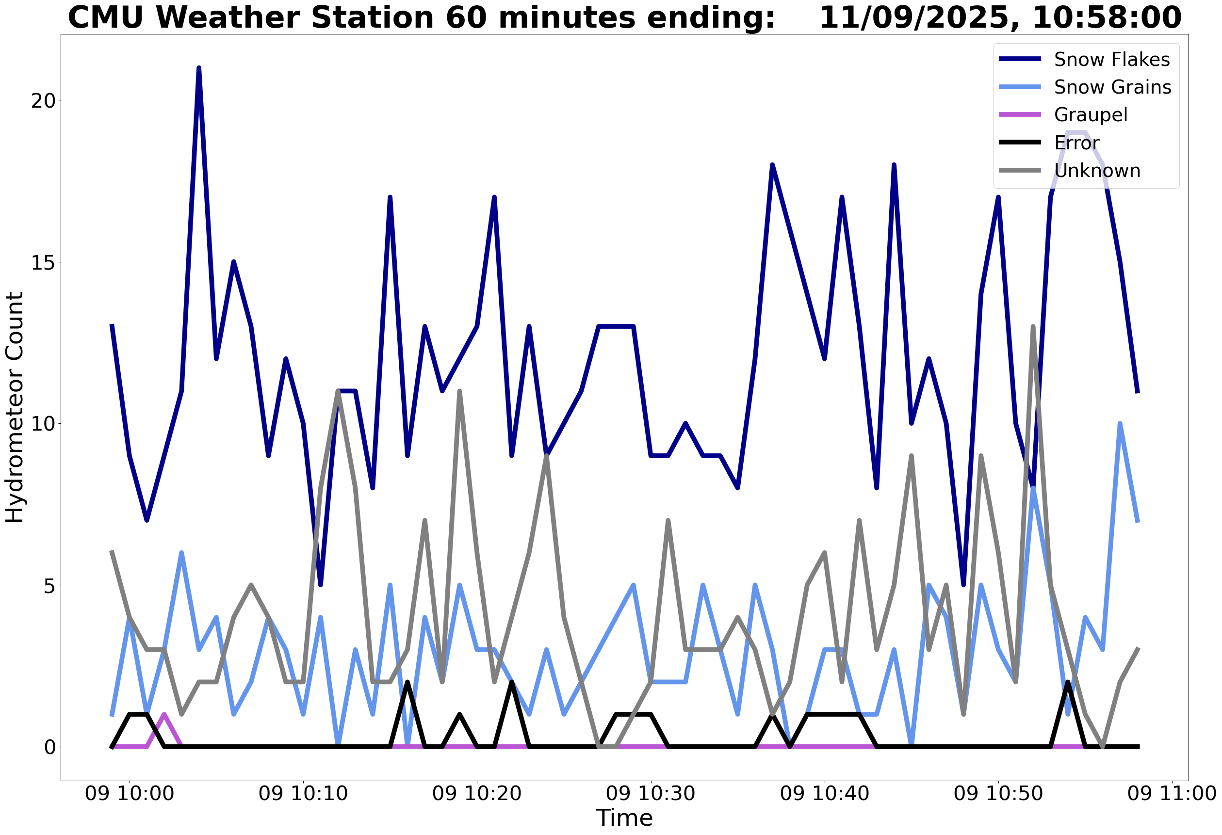
got down to 18 this morning, with some very efficient radiational cooling. Still have a layer of ice pellets on the grass from yesterday's bizarre very wet snow/sleet mix.
-
nice! yeah its a really easy way to spend an hour or two when i should be studying, to waste time. grand forks does seem a little trigger happy on their eastern counties there...
-
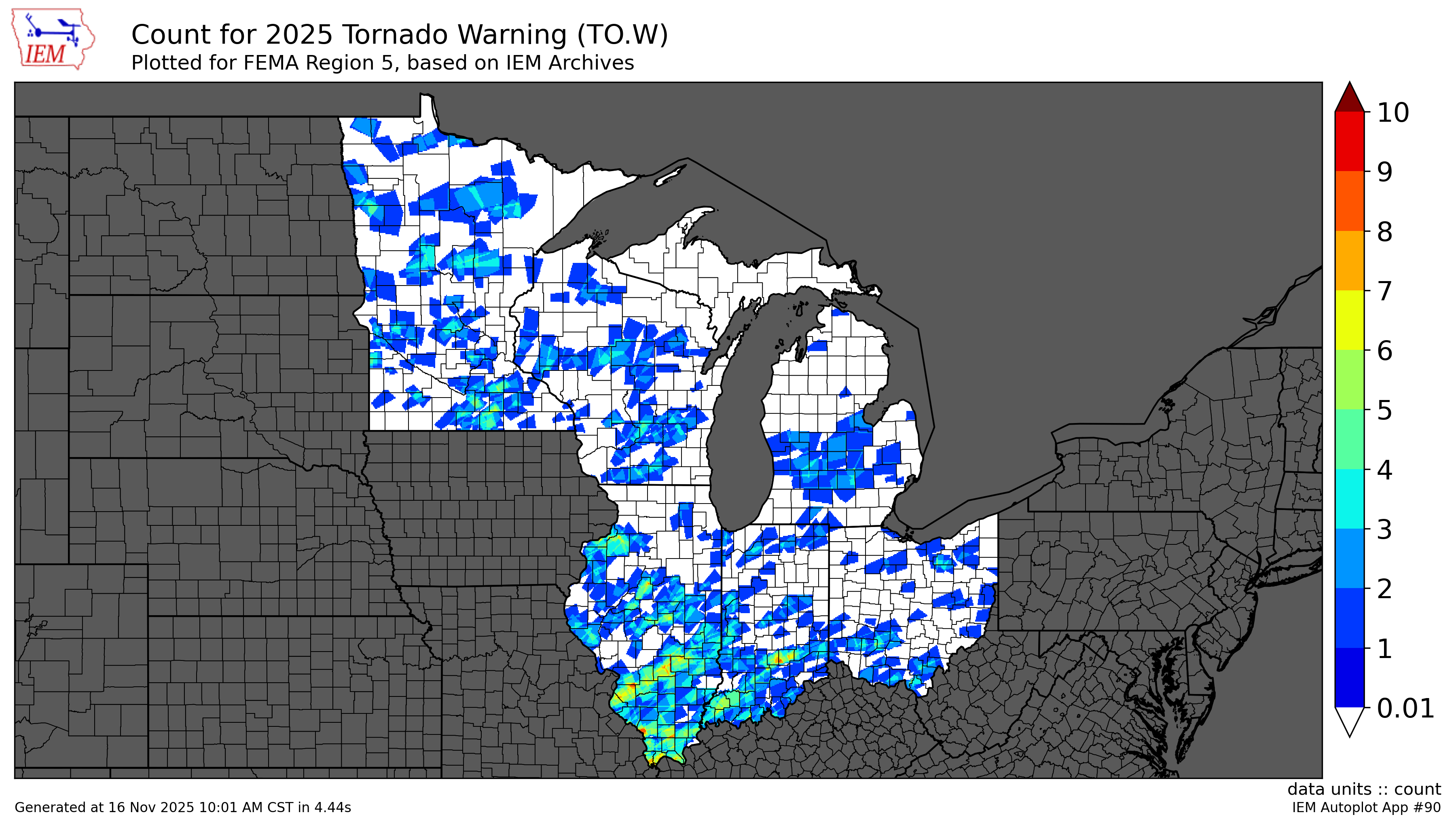
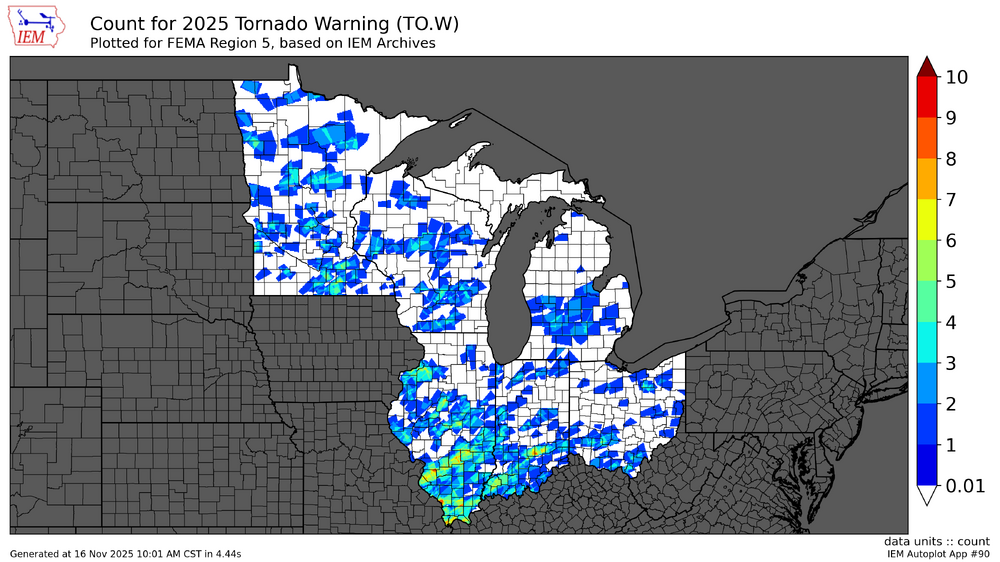
TOR warnings this year. Check out those hotspots in southern Illinois and Indiana!
-
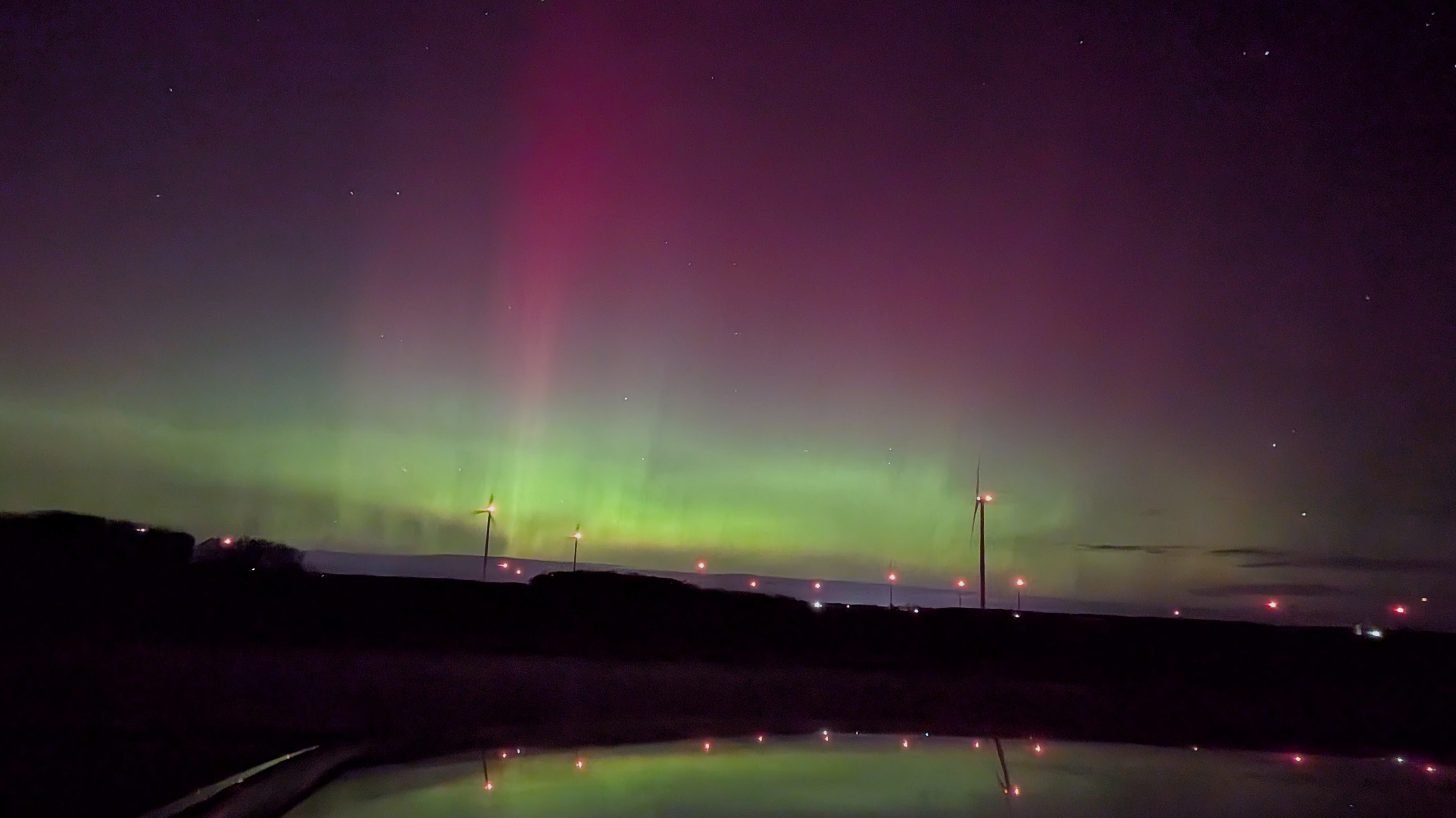
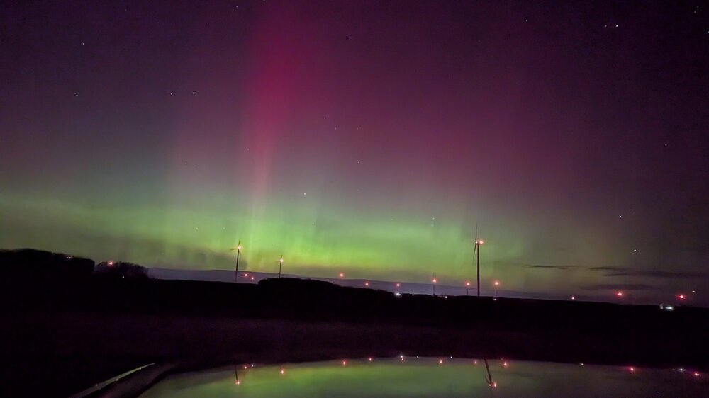
out of the 6 auroral events i've caught, this was probably 2nd (maybe 1st?) compared to october 10th of last year. Either way, really awesome experience, and i'm glad the clouds cooperated more than Tuesday night.
-
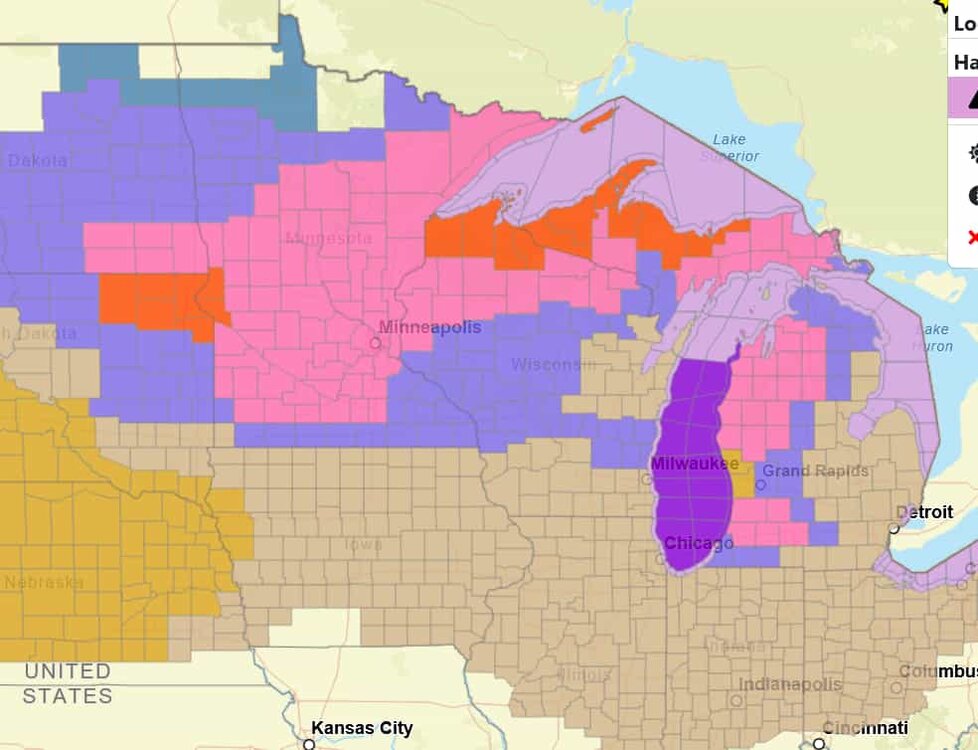
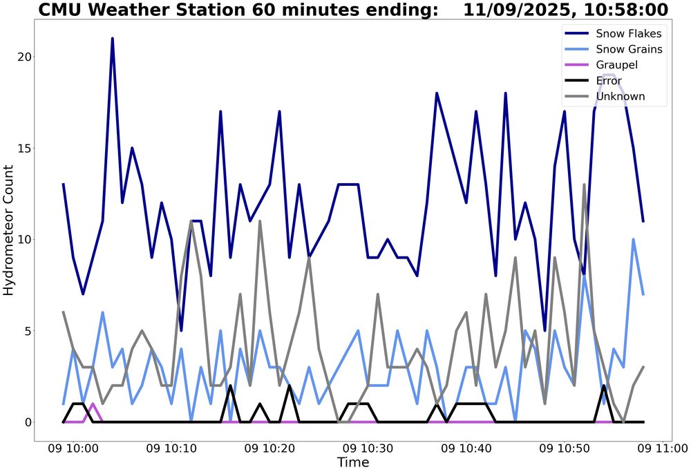
happy for you all in the lake effect bands, grass is partially covered here, and we've had some steady flakes over the past hour.
-
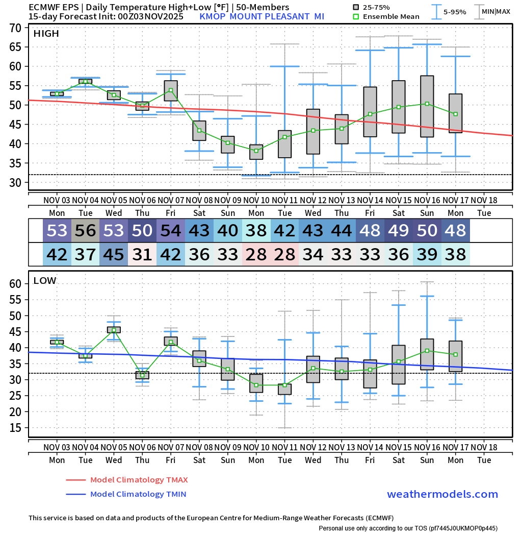
Not sure why the gif is reversed, but I like the trend on the eps honing in on a deeper low, located right near the MI/OH/IN border, which would be pretty favorable for snow for us in michigan.
-
Looks like about 60% of members on the 12z EPS have some snow during the day on Sunday, with that percentage closer to 90 when you include Monday, and the possible LE snow.
-
yessir!
-
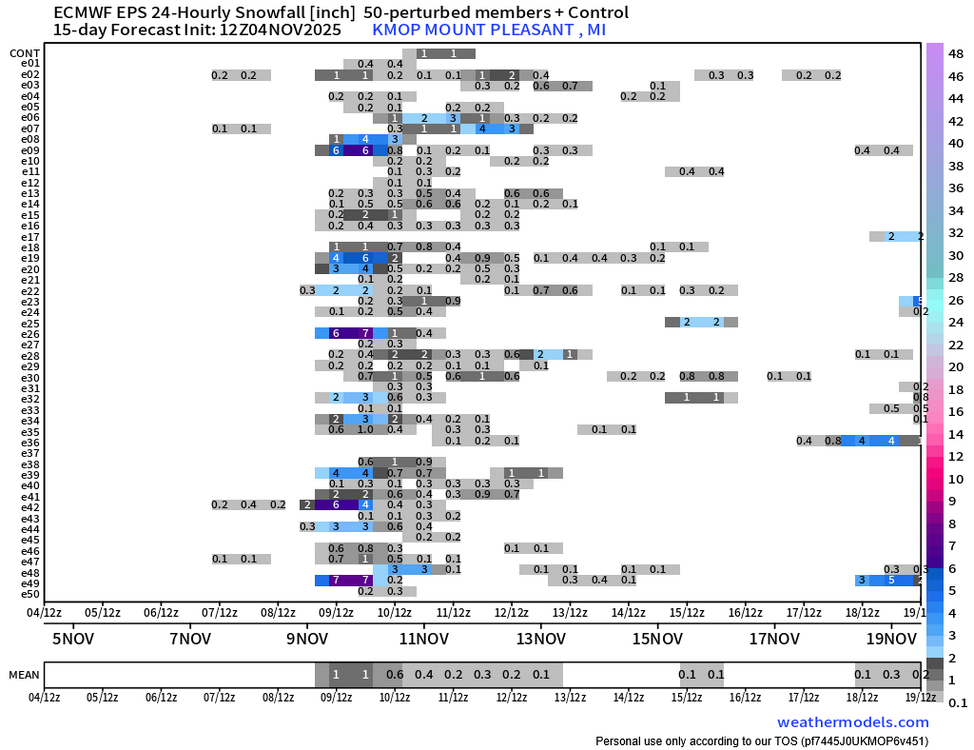
Past few runs of the EPS really trying to sell our first snow chcs of the season up here. Something to keep an eye on, fs


-
.thumb.jpg.ad3a2e31d30aff035044689b311a0540.jpg)
Major Hurricane Melissa - 892mb - 185mph Jamaica landfall
nvck replied to GaWx's topic in Tropical Headquarters
https://www.youtube.com/watch?v=z2HfoQ_HMfY -
Major Hurricane Melissa - 892mb - 185mph Jamaica landfall
nvck replied to GaWx's topic in Tropical Headquarters
either my wifi has totally dropped or the cam finally went down... ETA: back a couple min later -
Major Hurricane Melissa - 892mb - 185mph Jamaica landfall
nvck replied to GaWx's topic in Tropical Headquarters
looks like locations right on the shore are about to enter the eye.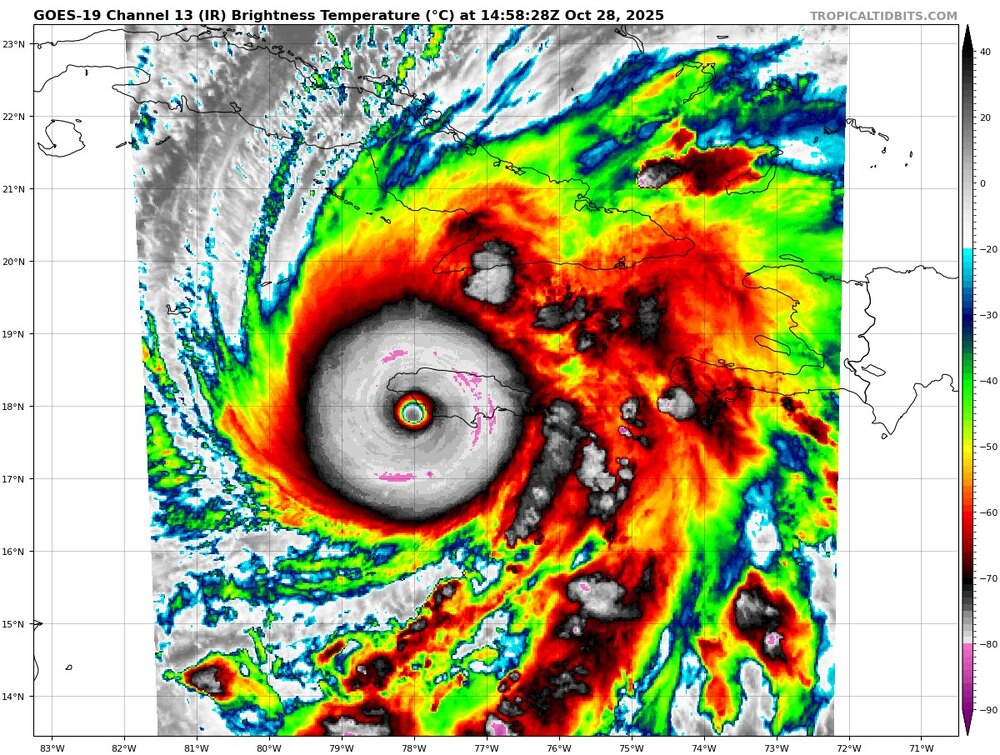
-
Major Hurricane Melissa - 892mb - 185mph Jamaica landfall
nvck replied to GaWx's topic in Tropical Headquarters
Hearing 889 extrap now Edit- check your sources lol


.png.67781a9423be635f76fb77a9f9888f46.png)