
Bob Chill
-
Posts
36,387 -
Joined
Content Type
Profiles
Blogs
Forums
American Weather
Media Demo
Store
Gallery
Everything posted by Bob Chill
-
Always appreciate your posts. We think alike often. That's either awesome or some scary S lolol. I'm pretty sold on the CFS monthly ideas in the high latitudes. Fits the "blocking is back for a stretch" weird multi decadal pattern that I personally think is real. It's not a predictable cycle like others but it does wax and wane in 8-12 year cycles. Problem with prediction is you only know its flipped in the rear view and there are plenty of odds and ends that muddy it up. I've seen enough last couple of years to feel oddly confident this winter will feature some really nice looks. But if we're all being honest, storm tracks just aren't what they used to be. Imo- it's no fluke it's hard AF to get normal stuff underneath us in a clean way... even with good looks. You could say the east is due for a run of traditional noreasters but again, muddy odds and ends are persistently and consistently stabbing us right in the heart. Random? I hope so but idk... Intuition doesn't feel like it is...
-
Just under 3" in my yard but I just got back from a trip to Roanoke. On the way back it was straight dumping from the east side of town to the Blue Ridge. Rivers, rocks, and debris on all roads lol. It was wild. Not like big flood stuff. Just sheets of running water and gutters barfing anything they had in them into the streets lol. My son saw a small tree stump floating down a side street. I was concentrating on driving at the time. Man that S was wild. Weather is awesome
-
I don't have any thoughts about next winter so I'll just use this one for now
-
Oh yea! I'd tell you to move north but I don't want to do that to innocent north of OKV peeps. They like rain and snow. Over 2" and counting. Ground is done absorbing. Heavies are running off pretty quick. Convective rain later (if it works out) should bring some mini flood photo ops lol. This event will end up being more than anyone needed to this area but man, we needed it anyway.
-
Man it's been dumpin down here lol. Start time kept getting pushed back leading in but it doesn't matter. Every wave and pulse has heavies mixed in. I wouldn't worry to much about a bust (except for a small area N of Winchester ). Tomorrow has convective potential and that will likely bring some warnings to the blue ridge into the piedmont. Some people already have over 3". My yard about half that. Glad it's coming in prolonged waves. We really needed it. Been a dust bowl since early April. Not kiddin either. Dustier than Tony Montana's upper lip and stuff
- 307 replies
-
- 11
-

-

-
Total hit and run. Filled in and mod snow took like 10 min then full foot on the gas for 90 min then rapid shutoff and mountains came back into full view. Man, what an awesome "personal" event. Wife is similar to me but not insane. She sat right by our biggest windows drinking coffee smiling start to finish. I need some warm days though. I have big time projects getting underway including a month behind the controls of an excavator and probably 100 tons of fill dirt to work with. Plan was to be done with this by 2/1 lol. Apparently frozen ground shuts down earthwork and dirt merchants
-
Shut off like a switch. 1.8" yesterday and 1.8" today. 2 completely different experiences but hit 3.6" total. Blue sky is in the distance. Should be good photo ops here shortly. I'm not really that close to climo. 9.3" on the season and modern climo maps tag this elevated area with 13" around smith mtn. I still give this winter a B-B+ grade based mostly on the feels. Multiple cold events, plenty of snow cover days, and lots of fun tracking. If i can hit 13" it's an A-. Below norm DJF with multiple events it's not normal or average. It's pretty rare.
-
After some solid un-luck yesterday, I managed to draw an inside straight. Might already have 2" new. I'll measure when it's done. Bust is unbusted
-
Better than ANYTHING yesterday lol. I'll clear and inch on this round easy. Might be there already. 15-20:1 stuff. Man I love upper level action. Reminds me of my Colorado years
-
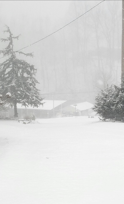
Heavies. Snow globe scene
-

Richmond Metro/Hampton Roads Area Discussion
Bob Chill replied to RIC Airport's topic in Mid Atlantic
Getting hit pretty good with mod high ratio snow with big dendrites. Half inch in under 30 mins so far. Hope it holds together for y'all. Heavier than anything i got yesterday lol. -
Getting mod snow now. Nice band!
-
Lt snow started up again. Not expecting much. Maybe .5" but radar looks OK and it cold AF so we'll see
-
Exactly. I'll enjoy any and all. March snow is like last hour at the bar after a long night. Things are winding down and thinning out and right when you're ready to call it a night, someone starts buying rounds of shots for everyone and a super hot girl starts talking to you. This is why you never go home early
-
Without fail, year after year, the period from March 15th to mid April annoys the heck out of me. Bipolar temps, a tendency for Grey skies, and plenty of mud just doesn't do it for me
-
Lt snow filled back in. Might pull off 1.802 or something like that haha Mesos like my area for the ull in the AM. If I could somehow tack on 1.2 the bust goes back in the bra
-
Obvious short range bust down here too. Snowed all day until about 3pm but I would be lying if I reported 2". About 1.8" everywhere I measured. Cold temps but no wind make it hard to find a juiced patch hahaha
-
Yep, batteries.... made of gold apparently. Prices imploded this year. I wasnt originally going to build this part out this quick. We have generators and 12v solar but opportunity struck. I'm using EG4 server rack batteries and inverter. I have 2 1.2kw batteries now but the system is plug and play expandable to 16 batteries and 6 inverters. That would cost more than a car lol but I made sure I built something that can grow with ease and compatibility. I'm amazed I can run my big tools like planers and table saws when its sunny and never touch the battery power. Enough OT out of me lol. It's going to snow again. When I don't know but I'm 100% sure it will snow again within the next 12 months...
-
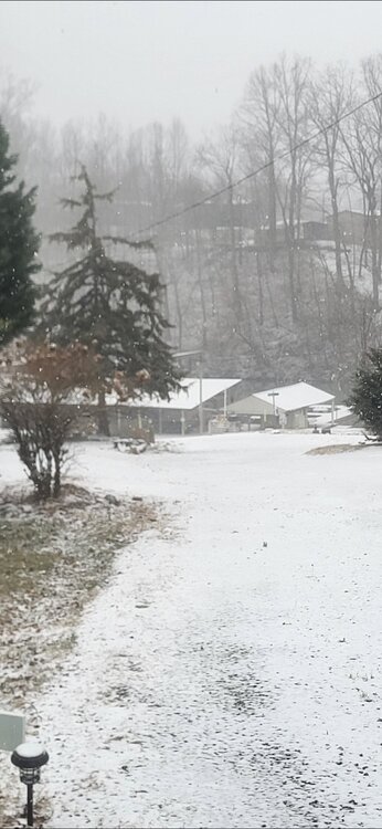
Just shy of an inch. Of course rates picked up now after the pic lol. Cold dry snow. She's a beaut Clark
-
Heisy pointed this out on the ops but the gefs shows it really clearly. 48hr h5 trends are 100% our friend. It's a flawed setup that is trending colder and more suppressed. Fits the personality of winter to a tee. We'll see if we can hit an inside straight. Beyond this even looks better every day
-
I never felt good about this one being more than a typical 3-6 deal. Any time you have disconnected or the chance at disconnected streams, its hard to get excited until everything agrees they will play nice because when they don't, a messy uncohesive storm is the result 9 times out of 10. The mid range runs 100% grabbed my attention and I started believing it may in fact turn the corner and dance a little but it didn't and that's that. I really REALLY hate when mid range models (euro in particular) go all ham at d 5-7. Pretty much ends the fun of the track like 19 times out of 20 lol. Losing a storm inside of 4 days sucks and it stings. No lie there. But hanging a hat on fantasy ops when they time and time and time again do this, that's a paradox Ensembles aren't helping inside of day 6 on both the eps/gefs because of the follow the leader stuff. It's been really bad this year. Patience is not a snow enthusiast strong point but enough beatings will teach just about anyone. I got knocked out in the years following 2016. By bring reasonable and patient i find that I enjoy every event quite a bit more than I ever have. Especially ones that back off in the short range.
-
Lol. You're not wrong. I just finished the solar install for our work shed. 2400 watts of panels, 3000w inverter, and 2kw of battery storage. Pretty awesome using the sun and a sawmill to build everything. Dry my milled wood while harvesting the sun to build. Freedom comes in many forms
-
Lift increasing and real dendrites are falling. Vis still around a mile so nothing crazy. Seeing some minor banding to my SW on radar. Not sure how this breaks for my yards but a period of mod colorado powder would set me right.
-
User name does not check out
-
Lol. I'm just doing what I always do. Call it like I see it. I don't want my name attached to anything.... well, maybe after the widespread 8-15" event. I'll take credit then and only then hahaha


