
EstorilM
-
Posts
123 -
Joined
-
Last visited
Content Type
Profiles
Blogs
Forums
American Weather
Media Demo
Store
Gallery
Everything posted by EstorilM
-

Feb 22nd/23rd "There's no way..." Obs Thread
EstorilM replied to Maestrobjwa's topic in Mid Atlantic
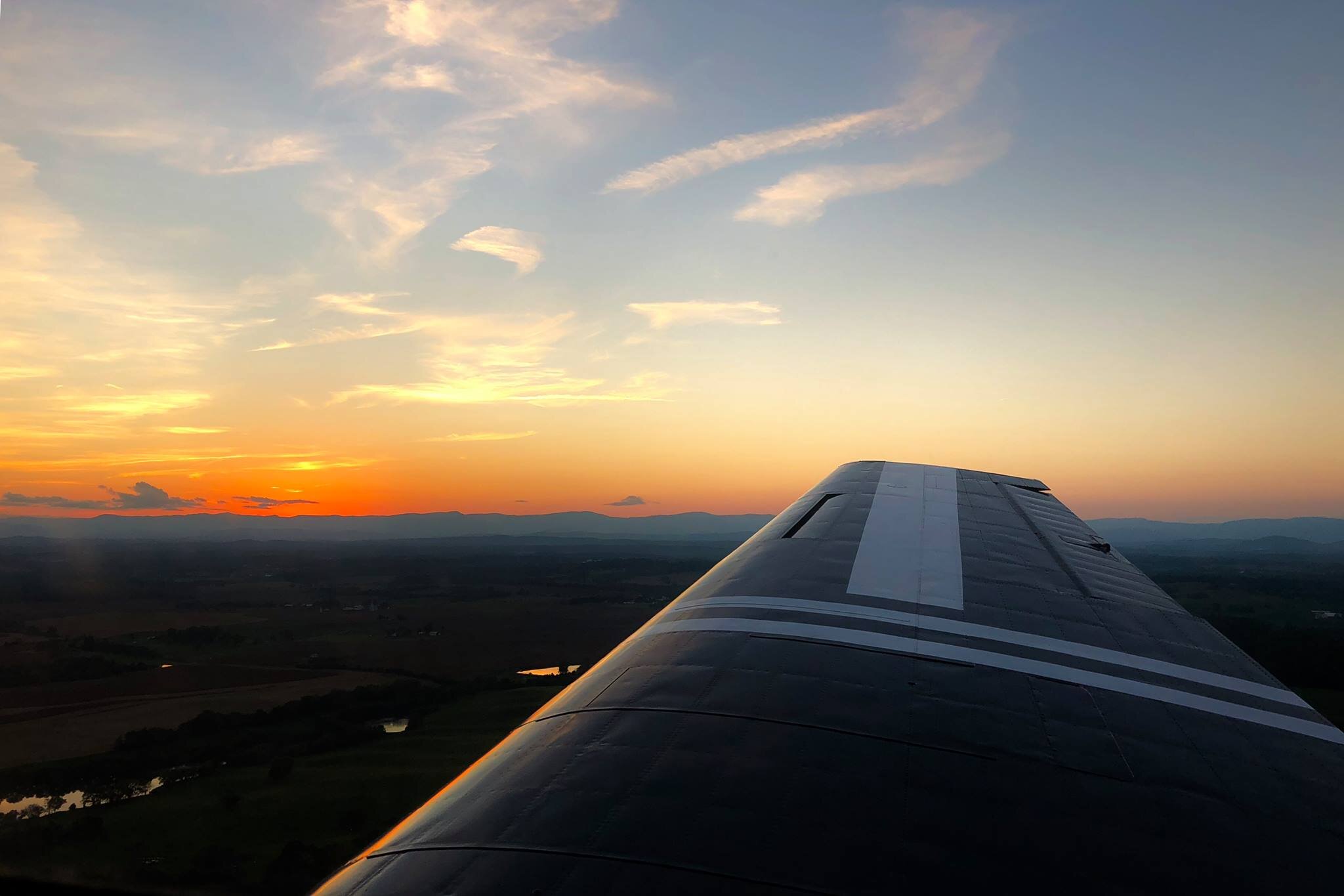
Down to 35.4, first wet flakes of the event just started mixing in (south of Leesburg.) -
Feb 22nd/23rd "There's no way..." Obs Thread
EstorilM replied to Maestrobjwa's topic in Mid Atlantic
And the wait begins… look at the bright side, we don’t have to worry about virga!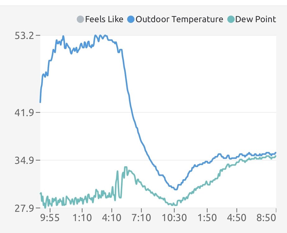
-
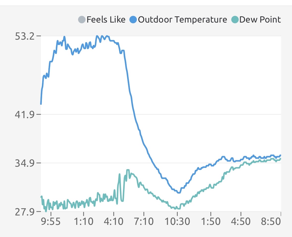
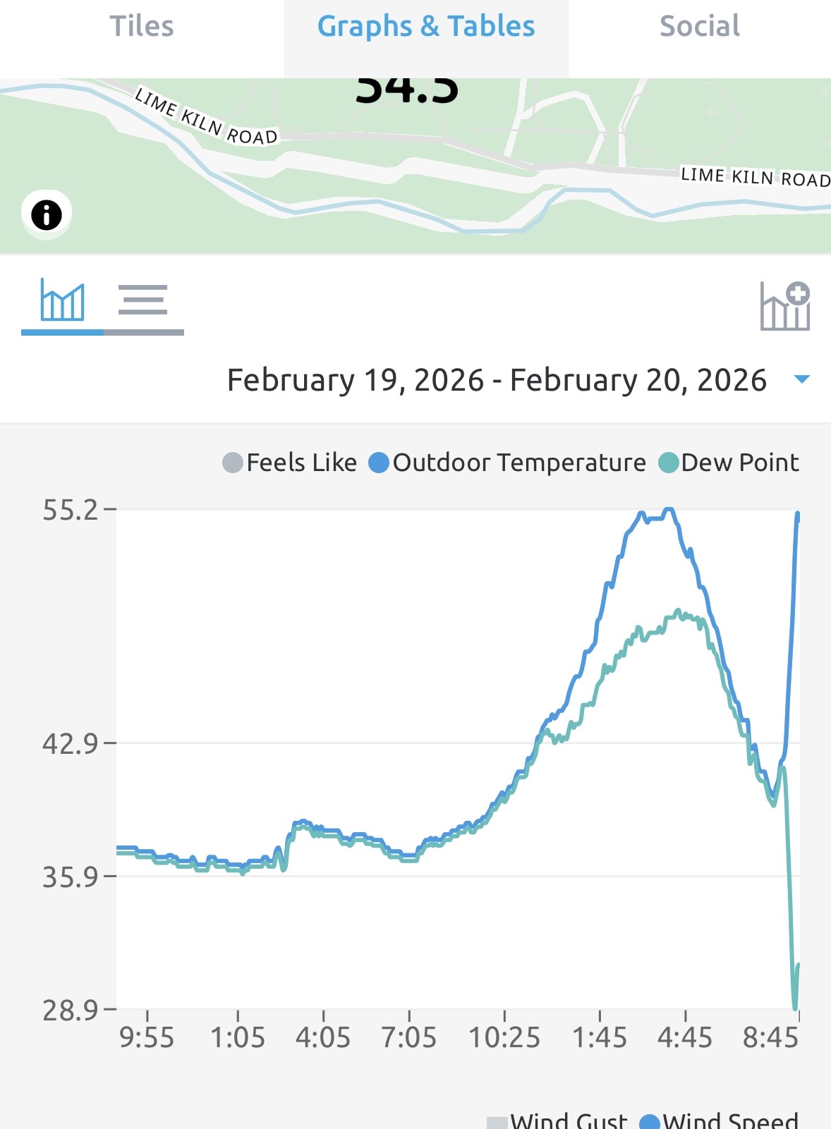
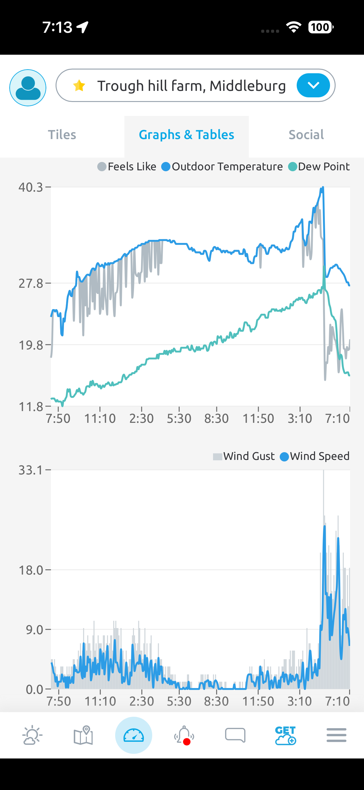
Yup I’m near the Blue Ridge mtns in Middleburg, not sure that’s close enough to have that impact though. The winds definitely jumped with the temp and dew point change, but the direction didn’t much (possible SW to WNW.) 14 deg temp change, 25 deg dew point change!
-
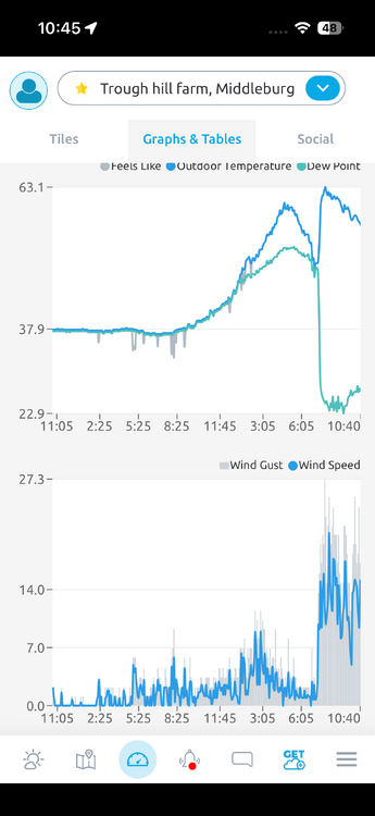
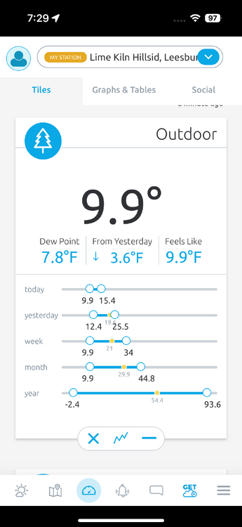
I just had the most bizarre thing happen. Glanced at my weather station and it said 55 degrees - I SWORE it showed 40 the last time I looked (when I got home around 730pm.) So I checked and sure enough, rose 15 degrees in less than an hour, after dark! I have another station at the farm a few miles away and it also showed a 15 degree jump.

-
Feb 22nd/23rd "There's no way..." Storm Thread
EstorilM replied to Maestrobjwa's topic in Mid Atlantic
Makes me miss Snobol lol -
Feb 22nd/23rd "There's no way..." Storm Thread
EstorilM replied to Maestrobjwa's topic in Mid Atlantic
Haha I just clicked refresh on that as well and saw it was "updated" but it doesn't seem like they even touched the stuff regarding the storm potential. -
Feb 22nd/23rd "There's no way..." Storm Thread
EstorilM replied to Maestrobjwa's topic in Mid Atlantic
Nah IMO with the temp profiles and this thing looking very coastal (I don't think we get the tilt early enough to bring it too far west of I-95) I think this is more of an advisory event for us unfortunately. Criteria for LWX is 5" - then again a watch means it only needs to be "possible" so... -
Feb 22nd/23rd "There's no way..." Storm Thread
EstorilM replied to Maestrobjwa's topic in Mid Atlantic
Based on their latest disco, I think they'll wait till the very last second for this one. Way too many stars need to align for this thing to be "dangerous" IMO. Sterling / LWX quote snippet sums up this whole mess perfectly: -
Feb 22nd/23rd "There's no way..." Storm Thread
EstorilM replied to Maestrobjwa's topic in Mid Atlantic
This has been my thought all along, which is why I haven't even looked at this thread till right now. We need the phase, the block, the trough to go negative, blah blah - even then temps are going to be close. I'm not being a "downer" but statistically the odds of everything coming to fruition are almost zero, and we literally need every element for this to be snow - otherwise it's (beneficial) rain, and / or wet snow melting on contact. I'm trying to stay grounded here; I've been blown up on social media for the last 24hr about a 3' monster snowstorm because of what the GFS showed lol. -
Nice - I was waiting for the update, they seemed all-in on the previous AFD as well (unusual for them.)
-
Sterling NWS
-
Exactly my thoughts, even sterling NWS said the same thing. I'm doing some of these QPF numbers in my head and it's kinda crazy what we're potentially looking at here. Also zero initial melting issues, lows Sat night are frigid. Sterling AFD earlier: This comes with the presumed snow- to-liquid ratio of 10:1 which this system will not be given the Arctic nature of the air mass."
-
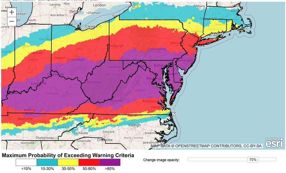
That's pretty impressive considering how conservative they typically are. The big storm that went south last year didn't have this type of confidence (at any point.) I guess we've been burned so many times that I'm not sure how to handle what's happening. There's a unicorn appearing before my very eyes and I'm not sure how to interpret it lol. Sterling NWS / LWX AFD - https://forecast.weather.gov/product.php?site=LWX&issuedby=LWX&product=AFD&format=CI&version=1&glossary=1&highlight=off In a multi- day sense, global ensemble probabilities remain very high for seeing 6+ inches of snow. This comes with the presumed snow- to-liquid ratio of 10:1 which this system will not be given the Arctic nature of the air mass. Ratios could be considerably higher yielding a fluffier snow. With the parent features still across the more barren high latitudes, models may take another day or two to resolve such features with better precision (note: recon flights are expected to take place near the Southwest CONUS later today - that`s where models have been most sensitive to changes, so hopefully this additional data will help hone in on details). The details will be important in determining any precipitation type transitions. However, given the very cold air locked in at and near the surface with strong Arctic high pressure anchored firmly to our north, plain rain is highly unlikely anywhere in the region. It will therefore come down to snow versus ice, both of which could be significant and highly impactful across a widespread area. . KEY MESSAGE 2...Frigid temperatures are looking like a virtual certainty this weekend into early next week. As mentioned in the winter storm section, Arctic high pressure takes charge over the weekend which yields frigid temperatures across the area. On Saturday, forecast 850-mb temperatures range from -15 to as low as -20C which even dry adiabatic mixing would keep surface temperatures below freezing. However, given the time of year and the fact 1000-850 mb winds are northerly, mixing largely tops out around 900 mb. With that said, Saturday`s high temperatures should struggle to escape the teens in most spots, with a few low 20s possible across far southern Maryland. Along the Allegheny Front, single digits are likely all that can be mustered. As snow comes in Saturday night, this will fall amidst temperatures in the single digits to lower teens. I'm still not used to the "key message" numbering thing for AFDs vs. the normal 1 day, 3 day, extended, etc.
-
Low sat night out here is 12, high Sunday is only 19. DC will be a bit warmer, but I’d expect ratios way above 10. I suppose it’s a safe bet to stick to 10:1 the way things go around here.
-
Yikes I’ll be at Wisp with my friends this weekend for an annual ski trip - coming home on Sunday to NoVa should be interesting. This after the HIGH on Saturday is going to be 7 degrees! I guess I asked the weather gods for winter weather for the weekend so - can’t complain.
-
Perhaps the precip shield, but I'd be comfortable locking in this cold. I mean most models have almost a week of single-digit lows; you could have models swing +15 degrees and it would still wouldn't even be "marginal" yet.
-
I'm not sure it'll matter much with the temps we're looking at now... insane prolonged cold.
-
Wow, the whole 23-26th time frame changed overnight it seems (as it does..) This is the weekend I'm going out to Wisp though. A few days ago the high on sat was like 40. Now it's 10! Low Friday night is -5. I kinda wish I had a block heater for my truck ugh. Looks like precip popped up for almost every day/night during the period as well, but that's like extreme NW MD in the mountains / resort areas so that's different.
-
Can you post? I know it’s a clown map but again, that’s when I’m going skiing so.. maybe I can needlessly hype up the crew lol.
-
What’s happening around the 22nd to 25th? Going skiing for the first time in 10+ years with some friends for the weekend, it would be awesome if we got some snow (it’s just Wisp lol, so deep creek md area.) I keep seeing some stuff popping up in the long-range for that period. More than half of my ski trips (only every 4ish years before this time) had some big snows those weekends. How’s that for an analog?
-
12/31-1/1 Possible Snow Showers/Squalls to Start 2026
EstorilM replied to bncho's topic in Mid Atlantic
Bummed that I missed it, but wow! Temps dropped 11 degrees in less than 15 minutes, with a peak gust of 35.3 MPH.
-
Wow, it got cooler way later yesterday evening vs the day before, so I figured it wouldn’t be quite as cold. I was proven very wrong when I woke up this morning lol.
-
12/12: The little Friday clipper that could? Or won't.
EstorilM replied to dailylurker's topic in Mid Atlantic
Whaaaat is the deal with central/SW Virginia this (and last I believe?!) season? Theres no way RIC has more annual snowfall than IAD lol. Then again as someone above said, they could be at their annual snowfall for the season in a few days. -
So much for a forecast low of 31! Down to 21.4 last night. The nearby PWS that isn’t in the creek valley area is ~4 degrees warmer though.

-
Well that was unexpected!

- 124 replies
-
- 18
-