vortmax
-
Posts
4,642 -
Joined
-
Last visited
Content Type
Profiles
Blogs
Forums
American Weather
Media Demo
Store
Gallery
Everything posted by vortmax
-

Feb 24-25th Snowstorm- Observation Thread
vortmax replied to BuffaloWeather's topic in Upstate New York/Pennsylvania
My town got called out on the AFD...famous! Lol Inversions are low at less than 4kft, but sharper sfc convergence between Oswego and Monroe county has supported concentrated snow showers for areas southeast of Lake Ontario, centered on Wayne county, where local accums of 1-3 inches may accumulate through the night. NYS Mesonet site in Ontario (northwest Wayne county) and the KSDC METAR site in Wayne County along with the BUF radar lower few angles suggest a stronger convergence band in that vcnty. -
Feb 24-25th Snowstorm- Observation Thread
vortmax replied to BuffaloWeather's topic in Upstate New York/Pennsylvania
Pouring snow here. Approaching 10" easy.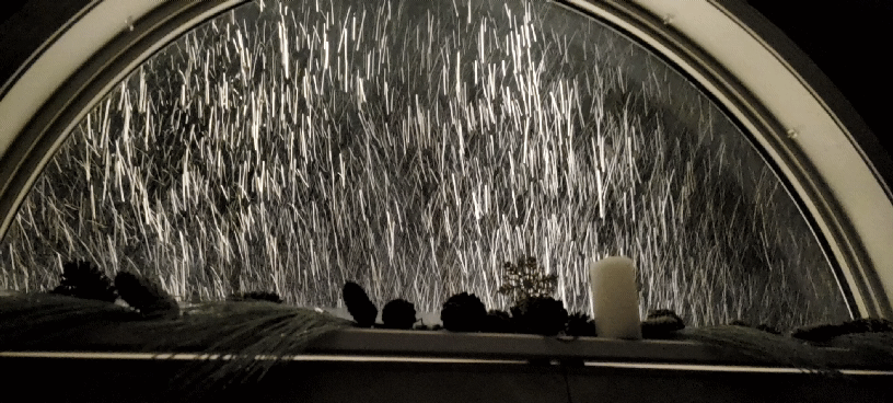
-
Feb 24-25th Snowstorm- Observation Thread
vortmax replied to BuffaloWeather's topic in Upstate New York/Pennsylvania
Huge puff bombs here again. -
Feb 24-25th Snowstorm- Observation Thread
vortmax replied to BuffaloWeather's topic in Upstate New York/Pennsylvania
We definitely have 8-9 easy. Just slowed down to flurries, but was pretty heavy for the last 4 hrs. -
Feb 24-25th Snowstorm- Observation Thread
vortmax replied to BuffaloWeather's topic in Upstate New York/Pennsylvania
Nope, they let WWAs expire. -
Feb 24-25th Snowstorm- Observation Thread
vortmax replied to BuffaloWeather's topic in Upstate New York/Pennsylvania
You can see the LE on the west end of LO here: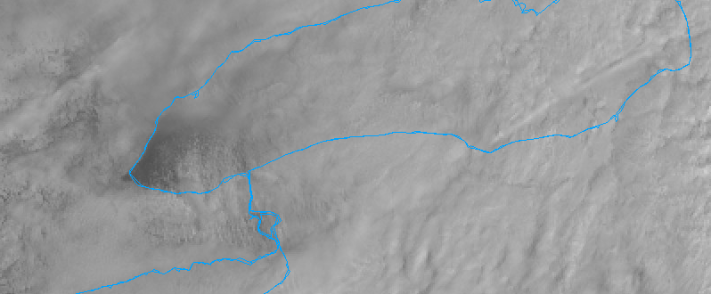
-
Feb 24-25th Snowstorm- Observation Thread
vortmax replied to BuffaloWeather's topic in Upstate New York/Pennsylvania
Winds ENE now...lake should start getting involved soon. -
Feb 24-25th Snowstorm- Observation Thread
vortmax replied to BuffaloWeather's topic in Upstate New York/Pennsylvania
-
Feb 24-25th Snowstorm- Observation Thread
vortmax replied to BuffaloWeather's topic in Upstate New York/Pennsylvania
Def band and LE to the rescue! 4-5" here as well. Winds starting to back. -
Potential of Widespread Snow/ Mixed Precipitation 2/25
vortmax replied to sferic's topic in Upstate New York/Pennsylvania
Seems the GFS/NAM were right. -
Potential of Widespread Snow/ Mixed Precipitation 2/25
vortmax replied to sferic's topic in Upstate New York/Pennsylvania
So the mesos/GFS seem to be winning this battle. -
Potential of Widespread Snow/ Mixed Precipitation 2/25
vortmax replied to sferic's topic in Upstate New York/Pennsylvania
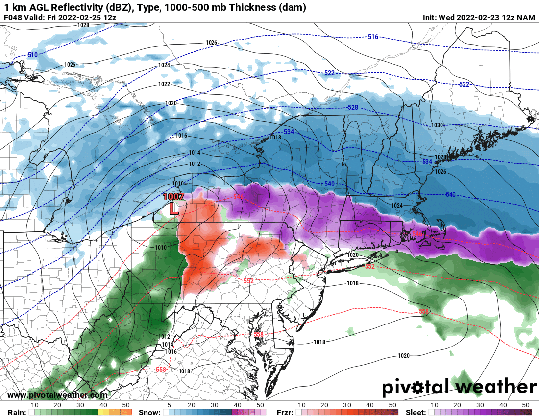
18z NAM 10:1 -
Jealous!
-
Potential of Widespread Snow/ Mixed Precipitation 2/25
vortmax replied to sferic's topic in Upstate New York/Pennsylvania
Quite the spread so close to the game. -
Potential of Widespread Snow/ Mixed Precipitation 2/25
vortmax replied to sferic's topic in Upstate New York/Pennsylvania
A blend of NAM and RGEM would be nice. -
Potential of Widespread Snow/ Mixed Precipitation 2/25
vortmax replied to sferic's topic in Upstate New York/Pennsylvania
Wow, much different and only 48hrs out.
-
We actually lost power this AM...
-
Potential of Widespread Snow/ Mixed Precipitation 2/25
vortmax replied to sferic's topic in Upstate New York/Pennsylvania
Might not be terrible as the coastal transfer may keep the South Shore snow, but that is CLOSE! -
Potential of Widespread Snow/ Mixed Precipitation 2/25
vortmax replied to sferic's topic in Upstate New York/Pennsylvania
Yup, it'll be interesting if the RGEM amps as much as the NAM. LP placement between the 2 are the similar, just NAM is ~5mb deeper and takes longer for the shift to coastal. -
Potential of Widespread Snow/ Mixed Precipitation 2/25
vortmax replied to sferic's topic in Upstate New York/Pennsylvania
No watches issued for WNY. BUF still must be unsure...I thought they put out watches even if it ends up being a WWA. -
Potential of Widespread Snow/ Mixed Precipitation 2/25
vortmax replied to sferic's topic in Upstate New York/Pennsylvania
My bet would be that the primary holds longer. IIRC this seems to have happened quite a bit over the past few seasons. -
Potential of Widespread Snow/ Mixed Precipitation 2/25
vortmax replied to sferic's topic in Upstate New York/Pennsylvania
Hope we get a long-term WNW LE event to bring SYR back to the party - or maybe even a good old fash Miller A. -
Potential of Widespread Snow/ Mixed Precipitation 2/25
vortmax replied to sferic's topic in Upstate New York/Pennsylvania
Right over CNY. lol -
Upstate NY Banter and General Discussion..
vortmax replied to wolfie09's topic in Upstate New York/Pennsylvania
What's with this trifecta of storms hitting the UK? -
Potential of Widespread Snow/ Mixed Precipitation 2/25
vortmax replied to sferic's topic in Upstate New York/Pennsylvania
JHW magnet in full effect.