vortmax
-
Posts
4,642 -
Joined
-
Last visited
Content Type
Profiles
Blogs
Forums
American Weather
Media Demo
Store
Gallery
Everything posted by vortmax
-

Upstate/Eastern New York-Springtime?
vortmax replied to BuffaloWeather's topic in Upstate New York/Pennsylvania
I guess you were. Dang! -
Upstate/Eastern New York-Springtime?
vortmax replied to BuffaloWeather's topic in Upstate New York/Pennsylvania
For some reason, I thought you were south. LEK should be getting it good in Caz. -
Upstate NY Banter and General Discussion..
vortmax replied to wolfie09's topic in Upstate New York/Pennsylvania
Same here for my basement. -
Upstate/Eastern New York-Springtime?
vortmax replied to BuffaloWeather's topic in Upstate New York/Pennsylvania
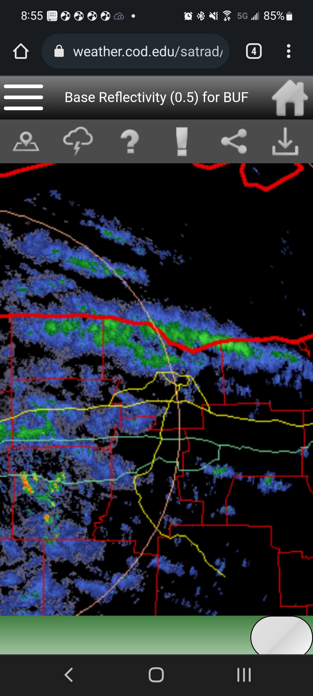
Where u at Matt? Radar says you're getting hammered.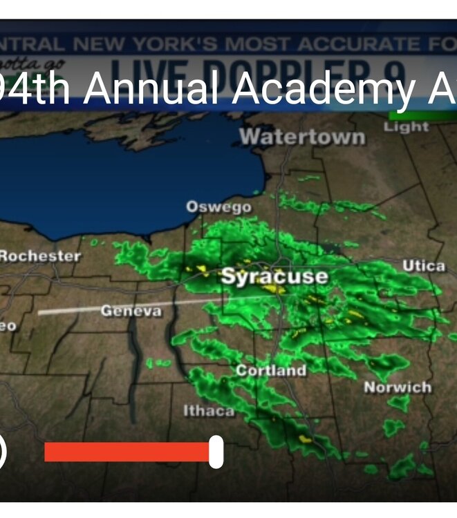
-
Upstate/Eastern New York-Springtime?
vortmax replied to BuffaloWeather's topic in Upstate New York/Pennsylvania
This band is legit. Jeb walk time.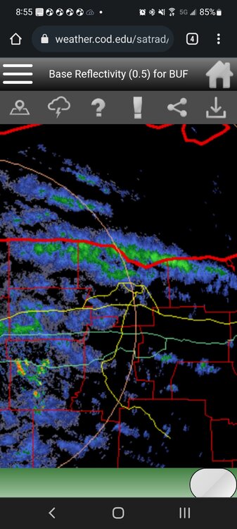
-
Upstate/Eastern New York-Springtime?
vortmax replied to BuffaloWeather's topic in Upstate New York/Pennsylvania
Win. -
Upstate/Eastern New York-Springtime?
vortmax replied to BuffaloWeather's topic in Upstate New York/Pennsylvania
The most organized lake effect snow will be closely tied to upstream connections. A Georgian Bay connection is likely to tie into Lake Ontario lake effect this evening and continue through Monday morning. There is low confidence in the exact placement of this band, but most 12Z model guidance has shifted the most persistent band southeast of Lake Ontario from Monroe to Oswego counties with potential secondary band to the west of this. An additional 2-4 inches is likely in most persistent bands tonight. -
Upstate/Eastern New York-Springtime?
vortmax replied to BuffaloWeather's topic in Upstate New York/Pennsylvania
Starting to cover the grass now with the sun dropping. -
Upstate/Eastern New York-Springtime?
vortmax replied to BuffaloWeather's topic in Upstate New York/Pennsylvania
This airmass is legit. -
Upstate/Eastern New York-Springtime?
vortmax replied to BuffaloWeather's topic in Upstate New York/Pennsylvania
It's gonna happen with 850s 2 to 3 SD below normal. -
Upstate/Eastern New York-Springtime?
vortmax replied to BuffaloWeather's topic in Upstate New York/Pennsylvania
Kind of interesting placement of WNY band just south of the shoreline. Seems a little odd to me. -
Upstate/Eastern New York-Springtime?
vortmax replied to BuffaloWeather's topic in Upstate New York/Pennsylvania
One day difference... -
Upstate/Eastern New York-Springtime?
vortmax replied to BuffaloWeather's topic in Upstate New York/Pennsylvania
I was just about to post this. INCREDIBLE. -
Upstate/Eastern New York-Springtime?
vortmax replied to BuffaloWeather's topic in Upstate New York/Pennsylvania
Is Winter really over? -
Upstate/Eastern New York-Springtime?
vortmax replied to BuffaloWeather's topic in Upstate New York/Pennsylvania
Line developing. We have heavy rain and thunder. -
Upstate/Eastern New York-Springtime?
vortmax replied to BuffaloWeather's topic in Upstate New York/Pennsylvania
Need a more SE storm track and we're golden... -
Upstate/Eastern New York-Springtime?
vortmax replied to BuffaloWeather's topic in Upstate New York/Pennsylvania
34.9 here with light rain. Love it..............not. -
Upstate/Eastern New York-Springtime?
vortmax replied to BuffaloWeather's topic in Upstate New York/Pennsylvania
The new king? Would like to see that model accuracy chart since the GFS upgrade. Seems to be doing well. -
Upstate/Eastern New York-Springtime?
vortmax replied to BuffaloWeather's topic in Upstate New York/Pennsylvania
Boring. -
Potential large EC storm/Heavy LES March 11-13th
vortmax replied to LakeEffectKing's topic in Upstate New York/Pennsylvania
I'm in Spencerport and coming down pretty good. Heading back home soon...32 there, warmer here. -
Potential large EC storm/Heavy LES March 11-13th
vortmax replied to LakeEffectKing's topic in Upstate New York/Pennsylvania
18z 3k having a hard time: -
Potential large EC storm/Heavy LES March 11-13th
vortmax replied to LakeEffectKing's topic in Upstate New York/Pennsylvania
The orientation of the precip is bent more northerly, north of Long Island. Look at ME for example. Wondering if this will phase more than models are thinking. -
Potential large EC storm/Heavy LES March 11-13th
vortmax replied to LakeEffectKing's topic in Upstate New York/Pennsylvania
More amped? -
Potential large EC storm/Heavy LES March 11-13th
vortmax replied to LakeEffectKing's topic in Upstate New York/Pennsylvania
Surprised that run wasn't closed! That's a wax and edge destroyer... -
Potential large EC storm/Heavy LES March 11-13th
vortmax replied to LakeEffectKing's topic in Upstate New York/Pennsylvania
As you said, it was only downhill from the 1st version...lol