Hurricane Agnes
-
Posts
8,581 -
Joined
Content Type
Profiles
Blogs
Forums
American Weather
Media Demo
Store
Gallery
Everything posted by Hurricane Agnes
-
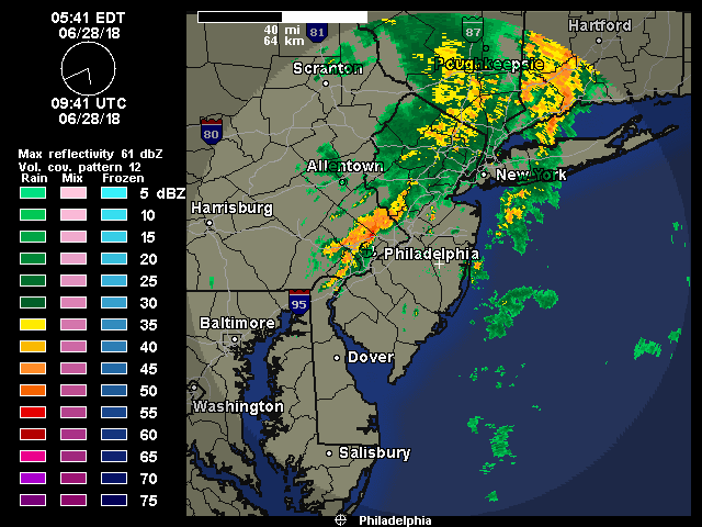
Looks like it has just about wrapped up unless something back-builds later and/or maybe with CF passage. Got 0.54" out of that.
-
Under the heavy stuff now. Up to just over 1/2" of rain at post time with just over 2"/hr rates.
-
Now getting heavier rains. Not blinding gully washer yet like earlier in the week, but pretty steady.
-
KYW reporting 5-points (in Montgomeryville) is flooded out. ETA - on my doorstep -
-
Starting to see something coming in from my SW and am getting some light rain now. Won't be long. Need some rain at the moment so I can wait on pulling out the hose before the heat hits.
-
Hearing first thunder after about almost an hour of lightning. Still no rain just yet but it might be incoming.
-
Wow - KYW traffic reporter Sam Clover just said he just got a call that "there was hail in Horsham".
-
There's a cluster that formed in Delco moving SW -> NE that might hit me. The other stuff seems to be concentrated in central Montco.
-
You just reminded me that I probably should crack the windows open a bit in my car this weekend so it doesn't become an Easy-Bake Oven.
-
I figured you might get smacked from that. The flow is coming up from the south but the whole line is moving to the east. Will see if it stays together enough to give me something. There has certainly been almost continuous lightning off to the west that I am seeing from here.
-
Got 0.02" of rain around 2 am this morning but currently there's been quite a bit of lighting for awhile now, off to the west, but no rain at the moment. Not hearing thunder but the lightning has been pretty significant. Temp is 72 and the air is thick with dps in the 70s. Not sure this line holds enough to hit me but it might -

-
It has been misting/drizzling/spritzing on and off all day but not enough to tip a bucket. Hit a high of 74 after a low of 62. Currently 73 with very light rain (enough to start to moisten the walks and streets). Regarding the GFS - I think we have seen enough times where it spots the general idea in the long range, then has 2nd thoughts in the mid-range, and then goes back to its initial idea (with modifications) in the short range, so we might see a shift again (regarding weekend temps), in the next day or so.
-
But we gained a minute or two in the evening, so we're even (but not for long)! Couldn't have asked for a better day although oddly enough, it almost felt like a late September day after a hot spell and with cool Canadian air filtering in. Didn't really feel like late June. Got up to 81 with a low of 65. Currently 73.
-
Pretty much done - rainbow has appeared in the east. Got 0.46" (as of post time 8pm). Sun popping out. Temp down to 73 from the 82 it was pre-rain.
-
Ha! Almost up to 1/2" (few more hundreds of an inch needed). Sky is starting to brighten to the west though so it is a fast mover.
-
Massive gusts coming through. Rain up to 0.26" at post time. Edit - now up to 0.41" as of 7:50, almost 2.5"/hr rates!
-
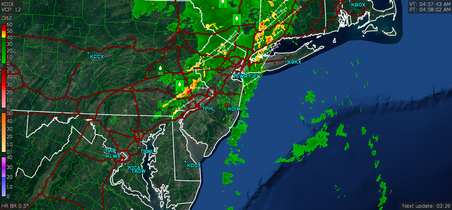
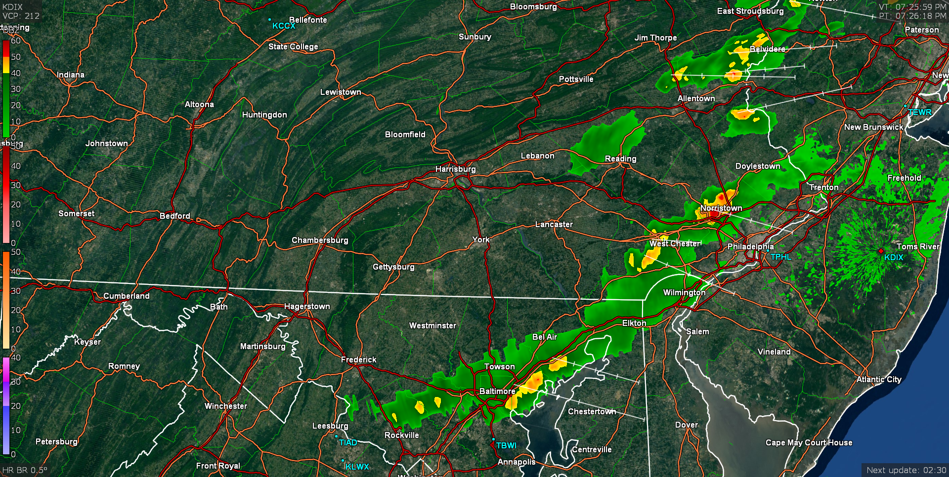
Heaviest now a few miles to my east, heavy rain now starting. The radar signature looks like it is bowing a bit -

-
Just starting to get some rain but it is windy. Temp is 82. Edit to add @7:40, just got some thunder.
-
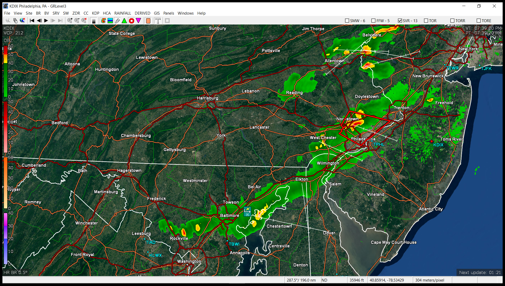
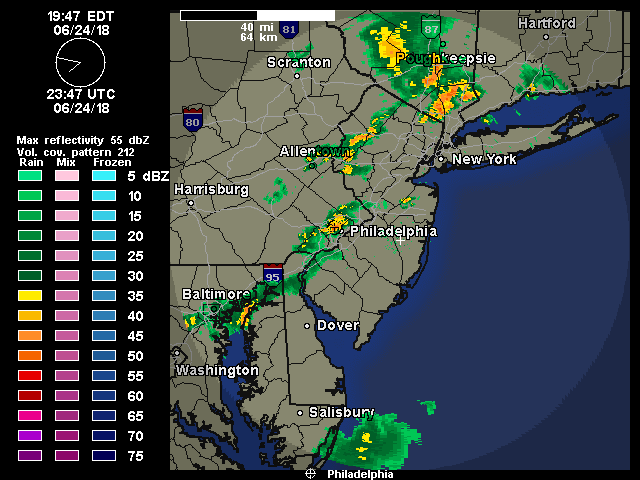
July 4th week will be a literal blast around here. LOL Mt. Holly just issued a severe thunderstorm warning for this area. Severe Thunderstorm Warning Severe Thunderstorm Warning PAC017-045-091-101-250000- /O.NEW.KPHI.SV.W.0040.180624T2332Z-180625T0000Z/ BULLETIN - IMMEDIATE BROADCAST REQUESTED Severe Thunderstorm Warning National Weather Service Mount Holly NJ 732 PM EDT SUN JUN 24 2018 The National Weather Service in Mount Holly NJ has issued a * Severe Thunderstorm Warning for... Southeastern Montgomery County in southeastern Pennsylvania... South central Bucks County in southeastern Pennsylvania... Philadelphia County in southeastern Pennsylvania... Northeastern Delaware County in southeastern Pennsylvania... * Until 800 PM EDT. * At 731 PM EDT, a severe thunderstorm was located over Conshohocken, or 11 miles northwest of Philadelphia, moving east at 30 mph. HAZARD...60 mph wind gusts. SOURCE...Radar indicated. IMPACT...Damage to roofs, siding, trees, and power lines is possible. * Locations impacted include... Philadelphia, Bensalem, Norristown, West Norriton, East Norriton, Yeadon, Conshohocken, Palmyra, Ambler, Jenkintown, Narberth, East Lansdowne, Rockledge, Abington, Bryn Athyn, Wissinoming, Morris Park, Bryn Mawr, Trout Lake and Tacony. PRECAUTIONARY/PREPAREDNESS ACTIONS... For your protection move to an interior room on the lowest floor of a building. Torrential rainfall is occurring with this storm, and may lead to flash flooding. Do not drive your vehicle through flooded roadways. && LAT...LON 4012 7487 3997 7510 3996 7513 3995 7514 3991 7519 4001 7543 4003 7540 4004 7541 4007 7536 4006 7539 4008 7541 4020 7532 TIME...MOT...LOC 2331Z 291DEG 27KT 4008 7532 HAIL...<.75IN WIND...60MPH $$ MPS
-
All that stuff and more is legal in PA now!
-
Day has become night out there now!

-
Yeah I may be in its path if that heavier blob near Norristown hangs together. The other blob is heading for Delco. It's already gotten pretty dark out (just came in to check the radar).
-
Cool front has been moving through. Started clouding up a bit about an hour ago and have been getting some breezes starting to mix out the humid air somewhat. Briefly hit 88 as a high so far today about 20 minutes ago and am currently 87 and partly sunny.
-
Temp here is 73 with dp 72. It's actually not too bad out there just yet but it's coming. Temp basically stayed in the 69/70 range overnight. Rain total yesterday was 0.31".
-
The warm front seems to possibly be in motion. Temp is starting to creep up now (may end up with a non-diurnal temp profile). Currently at 69 and overcast.