Hurricane Agnes
-
Posts
8,978 -
Joined
Content Type
Profiles
Blogs
Forums
American Weather
Media Demo
Store
Gallery
Everything posted by Hurricane Agnes
-
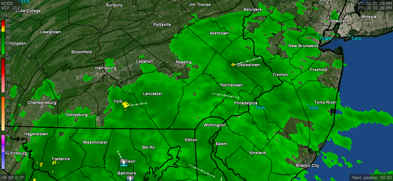
The KDOX radar (in Dover) will generally look "similar" to KDIX but obviously is shifted ever so slightly because it is down at Dover AFB, almost in central DE, vs the due east DIX. But it is the full shebang vs that little guy at KPHL. ETA - I had grabbed some screenshots from KDOX yesterday and the below is one taken of the event at about 1:30 pm.
-
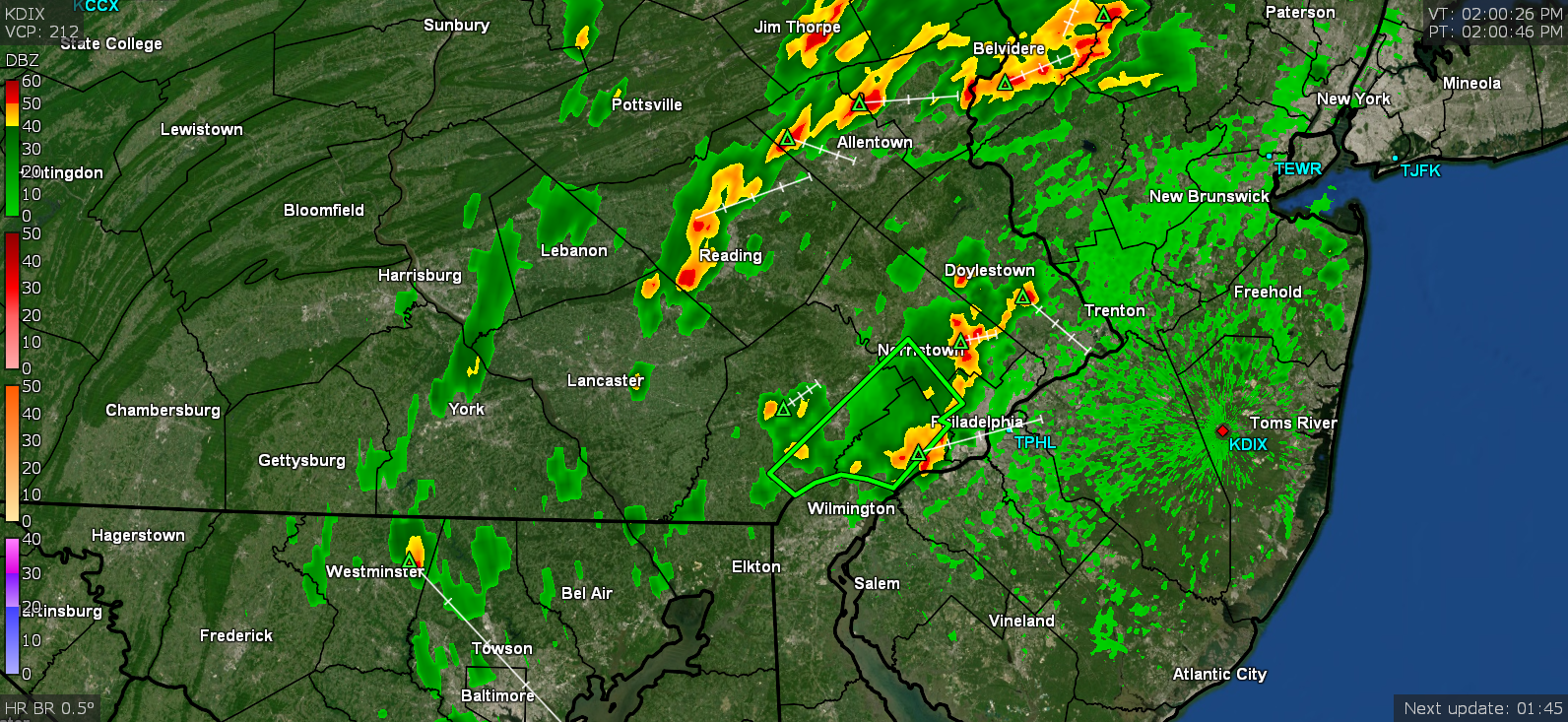
It's offline (starting about 8:30 am yesterday) until next Wednesday. I hate TPHL because it has such a tiny range. I have been using KDOX. It's better than nothing although I guess KBGM isn't too bad and I've used KLWX and KCCX when desperate.
-
DIX is down for maintenance for the week (starting yesterday) through to Wednesday. I have been using DOX but I expect due to the location and angle of the dish, the placement of the returns would be skewed because the thing is situated so far south of here - They did do a little mea culpa in a tweet - Specifically this (that sortof touches on what happened in Bucks and Lehigh Counties) - In other news, I noticed the humidity has ticked up a bit and after a low of 62 here, it's currently 74 and mostly cloudy, with dp 61. It was mostly sunny earlier today though.
-
I got a surprising 0.21" out of that. DOX seems to show it drying up more than moving. Currently 62 with dp 59 and overcast.
-
Actually had a low of 62 this morning, so a nice break. It has been overcast all morning and now am getting some light rain (currently at 0.02") and it's currently 64. I was a bit flummoxed that KDIX had suddenly died but then saw this - So it is due to be offline for scheduled maintenance until next Wednesday (6/16/21). I went on and switched to KDOX for my dopplers...
-
I finally got mine back down below 60. Some more trickled down here and got me down to 55. Temp still 82 but with the breeze, it's much better in the past hour.
-
I think it's down where you are now but the dry air behind it needs to travel over some hot streets and buildings before it gets to you!
-
I looked out this morning and there was a deck of cirrus obscuring the sky so there was no way to try to catch it. Otherwise my low was a little warmer than I expected this morning at 70 but I could tell when the front came through just after 8 am and that started the dry air influx, taking the dp that was just north of the low 70s, down to 57. It's stabilizing now and no longer a suffocating steam bath, but a typical late spring/early summer day. Currently at 82 with dp 61, and partly cloudy.
-
Getting fringed by a line of showers wish lightning flashes, the heaviest of which are south of me. So far up to 0.06" from it. Temp is down to 75 dp 71.
-
Had a broken deck of clouds on and off much of today but that has transitioned to mostly overcast with occasional threatening clouds. Some of the stuff that popped up west of here has been fizzling coming east so am not sure how much, if any rain I get today. In any case, I barely managed to hit 90 - and right on the dot, as the high, making it the 5th 90+ temp in a row IMBY. The overcast and clouds have generally kept the temps in check however but not the dps. Currently 84 with dp 75 and overcast.
-
Big difference in low temp here this morning, actually below 70 at 69, which oddly enough is supposed to be the progged high by Friday IIRC. Currently 72 with a steamy dp of 71 (windows fogged), but also with a deck of cirrus advecting in now, and sun breaking through where it can.
-
One of my sisters had texted a month ago about a huge swarm that had gathered on one of her neighbor's now ailing/mostly dead Ash tree. She said she was out in her backyard and heard a loud humming sound coming from that tree and looked up towards the upper part of the tree (almost 30 ft up) and saw them swarming and crawling around a hole in the collar stump left after a large branch had been pruned from the tree years ago. Must be the season!
-
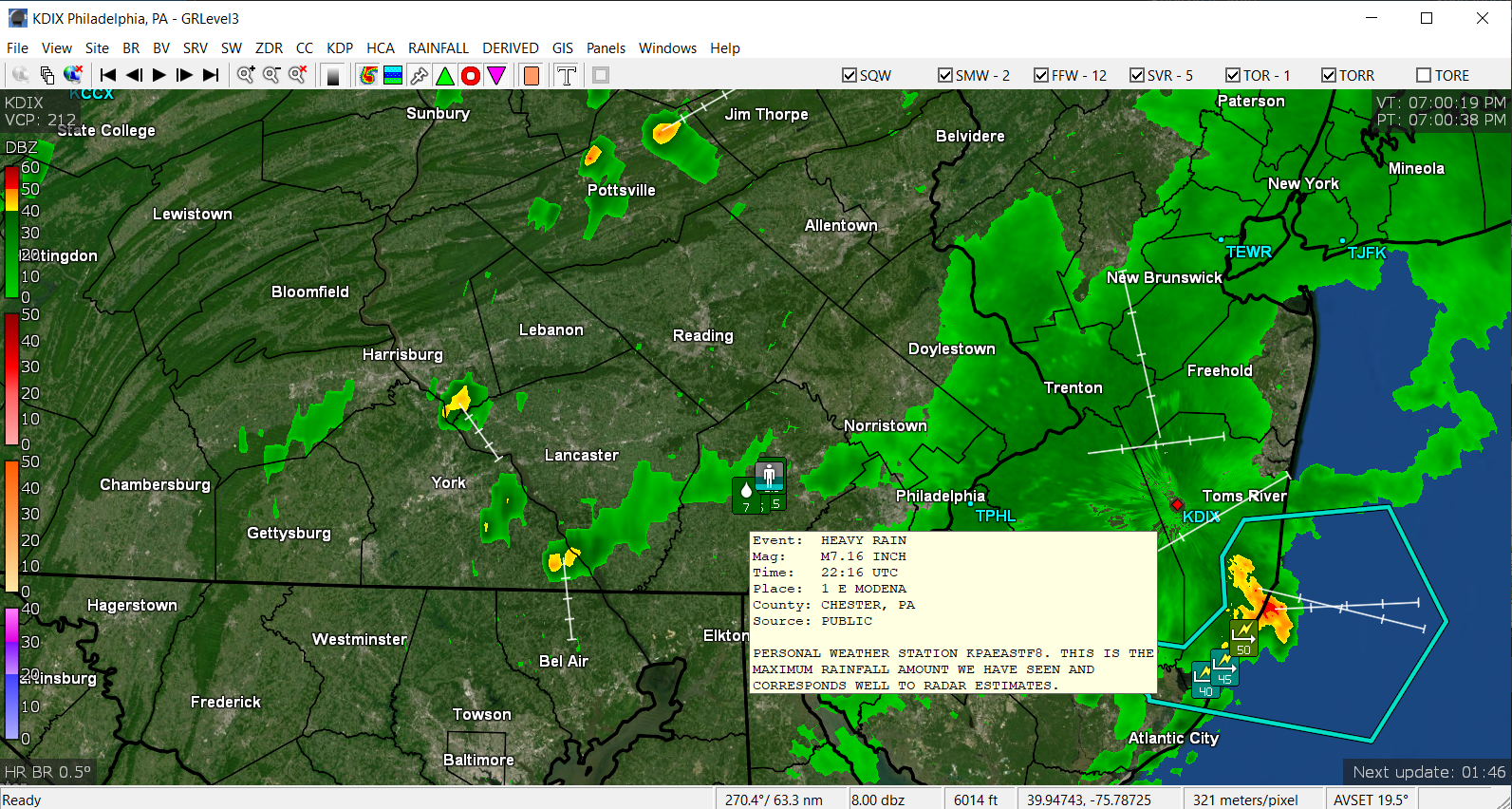
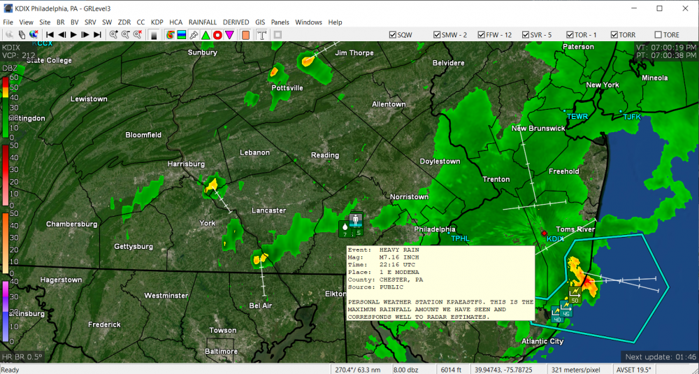
Except for some scattered radar returns, I may be mostly done and the sky is brighening to the west. So far have 0.61" from that. Temp is 72 with dp the same. I did see the reports from the Marhallton and West Bradford Twp. with the 6" reports and there was one rain gauge report of 7.16" (from the "public") in Chester.
-
Gettng some more light to moderate rain, with occasional thunder, and am up to 0.43" with this latest round. Temp is down to 72 with dp 71.
-
Got some on and off light rain (just heard a thunder) and may get fringed to the south by the next batch. Will see if the batch sitting over Chesco will hang together by the time it gets here. Currently up to 0.36" so far, with temp at 74 & dp 72. The plants did appreciate that.
-
Getting some clearing from the west and so far picked up 0.34" rain from that round. There's another band to the NW and not sure if it'll manage to hold together as it moves east, but may get fringed by it. Currently bright overcast and temp has settled at 74 with dp 73, and steaming up the windows.
-
Now under a heavier band with > 3/4" hour. Temp down to a steamy 75 with dp 73. ETA now up to 0.90"/hr.
-
Now getting moderate rain. Dropped the temp down to 78 (so far).
-
Getting lightning and thunder... temp down to 85 with dp 75. Skies dark.
-
Just issued...
-
I heard the post alert in my browser, looked at my radar, and figured what it is about. Some smackage about to happen! ETA - am seeing some foreboding clouds to my west and south. I just hit the 90 mark with dp 76, so definitely steamy out.
-
Well my "low" this morning wasn't much of a "low" at 75. The dp has been horrible this morning too - currently 76 and got as high as 78 earlier. Current temp is 87 with a hazy deck of cumulus keeping the sun appearances down.
-
Well I tapped 94 just before 3 pm and am now in the 3rd day of 90s as an "official heatwave". There was a bit of a breeze here that seemed to help mix out some of the worst of the humidity, although it was still like a furnace out there for this early in the season. Currently down to 86 and party cloudy, with dp 70.
-
Yeah, the cirrus of this morning has been replaced by some ominous cumulus and that cloud over knocked me down from 93 to around 88. I did recover back to 92 (even with the mostly cloudy), but the dews dropped out of the mid-70s down to 71.
-
Damn. Already 91 here and it's before noon. Dewpoint is a bopping between a juicy 75 and 76. I'm afraid to walk outside! Glad I did what I had to do early this morning.