Hurricane Agnes
-
Posts
8,951 -
Joined
Content Type
Profiles
Blogs
Forums
American Weather
Media Demo
Store
Gallery
Everything posted by Hurricane Agnes
-
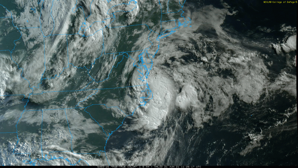
Oh yeah. Just checked and my dp is now up to 73. Temp is 76. The brief time that the sun broke through earlier took the temp up to 78 but it clouded over again and dropped it back down. You can see that cold front cutting across the Great Lakes on that sat image. The temps are in the 40s/50s behind it as it pushes east.
-
Cloud pumper! Sun is trying to come out though.
-
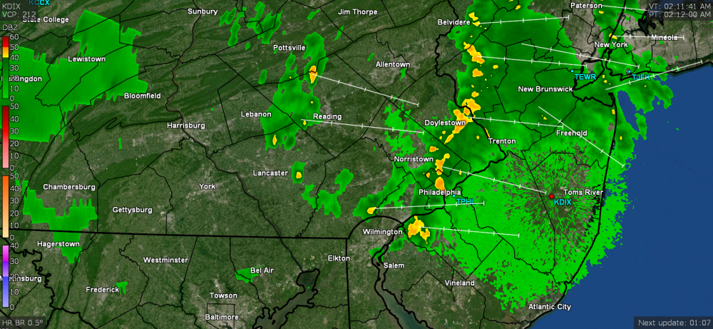
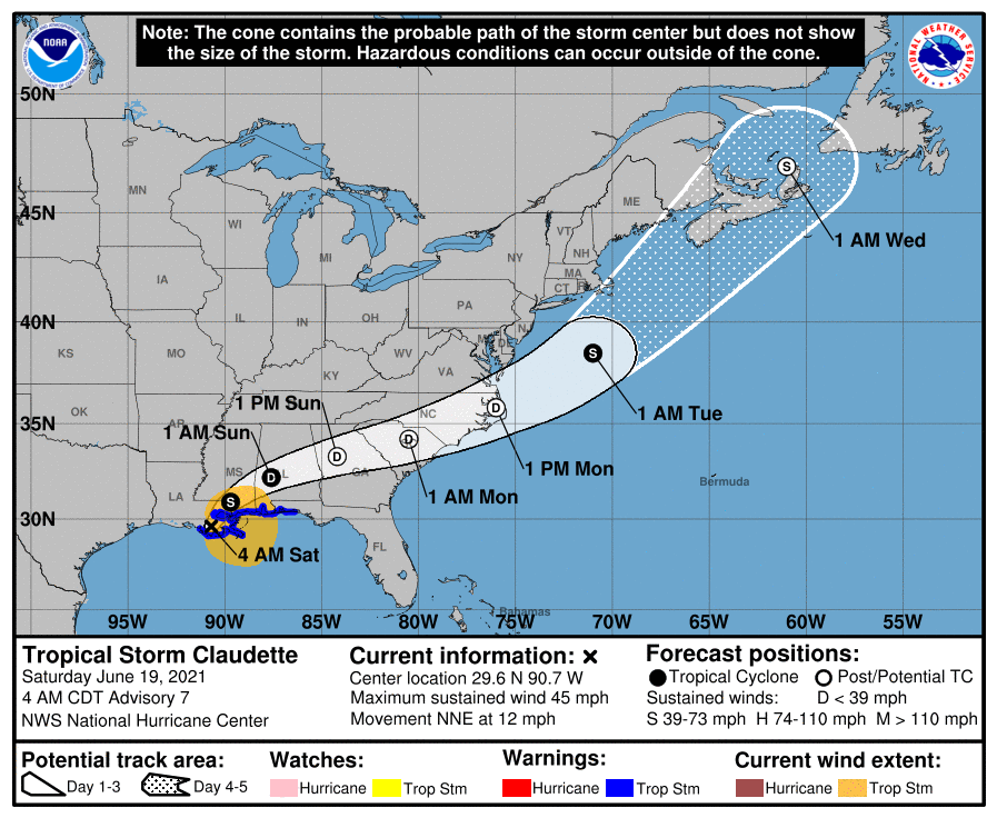
I saw the Heat Advisory flag lofted for the metro area. It's currently a steamy 75 with a dp of of 72 and the stratus that was hanging over my area was slowly breaking up, but it's still mostly cloudy at the moment. The later high temp is gonna depend on whether the sun can break out and stay out or not, which might be tricky and will depend on what impact happens (cloud-wise) from what is now TS Claudette (again), as it skirts south of here.
-
Well I hit 89 for a high today but it's almost 8:30 pm and currently still 83 with 72 dp, and mostly cloudy. The sun was also in and out today (am thinking the oft-referenced "self-destruct sunshine"), so that probably kept it from hitting 90 here.
-
I had a surprising low of 63 this morning. I guess the cold front (or probably better to call it "cool front") did its job given the dews. Currently 81 with dp 70.
-
I made it up to 89 just after 2:15 pm before the clouds rolled in, and started the downward temp trend. Currently getting some light rain (0.02" so far on top of the 0.16 from very early this morning). Temp is down to 75 now but dp is 71. It wasn't too bad an hour ago when I did venture out while the sun was clouded over despite the higher dp. LOL The radar is at Ft. Dix near Browns Mills... almost 30 miles NE of Cherry Hill!
-
The 66 ended up being my low this morning and I'm now up to 82 with a 70dp. I don't even want to think about going outside. The below was when I got nailed with the little top-off of rain.
-
LOL I know the track will continually change for what is now TS Claudette but I'm leaving this here for those how wish this type of cyclone track could have happened maybe 7 months from now. Heard some thunder just after 2am this morning and ended up with 0.16" from a couple cells that rolled through my area around that time. Currently 66 and partly cloudy.
-
Had a slightly warmer low this morning than yesterday (56) but still off to a good, although warmer start this morning. Currently sunny and 77 with dp 57, and slowly creeping up. Supposed to start heating up a bit for the next couple days so getting the last of the open door (with screen) and open windows before I throw the air back on again.
-
I expect many believe that anything Ji says is meteorologically impossible. Had an unexpected low of 53 this morning (if it hadn't been a bit breezy then it might have decoupled). Am currently at my high (so far) today of 77 with dp an amazing 46 and not a cloud in the sky.
-
As I understand it, Iceland was the more temperate area and Greenland (of "Greenland Block" fame) is actually the ice kingdom, with the glaciers and permafrost! I had a former co-worker who had been in the Navy during the '60s and he (and his wife) had been stationed at a base in Iceland (now closed) for a few years. He said the weather was pretty moderate (more like a typical Northern U.S. climate). As an obs - my low of 60 this morning was refreshing, and after a brief spike to 77 earlier, I'm currently at 74 (dp 54) and mostly cloudy, once lots of cumulus arrived and blocked the sun. Was able to turn the air off yesterday and today so far.
-
LOL I noticed that they sometimes start the "back to school" (focus on college/"dorm stuff") barely after those May college graduations happen (sometimes even this month after Father's Day, but more generally right after the July 4th sales to cover the time before the Labor Day sales). Amazon even moved "Prime Day" to next Monday/Tuesday (vs like it originally was mimicking - a "Christmas in July").
-
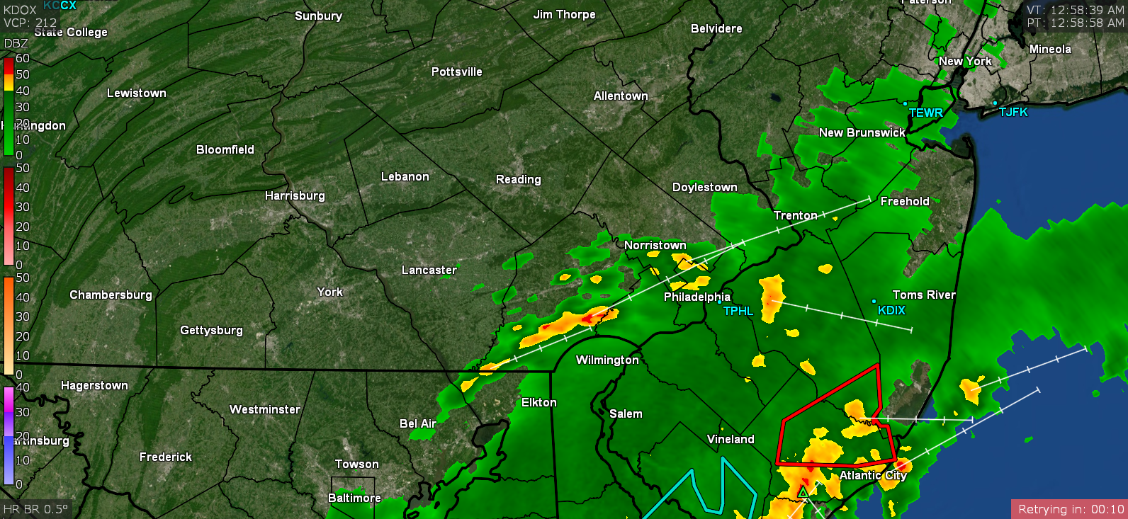
That secondary band nailed me just after midnight giving me 0.62". I lost my internet service so am investigating while running through my hot spot. So totals were 1.82" for the event. Currently 63 and misty. ETA - restarted stuff. Also saw I got nailed a couple times between midnight and 3 am.

-
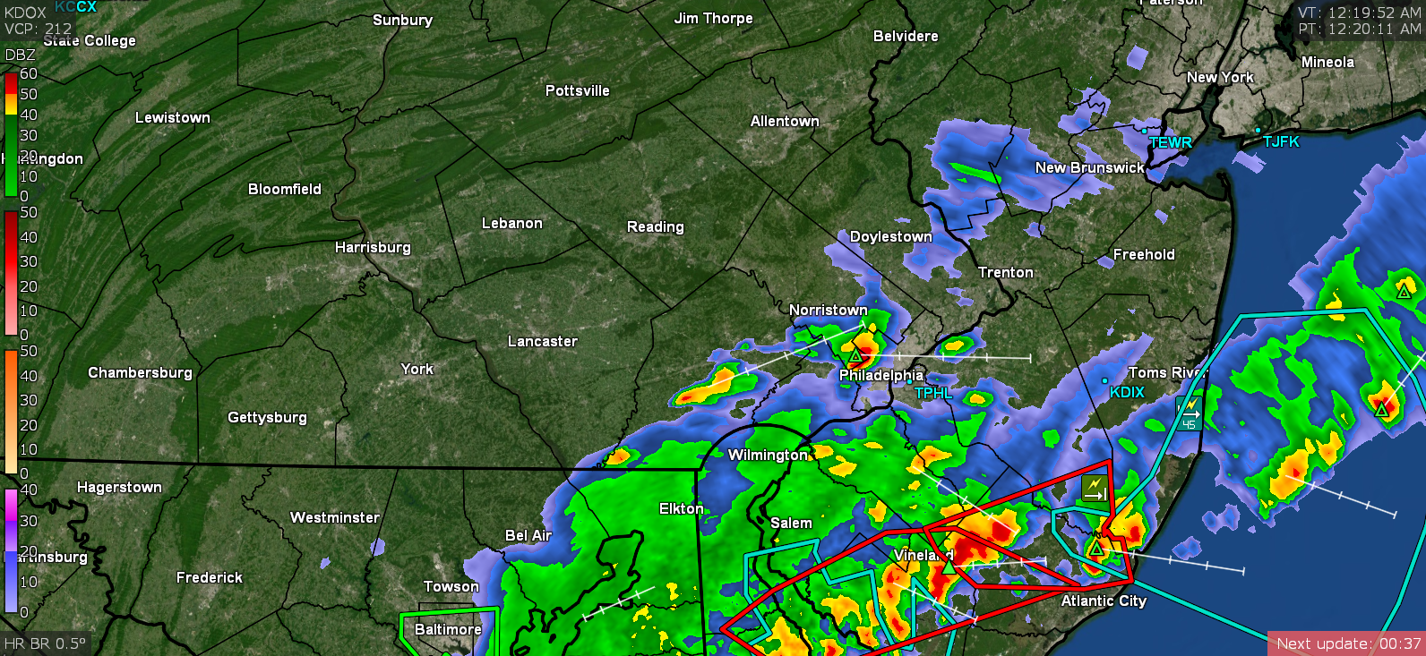
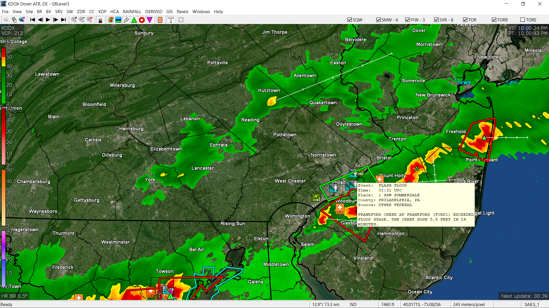
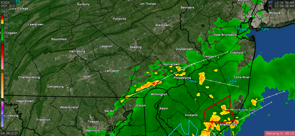
Frankford Creek went out of its banks according to a report. Rose 5.5ft in 24 minutes. Currently 66 here with dp 64 and cloudy. Looks like another weaker line to the west but am not sure if that holds together or not.

-
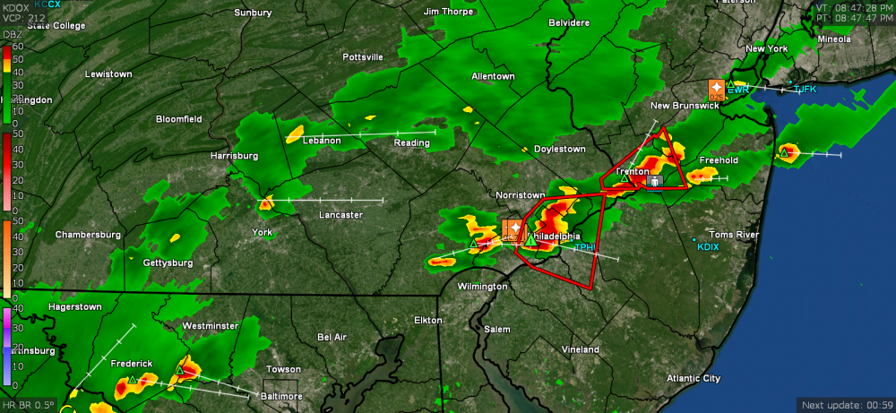
This will probably throw the tiny creek tributaries (like Cresheim Creek that feeds into the Wissahickon) right out of their banks in the lower lying areas. I *know* those streets are probably flooding right now. It seems to be a fast mover though. Spigot has cut off as that heavy band has moved past me now. Currently at 1.20". Getting a lot of lightning although not much thunder.
-
Yikes! I'm up to 1.10" and almost 5.5"/hr. I can hear it over the sound of my AC, air purifiers, and my radio playing some music. Up to 1.15".
-
Under a red. Getting almost 2.5"/hr rates. Up to 0.44" at post time. Temp down to 67. ETA - Holy crap! now almost 5"/hr gully washer! Got 0.95" in the bucket at edit time (8:48 pm).
-
Fireworks going over me! Getting rain and am up to 0.05" at post time.
-
Thunderstorm Warning up over my area. My high actually hit 85 today (low was 65). Currently 70 with dp 69.
-
The trough here in the east will probably carry that away from the coast unless something happens and it gets cut off from the flow. We got a long season to go although I don't expect it to eclipse last year. CPC is forecasting ENSO neutral at least through the summer (where last year we were in La Niña) -
-
LOL
-
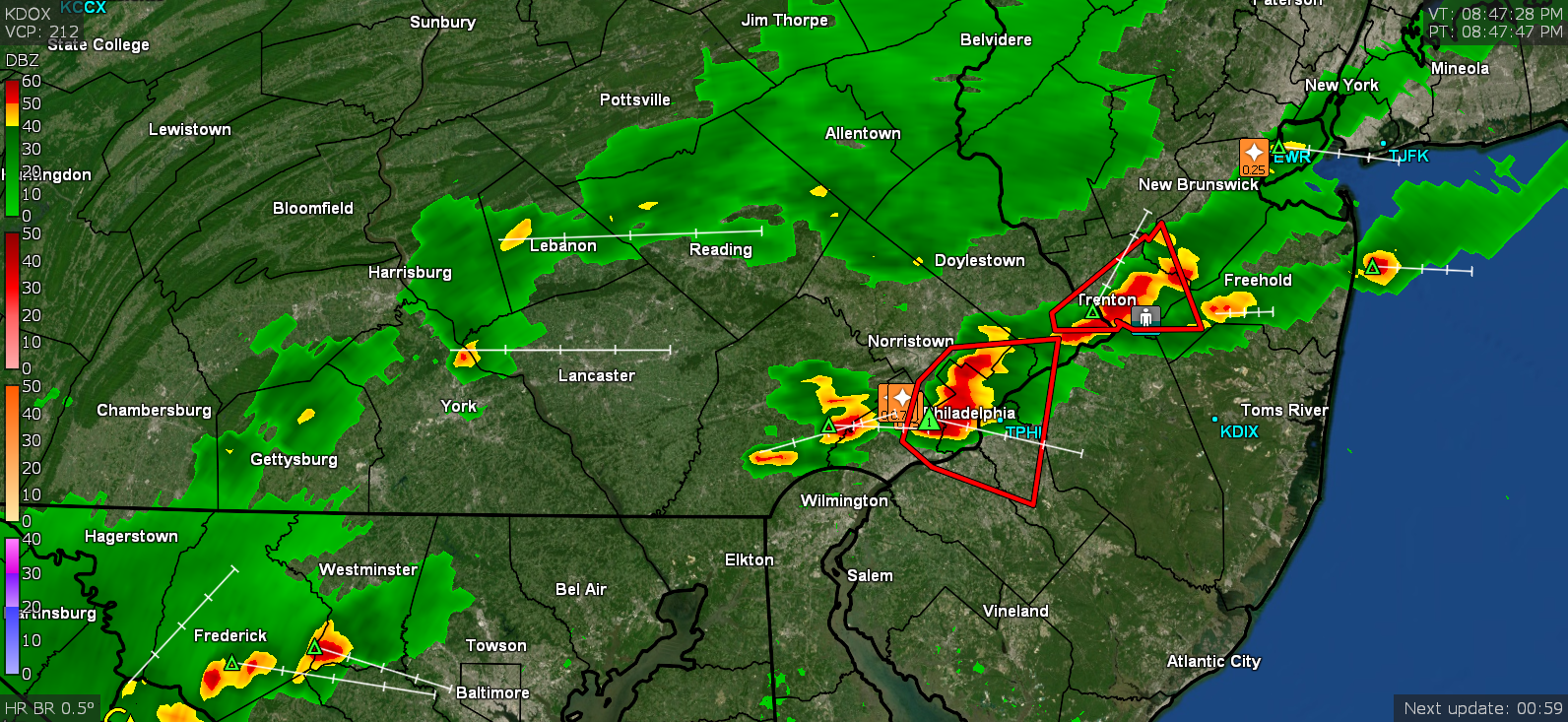
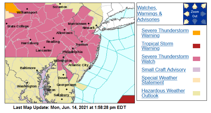
Here comes SPC - Currently a muggy 81 with dp 69 and mostly cloudy. ETA - The TS Warning is intriguing. I haven't had chance to see what that is about.
-
And probably one of these on the dash.
-
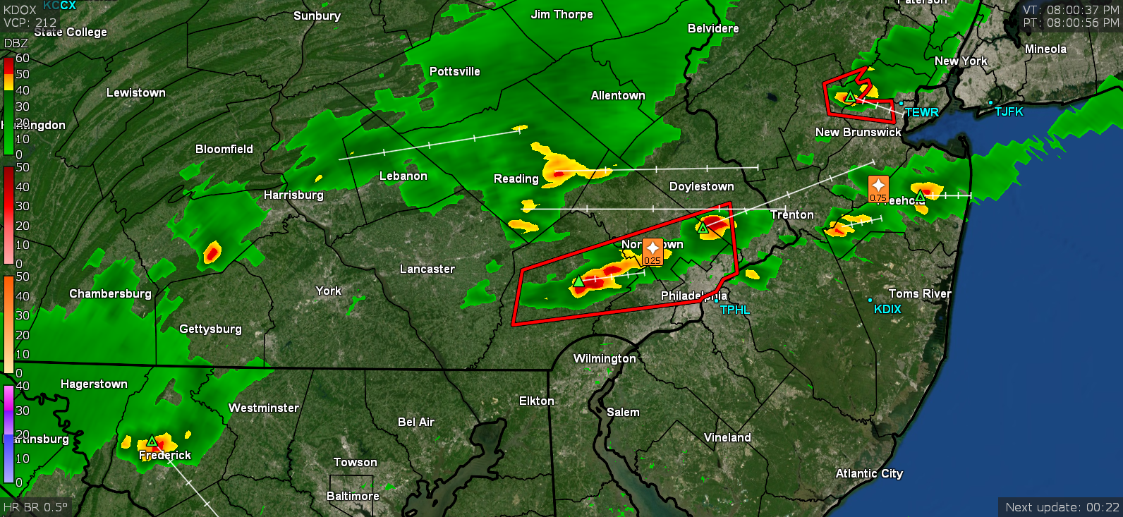
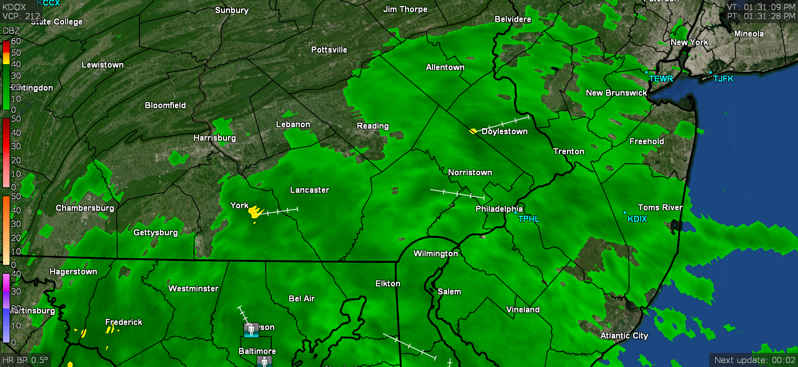
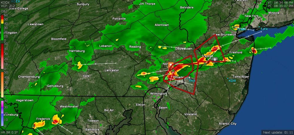
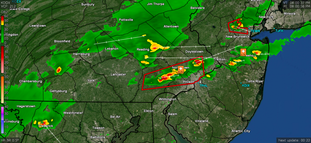
The KDOX radar (in Dover) will generally look "similar" to KDIX but obviously is shifted ever so slightly because it is down at Dover AFB, almost in central DE, vs the due east DIX. But it is the full shebang vs that little guy at KPHL. ETA - I had grabbed some screenshots from KDOX yesterday and the below is one taken of the event at about 1:30 pm.
-
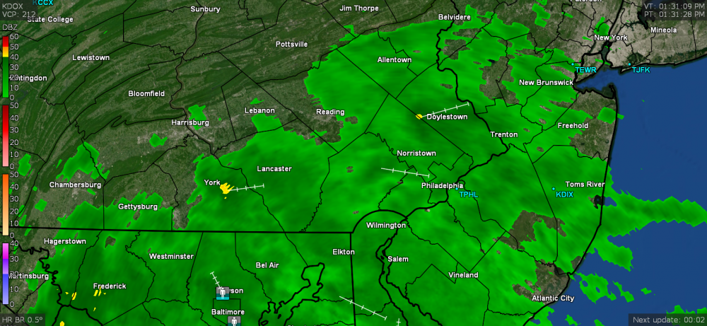
It's offline (starting about 8:30 am yesterday) until next Wednesday. I hate TPHL because it has such a tiny range. I have been using KDOX. It's better than nothing although I guess KBGM isn't too bad and I've used KLWX and KCCX when desperate.