Hurricane Agnes
-
Posts
9,264 -
Joined
Content Type
Profiles
Blogs
Forums
American Weather
Media Demo
Store
Gallery
Everything posted by Hurricane Agnes
-
https://www.aviationweather.gov/metar/symbol
-
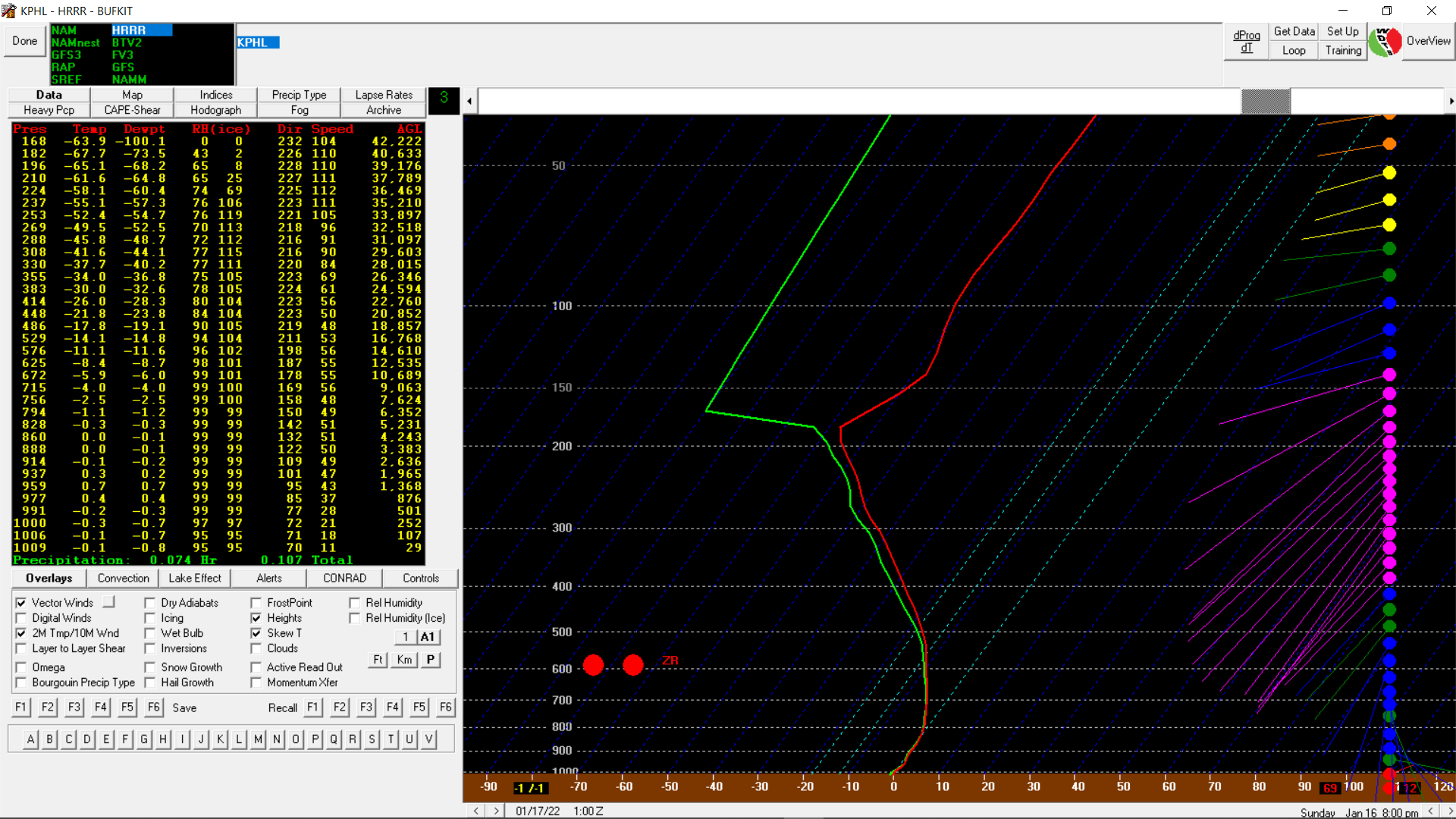
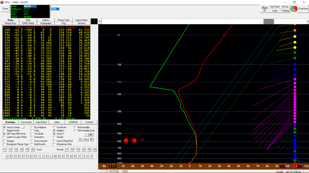
Under a heavier band now with moderate snow. Finally hitting 1/2". Temp/dp holding at 27/26. Bufkit HRRR soundings progged KPHL changeover to ZR by 8:00 pm.
-
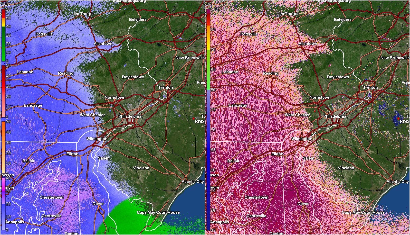
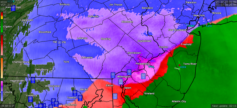
Still SN but barely. Haven't hit 1/2" yet. Temp has crept up to 27 with dp 26 and am now getting some fog. Looks to be a heavier blob moving up here imminently from the SE with the shift of the R/S line closer to the river.
-
Currently SN with just over 1/4". Temp holding at 26 but dp now up to 24.
-
Getting under pieces of the heavier returns and am up to SN- to SN. Cars starting to get coated. Temp 26 with dp ticked up again to 22.
-
Have a little powdered sugar dusting on the cars and currently SN--. Looks like a heavier batch might be incoming from the southwest though. Temp still 26 but dp has ticked up to 21.
-
It's showtime! Flakes have commenced. Temp 26/dp 20.
-
Virga here so far and temp has ticked up to 26 with dp 20.
-
I have the top sub so can add up to 19.53MB files (many of the sat animations can get that big - even with just a few frames)
-
-
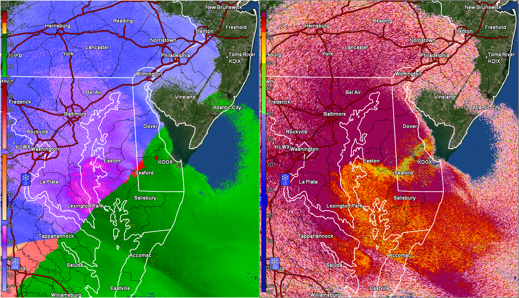
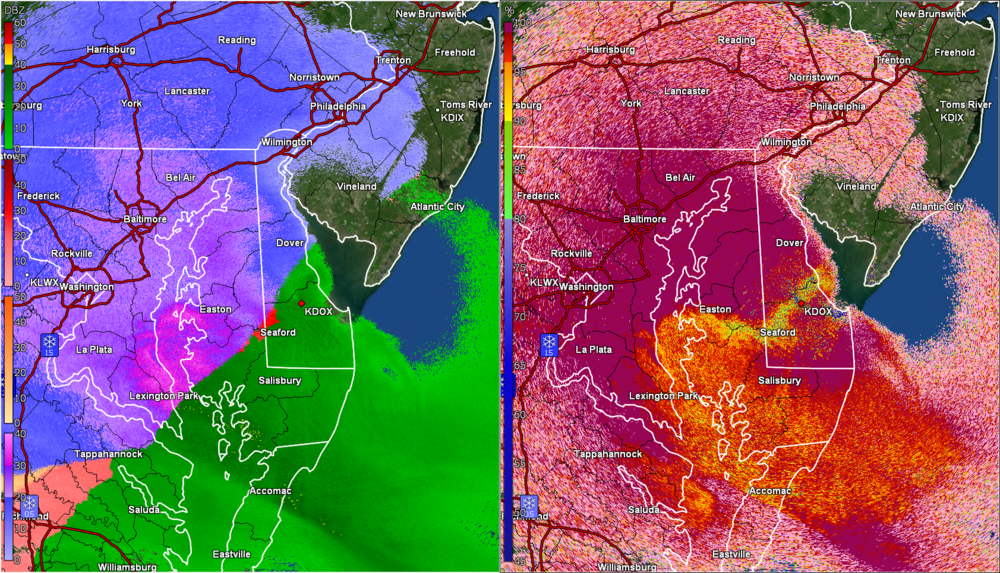
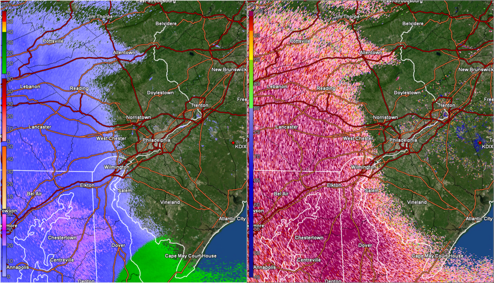
Currently holding at 25 wit dp 18 and overcast. Returns coming in from the SW. (edit to add cc panel)
-
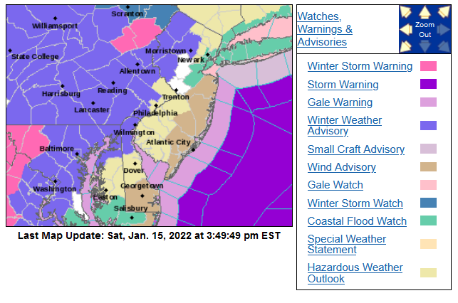
Current WSWs/WWAs (looks like another set of NJ counties, S/E, got added into the WWA) -
-
E PA/NJ/ DE Winter 2021-22 OBS Thread
Hurricane Agnes replied to JTA66's topic in Philadelphia Region
Currently overcast and I have hit 25 where it has topped off and held for the moment, with dp 16. -
MLK Storm - something for everyone
Hurricane Agnes replied to ChescoWx's topic in Philadelphia Region
if you are not suddenly under a dry slot! -
MLK Storm - something for everyone
Hurricane Agnes replied to ChescoWx's topic in Philadelphia Region
It's not a matter of eventually scouring out the ambient cold air, it's the solid ground and surfaces (including concrete and metal) that have been sitting in single digits and low 10s for a long time - i.e., initial liquid would freeze on contact unless the temp warmed up into the 40s for a bit before onset (where onset is supposed to happen late this afternoon and overnight with temps near or below freezing depending on where you live). I'm not expecting any significant "icing" per se but just that there might be some initial coating - although any snow that covers those surfaces first may mitigate it too. Edit to add - those poor folks in the central and western Carolinas are the ones who are going to have an ice storm extraordinaire. -
Am currently "up to" 16 with dp finally above 0 at 6. Despite the sky filled with a deck of cirrus, there is still sun shining through it.
-
MLK Storm - something for everyone
Hurricane Agnes replied to ChescoWx's topic in Philadelphia Region
That's my thought as well. Any type of liquid precip would freeze on contact on untreated surfaces (like a car for instance) and it would take some time for "warm" rain to melt that. Nothing worse than having a layer of water on top of ice (unless you like following a zamboni). -
MLK Storm - something for everyone
Hurricane Agnes replied to ChescoWx's topic in Philadelphia Region
WPC's latest - -
E PA/NJ/ DE Winter 2021-22 OBS Thread
Hurricane Agnes replied to JTA66's topic in Philadelphia Region
Looks like my bottom was 9 (8.6) and am now on the upswing. Currently sunny and 11 with dp on the rise as well at -1. -
E PA/NJ/ DE Winter 2021-22 OBS Thread
Hurricane Agnes replied to JTA66's topic in Philadelphia Region
It's been awhile but am down into the single digits (and the wind hasn't gone calm overnight either). Low so far this morning has been 9 and am currently 9 with dp -2. Hopefully that will take out any stinkbugs and lanternflies! -
MLK Storm - something for everyone
Hurricane Agnes replied to ChescoWx's topic in Philadelphia Region
Mt. Holly expanded the WWA into Philly and some areas east (into Bucks and Mercer/Somerset Counties NJ) with the early morning update - -
MLK Storm - something for everyone
Hurricane Agnes replied to ChescoWx's topic in Philadelphia Region
Mt. Holly's 5 pm hazards - -
MLK Storm - something for everyone
Hurricane Agnes replied to ChescoWx's topic in Philadelphia Region
Full Wolf moon coming up. 18z Euro gives a little something...
-
E PA/NJ/ DE Winter 2021-22 OBS Thread
Hurricane Agnes replied to JTA66's topic in Philadelphia Region
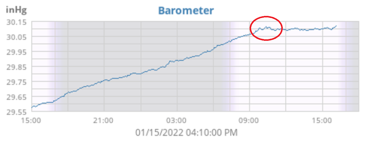
I actually made it up to 22 as a high today and I just saw this cool tweet from Mt. Holly - I was looking at a graph of my barometric pressure from my Ambient and there is a little ripple appearing on the plot (attached snapshot of my weewx plot taken at 4:10 pm EST). Otherwise it's currently mostly cloudy and 20 with dp -4 (and yes, I had to pull out the humidifier in the bedroom and it's on - humidity there has risen now from 25% to 35%, which is much better. My front bedroom is 20% and the basement is 12% (I do have stuff overwintering down there under T5 lights and different spectrums of LEDs but gotta get back to that - I have a portable humidifier down there too if necessary but haven't needed to use it in a few years).
-
MLK Storm - something for everyone
Hurricane Agnes replied to ChescoWx's topic in Philadelphia Region
WSWs, WWAs , Wind Advisories are up around the CWA -