Hurricane Agnes
-
Posts
9,264 -
Joined
Content Type
Profiles
Blogs
Forums
American Weather
Media Demo
Store
Gallery
Everything posted by Hurricane Agnes
-
That should freeze into a glacier as a nice base! Looks like my precip has ended for the moment and I'm still holding at 0.93" for today + 0.61 from yesterday (total 1.54"). Currently overcast and 35 with dp 30.
-
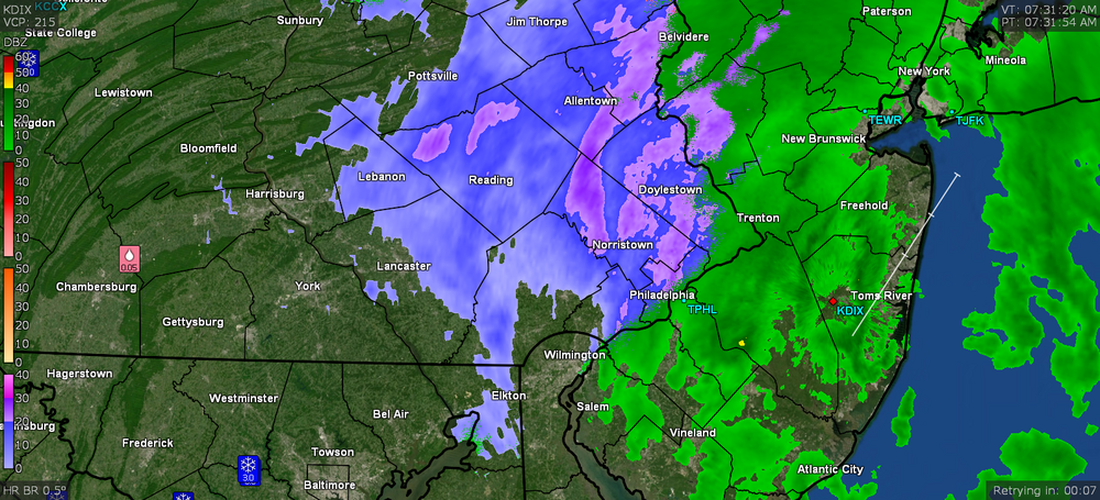
E PA/NJ/ DE Winter 2021-22 OBS Thread
Hurricane Agnes replied to JTA66's topic in Philadelphia Region
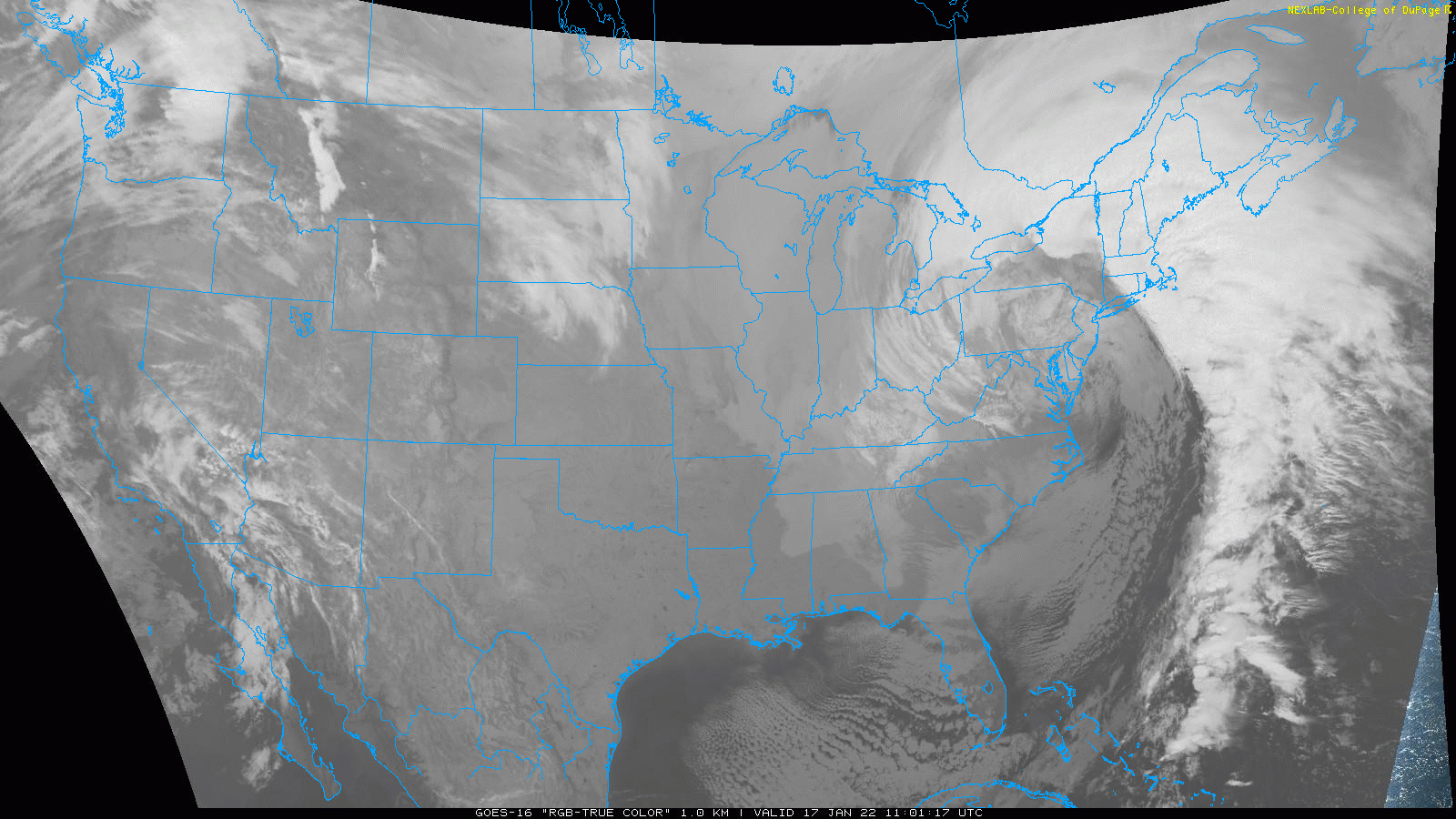
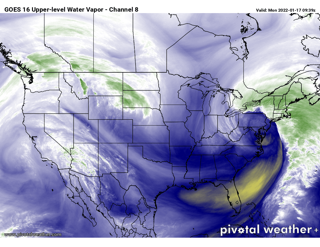
12z GFS makes that look like some kind of overrunning precip from a southern slider with a cold front behind it. It seems to be showing it like 12 hours faster than the NAM. Then the 23rd storm looks juicer but is depicted as another slider (although it could come north) and then the 25th looks like a clipper or even a Miller-B type setup. The 6z ECM shows a similar overrunning for the 20th with cold behind it. Definitely going to be active the next week though!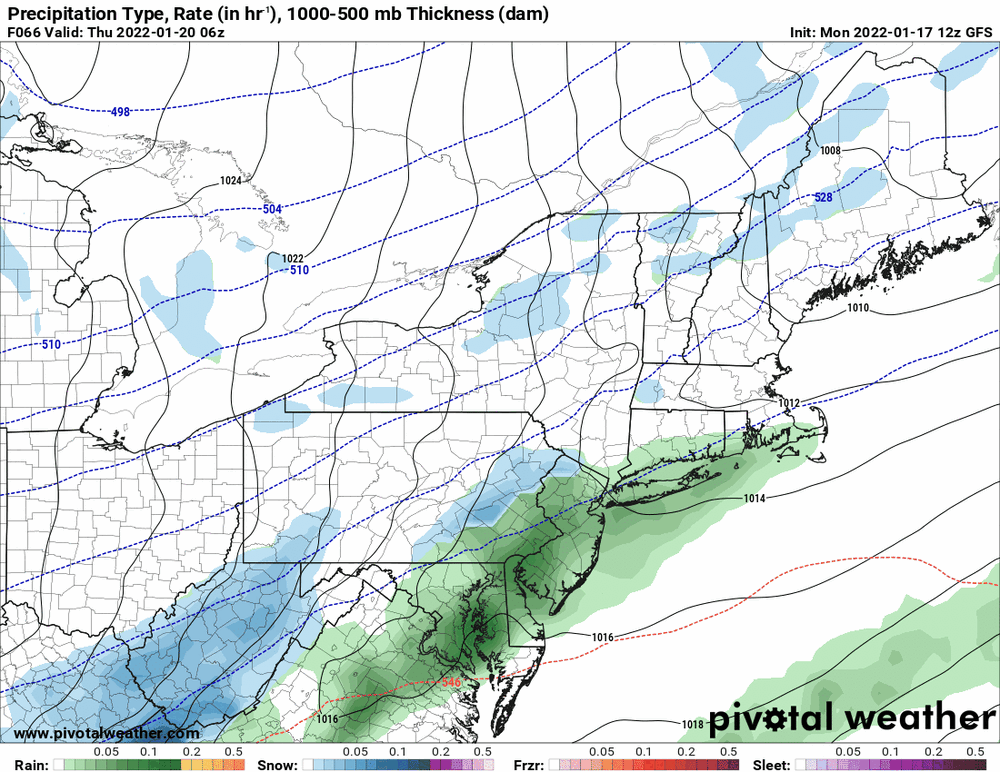
-
Hot off the press updated PNS - Looks like a thick wrap-around band may end up pivoting over the area as the storm continues to move up to the NE and away from the area. Currently getting a light snow/rain mix and temp is 34 with dp 33.
-
Now getting SN- (albeit wet, since the temp is still above freezing at 34). No stickage. The sky seems to be trying to brighten too.
-
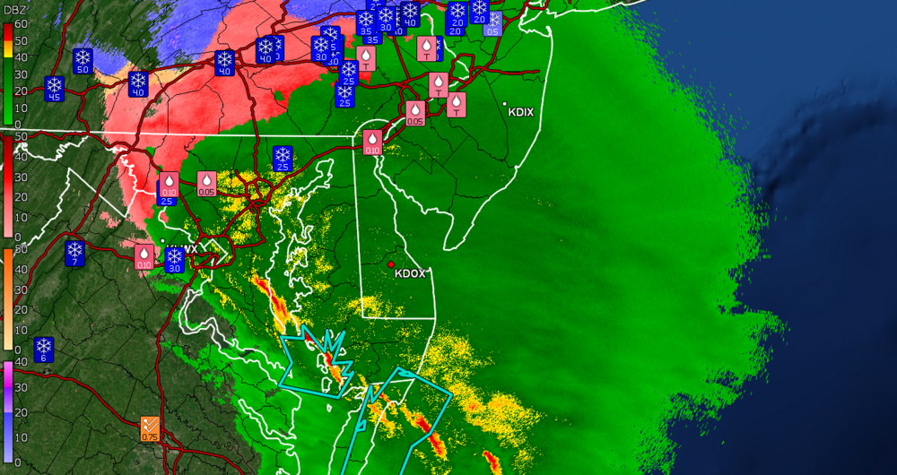
Getting a light snow/rain mix (the flakes are smaller than earlier, when they were near pancake size mixing with the rain). It is still contributing though so am up to 0.93" for the day (1.54" total). The back edge of the precip moving in from the SW is near but will see what happens with any wrap-around bands as the storm continues to push NE and pivots those bands around this way.
-
Mt. Holly (and adjacent WFOs) current Wind Advisories (including Coastal) -
-
Temp has dropped to 34 and more returns over me that are producing some wet snow. Got another 0.01" of liquid for 0.92" today/1.53" total 2-days.
-
As of post time, I am up to 0.91" of rain for today (so another 0.05") for a total of 1.52" for the 2 days so far. Temp is now down to 35, a 12 degree drop over about a 4 hour period. Have had cold returns over me and It's possible that it was a mix of snow/rain but looking out, it has been a cold rain for the most part.
-
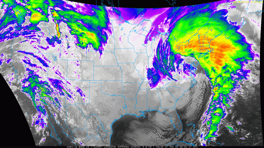
This thing is like the storm-that-shall-not-be-named size! All kinds of hazards in effect including a Wind Advisory that was extended north and west of the earlier advisories.
-
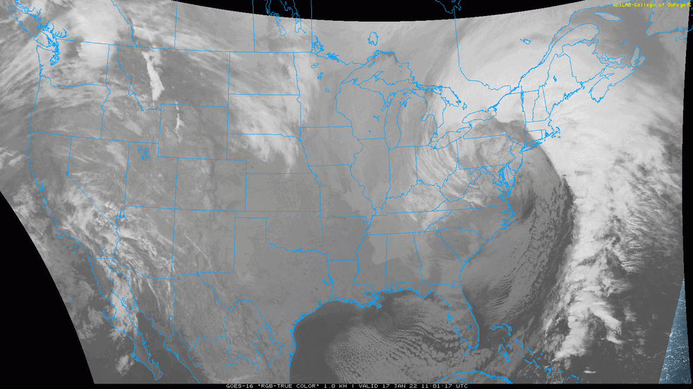
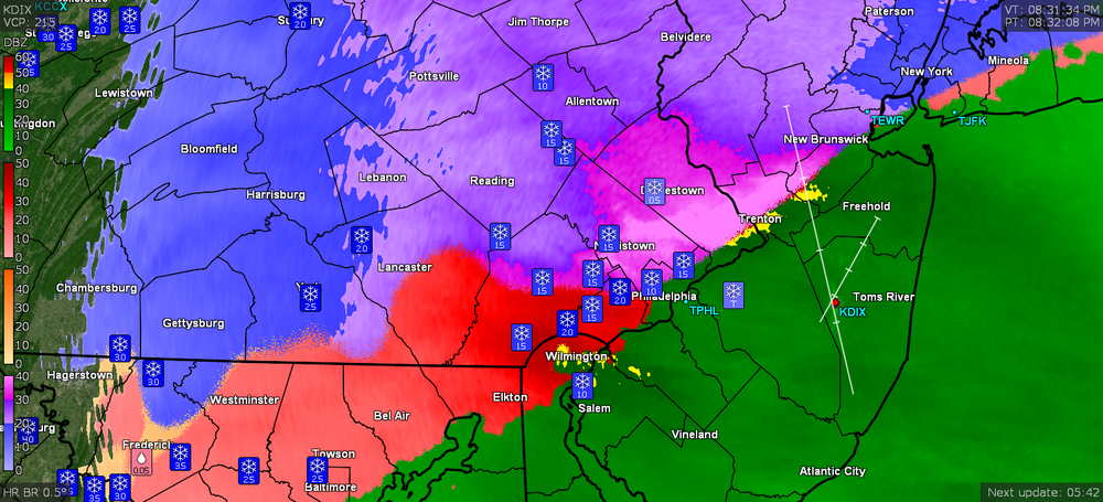
Currently 41 with dp 39 this morning, and 0.61" of rain/snow melt recorded for Sunday and another 0.85" overnight today, for a total of 1.46" for the event so far. Believe it or not, my "high" surged to 47 just after 3:30 this morning and is now on the way down again. And yup the snow is gone. The low appears to be sitting over the Chesapeake Bay.
-
Sterling just put up a SVR for the Annapolis area so there is definitely some convection going on with that line. Not sure if we will get any of it but this is definitely a dynamic storm. Now up to 39 with dp 38 and moderate rain. 0.20". Will probably be heading to bed shortly...
-
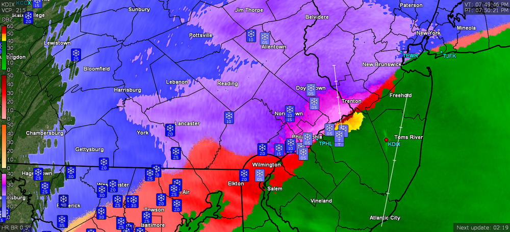
Yeah - the right front quadrant of the low. It'll be dependent on the eventual position of it as it moves north. ETA now up to 38 with 0.10" in the bucket.
-
And continuing the non-diurnal temp rise, am at 37 with light to moderate rain. Bucket finally tipped and is reading 0.03".
-
That's almost like a "candlelight dinner" for them.
-
Yeah am wondering if Mt. Holly does a short-fused advisory if necessary. The low hasn't gotten up here yet. I expect the bigger show will happen overnight once it gets closer. Am currently up to 36 and with dp 35.
-
The low is still down in the Carolinas (inland).
-
The wind products were only lofted at the shore locations - My temp continues to rise and I'm now at 35 with dp rising in tandem at 34 and rain. Haven't registered anything in the bucket yet as there's obviously snow on top of the opening but I expect that will dissolve away and get the tipper going again eventually.
-
Temp now up to 34 with dp 33 and plain rain has commenced. The winds have picked up too. R/S line continues to move to the NW.

-
Temp now 33 and still have a general pause in precipitation except for some DZ. Dripping is beginning to commence.
-
Temp now up to 31 and except for some FRDZ, all precip has ceased, as if someone from above is getting one last look before washing it all away.
-
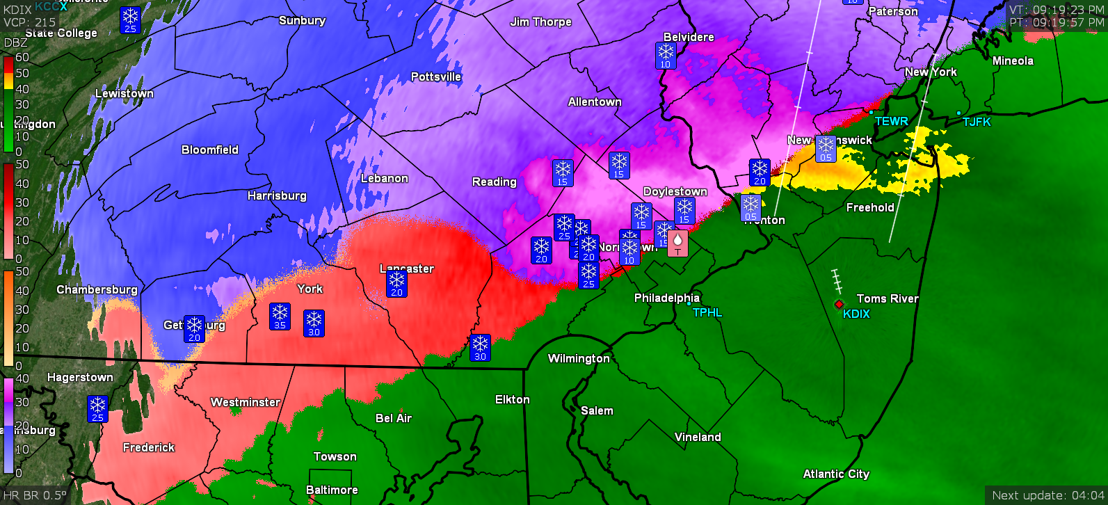
Now all ZR. Will go with the 1.25" as the snow total before this switch. I expect it may go back and forth with the p-types but the end is nigh. Didn't get pingers as a transition (although I won't rule out any that might happen as it vacillates in the upper atmosphere).
-
Getting mix snow/white rain. Temp now at 30 with dp 29.
-
That must suck for them. Temp now up to 29 with dp 28. No pingers yet but the pancake/dinnerplate flakes had thinned out some.
-
Have been getting pancake flakes the past 10 minutes or so that are laying down a nice layer and went out and measured with this current band and got 1.25". Temp is now up to 28 with dp 28 and fog. Will be listening for the inevitable pingers.
-
My sis in Upper Darby just texted that sleet is now mixing in with the snow where she is. She said she had "a couple inches" (not sure if she actually went out to measure but I know she was getting it there before I got any here).