Hurricane Agnes
-
Posts
9,344 -
Joined
Content Type
Profiles
Blogs
Forums
American Weather
Media Demo
Store
Gallery
Everything posted by Hurricane Agnes
-
January 28th/29th Event Obs - From KU to FU?
Hurricane Agnes replied to JTA66's topic in Philadelphia Region
Mt. Holly 5am update tweet - Still have SN (with some fog) and tep 22 with dp 21. -
January 28th/29th Event Obs - From KU to FU?
Hurricane Agnes replied to JTA66's topic in Philadelphia Region
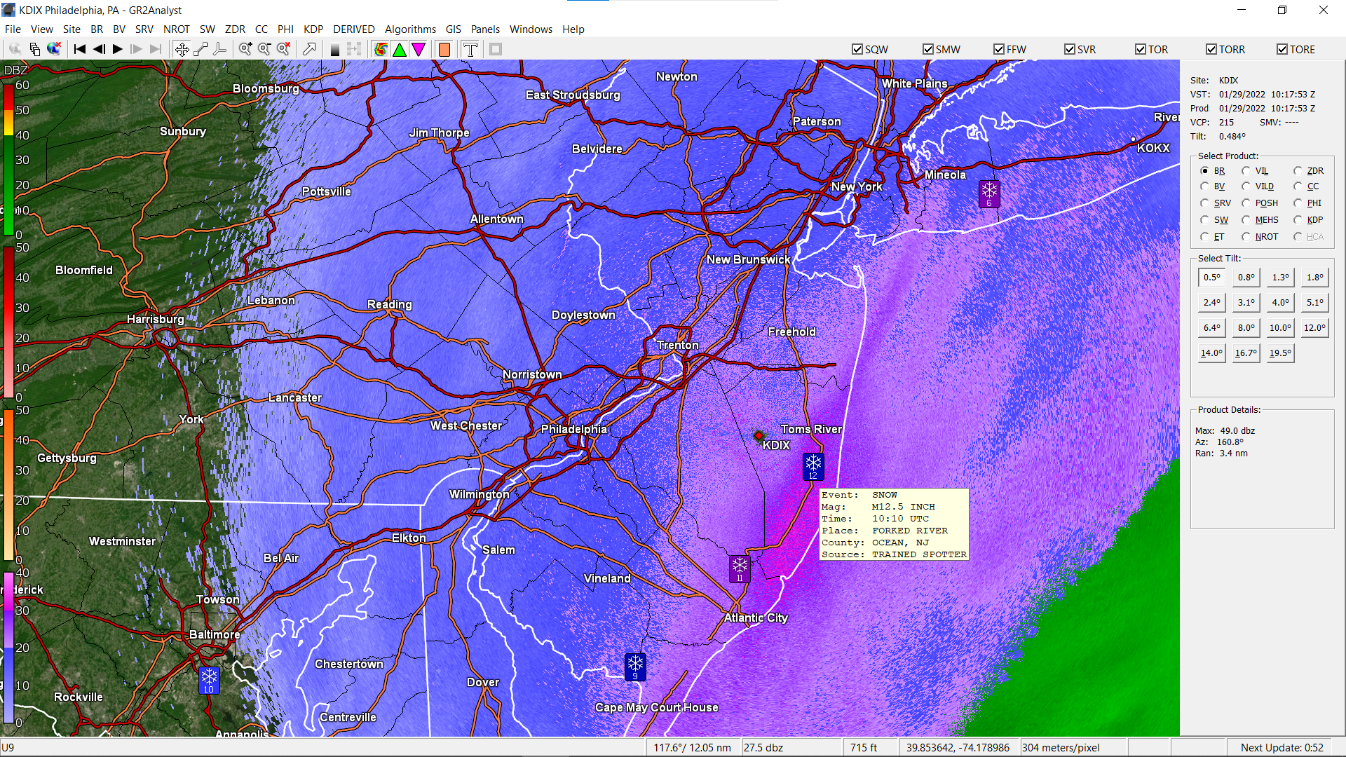
Some in S. Jersey not far from AC reporting 11" and so far a Forked River 12.5" spotter report is the highest showing up over there.
-
January 28th/29th Event Obs - From KU to FU?
Hurricane Agnes replied to JTA66's topic in Philadelphia Region
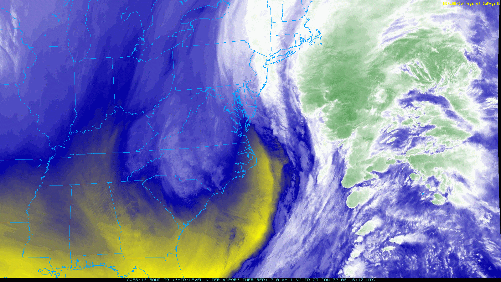
Mid-level WV really shows the kicker trough and what looks like some convection on the possible front-right quadrant of where the low is.
-
January 28th/29th Event Obs - From KU to FU?
Hurricane Agnes replied to JTA66's topic in Philadelphia Region
Currently looks to be at least 3" here on my board (based on one of those marked snow rulers) and will go out later with the ruler to confirm. Big note is that the temp that hung around 29/30 through yesterday did a gradual drop to the current 23 at post time with dp 22. Still have SN with very fine flakes. The heavier band appears to be sitting right along the river.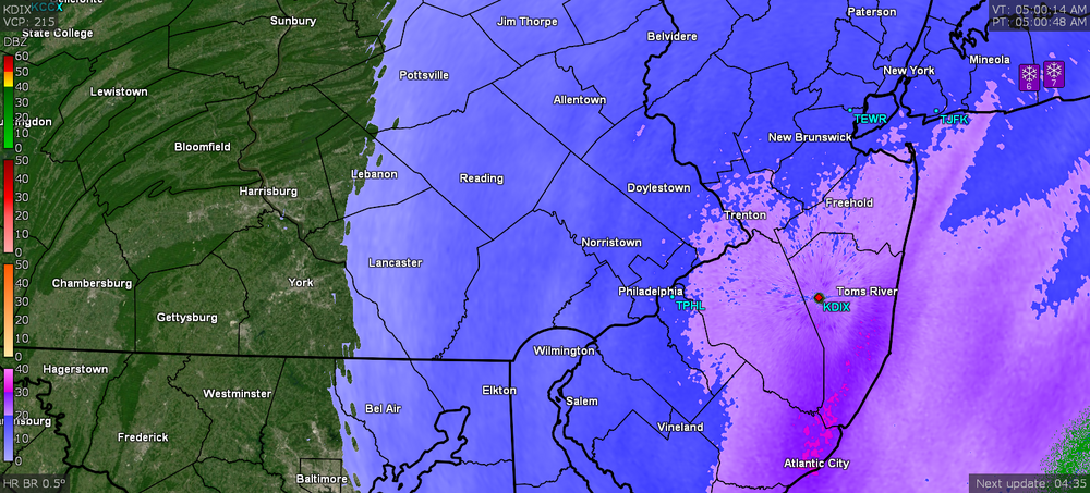
-
January 28th/29th Event Obs - From KU to FU?
Hurricane Agnes replied to JTA66's topic in Philadelphia Region
Tweeted by Mt. Holly about an hour ago - -
January 28th/29th Event Obs - From KU to FU?
Hurricane Agnes replied to JTA66's topic in Philadelphia Region
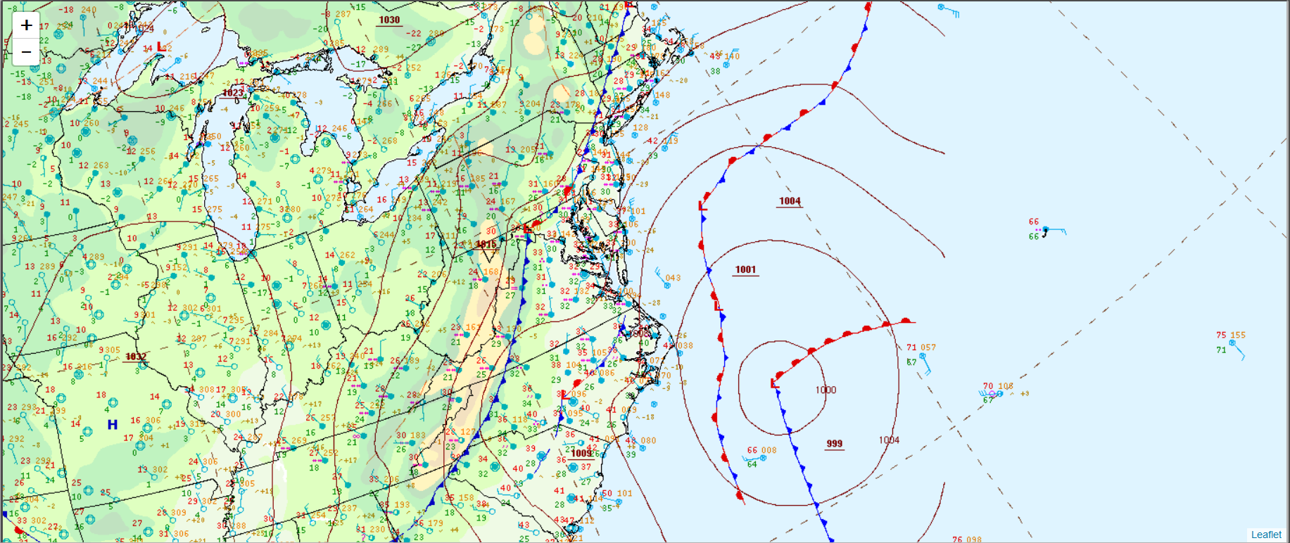
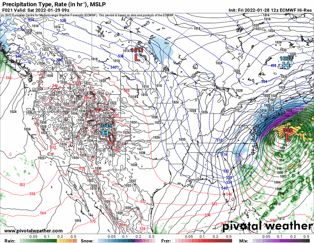
The storm is still all strung-out near the Carolinas. WPC issued a surface map about 15 minutes ago (timed at 4:47 am UTC/11:47 pm ET)
-
January 28th/29th Event Obs - From KU to FU?
Hurricane Agnes replied to JTA66's topic in Philadelphia Region
Currently fine-flaked SN and 29 with dp 28. Have about 1.5" out there (ballparked). ETA - treated streets and walks have now caved.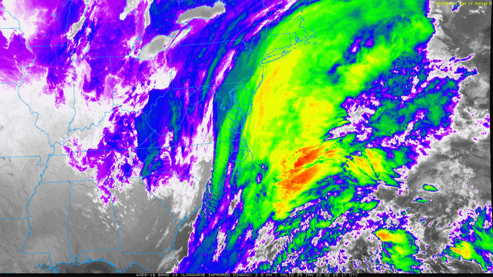
-
January 28th/29th Event Obs - From KU to FU?
Hurricane Agnes replied to JTA66's topic in Philadelphia Region
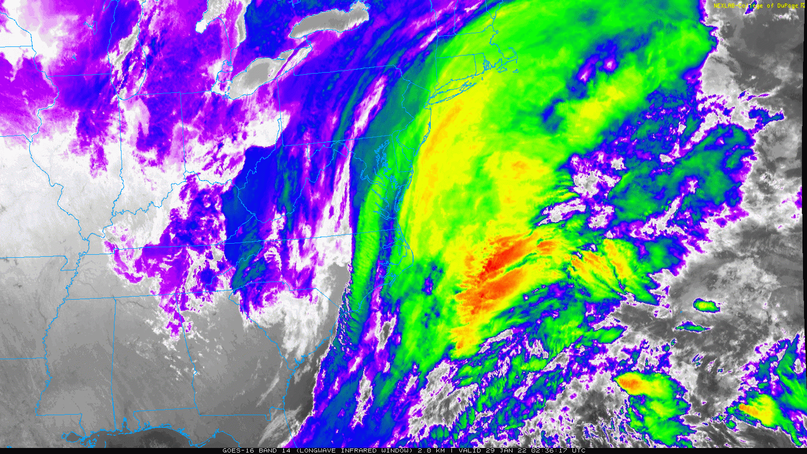
LWIR of the intensification and you can actually see the digging trough.
-
January 28th/29th Event Obs - From KU to FU?
Hurricane Agnes replied to JTA66's topic in Philadelphia Region
WPC retweeted NWS Boston's radar animation of what looks like a water vapor/cloud image showing the intensification happening (and I saw of some "low" because the "lows" have been plentiful with this thing ) - -
January 28th/29th Event Obs - From KU to FU?
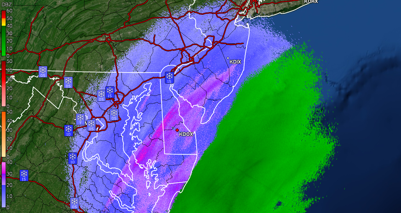
Hurricane Agnes replied to JTA66's topic in Philadelphia Region
View from KDOX.
-
January 28th/29th Event Obs - From KU to FU?
Hurricane Agnes replied to JTA66's topic in Philadelphia Region
It runs every hour so if you don't like a run, wait for the next one. Currently 30 here with dp 29 and colder parts of the streets are starting to cave. Despite the marginal surface temps, the snow is actually fine and would be about SN level. It's interesting that the current band that goes back to about Lancaster County, has been basically sitting over the area from there to the coast for the past 5 hours or so. I do see a R/S line not far off the coast though so not sure what will happen with that. -
January 28th/29th Event Obs - From KU to FU?
Hurricane Agnes replied to JTA66's topic in Philadelphia Region
Currently getting some variable SN- to SN from a band that has been overhead and had a heavier return (attached in this post) that moved through briefly and added a coating back to the bare cars and colder/untreated surfaces where there was snow melt/evaporation. It is below freezing now at 31 with dp 28.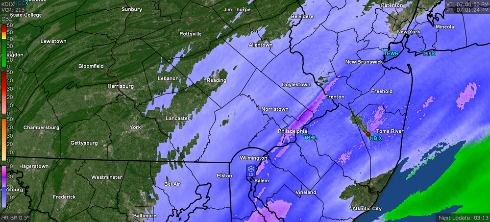
-
January 28th/29th Event Obs - From KU to FU?
Hurricane Agnes replied to JTA66's topic in Philadelphia Region
I have been talking about the "dance of the lows" the past couple days. And the models were depicting the do si do and other dance moves up the coast. -
January 28th/29th Event Obs - From KU to FU?
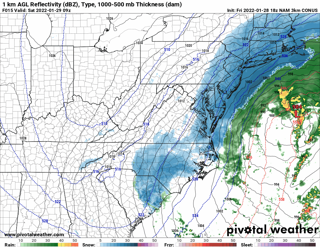
Hurricane Agnes replied to JTA66's topic in Philadelphia Region
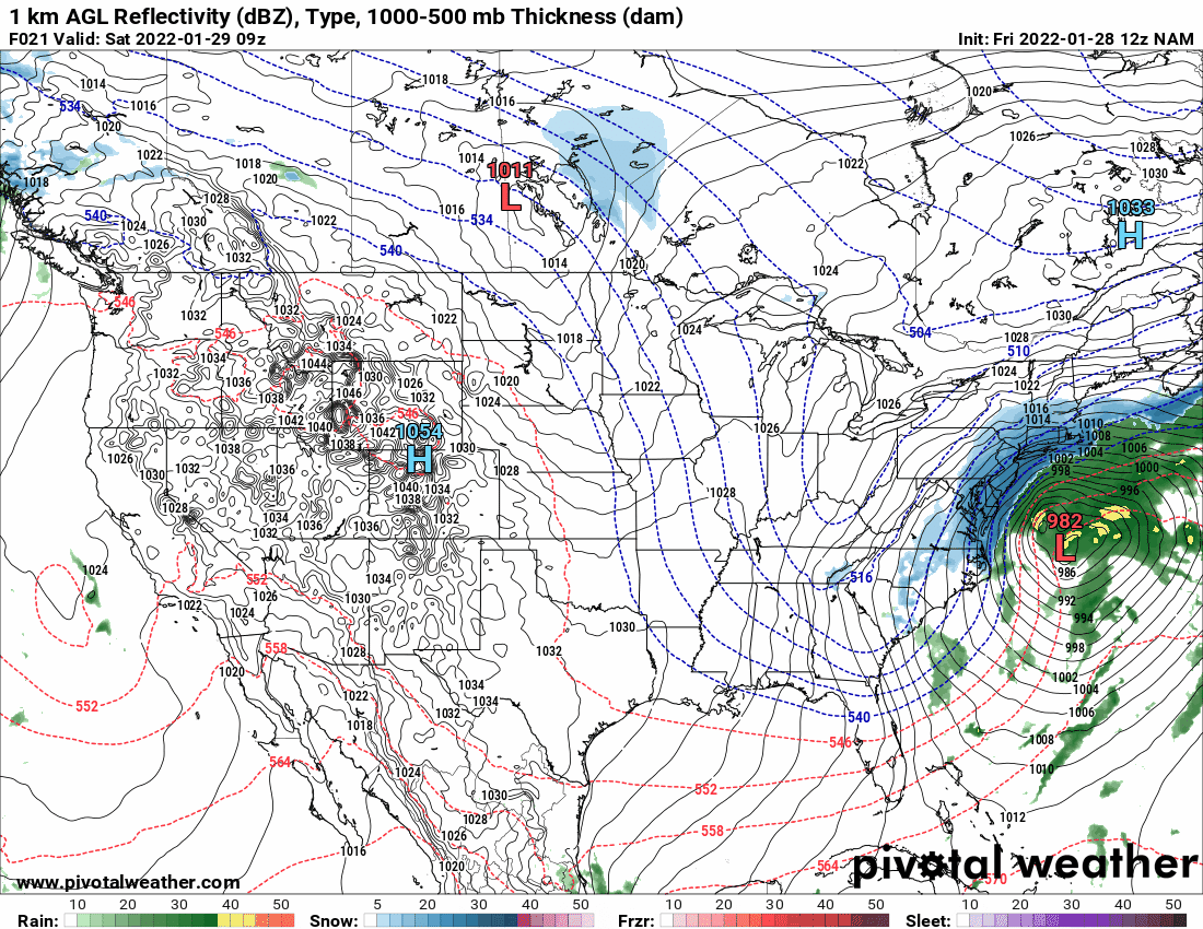
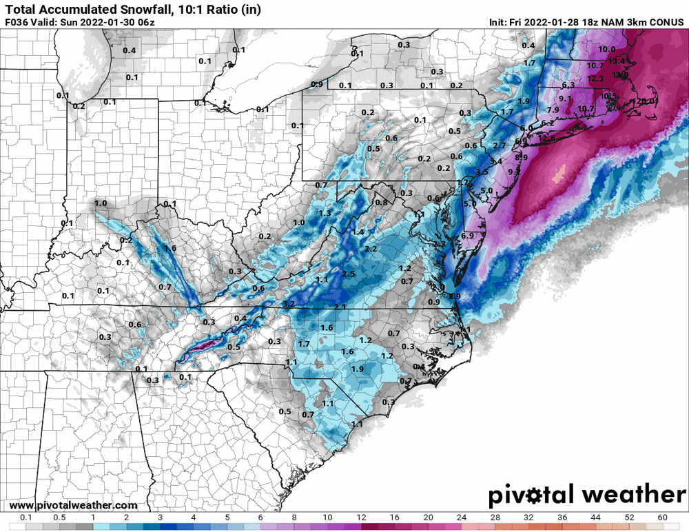
Ahh okay... missed that. As an obs, currently 32 with dp 28 and except for grassy/mulched areas, the 0.5" of snow that I got from round 1 (PRE) is gone. Am attaching the 18z 3k NAM.
-
January 28th/29th Event Obs - From KU to FU?
Hurricane Agnes replied to JTA66's topic in Philadelphia Region
IMHO a 4" - 8" (W --> E) in the I-95 corridor might still be a good call although I think Mt. Holly gave it a wider range initially - 4 - 11". -
January 28th/29th Event Obs - From KU to FU?
Hurricane Agnes replied to JTA66's topic in Philadelphia Region

-
January 28th/29th Event Obs - From KU to FU?
Hurricane Agnes replied to JTA66's topic in Philadelphia Region
Just hitting 32 now with dp 29 and the higher dbz band just went poof as it moved to the NE of me. So the melting of what I got so far has commenced while the sky is getting brighter (although no sun at this point). -
January 28th/29th Event Obs - From KU to FU?
Hurricane Agnes replied to JTA66's topic in Philadelphia Region
Latest tweet from Mt. Holly - -
January 28th/29th Event Obs - From KU to FU?
Hurricane Agnes replied to JTA66's topic in Philadelphia Region
Am in a pixie dust pause at the moment, so nothing being added to my 0.5". However a little band with some heavier returns appears to be headed this way so will see what happens. Currently 31 with dp 28. I actually have some melt that tipped the bucket in my station for 0.01" (have the Stratus out with funnel and inner tube removed to collect whatever it captures to do a SWE if I'm up to it). -
January 28th/29th Event Obs - From KU to FU?
Hurricane Agnes replied to JTA66's topic in Philadelphia Region
The "stall" is that other low and the "low dance"!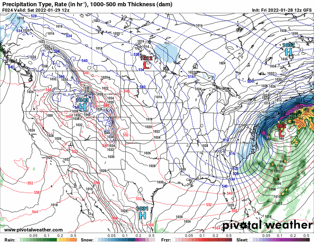
-
January 28th/29th Event Obs - From KU to FU?
Hurricane Agnes replied to JTA66's topic in Philadelphia Region
For the past week, the models have briefly shown some low scooting off the southern Florida coast and then "disappearing" while a new low forms off the coast of the Carolinas. As time went on, the Florida low would make "an appearance" and then the 2 lows seemed to be doing a waltz, the two cheek to cheek and jowl to jowl, while each one seemingly wanted to "take the lead" and yank the other in the opposite direction (either to the east or to the west) in the models, as they crawled up the coast. Sorry for my wild description but when you animate the runs, the "low(s)" just jump(s) around east/west/east/west wildly. As an obs, I am currently 30 with SN and dp 27. Looks like I have about 1/2" so far but there seems to be some insolation going on because there is some melting/evaporation despite the temps being below freezing. The wind is pretty light too so far so it's not blowing around. -
January 28th/29th Event Obs - From KU to FU?
Hurricane Agnes replied to JTA66's topic in Philadelphia Region
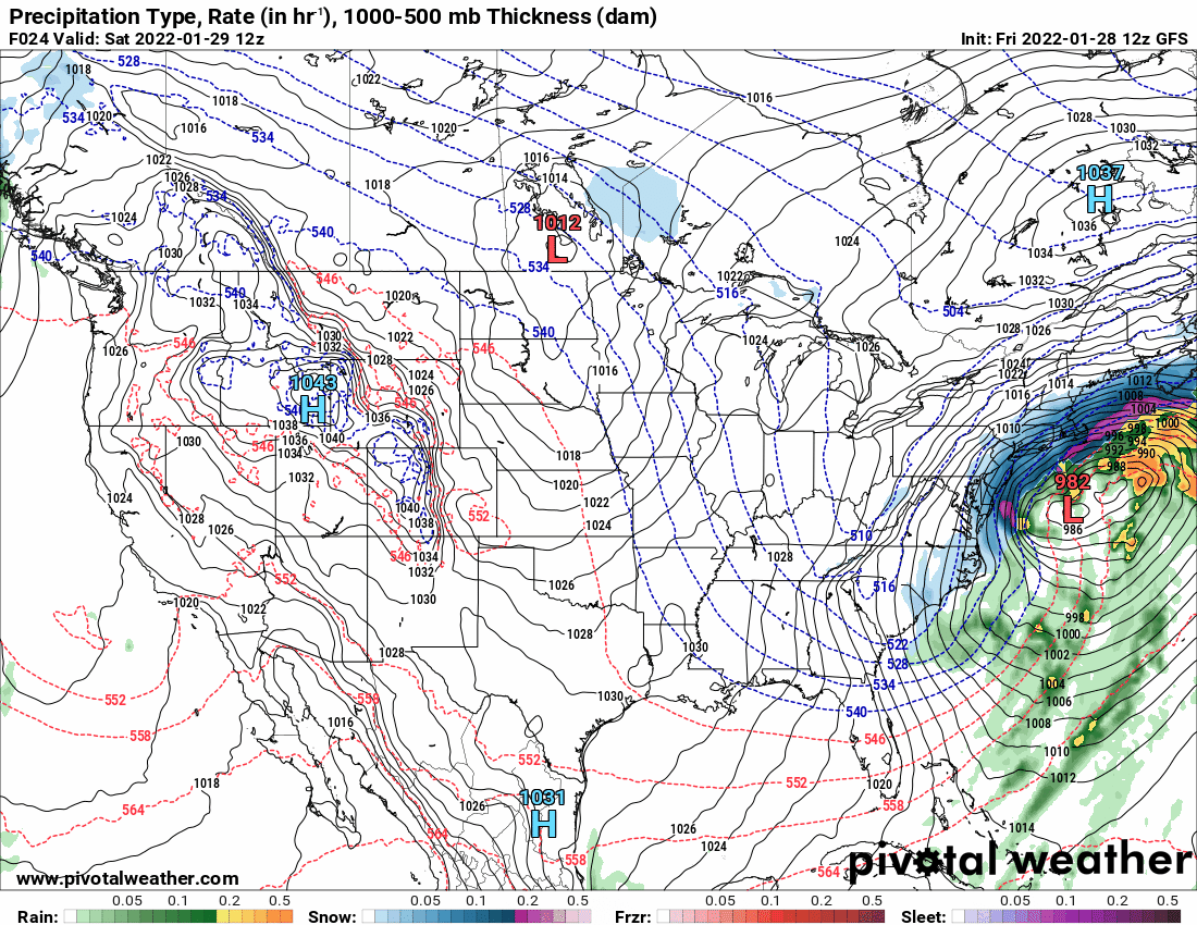
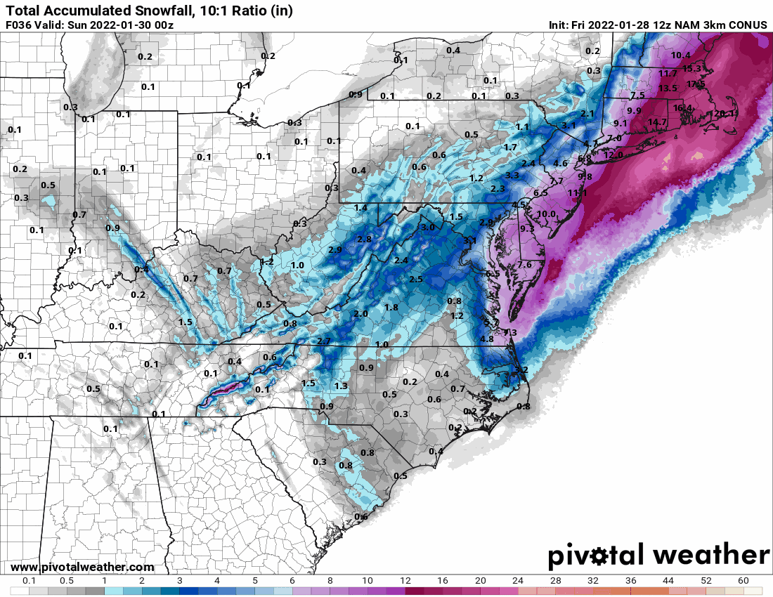
You are welcome and here is the 3K NAM!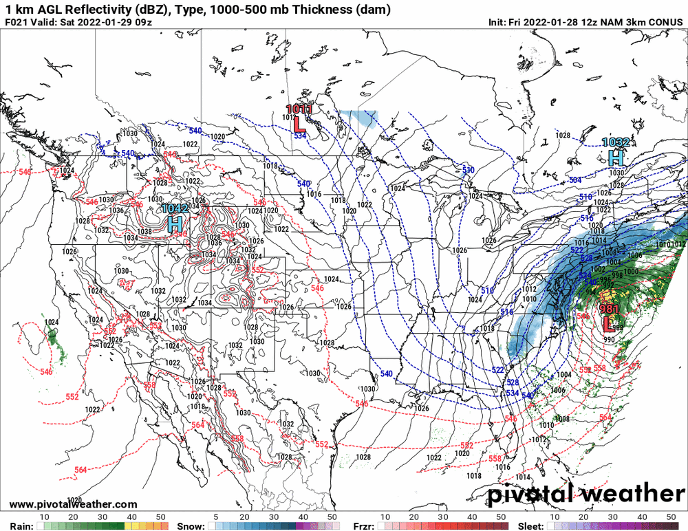
-
January 28th/29th Event Obs - From KU to FU?
Hurricane Agnes replied to JTA66's topic in Philadelphia Region
Obs of PRE - currently SN- but slightly bigger flakes and temp 28/dp 24. Have a light coating now including on grassy surfaces (although the grass is still clearly visible). -
January 28th/29th Event Obs - From KU to FU?
Hurricane Agnes replied to JTA66's topic in Philadelphia Region
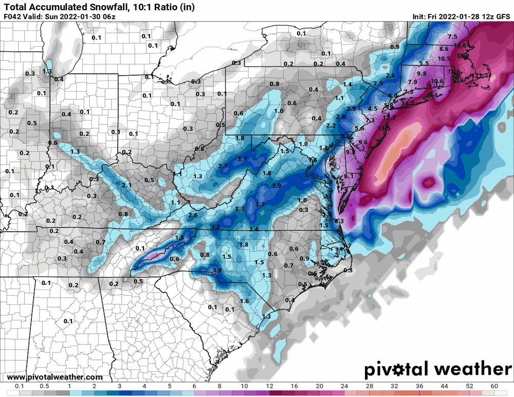
12z NAM looks tucked early on.
-
January 28th/29th Event Obs - From KU to FU?
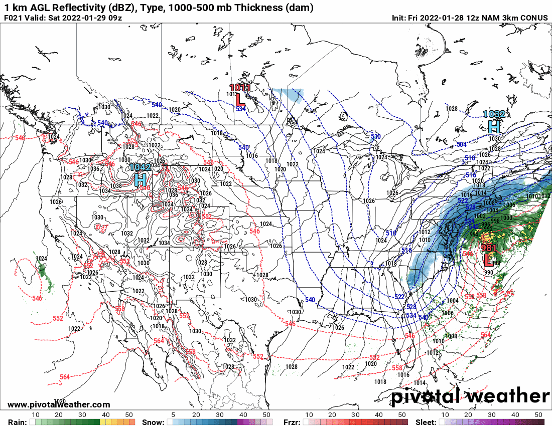
Hurricane Agnes replied to JTA66's topic in Philadelphia Region
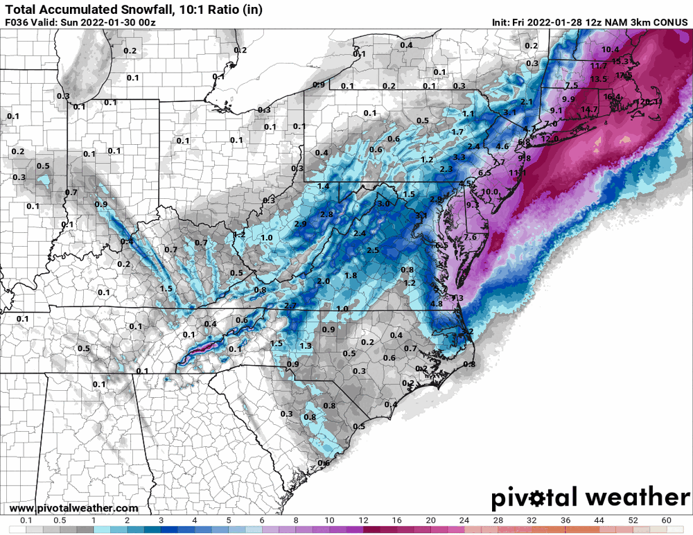
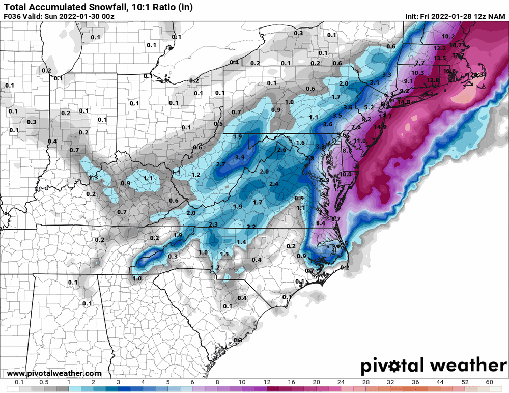
Thank you. 12z NAM is running so will post something once more panels are up.