Hurricane Agnes
-
Posts
9,264 -
Joined
Content Type
Profiles
Blogs
Forums
American Weather
Media Demo
Store
Gallery
Everything posted by Hurricane Agnes
-
E PA/NJ/ DE Winter 2021-22 OBS Thread
Hurricane Agnes replied to JTA66's topic in Philadelphia Region
Am under that little line of heavier precip (1/3rd in/hr so far) and am up to 0.29" with steady rain. Temp holding at 55. -
E PA/NJ/ DE Winter 2021-22 OBS Thread
Hurricane Agnes replied to JTA66's topic in Philadelphia Region
There are still some Kamu-sized plowed mounds around that are about to become glaciers, but just looked and yeah, almost all (except for some patches here and there in shady/north-facing areas) is gone. -
E PA/NJ/ DE Winter 2021-22 OBS Thread
Hurricane Agnes replied to JTA66's topic in Philadelphia Region
WPC's outlook - -
E PA/NJ/ DE Winter 2021-22 OBS Thread
Hurricane Agnes replied to JTA66's topic in Philadelphia Region
Last briefing issued by Mt. Holly - Currently holding at 54 (EDIT - just ticked up to 55) here in NW Philly with dp 54. Got a couple hundreds more of rain and am up to 0.24" for the day (total 0.67" for the 2-day event). Looks like there is a heavier band pushing down this way from the NW.
-
E PA/NJ/ DE Winter 2021-22 OBS Thread
Hurricane Agnes replied to JTA66's topic in Philadelphia Region
Ended up with 0.43" of rain yesterday with a non-diurnal high of 51 around 11:30 pm last night. Have 0.20" additional rain this morning (total 0.63 for the 2-day event) with current temp 54 and dp the same. Am in a brief precipitation lull at the moment with scattered returns nearby on radar. -
E PA/NJ/ DE Winter 2021-22 OBS Thread
Hurricane Agnes replied to JTA66's topic in Philadelphia Region
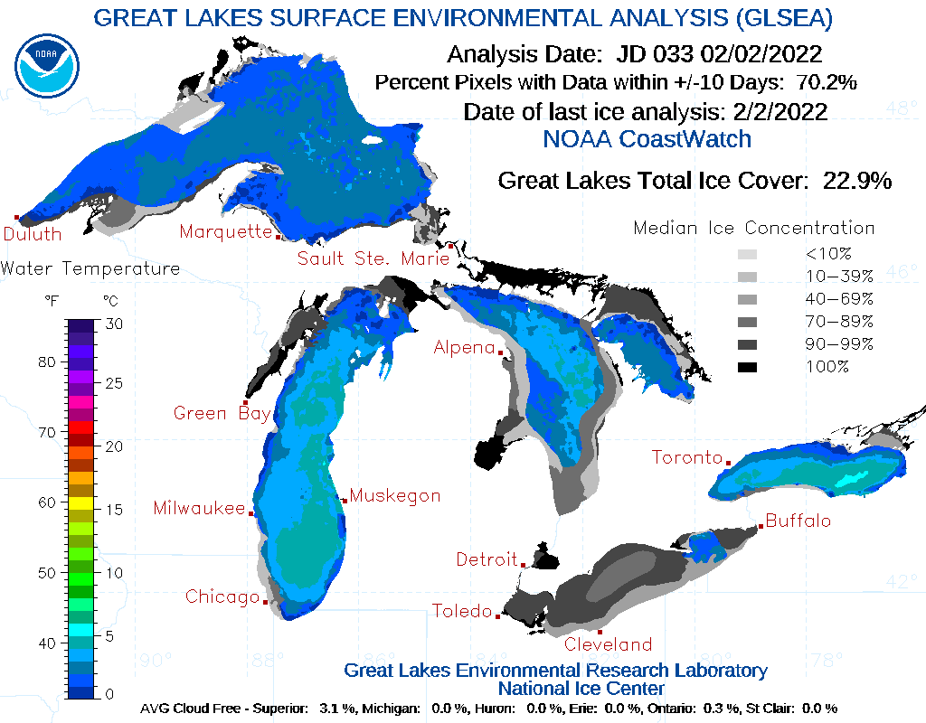
February IS the shortest month! I was just looking at what the Great Lakes ice coverage has been considering the recent arctic intrusions and some significant double digit below 0 lows in the upper MW this morning and found that it looks like Lake Erie is mostly frozen over (but not so much the bigger lakes), so at least for PA, that would pretty much shut off the lake effect machine. Am currently still holding at 46 with dp 46 and periodic light rain (now up to 0.35").
-
E PA/NJ/ DE Winter 2021-22 OBS Thread
Hurricane Agnes replied to JTA66's topic in Philadelphia Region
The old threads are still around in this forum. For example, one in early January (my birthday..lol) where an Advisory was lofted for the CWA - Another featuring a sleet-fest - VD storm with 2 rounds including sleet - If you go back to pgs 18 and 19 all the glory of that is there. My temp shot up to 46 and now the fog is back and getting worse. Am also getting some occasional light rain. When I was clearing the snow off my car from the last storm, I saw some robins running along my walk and hopping over a few shoveled show chunks in their way. I know some have started staying year round but growing up, they used to pretty much migrate and when you saw them again, they were "the harbinger of spring". -
E PA/NJ/ DE Winter 2021-22 OBS Thread
Hurricane Agnes replied to JTA66's topic in Philadelphia Region
That 2014 ice storm that ended up on top of some of the snowpack that we got that season, was enough to take out my mom's 60-some year old aluminum back patio cover (it had been there when we moved there and was supported by wrought iron supports that were carefully maintained and periodically painted with Rust-Oleum over the years). The freeze/thaw/freeze of the snow that collected on it coupled with the ice was too much and the thing collapsed in the center (it was difficult to even try to get a ladder against it to remove some of the glacial snow/ice pack on it). That cover was great because so many Memorial Days we would end up with rain and we would just roll the BBQ grill onto the patio (which had that cover but was open-air) and grill up some good eats. The storm also took out many white pines in the area and was pretty rough for those who had rows of them planted as a "privacy fence" (particularly a friend of mine whose backyard was adjacent to a school field). I am sure the arborists and other tree removal people had a record year. As an obs, I had a low of 39 this morning and am currently up to 44 with dp the same, intermittent light rain, and 0.13" in the bucket. -
E PA/NJ/ DE Winter 2021-22 OBS Thread
Hurricane Agnes replied to JTA66's topic in Philadelphia Region
Back around 1977 was what I call the "glacial" year. I was in high school at the time riding 2 SEPTA buses to get to school and had to get off one of the bus lines ("H" bus) and walk to the top of the hill where the route ran at the time (since changed), and then get back on because the bus couldn't go up without sliding back down. There were also times when the bus never came and only finally showed up late or was detoured, and we had to find where to get on. That was the year of the layering (long johns, turtle necks, wool sweaters, double socks, puffy down jackets, and so forth). In fact, just found this from the Inky about that year - specifically January - https://www.inquirer.com/philly/blogs/weather/Very-Big-Chill-The-month-that-froze-Philly.html I remember counting something like 17 ice storms in 1993 - 1994 (starting I think in December and going through to March). It was a nightmare but also agree that it is not a common event here (thankfully). One of those ice storms took down an old red cedar tree at my mother's house, between her property and her neighbor's (it had been there when we had moved there in 1968). It was at least 30ft tall and the way it was positioned, it uprooted and fell forward across the front, landing on the central walkway and some of the front hedges, and extended partway into the street. Luckily the way it fell, it was in between the parked cars. She also lost power during that storm. I think it's because Philly metro is "relatively close" to the ocean when compared to some of the places like western NC, that tend to get some nasty ice storms on a more regular basis. -
E PA/NJ/ DE Winter 2021-22 OBS Thread
Hurricane Agnes replied to JTA66's topic in Philadelphia Region
Made it up to 46 today and it has clouded up and is 40 with dp 37. There is some fleeting stuff that has been appearing on the radar the past couple hours. 18z Euro still keeping it rain down in the Philly metro area.
-
E PA/NJ/ DE Winter 2021-22 OBS Thread
Hurricane Agnes replied to JTA66's topic in Philadelphia Region
Digging around the point-and-click up that way, those Winter Storm Watches are underneath the Dense Fog advisories and the ones "visible" further north were issued by NY (Binghamton FO). Since they are further north of you, they would get the icing a bit earlier and they are not set to go into effect until "late Thursday". The "flash freeze" afterwards may be something that impacts much of the area including down here in Philly metro, and it might be easier to do a wider Advisory when that time comes. Am thinking a couple more runs might help get the models into more agreement regarding the timing of the cold. -
E PA/NJ/ DE Winter 2021-22 OBS Thread
Hurricane Agnes replied to JTA66's topic in Philadelphia Region
I think since the timing of that event is not until later tomorrow, the more immediate concern for any travel is the Dense fog and thus the advisory that goes into effect tonight (including the LV where Carbon and Monroe are not under that) - Once they are closer to the winter weather event, they can loft a short-fused Advisory where necessary. This keeps the immediate hazards sequential. The icing event verbatim from the colder GFS (18z) doesn't appear to start until the early commute time where the fog will already be pretty rough by then.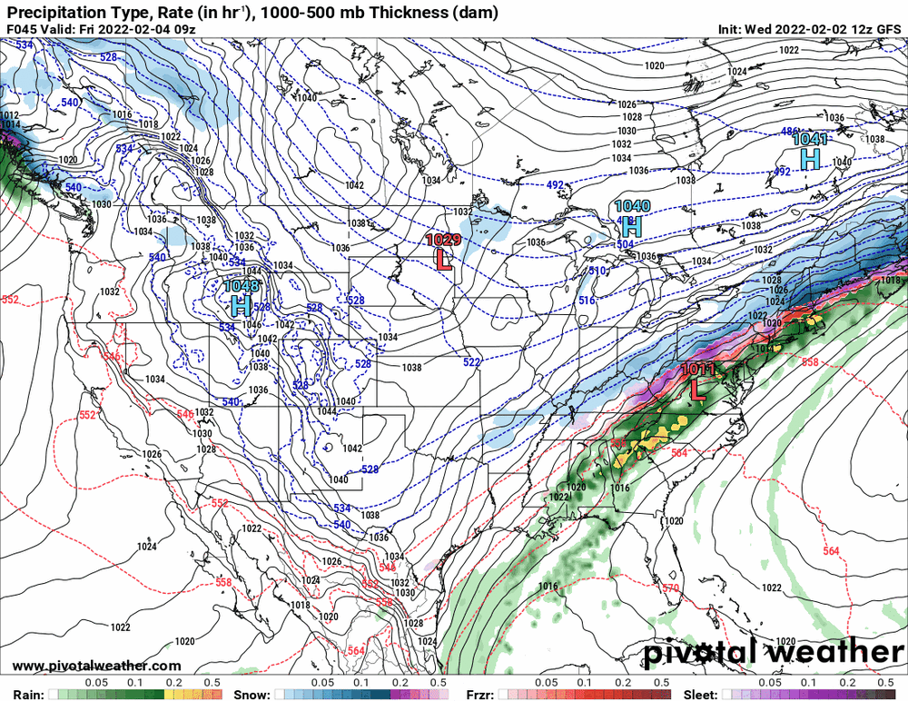
-
E PA/NJ/ DE Winter 2021-22 OBS Thread
Hurricane Agnes replied to JTA66's topic in Philadelphia Region
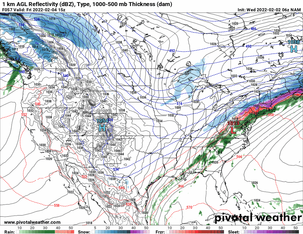
I think that is based off the GFS (its next generation). The 12z 3k NAM does show a bit of icing over the metro area before drying it up.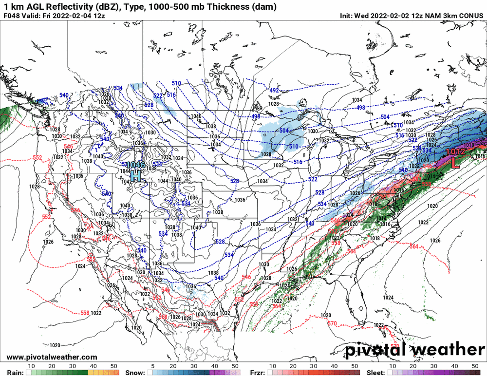
-
E PA/NJ/ DE Winter 2021-22 OBS Thread
Hurricane Agnes replied to JTA66's topic in Philadelphia Region
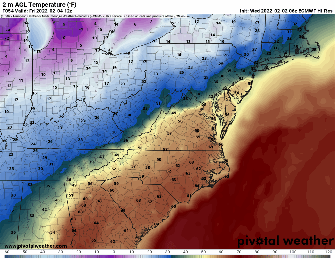
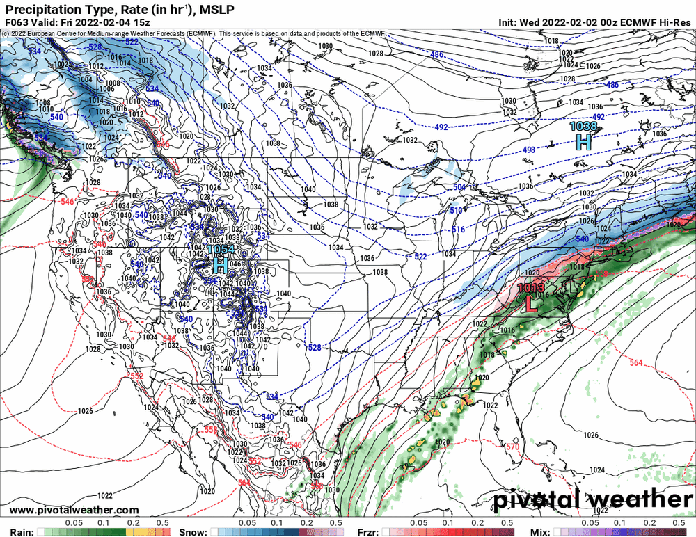
12z Euro is doing like the Canadian but even more so - basically just drying the precip up once it gets down to the metro Philly are with just a little mix at the end. Am currently up to 41 now with dp 37.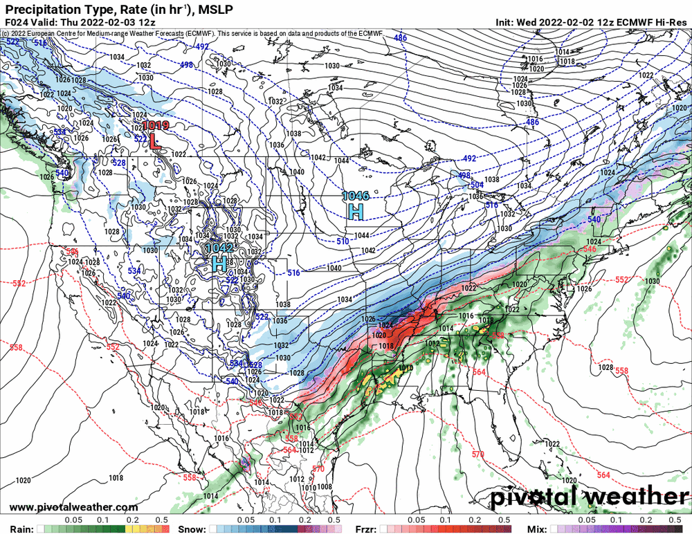
-
E PA/NJ/ DE Winter 2021-22 OBS Thread
Hurricane Agnes replied to JTA66's topic in Philadelphia Region
I am going to put my windshield cover back on my car later today once the car dries off some... just in case. -
E PA/NJ/ DE Winter 2021-22 OBS Thread
Hurricane Agnes replied to JTA66's topic in Philadelphia Region
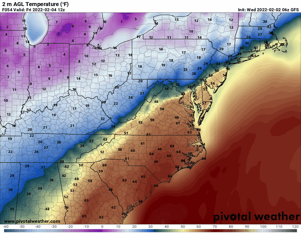
12z GFS still going with a somewhat prolonged icing situation to finish up with some snow. The Canadian is warming up around the metro Philly area and keeping it mostly rain with a little mix.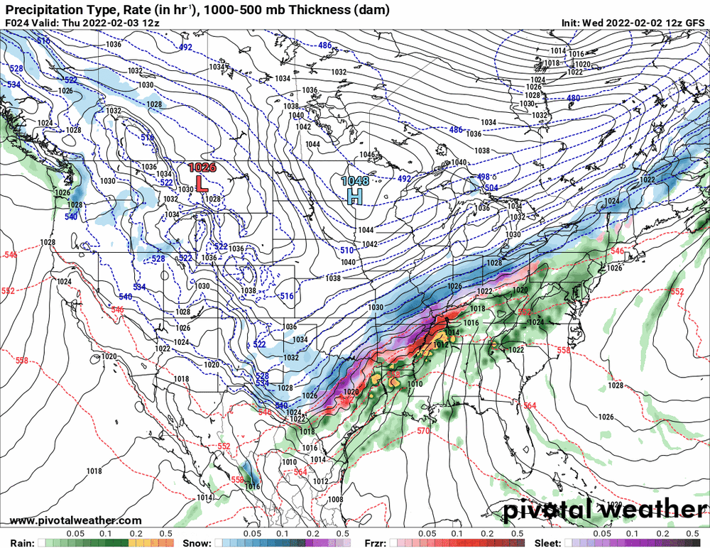
-
E PA/NJ/ DE Winter 2021-22 OBS Thread
Hurricane Agnes replied to JTA66's topic in Philadelphia Region
Sun finally popped out and the fog lifted once the temps finally went above freezing. Bottomed out at 23 this morning and have briefly touched 40 but am currently partly sunny and 39 with dp 35. -
E PA/NJ/ DE Winter 2021-22 OBS Thread
Hurricane Agnes replied to JTA66's topic in Philadelphia Region
Both the 6z Euro and GFS even had temps in those ranges at that time frame.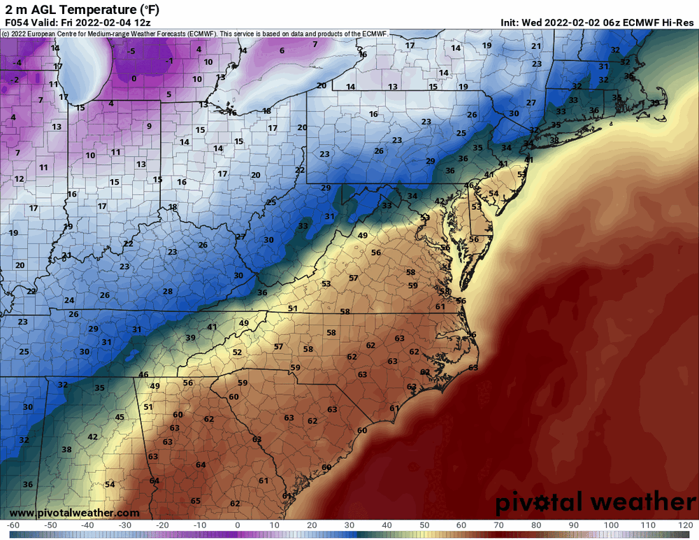
-
E PA/NJ/ DE Winter 2021-22 OBS Thread
Hurricane Agnes replied to JTA66's topic in Philadelphia Region
Mt. Holly had lofted a Dense fog advisory for the Philly metro area and also had a mention of freezing fog earlier (although where I am in Philly with below 32 temps currently at 30, it's freezing on the cars and colder surfaces. The streets and walks are treated but there was obviously some snow melt yesterday with the temps. -
E PA/NJ/ DE Winter 2021-22 OBS Thread
Hurricane Agnes replied to JTA66's topic in Philadelphia Region
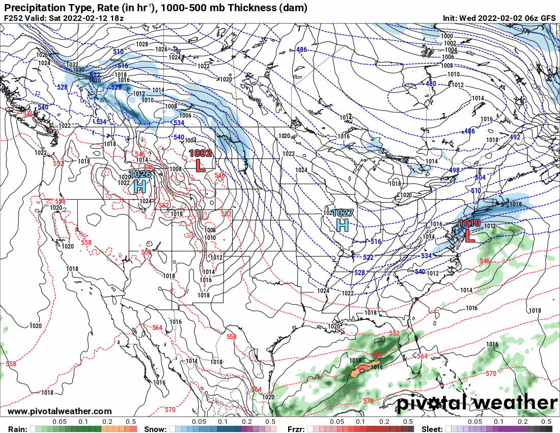
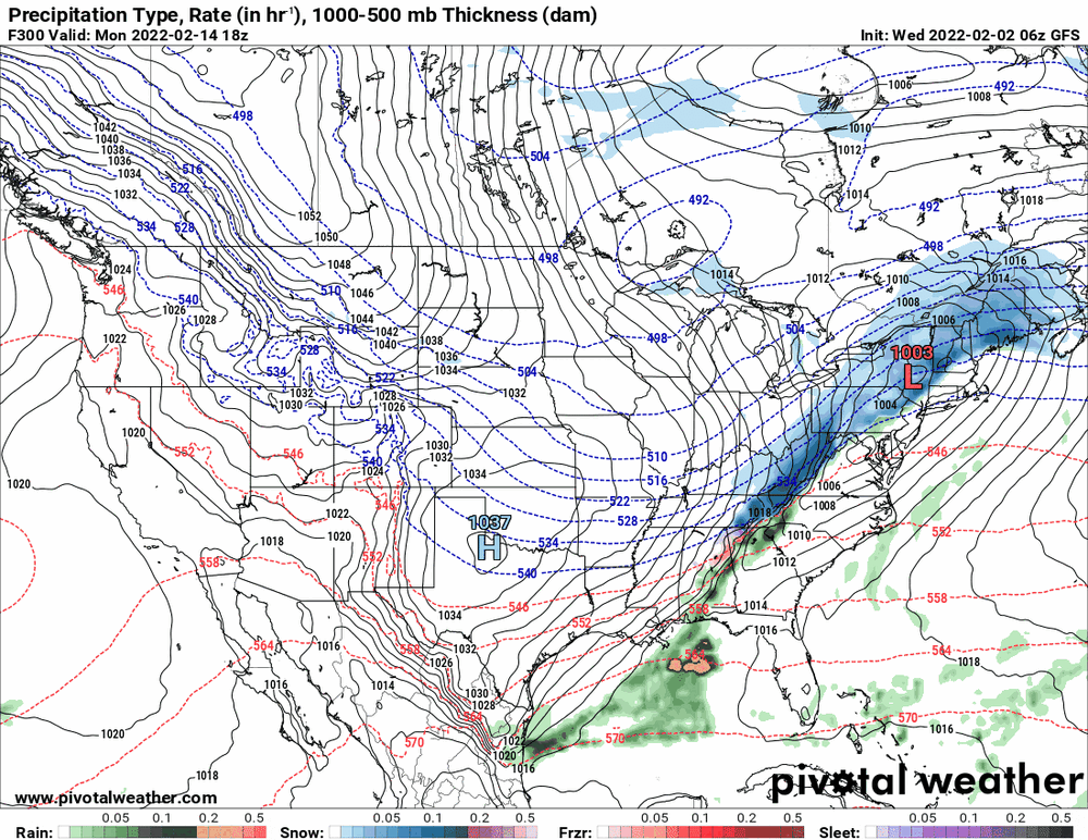
There are a couple more on the GFS long range including a pre-Valentine's scoot-by and on Valentine's Day frontal passage/apps runner.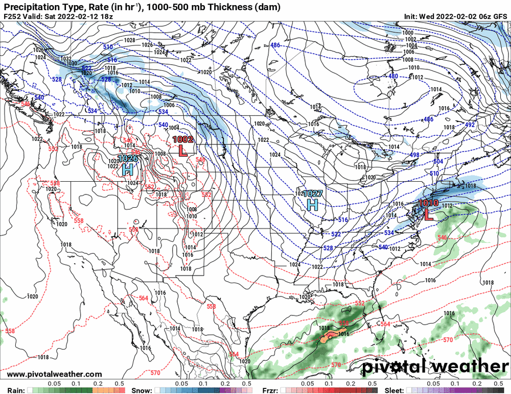
-
E PA/NJ/ DE Winter 2021-22 OBS Thread
Hurricane Agnes replied to JTA66's topic in Philadelphia Region
6z Euro warms the column and keeps it rain into Philly metro.
-
E PA/NJ/ DE Winter 2021-22 OBS Thread
Hurricane Agnes replied to JTA66's topic in Philadelphia Region
Well Punxsutawney Phil gave a nod to this subforum. 6 more weeks of winter. -
E PA/NJ/ DE Winter 2021-22 OBS Thread
Hurricane Agnes replied to JTA66's topic in Philadelphia Region
An obs and although progged, I guess I didn't expect it - have some stratus and (freezing) fog settling in with vis < 1/4 mile or so). And yes, it's currently below freezing here with temp 27 (27.3) and dp the same (26.8). -
E PA/NJ/ DE Winter 2021-22 OBS Thread
Hurricane Agnes replied to JTA66's topic in Philadelphia Region
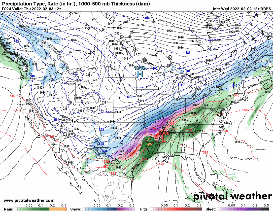
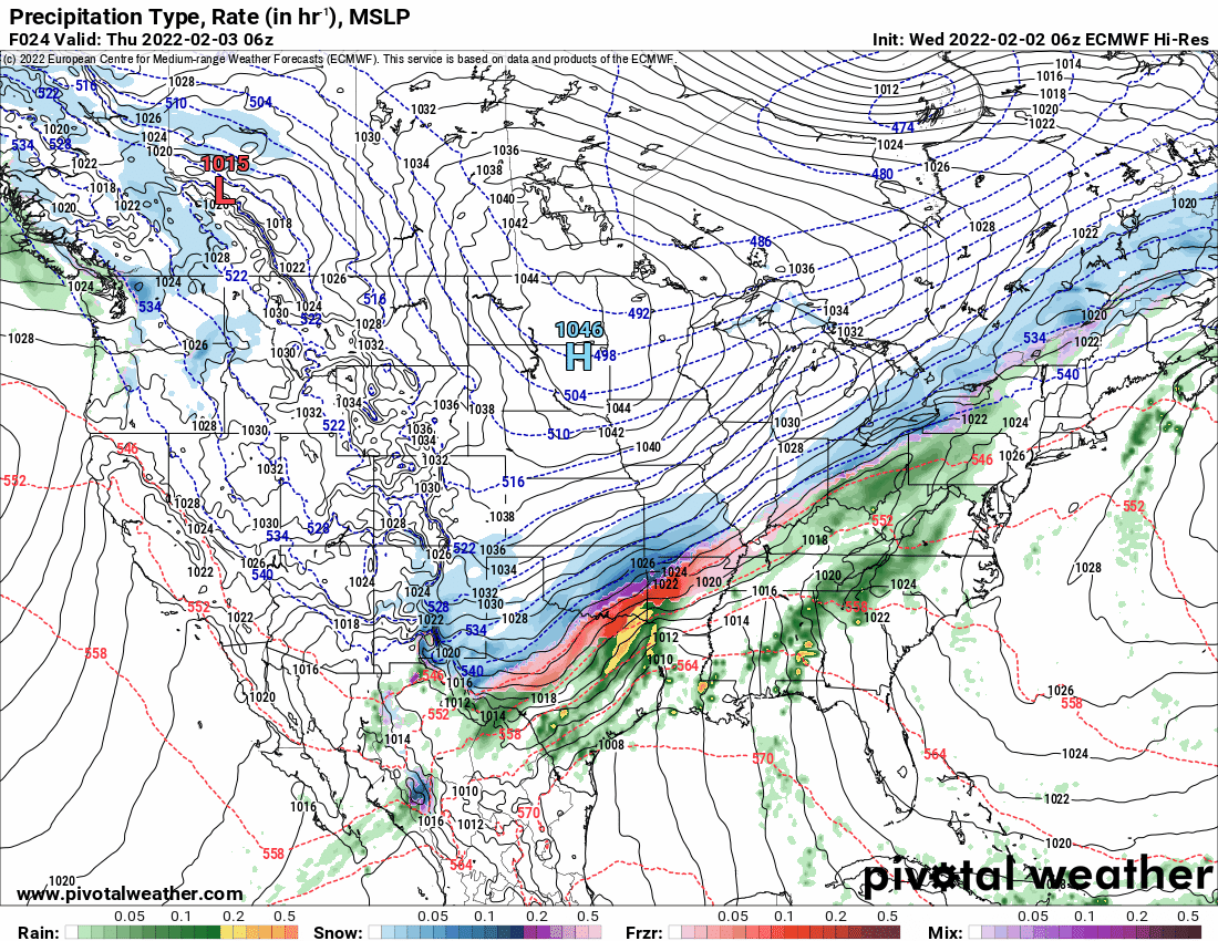
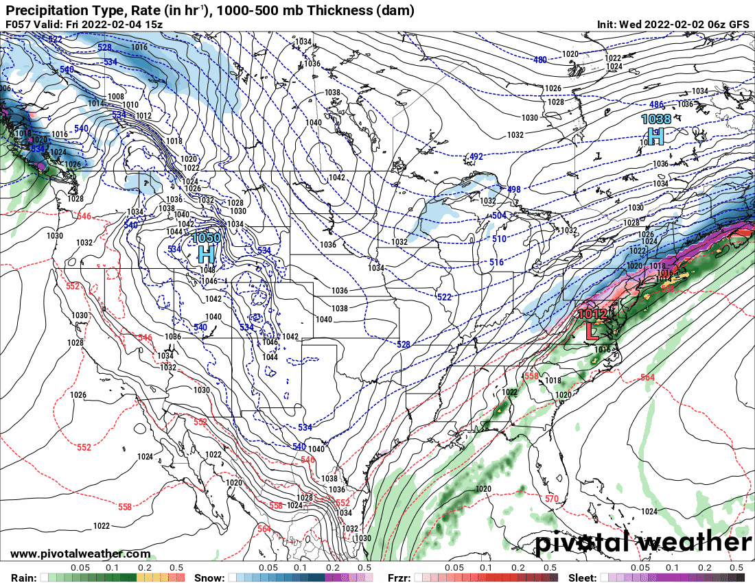
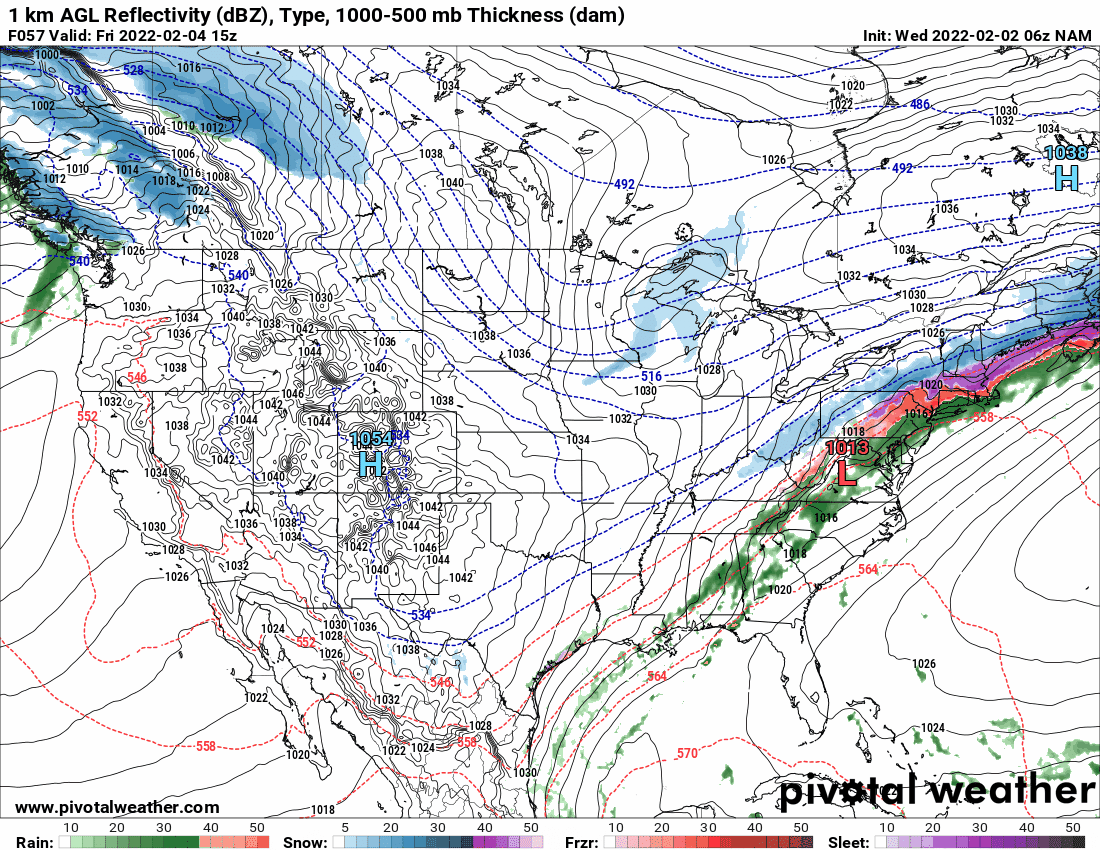
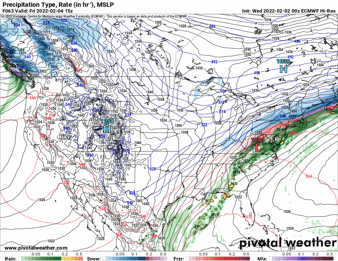
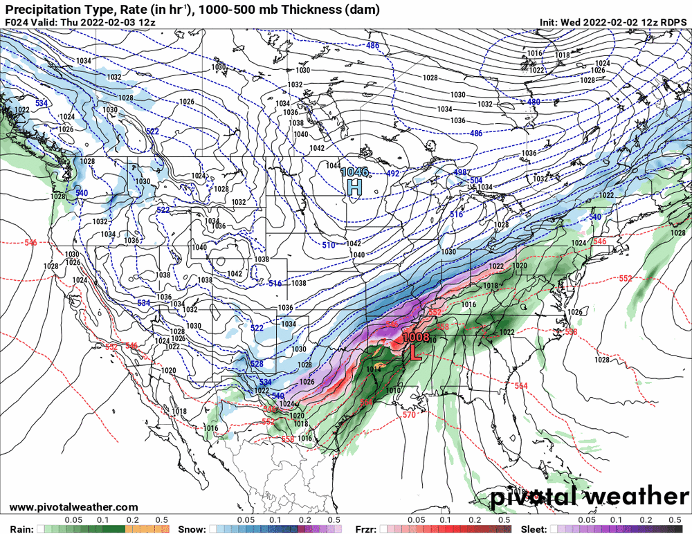
Interesting (and I think Mike suggested this in the AFD) that both the 6z NAM and 0z Euro are generally keeping tomorrow's event as generally rain along the the southern I-95 corridor, shunting the ice/snow across north of that area, where the 6z GFS shows more mix/ice as far south as Philly during the same time frame ("colder").
-
E PA/NJ/ DE Winter 2021-22 OBS Thread
Hurricane Agnes replied to JTA66's topic in Philadelphia Region
As an obs, after a low of 20 this morning, I did make it up to 37 and am currently back down to 30 with dp 25.