Hurricane Agnes
-
Posts
9,264 -
Joined
Content Type
Profiles
Blogs
Forums
American Weather
Media Demo
Store
Gallery
Everything posted by Hurricane Agnes
-
Mt. Holly afternoon update -
-
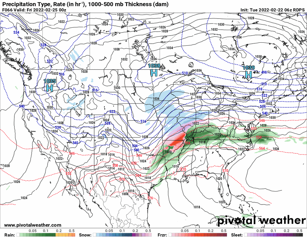
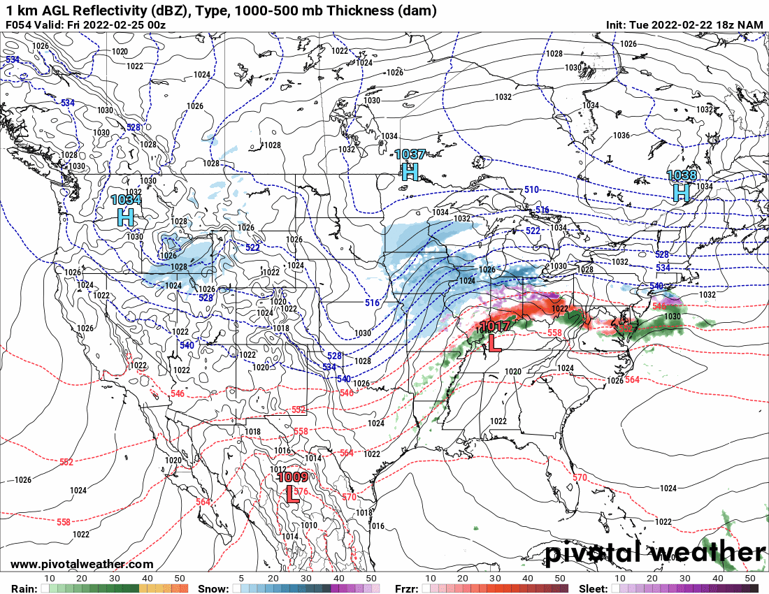
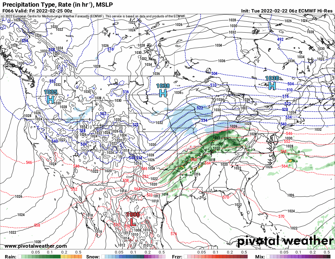
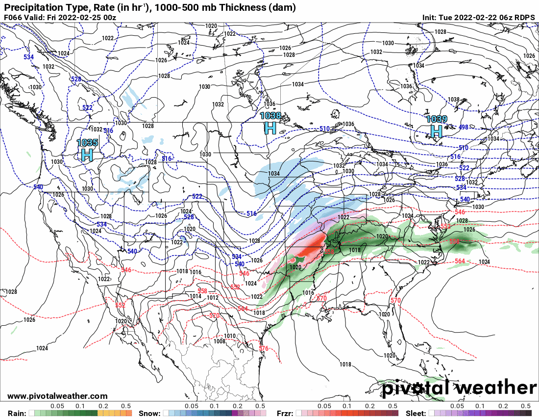
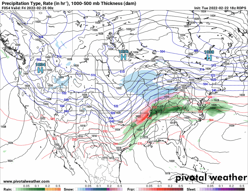
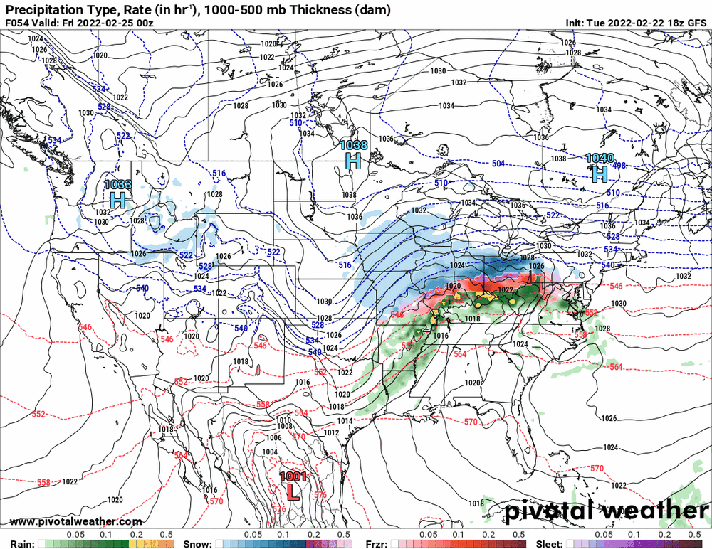
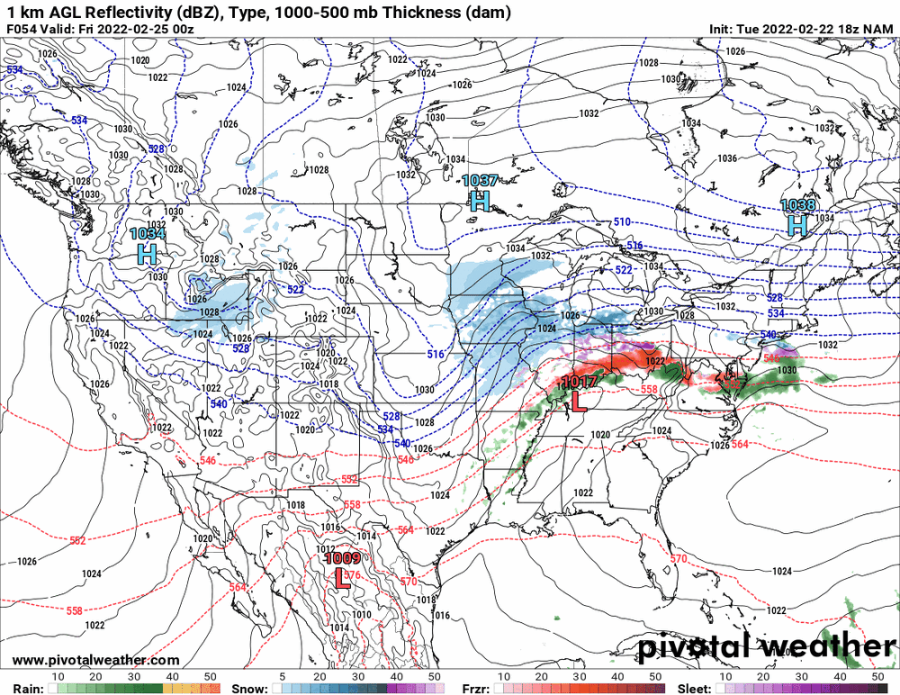
NAM still stands alone as the Euro holds tight.

-
While the 18z is running the RGEM holds its ground.
-
E PA/NJ/ DE Winter 2021-22 OBS Thread
Hurricane Agnes replied to JTA66's topic in Philadelphia Region
Hit 59 as a high today (so far as the temps have been up and down with the rain). The low was 38 and it's currently 56 with light rain, 0.16" in the bucket, and dp 55. -
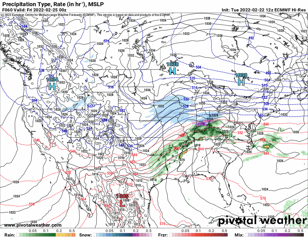
18z GFS still standing it's ground although dries up at the end.
-
18z NAM still dryslotting.
-
Here was Mt. Holly's take a few hours ago -
-
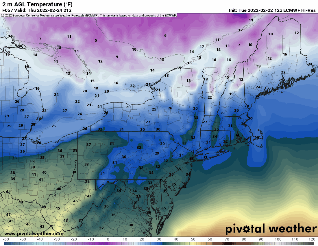
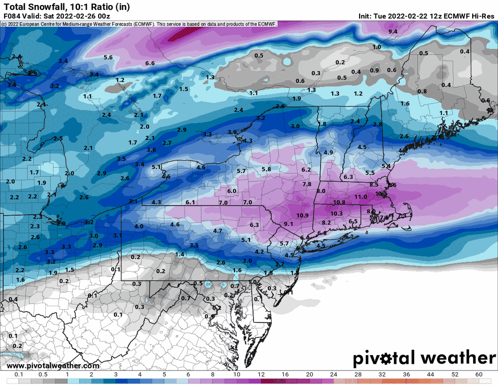
Was looking at the EC's temps for the period. It's gonna depend on where the warm sector ends up and who gets under it.

-
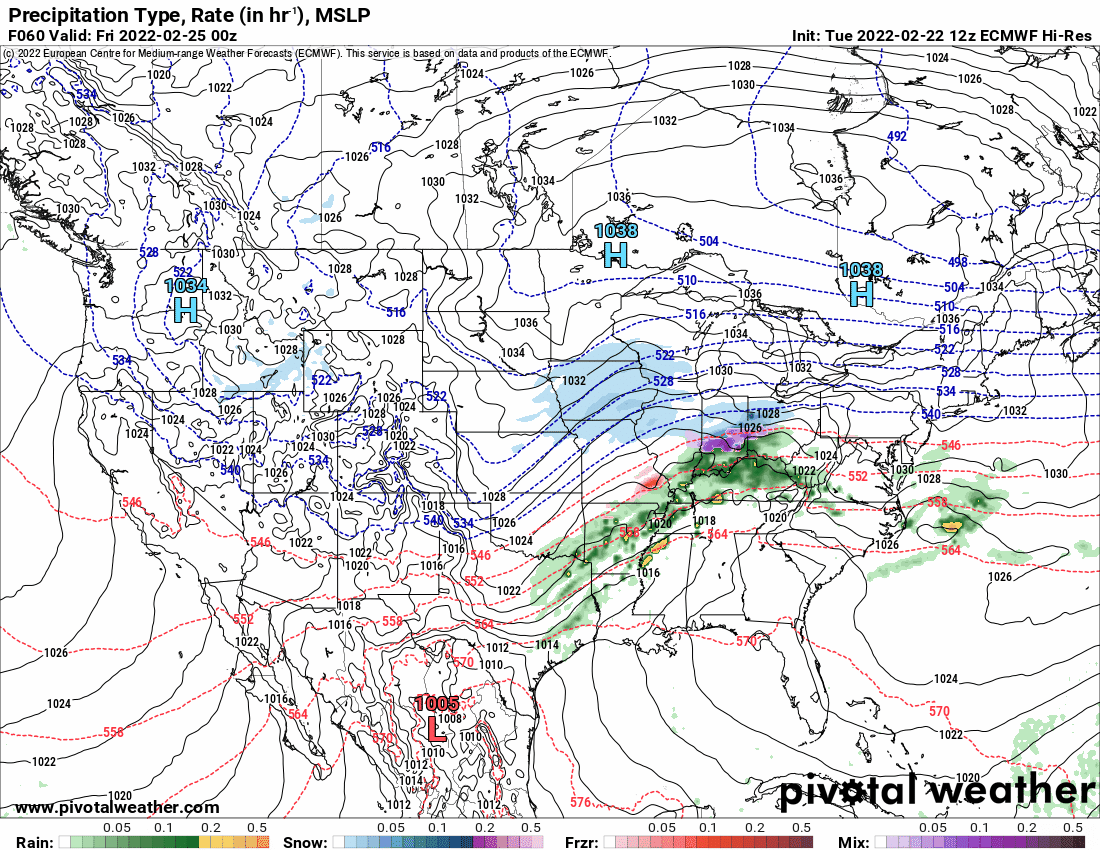
12z Euro looks real ugly.

-
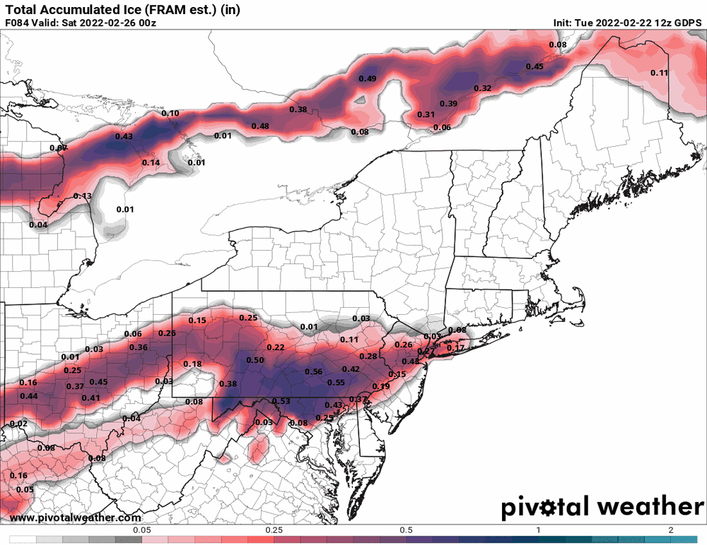
The Ukie doesn't seem to distinguish so am guessing it would be something that could include sleet/IP, etc.
-
EC has started so will soon see which way it goes! The Ukie did throw some snow down this way.

-
E PA/NJ/ DE Winter 2021-22 OBS Thread
Hurricane Agnes replied to JTA66's topic in Philadelphia Region
LOL -
E PA/NJ/ DE Winter 2021-22 OBS Thread
Hurricane Agnes replied to JTA66's topic in Philadelphia Region
NBM trying to keep it real with the ice and throws some snow up north (might be weighted more to the NAM solution).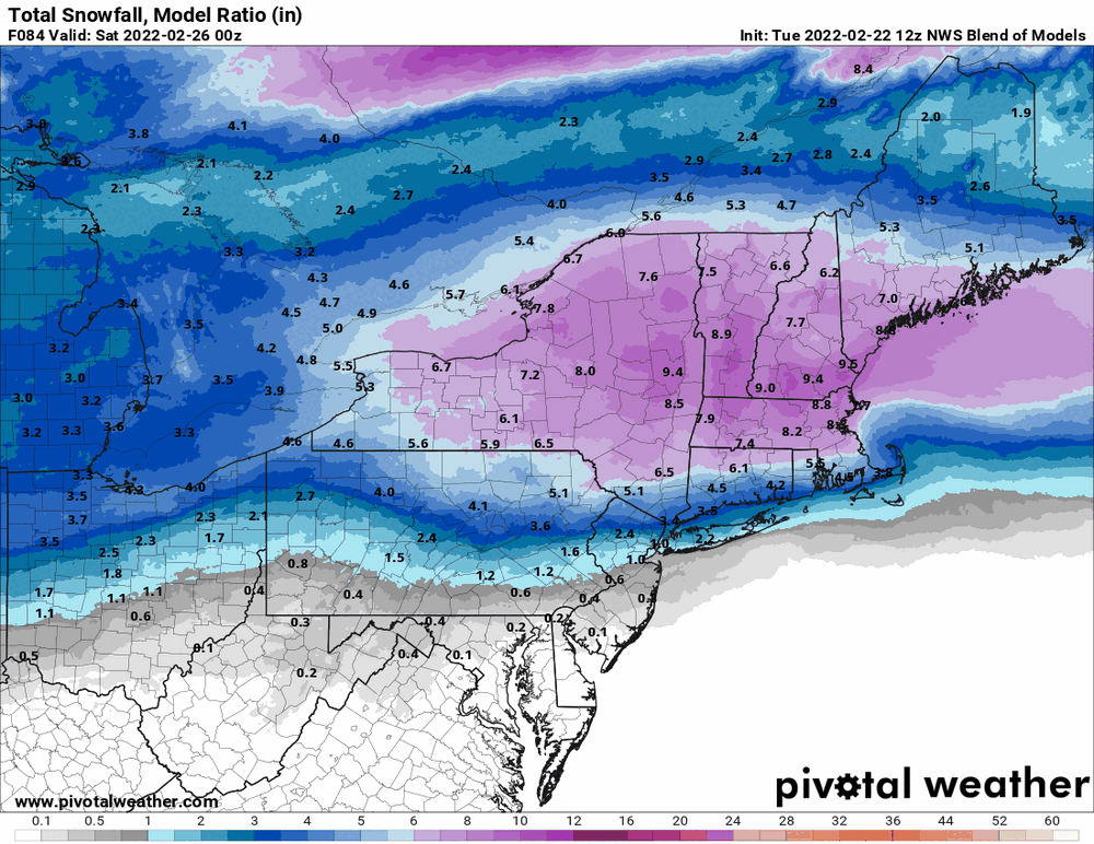
-
E PA/NJ/ DE Winter 2021-22 OBS Thread
Hurricane Agnes replied to JTA66's topic in Philadelphia Region
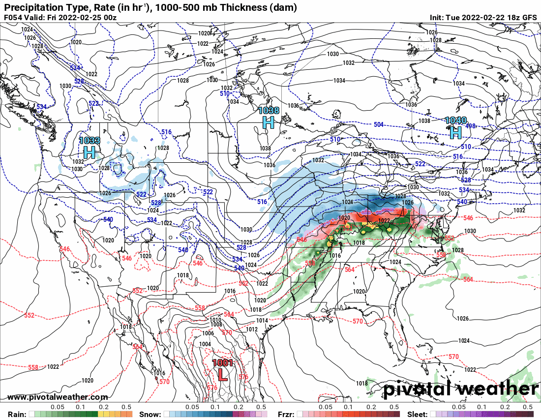
Seems the NAM's "dry" forecast is standing alone. GFS & GEM are not having it (although the GEM sortof spares I95).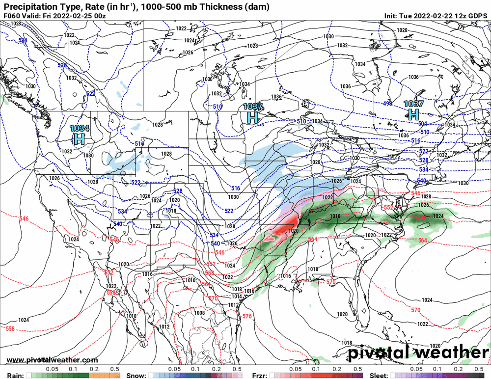


-
E PA/NJ/ DE Winter 2021-22 OBS Thread
Hurricane Agnes replied to JTA66's topic in Philadelphia Region
12z GFS even throws snow down into the I95 corridor!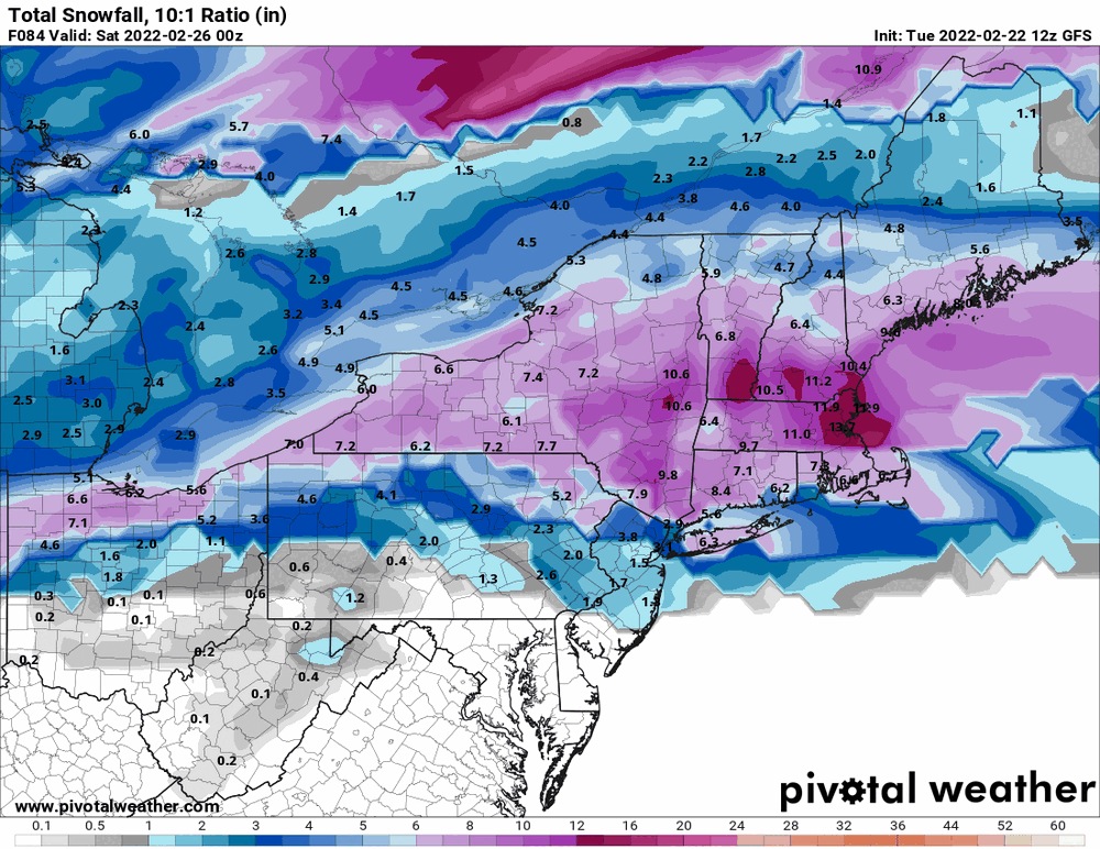

-
E PA/NJ/ DE Winter 2021-22 OBS Thread
Hurricane Agnes replied to JTA66's topic in Philadelphia Region
12z GFS still holding with a juicy overrunning storm...

-
E PA/NJ/ DE Winter 2021-22 OBS Thread
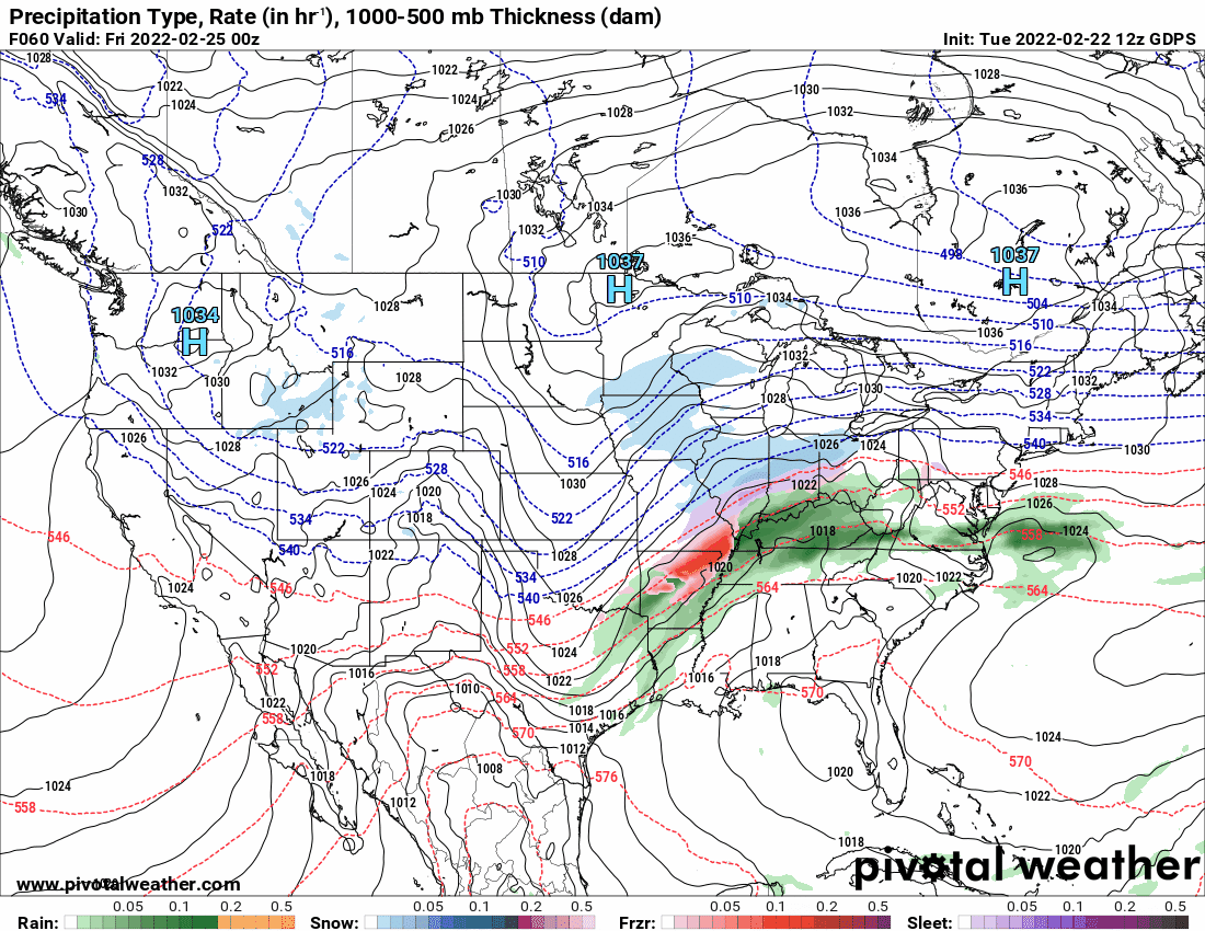
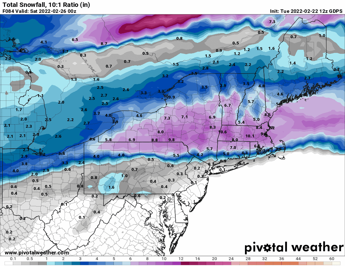
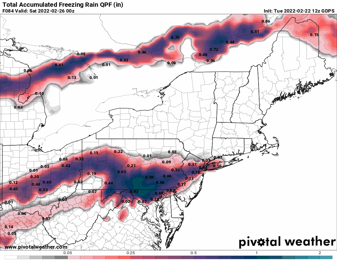
Hurricane Agnes replied to JTA66's topic in Philadelphia Region
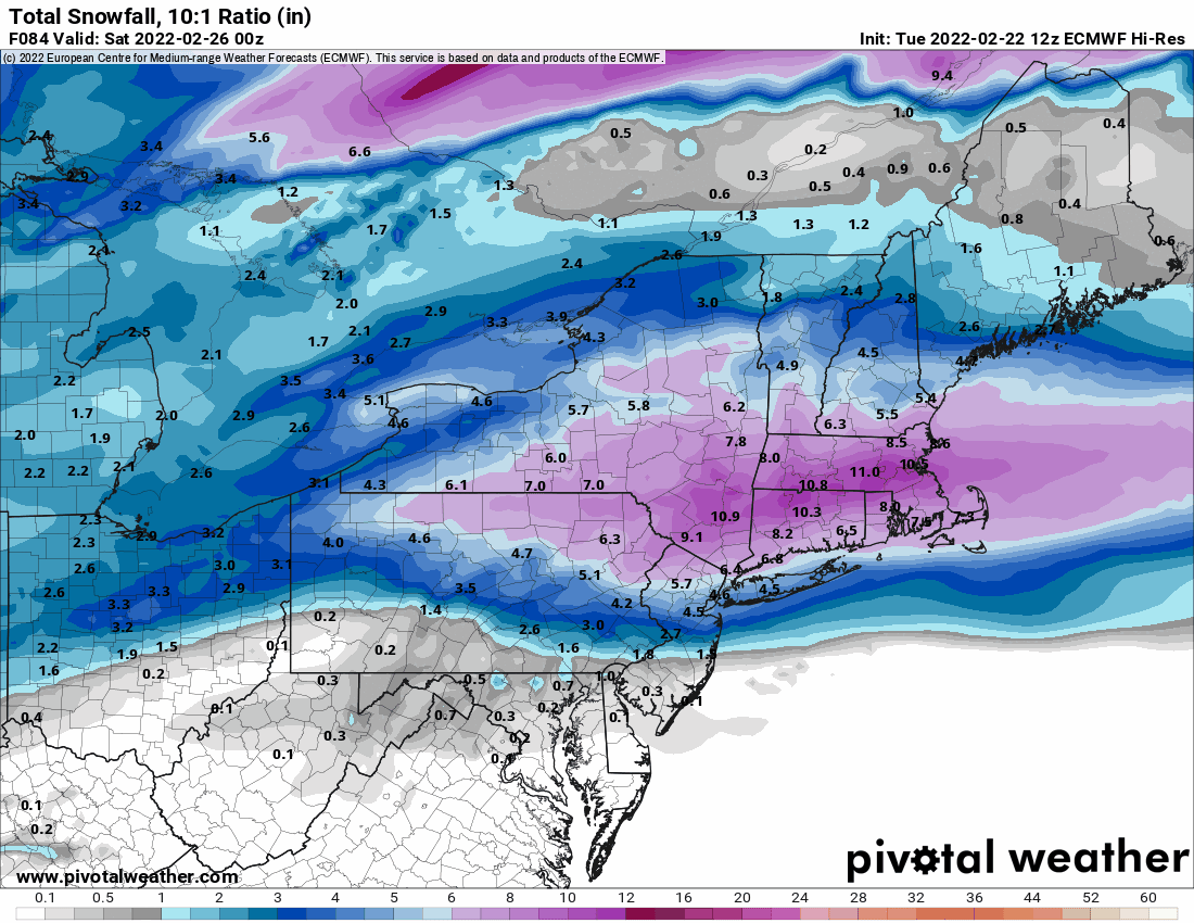
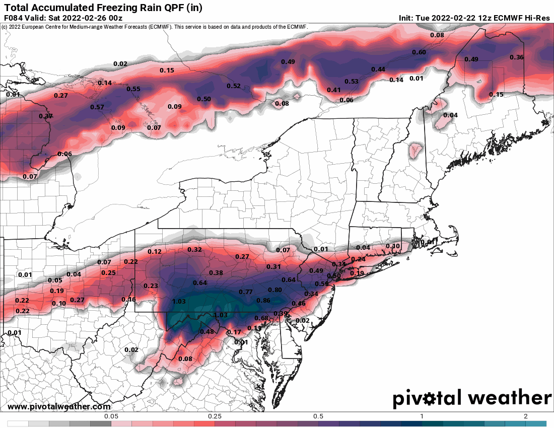
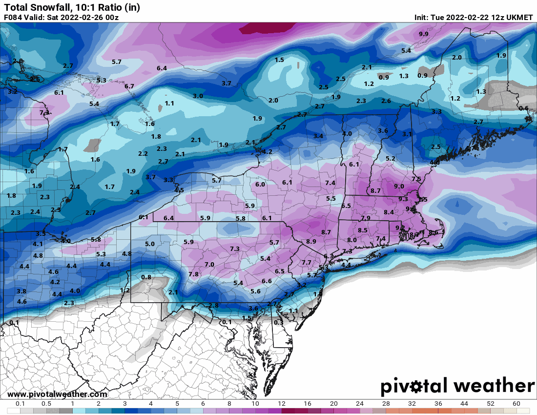
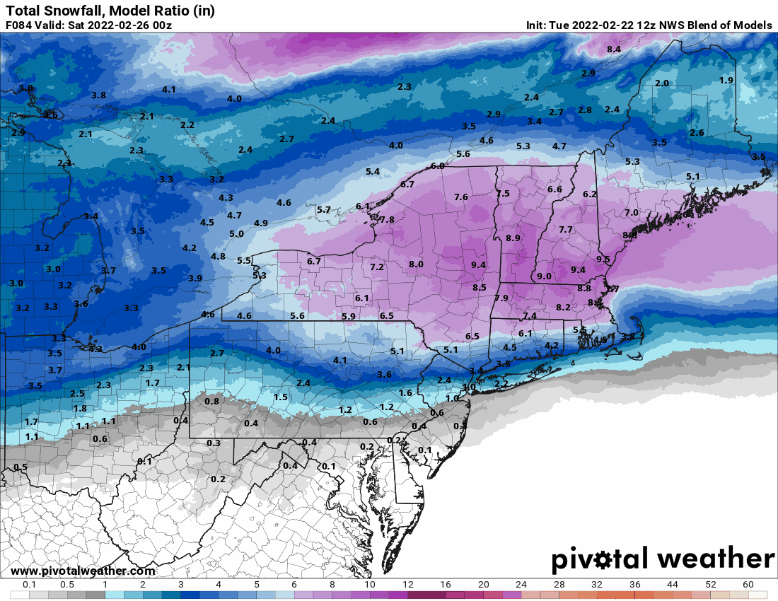
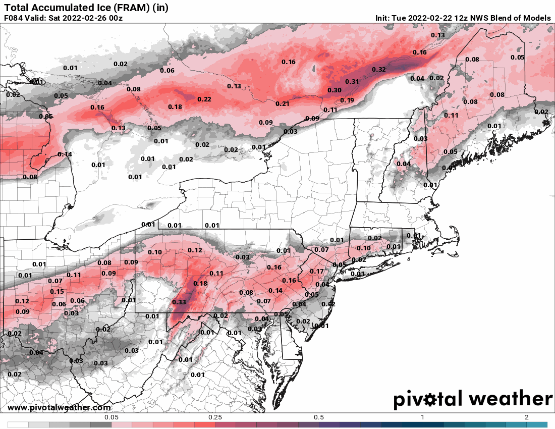
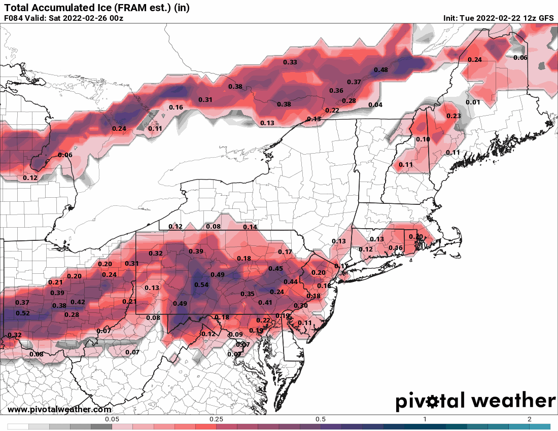
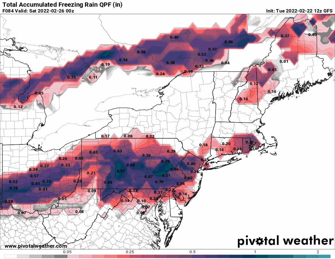
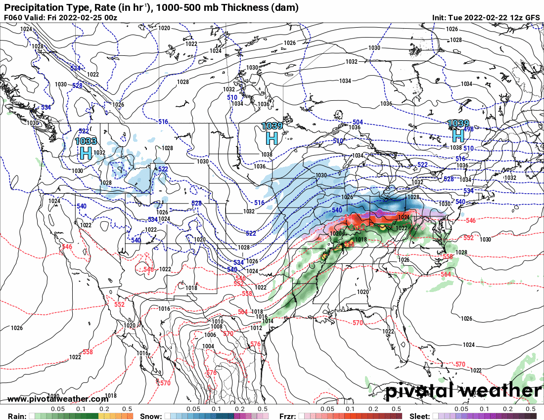
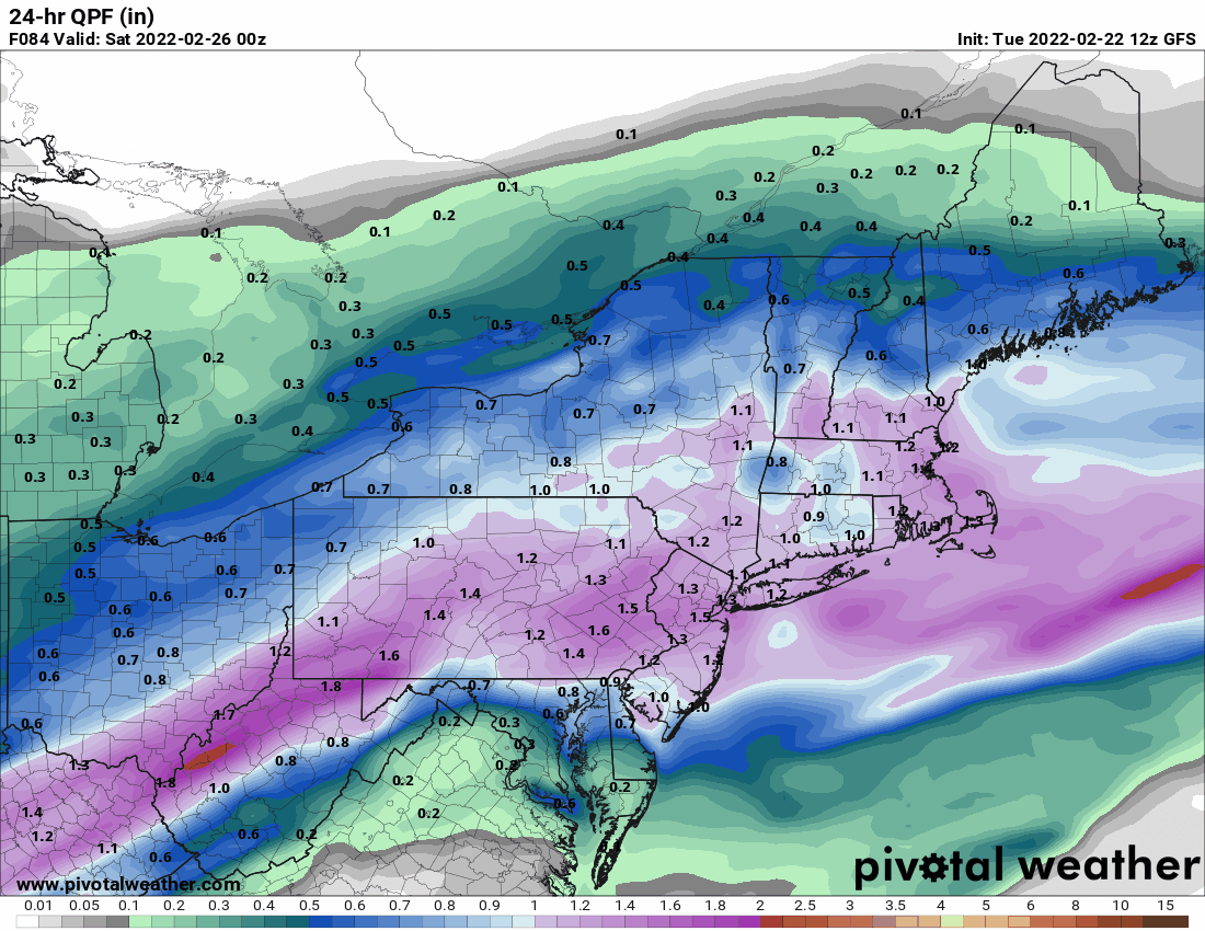
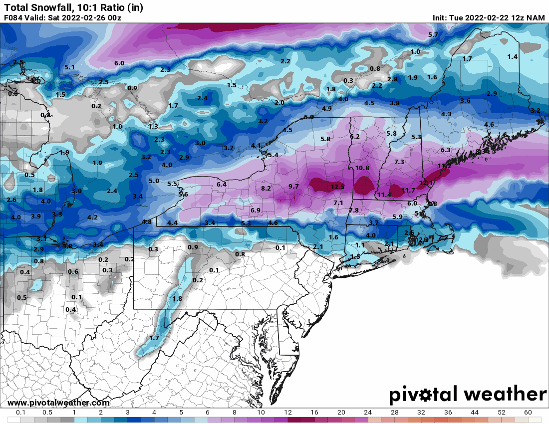
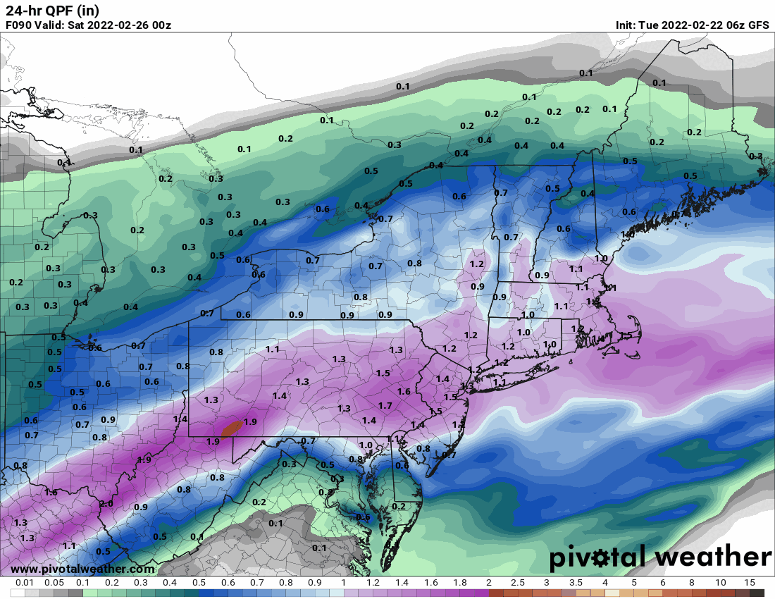
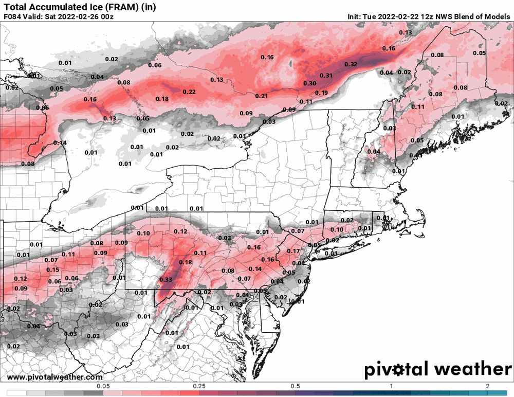
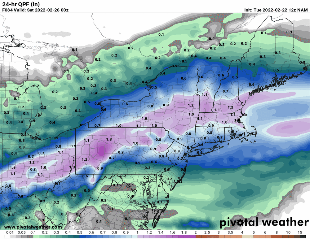
It's drier! anthonyweather beat me to the maps but can add the snow map and the overall 24hr qpf.
-
E PA/NJ/ DE Winter 2021-22 OBS Thread
Hurricane Agnes replied to JTA66's topic in Philadelphia Region
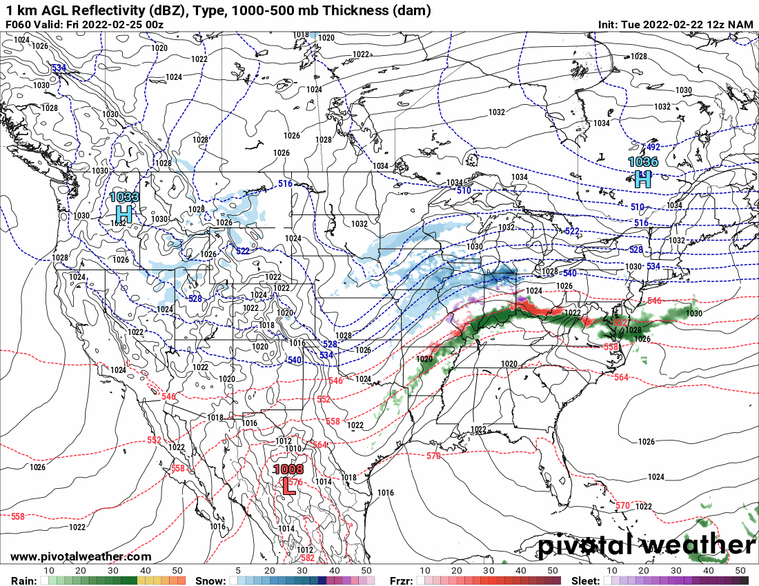
The 12z NAM keeps the same idea...
-
E PA/NJ/ DE Winter 2021-22 OBS Thread
Hurricane Agnes replied to JTA66's topic in Philadelphia Region
That's what I'm wondering too although some cold air is supposed to sink down over the area to chill things down (with some temp undulation as the storm moves in - at least looking at the below verbatum).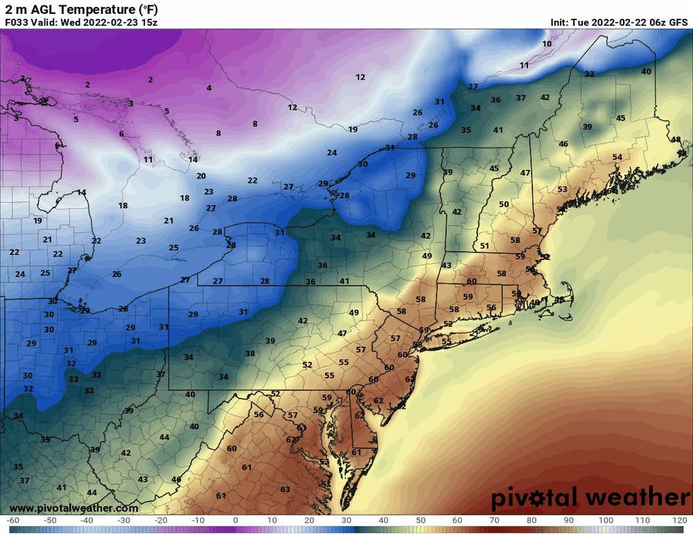
-
E PA/NJ/ DE Winter 2021-22 OBS Thread
Hurricane Agnes replied to JTA66's topic in Philadelphia Region
I would get the salt out... This seems almost like a weaker warmer version of the pre-VD storm (Feb. 12/13), with the snow pushed much further north. -
E PA/NJ/ DE Winter 2021-22 OBS Thread
Hurricane Agnes replied to JTA66's topic in Philadelphia Region
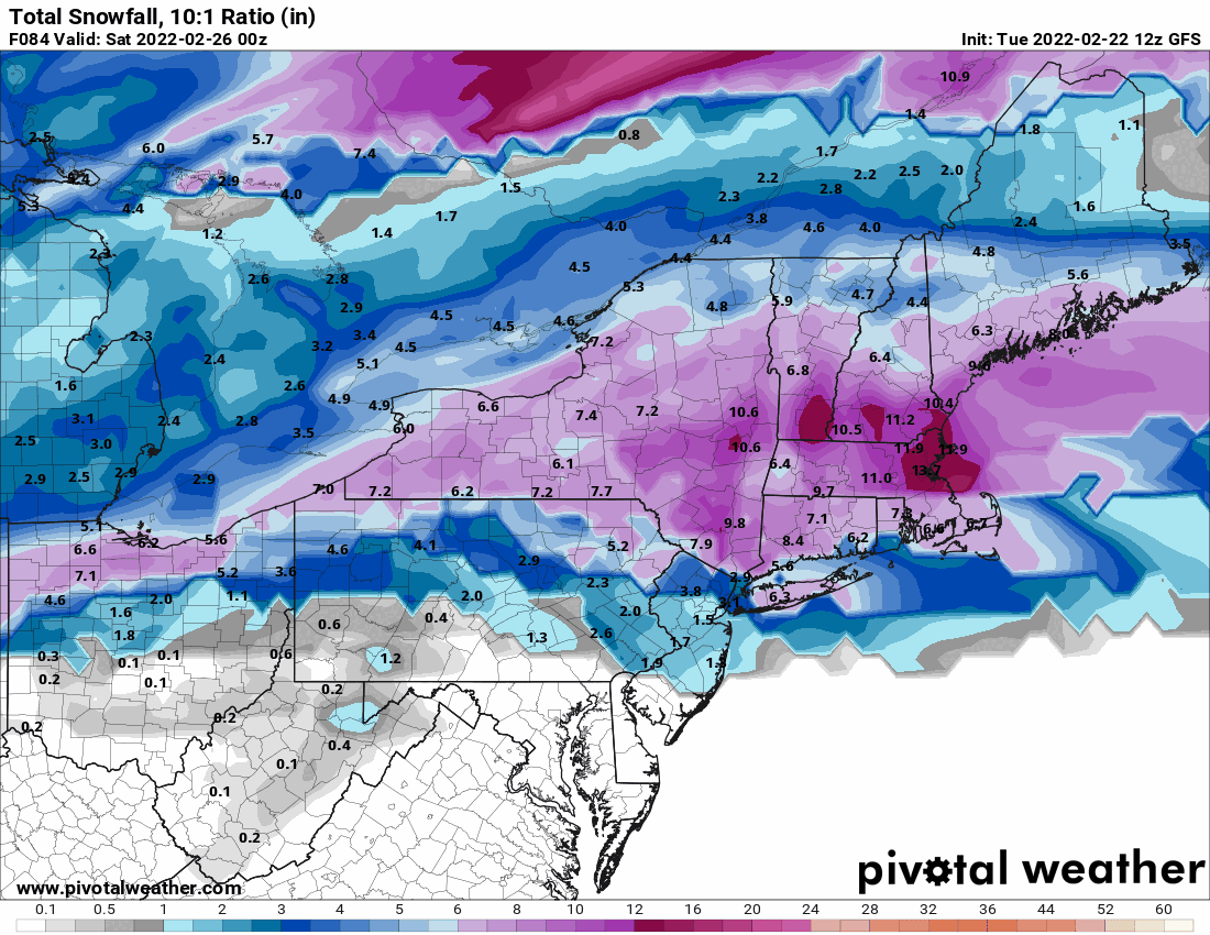
6z GFS has ~1.5" qpf. What that qpf will consist of is the question! I also think what is going to drive this other than the CAD is that apparently there is a lifting warm front and depending on how fast and how far it lifts, that will determine what the precipitation type will be and where. From what I recall, some models may bias on moving the warm front north too fast (and that probably depends on the time of year too).
-
E PA/NJ/ DE Winter 2021-22 OBS Thread
Hurricane Agnes replied to JTA66's topic in Philadelphia Region
It got lost back with the 0z.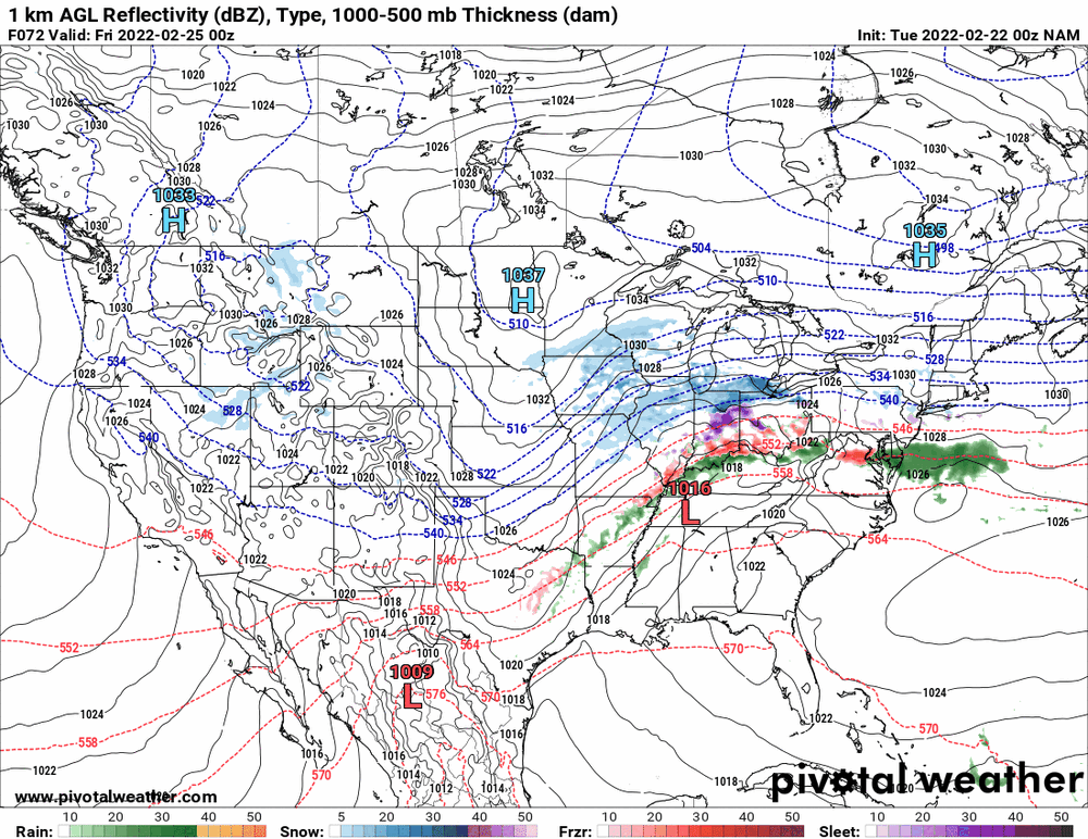
-
E PA/NJ/ DE Winter 2021-22 OBS Thread
Hurricane Agnes replied to JTA66's topic in Philadelphia Region
I don't know where Levi has the site hosted but I do know he lives in Hawai'i so he is 6 hours difference from here and if he was having maintenance done on it, it would currently be very early morning there. -
E PA/NJ/ DE Winter 2021-22 OBS Thread
Hurricane Agnes replied to JTA66's topic in Philadelphia Region
Am getting this trying the site - They might be doing some maintenance, etc. -
E PA/NJ/ DE Winter 2021-22 OBS Thread
Hurricane Agnes replied to JTA66's topic in Philadelphia Region
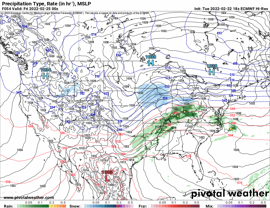
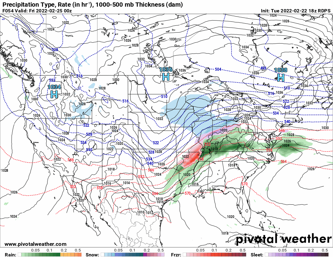
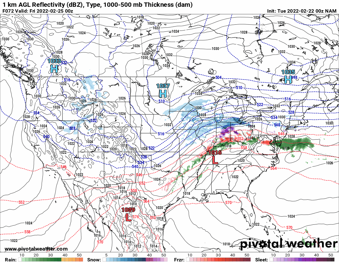
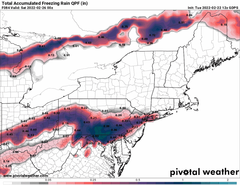
The 6z Euro has now picked up on the NAM's earlier double low jawn. Adding the Canadian now sortof in range.