SolidIcewx
-
Posts
1,526 -
Joined
-
Last visited
Content Type
Profiles
Blogs
Forums
American Weather
Media Demo
Store
Gallery
Everything posted by SolidIcewx
-
DTW area looking at 98 to 100 in the middle of the week. I work outside so that’s gonna be fun
-

2022 Short/Medium Range Severe Weather Discussion
SolidIcewx replied to Chicago Storm's topic in Lakes/Ohio Valley
I certainly hope one does occur I’ve been wishing for a strong MCS or MCV to hit the DTW area. The potential instability of up to 5000 j/kg is pretty gnarly for this area -
2022 Short/Medium Range Severe Weather Discussion
SolidIcewx replied to Chicago Storm's topic in Lakes/Ohio Valley
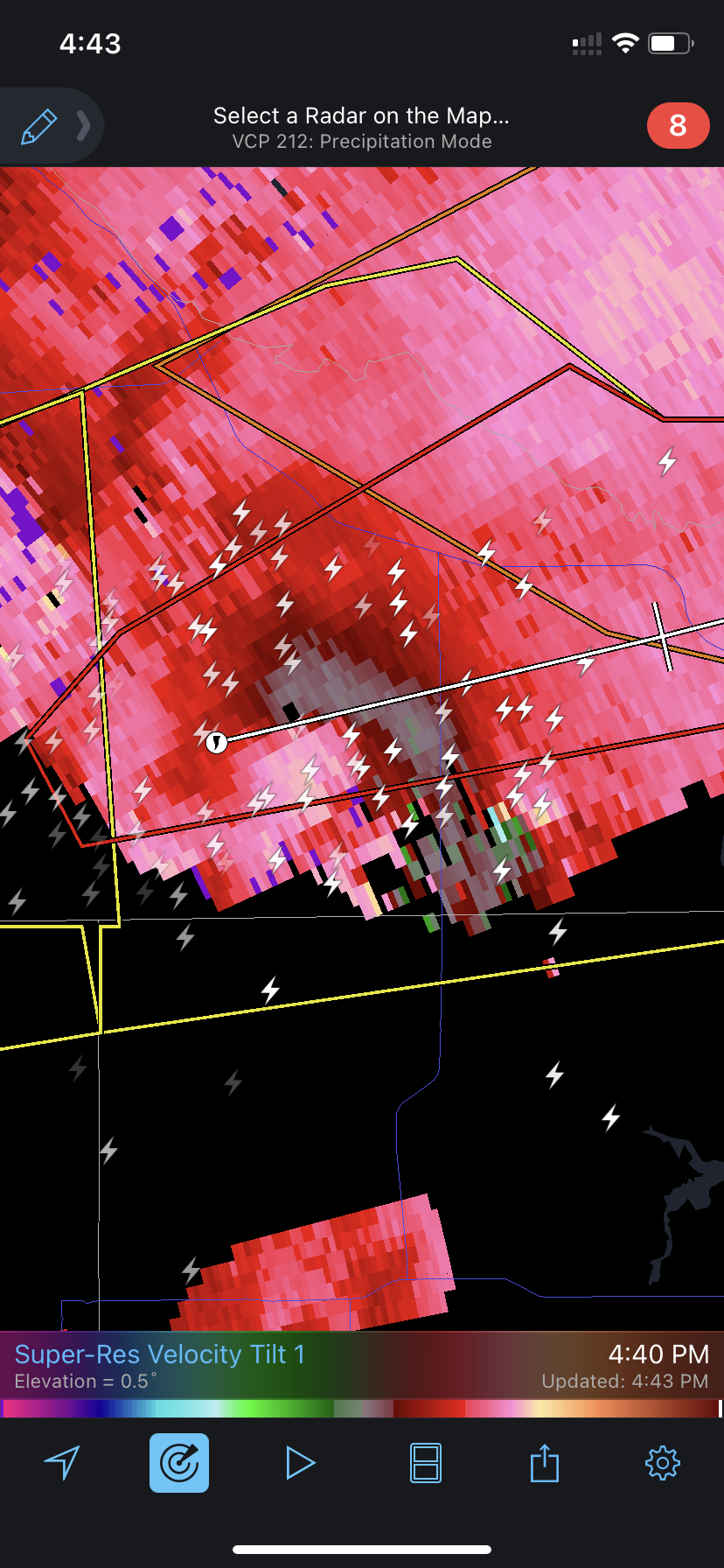
Far from the radar but pretty insane
-
2022 Short/Medium Range Severe Weather Discussion
SolidIcewx replied to Chicago Storm's topic in Lakes/Ohio Valley
Looks like it’s cycling now -
2022 Short/Medium Range Severe Weather Discussion
SolidIcewx replied to Chicago Storm's topic in Lakes/Ohio Valley
-
Yeah we are the ugly ducklings around here lol. They should honestly with the 5 potential. Gonna be nice to cover up the ground again
-
Always be humble. I will be happy myself later this week with 3 or 4 inches. Before we know it we will have squall lines rolling thru
-

-
I was expecting a little more rain last night but I see a big rain shield moving back into Michigan from the south. Im definitely going to enjoy the near 60 degree temps
-
So much melt my sidewalk is a river IMG_3159.MOV
-
Glad we all are thinking the same thing
-
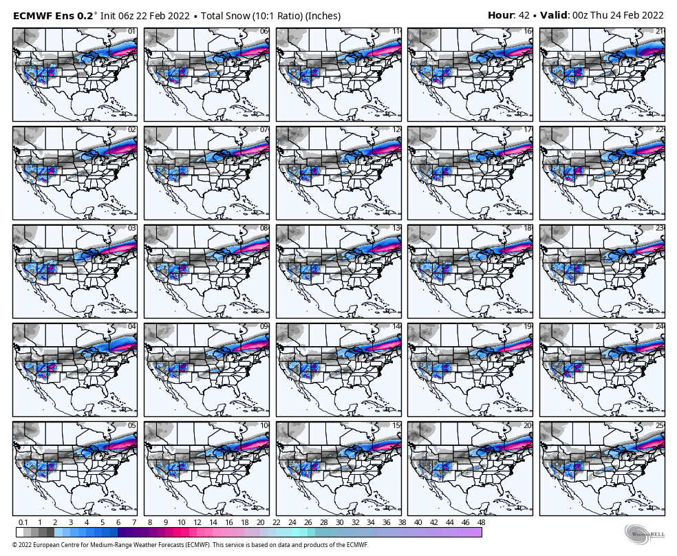
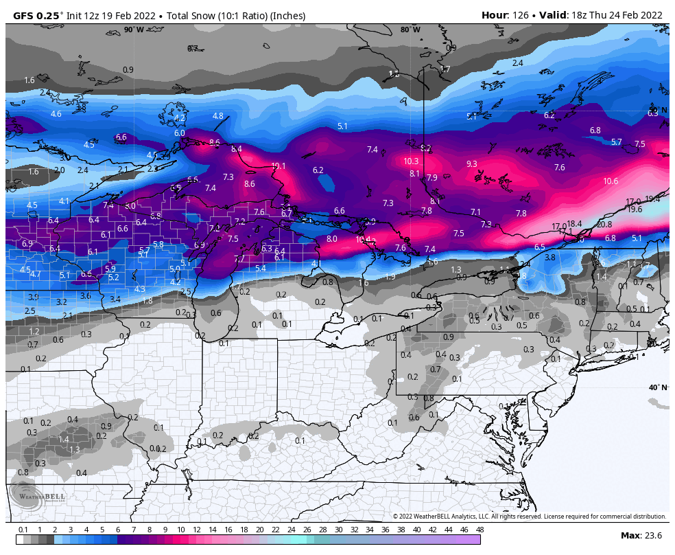
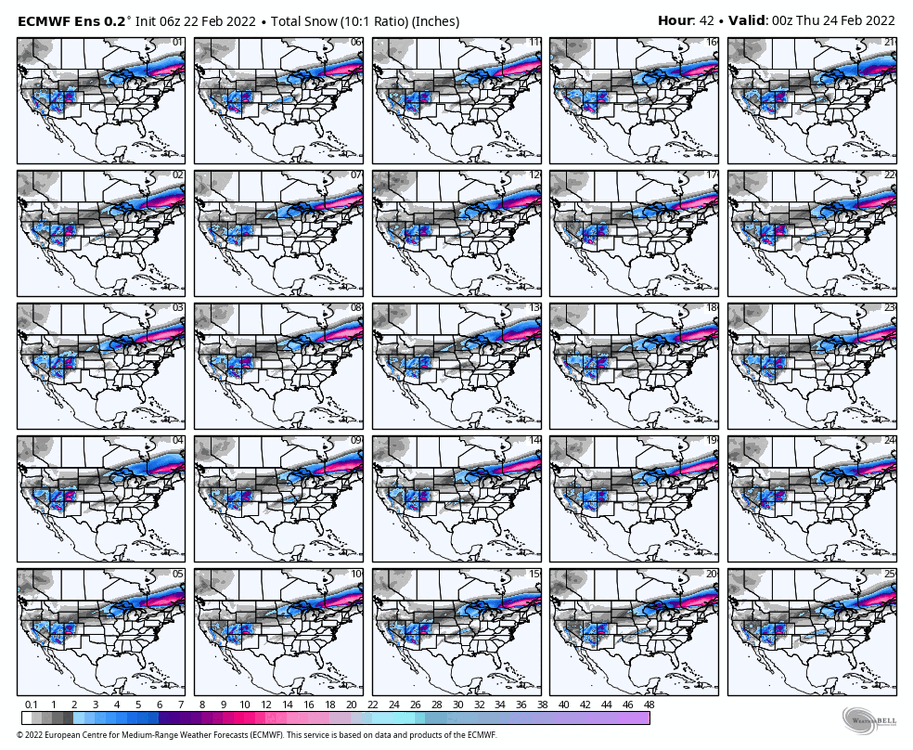
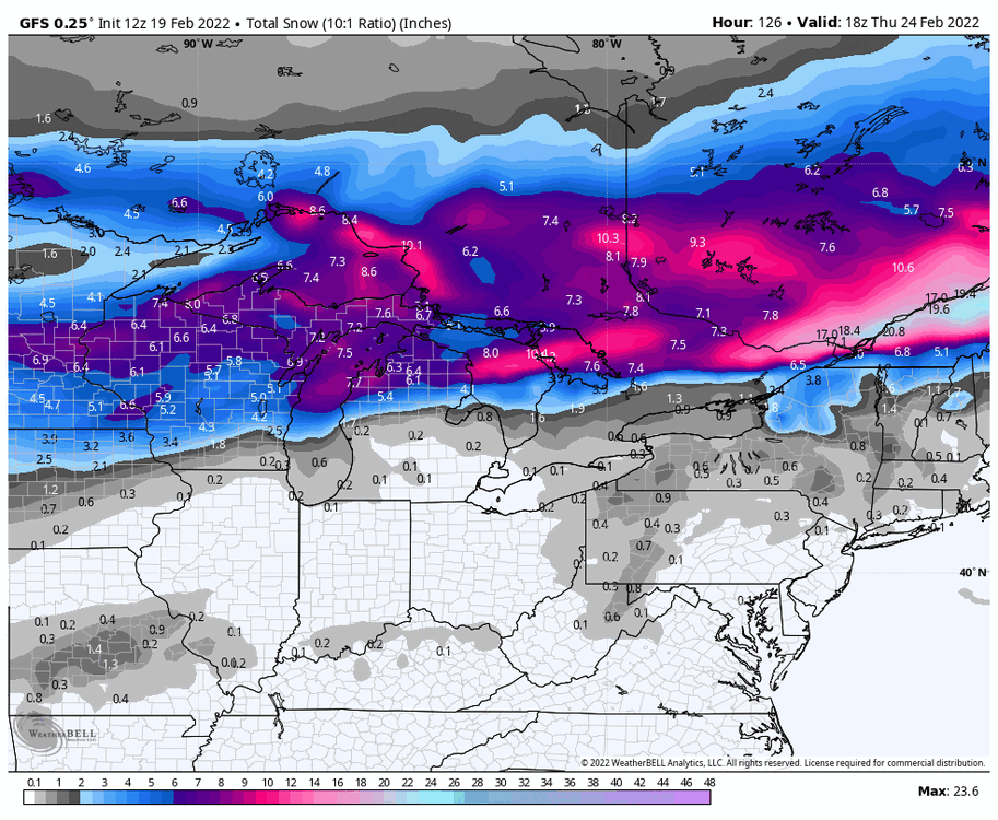
ECMWF 10:1 ratios 00Z Thursday to 18Z Friday. Quite the spread like sports gambling
-
I’m quite pleased with the potential for mid 50s here around DTW
-
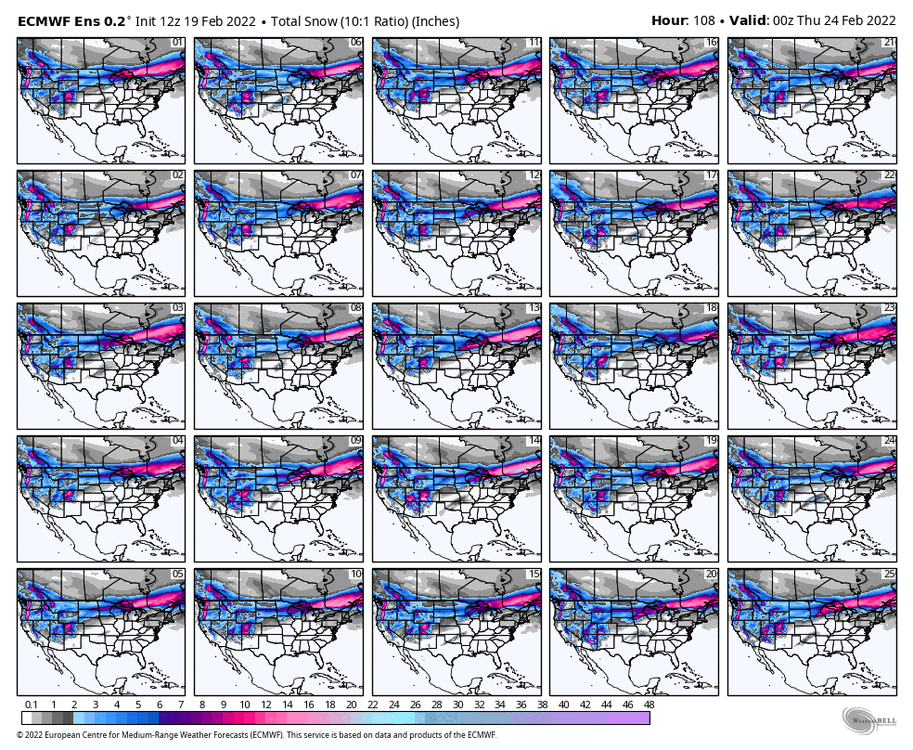
It’s a reference at work only had time to put off one model
-
Exactly a litteral grain of sand in the ocean of models
-
Apparent screw zone but obviously just one model days out
-
Definitely was pretty awesome thing to witness those winds were stronger then expected
-
If there is a huge arctic push of cold air behind the first storm it may trend south like the others. Obviously not the only factor
-
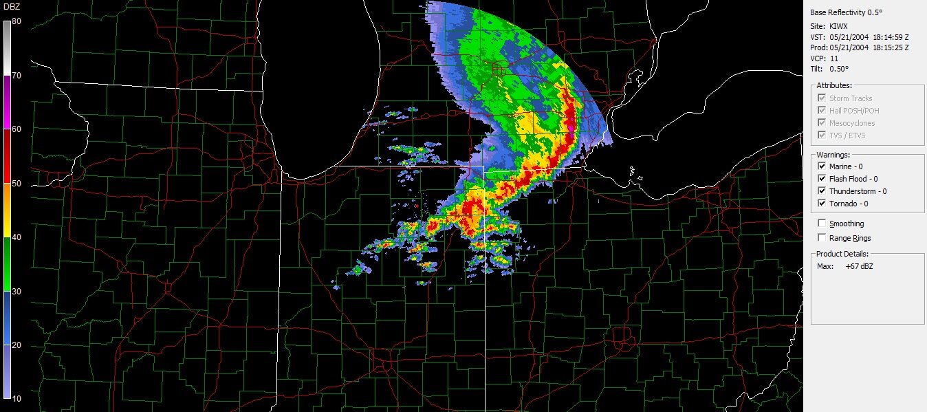
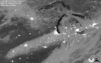
Pretty cool pic from last storm
-
That’s a lot of sleet time but yes better then ice. I’m actually happy for a rain event definitely better then ice
-
First storm will be north. That will allow more cold air to come down from Canada for the second storm I feel like that one will be a southeast trender as well. Just a plausible guess
-

-
That is true I noticed that also. I guess I can’t put the skates away yet
-
I live in the southwest part of canton and avoided that dry slot to the northwest I definitely shoveled more then 3 inches
-
I’m dead.. that’s hilarious my wife is looking at me like I’m insane from laughing