wx_observer
-
Posts
256 -
Joined
-
Last visited
Content Type
Profiles
Blogs
Forums
American Weather
Media Demo
Store
Gallery
Everything posted by wx_observer
-
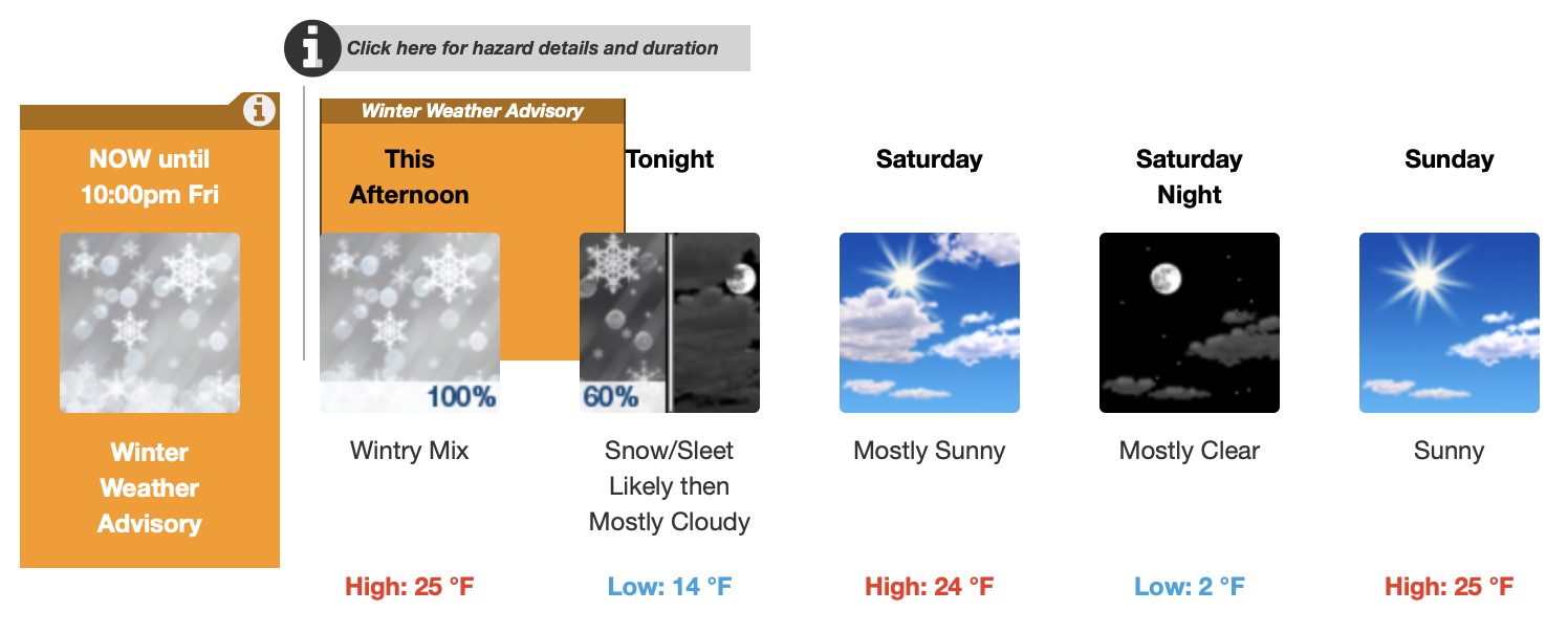
.NEAR TERM /THROUGH TONIGHT/... 10 AM update... Extreme impacts being felt across the Berkshires with widespread power outages and travel disruptions. Locally up to 2 feet of snow has already been reported. Power outages not as widespread in northern Worcester county where around a foot of snow has fallen as of 8 am. However, heaviest of the snow will continue into the afternoon in this area along the northern periphery of the mid level low with low level jet providing strong moisture advection and forcing for ascent. An additional 8-12 inches is expected across the Berkshires and northern Worcester hills. Max snowfall of 20-30 inches in the Berkshires with locally up to 3 feet not out of the question. In the northern Worcester Hills 1-2 feet is expected with worsening conditions through the day.
-
Those Sterling and Holden MA numbers are impressive--I'm only a few miles from there and have about half that. But it looks to be trying to make up for it now though.
-
32 f with about 2.5 inches on the ground on Worcester / Holden line. It’s snowed steadily most of the night, but it’s not quite accumulating on the ground quickly so far.
-
Ticked up to 34 here in ORH. Still snowing, but a lot of water coming down the gutters too.
-
32.5 in ORH. Good sized flakes and the road is getting a coating now. Not even an inch out there yet, but it’s already clinging to the side of the telephone pole.
-
Down to 34 in N ORH. Not much sticking yet, but flake rate has gone up.
-
36 f and snowing N ORH
-

The last hurrah? Putting all the eggs in the Tuesday 3/14 basket
wx_observer replied to Ginx snewx's topic in New England
That's wild...ORH gets skunked with less than BOS, but only a few miles away from 20+. Brain cannot compute. -
The last hurrah? Putting all the eggs in the Tuesday 3/14 basket
wx_observer replied to Ginx snewx's topic in New England
One is valid at 15z, the other is 00z... -
The last hurrah? Putting all the eggs in the Tuesday 3/14 basket
wx_observer replied to Ginx snewx's topic in New England
That's not even a 10:1 map. Those totals would be pretty devastating if it's all white concrete. -
The last hurrah? Putting all the eggs in the Tuesday 3/14 basket
wx_observer replied to Ginx snewx's topic in New England
That is a fantastic sunrise photo...now what was it that they say about red in the morning....? -
The last hurrah? Putting all the eggs in the Tuesday 3/14 basket
wx_observer replied to Ginx snewx's topic in New England
Forget generators--that Gardner / Paxton stretch might just need to move on to chainsaws and roof trusses. It's so forested out that way too. WSSI upped them to extreme impacts. -
The last hurrah? Putting all the eggs in the Tuesday 3/14 basket
wx_observer replied to Ginx snewx's topic in New England
Major impacts on WSSI look like they expanded from previous update...quite a bit more into E MA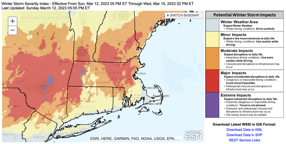
-
The last hurrah? Putting all the eggs in the Tuesday 3/14 basket
wx_observer replied to Ginx snewx's topic in New England
I’d normally agree, but I live on a busy road in ORH and this year I’ve seen worse snow removal than I have in the past 13 years living here. For sub-warning events, too. They’ve had a hard time hiring enough plow drivers, from what I’ve heard. -
The last hurrah? Putting all the eggs in the Tuesday 3/14 basket
wx_observer replied to Ginx snewx's topic in New England
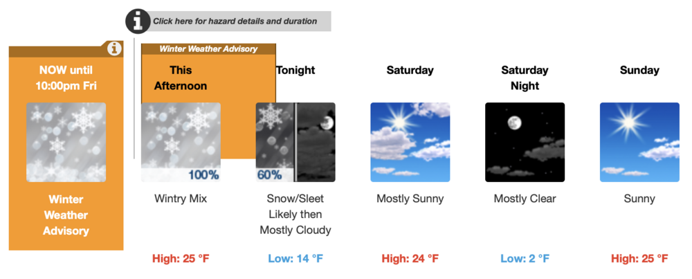
didn’t realize the winds were expected to be this high this far inland. That, plus 12-18” sounds like generator territory. URGENT - WINTER WEATHER MESSAGE National Weather Service Boston/Norton MA 335 PM EDT Sun Mar 12 2023 MAZ002>004-008-009-026-130845- /O.UPG.KBOX.WS.A.0005.230314T0000Z-230315T1200Z/ /O.NEW.KBOX.WS.W.0004.230314T0000Z-230315T1200Z/ Western Franklin MA-Eastern Franklin MA-Northern Worcester MA- Western Hampshire MA-Western Hampden MA-Northern Middlesex MA- Including the cities of Charlemont, Greenfield, Orange, Barre, Fitchburg, Chesterfield, Blandford, and Ayer 335 PM EDT Sun Mar 12 2023 ...WINTER STORM WARNING IN EFFECT FROM 8 PM MONDAY TO 8 AM EDT WEDNESDAY... * WHAT...Heavy wet snow expected. Total snow accumulations of 12 to 18 inches. Winds gusting as high as 55 mph. * WHERE...the high terrain of western and central Massachusetts. * WHEN...From 8 PM Monday to 8 AM EDT Wednesday. * IMPACTS...Travel could be very difficult to impossible, with snow covered roads and near zero visibility at times. Gusty winds could bring down tree branches. * ADDITIONAL DETAILS...heavy wet snow combined with gusty winds will increase the risk for power outages. This will be a high impactful winter storm. PRECAUTIONARY/PREPAREDNESS ACTIONS... If you must travel, keep an extra flashlight, food, and water in your vehicle in case of an emergency. -
Any educated guesses on how much ice accretion we're looking at in SNE?
-
Been waiting for snow all freaking winter...and it comes on the one day I don't want it. Early AM meeting at school tomorrow--any guess at school cancellations for Worcester?
-
Pinging here now pretty well north of Pike...didn't think the sleet would make it this far N
-
6" on the N side of Worcester so far. Snowfall rates have been pretty heavy for the past few hours.
-
Winter storm for the 25th of February is imminent.
wx_observer replied to Typhoon Tip's topic in New England
Someone's kid home on February vacation made the maps at NWS today.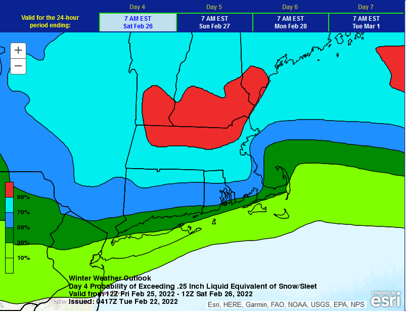
-
I have 100’ of public sidewalk I’m responsible for cleaning. Note to self: next time, buy the house on the other side of the road, lol.
-
I suppose this should solidify any remaining pack nicely...
-
Does higher elevation in an event like this make it more likely to have freezing rain instead of sleet? In that there would be less cold air near the surface to allow a refreezing into pellets?
-
It's a bonus when just enough freezing rain mixes in with the sleet to turn the slushy ice pellets into a solid mass. The main roads in Worcester are looking gnarly right now. Looking at the trees, we've been getting quite a bit of freezing rain here. I tried to get a photo out the window, but the screen is iced shut.
-
Crash helmet time in Central MA--that sleet means business!