wx_observer
-
Posts
278 -
Joined
-
Last visited
Content Type
Profiles
Blogs
Forums
American Weather
Media Demo
Store
Gallery
Everything posted by wx_observer
-

Blowvember - and not named for wind potential
wx_observer replied to Go Kart Mozart's topic in New England
It's 44 here now, with a wind chill of about 36 F. Going to have several chilly nights in central MA, getting down into the 20s. -
Blowvember - and not named for wind potential
wx_observer replied to Go Kart Mozart's topic in New England
Seems to be a theme emerging for the winter season. Might hedge my bets again this year and pay per diem for snow removal instead of a flat rate for the whole season.
-
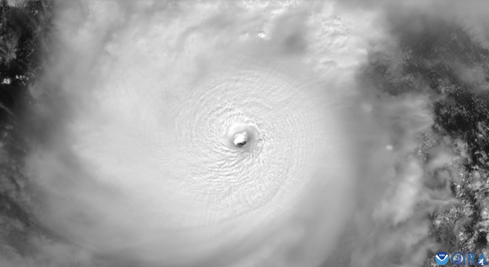
Hot damn, GOES-19...that loop is incredible! Wish this beast wasn't heading towards any population centers though. https://satlib.cira.colostate.edu/loop_of_the_day/jaw-dropping-high-resolution-view-of-hurricane-miltons-eye/
-
September vibes - Last 90s for some, 1st frost for others
wx_observer replied to tamarack's topic in New England
Well, you don't see that everyday...a left hook after a panhandle landfall.
-
September vibes - Last 90s for some, 1st frost for others
wx_observer replied to tamarack's topic in New England
You know it's quiet on the weather front when there's a full blown conversation about heat pumps and solar panels and not much else that day... -
September vibes - Last 90s for some, 1st frost for others
wx_observer replied to tamarack's topic in New England
Same reason why I haven't done it too. Based on the terms, I may as well buy the system myself and pay to finance it over time with the money I save on the electric bill. At least the power I would generate is mine, and I would be free to use the system as a backup power source in an outage...which none of those government incentive programs would offer. I was like--wait. I would have a renewable energy source right on my roof, but if there is a power outage I can't use it and all my lights go out too?! That would just piss me off a little too much, thanks. -
September vibes - Last 90s for some, 1st frost for others
wx_observer replied to tamarack's topic in New England
Around here most of those solar programs that install panels at no cost to the homeowner require you to send the electricity you generate back to the "macro grid" company. They give you a credit on your bill based on whatever weird calculations they use. But if the electric company is getting all these homes to provide energy that they no longer have to generate themselves, you have to wonder why the rates wouldn't be going down. -
I'm almost afraid to say it...but will be spending this week in seacoast NH and am loving this forecast! Even getting a vacation from the dews
-
Nice writeup about severe potential today from BOX. Last paragraph is especially helpful from a public awareness standpoint regarding warnings today. Seems like having an actual "eye to the sky" is especially important today. Severe Weather: Not much has changed with the potential of severe weather. As we mentioned, the environment this afternoon/evening is favorable for short-lived tornadoes as remnants of Debby track to the west of New England. These situations often feature very high shear in lowest levels and low LCLs (cloud bases) but in order to support tornado formation we need instability in lowest levels (0-3km CAPE) and either surface boundary or mesolow to focus low level spin. In this case, we`re seeing several favorable signals in model guidance, especially for western thirds of MA/CT. First, there is sufficient 0-3km CAPE (over 200 J/kg) as warm front lifts through during late afternoon and early evening. Local CSTAR research has shown that we only need to see values of 25-75 J/kg in tropical remnant environments so that should easily be attainable. Second, environment itself favors high amounts of shear in lowest levels and in this case we have over 200 m2s2 of 0-1km shear, much of which is focused in 0-500m layer. Research has also shown the 0-500m layer can be a good discriminator for tornadoes vs non tornado environments (values of 95 or higher). Lastly, LCL heights are down to 500m which is below the typical height of about 700m. While these factors line up very well and have support from SREF Tornado Ingredients, it`s not always a lock in these situations. Certainly we`ll be on the eastern edge of more favorable area (region closer to the actual remnant low itself). But we have to watch its warm front extending eastward as well as possibility of mesolow formation along boundary to help enhance spinup. It`s also possible to have all of this occur without any lightning. It`s important to stress that these types of circulations, while potentially supportive of tornadoes, tend to be very shallow in nature and do not last very long. Radar detection can be difficult especially at farther distances from the radar. These situations are usually handled by issuing Severe Thunderstorm Warnings with the "Tornado Possible" tag since it is difficult to track these transient couplets. However, any longer-lived couplets that do manage to form can be handled with Tornado Warnings.
-
I’m supposed to go to Hampton beach next Monday. But if those big rains pan out my basement could have enough water in it to be a wave pool by then.
-
Seems pretty slow moving out of the starting gate. Yet still not reaching H status.
-
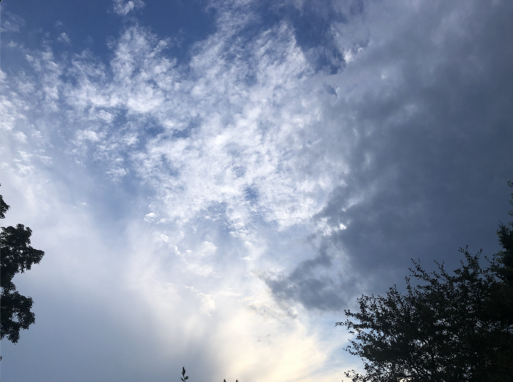
Yeah, the cloud tops aren't as high now and not as much lightning as they reached ORH. But really thankful for the rain either way.
-
That cell in Paxton / Spencer MA is looking pretty spicy. Heading right for me, but I've been whiffed N / S too many times this summer to put any money on it reaching me.
-
I've seen one or two so far. But seeing as I'm planning to get a dumpster to clear out some junk that's been in the yard this week, I think I'm about to discover where they've been hiding out. BzzzZZZzzzzZZZZZ!!!!
-
Seems like I keep finding myself too far north or too far south to get much rain from these storms lately. MA/CT border probably won't cut it for me...and we could really use some rain here.
-
There have been some sightings of flamingos at the beach in Yarmouth, for whatever that is worth... https://www.wcvb.com/article/flamingo-sighting-reported-at-cape-cod-beach/61620985
-
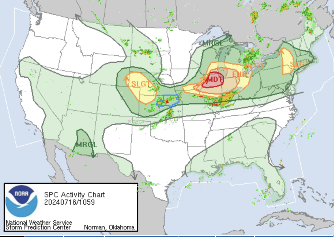
MDT on the map:

-
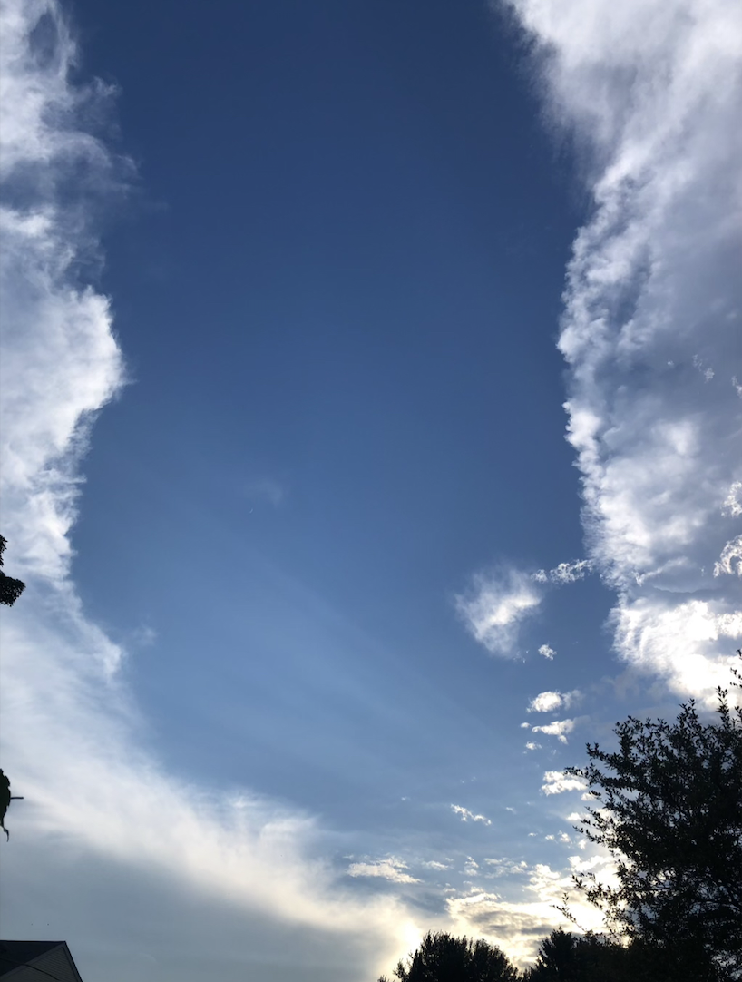
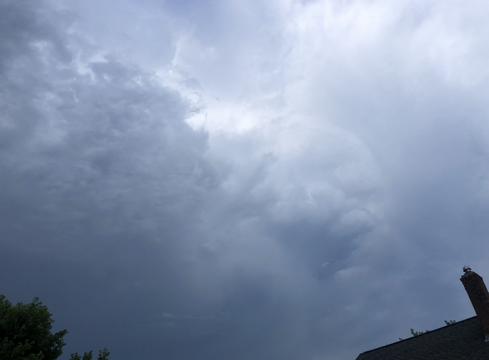
And for the dark side to the North--just missed a huge lightning bolt in this shot. Definitely sliding south towards me more.
-
-

-
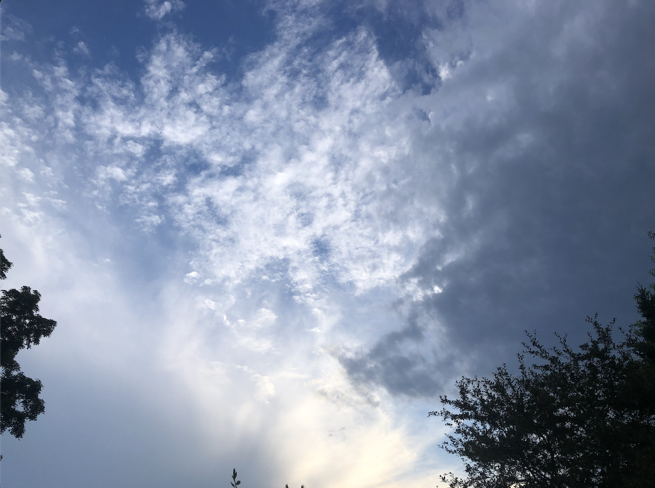
Central MA...looks like I'm in the slot between the storm in Petersham to the North (right) and the cloud deck out ahead of the area of storms near Springfield (left). That Petersham storm has some oomph. Thunder is rumbling the ground here.

-
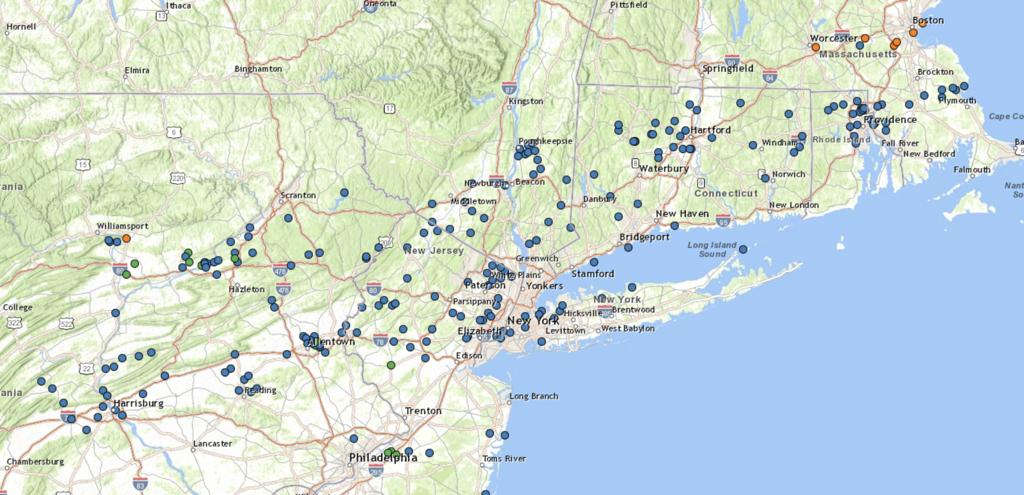
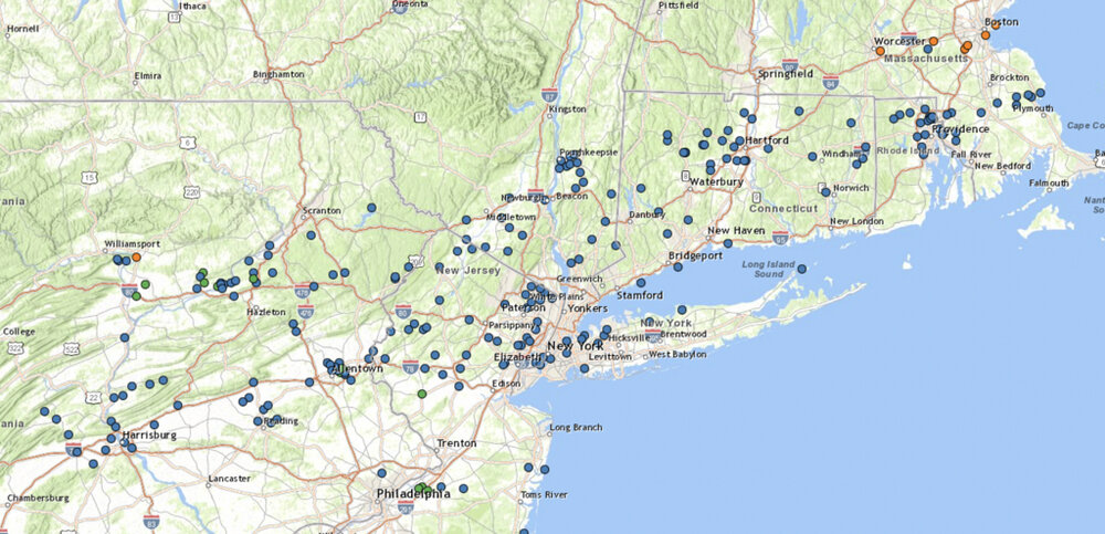
400 Miles takes you to about the mid-point of PA. A lot of wind damage reports over that distance, but most of them are without a specific wind reading.
-
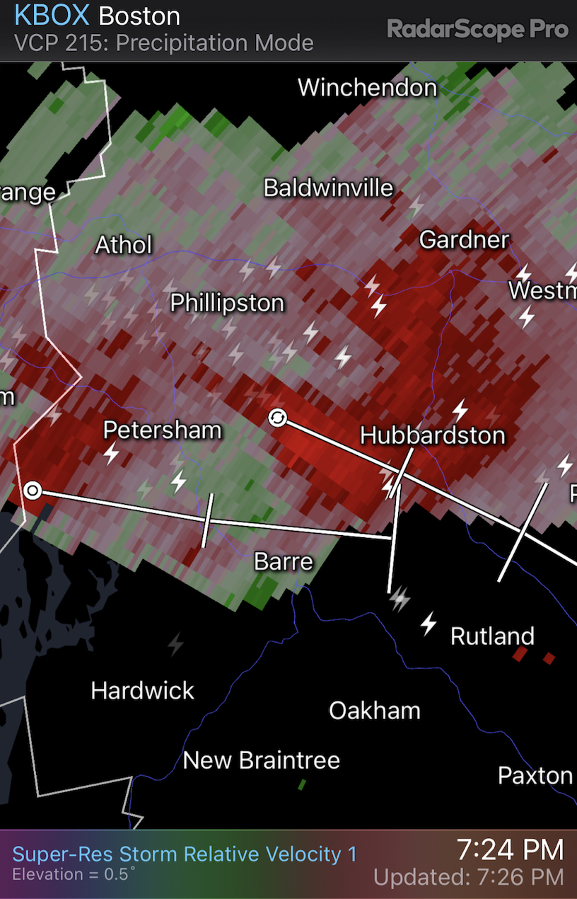
RadarScope has a tornado signature on the cell heading towards Mansfield, ct.
-
The severe thunderstorm warning for the cell that went through Springfield ma says that 80 mph winds were observed. Damage threat: destructive according to NWS
-
We're hilly and wooded up here too, so it's a lot harder to see something coming from further away than somewhere that is largely flat. On top of it, we don't get tornados up here often and have a population less prepared for them. Kind of like getting a winter storm warning in a southern state for only a couple inches of snow. At least basements are pretty common in most of New England.