wx_observer
-
Posts
278 -
Joined
-
Last visited
Content Type
Profiles
Blogs
Forums
American Weather
Media Demo
Store
Gallery
Everything posted by wx_observer
-
 Natural gas had a huge spike, too. Thankfully it's come down a bit. https://www.cnbc.com/2026/01/26/us-natural-gas-prices-snow-ice-winter-storm-fern.html
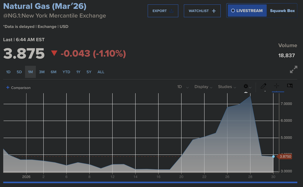
-
January 2026 regional war/obs/disco thread
wx_observer replied to Baroclinic Zone's topic in New England
I was getting pretty stressed out reading the public freakout posts from the fella that wasn't going to be here for the storm for the last few days. Hopefully he will be back in time for this one lol. -
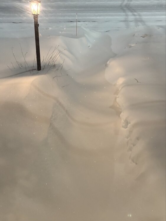
A bit breezy with light, yet steady flurries here. Eyeballing around 18-20", but may be a little higher. There's a LOT of drifting. Glad it's supposed to get into the 20s today to clear out. Great storm, aside from some mild frustration about inefficient growth.
-
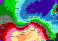
This band headed into Worcester County looks like it's got some oomph to it.
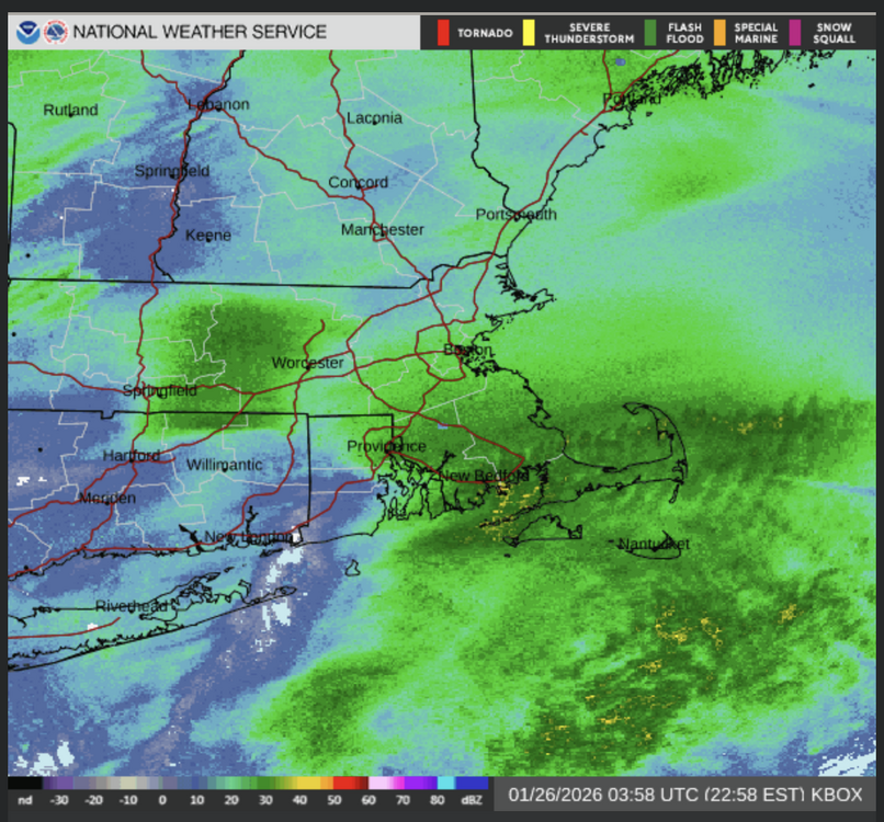
-
Latest BOX map for expected snowfall 7pm tonight to 7pm tomorrow.
-
Wait, the pic of the weinermobiles on a racetrack posted earlier wasn't some kind of ai generated meme? I can't tell if I preferred knowing or not knowing the truth about that. https://apnews.com/article/indianapolis-500-wienermobile-race-aaf5de7fdd08d8fc4e4d9be09f350de5
-
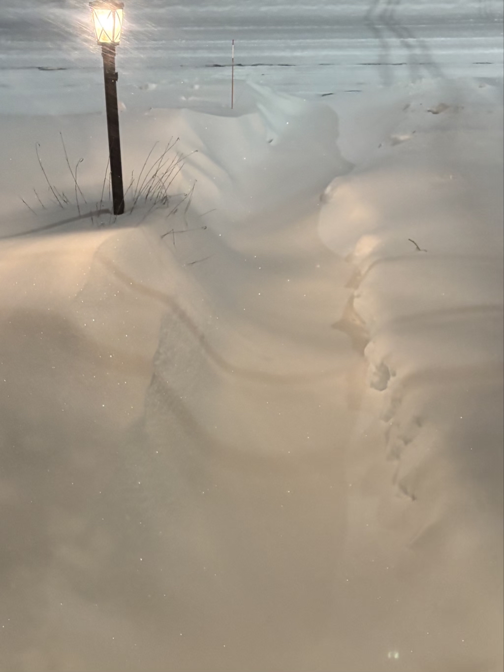
Walkway was shoveled less than two hours ago, and filling in again nicely. Part new accumulation, part drifting. Wind is picking up a bit, and the snow blowing off the roof sounds like granulated sugar. You can even see sparkles in the pic...
-
Really fine powder here, and it's warmest we've been all storm at 7F. Coming down really heavy and visibility is less than 1/2 mile...but slow to put on inches. Maybe 8" total, eyeballing it.
-
I thought so too. I lived in an area very hard hit and was without power for about a week after that ice storm in Worc county. Had to drive out first thing that next morning, and I was driving over small trees. Glad I had a Jeep back then. My CRV wouldn't have made it.
-
Surpassed 1M total power outages nationwide. At least according to this source https://poweroutage.us/
-
It's been interesting watching that coastal front come on shore with those heavier snow bands are pushing through in the opposite direction. The CF is kind of getting lost in the last few frames so it's hard to tell what is happening with it...at least looking at radar.
-
Really heavy band here in central MA right now. Curious how much it puts down because accums here so far haven't piled up too fast. A lot of powdery flakes, with a few really big ones mixing in right now
-
That would be a disaster up here...it's bordering on catastrophic for a southern state that doesn't get much wintry precip.
-
About an hour or so since first wispy flakes. Went to go make some brownie cookies and now we have really fine powder coming down, and a fine dusting on the ground. 3F.
-
First wispy flakes here @ border of northern and southern Worcester County.
-
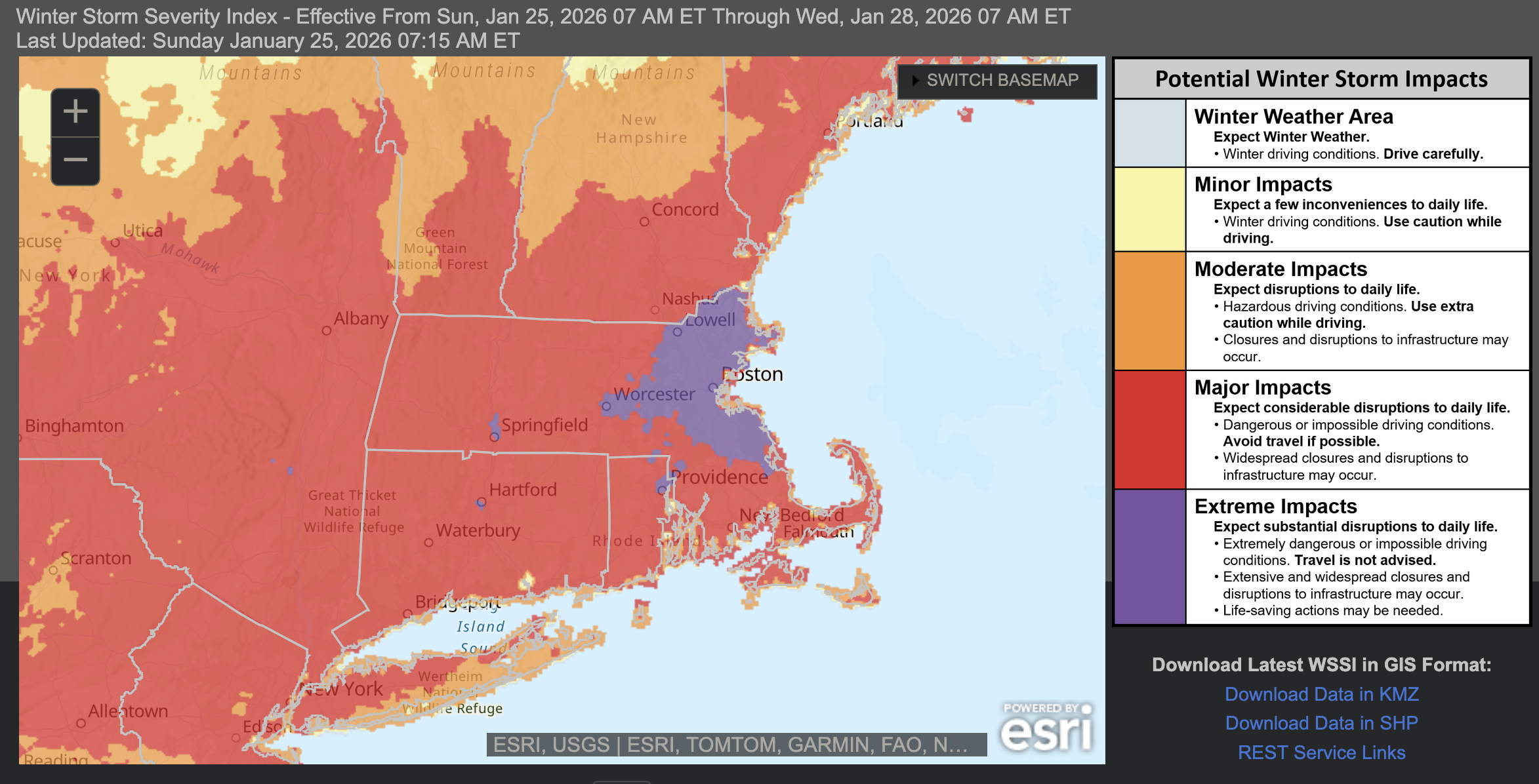
Latest WSSI map has a pretty large swath of extreme impacts in MA. A bit suspect that it cuts off so cleanly at the NH border though.

-
Clouds from this system go all the way to the Pacific off the coast of Mexico. Look at those waves of clouds over the N Atlantic, too. Pretty strong lightning signatures along that line from TX to AL.
-
“Cory’s in LA! Let’s MECS!” Jan. 24-26 Disco
wx_observer replied to TheSnowman's topic in New England
Am I just easily impressed, or is this one hell of a storm to put out this much snow across such a large area and not even be sub 1000mb? -
“Cory’s in LA! Let’s MECS!” Jan. 24-26 Disco
wx_observer replied to TheSnowman's topic in New England
I'm not a met and I'm not nearly as knowledgeable as most in here. But for me, NWS has historically been what I considered the most objective forecast source, not focused on ratings or hype or profit. They took the data and made a forecast based on an educated interpretation of that data, and explain their rationale in the discussions. What is the NBM? The discussions I read seem like they are written and signed by specific employees. -
“Cory’s in LA! Let’s MECS!” Jan. 24-26 Disco
wx_observer replied to TheSnowman's topic in New England
Better agreement with their forecast, at least. -
“Cory’s in LA! Let’s MECS!” Jan. 24-26 Disco
wx_observer replied to TheSnowman's topic in New England
That almost makes it more confusing, doesn't it? If maps have a 7a cutoff, you'd think that any additional snow after that would make the winter storm watches predict storm totals higher than the maps. -
“Cory’s in LA! Let’s MECS!” Jan. 24-26 Disco
wx_observer replied to TheSnowman's topic in New England
Yeah, it seems like they used to do a better job of putting out a consistent package update. Now there's a lot more disconnect between forecast products / shifts, etc. It's too bad. I always felt like we had an above average NWS office here. Not necessarily perfect, and at times overly cautious. But generally solid as far as weather forecasting goes. I still like reading their forecast discussions, though. -
“Cory’s in LA! Let’s MECS!” Jan. 24-26 Disco
wx_observer replied to TheSnowman's topic in New England
Today's 3:33 AM Winter Storm Watch text now has an 8-15" storm total for the region. That's a lot of bumping down totals in a pretty short time frame, compared to that first snowfall map that came out at 1am that showed a bunch of the south shore at 18-24". -
“Cory’s in LA! Let’s MECS!” Jan. 24-26 Disco
wx_observer replied to TheSnowman's topic in New England
They could at least pick a color somewhat different from the ocean. Or adjust the breakpoints seeing as there is no need for half of them. Just about anything other than what they did, really. -
We have close to 4" of new snow here from last night. Wasn't expecting quite that much.