wx_observer
-
Posts
278 -
Joined
-
Last visited
Content Type
Profiles
Blogs
Forums
American Weather
Media Demo
Store
Gallery
Everything posted by wx_observer
-
 Helpful--TY! Was wondering if it would hold out until this evening to get the lawn mowed. Probably not, if that model verifies.
 -
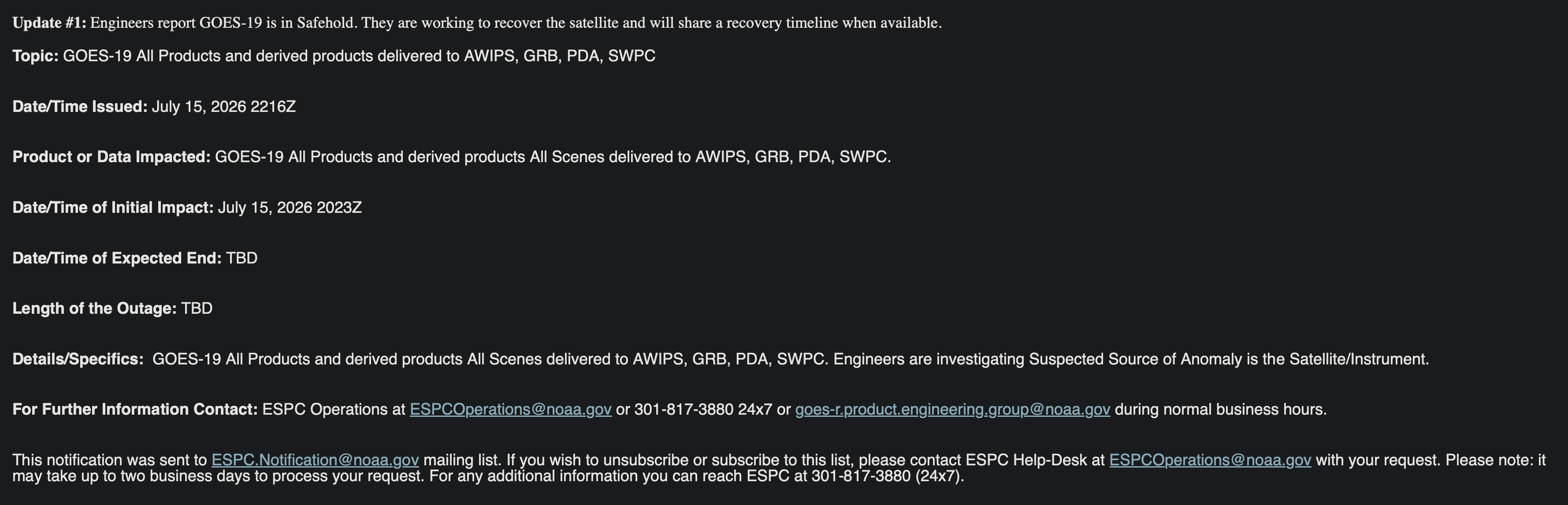
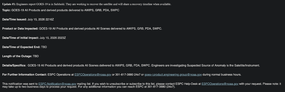
Looks like GOES 18 is being used as a fallback? https://www.ospo.noaa.gov/operations/goes/status.html https://usradioguy.com/news/goes-19-in-safe-hold/
-
Curious--is it on par with a normal cloudy day?
-
Wow, it looks like 8:30 pm out there. There's a weird "solar eclipse" vibe about it where things don't quite seem right. The air definitely has a heaviness to it. I don't smell smoke, but my mouth kind of tastes weird. Was it mostly forest that burned up there, or did it hit a lot of manmade things that have who knows what in them?
-
The sunbeam my cat is sitting in is making her look orange-pink. It's like it's sunset.
-
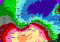
Don't see this too often:
-
I visualize data for a living. I can't imagine there being a circumstance where I would find that graphic meaningful. It would even be odd if your range was 90-95. The word "authority" is doing a lot of heavy lifting IMO.
-
Hoisting the Sultan Signal: Heavy Rain Event July 5-7
wx_observer replied to WxWatcher007's topic in New England
I don't care what the thermometer says. 61 degrees in July feels soooo much colder than 61 degrees in May. I'm shivering my timbers over here...brrrr! -
Maybe getting a shade cloth on the veggie garden will be worth it after all...been on the fence about it.
-
Beautiful pre-heat morning here in central MA! 68F with partial cloud cover, and still comfortable humidity. The breeze still feels cool, but since it's coming from the south I expect that will change soon.
-
NWS website down. EDIT: Came back up as soon as I posted this.
-
From Junorch to Jultorch...
-
Those cells peaked just west of me. It's about as hard as I've seen it rain, but it was otherwise unremarkable by the time the cell got here.
-
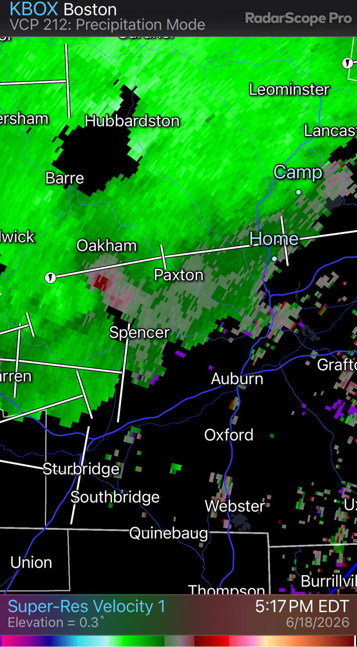
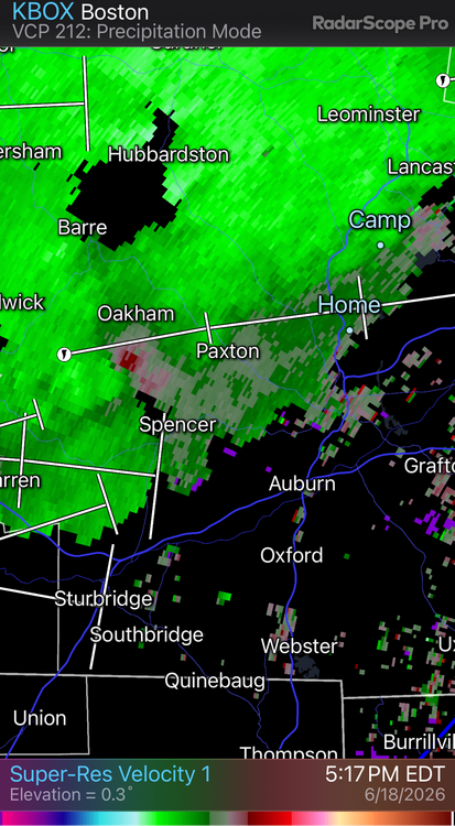
Mostly torrential rain right now, but really to head downstairs if needed. Gusty, but no more than earlier today. Not surprised if something happened in Paxton area--it looked pretty strong on velocity in that area.
-
That cell back in Warren is a bit amped too
-
And we're warned. The storm track going right over my house. Didn't have to chase anything lol
-
Okay, it's got my attention now...
-
TVS heading this way. Always interesting to see what actually happens with cells like this. Usually it's much ado about nothing.
-
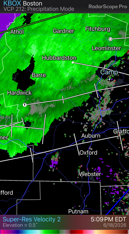
Sunny now, but still very breezy in central MA. This wind today has been stronger than I normally see during the average t-storm. North of MA border looks feisty! Really impressive main line of storms, but not sure how much of this makes it into Central / Eastern MA.
-
Skies are brightening up here. FWIW, there's already a tor warning in Western NY.
-
A month out from my last frost date, and I just gave away the last of my backup starter plants. Fun times.
-
So what does that look like in terms of surface winds? I'm in central MA and trying to figure out if I need to protect the veggie garden plants.
-
Just north of it, yes.
-
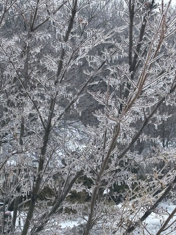
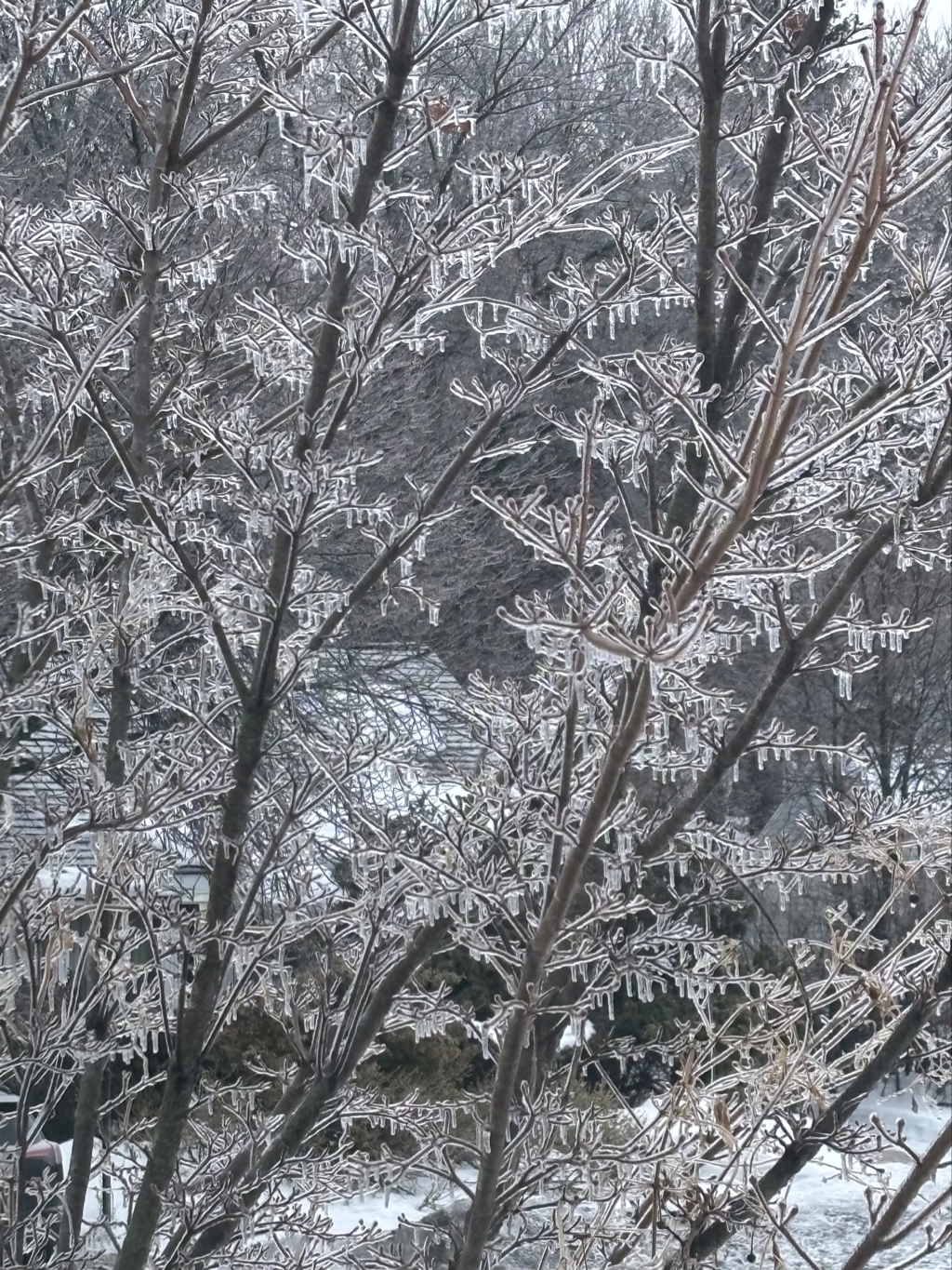
Temps were borderline for ice here. You can tell by the amount of drippy icicles on everything, rather than a thicker radial coating.
-