wx_observer
-
Posts
278 -
Joined
-
Last visited
Content Type
Profiles
Blogs
Forums
American Weather
Media Demo
Store
Gallery
Everything posted by wx_observer
-

“Cory’s in LA! Let’s MECS!” Jan. 24-26 Disco
wx_observer replied to TheSnowman's topic in New England
Not too often that you see San Antonio and Presque Isle have extreme cold watches at the same time...with a nearly solid wall of winter weather alerts in between.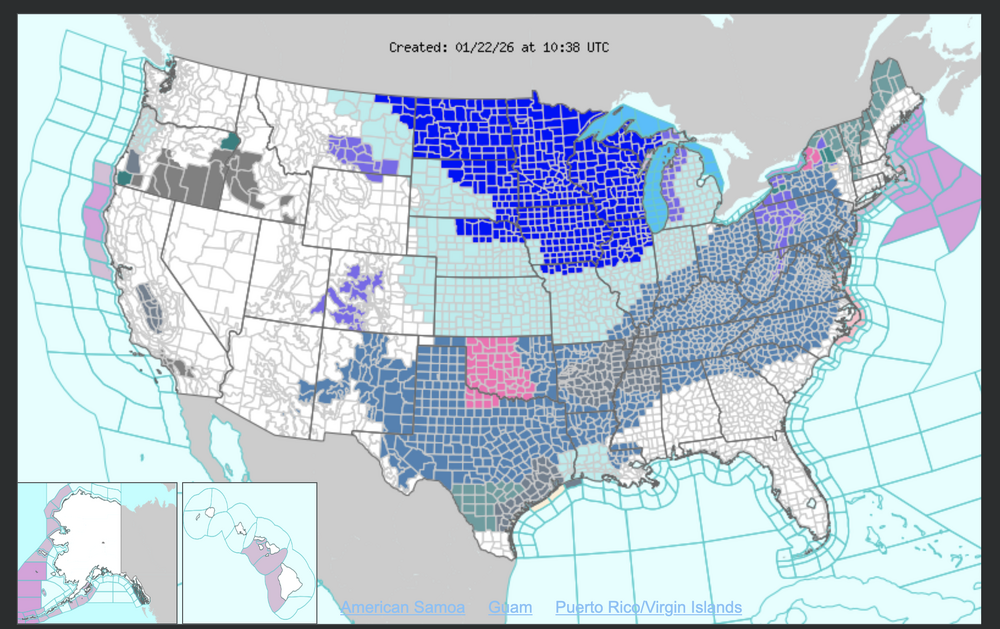
-
January 2026 regional war/obs/disco thread
wx_observer replied to Baroclinic Zone's topic in New England
Skies should be clear enough tonight to see the aurora if it makes it far enough south: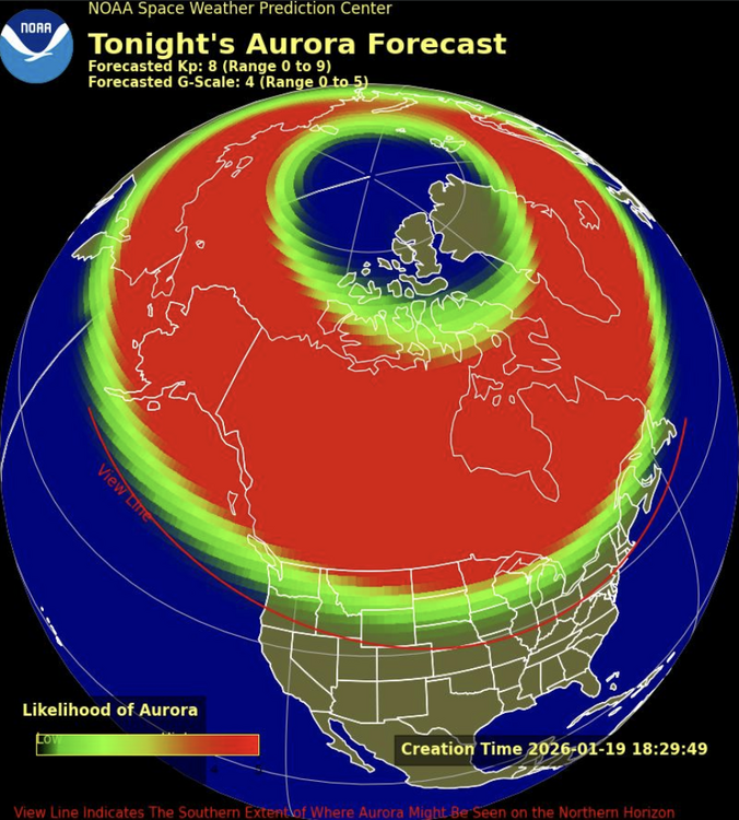
-
Rise of the Machines: January 18-19 Winter Storm Obs Thread
wx_observer replied to WxWatcher007's topic in New England
Snow is really holding on out there. It looks like about 5-6 inches total for the weekend in Central MA.
-
January 2026 regional war/obs/disco thread
wx_observer replied to Baroclinic Zone's topic in New England
Snow Squall Warning until 8:30 AM. Don't see those too often! Looks pretty intense just south of Grafton, heading towards Milford right now. -
December 2025 regional war/obs/disco thread
wx_observer replied to Torch Tiger's topic in New England
Yep. 9 F here with -4 wind chill in Central MA. This is the kind of cold we normally see in the coldest week of January, not early Dec. Lots of water main breaks in my area in the past few days...gotta wonder if it's related. -
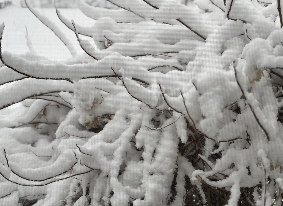
So far, no flip back to snow here. But we have way more ice than I expected from this one. Not sure how much because it's dark. But there's at least enough to have visible icicles on the power lines, and enough to flatten a mature 8' steeds holly to about half its normal height. You can hear the ice on the tree limbs when the wind blows. North facing surfaces seem to be hit the worst.
-
29 F and a mix of freezing rain and sleet here. Got about 2.5-3 inches on the ground before the switch. Roads look really messy.
-
Looks like we've switched to straight freezing rain here. Seems to have switched over as soon as that heavier band of precip over central MA moved in.
-
Hearing some pinging out there now at the border of Southern and Northern Worc County.
-
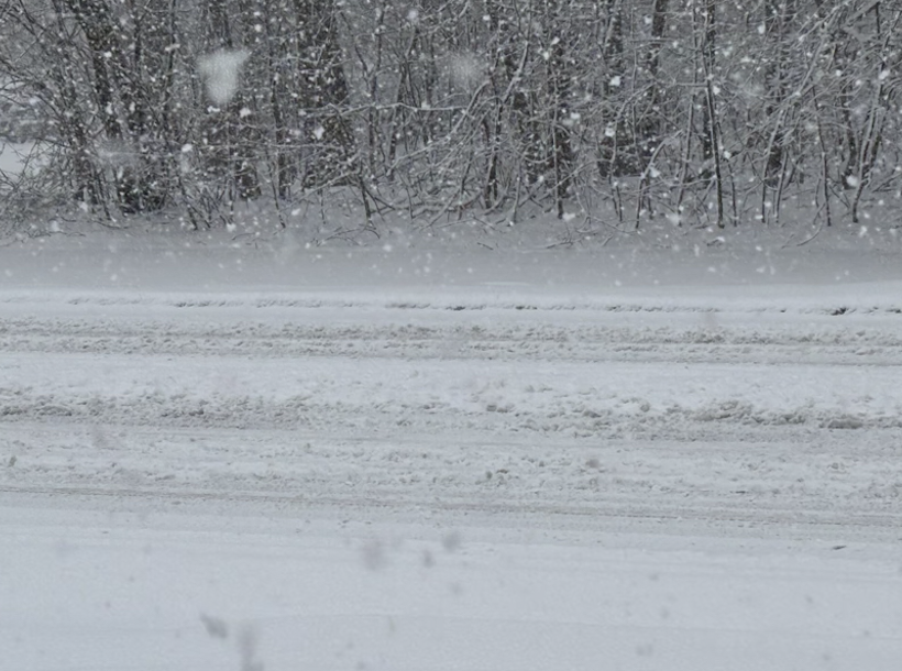
About an inch on the ground with moderate snow right now at the Worcester / WB line. Major roads right off the highway are snow covered. It's the perfect snowfall for a nice cup of tea and staying off the roads. First storms without any existing salt or sand on the road are pretty messy, even with just a few inches of snow.
-
First Winter Storm to kickoff 2025-26 Winter season
wx_observer replied to Baroclinic Zone's topic in New England
Light snow, and sticking to the roads pretty quickly here at the Holden / WB / Worcester line. Warm pavement? Not here. Warm grass, maybe. -
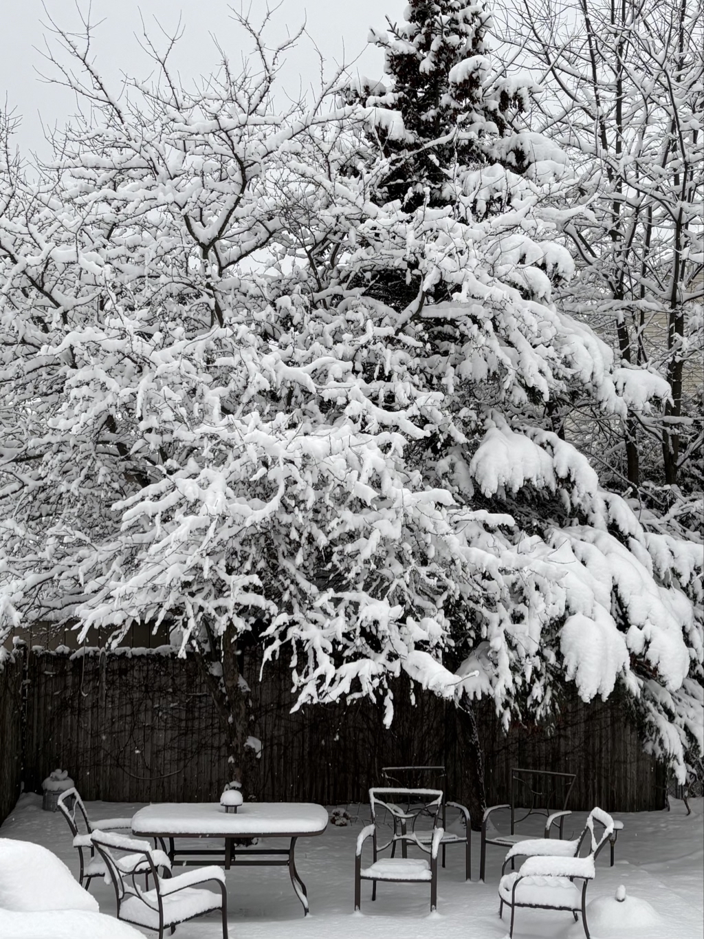
I'm probably a couple miles north of you, and have a little over 6" here too. It's beautiful--just didn't expect to get my biggest snowfall of the season mid-April.
-
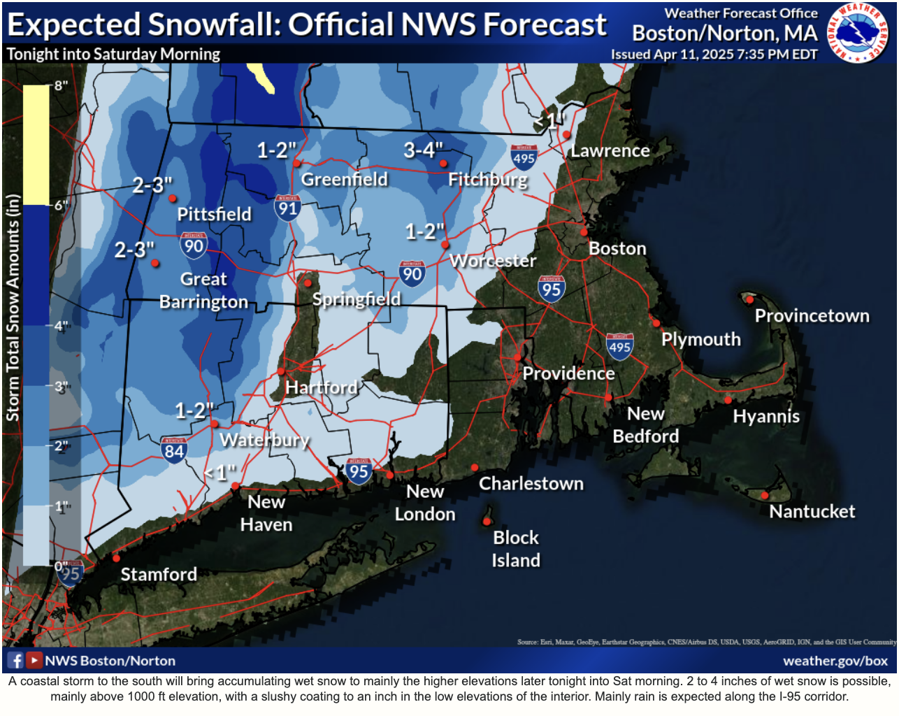
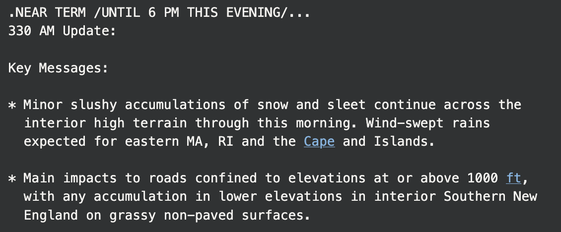
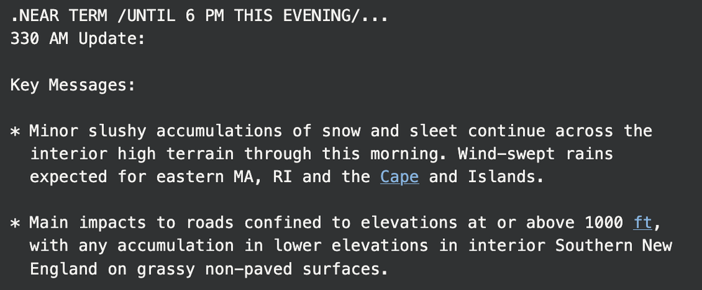
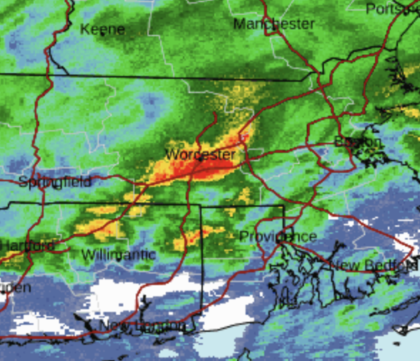
Guess this is what we should expect now that they have cut all that funding and staff at NWS? Most recent snow map on the website is from 7:30 pm last night. I'm in the 2-3" range on this map and I'm technically not even in the WWA zone. I'm at 650 elevation and have at least 6" on the ground...and it's still snowing. The 3:30 am update follows suit:

-
At the border of Northern and Southern Worcester County. About 650 elevation.
-
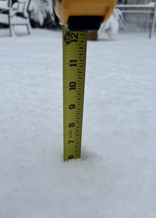
Looks like 6" on the nose here:
-
Nope. But I didn't hear any thunderclaps after that first one.
-
This is on a double-line main road. I'd say we're around 4" here, at least that much on grassy surfaces.
-
Beefy band in Central MA--still snow, at least where I am.
-
Thundersnow in Central MA!!!
-
I can't remember the last time I heard wind howl like this. We have to be gusting over 60 here.
-
24F and pouring freezing rain here now. A few pellets mixed in.
-
Heavy sleet right now in Central MA at the NWC/SWC border. Actually...it sounds like it might have switched over to more freezing rain as I'm typing this.
-
December 2024 - Best look to an early December pattern in many a year!
wx_observer replied to FXWX's topic in New England
Looks like we had freezing rain most of the night in Central MA. There's maybe about a .10 glaze out there. -
Lots of huuuuge flakes in Central MA right now. Maybe around 4" on the ground, but it's snowing at a pretty good clip here ATM.
-
Blowvember - and not named for wind potential
wx_observer replied to Go Kart Mozart's topic in New England
We got just enough frozen precipitation overnight to make mini icicle nubs on the handrails and glaze the car windows. Roads and sidewalks could be really slick until it warms up a few more degrees.