wx_observer
-
Posts
287 -
Joined
-
Last visited
Content Type
Profiles
Blogs
Forums
American Weather
Media Demo
Store
Gallery
Everything posted by wx_observer
-
 Clouds from this system go all the way to the Pacific off the coast of Mexico. Look at those waves of clouds over the N Atlantic, too. Pretty strong lightning signatures along that line from TX to AL.
 -
“Cory’s in LA! Let’s MECS!” Jan. 24-26 Disco
wx_observer replied to TheSnowman's topic in New England
Am I just easily impressed, or is this one hell of a storm to put out this much snow across such a large area and not even be sub 1000mb? -
“Cory’s in LA! Let’s MECS!” Jan. 24-26 Disco
wx_observer replied to TheSnowman's topic in New England
I'm not a met and I'm not nearly as knowledgeable as most in here. But for me, NWS has historically been what I considered the most objective forecast source, not focused on ratings or hype or profit. They took the data and made a forecast based on an educated interpretation of that data, and explain their rationale in the discussions. What is the NBM? The discussions I read seem like they are written and signed by specific employees. -
“Cory’s in LA! Let’s MECS!” Jan. 24-26 Disco
wx_observer replied to TheSnowman's topic in New England
Better agreement with their forecast, at least. -
“Cory’s in LA! Let’s MECS!” Jan. 24-26 Disco
wx_observer replied to TheSnowman's topic in New England
That almost makes it more confusing, doesn't it? If maps have a 7a cutoff, you'd think that any additional snow after that would make the winter storm watches predict storm totals higher than the maps. -
“Cory’s in LA! Let’s MECS!” Jan. 24-26 Disco
wx_observer replied to TheSnowman's topic in New England
Yeah, it seems like they used to do a better job of putting out a consistent package update. Now there's a lot more disconnect between forecast products / shifts, etc. It's too bad. I always felt like we had an above average NWS office here. Not necessarily perfect, and at times overly cautious. But generally solid as far as weather forecasting goes. I still like reading their forecast discussions, though. -
“Cory’s in LA! Let’s MECS!” Jan. 24-26 Disco
wx_observer replied to TheSnowman's topic in New England
Today's 3:33 AM Winter Storm Watch text now has an 8-15" storm total for the region. That's a lot of bumping down totals in a pretty short time frame, compared to that first snowfall map that came out at 1am that showed a bunch of the south shore at 18-24". -
“Cory’s in LA! Let’s MECS!” Jan. 24-26 Disco
wx_observer replied to TheSnowman's topic in New England
They could at least pick a color somewhat different from the ocean. Or adjust the breakpoints seeing as there is no need for half of them. Just about anything other than what they did, really. -
We have close to 4" of new snow here from last night. Wasn't expecting quite that much.
-
“Cory’s in LA! Let’s MECS!” Jan. 24-26 Disco
wx_observer replied to TheSnowman's topic in New England
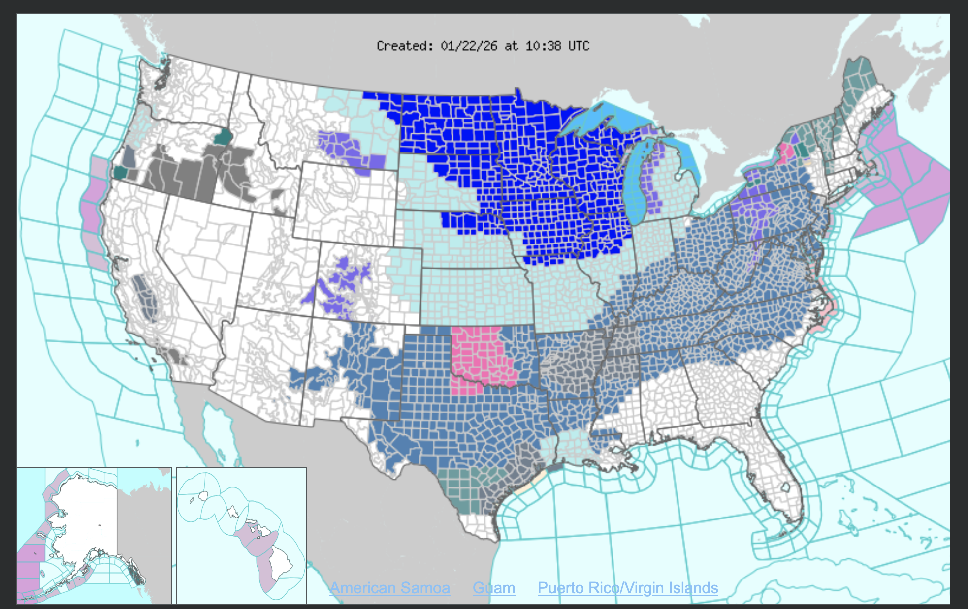
Not too often that you see San Antonio and Presque Isle have extreme cold watches at the same time...with a nearly solid wall of winter weather alerts in between.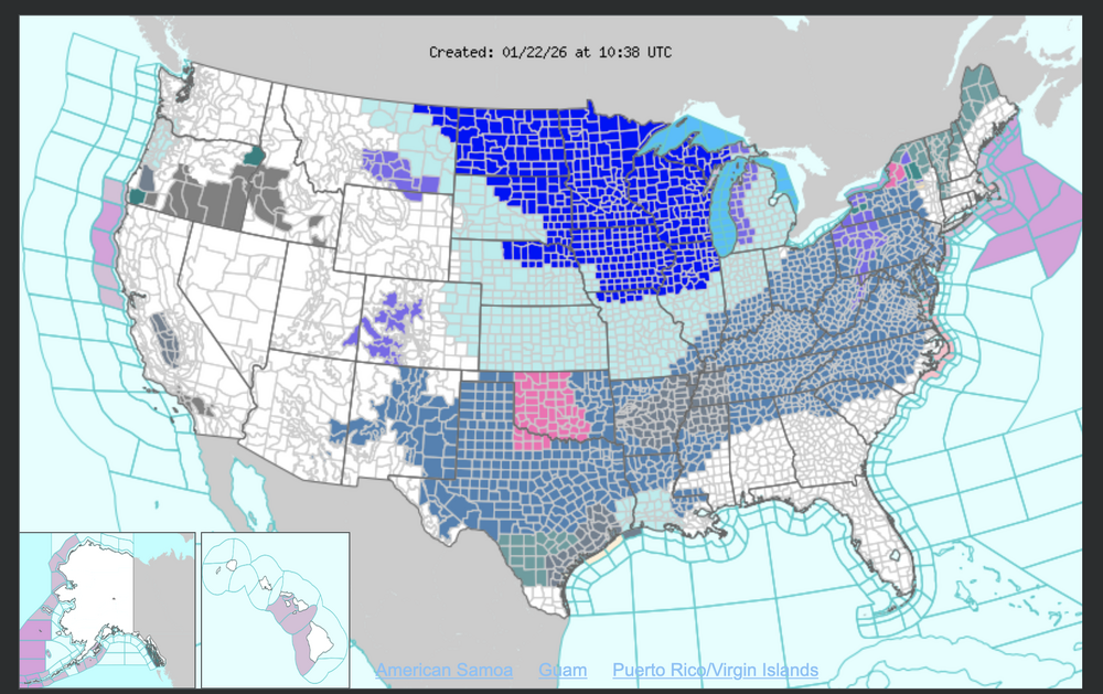
-
January 2026 regional war/obs/disco thread
wx_observer replied to Baroclinic Zone's topic in New England
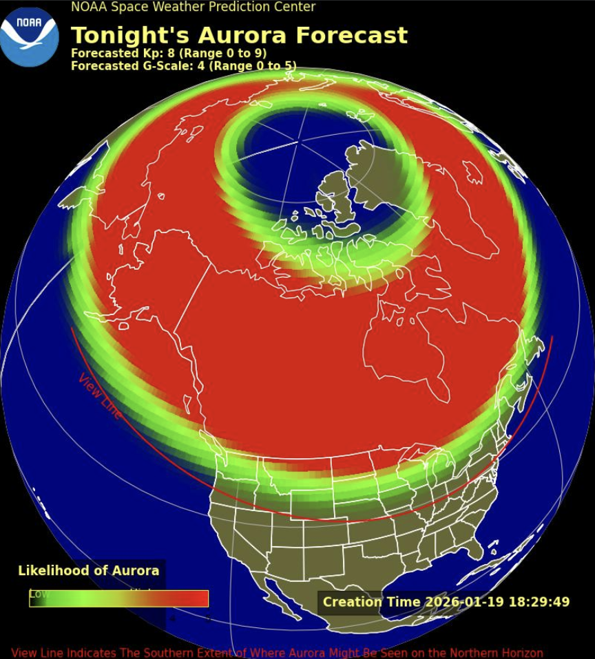
Skies should be clear enough tonight to see the aurora if it makes it far enough south: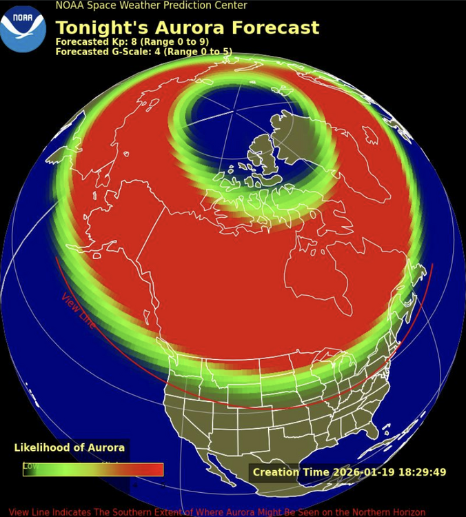
-
Rise of the Machines: January 18-19 Winter Storm Obs Thread
wx_observer replied to WxWatcher007's topic in New England
Snow is really holding on out there. It looks like about 5-6 inches total for the weekend in Central MA.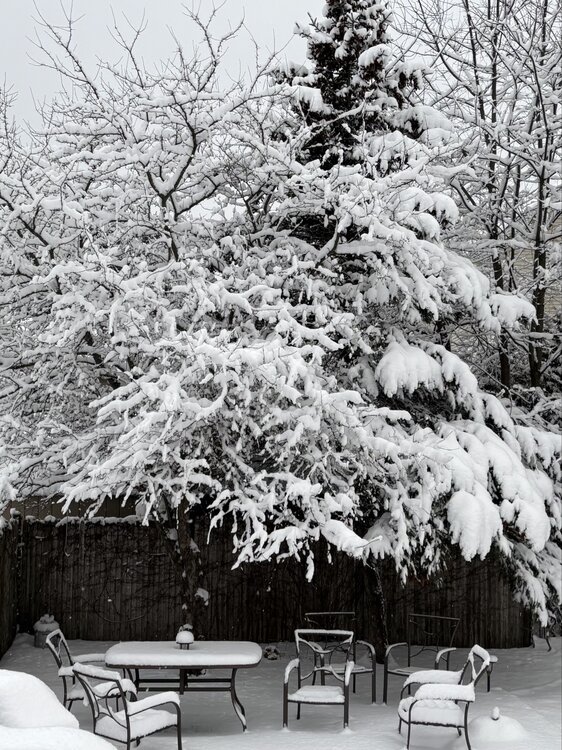
-
January 2026 regional war/obs/disco thread
wx_observer replied to Baroclinic Zone's topic in New England
Snow Squall Warning until 8:30 AM. Don't see those too often! Looks pretty intense just south of Grafton, heading towards Milford right now. -
December 2025 regional war/obs/disco thread
wx_observer replied to Torch Tiger's topic in New England
Yep. 9 F here with -4 wind chill in Central MA. This is the kind of cold we normally see in the coldest week of January, not early Dec. Lots of water main breaks in my area in the past few days...gotta wonder if it's related. -
So far, no flip back to snow here. But we have way more ice than I expected from this one. Not sure how much because it's dark. But there's at least enough to have visible icicles on the power lines, and enough to flatten a mature 8' steeds holly to about half its normal height. You can hear the ice on the tree limbs when the wind blows. North facing surfaces seem to be hit the worst.
-
29 F and a mix of freezing rain and sleet here. Got about 2.5-3 inches on the ground before the switch. Roads look really messy.
-
Looks like we've switched to straight freezing rain here. Seems to have switched over as soon as that heavier band of precip over central MA moved in.
-
Hearing some pinging out there now at the border of Southern and Northern Worc County.
-
About an inch on the ground with moderate snow right now at the Worcester / WB line. Major roads right off the highway are snow covered. It's the perfect snowfall for a nice cup of tea and staying off the roads. First storms without any existing salt or sand on the road are pretty messy, even with just a few inches of snow.
-
First Winter Storm to kickoff 2025-26 Winter season
wx_observer replied to Baroclinic Zone's topic in New England
Light snow, and sticking to the roads pretty quickly here at the Holden / WB / Worcester line. Warm pavement? Not here. Warm grass, maybe. -
I'm probably a couple miles north of you, and have a little over 6" here too. It's beautiful--just didn't expect to get my biggest snowfall of the season mid-April.
-
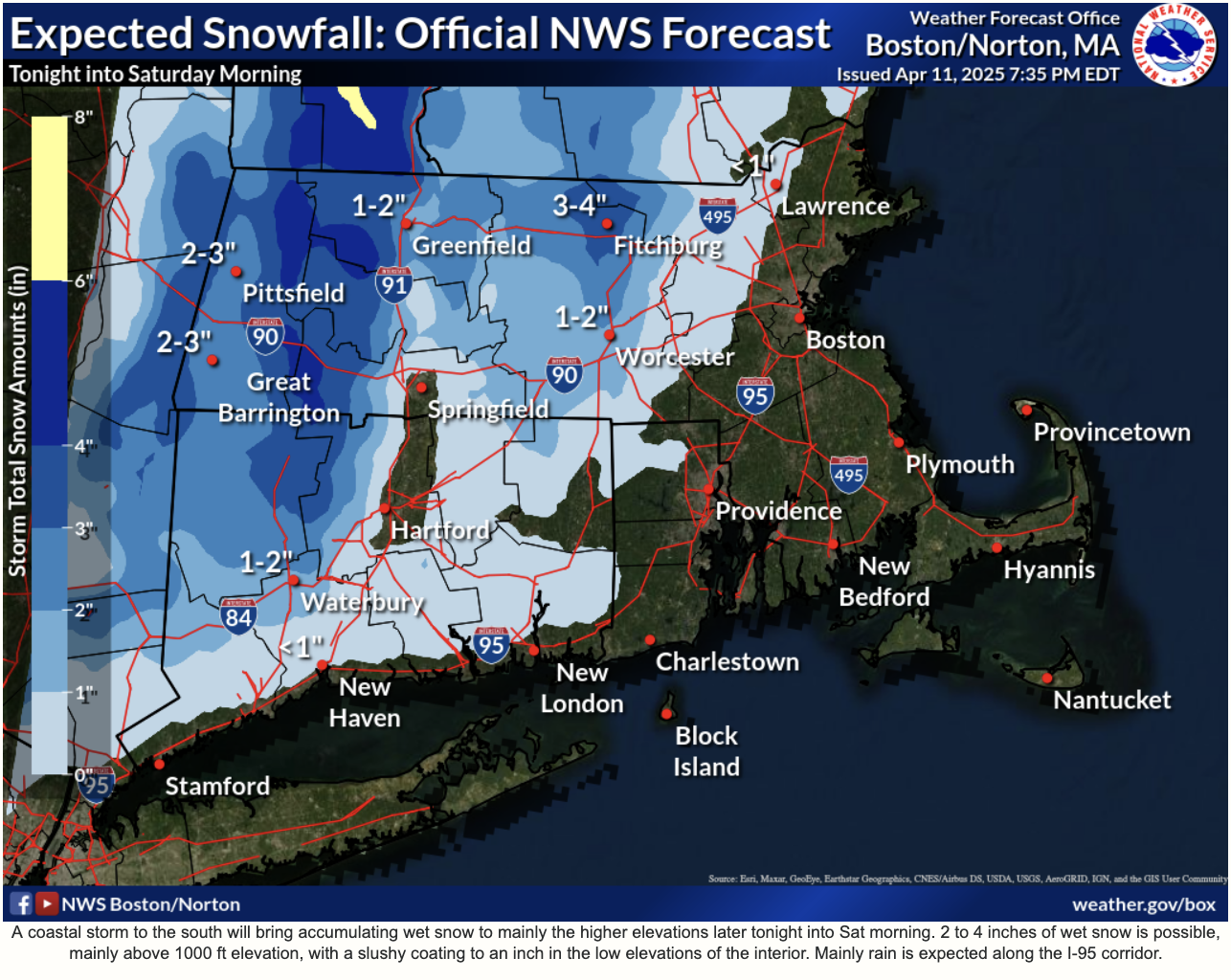
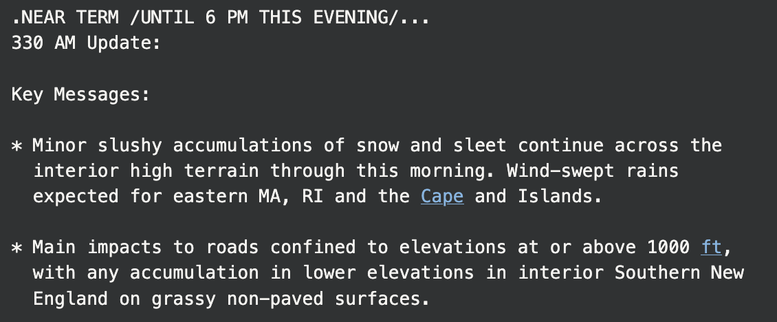
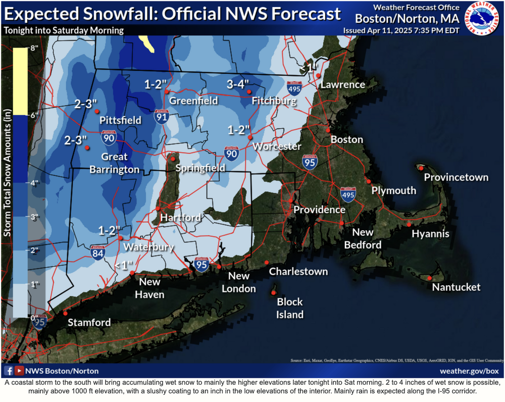
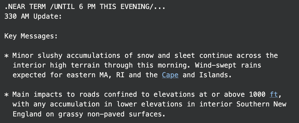
Guess this is what we should expect now that they have cut all that funding and staff at NWS? Most recent snow map on the website is from 7:30 pm last night. I'm in the 2-3" range on this map and I'm technically not even in the WWA zone. I'm at 650 elevation and have at least 6" on the ground...and it's still snowing. The 3:30 am update follows suit:
-
At the border of Northern and Southern Worcester County. About 650 elevation.
-
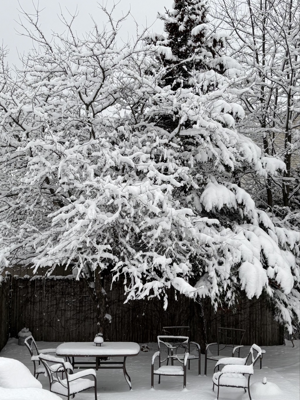
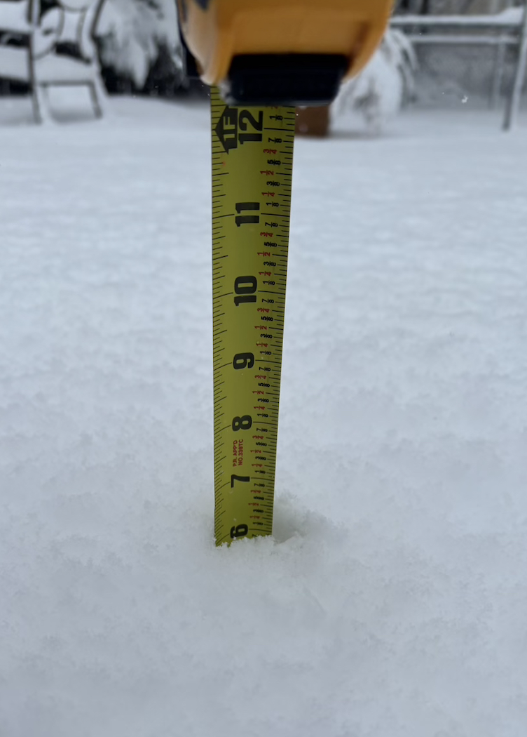
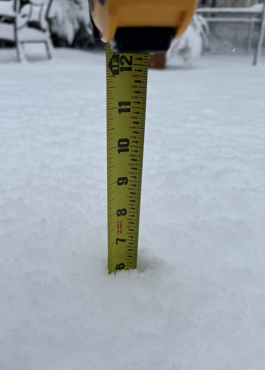
Looks like 6" on the nose here:
-
Nope. But I didn't hear any thunderclaps after that first one.