SnowenOutThere
-
Posts
5,666 -
Joined
-
Last visited
Content Type
Profiles
Blogs
Forums
American Weather
Media Demo
Store
Gallery
Everything posted by SnowenOutThere
-


-
Thank you! To be entirely honest knowing which model solution is correct goes beyond my forecasting ability as I don't know enough about the synoptics behind storm formation yet (though I am trying to learn). However, I am generally able to identify which runs are better and why in relation to synoptics. I think the main way that the Euro develops the storm to be weaker lies in it having less favorable interactions with the low pressure up north. Looking just at the GFS to Euro we can see the GFS gets the ULL out of the northeast slightly faster so there is less connection between the waves. The Euro on the other hand keeps it a little slower with the northern ULL so there is more suppression and reduction in actual ability to form a low. Though as I said before this is getting to the end of my knowledge so take it with a grain of salt.
-
Just now realizing how delusional it is to truly be trying to extrap the hour 15 of the HRRR its like this
-
So far (and this is borderline delusional to say) I like the changes that the HRRR has made through the grad total of hour... 15.
-
With the 0z HRRR running for the Monday storm I'm going to do a quick breakdown of what we want it to show (as its 18z run was by far the best we've seen for us). I will be comparing it to the 18z Euro. So starting out early in the run the first appreciable difference is that the more northern parts of the shortwave (plus the northern crusher) are weaker compared to the Euro. This helps our system out by allowing it to consolidate a bit more rapidly in the plains which in turn allows for an earlier amplification period. However, the real difference is in the confluence up north. The Euro has this running across our northeastern states. The HRRR on the other hand has it around 50 plus miles further north keeping the confluence located more in Canada and less across upstate New York. This obviously gives our storm a bit more room to breathe. So as the 0z runs its going to be important to see if it maintains these positive aspects. Additionally, it gives us a reference for how the setup would need to look in order to get snow into the subforum proper.
-
Euro has a light clipper next Friday but the H5 is such a mess I doubt its going to be even close to what we end up with as we have 5 different H5 vorticity max areas all interacting with each other. Sorta reminds me of this with how it plays out

-
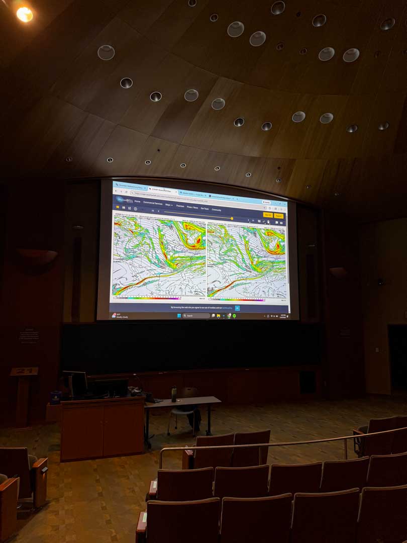
I also think I win when it comes to my setup for analyzing the various potential storms we got on our radars. Its a bit of a weather nerds dream to have a whole projector to yourself.

-
You can see another area of vorticity just barely escape out ahead of our wave. I mean this is the GFS at hour 147 and just look at how close our waves are to creating something truly special Instead it escapes and its all the NS doing work Ngl for whatever reason I'm feeling this one. We got all the stuff setup at the H5 level and just need something to combine together.
-
-
One of the funnier discussions I’ve seen. Don’t blame that at all though!
-
Reviewing my event snowfall forecast and I think I did pretty well. Only real miss was underestimating how far east the northern extent of the 2-4 would reach as it ended up getting close to Cville itself.
-
Ah, I've considered if its worth upgrading to that one. I didn't know Farmville had a bridge like that but its only an hour and a half from where I'm at currently so next event I might need to make the trek down there. Once again though those pictures are just amazing.
-
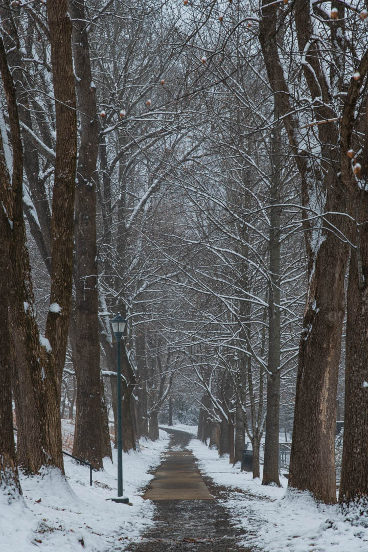
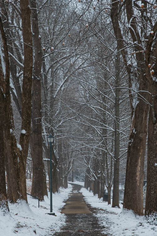
Final shots of the snow (heavily compressed if anyone knows how to seamlessly link to an actual image hosting site please let me know!) before I'm forced to lock myself in a windowless room for finals studying. I've loved getting to track this storm from the synoptic stuff down to radar nowcasting and then getting to enjoy it while it snowed. Thank you to everyone who posted in this thread!
-
Amazing pictures! What did you use to shoot them (especially the drone shots as they seem far nicer than what I can get with my mini 2). As others said that bridge shot is something special.
-
BTW @NorthArlington101 Euro has the Monday storm with a significant jump northward to get snow flurries close to the DC metro area. The 12z CMC also had a more consolidated precap field as well FWIW.
-
Looking at the bottom image (and from talking to @brooklynwx99 earlier) we need to have that low of Alaska to retrograde off the coast more (which it has been doing in more recent runs) in order to pump up the PNA and get more amplitude for our shortwave(s). Would be fun to have a rather strong storm pop into existence within a couple days of the event which isn't impossible given how the right pieces are all there.
-
To comment on the actual dynamics of next week I haven't really checked the models much as I was outside for 11 hours yesterday but looks like lots of NS vorticity flying around so models wont have a great handle on events. Either way we have the cold in place and a good upper air pattern so all we need is to get lucky. Additionally, if we get that bowling ball over us our lapse rates would be insane enough to help out any system that does form (12z GFS for example).
-
Please god lets have this somehow be right because look at this sounding I don't know how to draw up a better one. Gets over an inch of snow per hour for six hours and a storm total of 8 inches. Would probably go down as my favorite event if it happened verbatim
-
Last winter's January 3rd snow squall was awesome. Had 2 instances of thunder snow (with lightning flashes!) as it switched from graupel to dendrites. Just wish it lasted a bit longer to get accumulations above .4 of an inch
-
Yk what I think I should be allowed to create more threads in the future if we’re getting snow 12+ hours it was supposed to end.
-
Well I like to think that my skill has something to do with them too lmao. But the d850 is 45mp flagship dslr camera so it’s pretty much a professional camera.
-
Nikon D850 with the 24-120 f/4 lens for all of the pictures I've posted. I'm lucky where my hobbies of meteorology and photography align quite nicely (though meteorology is SO much cheaper lmao). Besides, if you think that picture is nice that is the 50% quality 4 times downscaled pixel wise version that AMWX lets me upload.
-
The students weren't the only ones on Grounds enjoying the snow today!
-
Did a basic ruler measurement which showed that I got somewhere between 3-4inches of snow (since compacted to 3). I’ve been up since 3am and outside for 9 of those hours so now it’s nap time before lighting of the lawn (holiday light snow) and the midnight snowball fight
-
UVA's chemistry department's amazing decision to make our group exam online over zoom is currently going great. 1. No one knows which group to go in 2. No one is able to access the questions 3. No one knows how to submit them. Meanwhile I am watching snow fall outside my window this is cruel