
TheNiño
-
Posts
316 -
Joined
-
Last visited
Content Type
Profiles
Blogs
Forums
American Weather
Media Demo
Store
Gallery
Everything posted by TheNiño
-
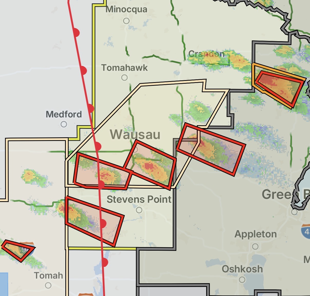
Watch is up lol. Significant clearing behind the line. Madison is sunny and already at 92
-
Seriously. I had the same thought. Feels like I’m wearing the air. Pretty dense fog here next to the lake too
-
Good grief. Hopefully they get it out of their system before Oshkosh
-
This is my moment
-
Welp here we go again
-
Oshkosh AirVenture could be interesting. Not like there’s 10s of thousands of people camping and thousands of planes that aren’t tied down properly. Hopefully they catch a break
-
- 386 replies
-
- 10
-

-

-
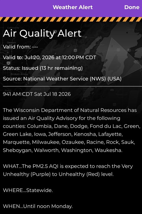
Six Flags closed at 3 today. First time in the parks history it closed due to air quality. Black Keys concert in Chicago also cancelled
-
☠️
-
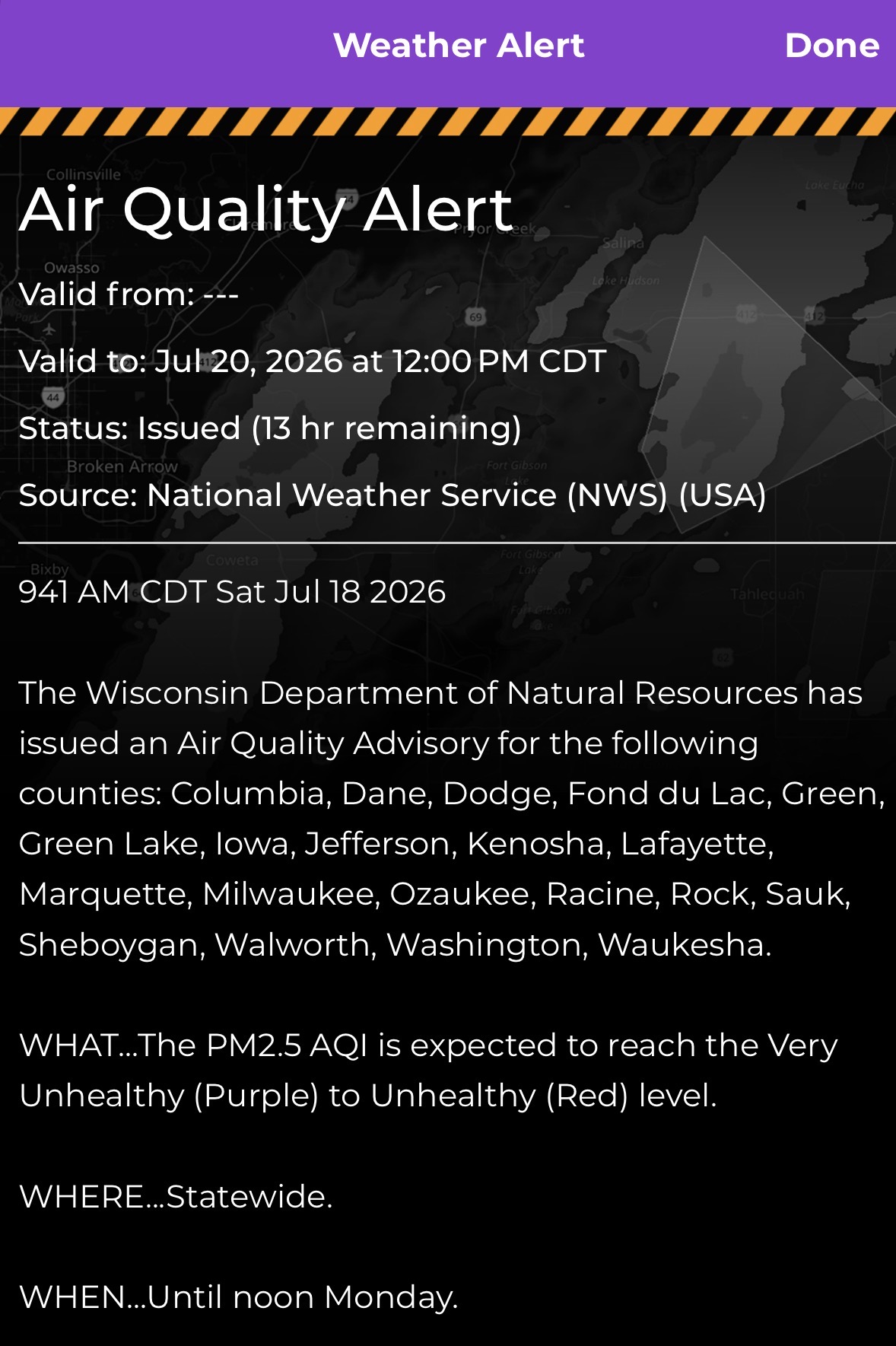
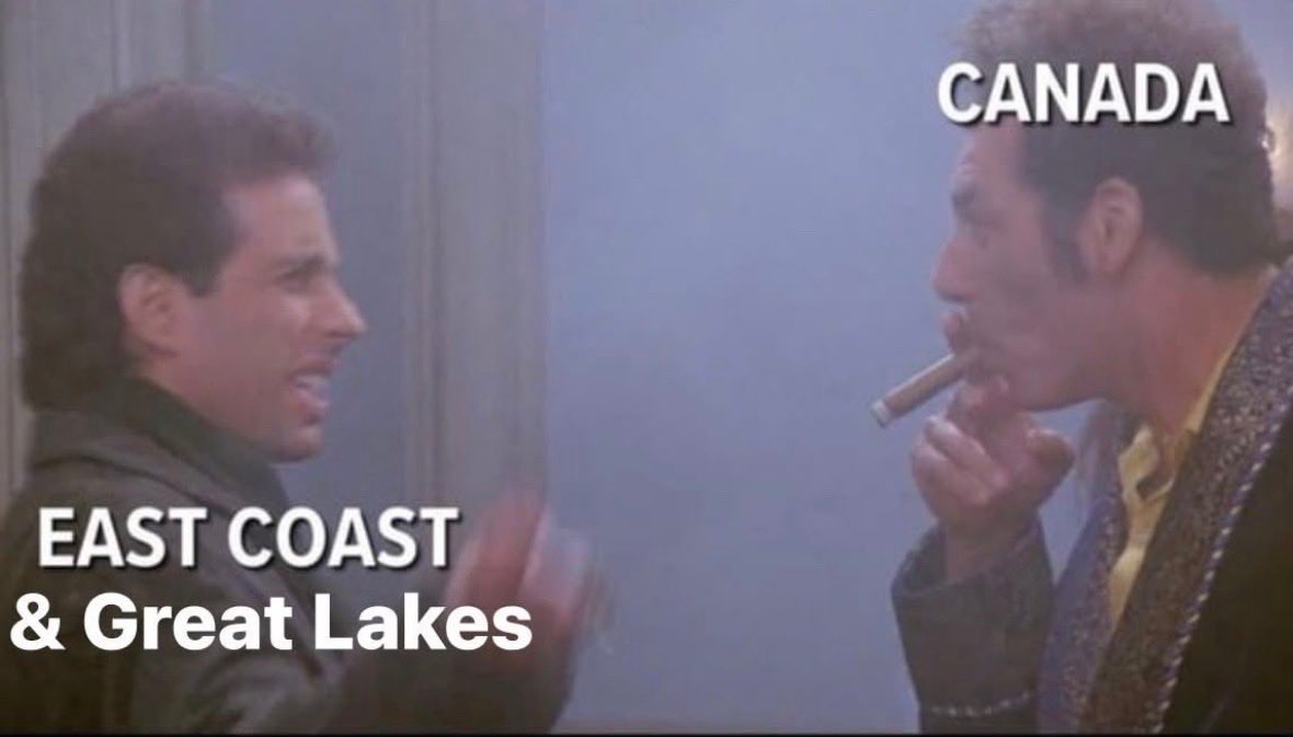
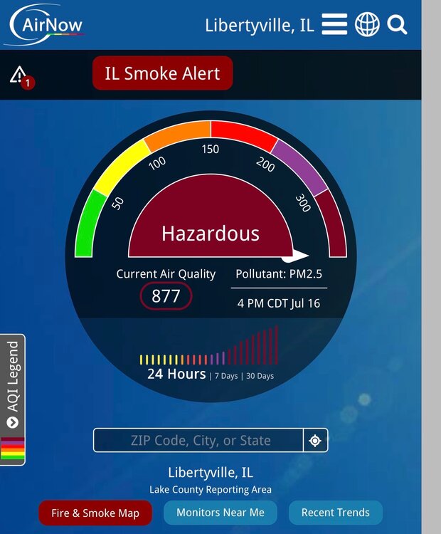
The past few years has been crazy with the smoke but this is the worst I’ve ever experienced. AQI in Libertyville was over 700 briefly. That’s absolutely insane. Not sure how to look up historical data on this but is this a relatively new thing within the past 5-10 years? I do not remember anything like this ever happening in the 90s - 2010s. I’m sure climate change is a contributor but what else is at play here? Why are the fires so much more intense than in decades past? Has Canada stopped doing some sort of prevention/mitigation that they used to do in the past? Have rainfall amounts dramatically decreased up there recently? Or am I simply misremembering and this has always been an issue? It feels like this only started happening maybe 5 years ago but it’s been every summer since.
-
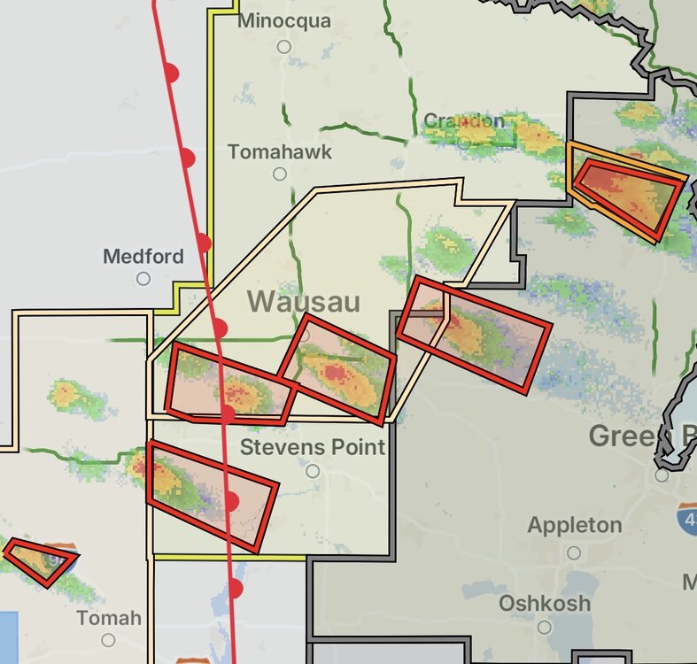
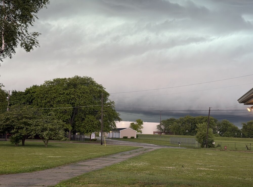
Tor warned here. I’ve actually lost track of how many we’ve had. What a crazy year Edit: Warning was cancelled before it got here. Nice little non rotating wall cloud rolled through though. I’d estimate 50mph gusts. Power is out. Was a fun one
-
I am absolutely loving this show. Got about 12 mosquito bites taking this though. Little bastards
-
-
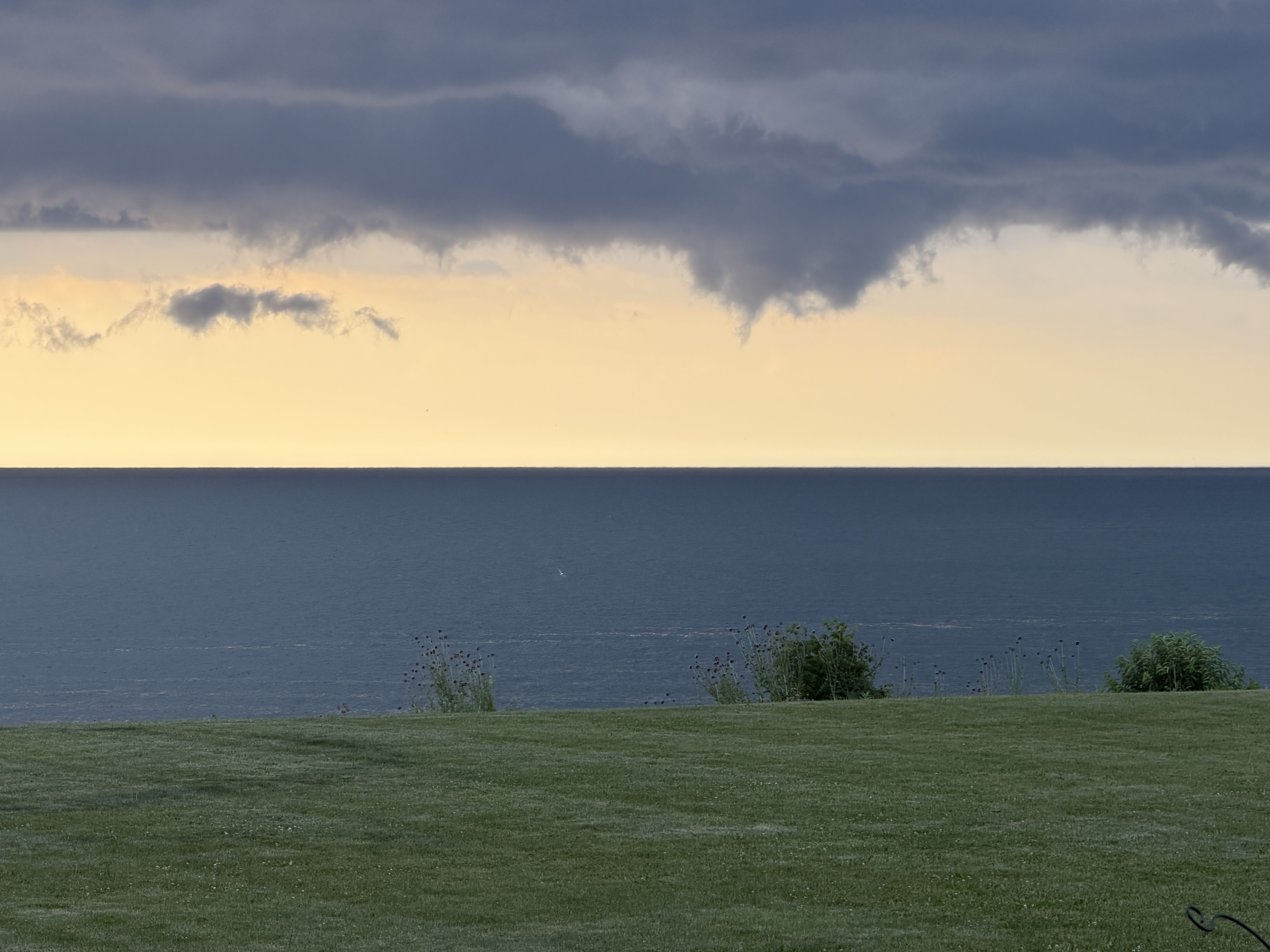
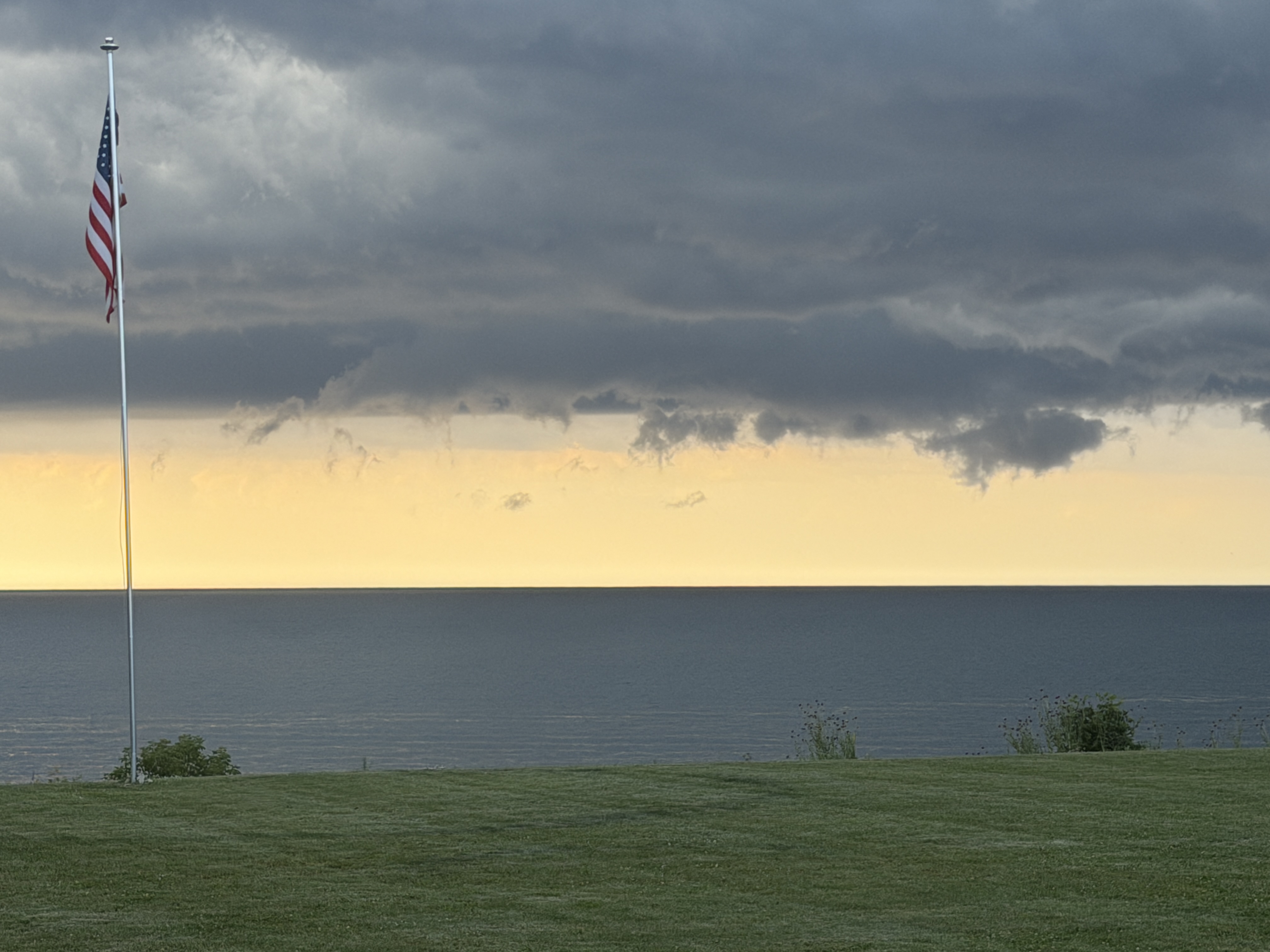
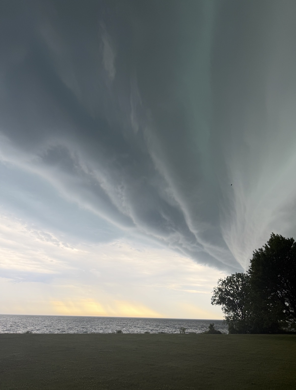
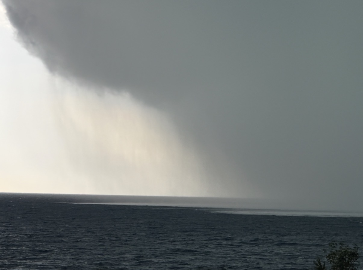
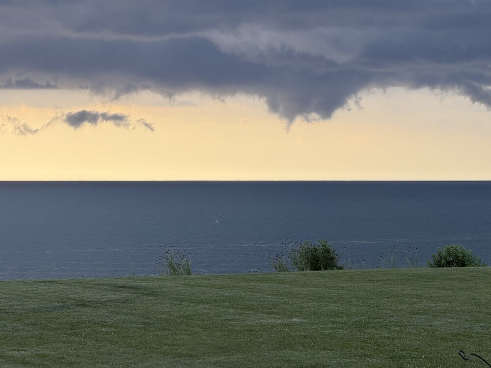
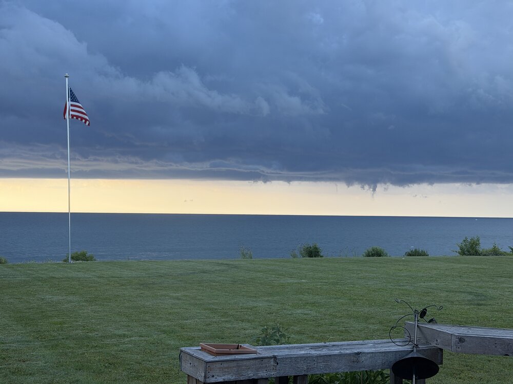
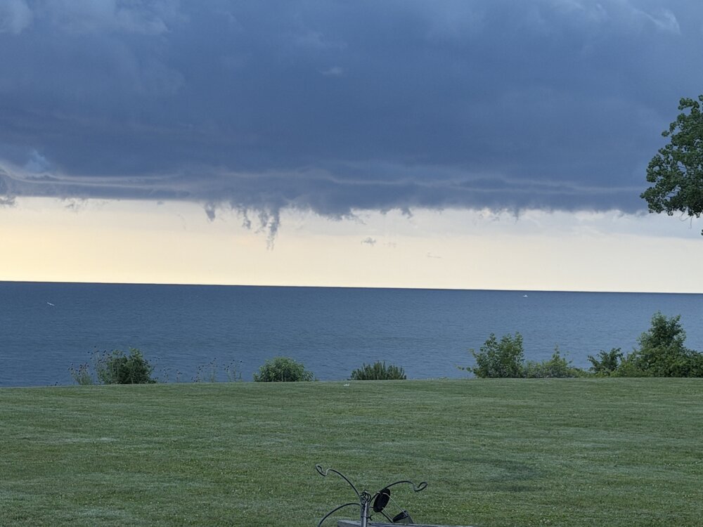
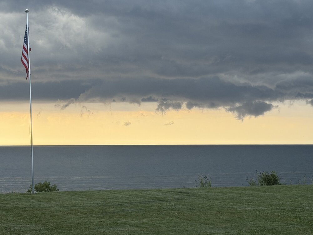
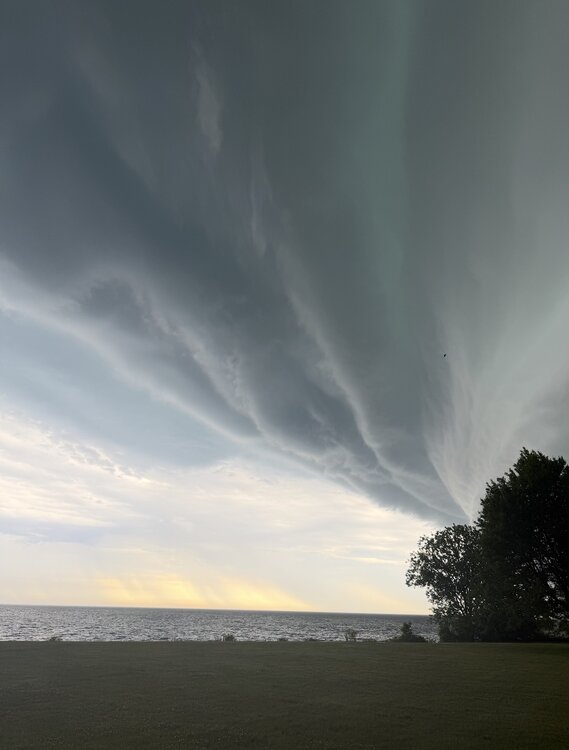
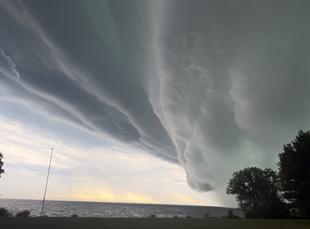
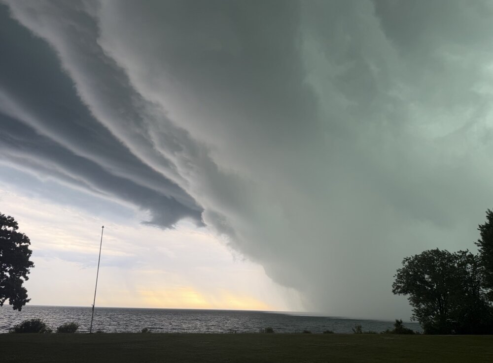
Some neat cloud formations over the lake this morning. No rotation. Just kinda cool
-
Always seem to get something on or around the 4th around here. A couple years ago I was at a fireworks show with epic lightning and an approaching storm in the distance and that wasn’t the first time. Wouldn't hate if that happened again. Not looking like that’ll happen on the 4th which I guess is good but seems to happen a lot
-
Forget all your typical heatwave songs. Time for us to enjoy the summer like the manly men we are. Anyone got an extra scooter? We’re in this for a while better make the best of it lol
-
Actually asking. What is the effect of the tropical storm going to have on this? It has to have some impact I feel like it’ll steal some energy, no? Nobody seems to be talking about it and I’m legit asking
-
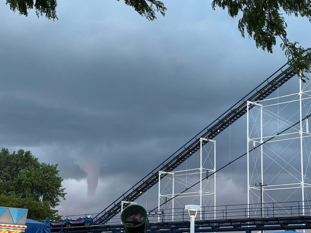
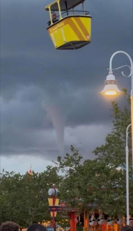
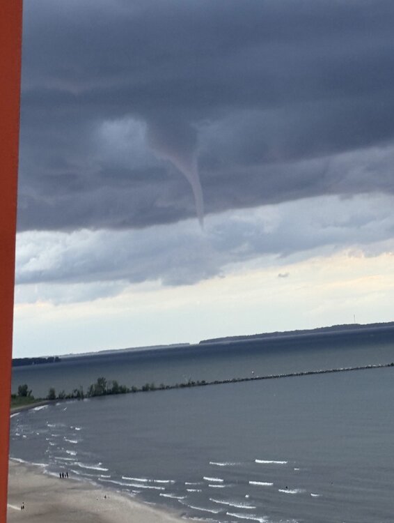
Water spout at Cedar Point

- 221 replies
-
- 11
-
-

-
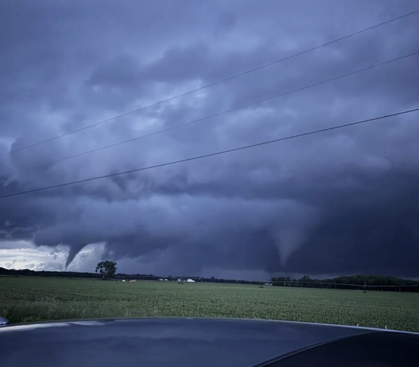
EF-1 confirmed in Somers near Kenosha. Missed me by a few miles. That is the second confirmed tornado in the little town of Somers this season. https://www.fox6now.com/news/wisconsin-confirmed-tornado-thursday-061126.amp
-
This is from Kouts
- 260 replies
-
- 11
-
-

-
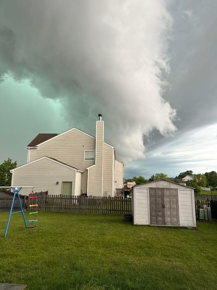
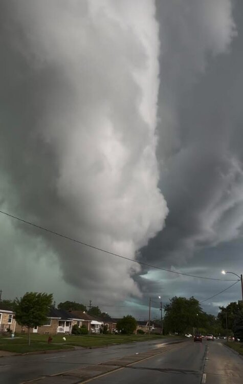
Given how beautiful the Kenosha storm was there is a TON of pictures/videos coming in. I’m thinking the “public confirmed” tornado was actually a rotating wall cloud that never actually made it to the ground. But given the rotation a lot of people thought it was.

-
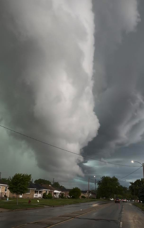
Confirmed tornado in northern Kenosha. Missed me by a few miles. Video here: https://x.com/kenoareaweather/status/2065212739945934931?s=46 (Not the actual tornado but just an early video put out) Absolutely beautiful storm though

- 260 replies
-
- 16
-
-
My brothers tree took a lightning strike in Algonquin. Power is still out there as well
-
Power just went out in Algonquin
-
Wasn’t expecting a watch this far east. Probably won’t even get here until 4-5am and I can’t imagine it’ll stay together but we’ll see. I’ll take a few rumbles even if that’s the most I get out of it. edit: ended up being nothing as expected but some good c2g so I’ll take it