
BuCoVaWx
-
Posts
145 -
Joined
-
Last visited
About BuCoVaWx

Recent Profile Visitors
2,712 profile views


-
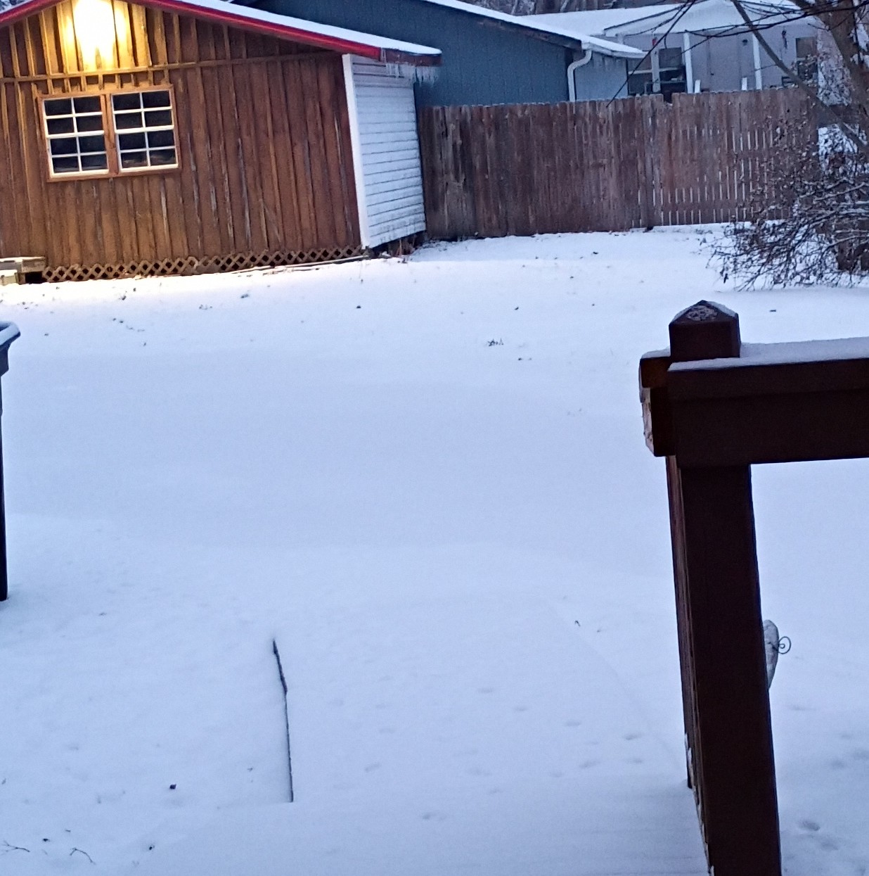
I have around 4 inches of snow accumulation on grass, vehicles etc. Not much on the main roads, some rough secondary roads as night falls. It's still snowing in waves now. Looks to be letting up soon though.
- 375 replies
-
- 3
-

-
- severe
- mountain snow
- (and 1 more)
-
Been snowing on and off for a few hours now. Ground is lightly covered.
-

Jan 30th-February 1st 2026 Arctic Blast/ULL Snow OBS Thread.
BuCoVaWx replied to John1122's topic in Tennessee Valley
I have 6.5" of snow at this point. It was supposed to stop snowing at noon. It's still coming down, though it is very small and on the lighter side. Definitely has that good ol winter day of years gone by feel to it. I'm very happy most people, if not all forum wide got a good hit! -
Jan 30th-February 1st 2026 Arctic Blast/ULL Snow OBS Thread.
BuCoVaWx replied to John1122's topic in Tennessee Valley
That would be great. Euro shows me around 6-8" last I checked. I'm a bit more north, might be a struggle to get that little extra up here. -
Jan 30th-February 1st 2026 Arctic Blast/ULL Snow OBS Thread.
BuCoVaWx replied to John1122's topic in Tennessee Valley
Was able to grab a few pics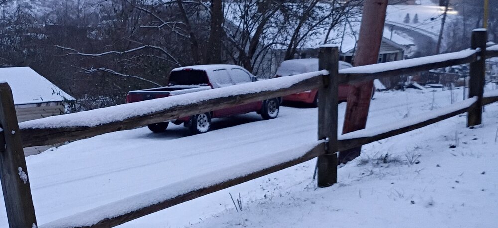

- 608 replies
-
- 13
-
-
Jan 30th-February 1st 2026 Arctic Blast/ULL Snow OBS Thread.
BuCoVaWx replied to John1122's topic in Tennessee Valley
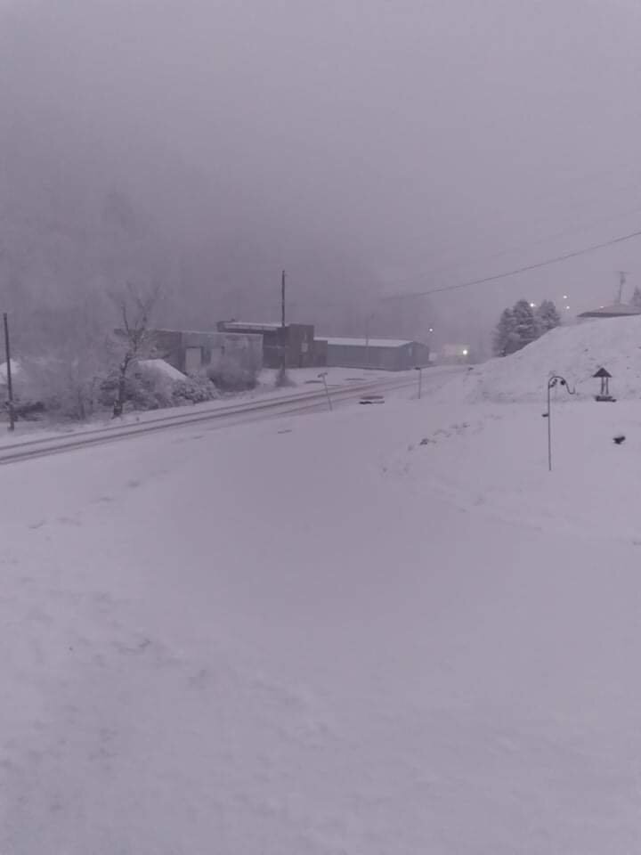
Snow is still coming down at a decent rate here. It's very small fine flakes, but it's starting to add up. Just a little over an inch so far, at least that's what my brother measured. My girls aren't home to measure and take pics for me, but I will try to get a few pics up tomorrow. -
Jan 30th-February 1st 2026 Arctic Blast/ULL Snow OBS Thread.
BuCoVaWx replied to John1122's topic in Tennessee Valley
It has been snowing consistently for a few hours and until 15-30 minutes ago, it was only sticking to grass and vehicles. The roads and my front porch are lightly covered now. -
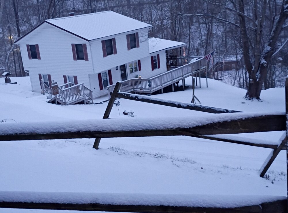
Sorry I'm late to getting to post. It came down with a quick burst a bit ago. Enough to cover everything. It stopped for a little, but it's starting to pick back up.
- 782 replies
-
- 2
-
-
- extreme cold
- snow
- (and 1 more)
-
Stopped snowing here around midnight. Had around 1.5" of snow/sleet. ZR kicked in around 2am, was forecast to stop around 6am with a high of 43 today. It didn't change over to all rain until around 3pm today. The temp stayed right around 33 up until this afternoon, now it's around 36. My cousin who lives 2 hours to the northwest of me has 6 inches of snow.
- 618 replies
-
- 3
-
-

-
- observations
- obs thread
- (and 1 more)
-
Moderate snow in Keen Mountain. Ground and roads are white.
- 618 replies
-
- 2
-
-
- observations
- obs thread
- (and 1 more)
-
The forecast on Tuesday for today and tomorrow had around 14-22 of snow inches total. I should have screenshot it. Probably won't see that again for awhile lol. I knew that total was too good to be true. That's the game we play in this part of the world.
- 618 replies
-
- 4
-
-
- observations
- obs thread
- (and 1 more)
-
Just now starting to throw some flurries out here. Too bad for all the ZR/rain tonight and tomorrow, makes me sad this time of year. Maybe in the next week or two we can cash in. Great pics everyone!
- 618 replies
-
- 1
-
-
- observations
- obs thread
- (and 1 more)
-
It gives me 15". I would be very happy if I received half of that total. The 06z NAM gives me no snow, but 1.5" of ZR. Who knows what's going to happen at this point.
-
WINTER STORM WARNING IN EFFECT FROM 7 AM SATURDAY TO 7 AM EST MONDAY... * WHAT...Heavy mixed precipitation expected. Total snow and sleet accumulations between 3 and 8 inches and ice accumulations between two tenths and four tenths of an inch. * WHERE...Portions of southwest Virginia and southeast and southern West Virginia. * WHEN...From 7 AM Saturday to 7 AM EST Monday. * IMPACTS...Power outages and tree damage are likely due to the ice. Travel could be nearly impossible. The hazardous conditions could impact the Monday morning commute.
-
Charleston going with this. I believe it's going to change between now and Saturday. WINTER STORM WATCH IN EFFECT FROM SATURDAY MORNING THROUGH MONDAY MORNING... * WHAT...Heavy snow expected. Total snow accumulations between 6 and 12 inches possible. Locally higher amounts are possible. * WHERE...Portions of northeast Kentucky, southeast Ohio, southwest Virginia, and central, northeast, northern, southeast, southern, and western West Virginia. * WHEN...From Saturday morning through Monday morning.