MN Transplant
-
Posts
17,858 -
Joined
-
Last visited
Content Type
Profiles
Blogs
Forums
American Weather
Media Demo
Store
Gallery
Everything posted by MN Transplant
-
This seems like a load management move for Prielipp, who is now already over his highest number of innings pitched in his career. You have Ryan, Taj, Ober and then fill in the starts with Prielipp, Matthews and Kremer. It isn’t a great rotation, but somehow the Twins lead the AL in scoring.
-
Our region has the problem of a lot of people living among a lot of trees. Equivalent severe storms here are much more impactful than in the plains. Yes, they are going to warn every couplet because it doesn’t take much to be damaging.
-
After no measurable rain in the last 9 days and the low dews over the last few, the lawn is crunchy. Sprinklers are on full send this morning.
-
Ultimate Grand Slam on an 0-2 count. Amazing.
-
I'd be surprised if they make many moves. They are too close to the division lead (2 GB) to ship off Joe Ryan or Ryan Jeffers. They could add a reliever.
-
I’m out watering. At least some of the MD rain will keep the Potomac running.
-
Despite some rain today, DCA will clinch another below average precip month, making it 12 out of 13. A debacle for those of us immediately south and west of DC.
-
2026 Mid-Atlantic Severe Storm General Discussion
MN Transplant replied to Kmlwx's topic in Mid Atlantic
Trace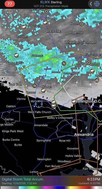
- 1,704 replies
-
- 3
-

-

-
- severe
- thunderstorms
- (and 7 more)
-
2026 Mid-Atlantic Severe Storm General Discussion
MN Transplant replied to Kmlwx's topic in Mid Atlantic
Need to move to Maryland for rain -
Rock Maze is weird. You start on this nothing trail through the woods and out of nowhere is this random area with massive rock formations. Fun spot.
-
DCA has had one above average precip month since June 2025. That was due to the sleet storm in January. July to date is -0.32" so maybe we can get lucky over these last few days.
-
Going to Sky Meadows always makes me want to buy a few acres out there with a modest house and live happily. Then I look at the prices in, say, Delaplane, and see that others with way more money than me have already had that idea. Got a few sprinkles overnight from the stuff that slid by to the south. Perfectly happy keeping the clouds around.
-
2026 Mid-Atlantic Severe Storm General Discussion
MN Transplant replied to Kmlwx's topic in Mid Atlantic
There's a version I used in my graduate studies called NCAPE (Normalized CAPE). Normalized CAPE (J/kg)The NCAPE (Normalized CAPE) is CAPE that is divided by the depth of the buoyancy layer (units of m s**-2). Values near or less than .1 suggest a "tall, skinny" CAPE profile with relatively weak parcel accelerations, while values closer to .3 to .4 suggest a "fat" CAPE profile with large parcel accelerations possible. Normalized CAPE and lifted indicies are similar measures of instability.- 1,704 replies
-
- 3
-
-
- severe
- thunderstorms
- (and 7 more)
-
0.45”. What a disappointment. Despite the various events, I am still below normal for July and falling further behind ytd.
-
2026 Mid-Atlantic Severe Storm General Discussion
MN Transplant replied to Kmlwx's topic in Mid Atlantic
0.17” rain and a peak wind gust of 12mph today -
2026 Mid-Atlantic Severe Storm General Discussion
MN Transplant replied to Kmlwx's topic in Mid Atlantic
Yup, this tracks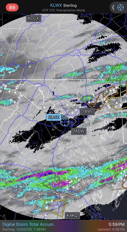
- 1,704 replies
-
- 3
-
-

-
- severe
- thunderstorms
- (and 7 more)
-
2026 Mid-Atlantic Severe Storm General Discussion
MN Transplant replied to Kmlwx's topic in Mid Atlantic
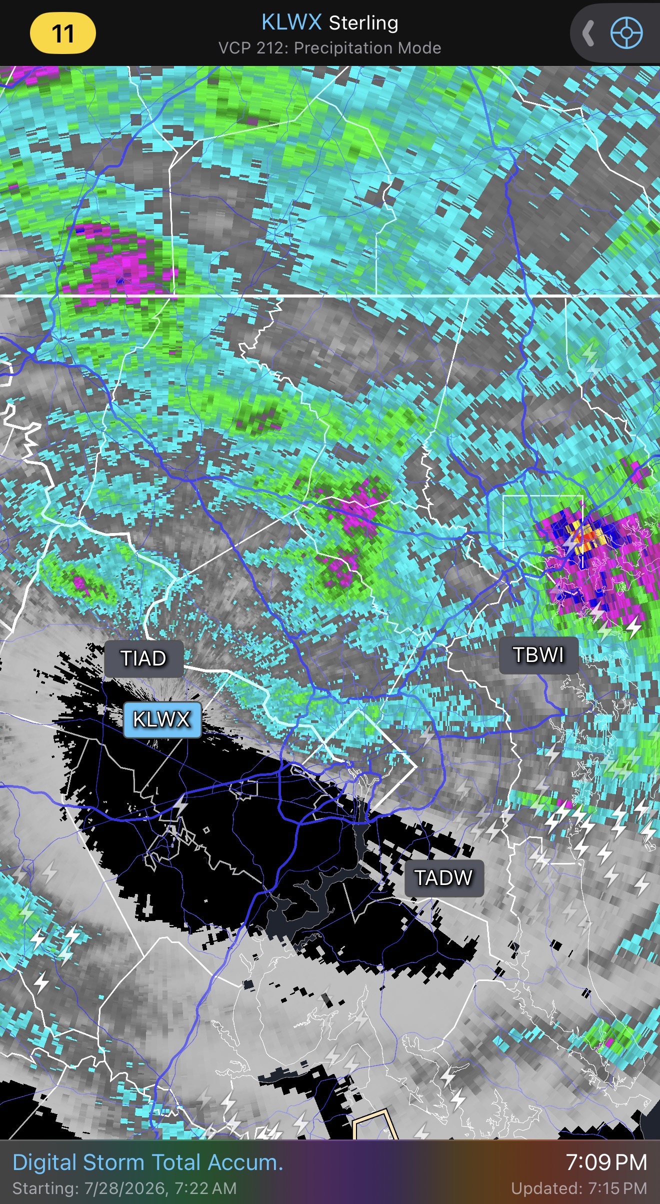
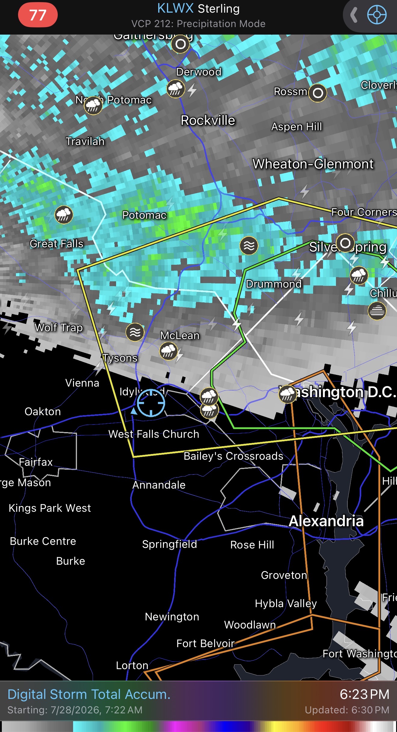
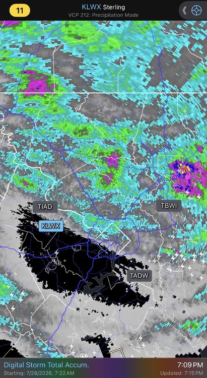
It is trying just west of DC. Not sure if we'll get the upscale growth that Frederick Co did. -
2026 Mid-Atlantic Severe Storm General Discussion
MN Transplant replied to Kmlwx's topic in Mid Atlantic
Two SVR warnings now SE of DC. Throwing off a little gust front to the north, so we'll see if anything can happen with that. -
2026 Mid-Atlantic Severe Storm General Discussion
MN Transplant replied to Kmlwx's topic in Mid Atlantic
If we are at the coping stage, at least the atmosphere isn't "worked over" by the time the later round gets here.- 1,704 replies
-
- 1
-
-
- severe
- thunderstorms
- (and 7 more)
-
2026 Mid-Atlantic Severe Storm General Discussion
MN Transplant replied to Kmlwx's topic in Mid Atlantic
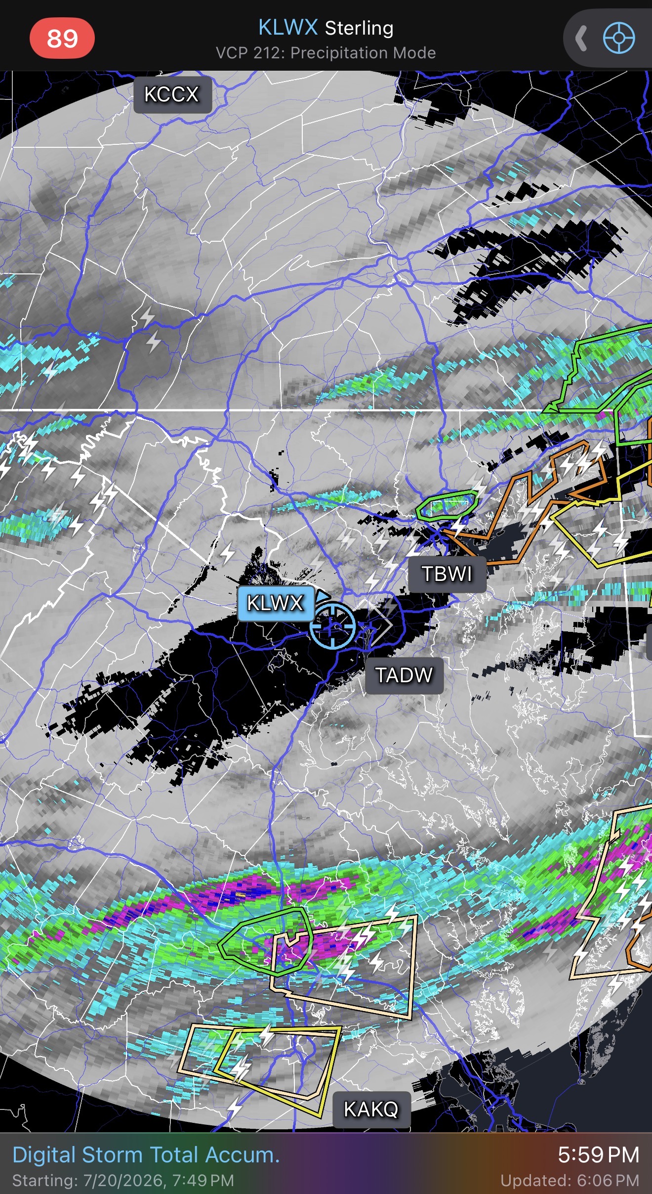
Based on the CAMs, we were all hoping that this would be a two-round day, with discrete cells out front before the organized stuff gets here later. We just didn't get initiation and now have to wait for the stuff in Ohio to come together. 18z HRRR brings it in around 10pm, but there is a risk of it being south.- 1,704 replies
-
- 3
-
-
- severe
- thunderstorms
- (and 7 more)
-
2026 Mid-Atlantic Severe Storm General Discussion
MN Transplant replied to Kmlwx's topic in Mid Atlantic
The HRRR wanted initiation to happen already, but so far there is only one new cell up west of Gettysburg. Things can change quickly in this environment, though. -
2026 Mid-Atlantic Severe Storm General Discussion
MN Transplant replied to Kmlwx's topic in Mid Atlantic
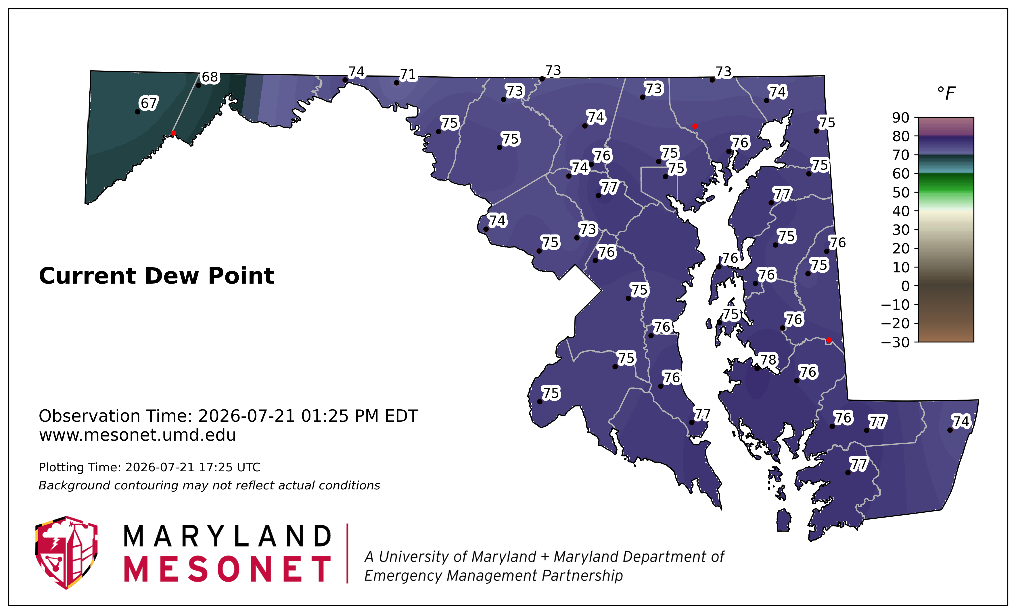
The mesonet DPs are agressive.
- 1,704 replies
-
- 2
-
-
- severe
- thunderstorms
- (and 7 more)
-
2026 Mid-Atlantic Severe Storm General Discussion
MN Transplant replied to Kmlwx's topic in Mid Atlantic
87/77. Ripe.- 1,704 replies
-
- 2
-
-
- severe
- thunderstorms
- (and 7 more)
-
2009-2010 was the warmest Canadian winter on record (to that point).
-
0.47”. I’ll take it, but we desperately need a region-wide soaker.