SUNYGRAD
-
Posts
186 -
Joined
-
Last visited
Content Type
Profiles
Blogs
Forums
American Weather
Media Demo
Store
Gallery
Everything posted by SUNYGRAD
-
Agree, and in our favor for more snow/sleet.
-
-
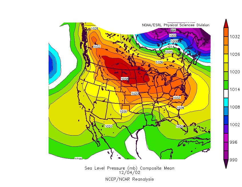
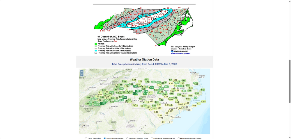
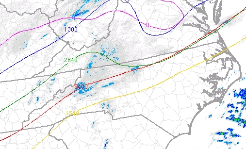
Winter Storm Event – Products | North Carolina State Climate Office
-
The High wants to anker in place driving the cold air down for sure.
-
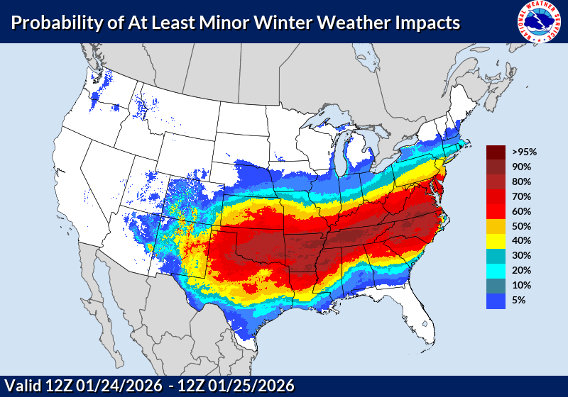
Cannot recall seeing these high probabilities in advance (especially for NC) and over such a large area----in several years.
-
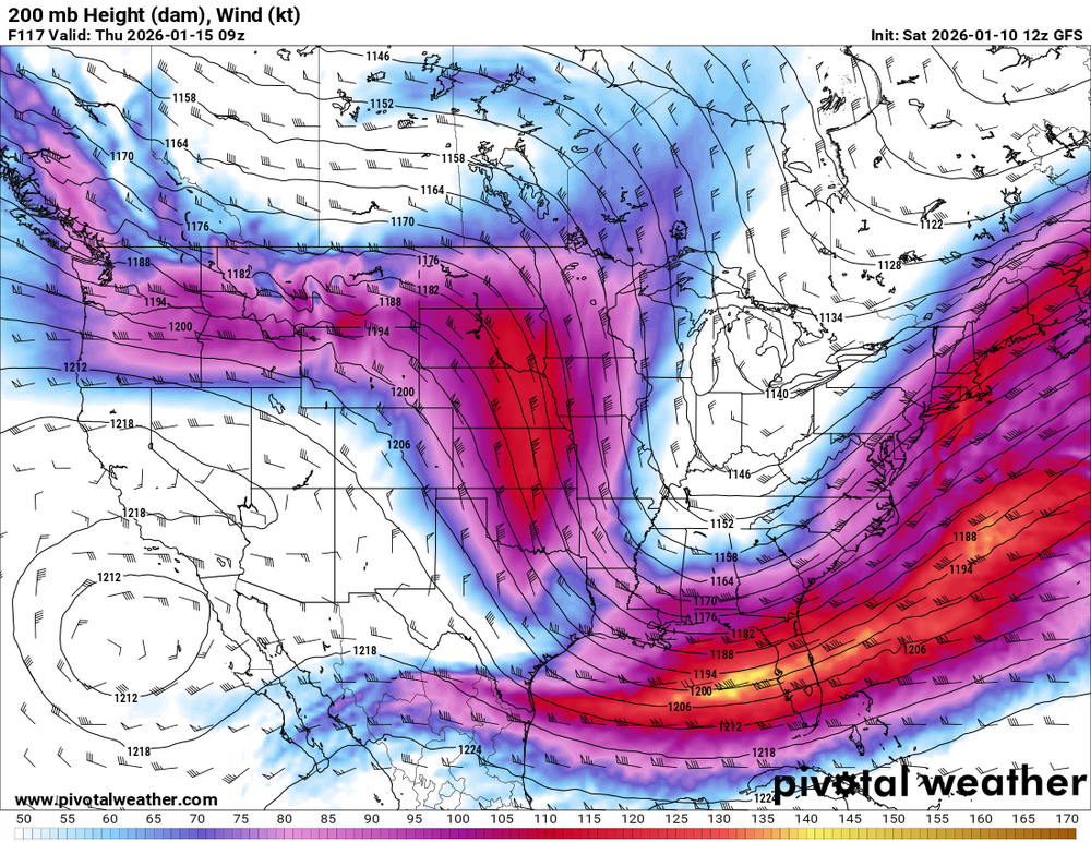
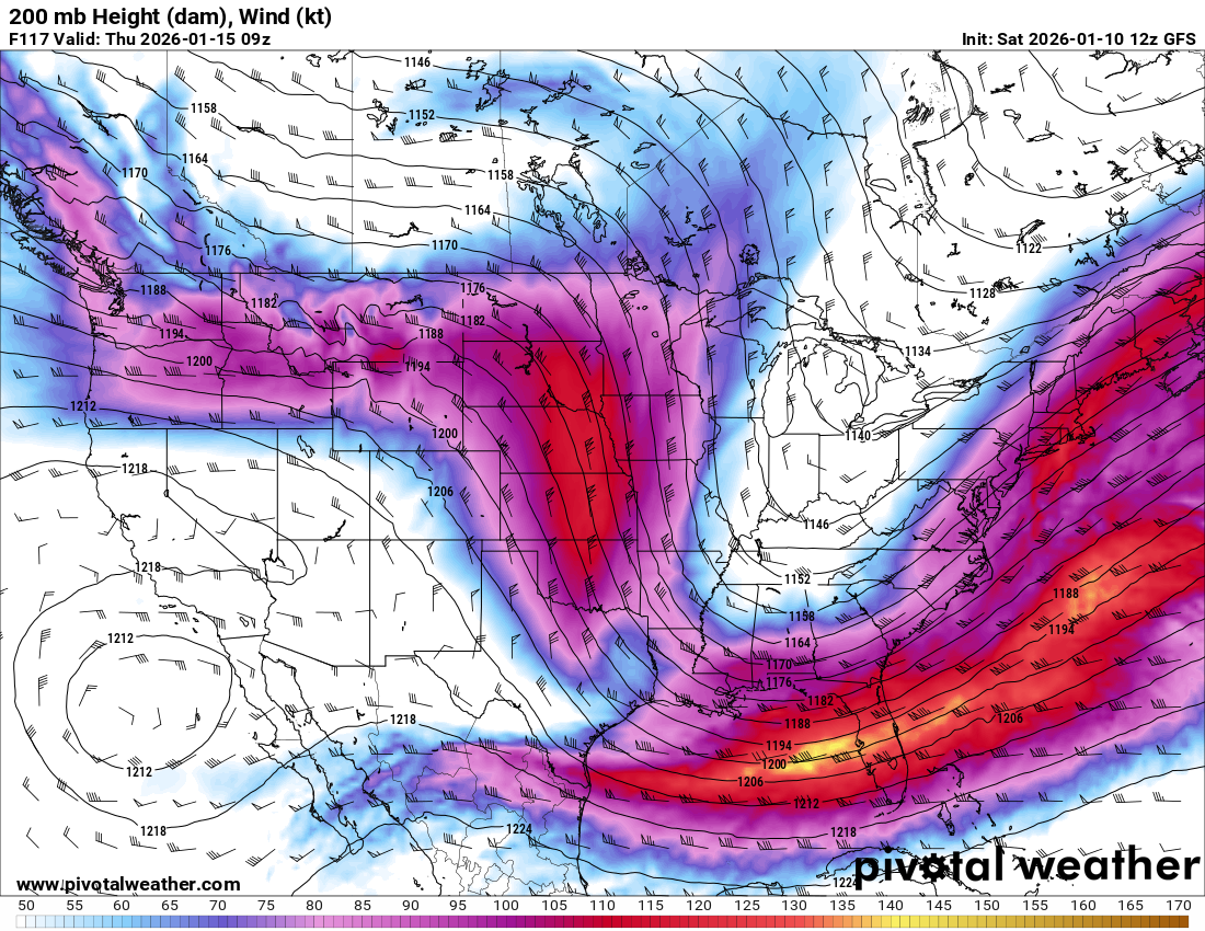
Fairly impressive 200 MB jet on GFS
-
Old GFS playing with us.
-
...disagree on 15th/16th just yet.
-
Holy smokes for 12Z GFS
-

-
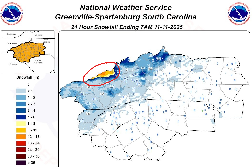
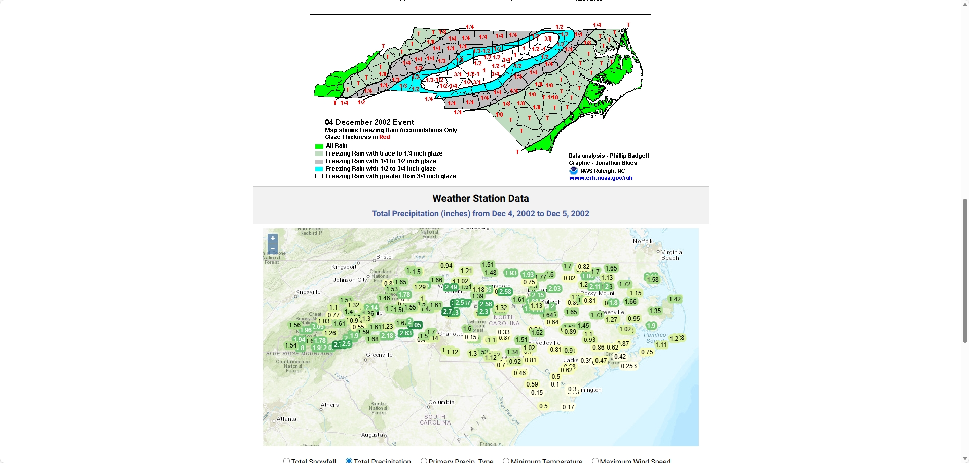
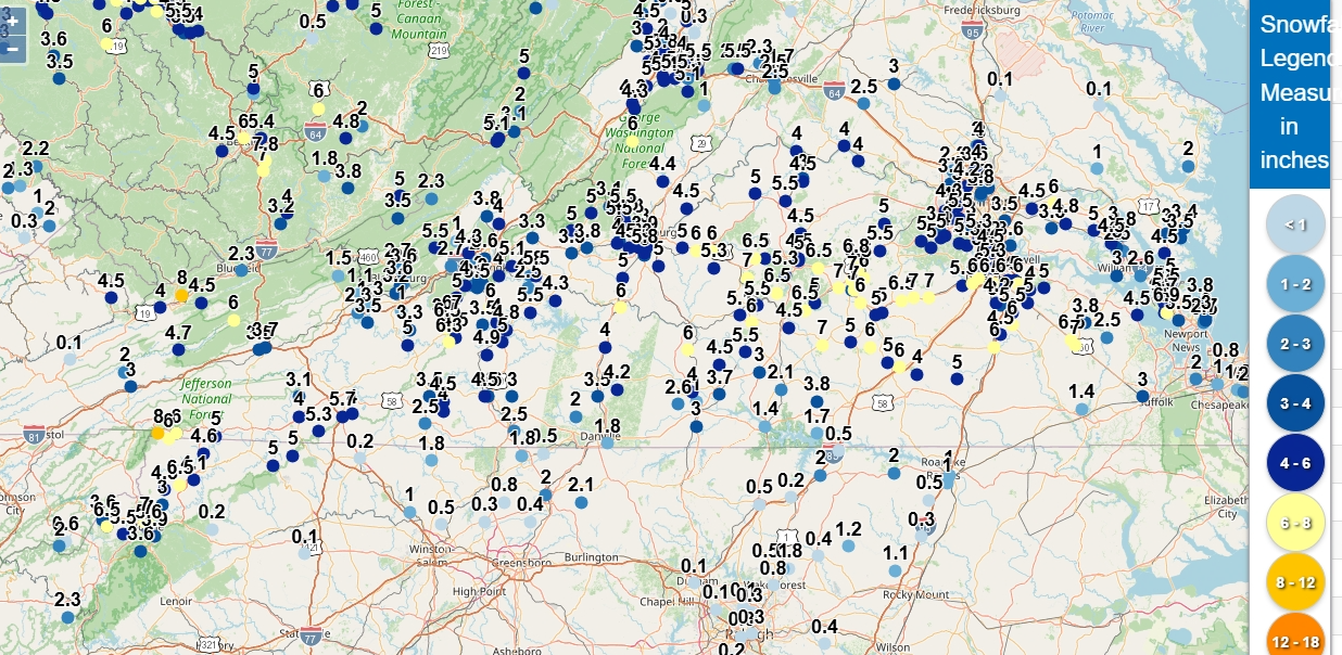
snowfall reports weather.gov/source/crh/snowmap.html?sid=rah

-
-
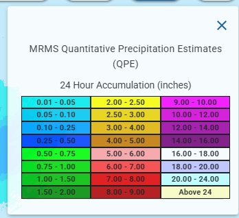
Estimated precip totals from yesterday's storm. Source: nowCOAST
.thumb.png.552996405b1868c2921afb7683128f27.png)
-
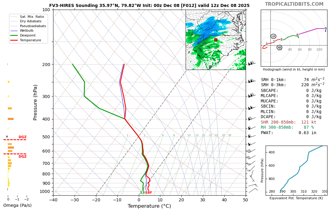
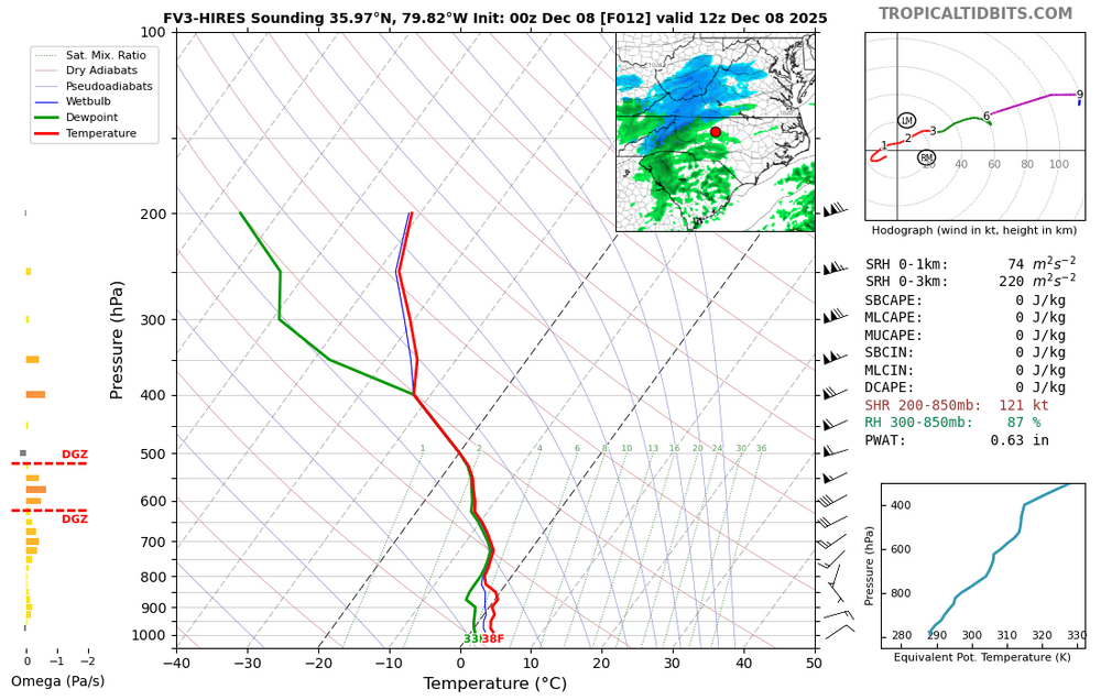
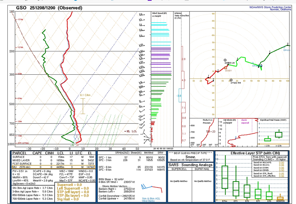
comparision with FV3-
-
Rather dry in lower levels
-
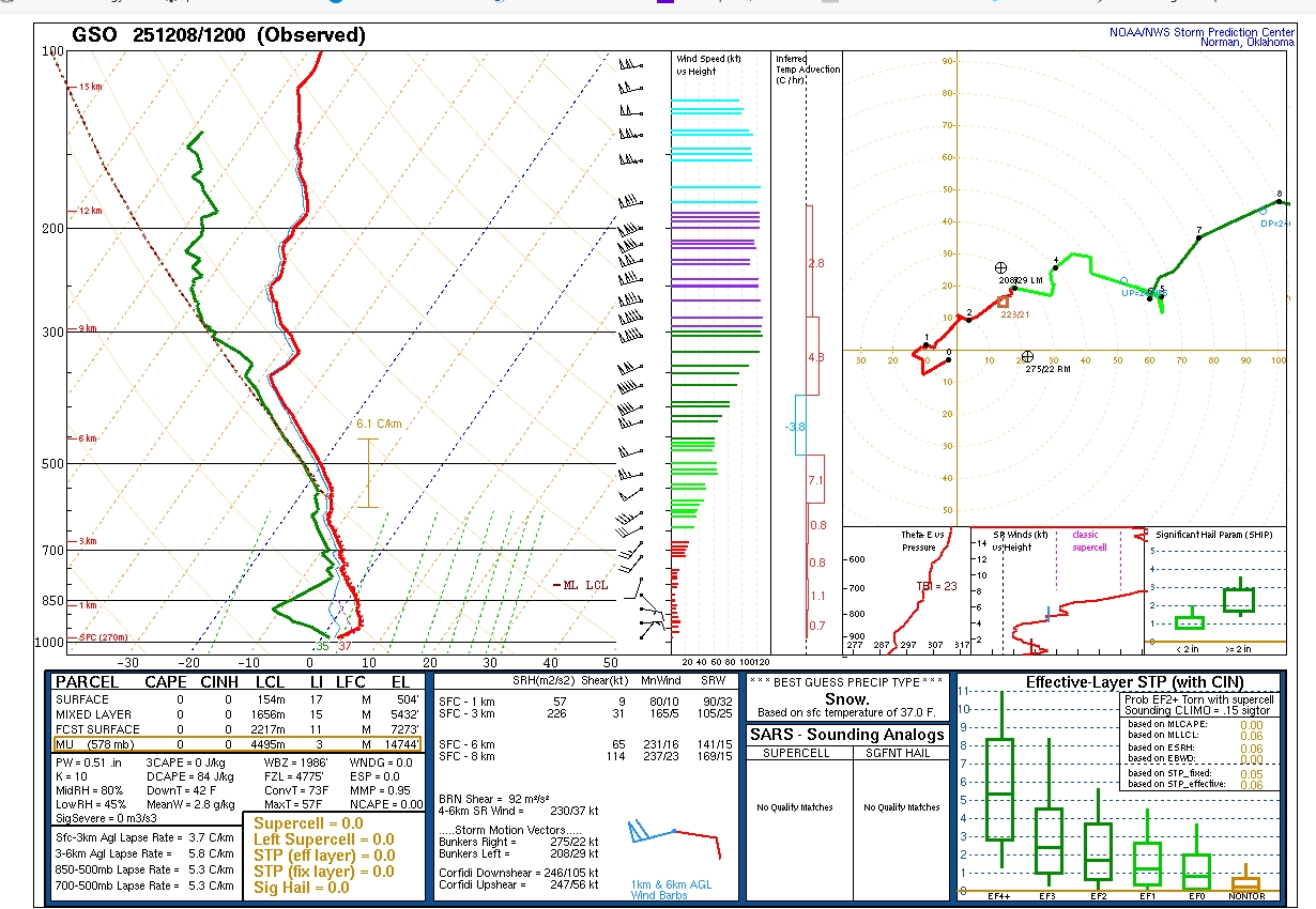
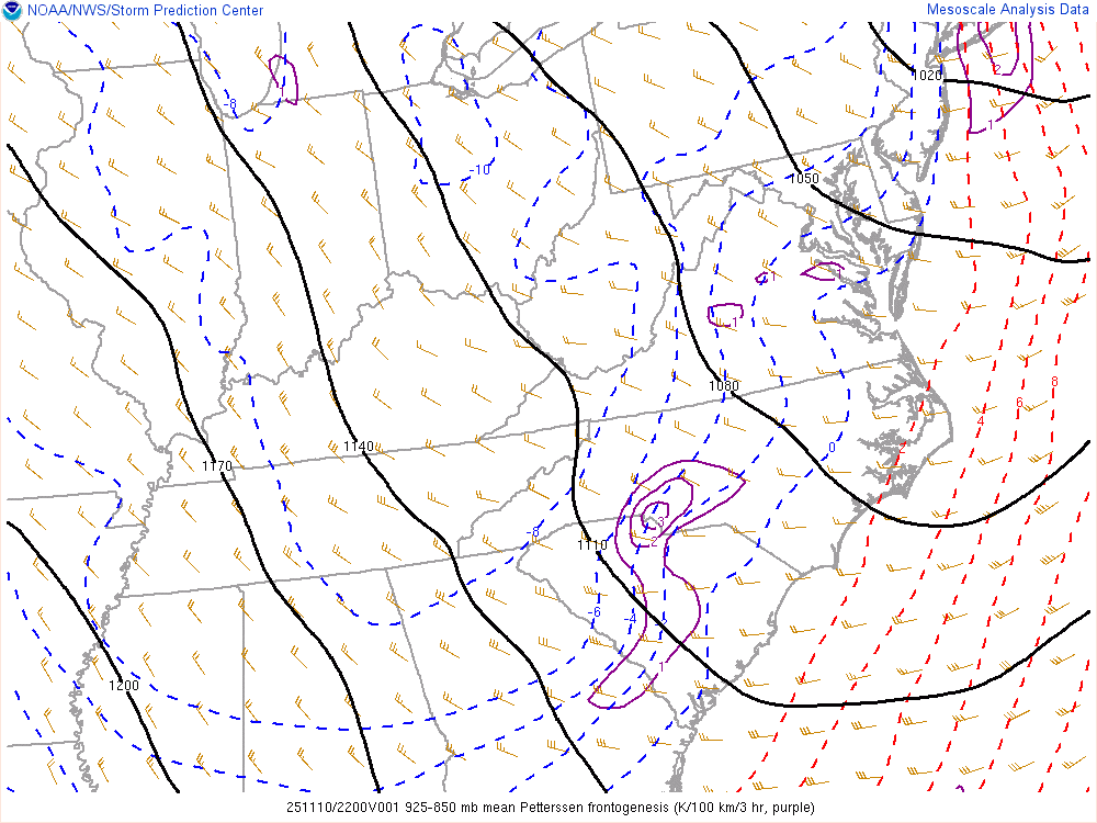
Can see some colder air move in as thickness drops into mountains and Piedmont. SPC Hourly Mesoscale Analysis
-
I swear the atmosphere has muscle memory sometimes. The northern shift creates eye strain and even some tears for us in NC.
-
Definitely some better lift at 700 and 850 on the 12Z FV3 for northern third of NC, especially western half. Probably will be the keys to how strong these levels will be and ultimately precip. Just my opinion.
-
-


-
Eye-thanks, I did see it and why I included the wide view.
-
For you Iguana
-
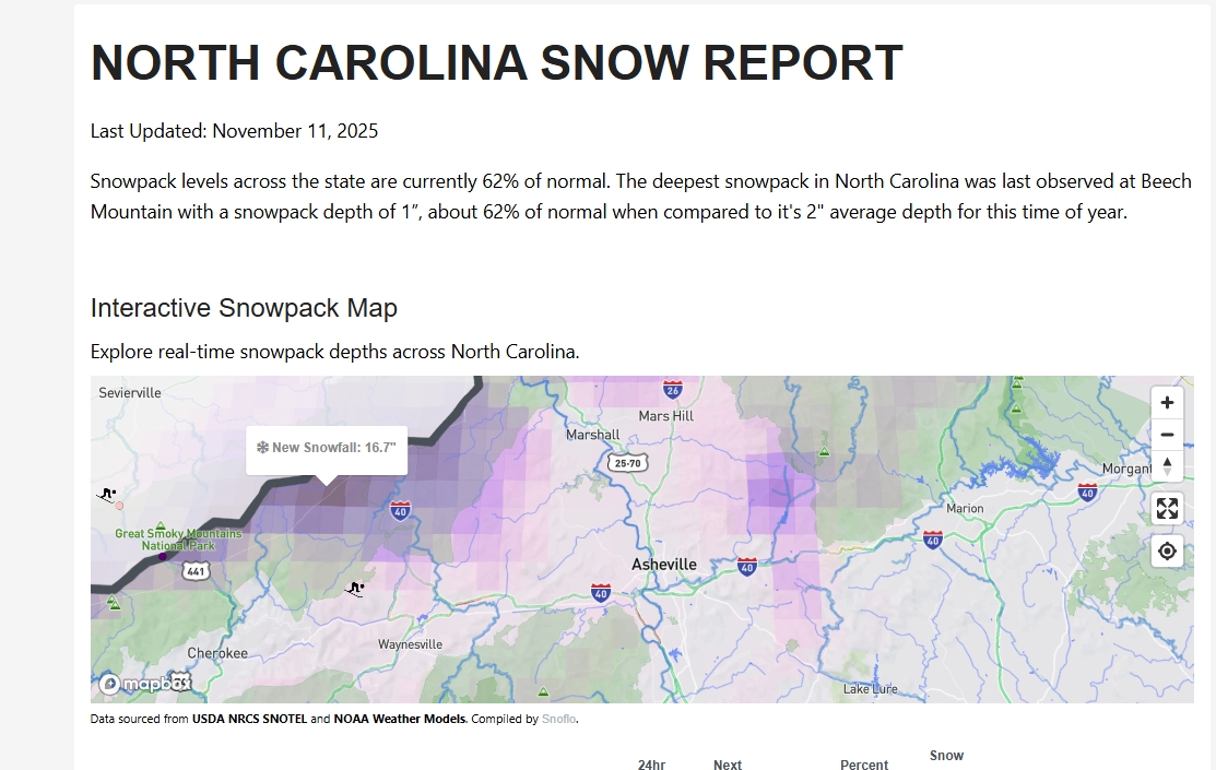
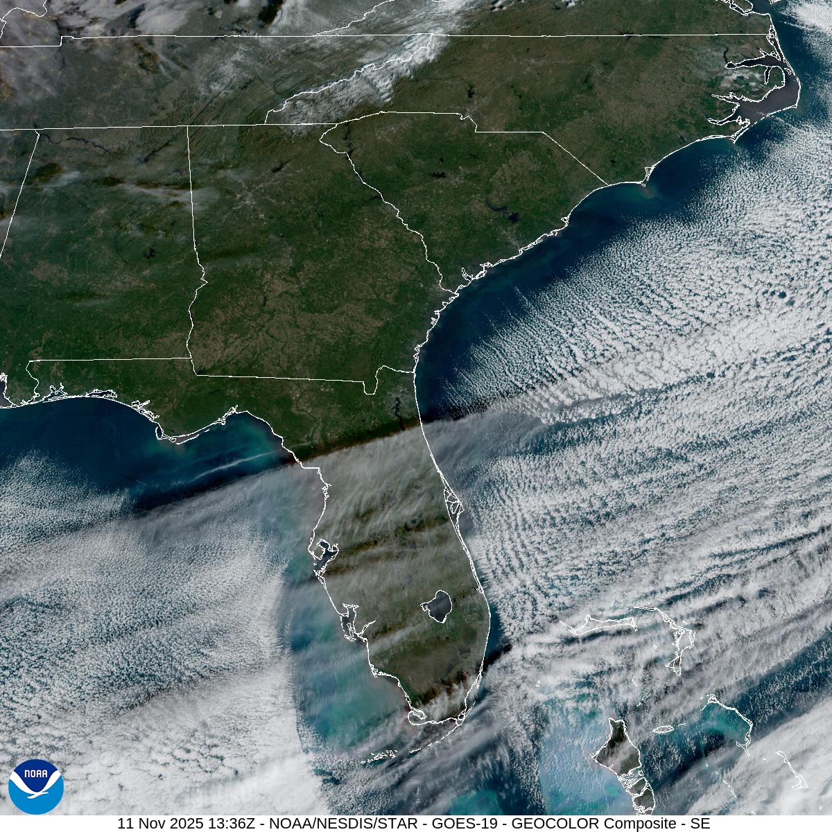
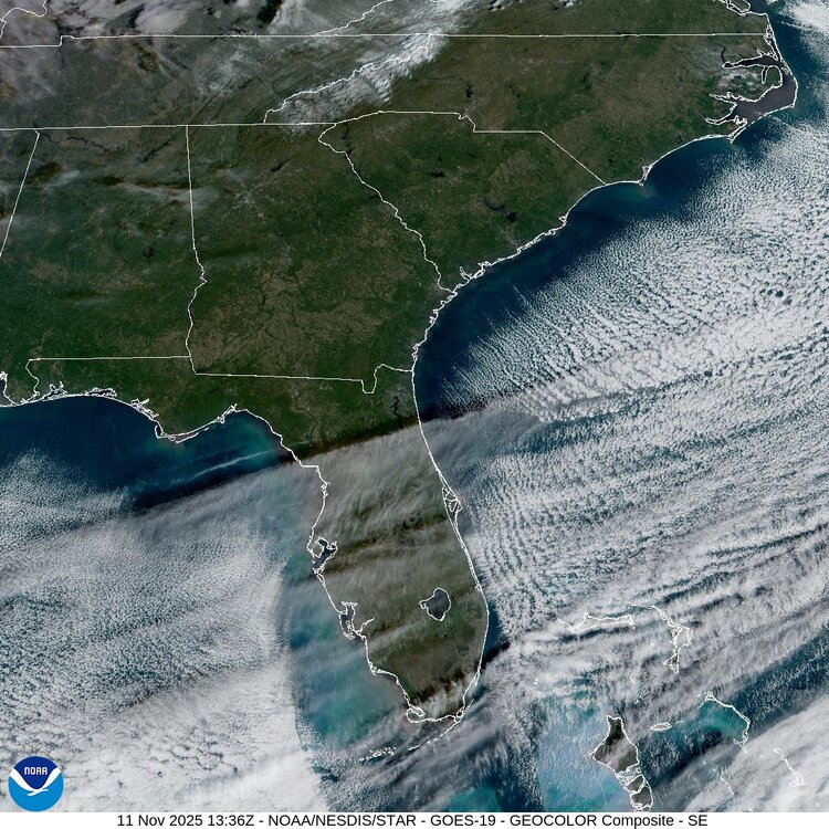
Decent snow cover for any time of the winter season, but for early mid-November is pretty cool.
-
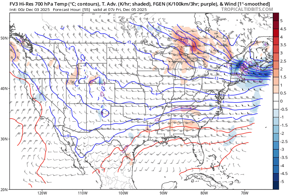
Pretty good lower-level frontogenesis corresponds with radar returns over lower Piedmont area, including Charlotte.
-
38 five miles SSW of downtown W-S this morning.


.png.0cd7342df64924e41118a32b0497008c.png)