SUNYGRAD
-
Posts
257 -
Joined
-
Last visited
Content Type
Profiles
Blogs
Forums
American Weather
Media Demo
Store
Gallery
Everything posted by SUNYGRAD
-

The “I bring the mojo” Jan 30-Feb 1 potential winter storm
SUNYGRAD replied to lilj4425's topic in Southeastern States
Double or nothing... -
The “I bring the mojo” Jan 30-Feb 1 potential winter storm
SUNYGRAD replied to lilj4425's topic in Southeastern States
-
The “I bring the mojo” Jan 30-Feb 1 potential winter storm
SUNYGRAD replied to lilj4425's topic in Southeastern States
Can we rename this storm.... maybe Majestic Phaser? Is it even allowed?? -
The “I bring the mojo” Jan 30-Feb 1 potential winter storm
SUNYGRAD replied to lilj4425's topic in Southeastern States
GSP is taking this potential storm seriously with their point forecasts this far out. I clicked on Davie Co. Friday NightA 50 percent chance of snow after 7pm. Mostly cloudy, with a low around 15. SaturdayA 40 percent chance of snow before 5pm. The snow could be heavy at times. Mostly cloudy, with a high near 24. I highlighted the heavy snow -
The “I bring the mojo” Jan 30-Feb 1 potential winter storm
SUNYGRAD replied to lilj4425's topic in Southeastern States
It is easy to be caught up in precipitation maps. -
The “I bring the mojo” Jan 30-Feb 1 potential winter storm
SUNYGRAD replied to lilj4425's topic in Southeastern States
I think the GFS is in The Circle of Trust" at the moment. -
The “I bring the mojo” Jan 30-Feb 1 potential winter storm
SUNYGRAD replied to lilj4425's topic in Southeastern States
I hope to enjoy watching the progress on this one and most of the modeling keeps it sane for everyone. -
Southern Crippler - Get well soon Jimbo Storm Obs
SUNYGRAD replied to BooneWX's topic in Southeastern States
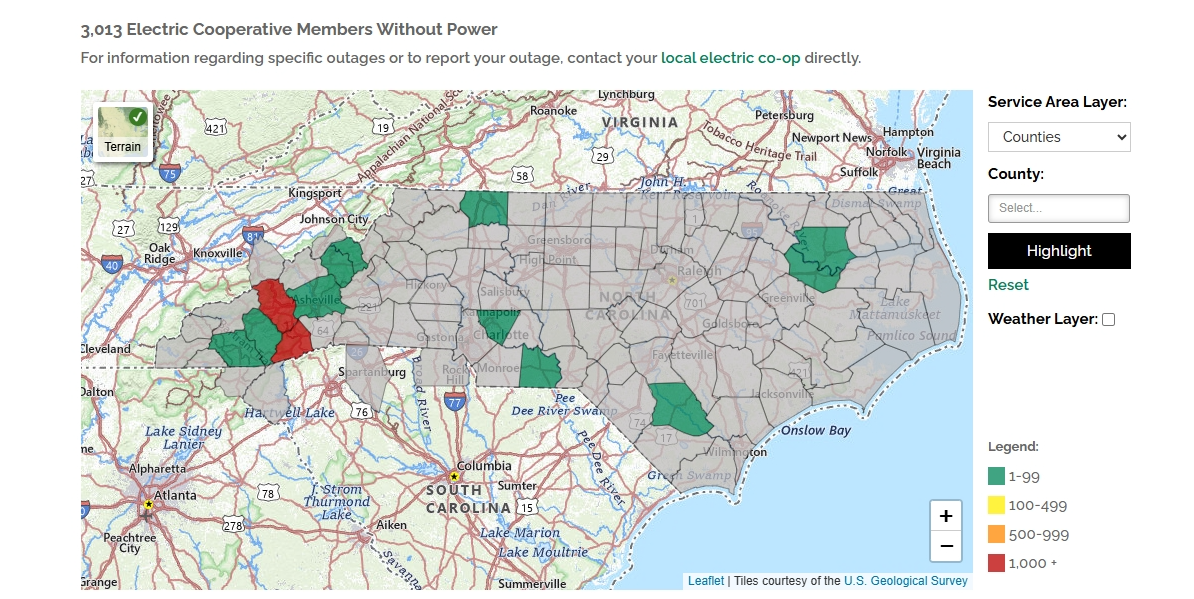
Impressive storm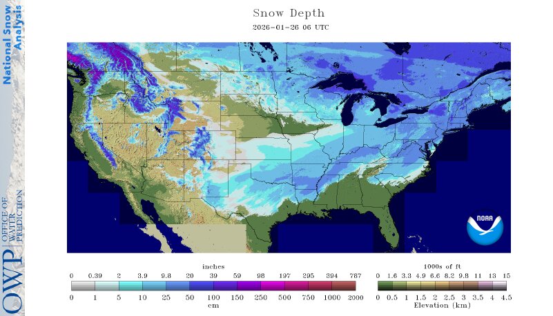
-
The “I bring the mojo” Jan 30-Feb 1 potential winter storm
SUNYGRAD replied to lilj4425's topic in Southeastern States
Looks like probably a minor or even moderate event is on the table for most of NC. -
Southern Crippler - Get well soon Jimbo Storm Obs
SUNYGRAD replied to BooneWX's topic in Southeastern States
I have a storm total of 2.25 inches total of sleet and snow. Some minor compaction here SW of Winston Salem. -
Southern Crippler - Get well soon Jimbo Storm Obs
SUNYGRAD replied to BooneWX's topic in Southeastern States
switched to heavy sleet and fog here near Winston Salem. -
Southern Crippler - Get well soon Jimbo Storm Obs
SUNYGRAD replied to BooneWX's topic in Southeastern States
...I'm having some Bourbon, perhaps some EH Taylor. -
Southern Crippler - Get well soon Jimbo Storm Obs
SUNYGRAD replied to BooneWX's topic in Southeastern States
Moderate sleet and 22 near Winston Salem. -
Southern Crippler - Get well soon Jimbo Storm Obs
SUNYGRAD replied to BooneWX's topic in Southeastern States
Heck yeah with sledding. I am late 50s and I am going. -
Southern Crippler - Get well soon Jimbo Storm Obs
SUNYGRAD replied to BooneWX's topic in Southeastern States
Feels like that movie...The Day After Tomorrow. -
Southern Crippler - Get well soon Jimbo Storm Obs
SUNYGRAD replied to BooneWX's topic in Southeastern States
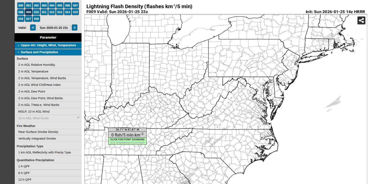
May hear some thunder or even see some lightning. Mid-level lapse around 5.5.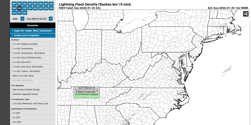
-
Southern Crippler - Get well soon Jimbo Storm Obs
SUNYGRAD replied to BooneWX's topic in Southeastern States
I really hope that it is more of a mix. -
Southern Crippler - Get well soon Jimbo Storm Obs
SUNYGRAD replied to BooneWX's topic in Southeastern States
Moderate sleet here in Winston Salem at 10:20. -
Southern Crippler - Get well soon Jimbo Storm Obs
SUNYGRAD replied to BooneWX's topic in Southeastern States
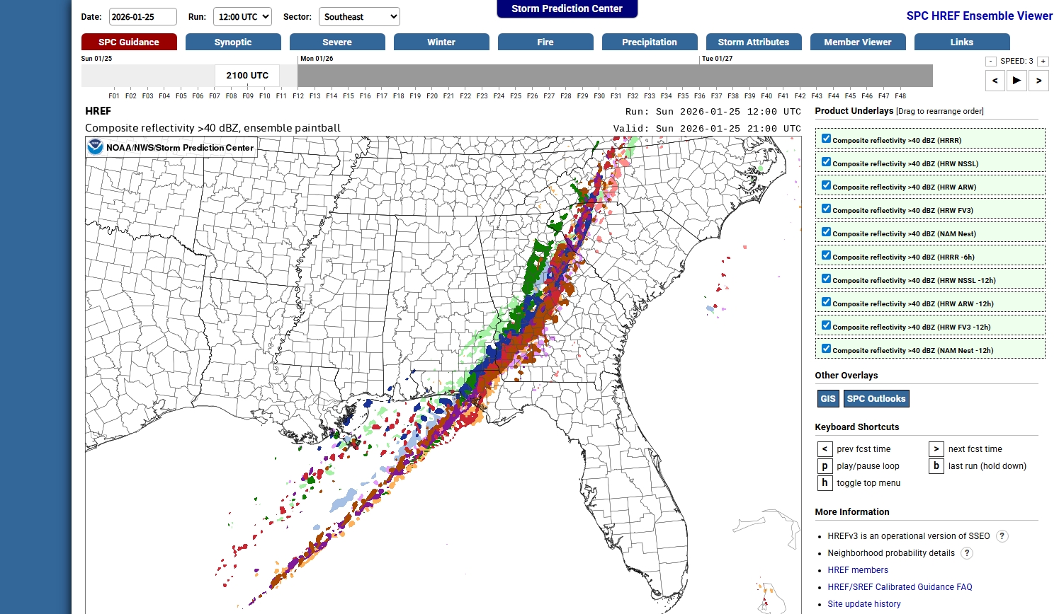
Some ideas of precip types this afternoon over Triad. https://www.spc.noaa.gov/exper/href/index.php?model=href&product=cref_pb40§or=se&rd=20260125&rt=1200.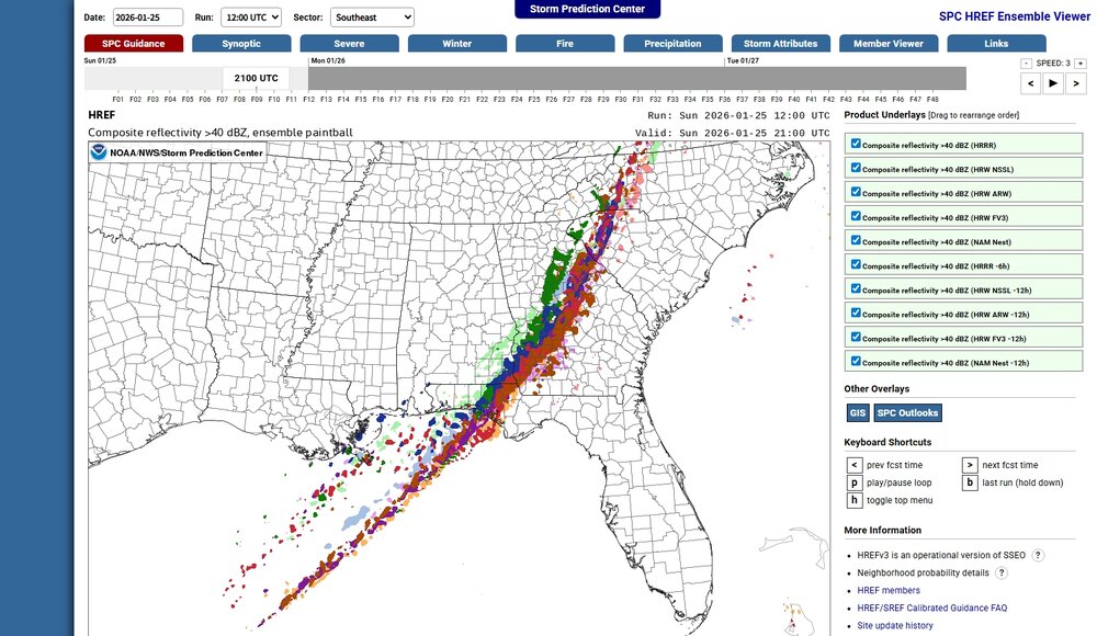
-
It is possible, but many surfaces are already cold and depending how much snow/sleet you have, it could exacerbate the situation, some trees----like pines.
-
Southern Crippler - Get well soon Jimbo Storm Obs
SUNYGRAD replied to BooneWX's topic in Southeastern States
Sure, is great news in general at this point. Duke is similar.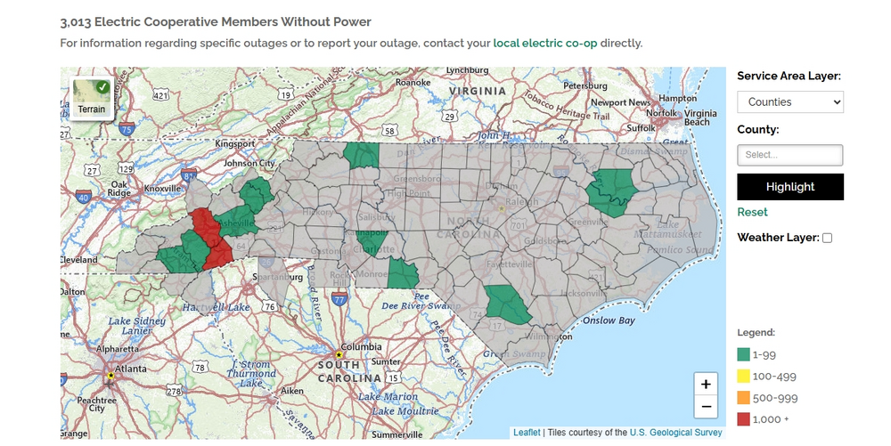
-
Southern Crippler - Get well soon Jimbo Storm Obs
SUNYGRAD replied to BooneWX's topic in Southeastern States
I hope I hear thunder with frontal band today, so I can get really excited for the next storm and the snow within 10 days. -
Southern Crippler - Get well soon Jimbo Storm Obs
SUNYGRAD replied to BooneWX's topic in Southeastern States
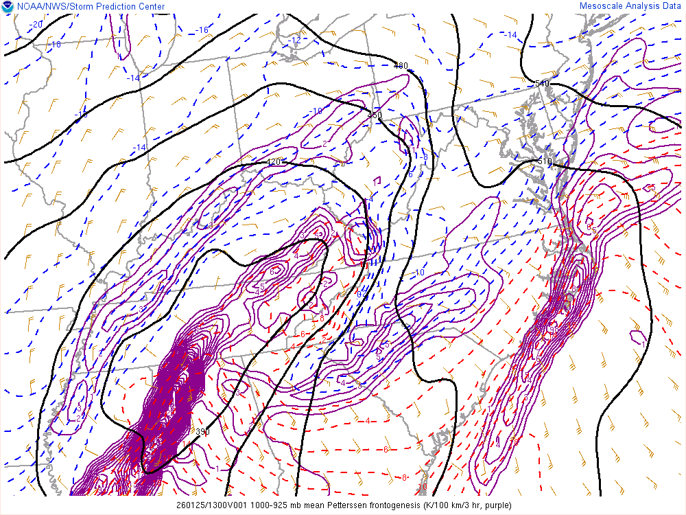
Just a testament of how strong the damning event was and is. We don't always get this scenario in Carolinas. -
Southern Crippler - Get well soon Jimbo Storm Obs
SUNYGRAD replied to BooneWX's topic in Southeastern States
-
Southern Crippler - Get well soon Jimbo Storm Obs
SUNYGRAD replied to BooneWX's topic in Southeastern States