SUNYGRAD
-
Posts
251 -
Joined
-
Last visited
Content Type
Profiles
Blogs
Forums
American Weather
Media Demo
Store
Gallery
Everything posted by SUNYGRAD
-
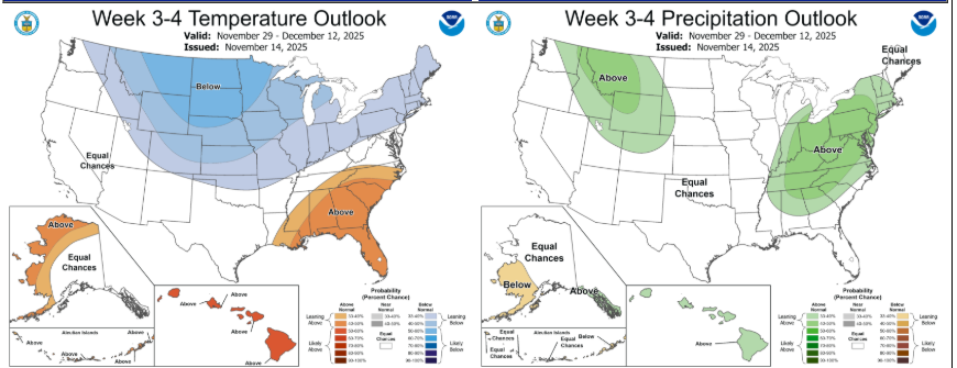
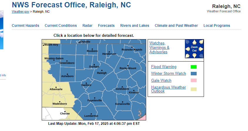
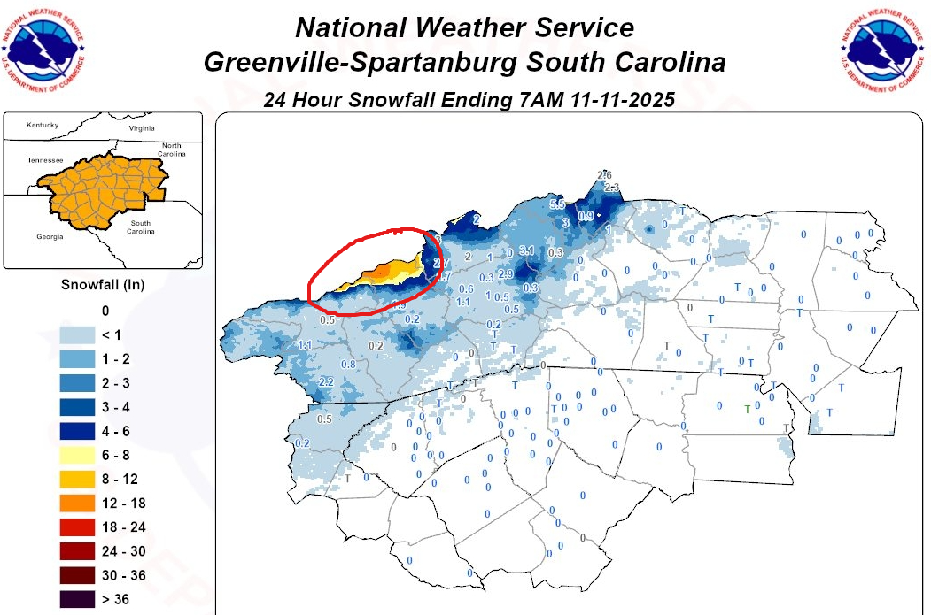
snowfall reports weather.gov/source/crh/snowmap.html?sid=rah

-
-
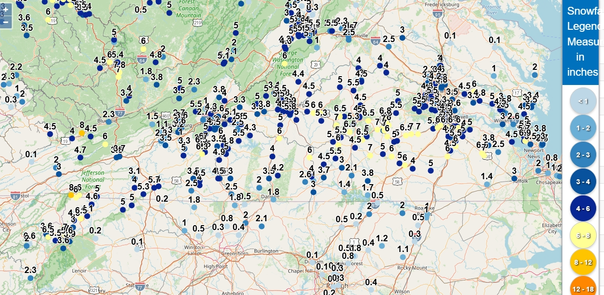
Estimated precip totals from yesterday's storm. Source: nowCOAST
.thumb.png.552996405b1868c2921afb7683128f27.png)
-
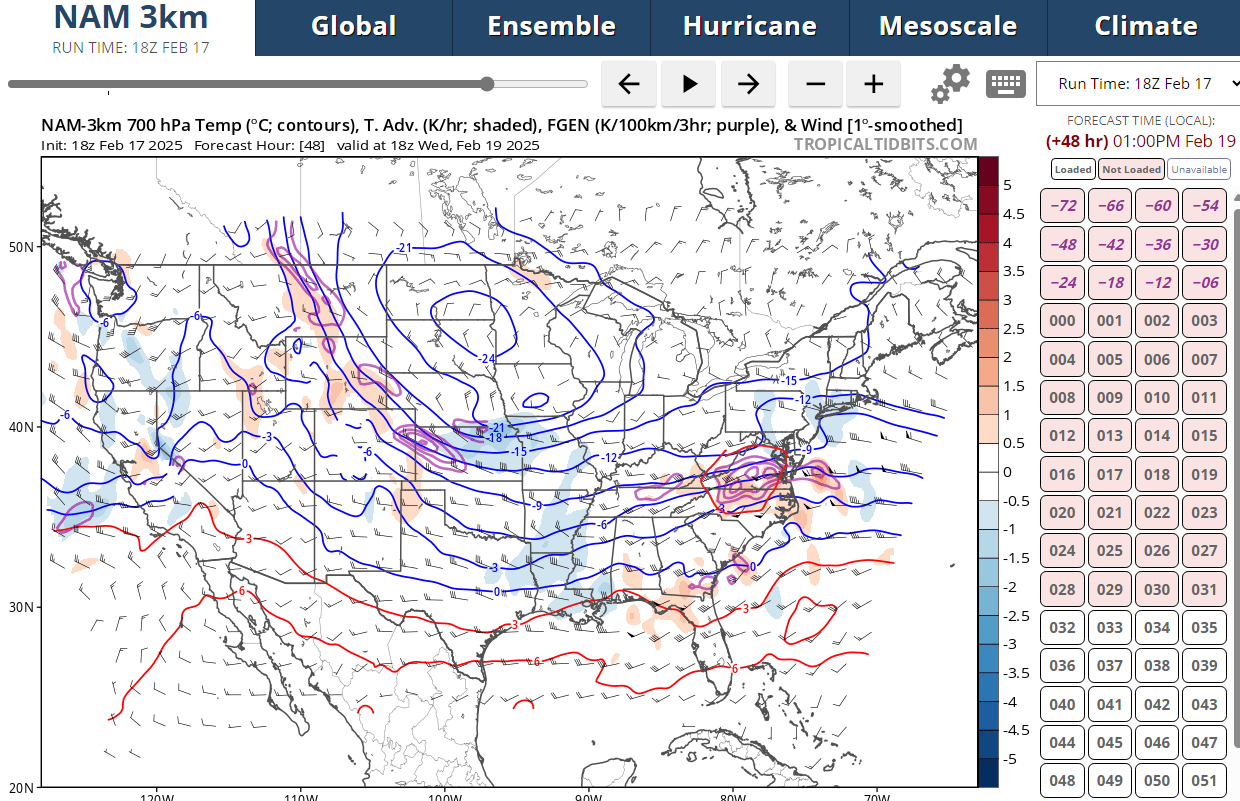
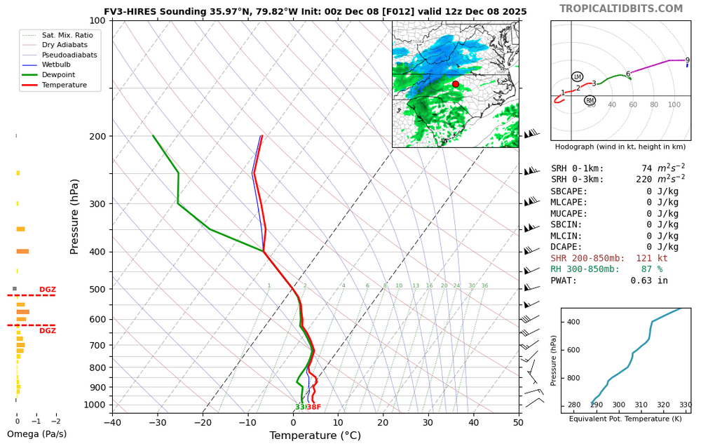
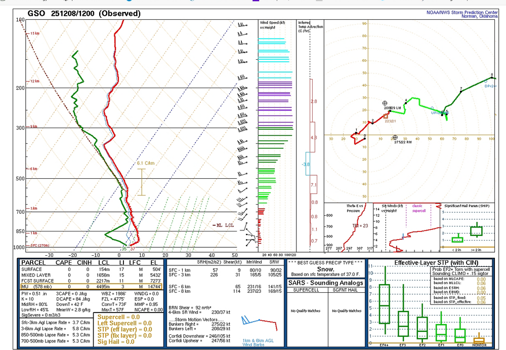
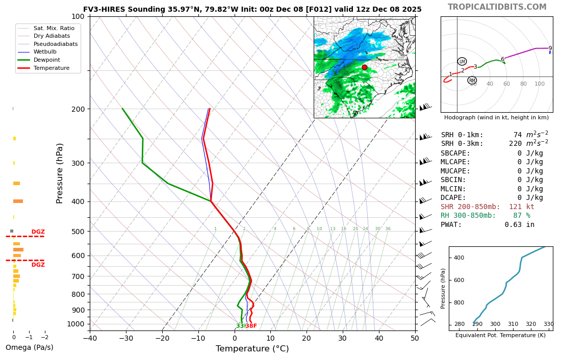
comparision with FV3-
-
Rather dry in lower levels
-
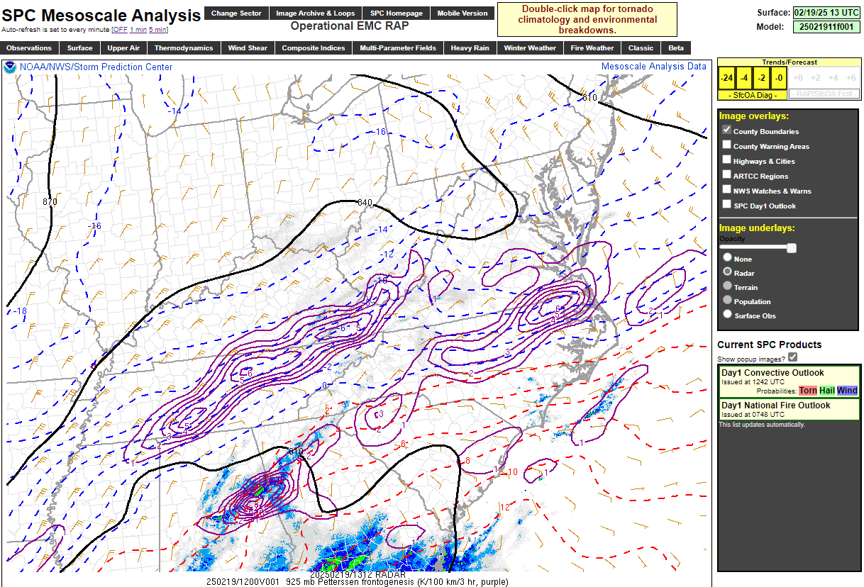
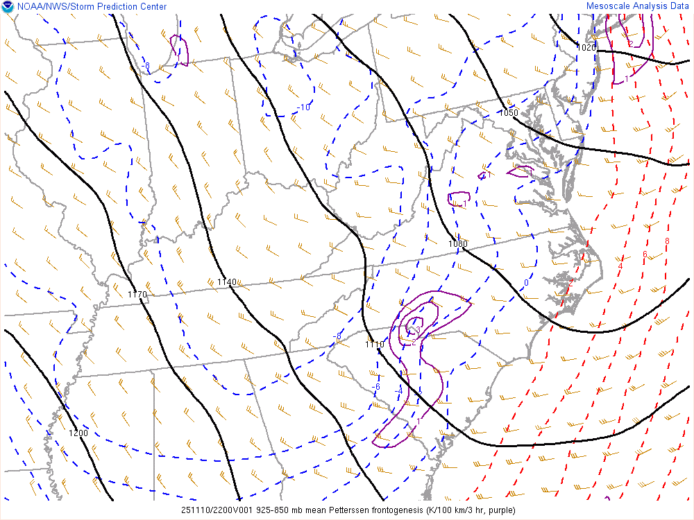
Can see some colder air move in as thickness drops into mountains and Piedmont. SPC Hourly Mesoscale Analysis
-
I swear the atmosphere has muscle memory sometimes. The northern shift creates eye strain and even some tears for us in NC.
-
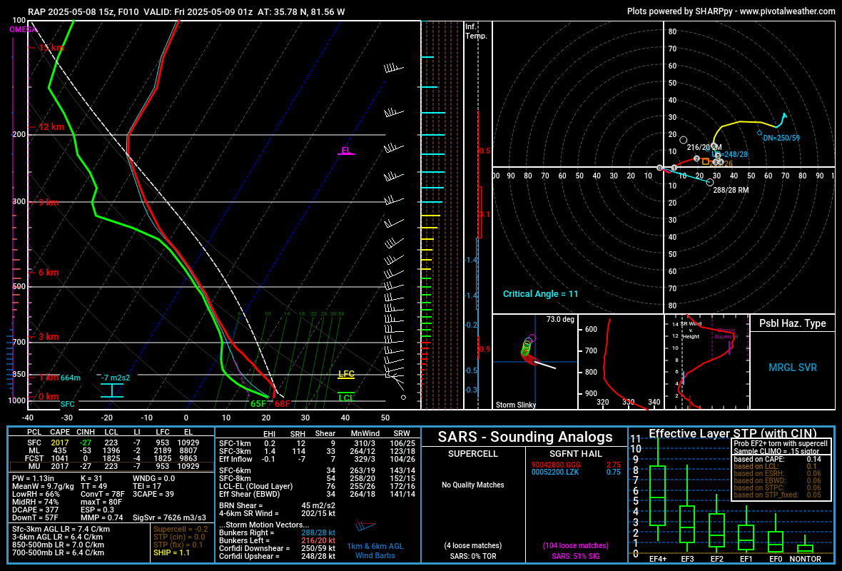
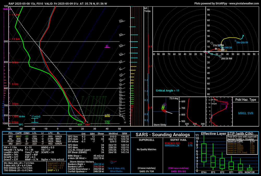
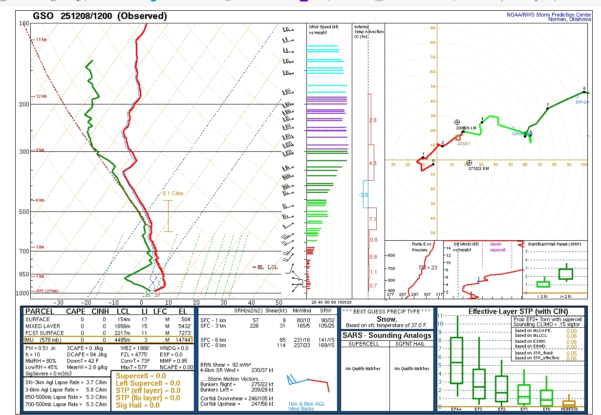
Definitely some better lift at 700 and 850 on the 12Z FV3 for northern third of NC, especially western half. Probably will be the keys to how strong these levels will be and ultimately precip. Just my opinion.
-
-


-
Eye-thanks, I did see it and why I included the wide view.
-
For you Iguana

-
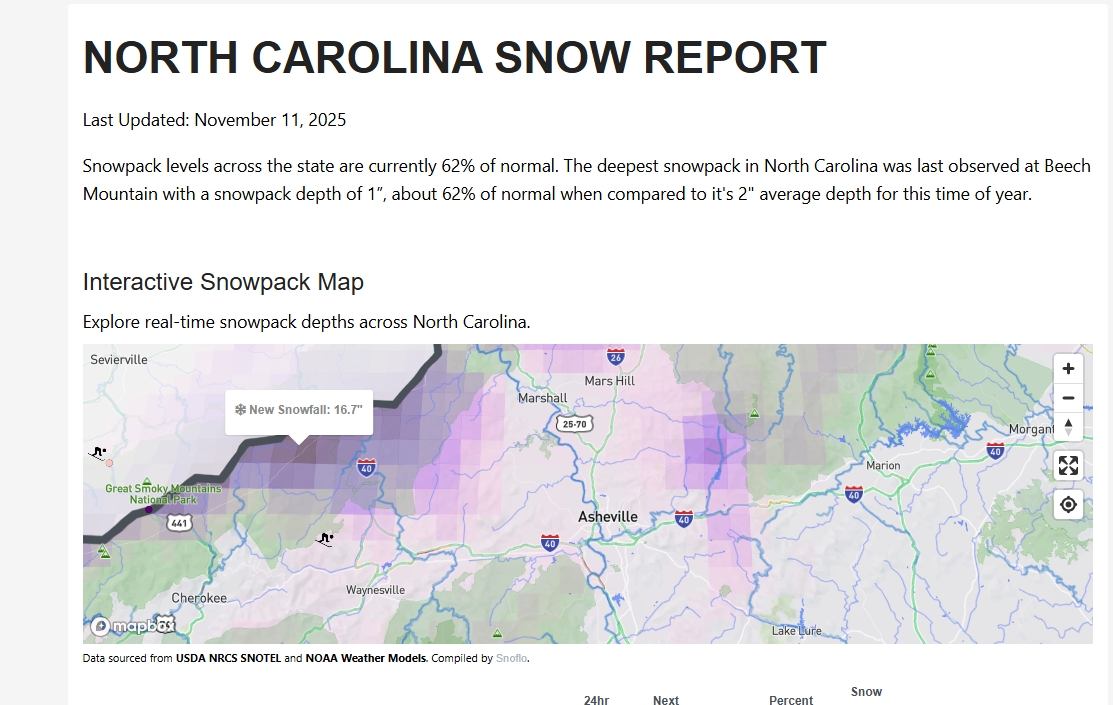
Decent snow cover for any time of the winter season, but for early mid-November is pretty cool.
-
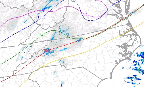
Pretty good lower-level frontogenesis corresponds with radar returns over lower Piedmont area, including Charlotte.
-
38 five miles SSW of downtown W-S this morning.
-
Last night my family took this pic at Cherry Grove, SC, and a few blocks from ocean. Note the streak and bright light, with lightning in distance. They saw some really cool meteors.
.thumb.jpg.32f611da7b58539cbc84f4e2d4f59e3b.jpg)
-

2025 Spring/Summer Mountain Thread
SUNYGRAD replied to Maggie Valley Steve's topic in Southeastern States
-
2025 Spring/Summer Mountain Thread
SUNYGRAD replied to Maggie Valley Steve's topic in Southeastern States
-
2025 Spring/Summer Mountain Thread
SUNYGRAD replied to Maggie Valley Steve's topic in Southeastern States
Pretty impressive for sure-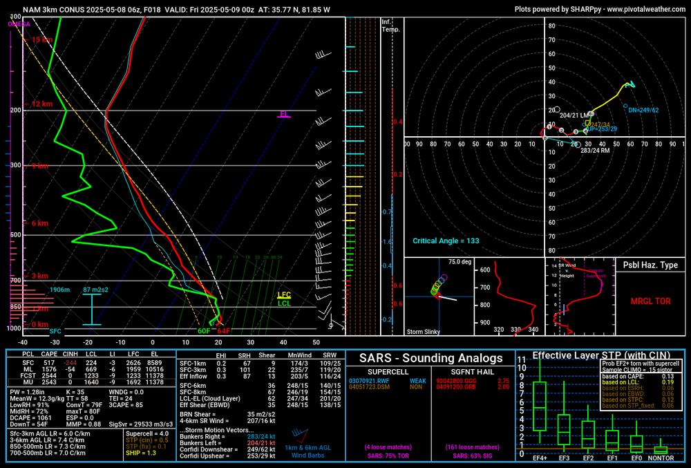
-
1.1 here this morning or right at 2.0 inches total----a few miles south-south-east of Winston Salem
-
Have to use high resolution at moment----look for icon at top of radar page for GSP.
-
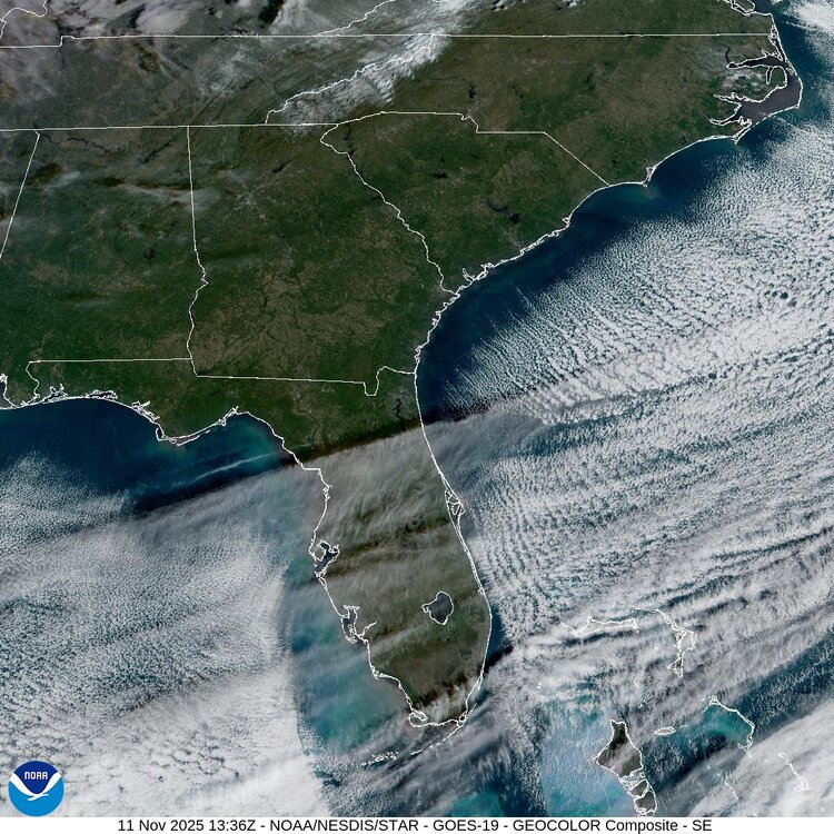
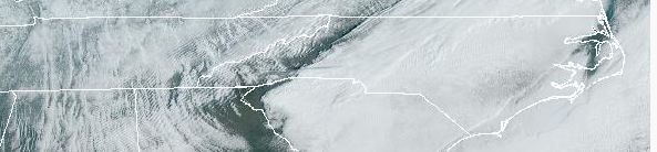
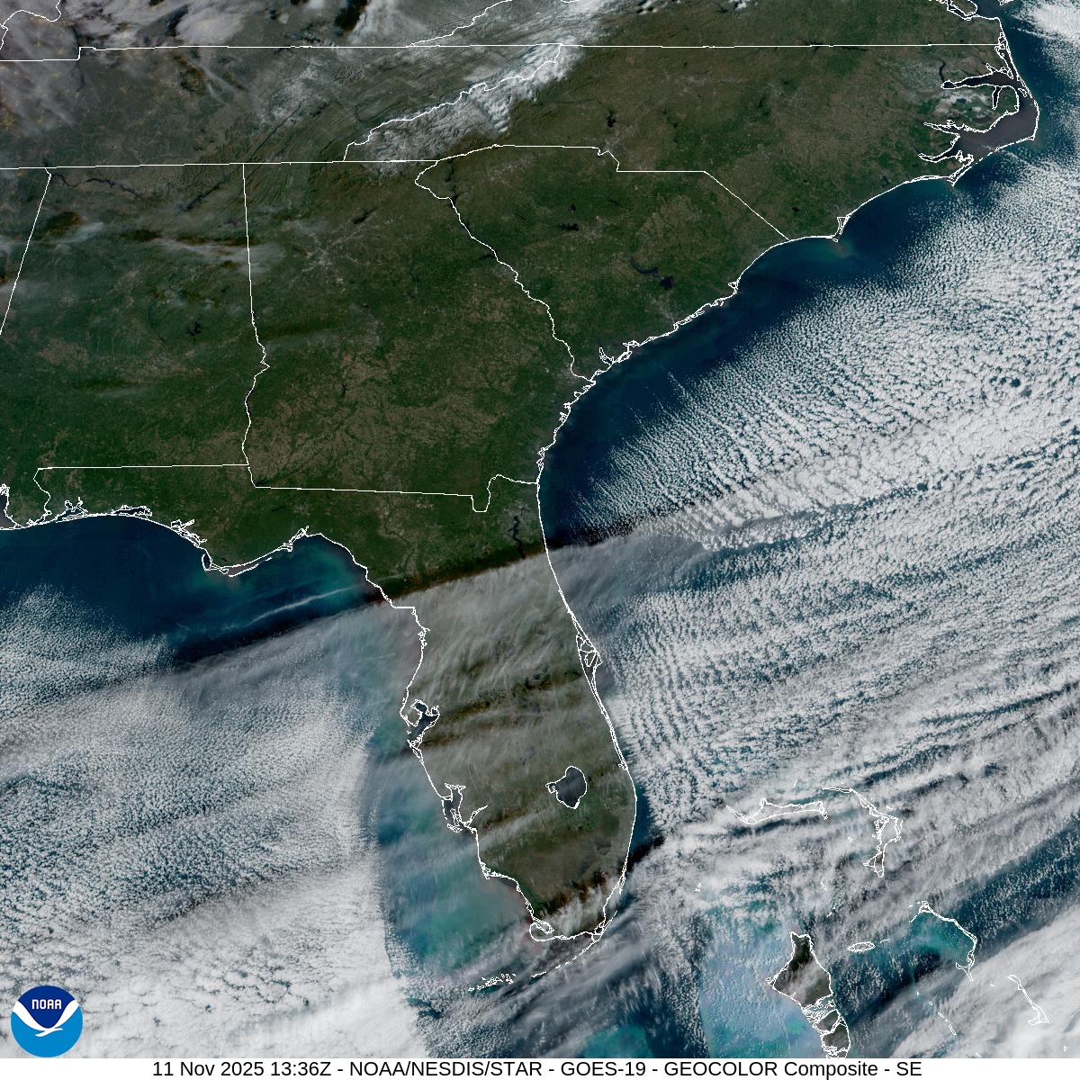
Cool image of snow bands pulling thru Piedmont: Sector Images: Southeast - NOAA / NESDIS / STAR. 0.6 inches thus far here near Winston Salem.
-
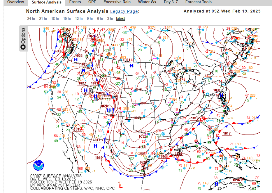
February 19-20 Major Winter Storm Threat
SUNYGRAD replied to NorthHillsWx's topic in Southeastern States

-
February 19-20 Major Winter Storm Threat
SUNYGRAD replied to NorthHillsWx's topic in Southeastern States
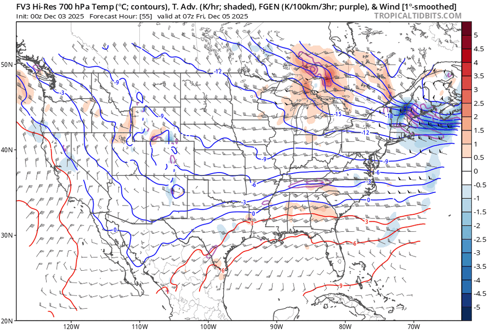
See the FGEN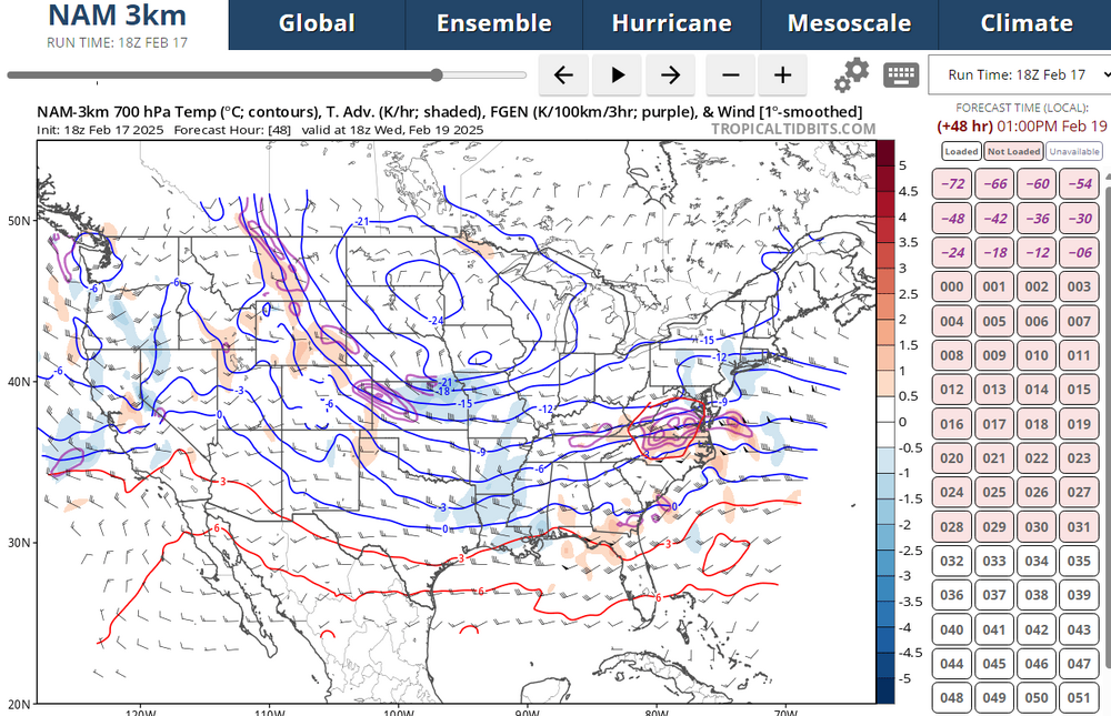
-
February 19-20 Major Winter Storm Threat
SUNYGRAD replied to NorthHillsWx's topic in Southeastern States

.png.0cd7342df64924e41118a32b0497008c.png)


.jpg.6f122b33d2f191a3cd80feeba4f78b1a.jpg)