-
Posts
1,164 -
Joined
-
Last visited
Content Type
Profiles
Blogs
Forums
American Weather
Media Demo
Store
Gallery
Everything posted by Prospero
-
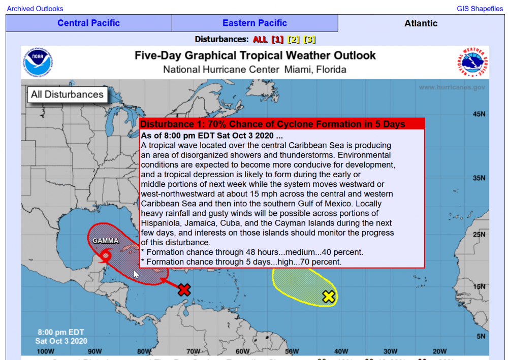
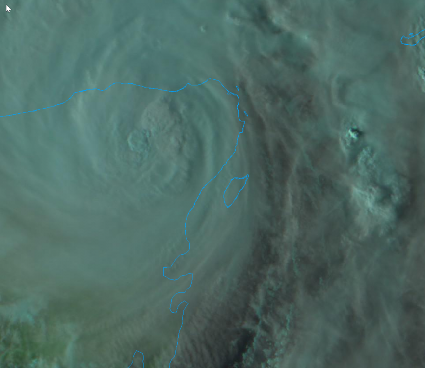
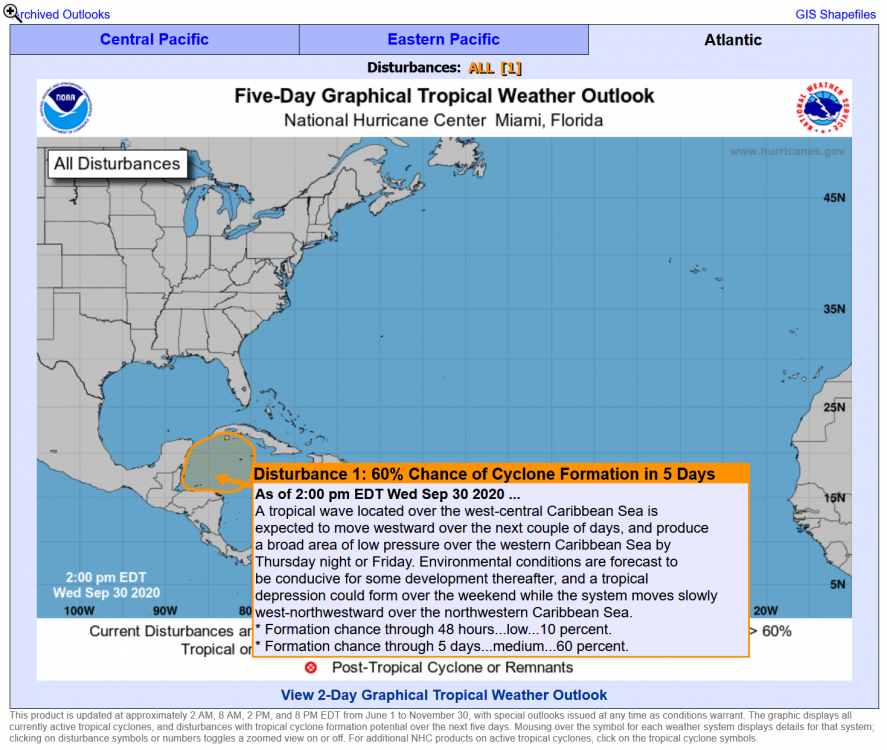
I decided to look up "Gamma" on the internet, to see what I could learn. Now I think forever to me, "Gamma" was the tropical storm that was in early October 2020.
-
OK, in my case anyway. UGH I saw a "Major Hurricane Marie" thread active, I figured it had to be new photos from a storm months ago in the Atlantic or Gulf of Mexico that I obsessed about and forgot.
-
"Marie is a category 3 hurricane on the Saffir-Simpson Hurricane Wind Scale. Steady weakening is expected during the next several days, and Marie is forecast to become a tropical storm by Sunday night." Hmmmm, "this will probably be better than all the atlantic storms", still verified?
-
Do I see a new burst?
-
-
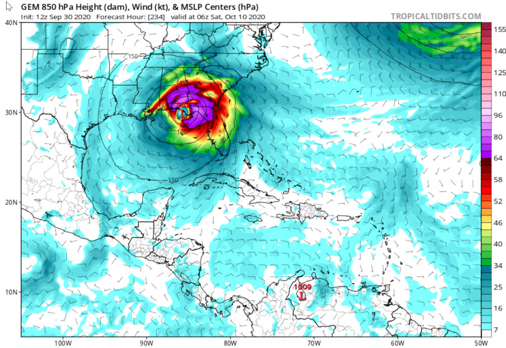
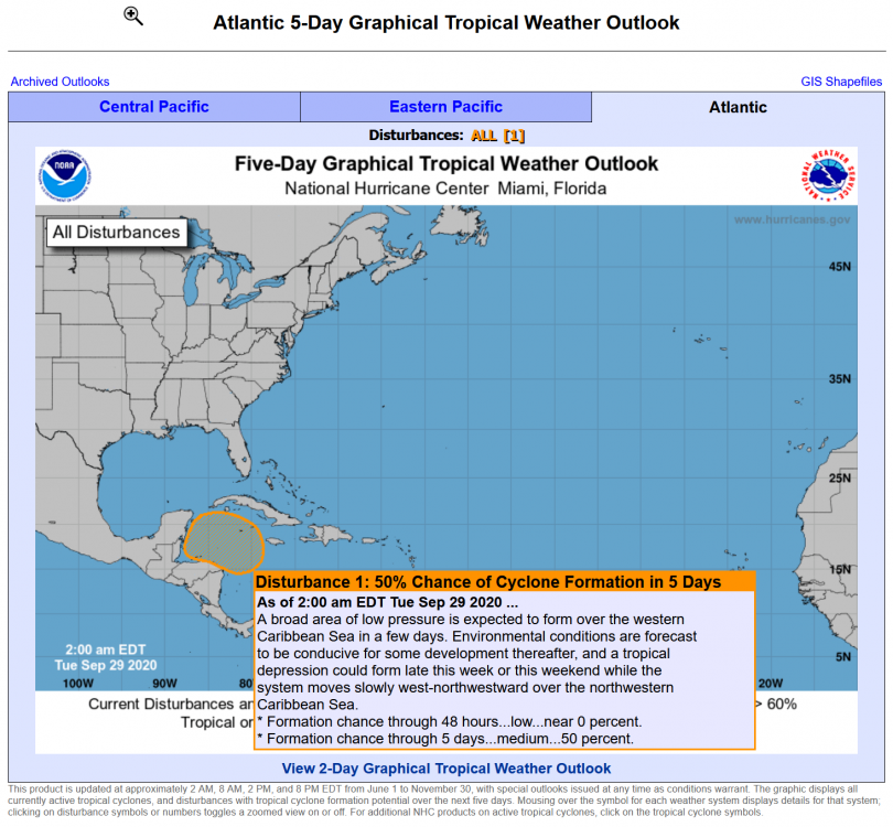
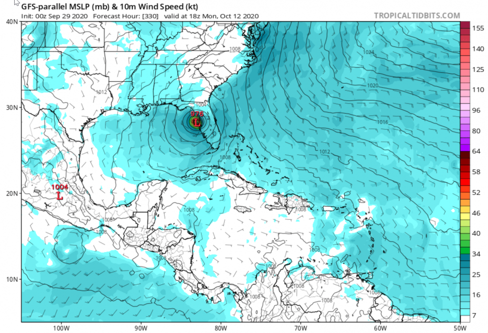
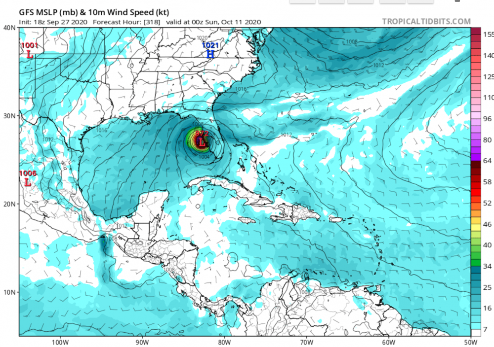
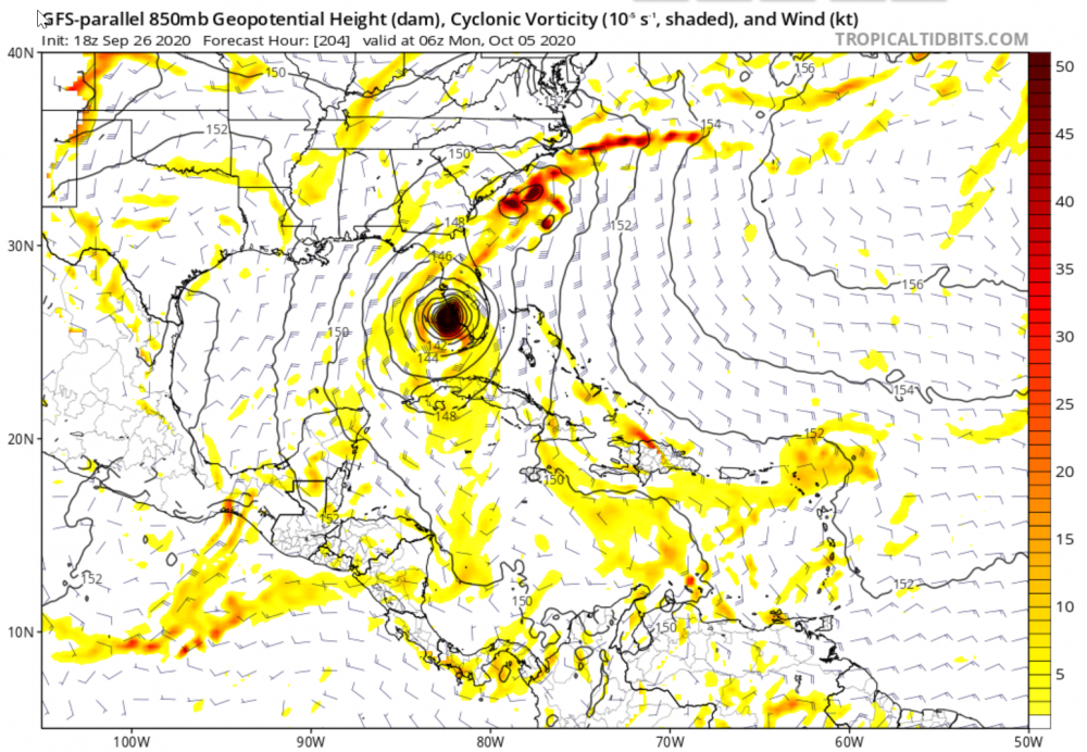
Figuring here October 10 through 14 is a time to watch for Florida Gulf Coast. If we get through that, we'll start to relax. Not that we are not starting to relax even now... But hey, November is never a slam dunk finished season either. I may start to watch the blizzard forums...
-
We are getting rain here right now on the west central Florida coast in October. Always a treat, and almost always a tropical system this time of year (even though a cold front did come through this past week). I think we'd be in a drought this summer if not for the steady stream of TCs.
-
Tonight: ............................................ Can anybody find me some model to hug? Ooh, each morning I get up I die a little Can barely stand on my feet (Take a look at yourself) Take a look in the mirror and cry (and cry) Lord, what you're doing to me (yeah yeah) I have spent all my years in believing you But I just can't get no relief, Lord! Somebody (somebody) ooh somebody (somebody) Can anybody find me some model to hug? I work hard (he works hard) every day of my life I work 'til I ache in my bones At the end (at the end of the day) I take home my hard earned pay all on my own I get down (down) on my knees (knees) And I start to pray 'Til the tears run down from my eyes Lord, somebody (somebody), ooh somebody (Please) can anybody find me some model to hug? ................................... OK, yea tomorrow will be another day...
-
Just need a model to hug tonight...
-
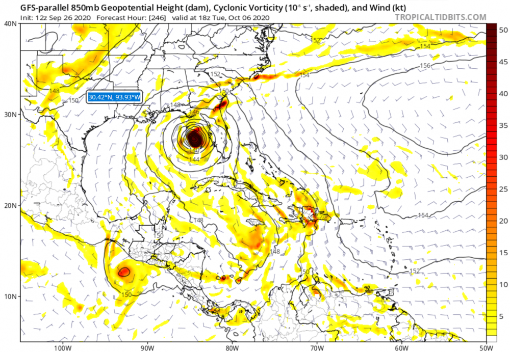
The GFS generally has more weight with me, and October 11 is far away date for now, but will be paying attention...
-
Oh yea, Charlie, it had us in the cross-hairs in Tampa Bay up to a few hours before landfall. So many people evacuated with a historic traffic jam on the bridges to go to Orlando for safety. Charlie did a surprise hard right at Port Charlotte and mostly missed Tampa Bay. But my friends who went to Orlando had stories of trees falling down in hotel parking lots, power being out, so on. One person came home to a waterfront home on the intercoastal waterway here and their old dried out Christmas tree from the year before was still sitting on their boat dock. I was in Sun City Center in southeast Hillsborough County watching shutters and roof tiles fly down the road. I watched for a couple hours, still daylight which seems to be a real treat for us storm geeks. They have very few trees in that senior community, but driving around the next morning did see a lot of trees down on the main highways and streets. There was a mile long swath on I-75 just north of the Port Charlotte exit where it was obvious the eye wall came through. Wow, it was a Cat 5 if I remember right. Looked more like a wide tornado path came by. Trees snapped off like match sticks. Francis and Jeanne were both stronger in this area the same year very soon after. What a year.
-
If I had a dollar for every time a model showed a storm passing by or over Tampa Bay this season, well... I suppose I could buy a large extra crispy mushroom pineapple pizza and a 12 pack of Amber Bock.
-
Watching here in Gulfport Florida. We never get too relaxed this time of year. Granted, it is quiet now and absolutely gorgeous as far as weather. But as the Grateful Dead say, "When life looks like Easy Street, there is danger at your door". Even so, it does feel like things are over here for us. Kind of hoping, we were very lucky so far for 2020. It has been interesting season (ok maybe trolling Ghost of Leroy), and we felt several storms with gusts in the TS range, a lot of rain at times, mild surges, etc., but all in all very easy season for the central west coast of Florida. We were in five day cones, so we did have moments of excitement. LOL
-
Wow! Kind of surreal.
-
A Wilma that wind shear takes down to a TS a few hours before landfall works for me. We've dodged a few this year, and have barely done any prep, but could handle the thrill (and fear) as long as we don't lose power or any more trees. Irma took all of our morning to noon shade Oaks and our electric bill went way up keeping out house cool in the summer since. I'd even be open to a decent 6-8 ft storm surge and our humble town of Gulfport, Florida would recover and everyone would pitch in to help out the businesses downtown. (They may not agree so much though...) I suppose a 6-8 ft storm surge here might be closer to 12 ft or more in downtown Tampa where the Tampa Bay might be pushed up, so that would not be good news for Tampa. I'd rather no more storms for Texas, Louisiana, Mississippi, Alabama, or the Florida panhandle this year. They got their share already. Of course I'd rather a weak storm hit here on the weekend when I am not working as much so I can enjoy it more. So far I give the season an A-. It started early, kept busy, a lot of hours watching and reading here and there, and I really haven't been bored til now. But with the absolutely gorgeous weather the past couple days here on the central west coast of Florida, no complaints at all.
-
I'm pretty sure every mile of the Gulf Coast and most, if not all of the Atlantic Coast of the US has been in a cone at least once this season. Makes for an interesting season so far...
-
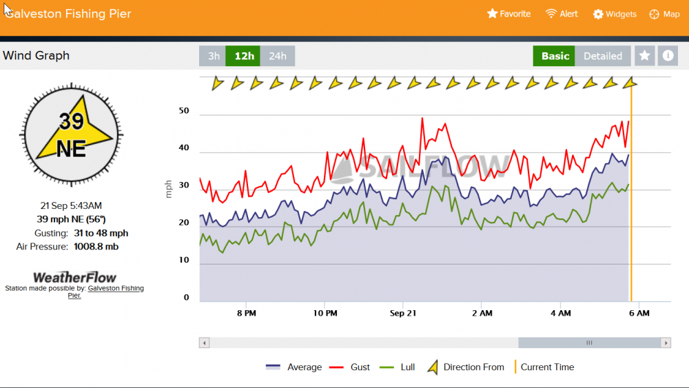
It's getting lighter in Texas. Here are some Galveston cams: https://www.galveston.com/webcams/
-
-
Of course we had the total non-attention getter over Florida that became Omar I posted about during a day like today. Who remembers Omar during 2020? EDIT: Added: Neighbors lost power here in Gulfport, FL. Granted nothing like other areas this year, but for a system with 0% chance of development at the 8PM update, a spinning low over Florida still gets our attention. Seems like over warm Gulf waters late tonight it might flair up a bit before it meets its demise. Already sustained winds at 30 mph around here.


